Devastating forest fires in central and southern Portugal
undefined
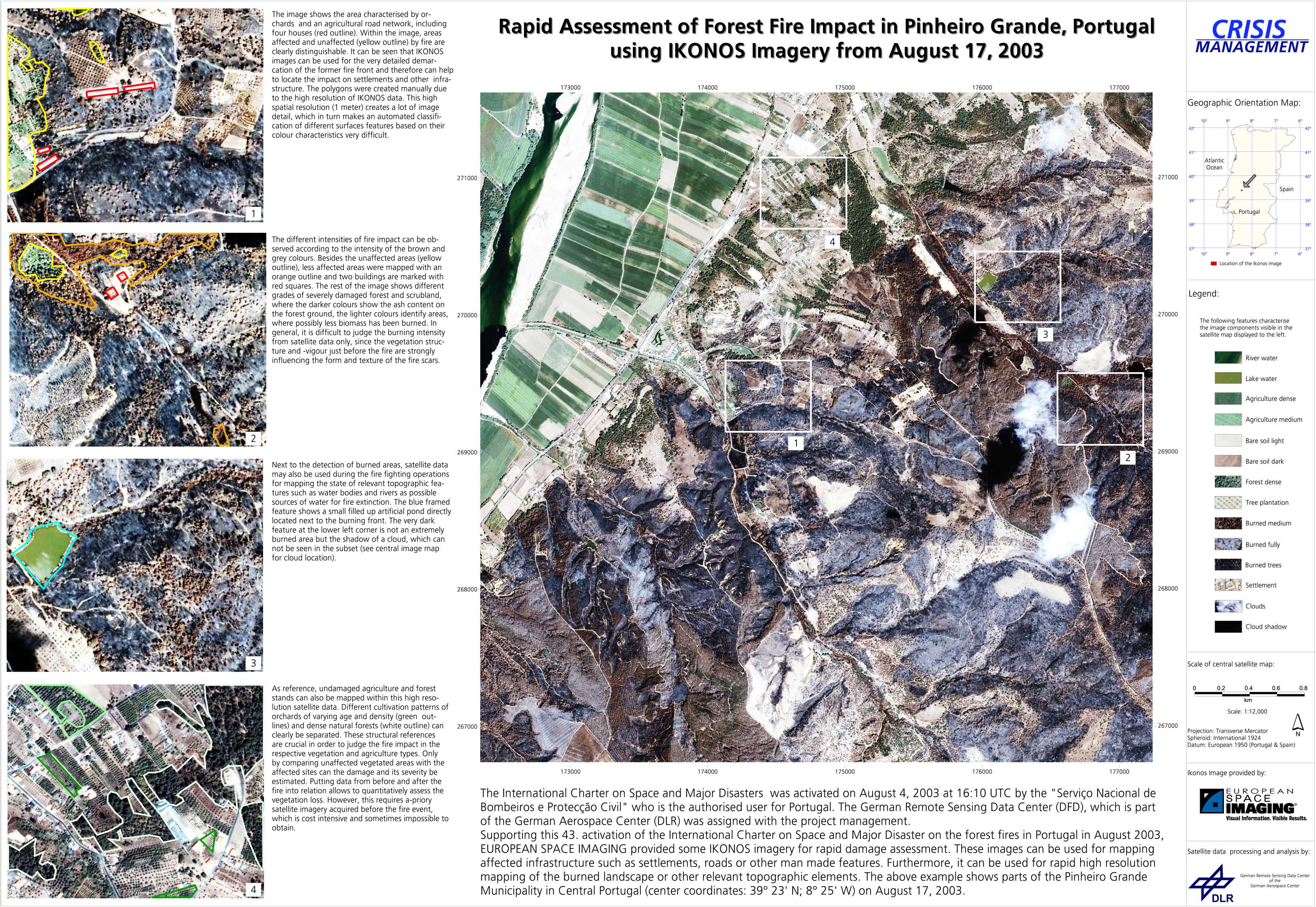
Earth observation satellites make rapid mapping of large regions of the earth's surface possible and can be a valuable help for the disaster management. Data can be used from both passive instruments, which collect information in the visible and infrared spectral range, and from radar instruments, which actively send signals which can see through smoke. In cooperation with the European Space Agency ESA and other national and international partners, DFD had been acquiring available satellite data since August 5, 2003, and made them available to local situation centers for fire fighting and examination. DFD used its own receiving equipment for the purpose and processes the raw data for use in the field. On August 5, the Portuguese Servicio Nacional de Bombeiros e Protecccao Civil requested activation of the International Charter on Space and Major Disasters. The ZKI took over the project management for this Charter call from Portugal at the request of ESA and was coordinating data distribution and analysis. In addition to the satellite data already provided by ZKI and its partners from NOAA-AVHRR, MODIS and DLR's own BIRD satellite, other information was made available for evaluating the situation and for crisis management. Relating to the decrease of forest fires in Portugal and after consultation with the authorized user in Portugal, the Charter call 43 has been closed on August 24. During the 18 days, 52 satellite images (34 NOAA-AVHRR, 3 ENVISAT-MERIS, 9 SPOT, 3 BIRD, 1 IKONOS), 17 NOAA-AVHRR fire masks, 2 MERIS and 2 SPOT masks of the fire scars were delivered as geocorrected data sets as pre-decided with RISCOS. As an example, ZKI could provide the NOAA-AVHRR fire masks daily in the morning only a few hours after the acquisition. The provision of all these imagery and value added products was only possible due to the strong support of the various envolved Charter institutions and the support of several teams within DLR. We hope that we could make some valuable contributions to the handling of the fire situation and the crisis management team in Portugal.
Portugal - P01 - Forest fire damage assessment in Pinheiro Grande (Central Portugal) with IKONOS satellite imagery
Creation Date 20. August 2003
undefined