Supporting relief organisations in flooded areas of the Rhone valley, southern France
undefined
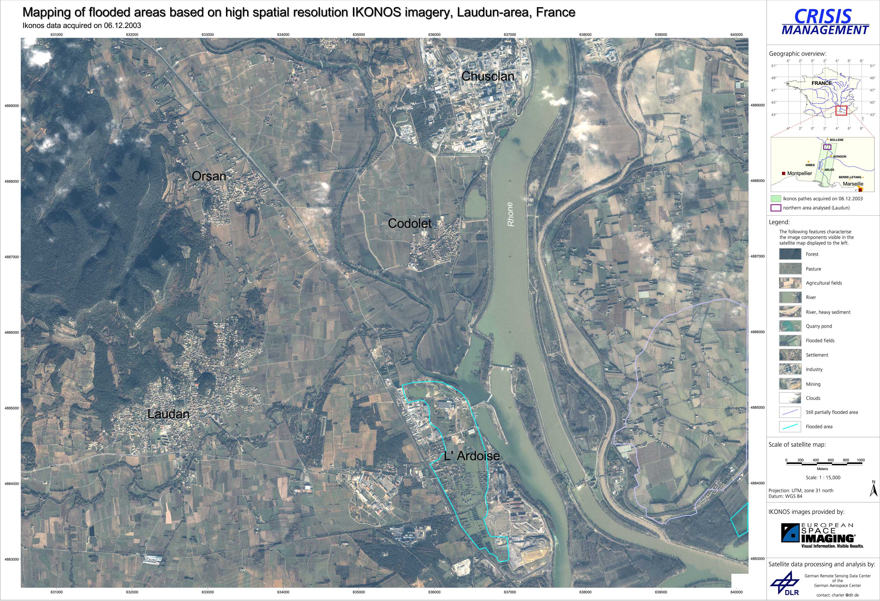
The German governmental disaster relief organization (THW) in Arles was equipped with satellite maps derived from high resolution IKONOS satellite images analyzed by ZKI. On December 4, 2003, the french civil protection agency triggered the International Charter on Space and Major Disasters, which supports relief activities with satellite imagery on a best effort basis.
France - P01 - Overview satellite map - Laudun (Southern France)
Creation Date 06. December 2003
undefined