Emergency mapping of the damages resulting from the earthquake in Bam, Kerman Provinz/Iran
undefined
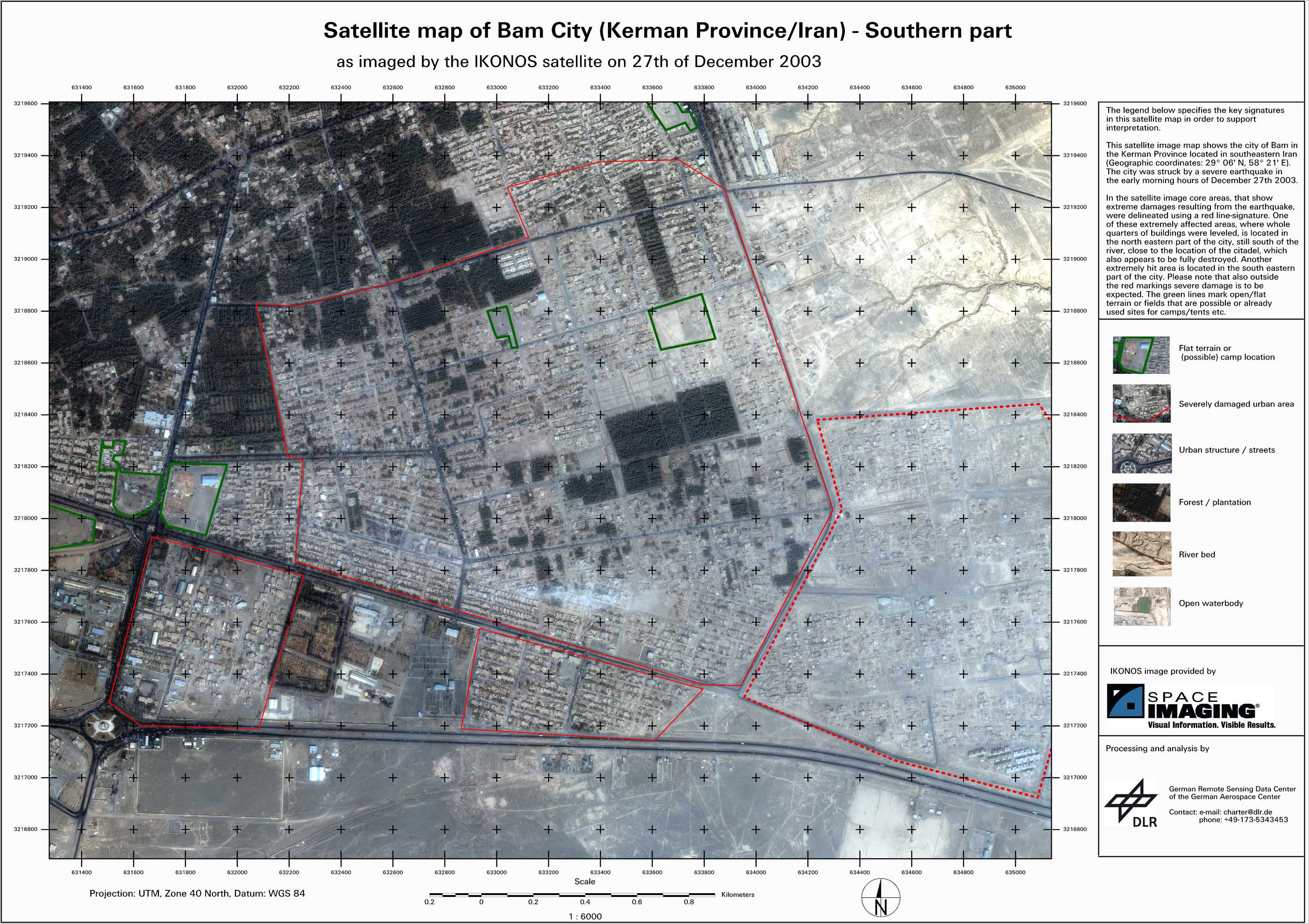
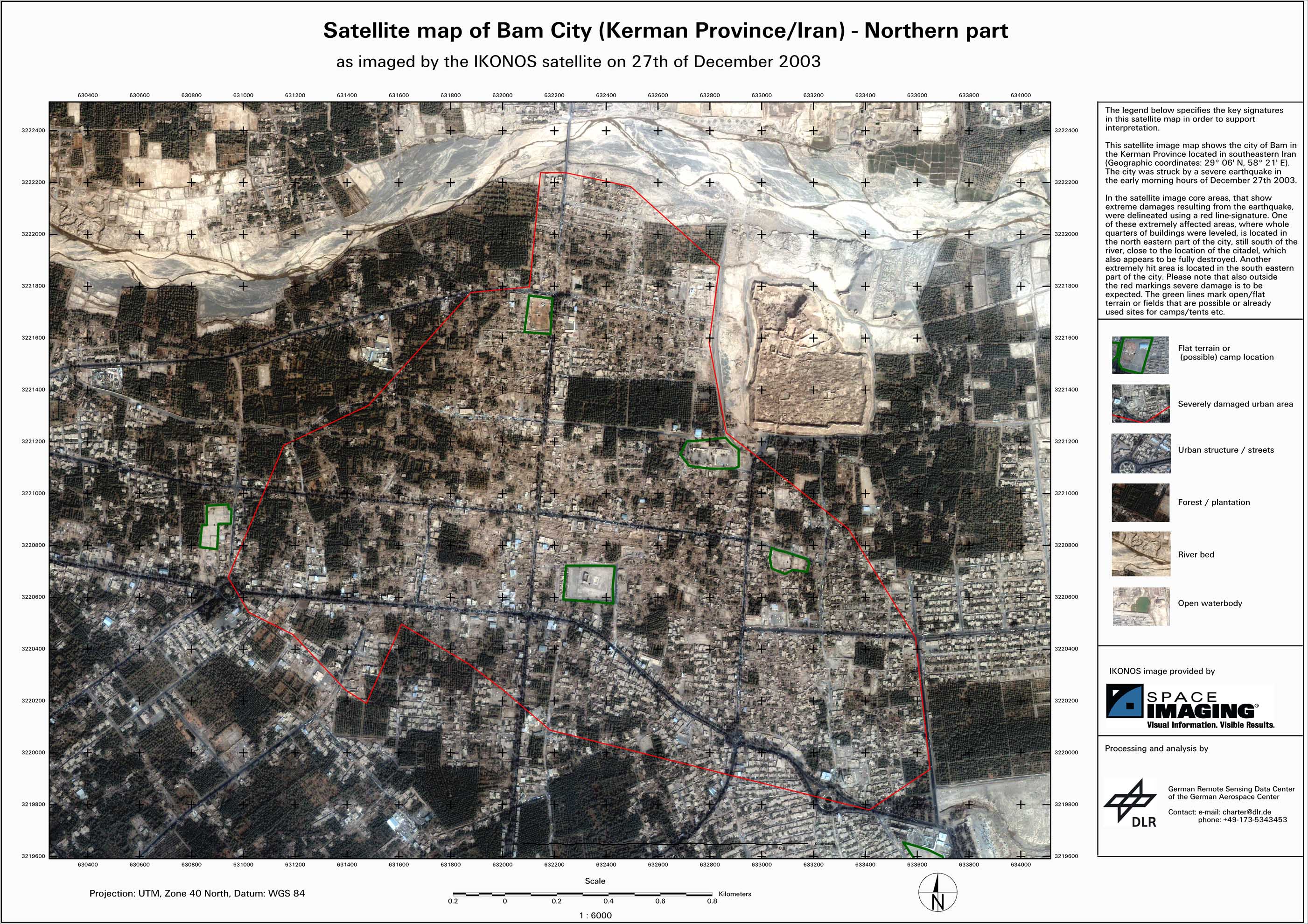
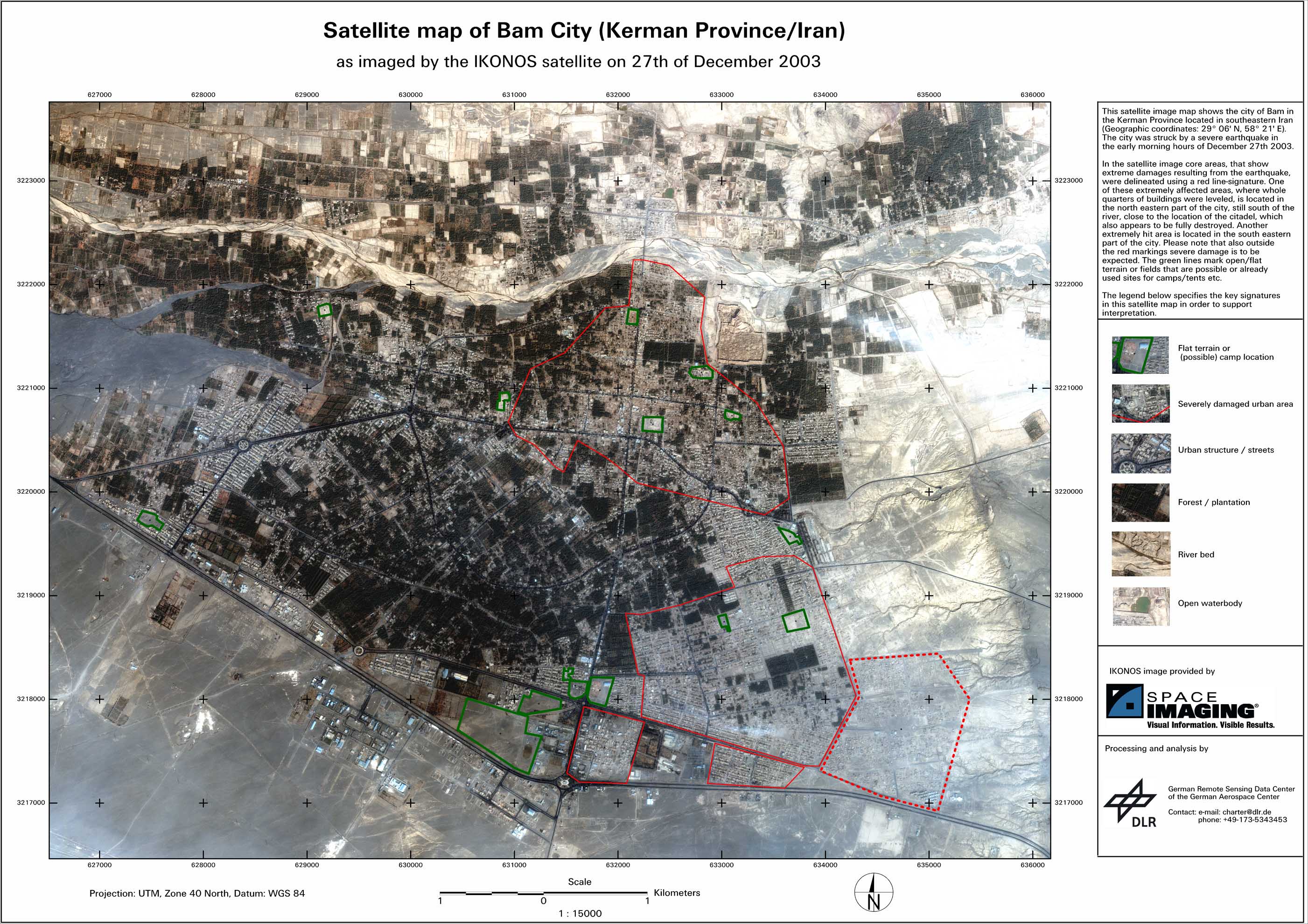
Supporting the international relief activities undertaken by various humanitarian organisations in the area around the city of Bam (Iran) and supporting the activation of the International Charter on Space and Major Disasters, the Center for Satellite Based Crisis Information in cooperation with the company Space Imaging have made first damage analysis maps available, based on IKONOS satellite imagery.
Iran - P03 - Satellite map - Southern Bam city
Creation Date 27. December 2003
Iran - P02 - Satellite map - Northern Bam city
Creation Date 27. December 2003
Iran - P01 - Overview satellite map of Bam City
Creation Date 27. December 2003
undefined