Satellite image analysis after the earthquake in Morocco
undefined
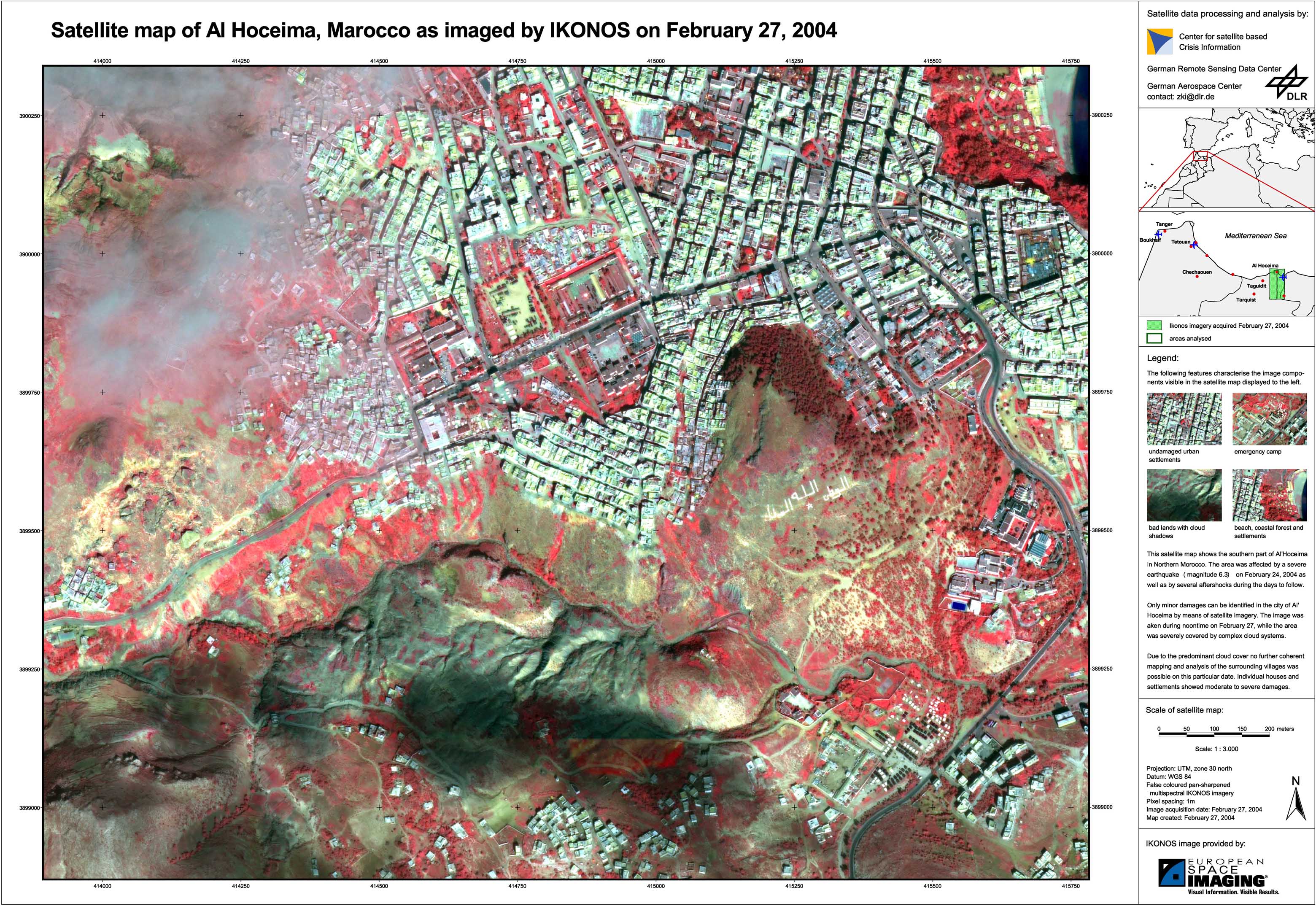
After the earthquake southwest of Al Hoceima on Februar 24, 2004 IKONOS imagery was analysed in order to identify the damage assessment. An acquisition on February 25 was not possible due to the local weather situation. The company European Space Imaging provided an IKONOS image on February 27 which was still 60 percent cloud covered. Therefore the affected region could be only partially analysed and interpreted.
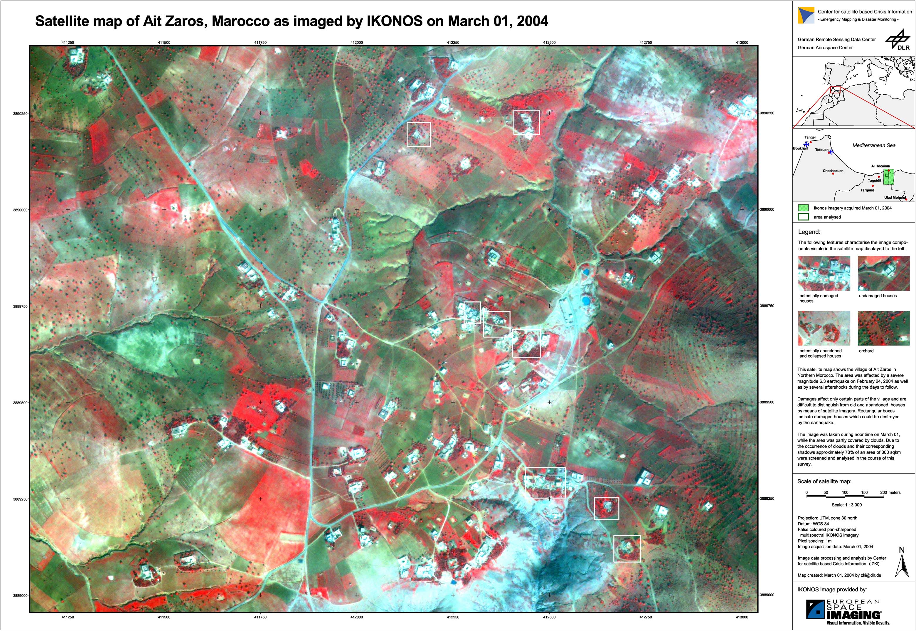
Morocco - P03 - Satellite map - Ait Zaros
Creation Date 27. February 2004
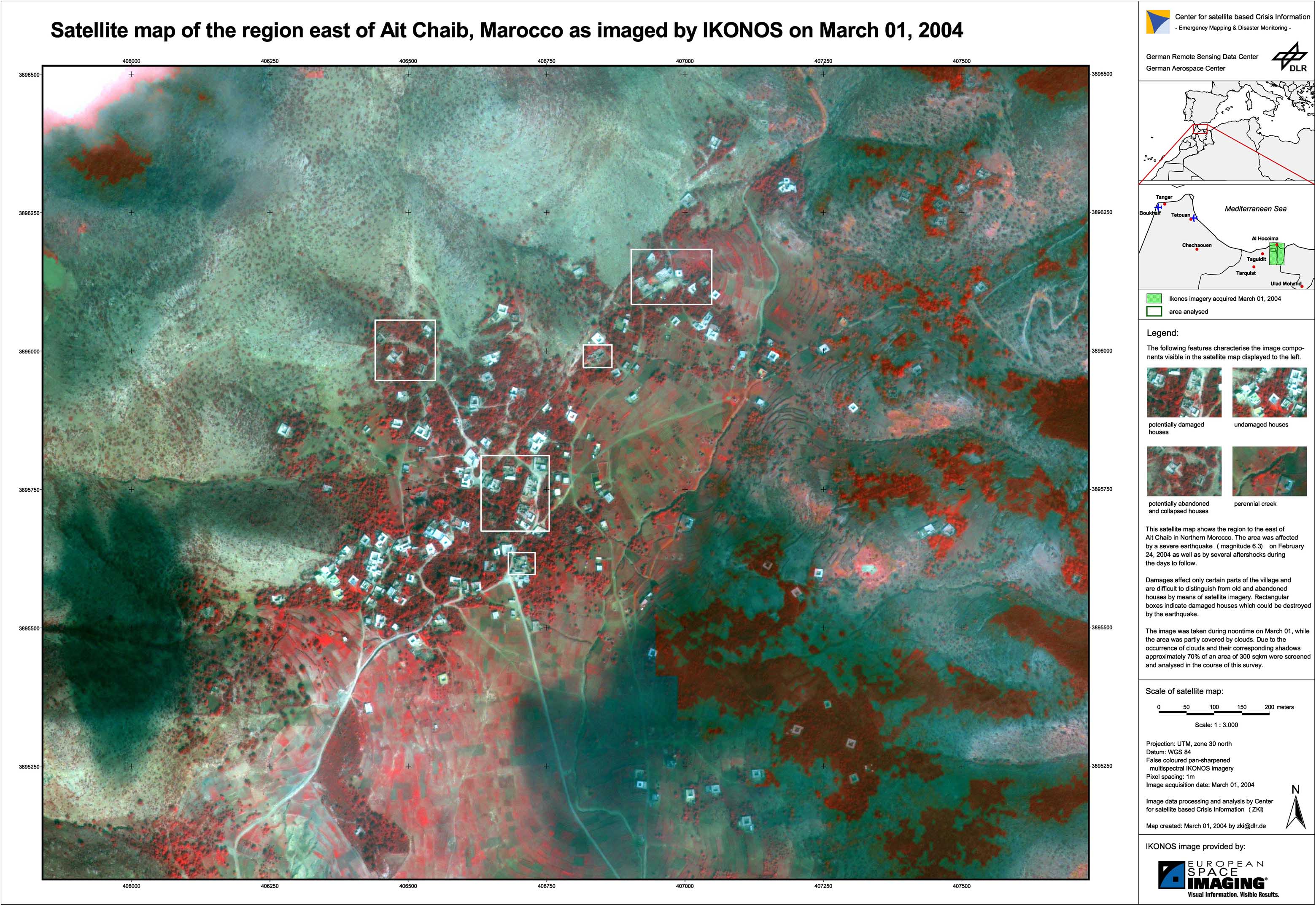
Morocco - P02 - Satellite map - Ait Chaib
Creation Date 27. February 2004
Morocco - P01 - Satellite map - Al Hoceima
Creation Date 27. February 2004
undefined