Mapping of forest fires in southern Portugal (Algarve region)
undefined
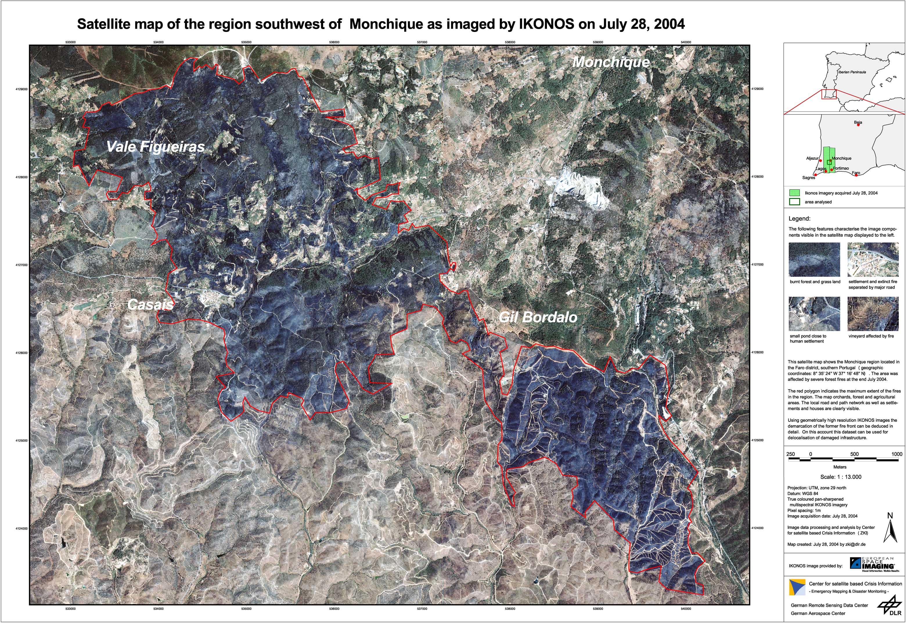
The major forest fires in Spain and Portugal in July 2004 were recorded and analyzed at DFD's Center for Satellite Based Crisis Information (ZKI), which produced a detailed satellite map of the affected area in the Monchique region based on Ikonos data. In addition MODIS imagery was analyzed to obtain an overview of the current distribution of fires across the entire Iberian Peninsula. Earth observation satellites make possible rapid mapping of large regions of the earth's surface and can be a valuable help for the disaster management. Data can be used from both passive instruments, which collect information in the visible and infrared spectral range, and from radar instruments, which actively send signals which can see through smoke. In cooperation with European Space Imaging (EUSI), a supplier of high quality, high-resolution, global IKONOS satellite imagery, DFD conducted a fast mapping excercise to show the extent and damage of forest fires in the Algarve Region. DFD uses its own receiving equipment for the purpose and processes the raw data for use in the field.
Portugal - P01 - Forest fire damage assessment
Creation Date 28. July 2004
undefined