Base mapping of Dhaka region/Bangladesh
undefined
A base mapping activity was performed on request of the Governmental Disaster Relief Organization (THW) of the Federal Republic of Germany for the area around Dhaka, Bangladesh. This activity was pursued on the background of a commonly planned humanitarian aid campaign of the THW and the United Nations (UNOCHA) with a focus on drinking water management and supply after heavy flooding damage in the past weeks. Ikonos imagery was kindly provided by Space Imaging North America (SINA) with support of European Space Imaging (EUSI).
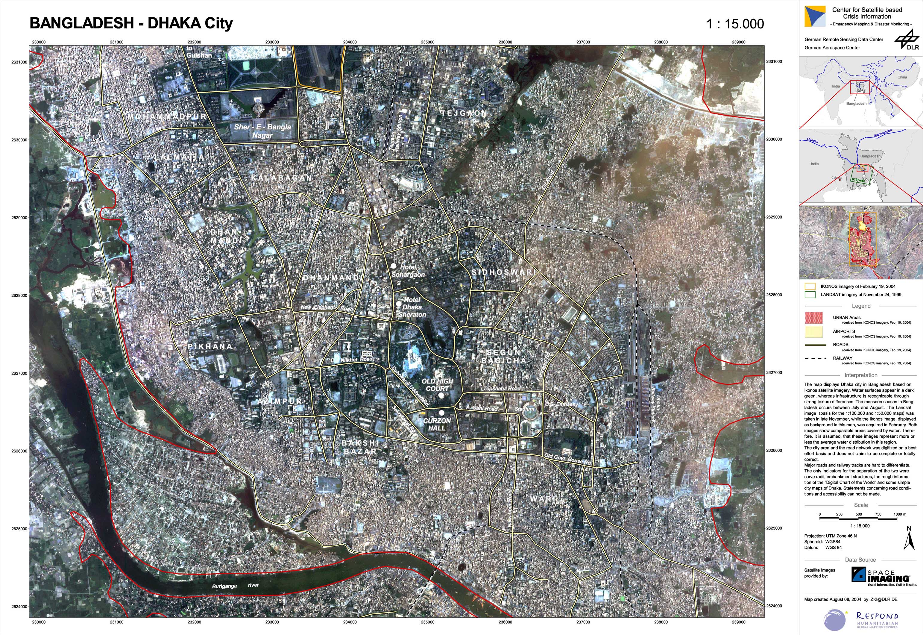
Bangladesh - P03 - Satellite map of Dhaka-city/Bangladesch
Creation Date 08. August 2004
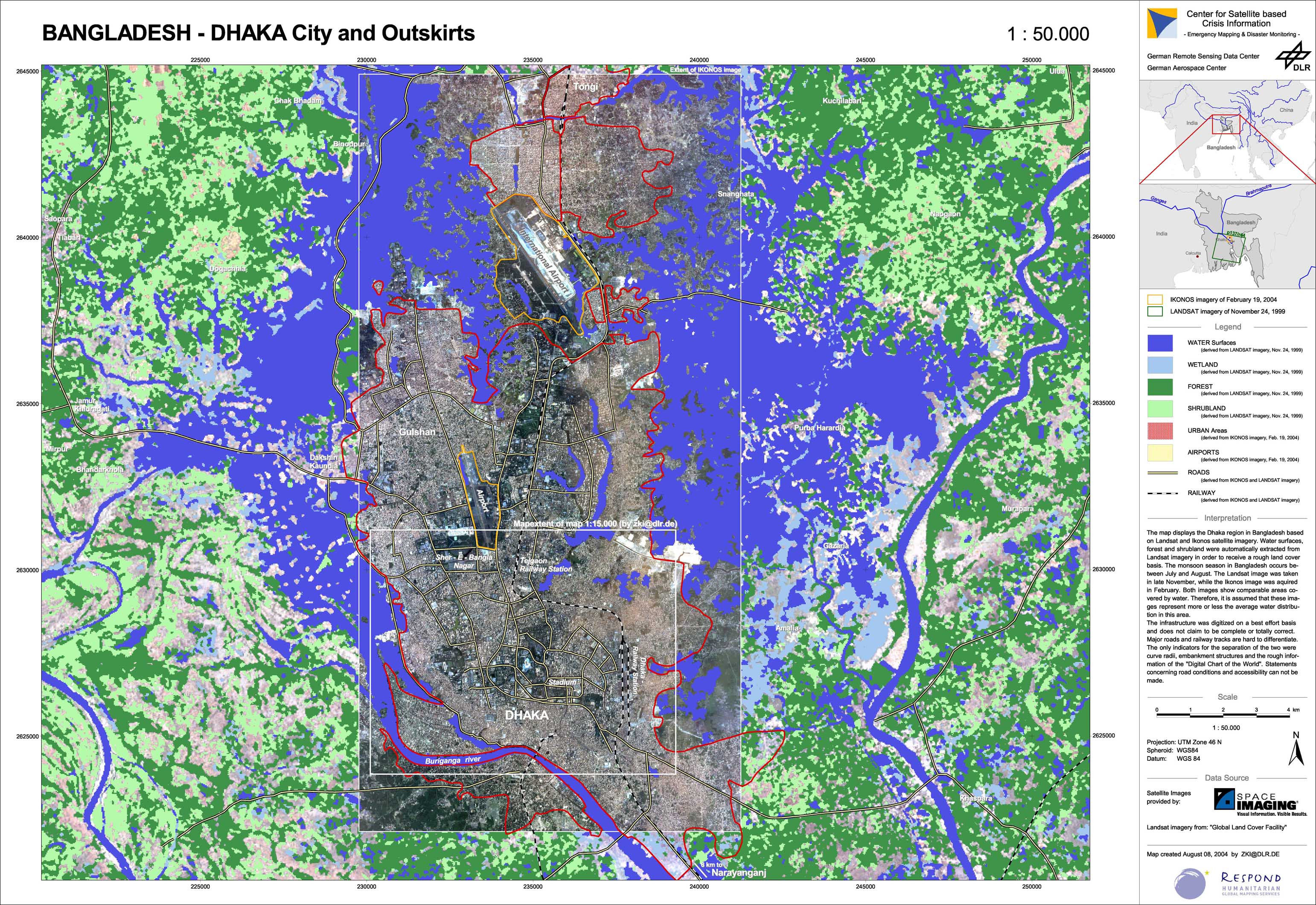
Bangladesh - P02 - Reference map of the Dhaka region
Creation Date 08. August 2004
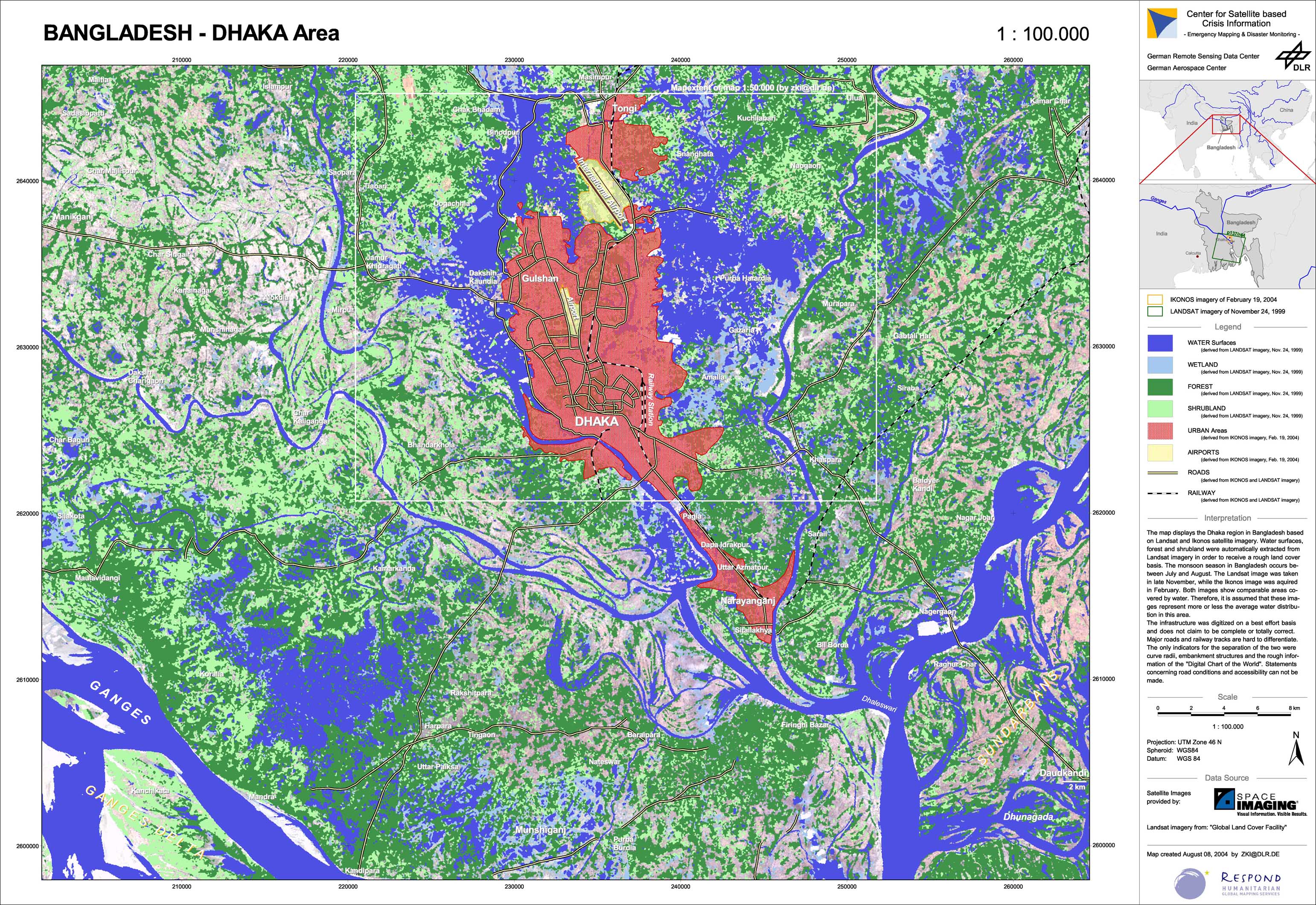
Bangladesh - P01 - Reference map of the Dhaka region
Creation Date 08. August 2004
undefined