Base and crisis mapping of Al Fashir and Al Junaynah region in Darfur/Sudan
undefined
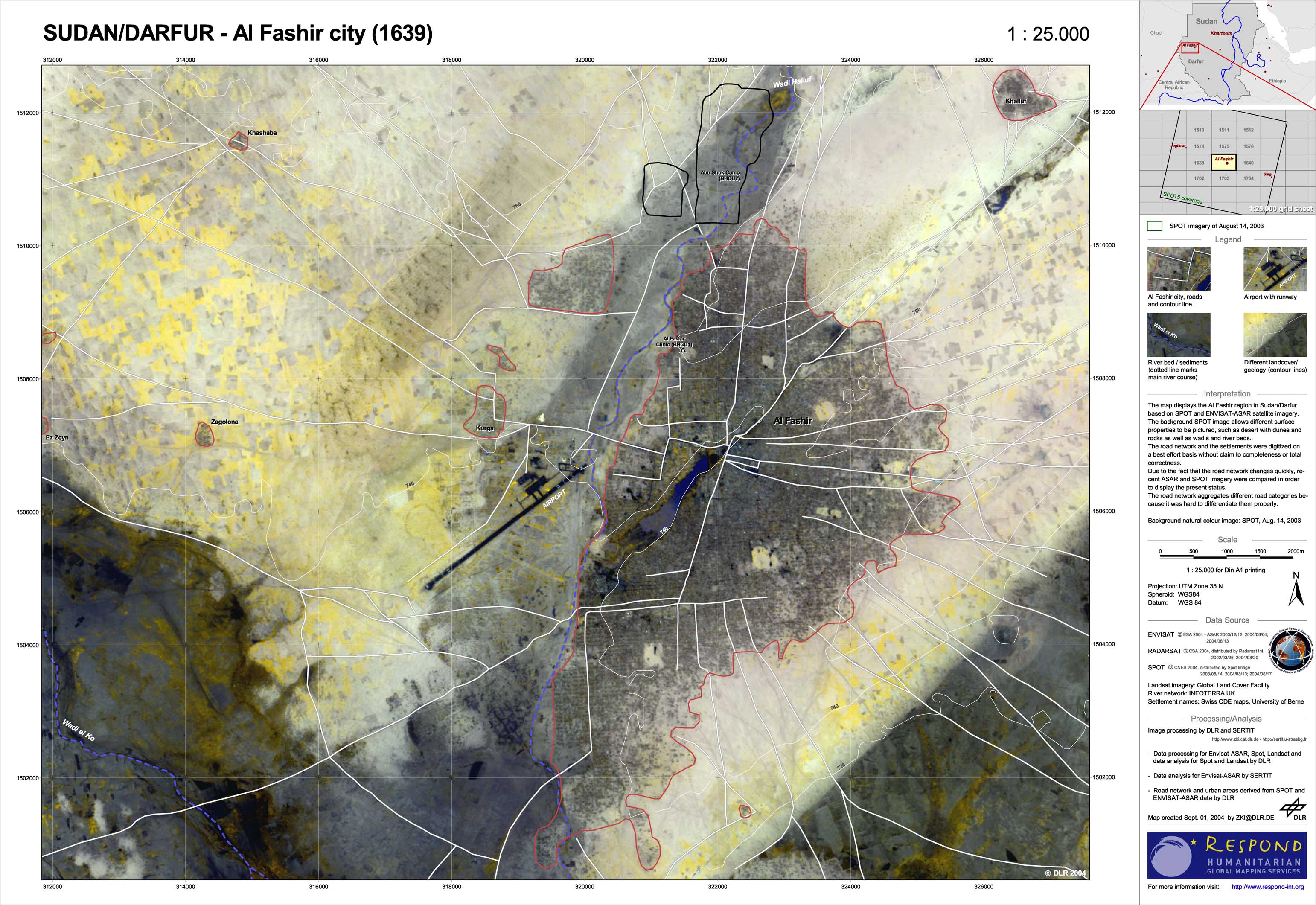
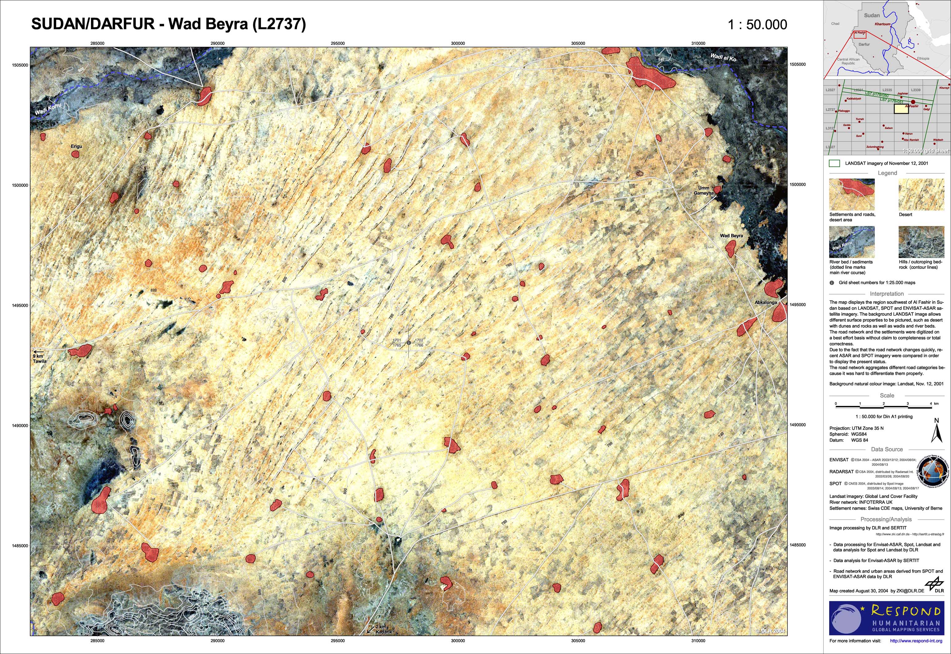
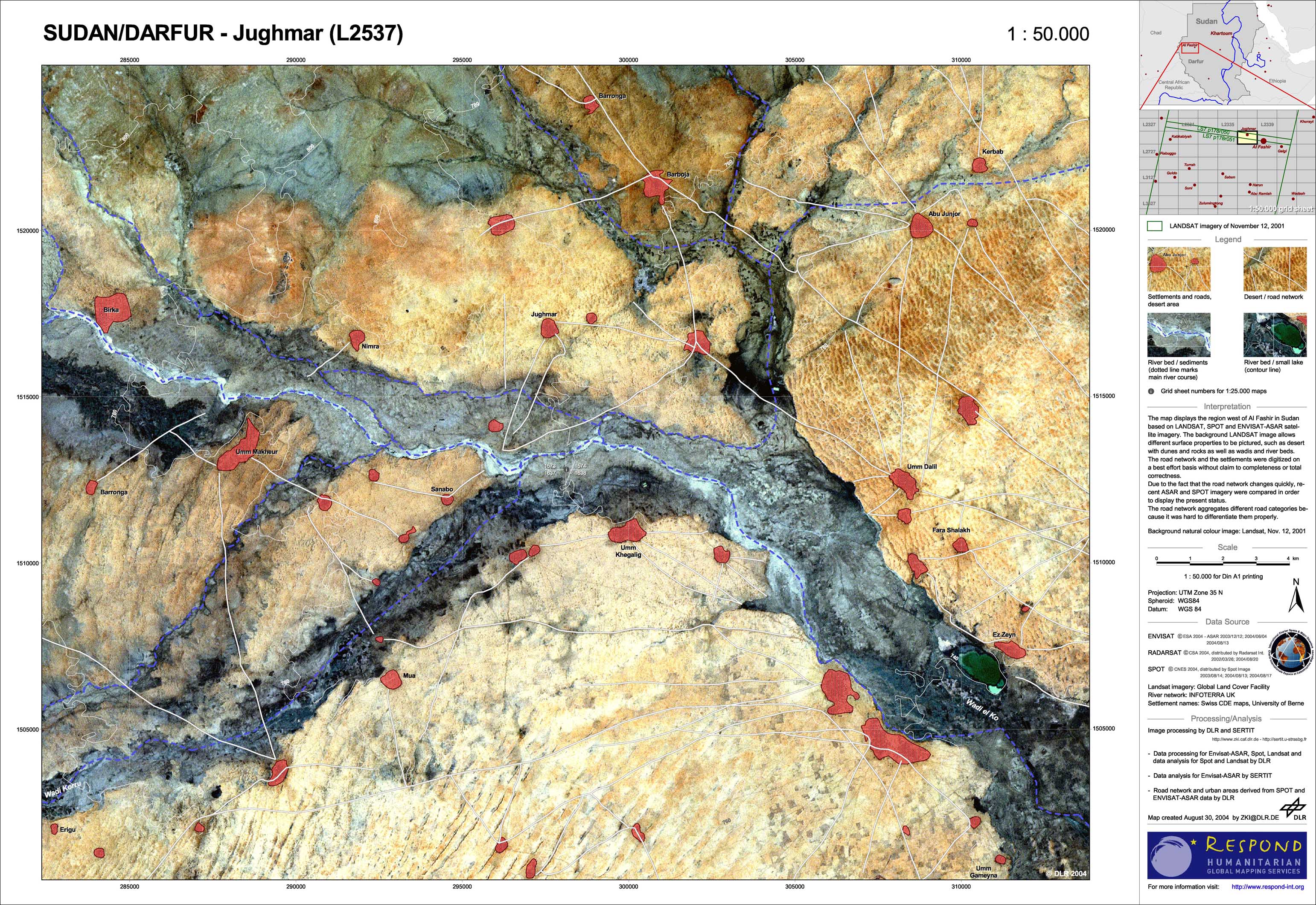
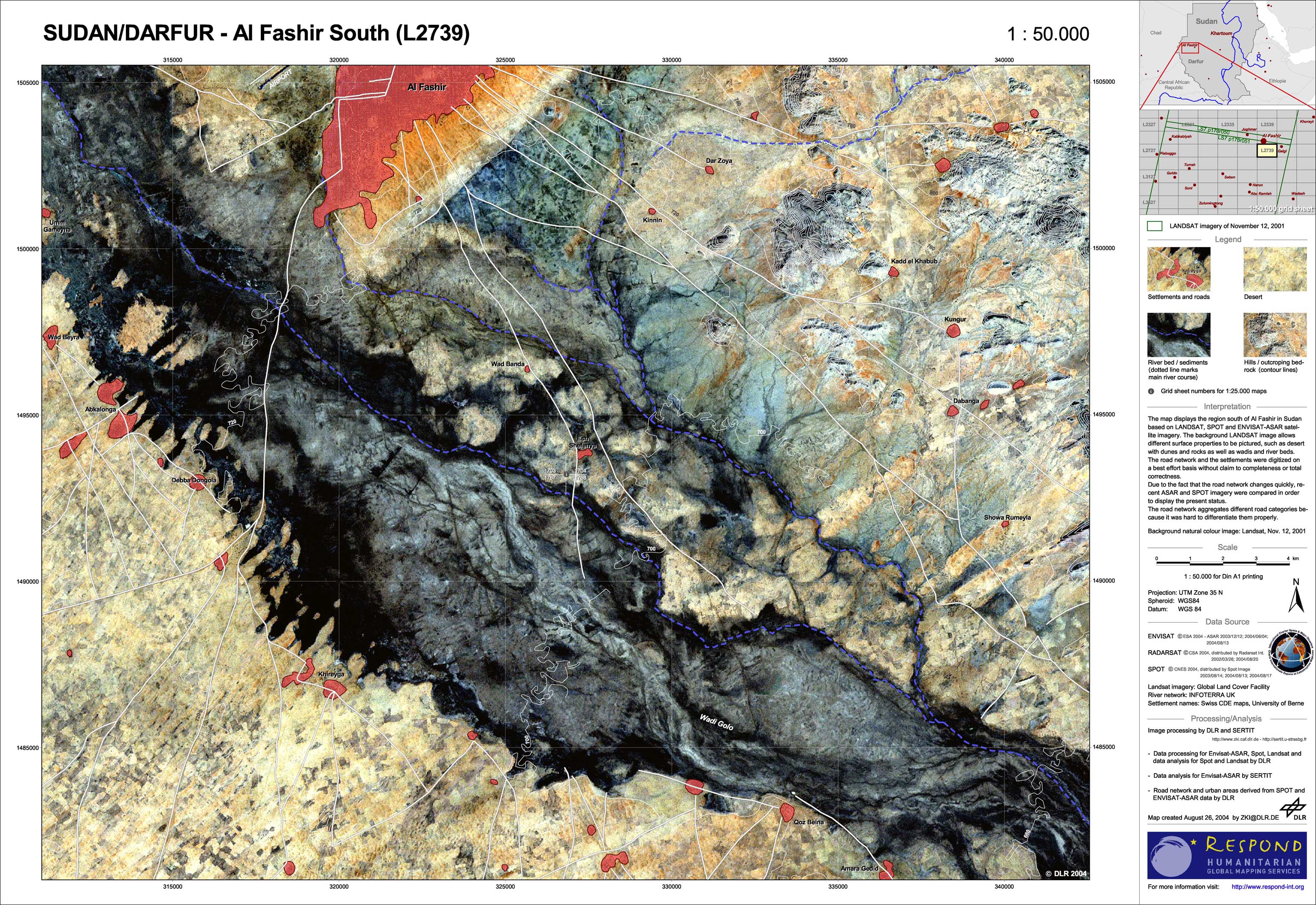
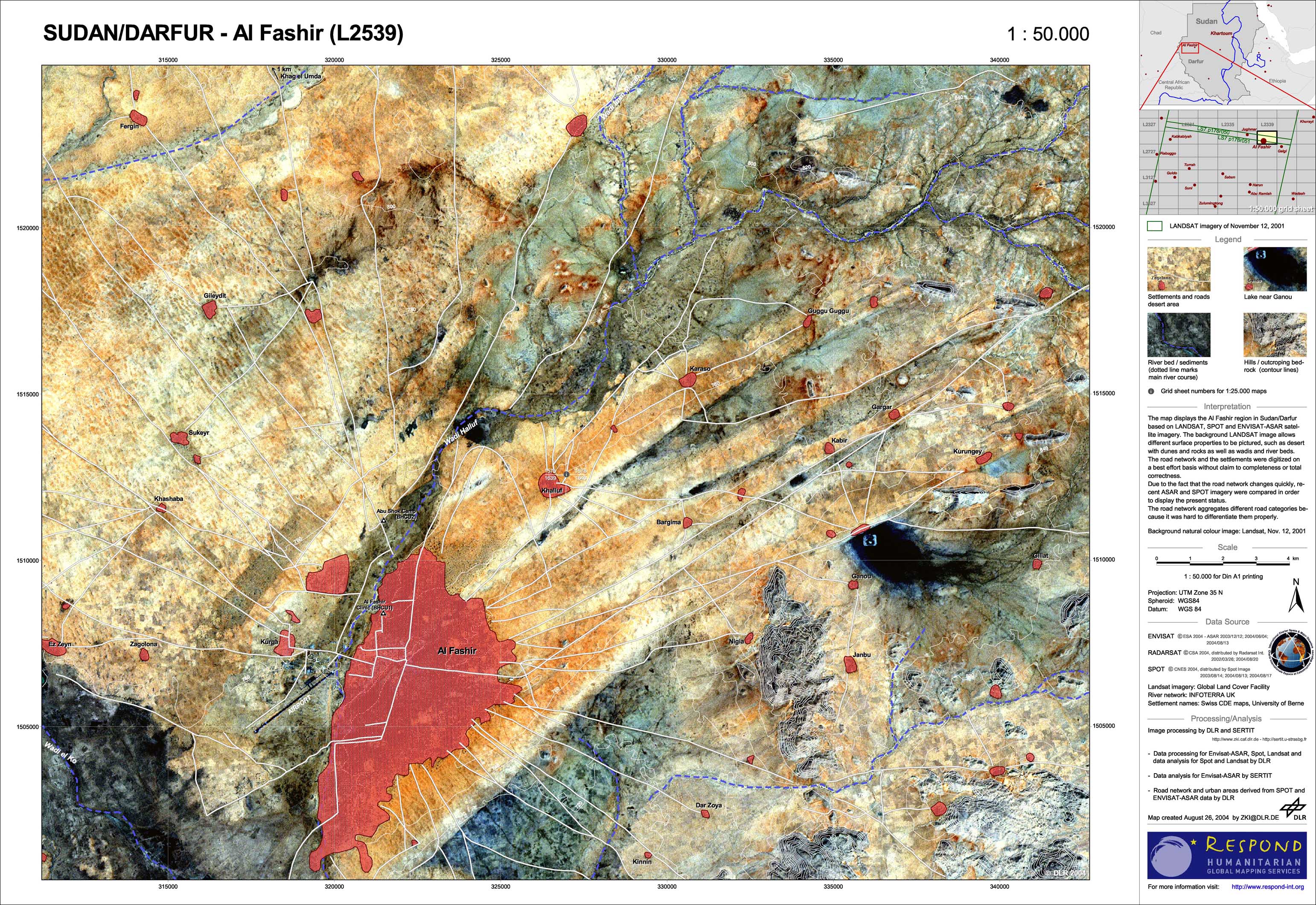
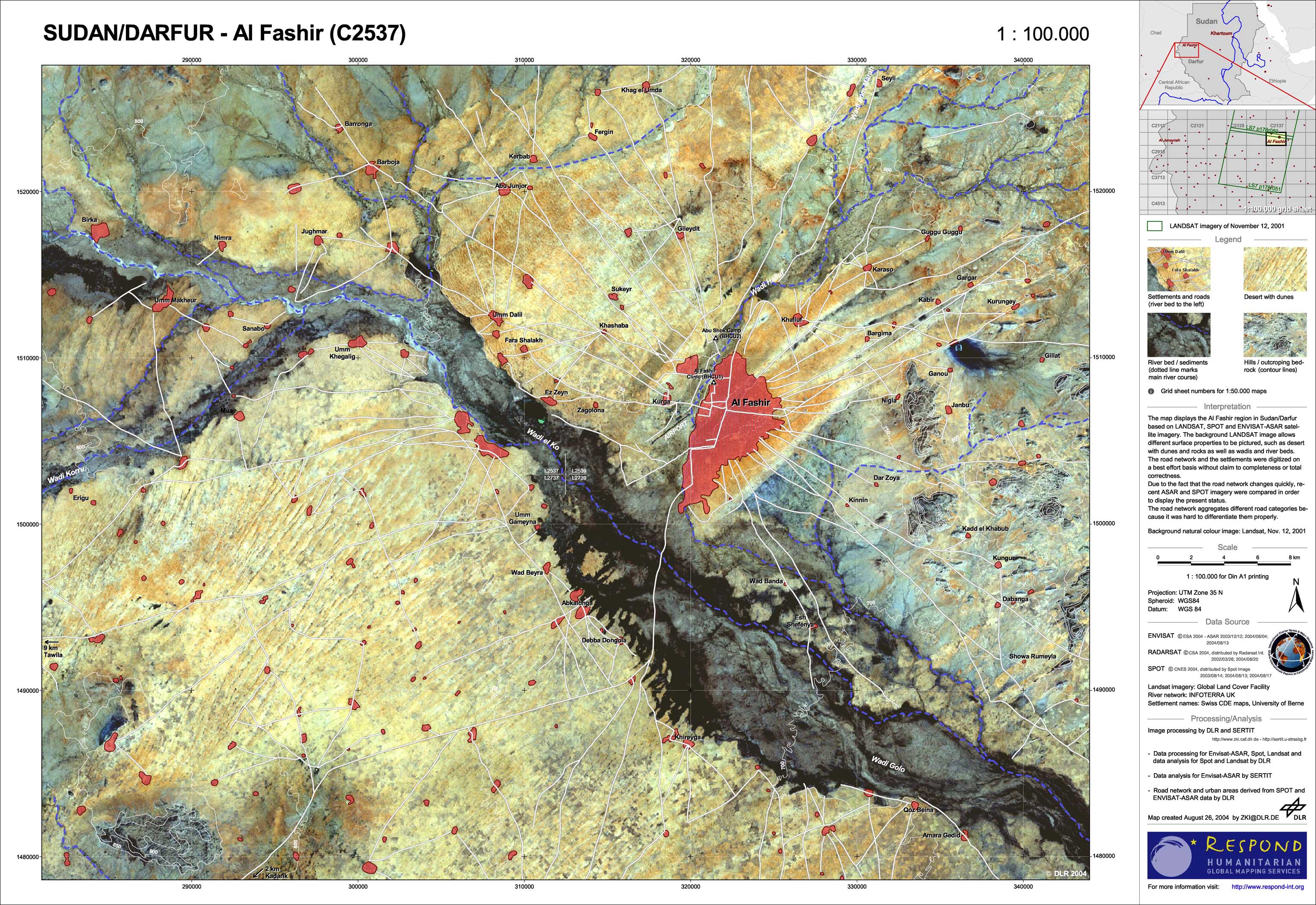
Because of the continuing refugee situation and the onset of the rainy season in western Sudan, the humanitarian aid organizations working there are in urgent need of up-to-date, detailed maps. In consultation with UN-OCHA, Germany's disaster relief organization (THW) and the German Red Cross (DRK), the crisis regions around the cities of Al Fashir and Al Junaynah were the first to be mapped. The focus was on ascertaining the road network, its condition, and the traversability of possibly flooded wadis and river valleys. Recording settlements and refugees camps and their current size was also of high interest. Satellite data were made available for the maps by the 'International Charter on Space and Major Disasters' and processed and interpreted in the context of the ESA GMES Service Element, 'RESPOND'
Sudan - P06 - Al Fashir city/Sudan
Creation Date 31. August 2004
Sudan - P05 - south-western region of Al Fashir/Sudan
Creation Date 31. August 2004
Sudan - P04 - western region of Al Fashir/Sudan
Creation Date 31. August 2004
Sudan - P03 - southern region of Al Fashir/Sudan
Creation Date 31. August 2004
Sudan - P02 - Al Fashir/Sudan
Creation Date 31. August 2004
Sudan - P01 - Al Fashir region/Sudan
Creation Date 31. August 2004
undefined