ZKI in cooperation with UNHCR performed a refugee camp monitoring for Chad
undefined
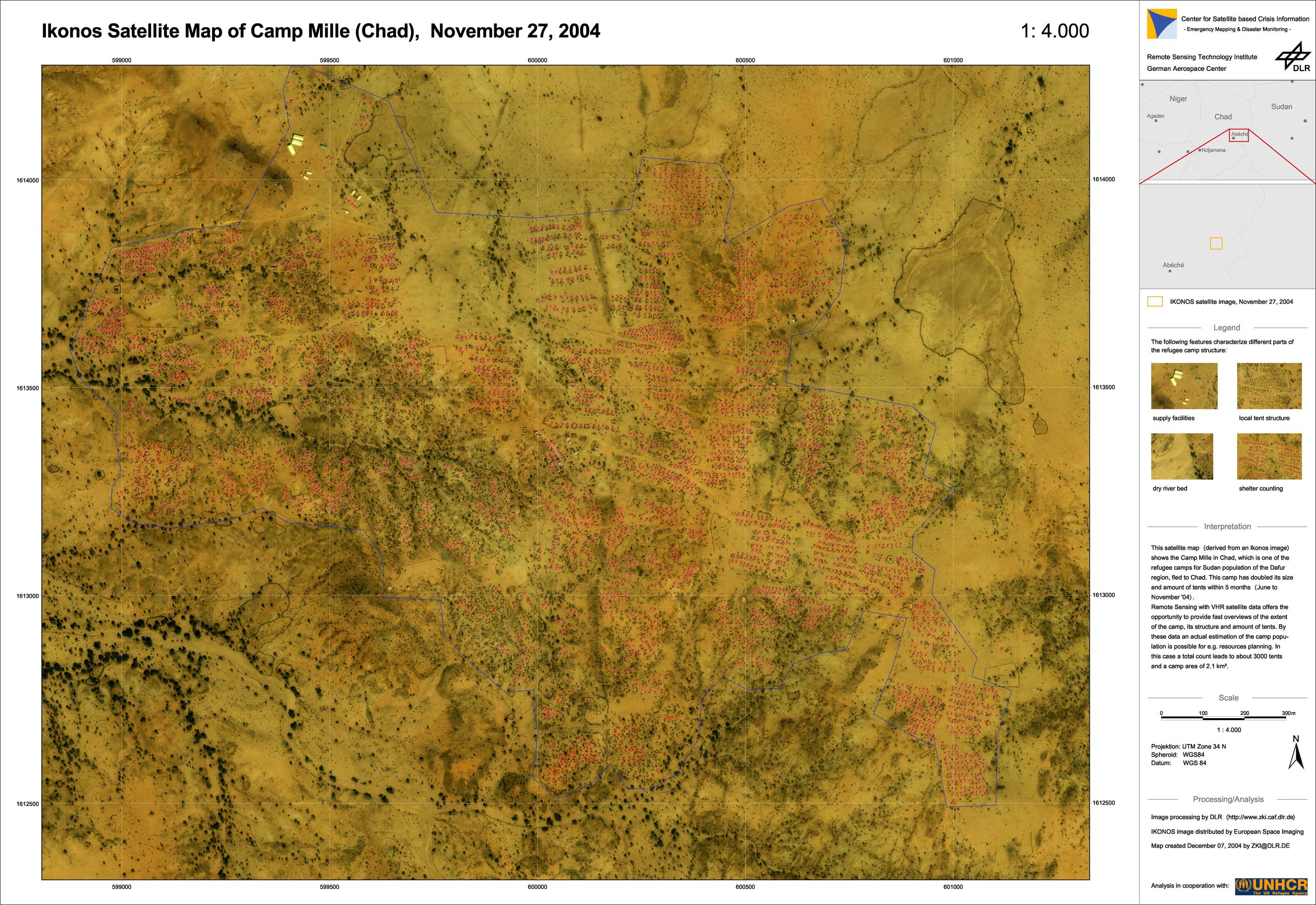
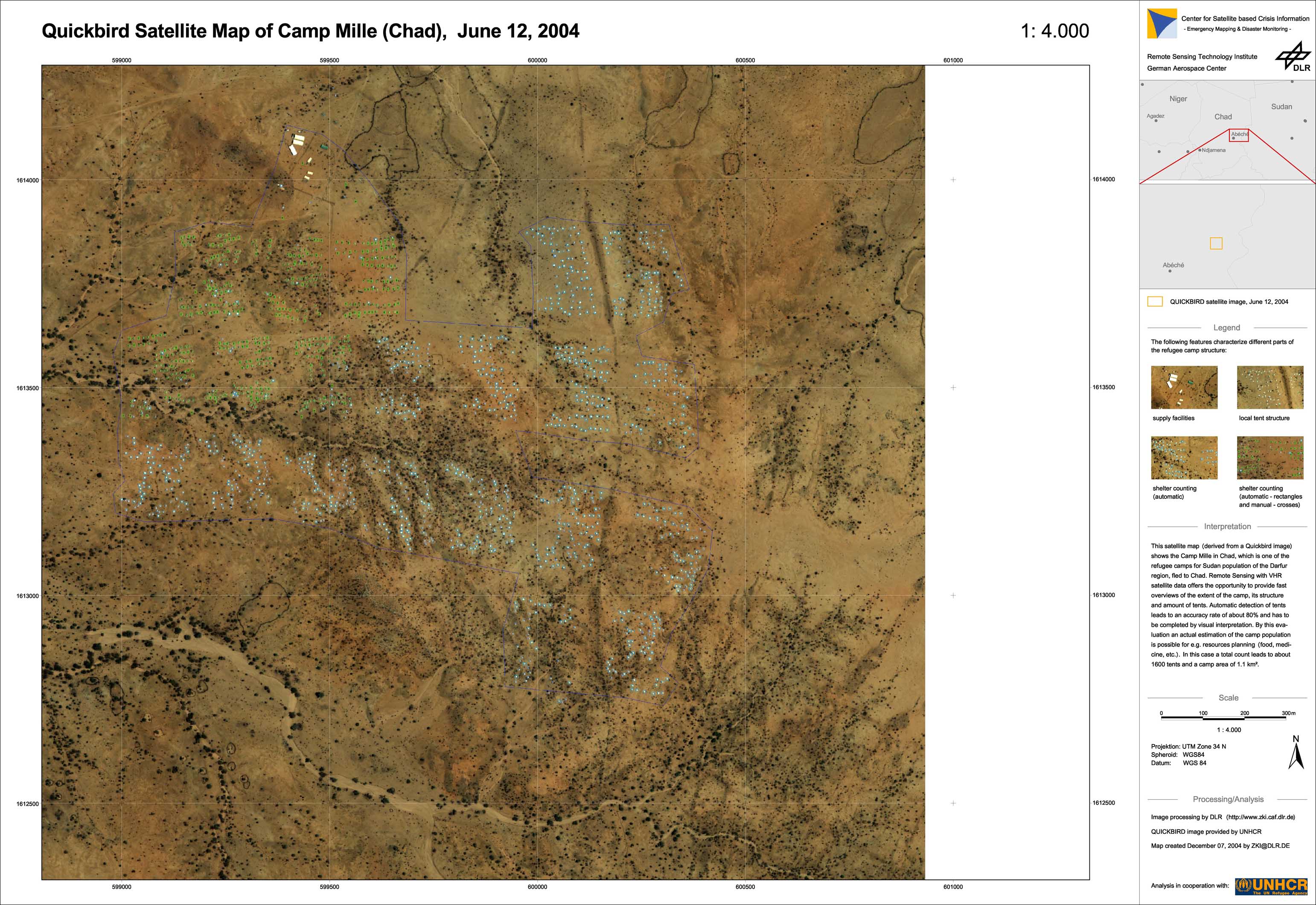
Due to Civil War, thousands of people escape the Darfur region in Sudan and seek shelter in the state of Chad, where many refugee camps have been established. Not all of them are permanently supervised by international organizations. UNHCR, the High Commissioner for Refugees asked for a subsequent satellite data acquisition to be able to monitor the change in size and amount of tents of the refugee camp Mille by change detection methods. The satellite maps show the Camp Mille in Chad: one image (June 2004) has been acquired with the Quickbird satellite, while the later one (November 2004) has been acquired with the Ikonos satellite. During this period the camp has doubled its size and its amount of tents. Remote Sensing with VHR satellite data offers the opportunity to provide fast overviews of the extent of a camp, its structure and amount of tents. With these data an actual estimation of the camp population is possible for e.g. resources planning (food, medicine, etc.). In this case a total count leads to about 1600 tents in June and about 3000 tents in November with the camp area growing from 1.1km² to 2.1km². Automatic detection of tents has been performed with template matching methods (small rectangles), while it had to be completed by manual methods (crosses). This combined evaluation procedure allows the fastest and most reliable interpretation of VHR satellite images for the above mentioned purposes.
Chad - P02 - Ikonos-satellite map of refugee camp Mille
Creation Date 27. November 2004
Chad - P01 - Quickbird-satellite map of refugee camp Mille
Creation Date 12. June 2004
undefined