
ZKI satellite mapping supports international humanitarian relief teams in Southeast Asia
undefined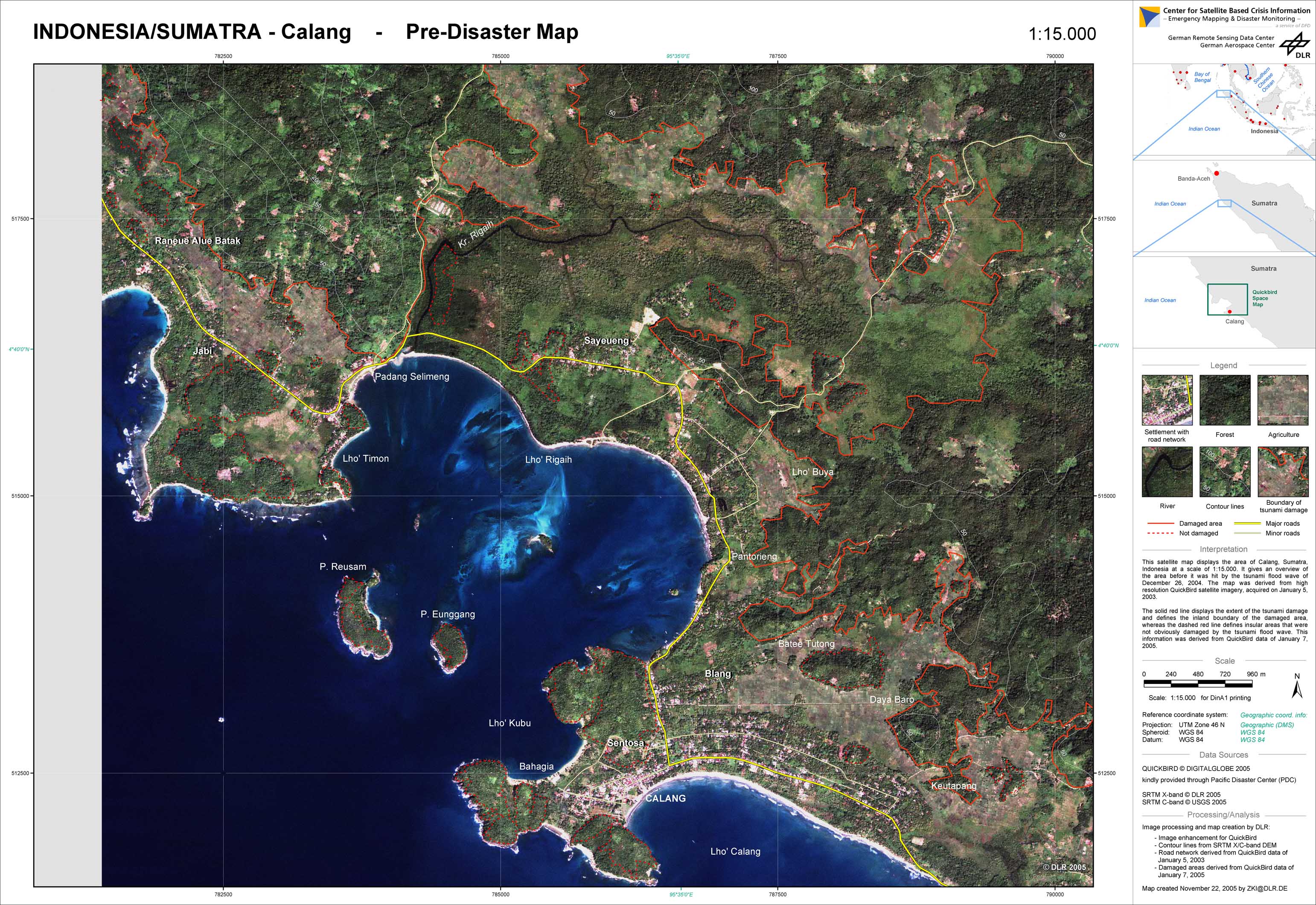
Indonesia - P45 - Pre-disaster satellite map of the city of Calang, Banda Aceh Region /Sumatra
Creation Date 23. November 2005
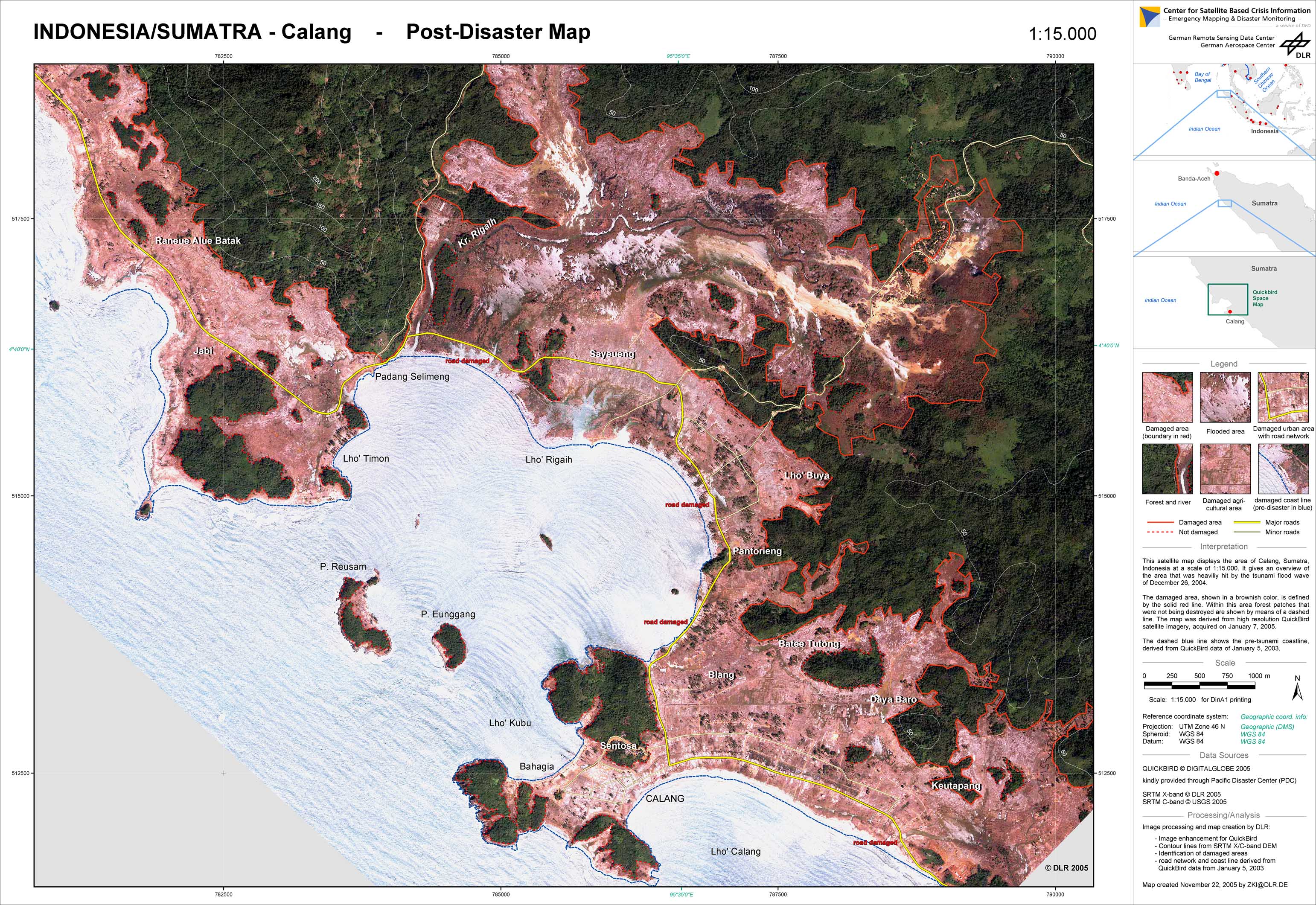
Indonesia - P46 - Post-disaster satellite map of the city of Calang, Banda Aceh Region/Sumatra
Creation Date 23. November 2005
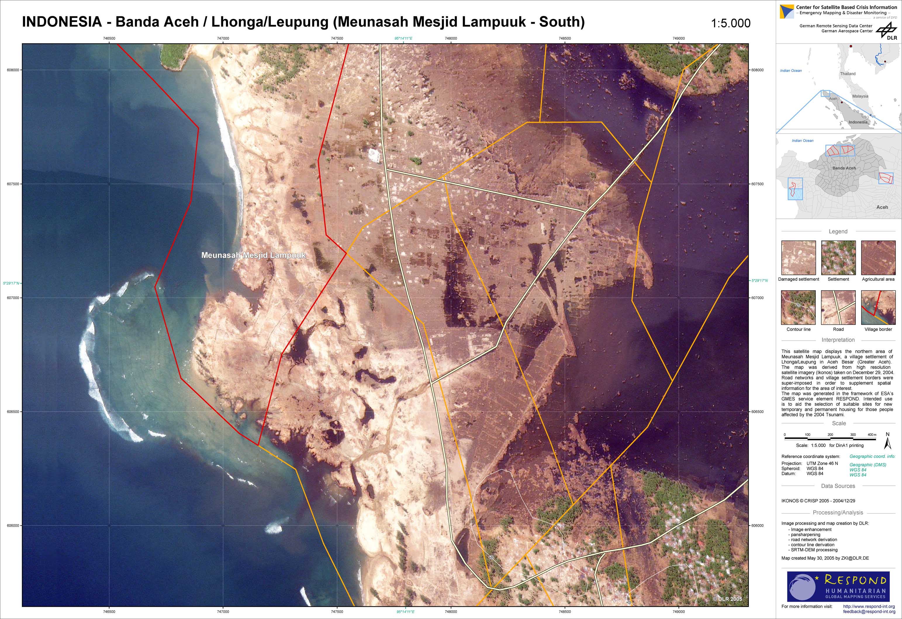
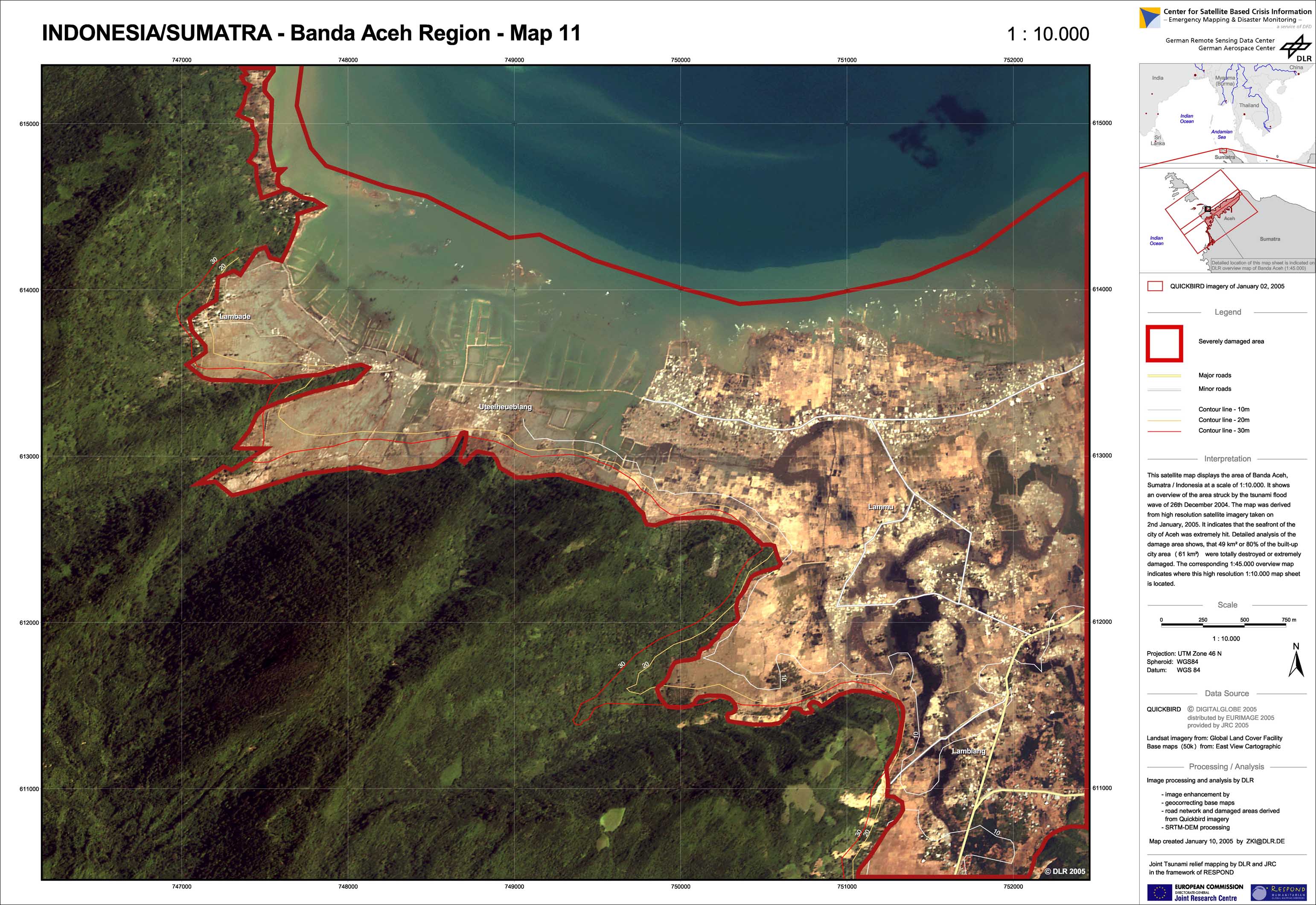
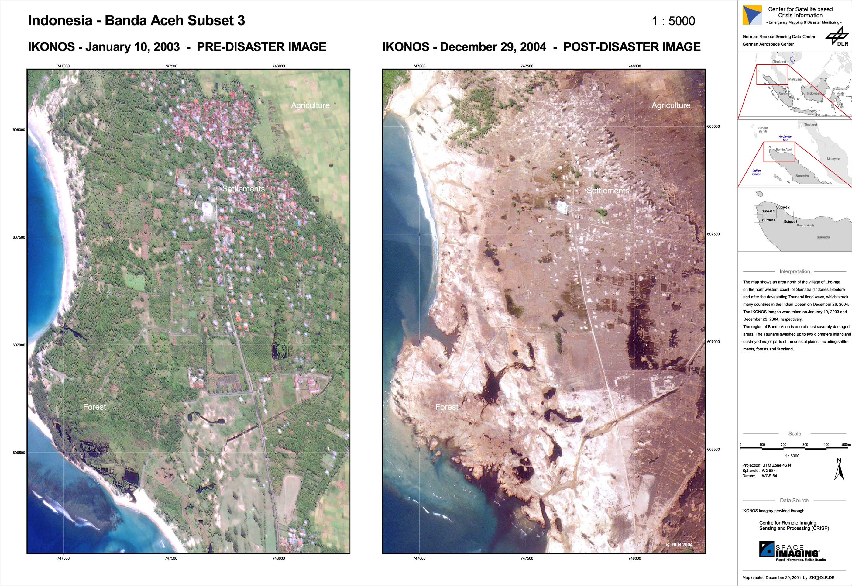
Indonesia - P44 - Banda Aceh - Satellite map - Lhonga/Leupung (Meunasah Mesjid Lampuuk - South)
Creation Date 30. May 2005
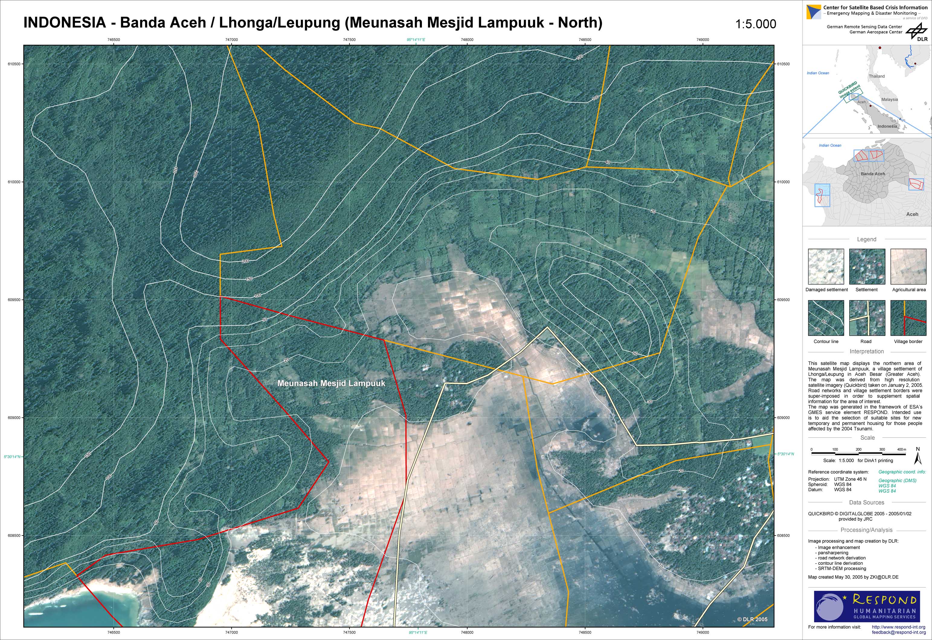
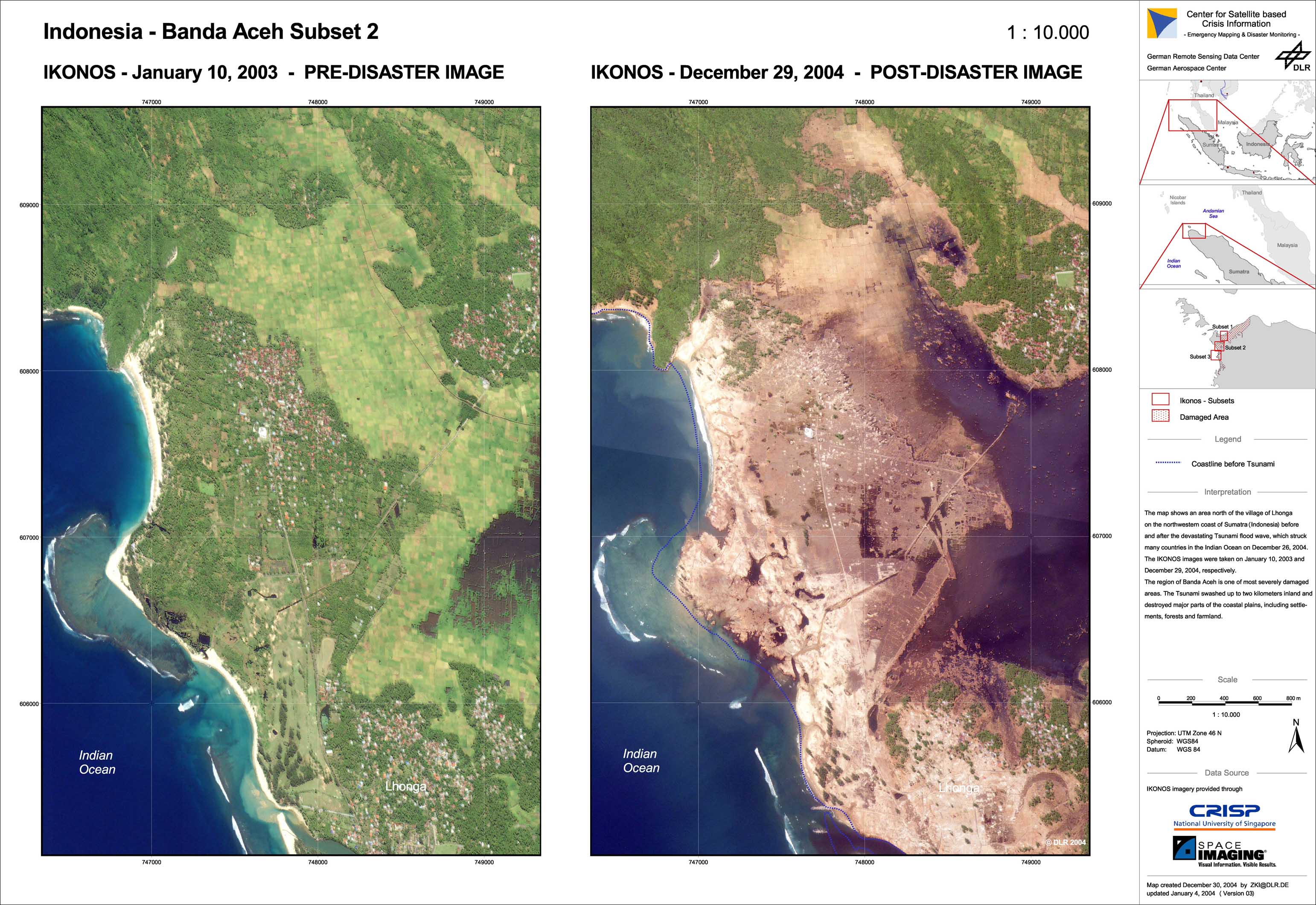
Indonesia - P43 - Banda Aceh - Satellite map - Lhonga/Leupung (Meunasah Mesjid Lampuuk - North)
Creation Date 30. May 2005
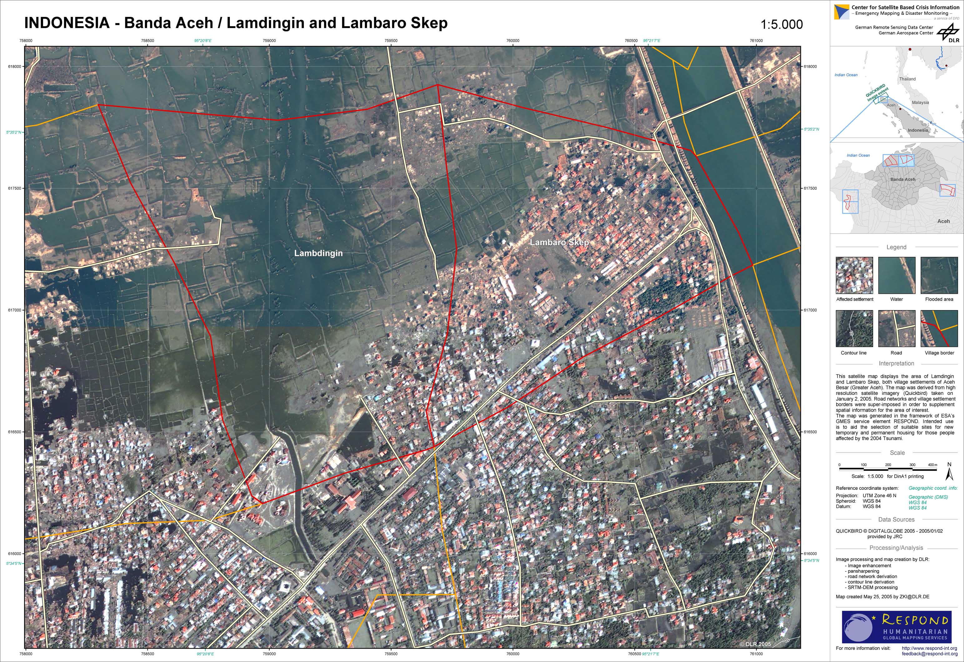
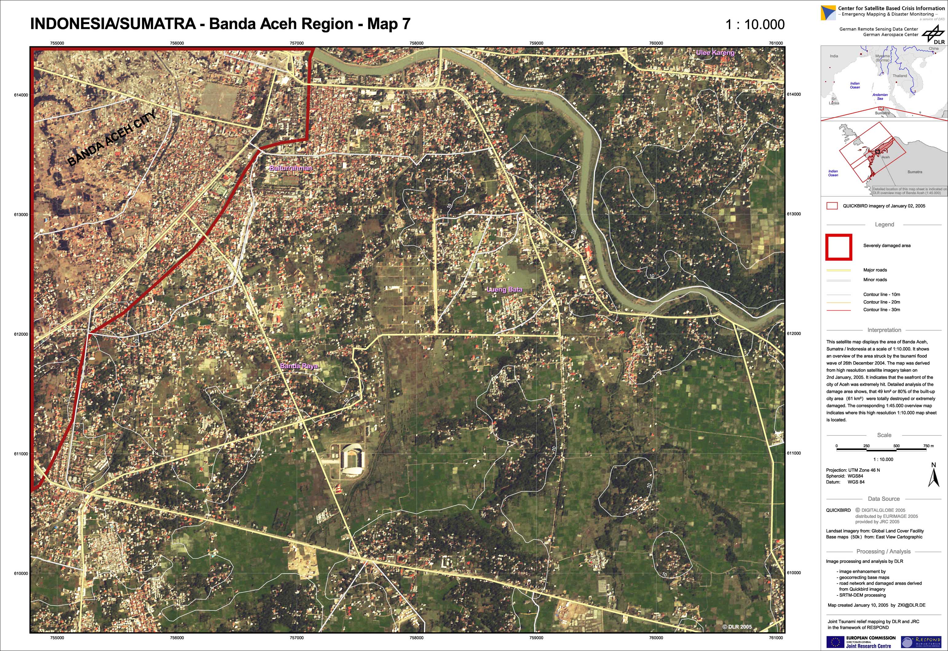
Indonesia - P42 - Banda Aceh - Satellite map - Lamdingin and Lambaro Skep
Creation Date 25. May 2005
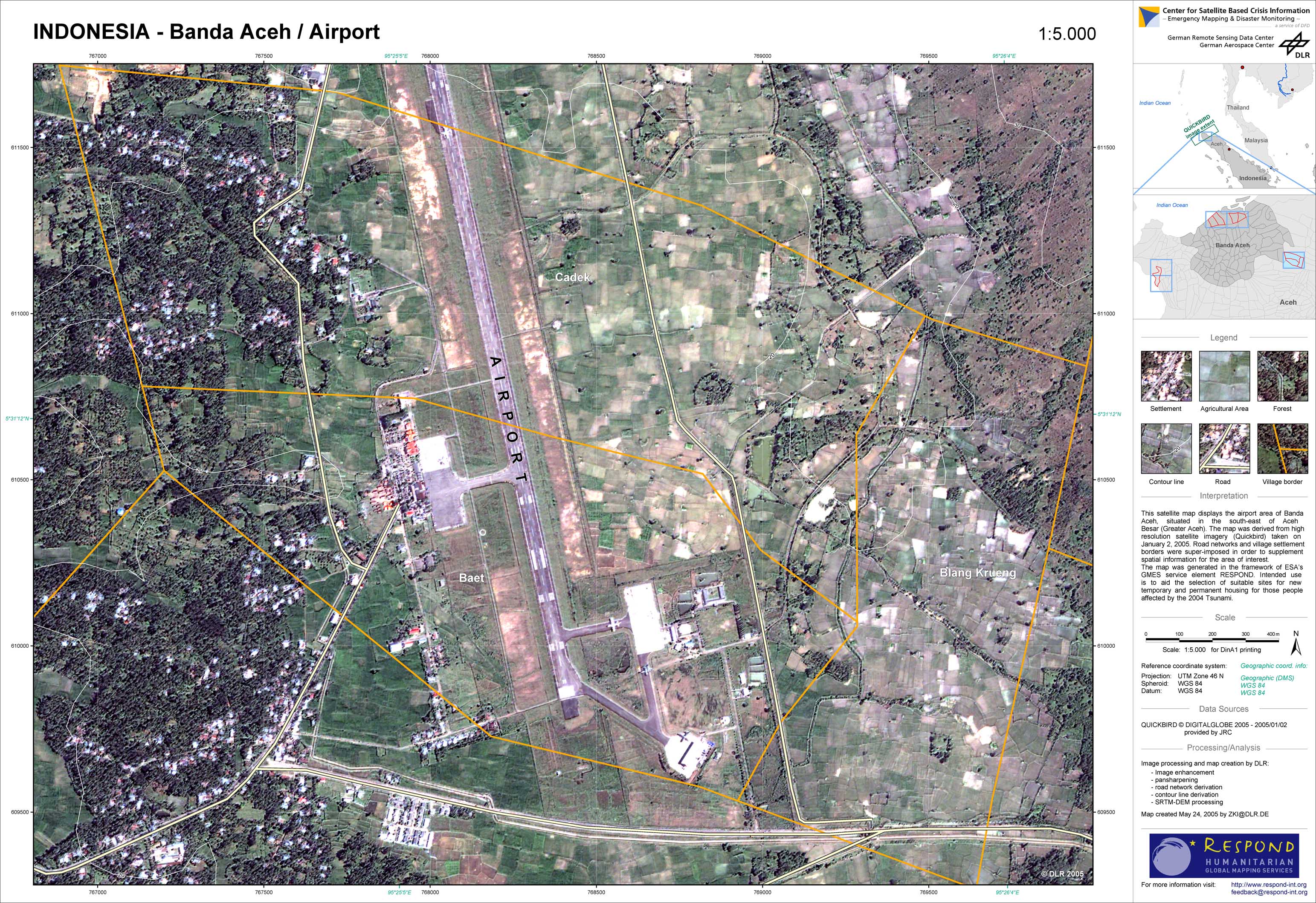
Indonesia - P41 - Banda Aceh - Satellite map - Airport
Creation Date 25. May 2005
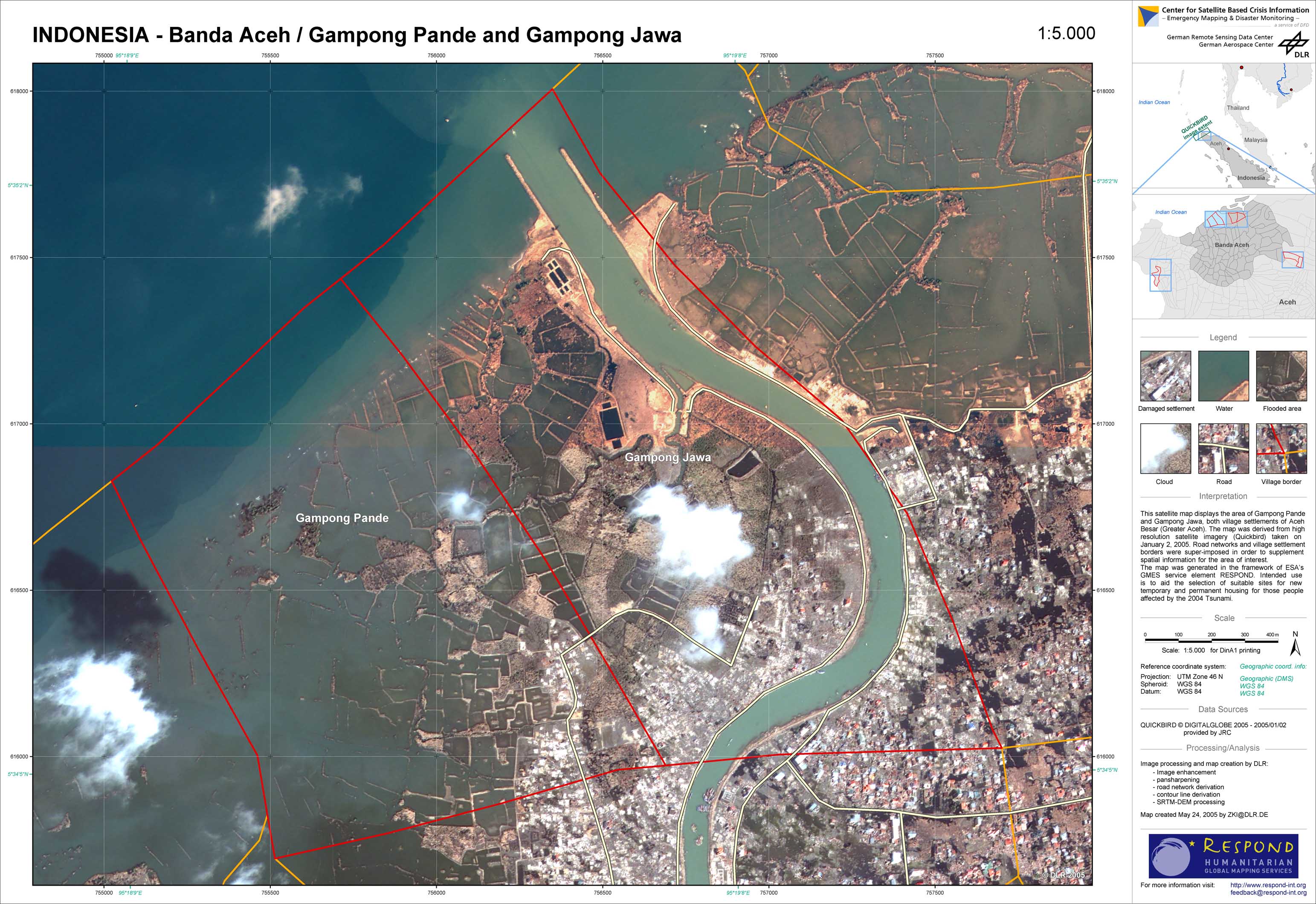
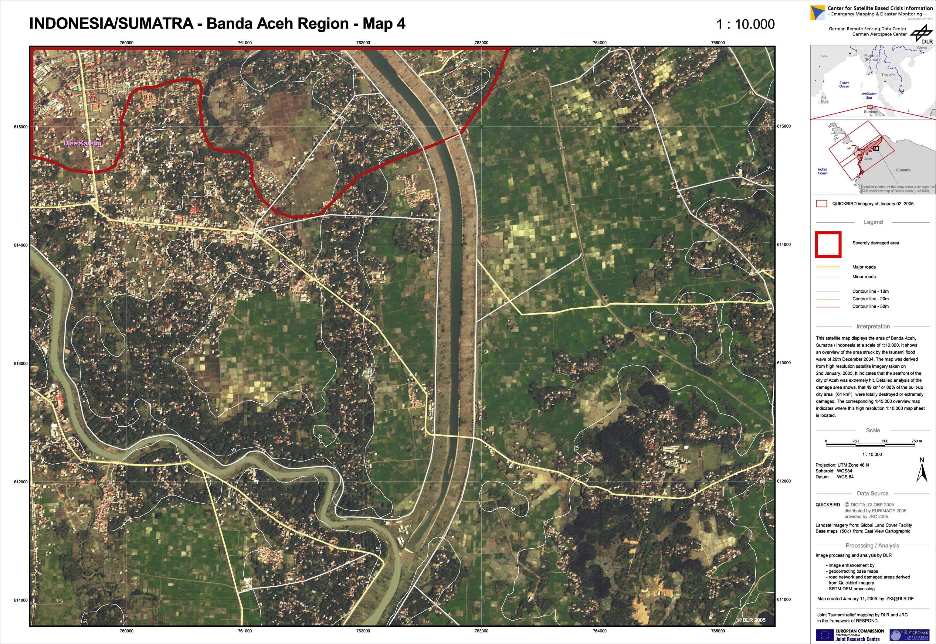
Indonesia - P40 - Banda Aceh - Satellite map - Gampong Pande and Gampong Jawa
Creation Date 24. May 2005
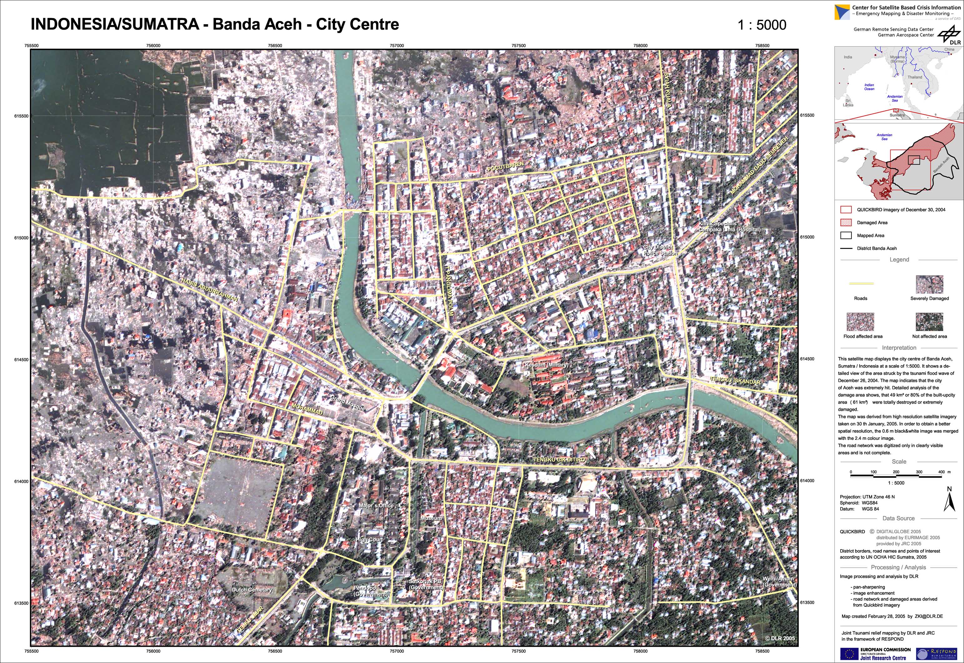
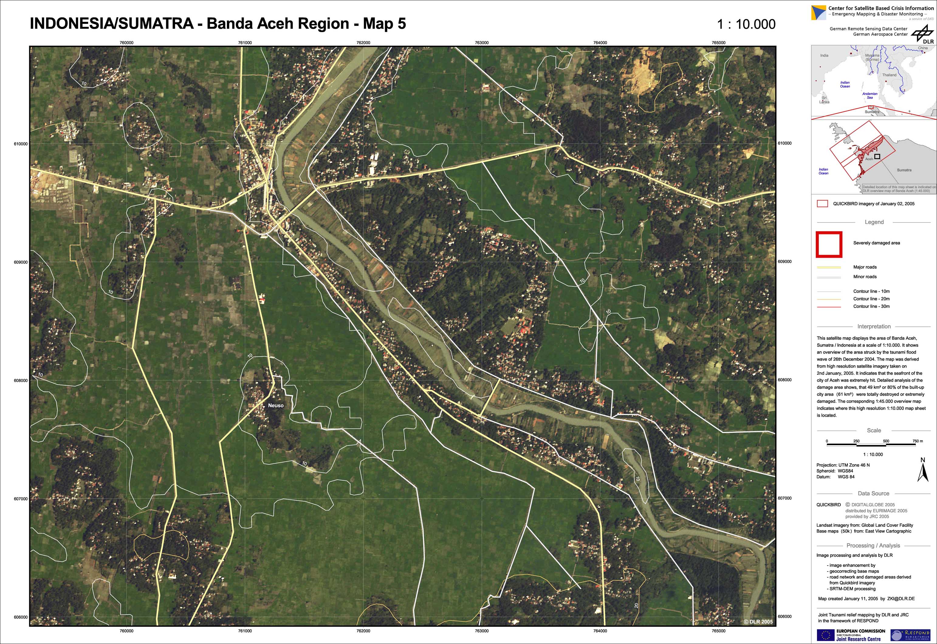
Indonesia - P39 - Banda Aceh - Satellite map - City centre
Creation Date 28. February 2005
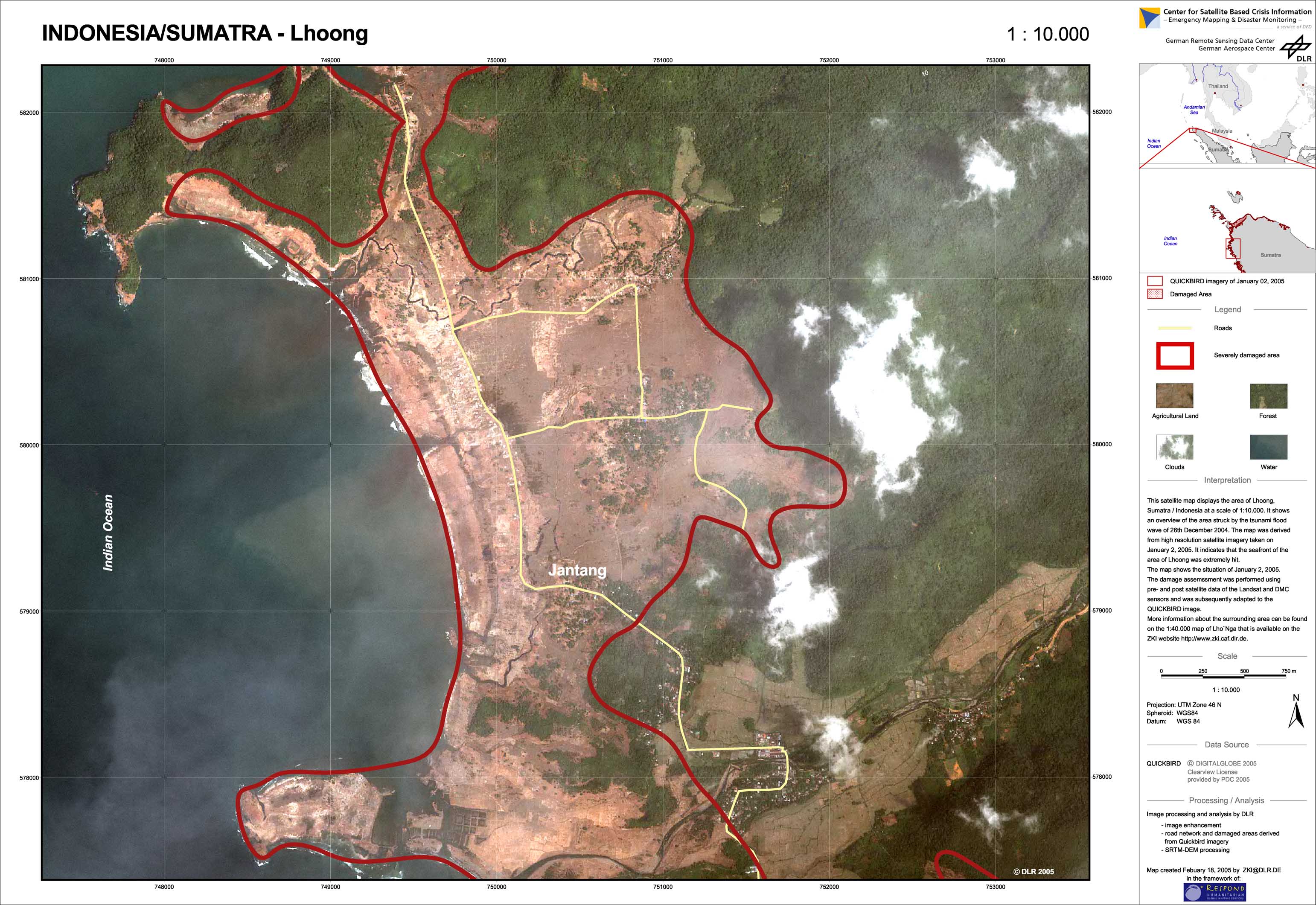
Indonesia - P38 - Satellite map and affected area - Lhoong
Creation Date 18. February 2005
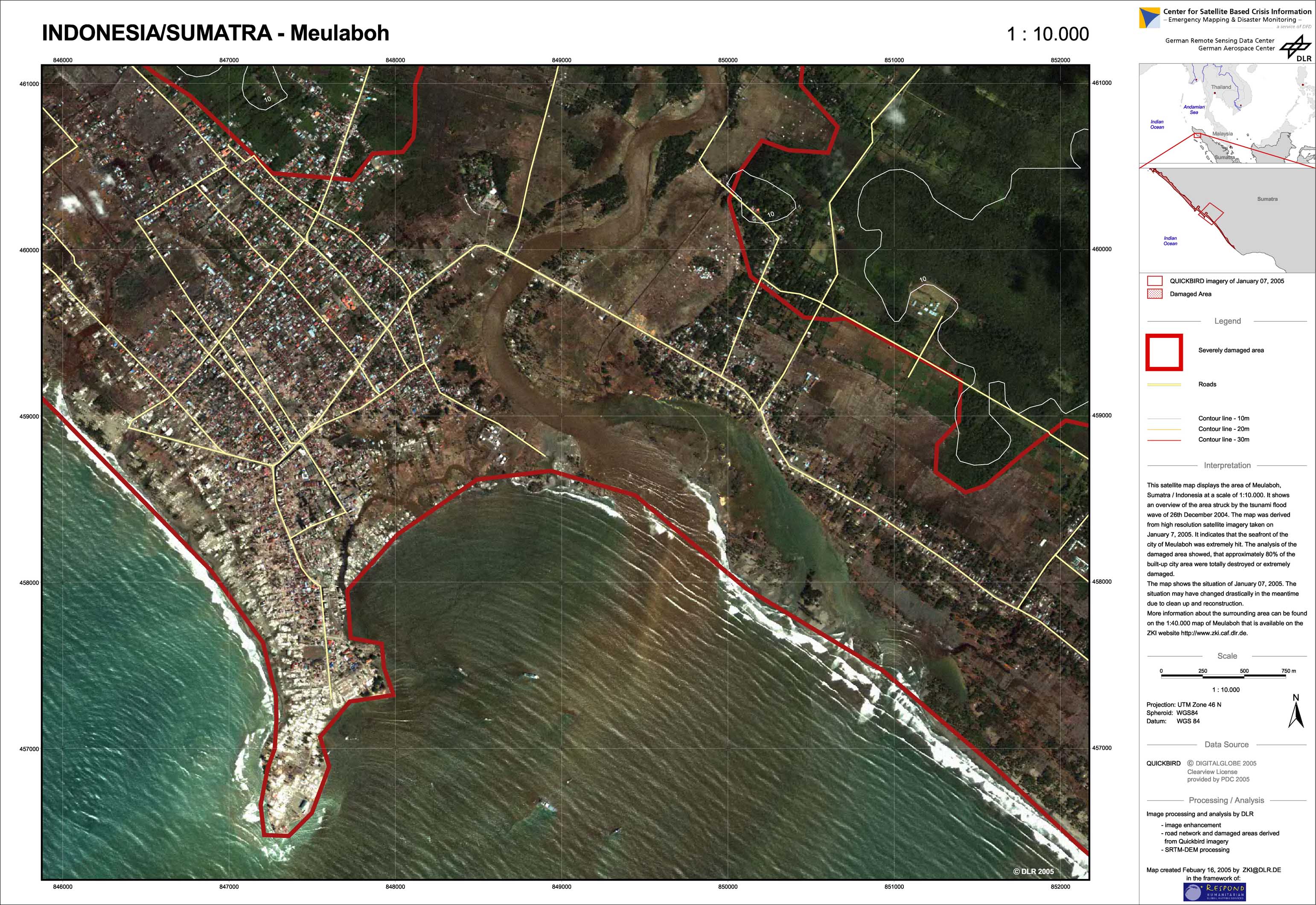
Indonesia - P37 - Satellite map and affected area - Meulaboh
Creation Date 16. February 2005
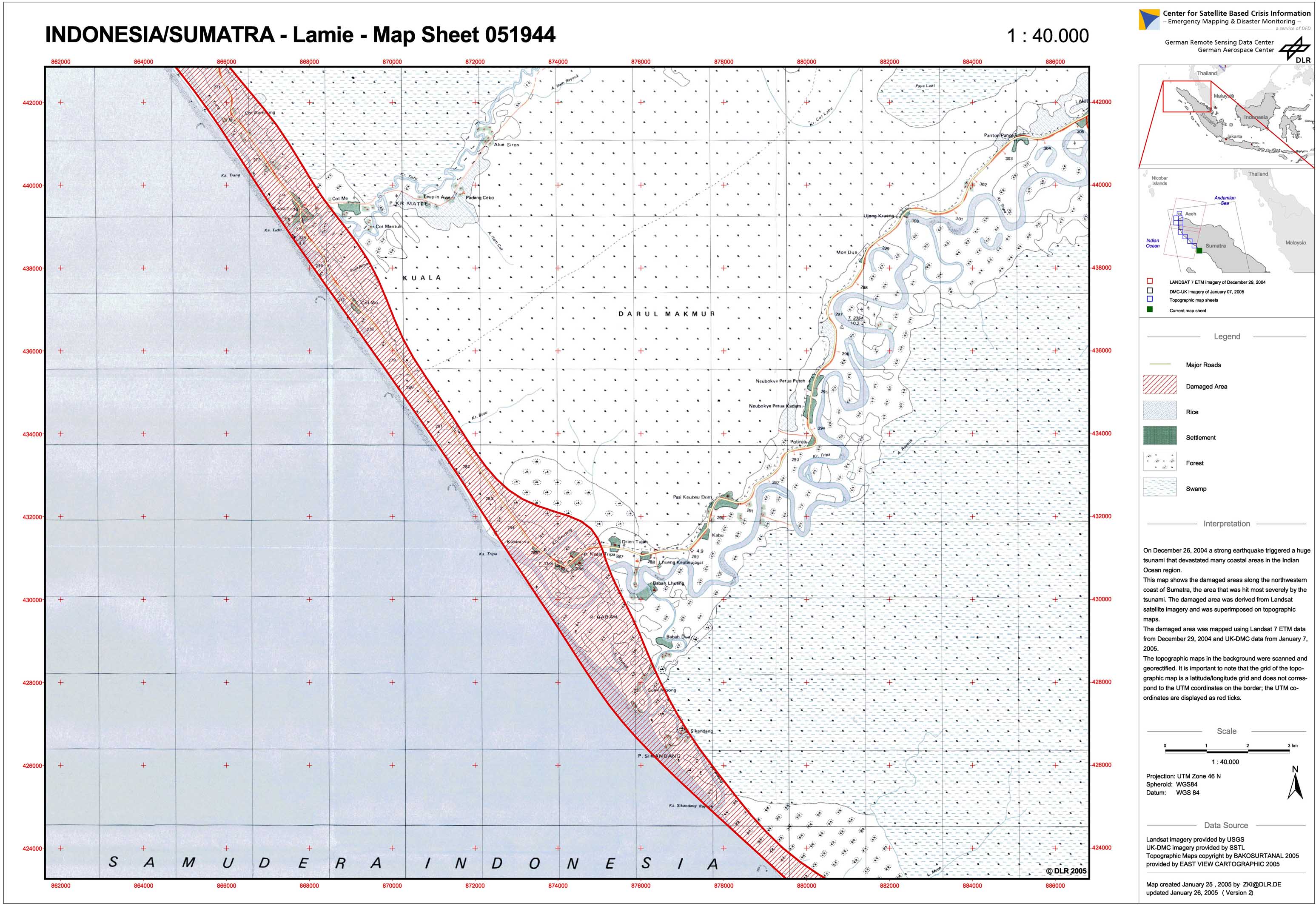
Indonesia - P36 - Damage assessment on NW-coast of Sumatra, map 10: Lamie - 051944
Creation Date 26. January 2005
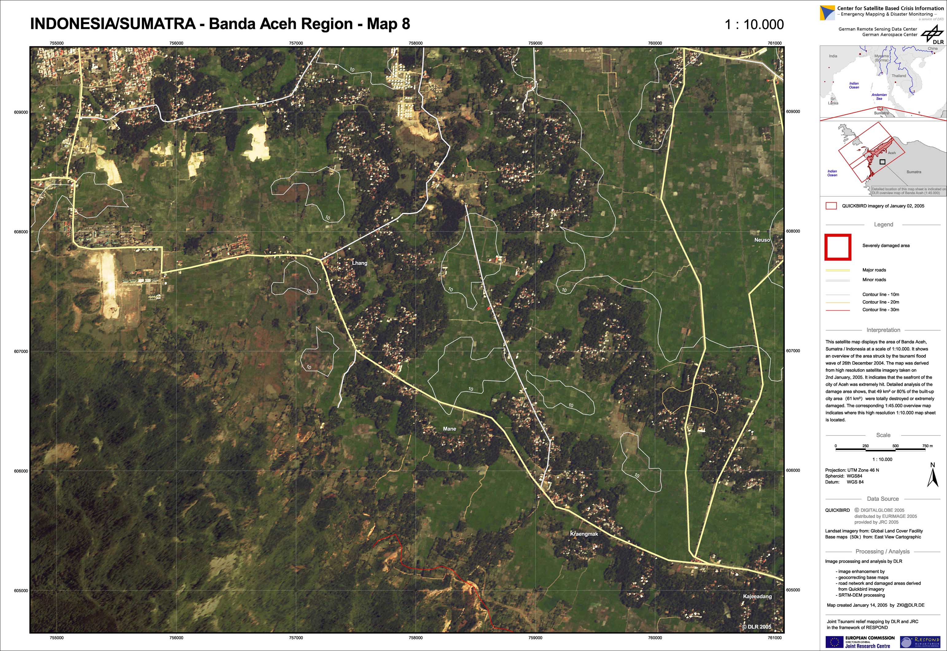
Indonesia - P20 - Aceh region BA-08 - Satellite map (new satellite imagery)
Creation Date 14. January 2005
Indonesia - P13 - Aceh region BA-01 - Satellite map (new satellite imagery)
Creation Date 14. January 2005
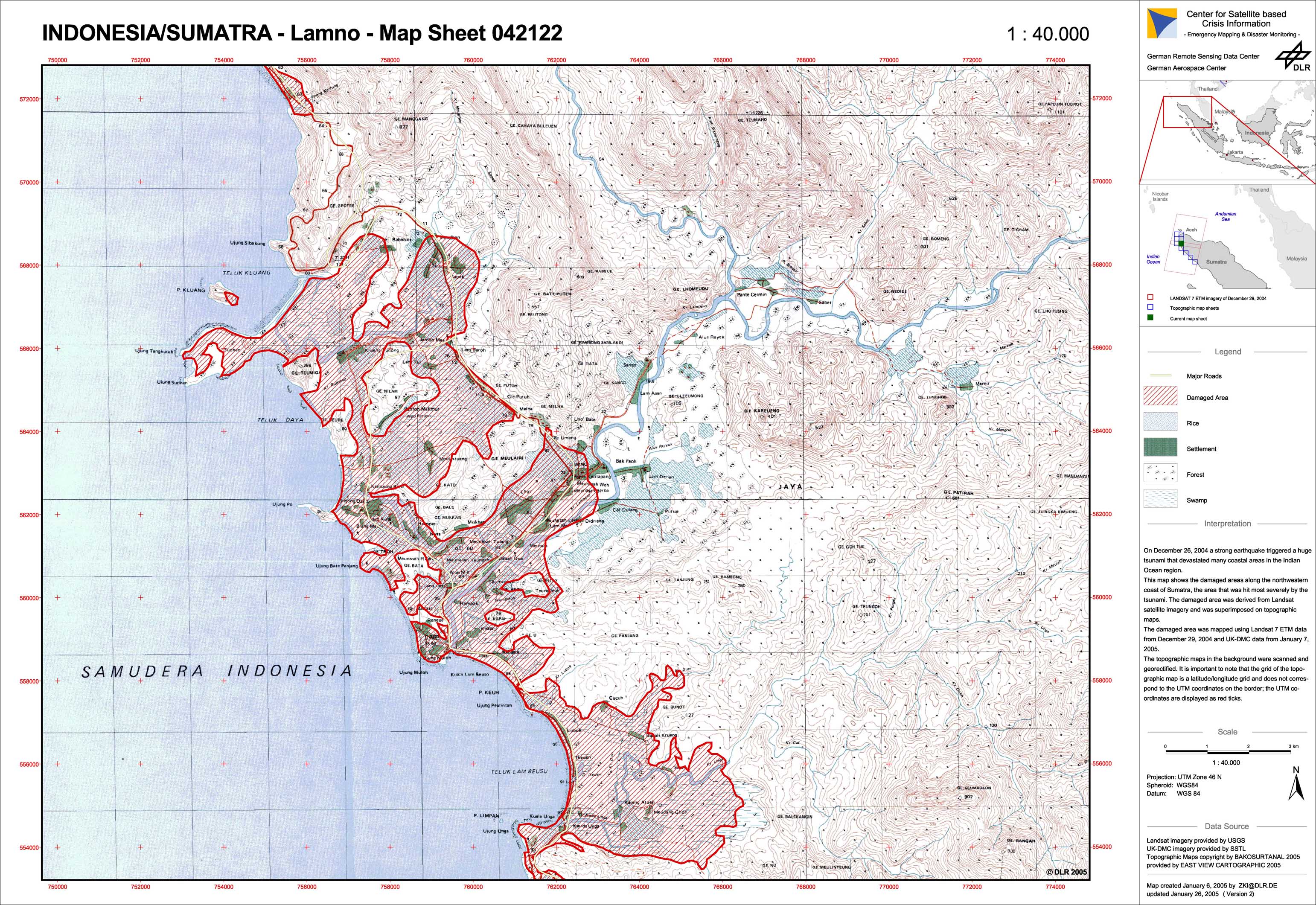
Indonesia - P31 - Damage assessment on NW-coast of Sumatra, map 5: Lamno - 042122
Creation Date 12. January 2005
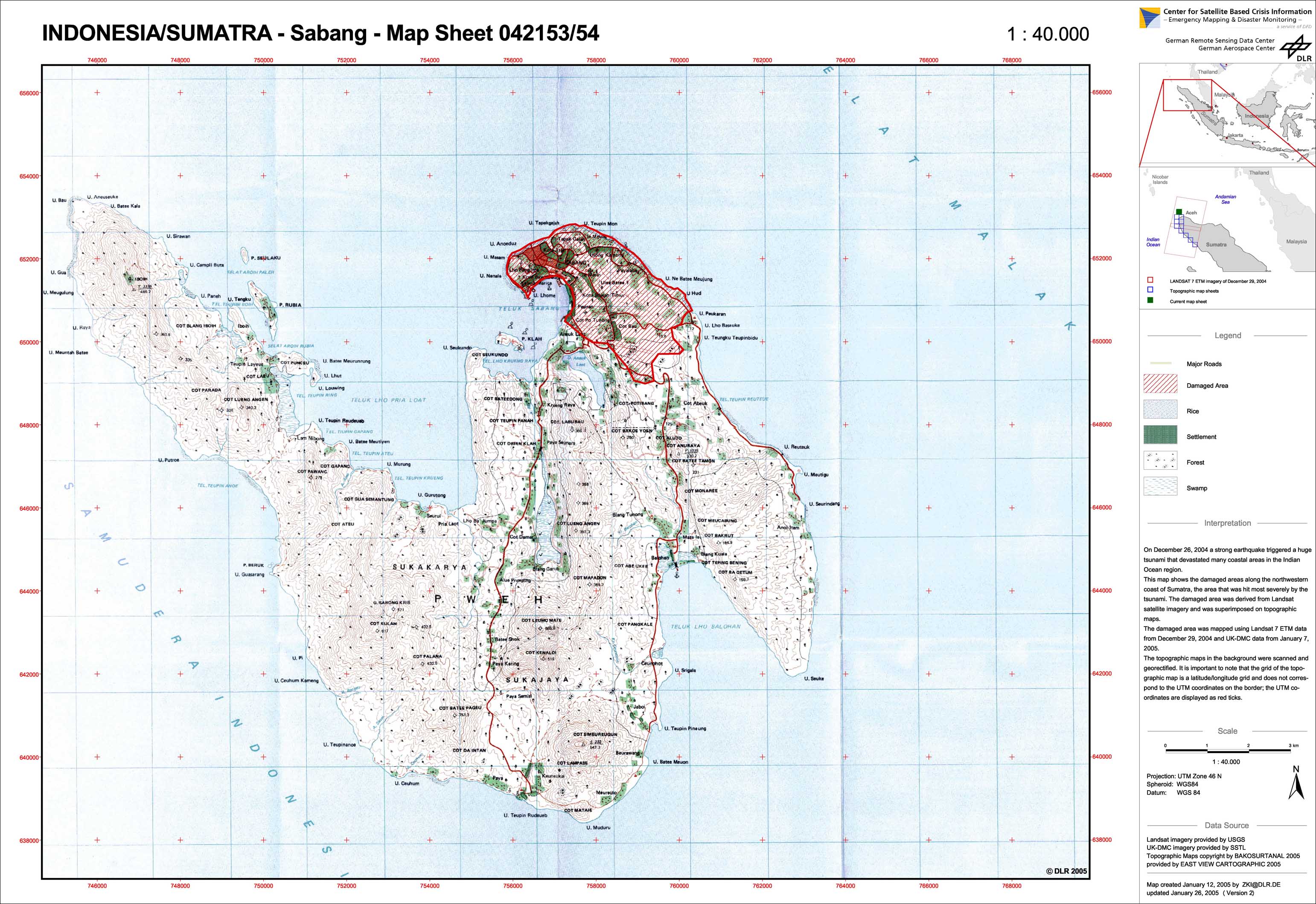
Indonesia - P35 - Damage assessment on NW-coast of Sumatra, map 9: Sabang - 042153/54
Creation Date 12. January 2005
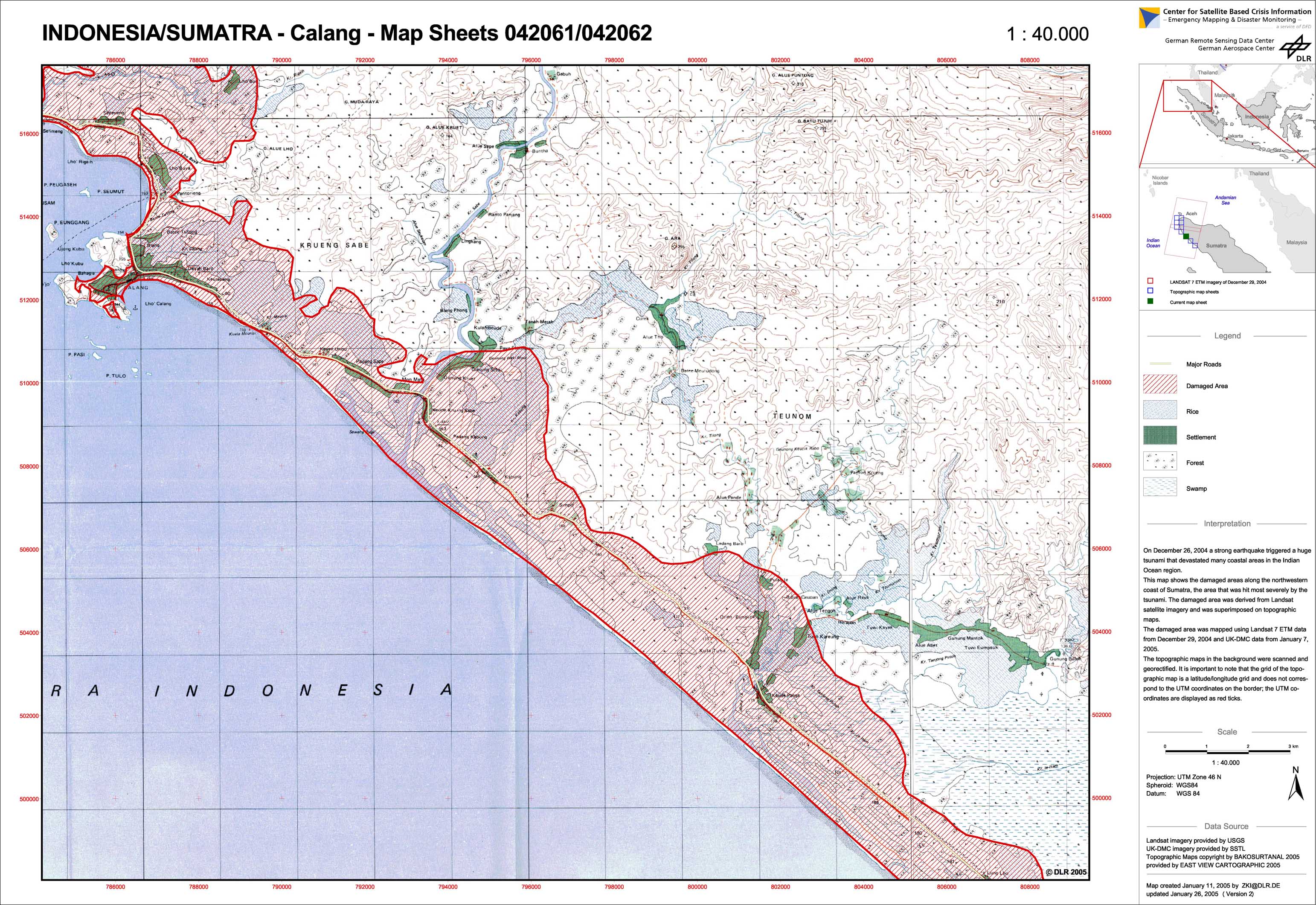
Indonesia - P29 - Damage assessment on NW-coast of Sumatra, map 3a: Calang - 042061/62
Creation Date 11. January 2005
Indonesia - P17 - Aceh region BA-05 - Satellite map (new satellite imagery)
Creation Date 11. January 2005
Indonesia - P16 - Aceh region BA-04 - Satellite map (new satellite imagery)
Creation Date 11. January 2005
Indonesia - P19 - Aceh region BA-07 - Satellite map (new satellite imagery)
Creation Date 10. January 2005
Indonesia - P23 - Aceh region BA-11 - Satellite map (new satellite imagery)
Creation Date 10. January 2005
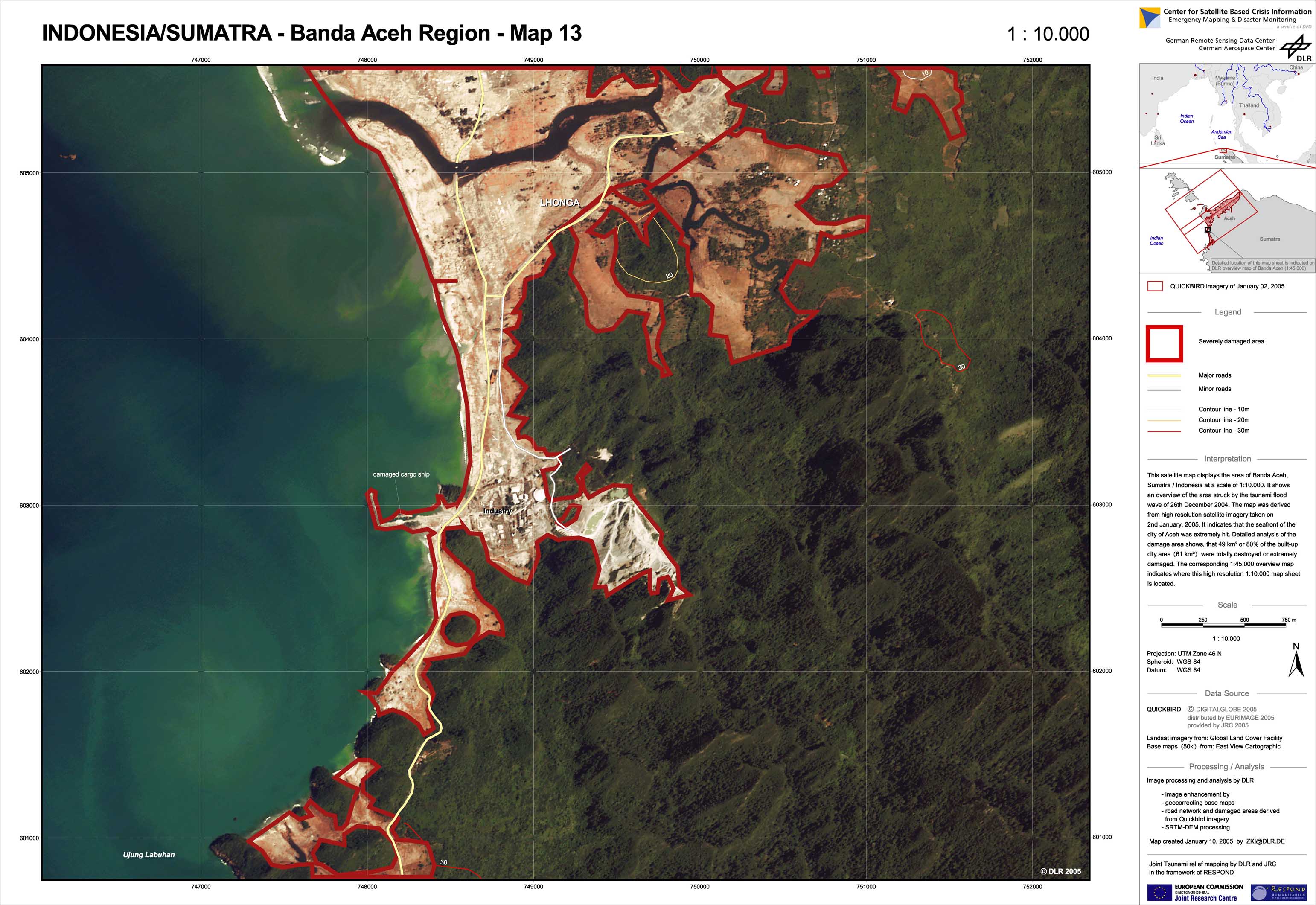
Indonesia - P25 - Aceh region BA-13 - Satellite map (new satellite imagery)
Creation Date 10. January 2005
Indonesia - P22 - Aceh region BA-10 - Satellite map (new satellite imagery)
Creation Date 07. January 2005
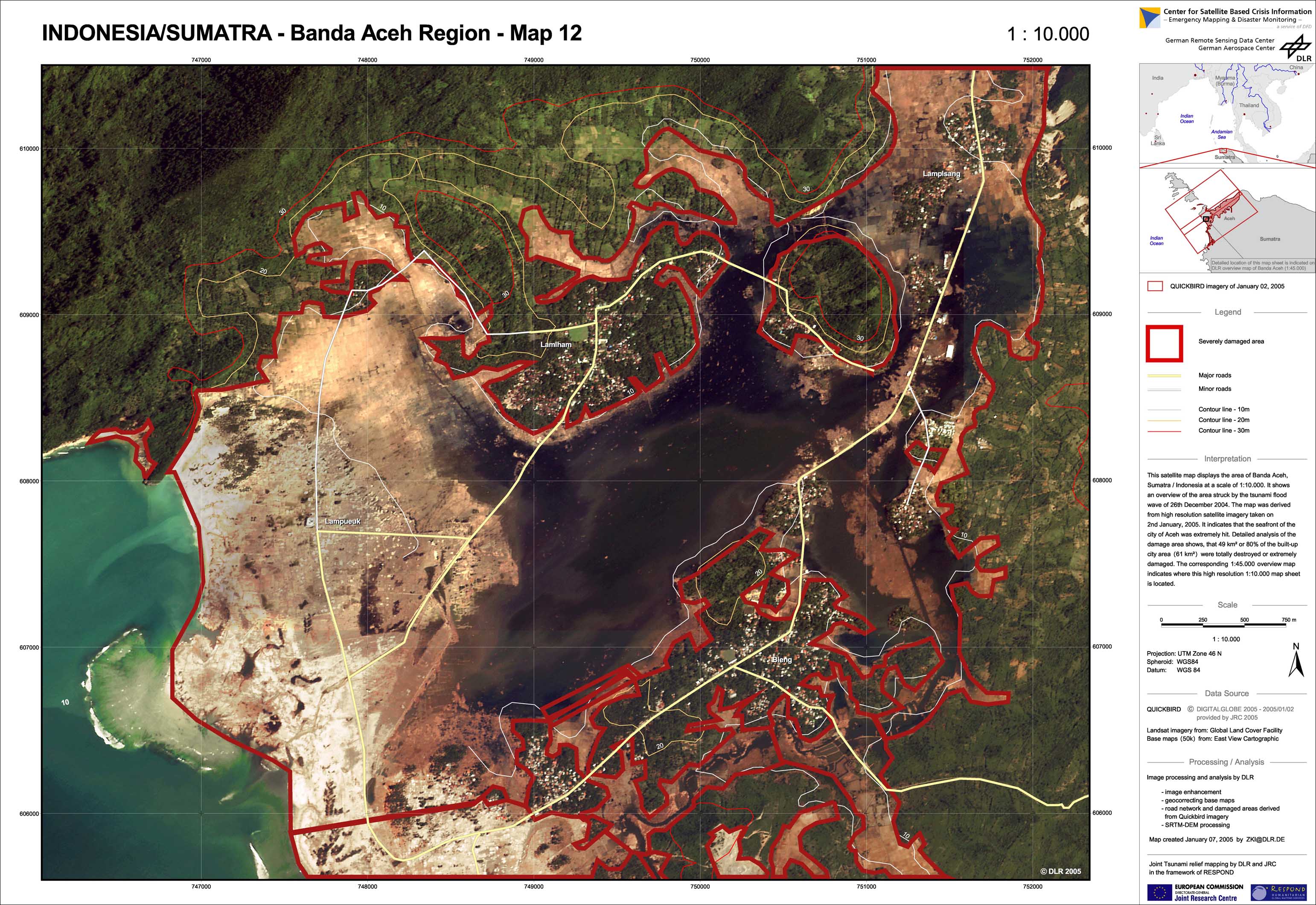
Indonesia - P24 - Aceh region BA-12 - Satellite map (new satellite imagery)
Creation Date 07. January 2005
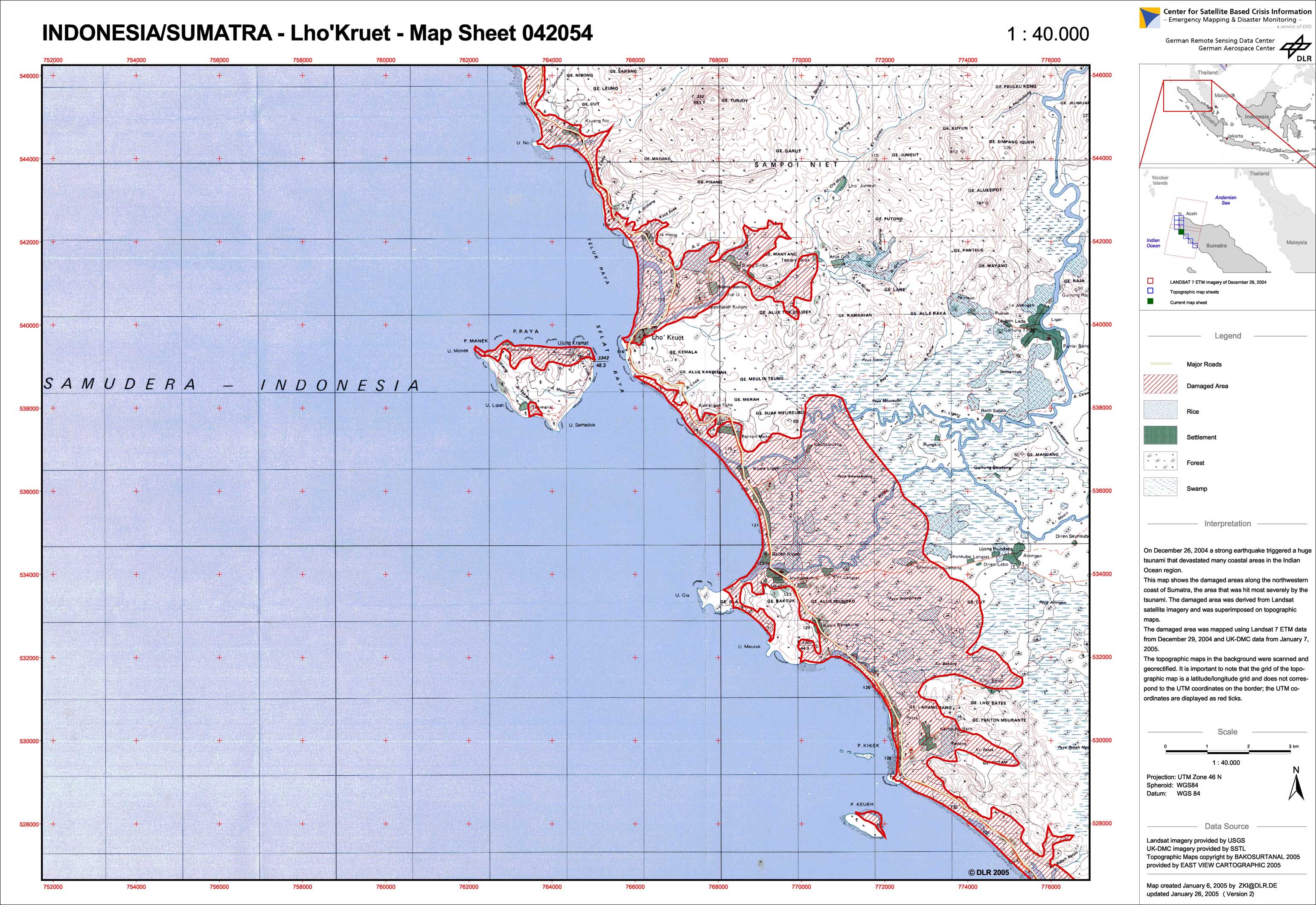
Indonesia - P30 - Damage assessment on NW-coast of Sumatra, map 4: Lho'Kruet - 042054
Creation Date 07. January 2005
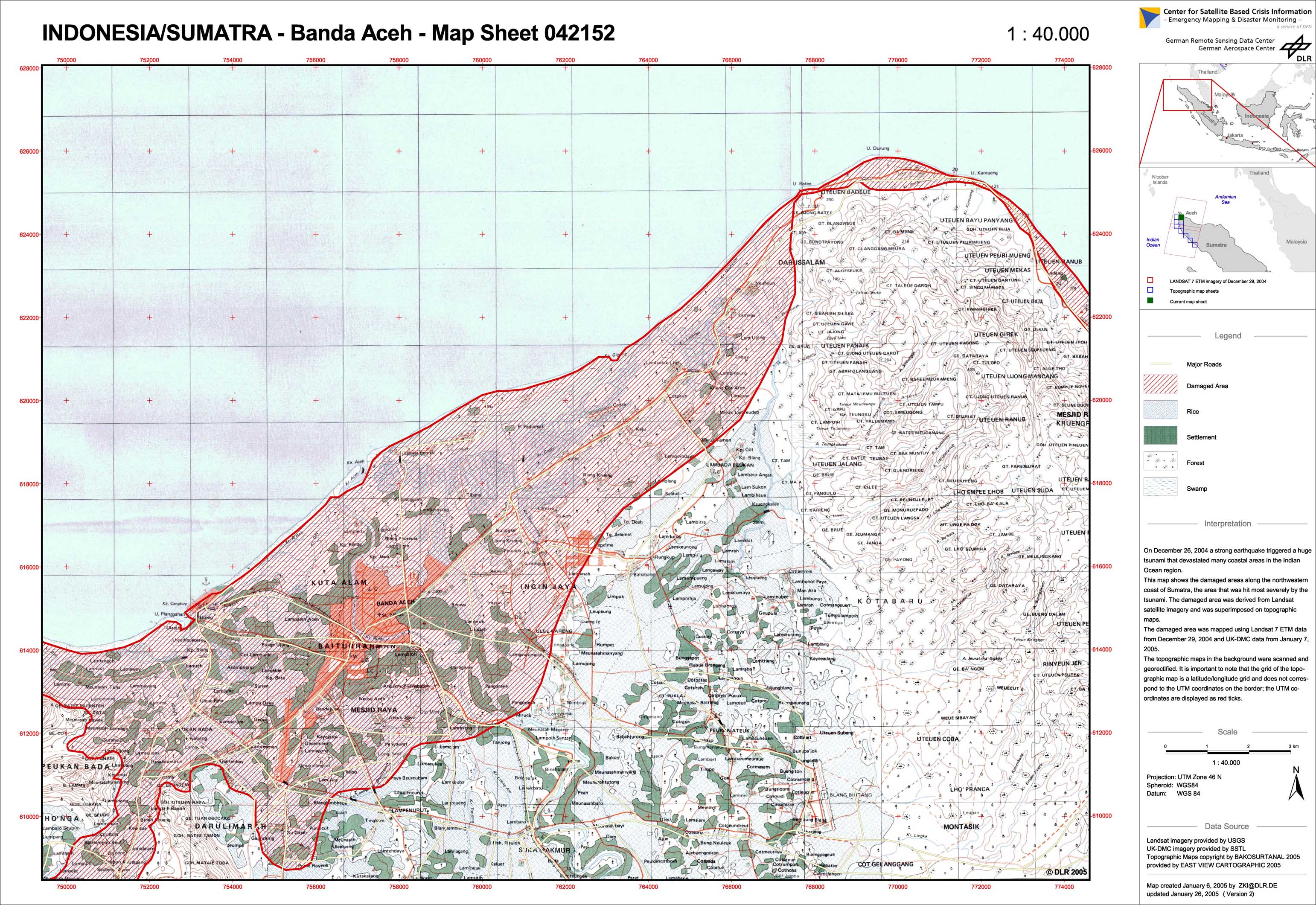
Indonesia - P34 - Damage assessment on NW-coast of Sumatra, map 8: Banda Aceh - 042152
Creation Date 06. January 2005
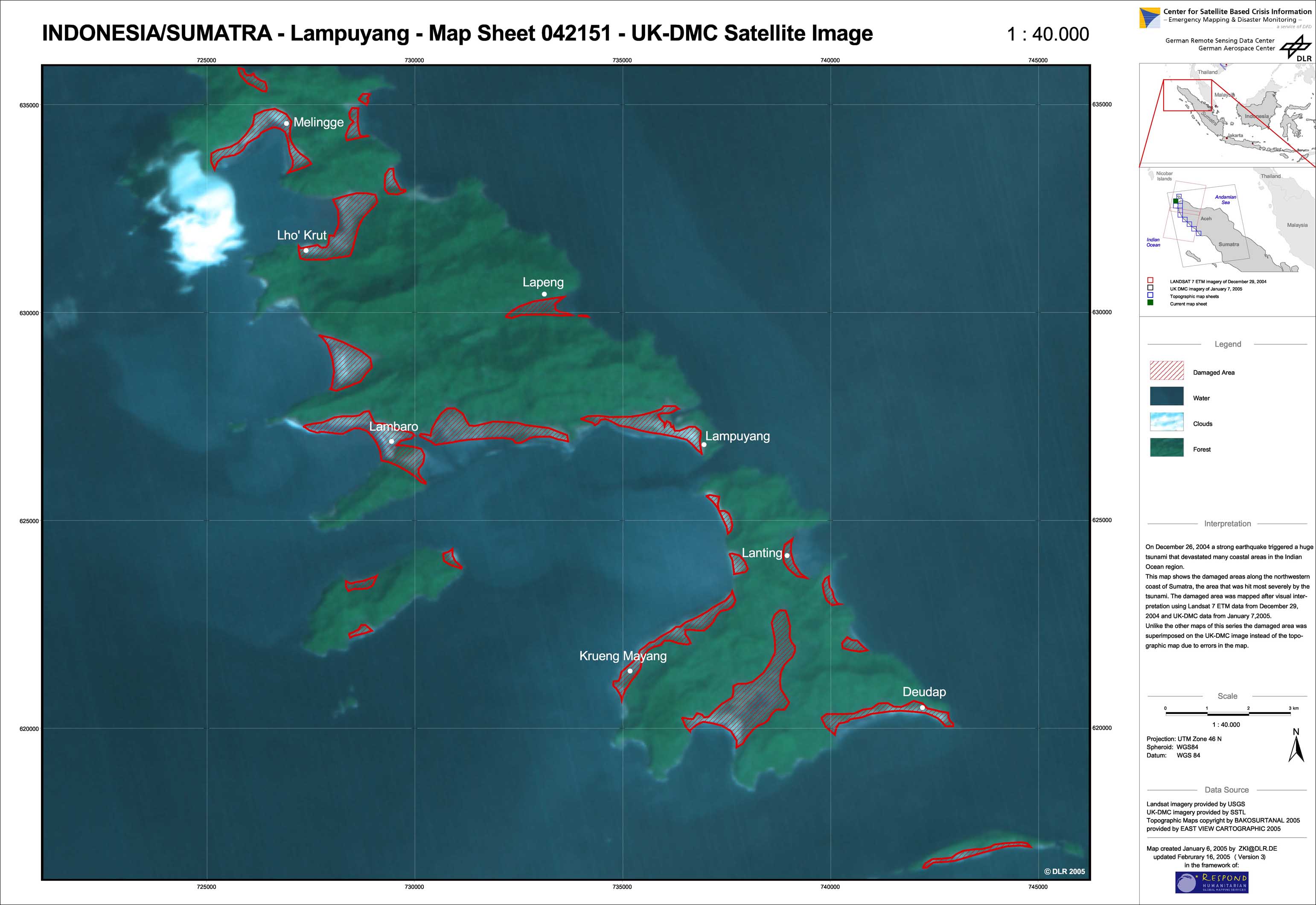
Indonesia - P33 - Damage assessment on NW-coast of Sumatra, map 7: Lampuyang - 042151
Creation Date 06. January 2005
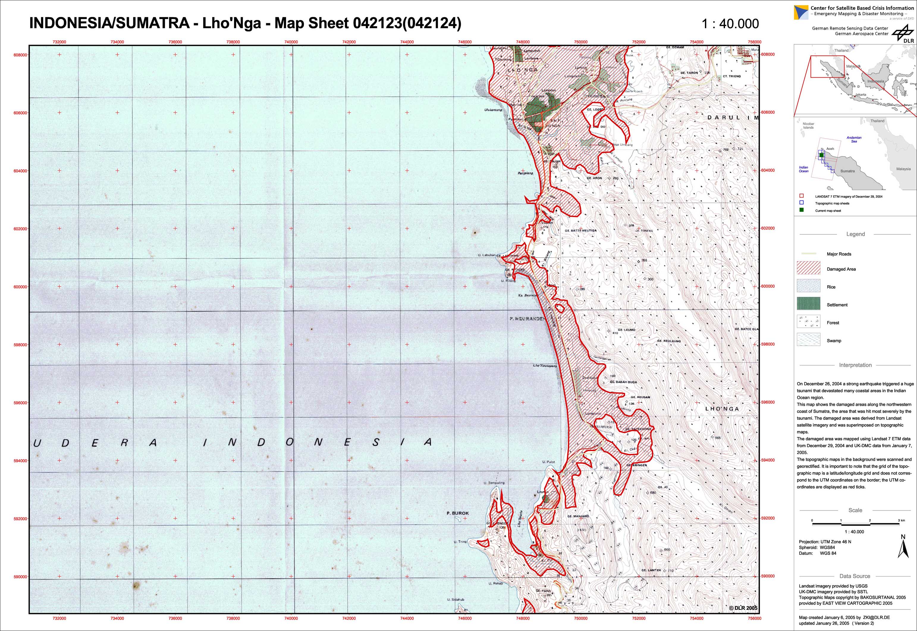
Indonesia - P32 - Damage assessment on NW-coast of Sumatra, map 6: Lho'Nga - 042123/24
Creation Date 06. January 2005
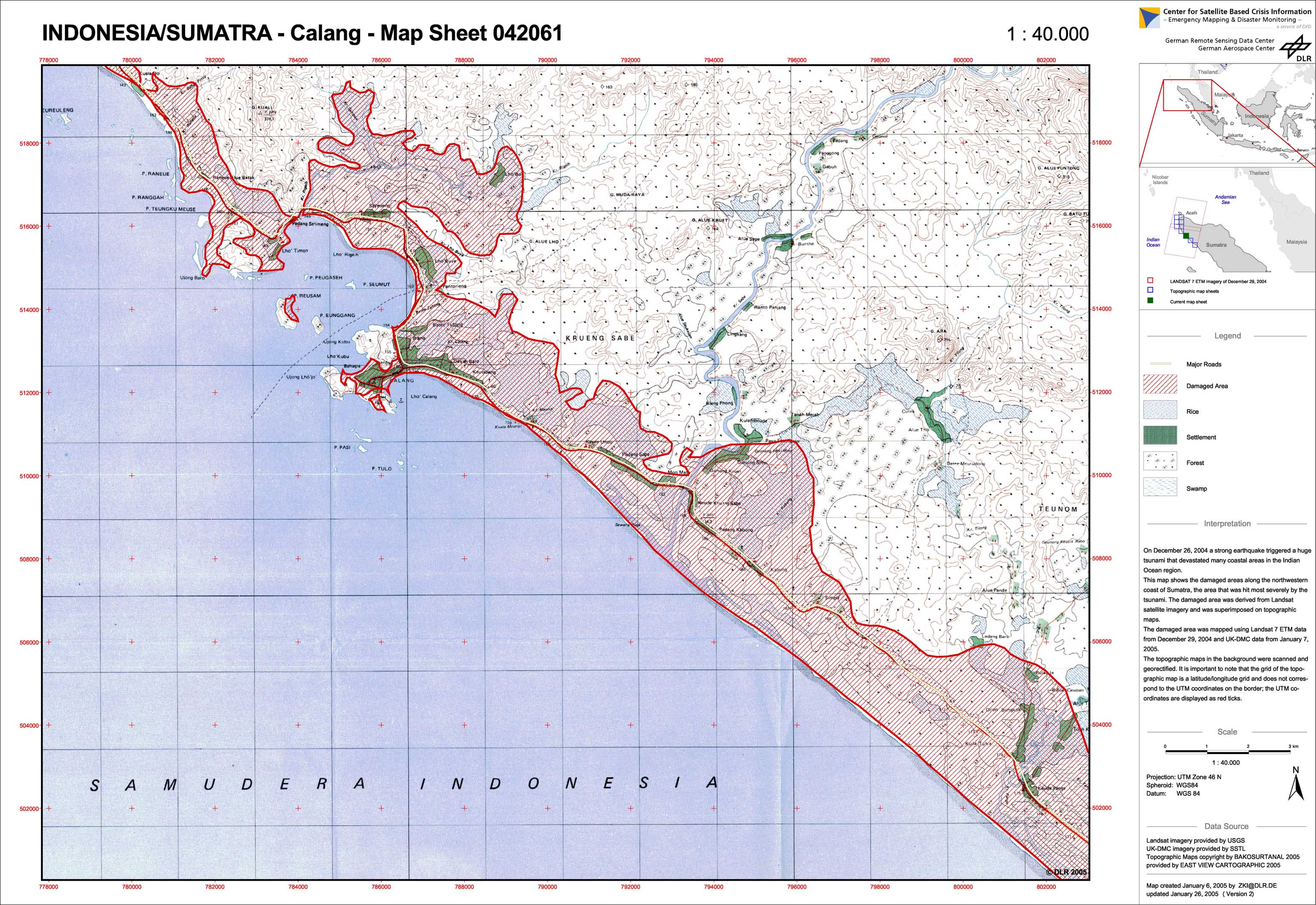
Indonesia - P28 - Damage assessment on NW-coast of Sumatra, map 3: Calang - 042061
Creation Date 06. January 2005
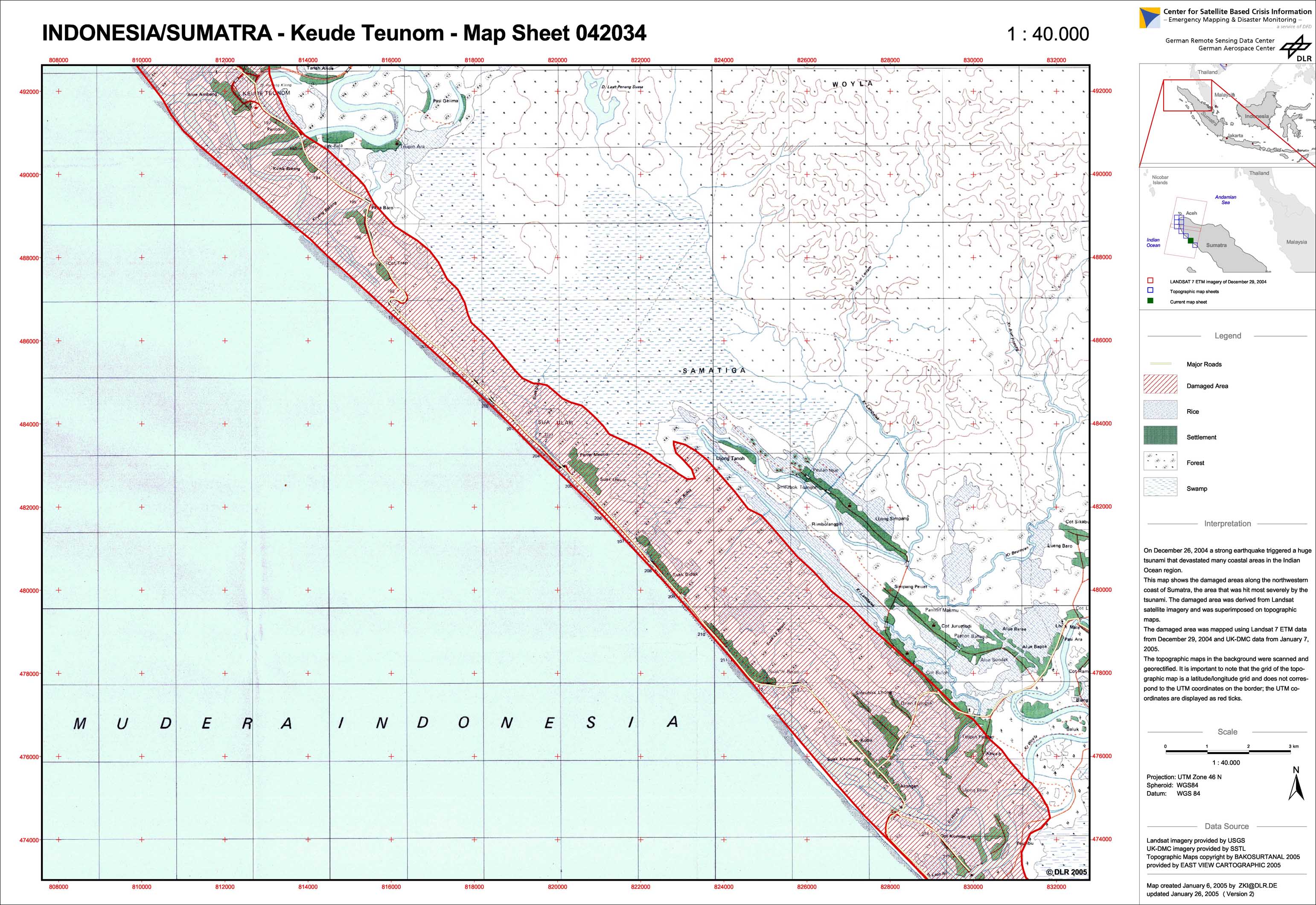
Indonesia - P27 - Damage assessment on NW-coast of Sumatra, map 2: Keude Teunom - 042034
Creation Date 06. January 2005
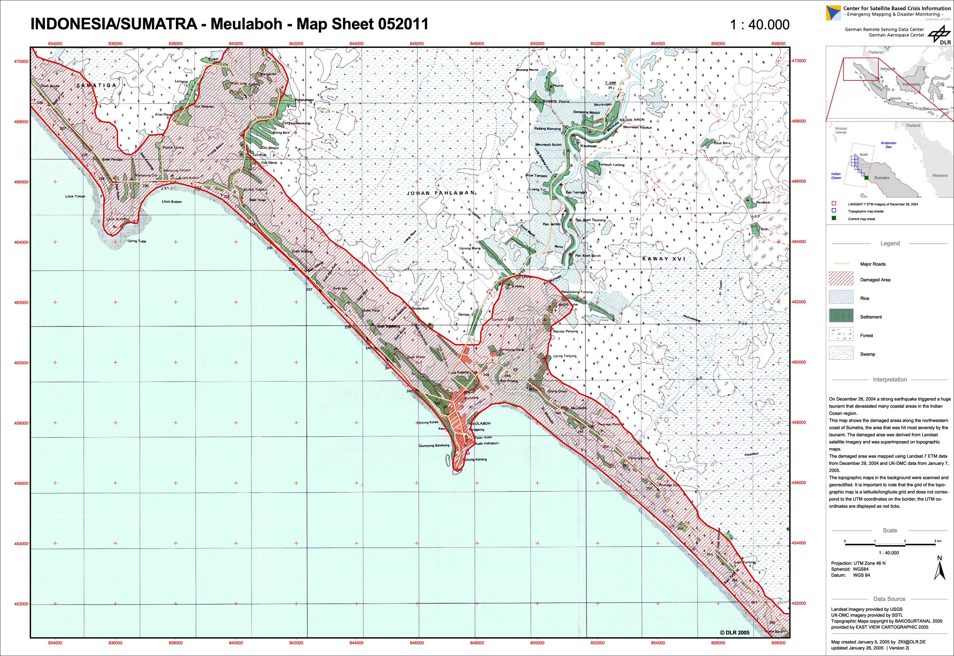
Indonesia - P26 - Damage assessment on NW-coast of Sumatra, map 1: Meulaboh - 052011
Creation Date 05. January 2005
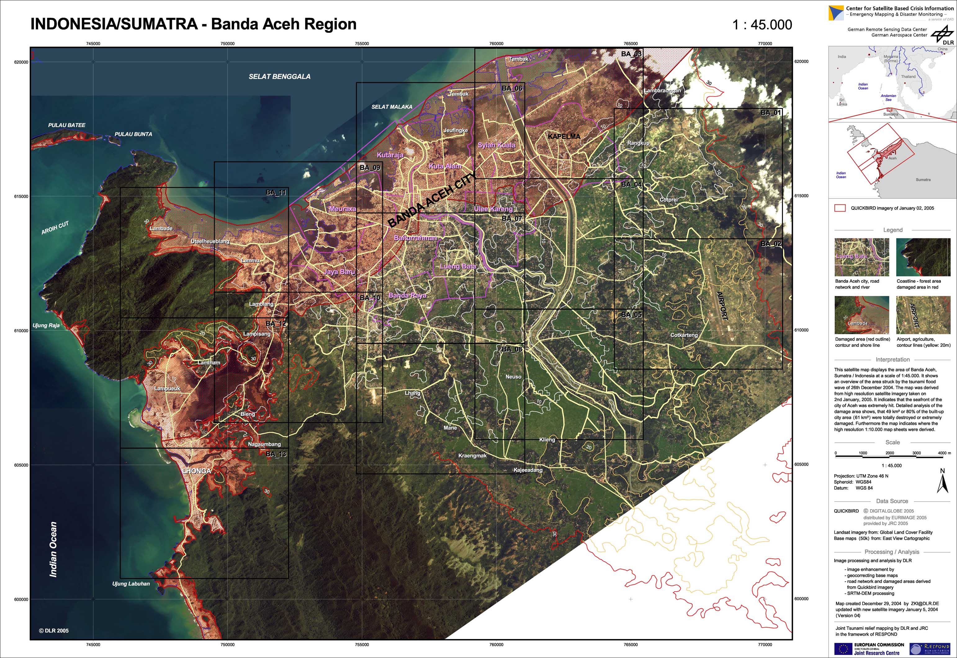
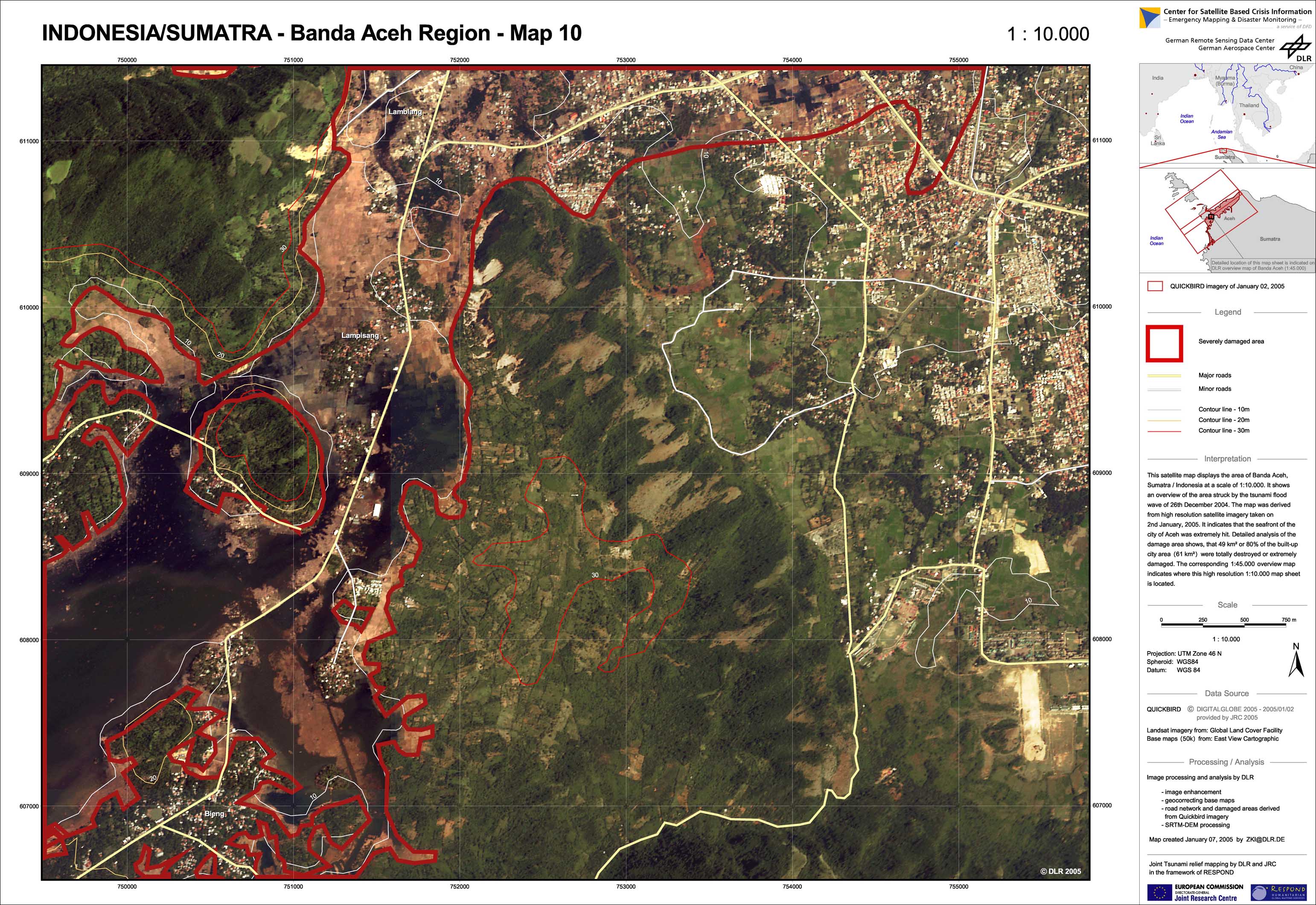
Indonesia - P12 - Aceh region - Satellite map (new satellite imagery)
Creation Date 05. January 2005
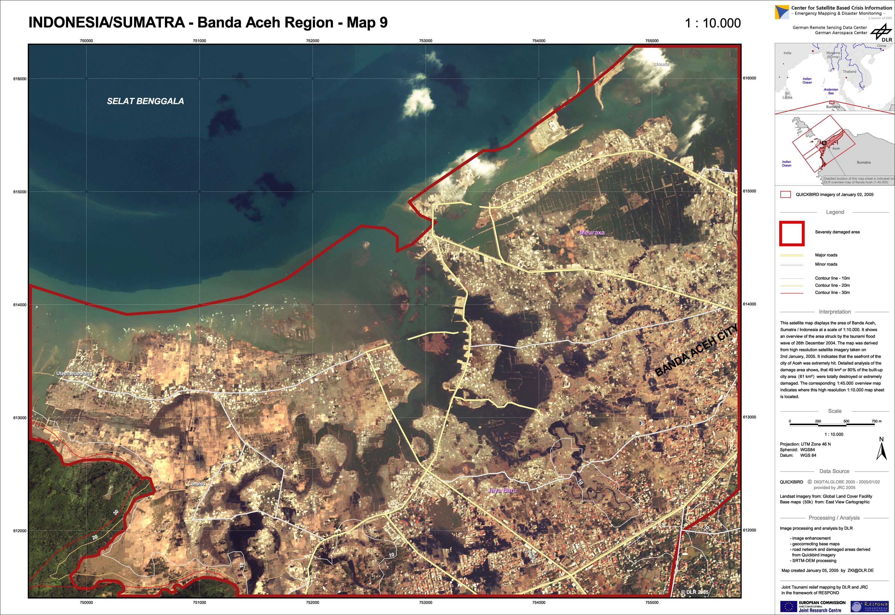
Indonesia - P21 - Aceh region BA-09 - Satellite map (new satellite imagery)
Creation Date 05. January 2005
Indonesia - P15 - Aceh region BA-03 - Satellite map (new satellite imagery)
Creation Date 05. January 2005
Indonesia - P14 - Aceh region BA-02 - Satellite map (new satellite imagery)
Creation Date 05. January 2005
Indonesia - P18 - Aceh region BA-06 - Satellite map (new satellite imagery)
Creation Date 05. January 2005
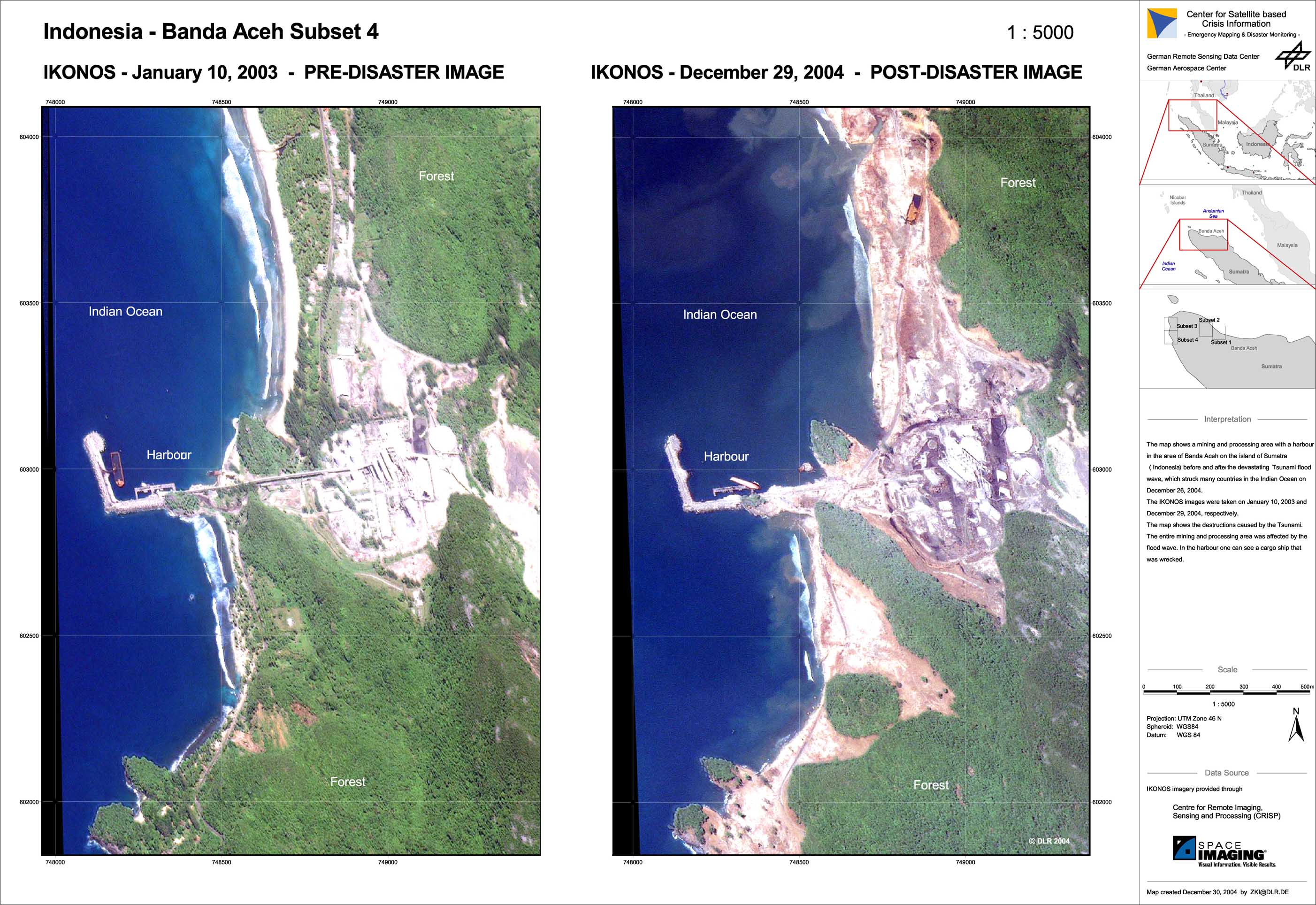
Indonesia - P06 - Aceh region - Satellite map 04 (from new and archived satellite imagery)
Creation Date 31. December 2004
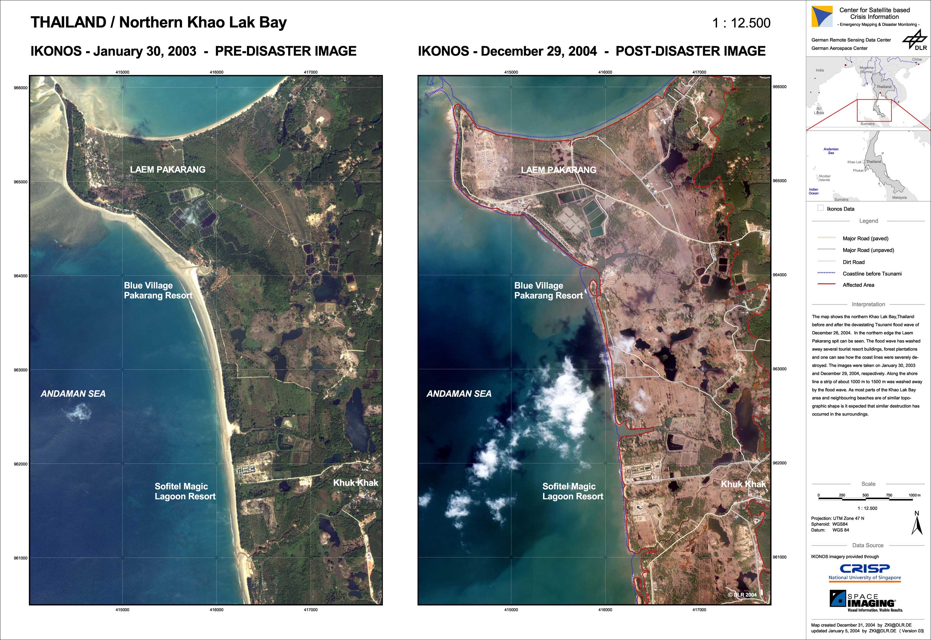
Thailand - P02 - Northern Khao Lak region - High resolution satellite map (from new and archived satellite imagery)
Creation Date 31. December 2004
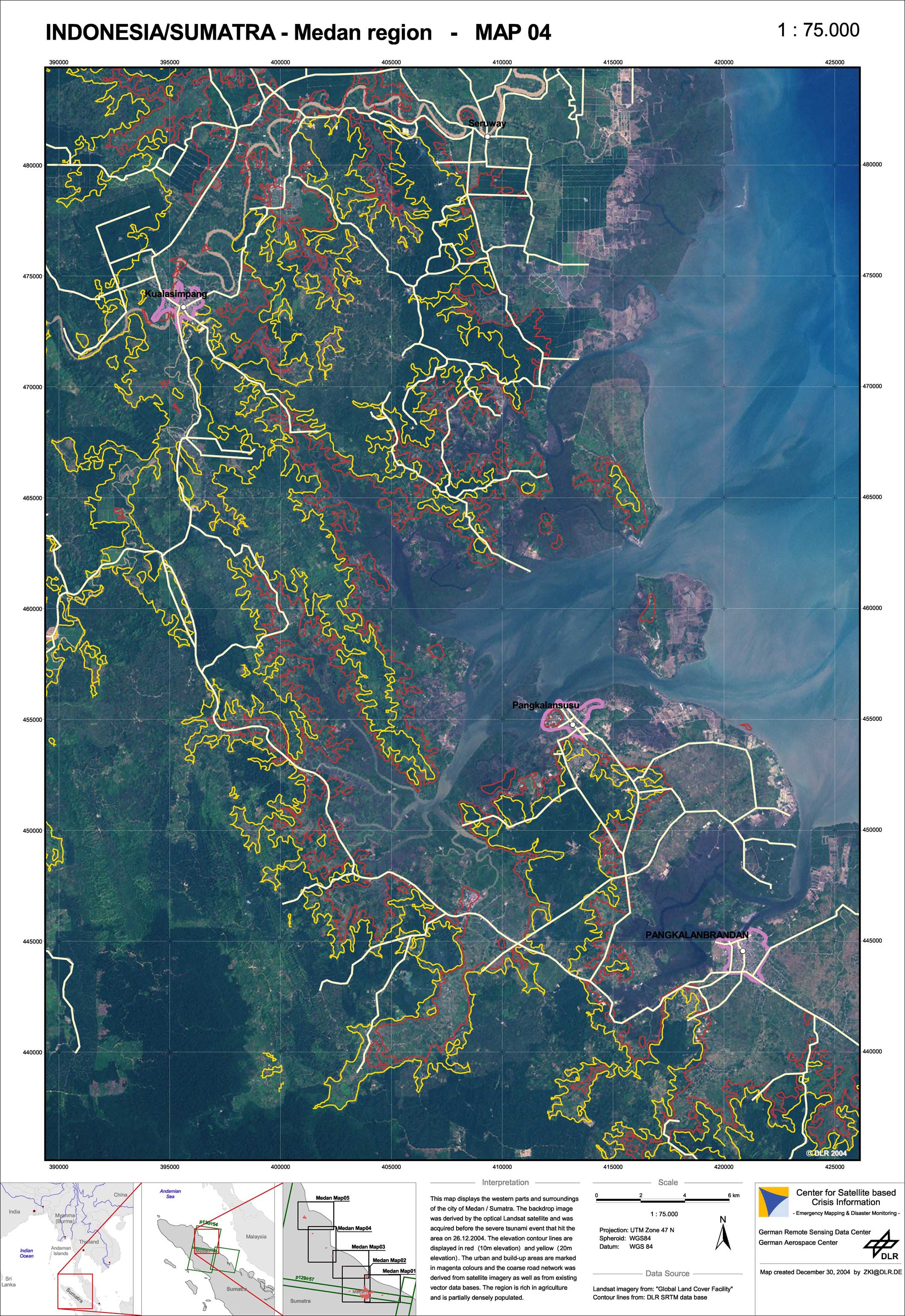
Indonesia - P10 - Medan region - Overview satellite map 04 (from archived imagery)
Creation Date 30. December 2004
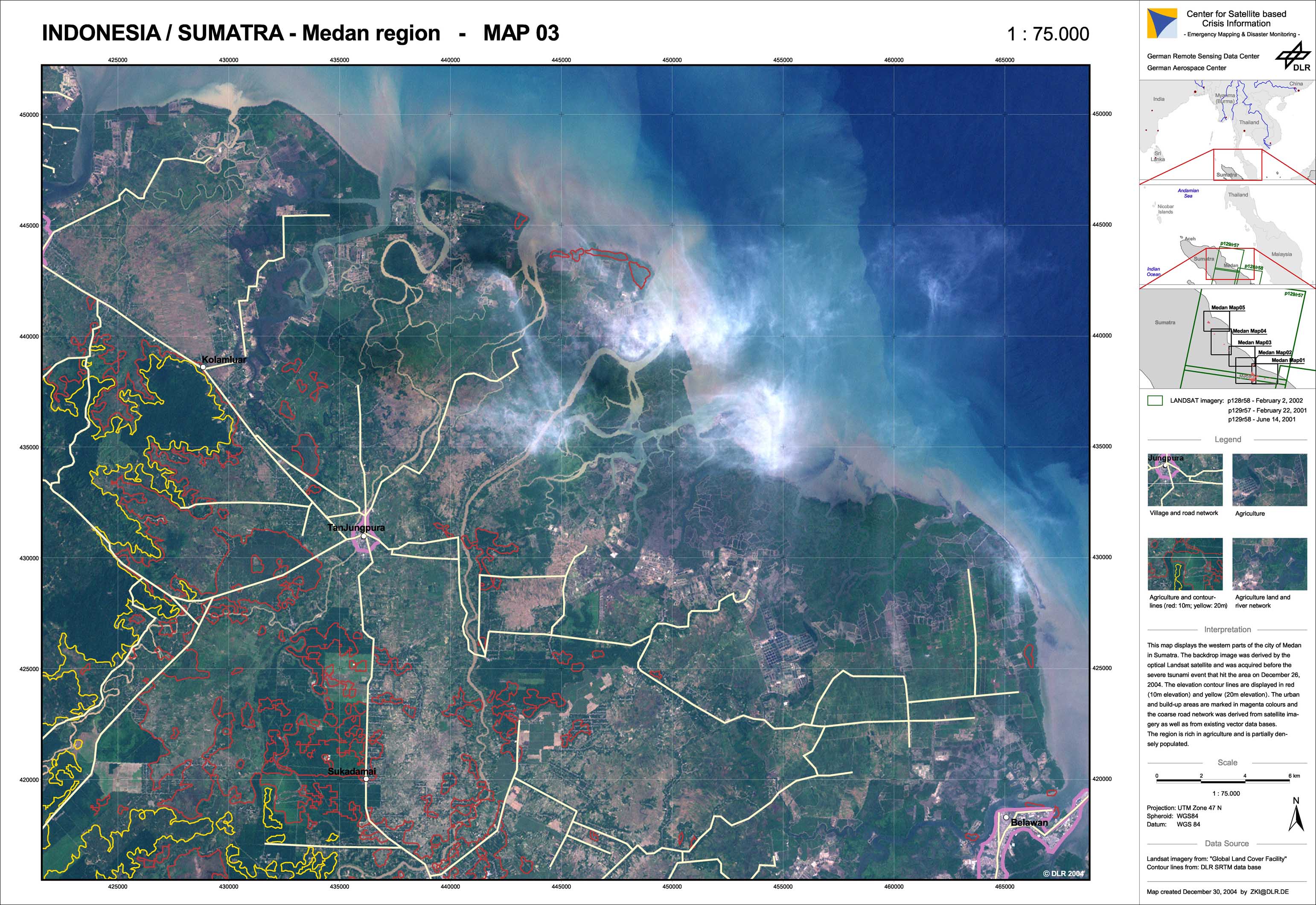
Indonesia - P09 - Medan region - Overview satellite map 03 (from archived imagery)
Creation Date 30. December 2004
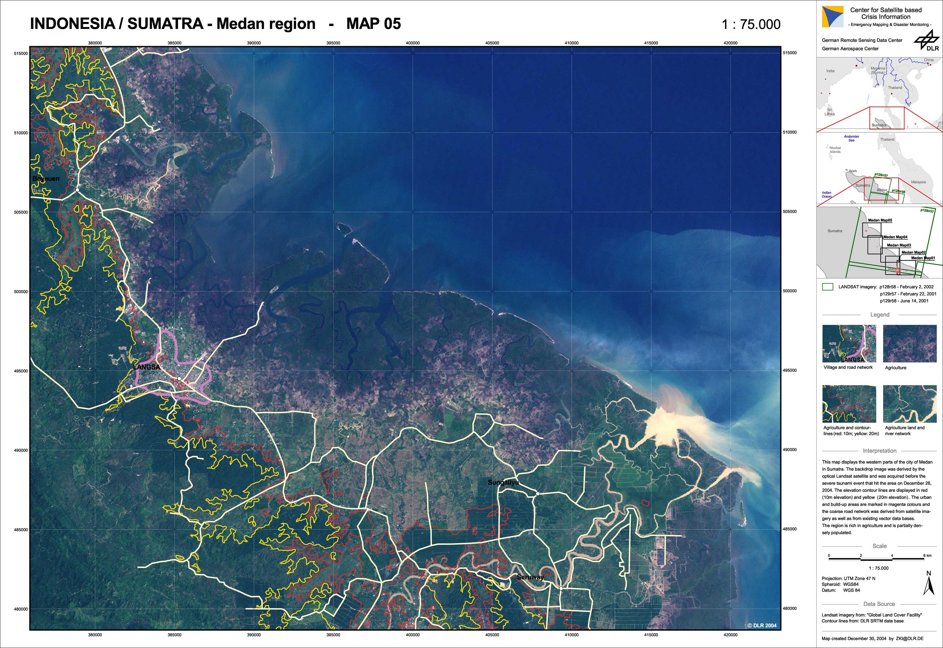
Indonesia - P11 - Medan region - Overview satellite map 05 (from archived imagery)
Creation Date 30. December 2004
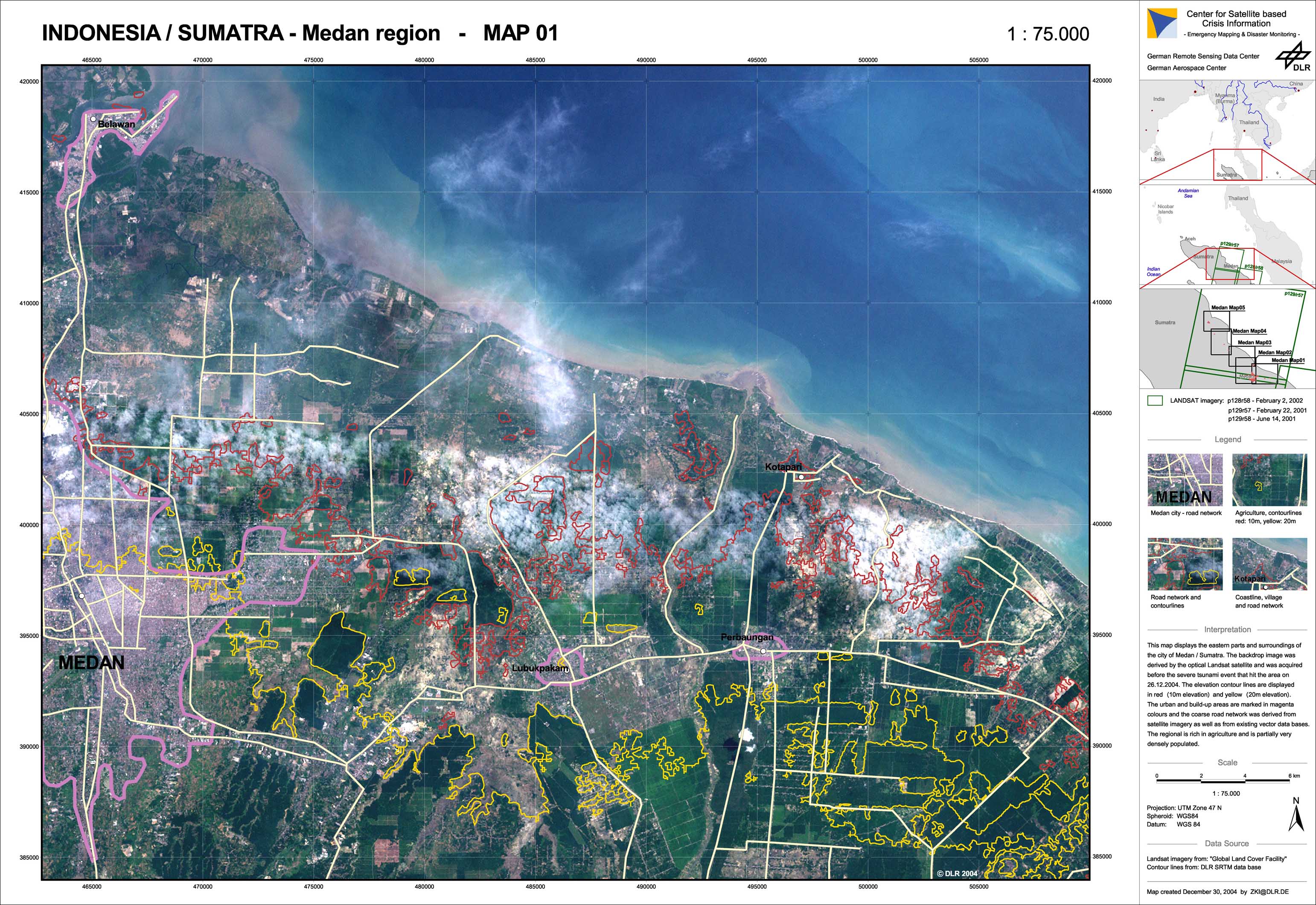
Indonesia - P07 - Medan region - Overview satellite map 01 (from archived imagery)
Creation Date 30. December 2004
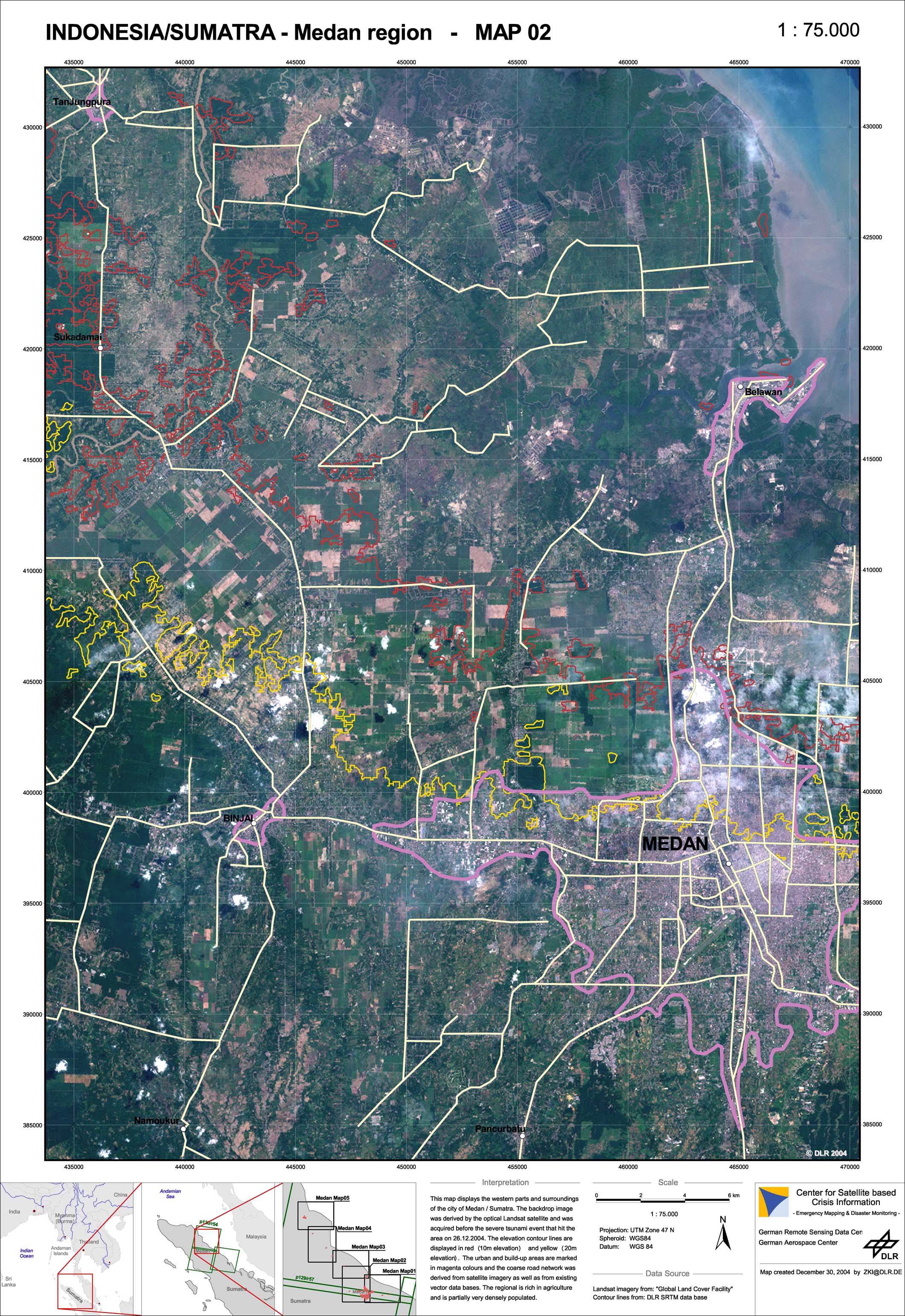
Indonesia - P08 - Medan region - Overview satellite map 02 (from archived imagery)
Creation Date 30. December 2004
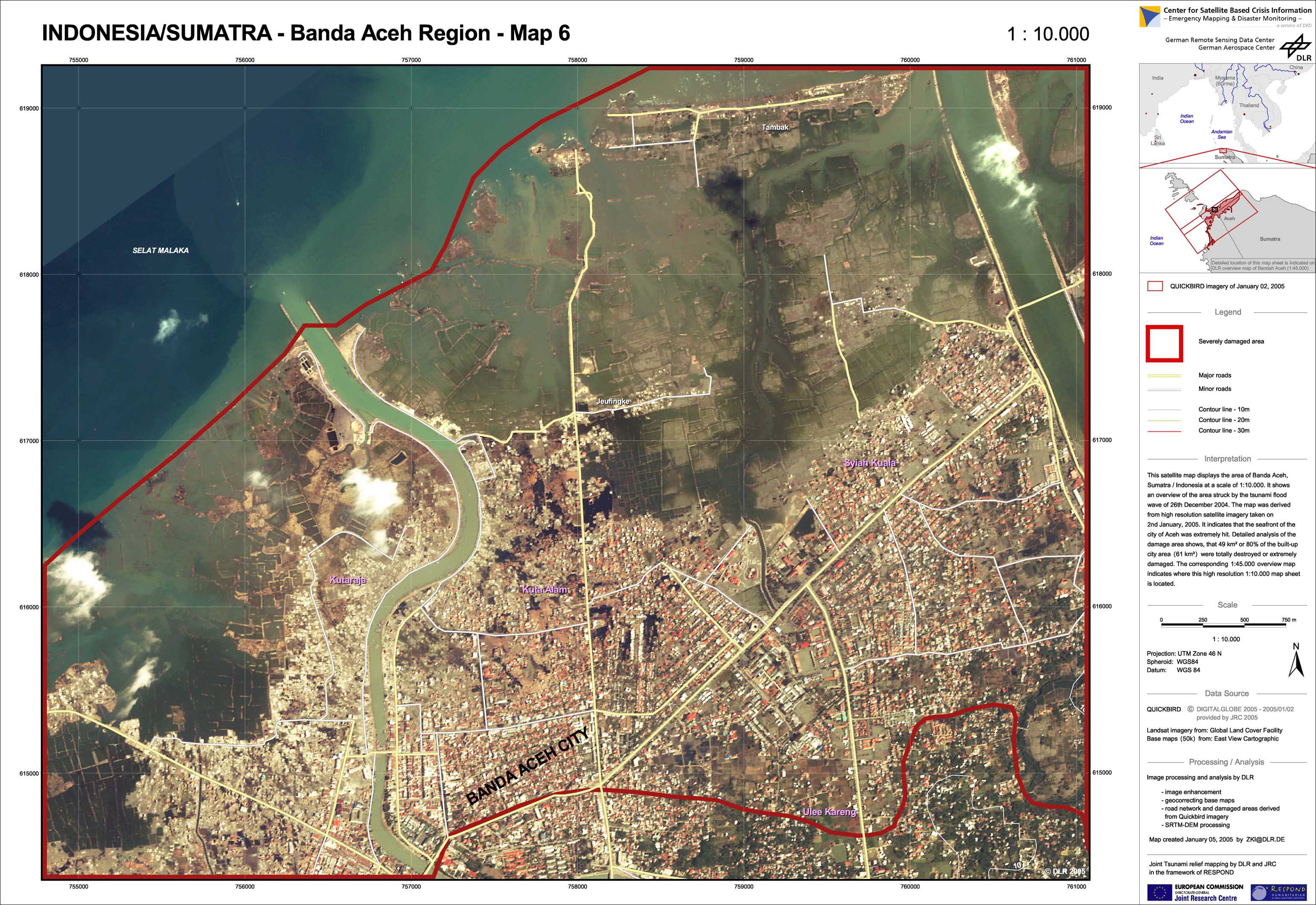
Indonesia - P05 - Aceh region - Satellite map 03 (from new and archived satellite imagery)
Creation Date 30. December 2004
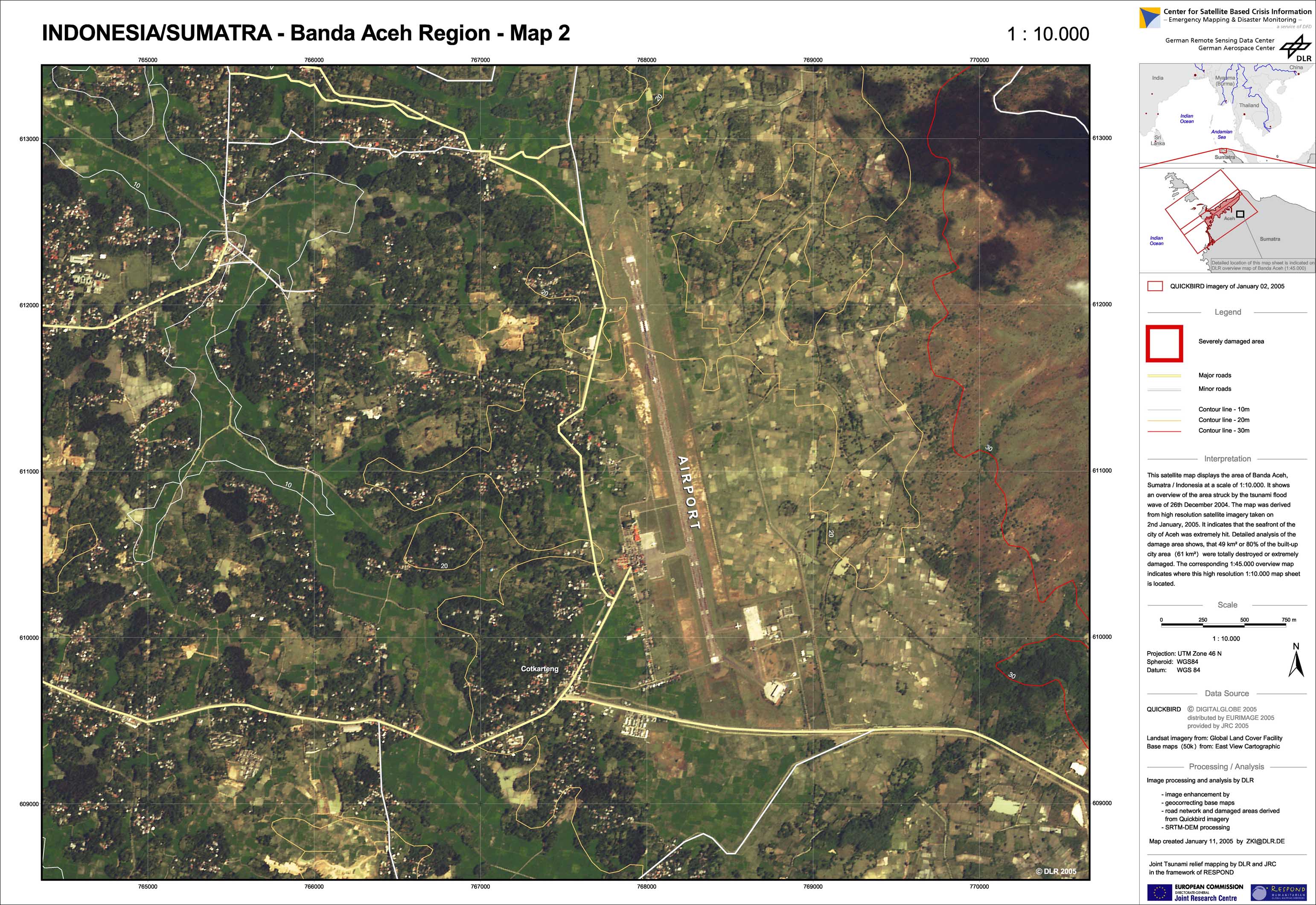
Indonesia - P04 - Aceh region - Satellite map 02 (from new and archived satellite imagery)
Creation Date 30. December 2004
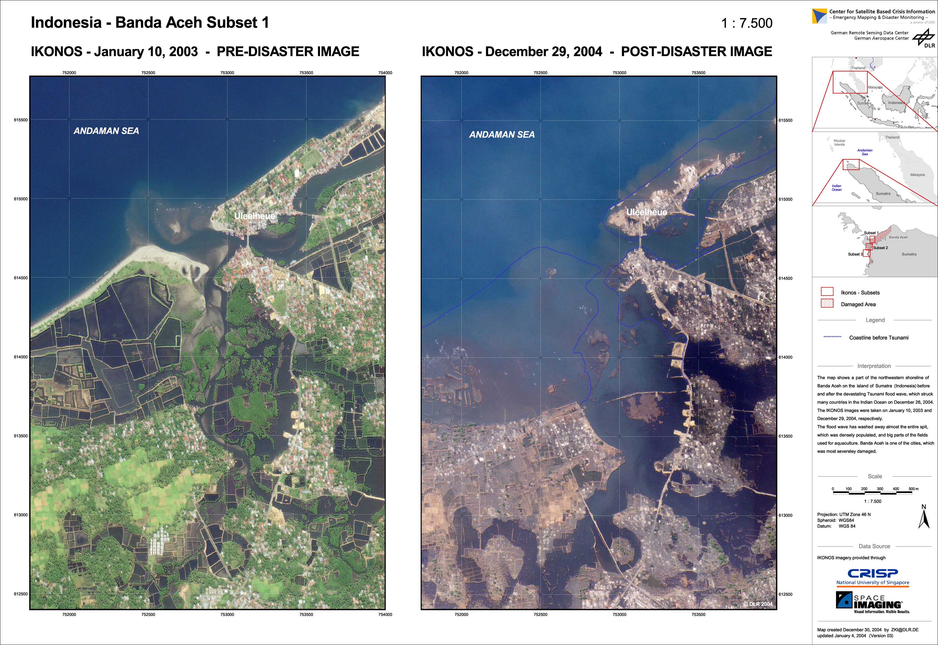
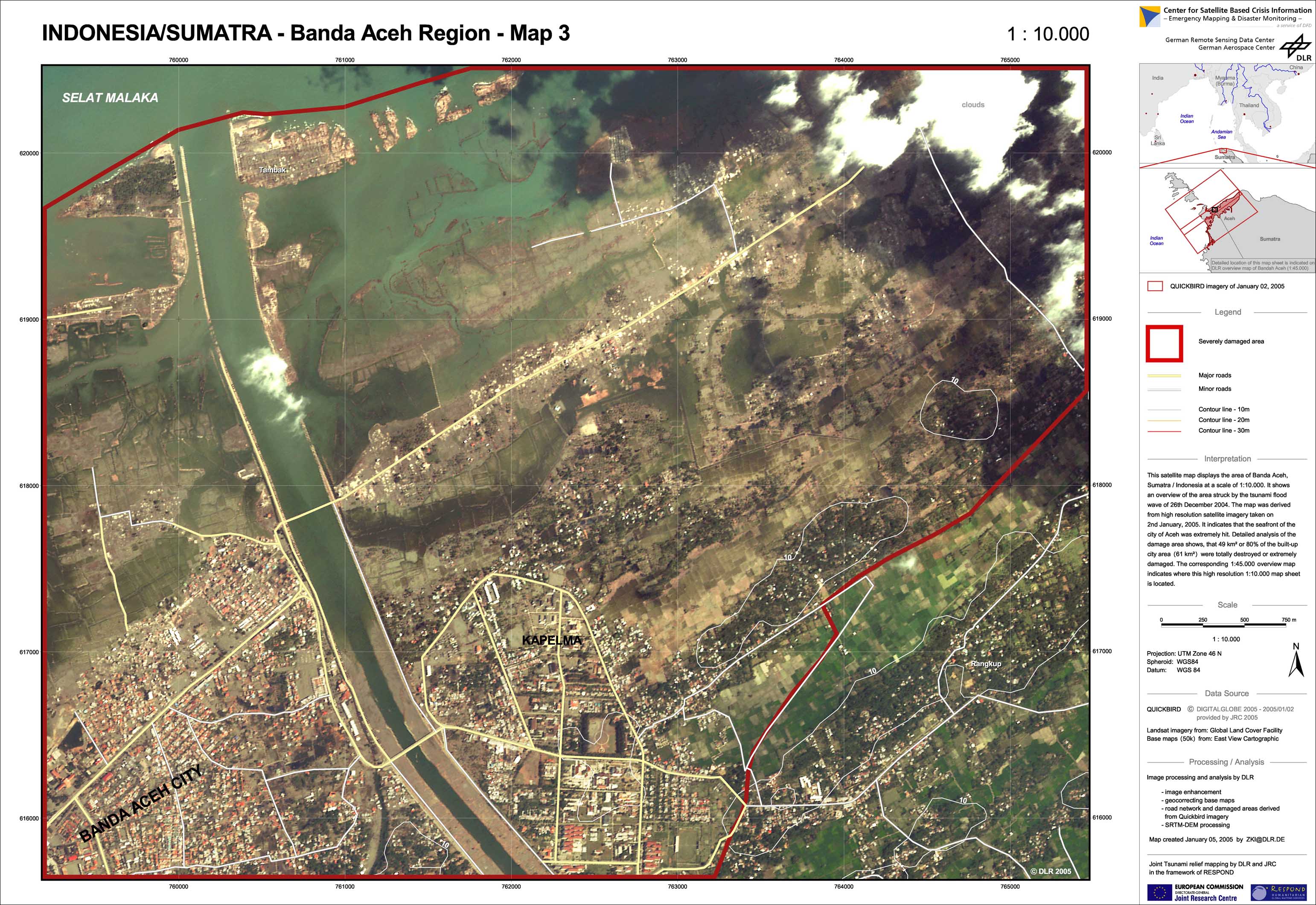
Indonesia - P03 - Aceh region - Satellite map 01 (from new and archived satellite imagery)
Creation Date 30. December 2004
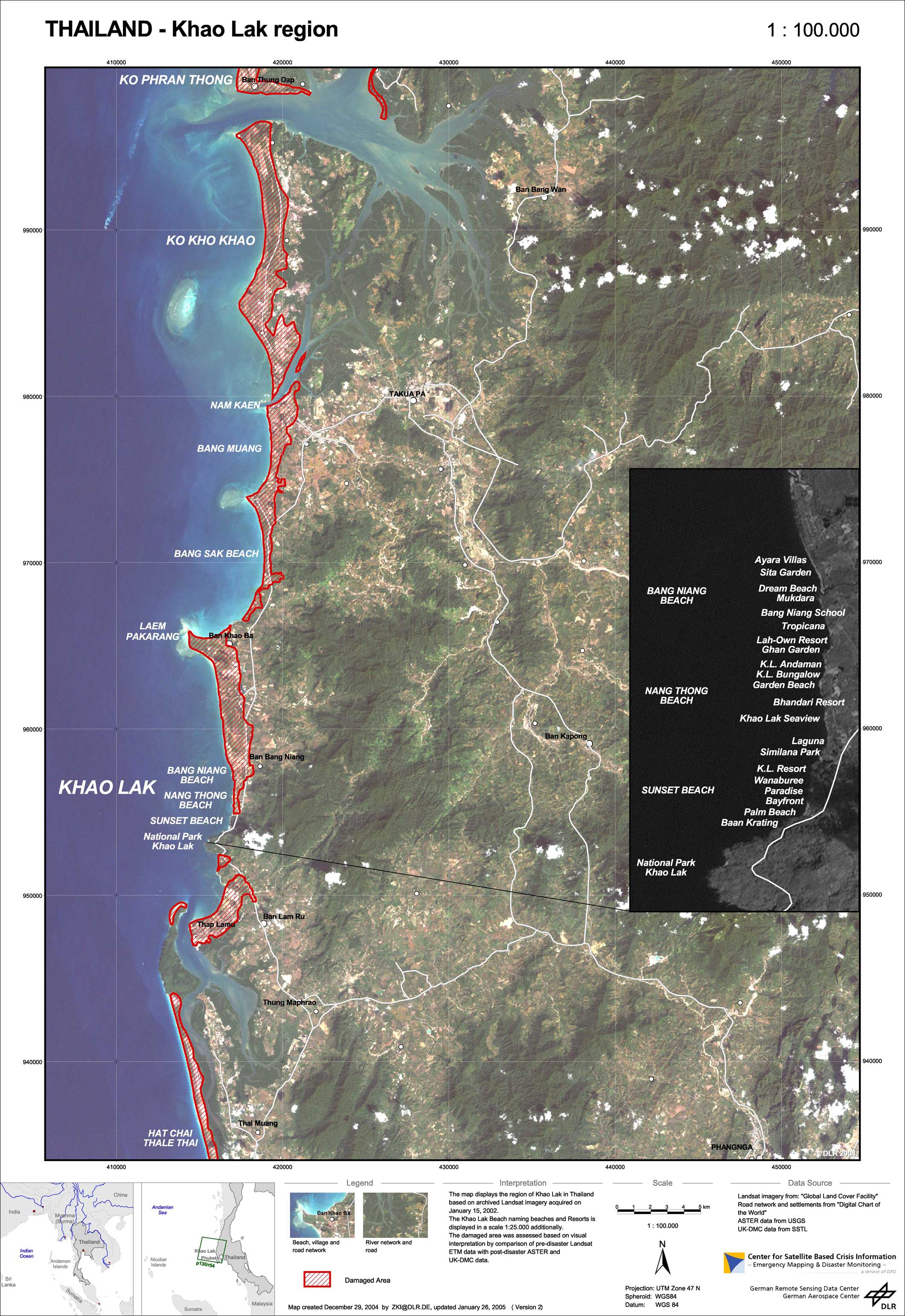
Thailand - P01 - Khao Lak region - Overview satellite map (from archived imagery)
Creation Date 29. December 2004