ZKI supports international humanitarian relief teams in Indonesia through RESPOND
undefined
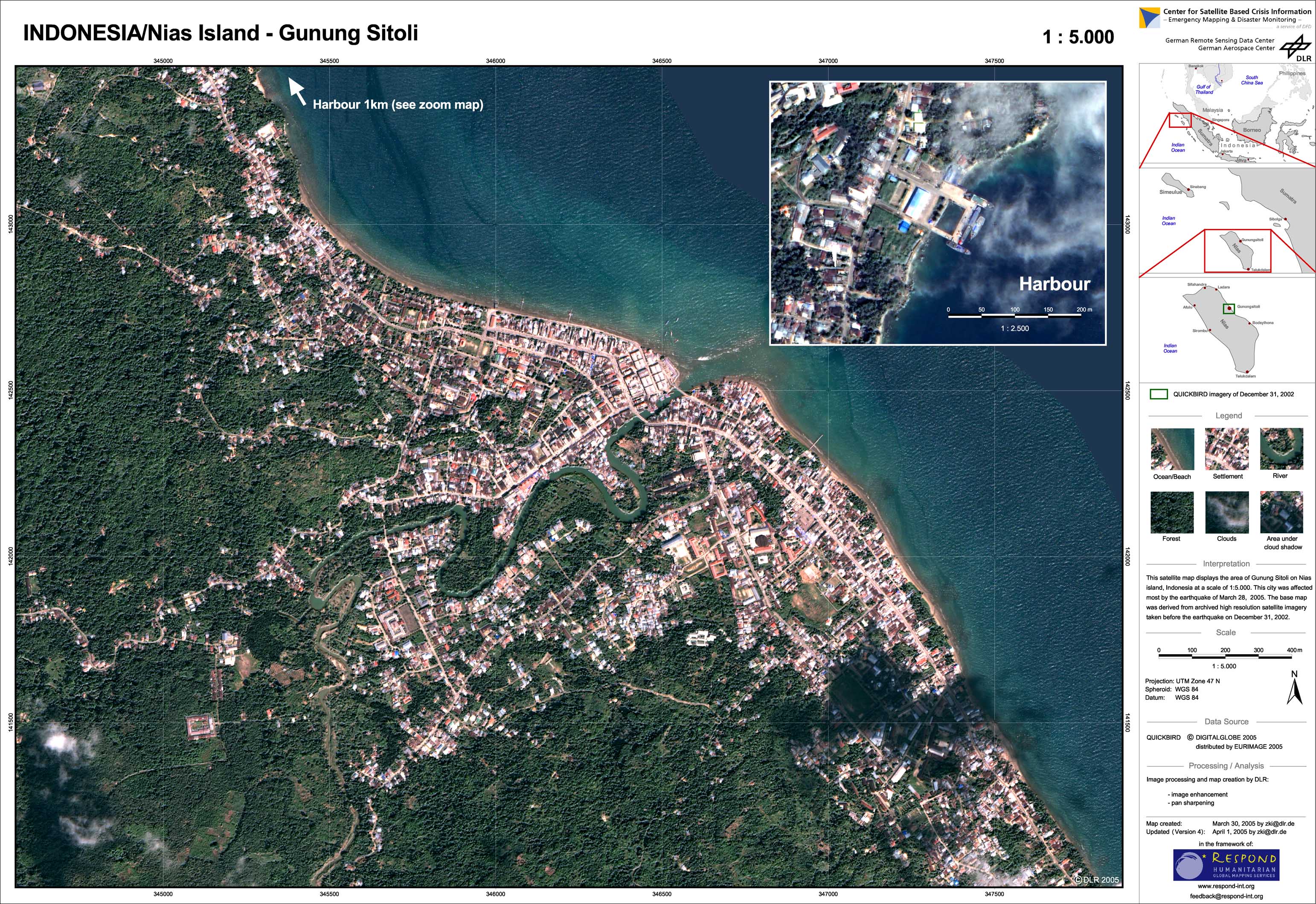
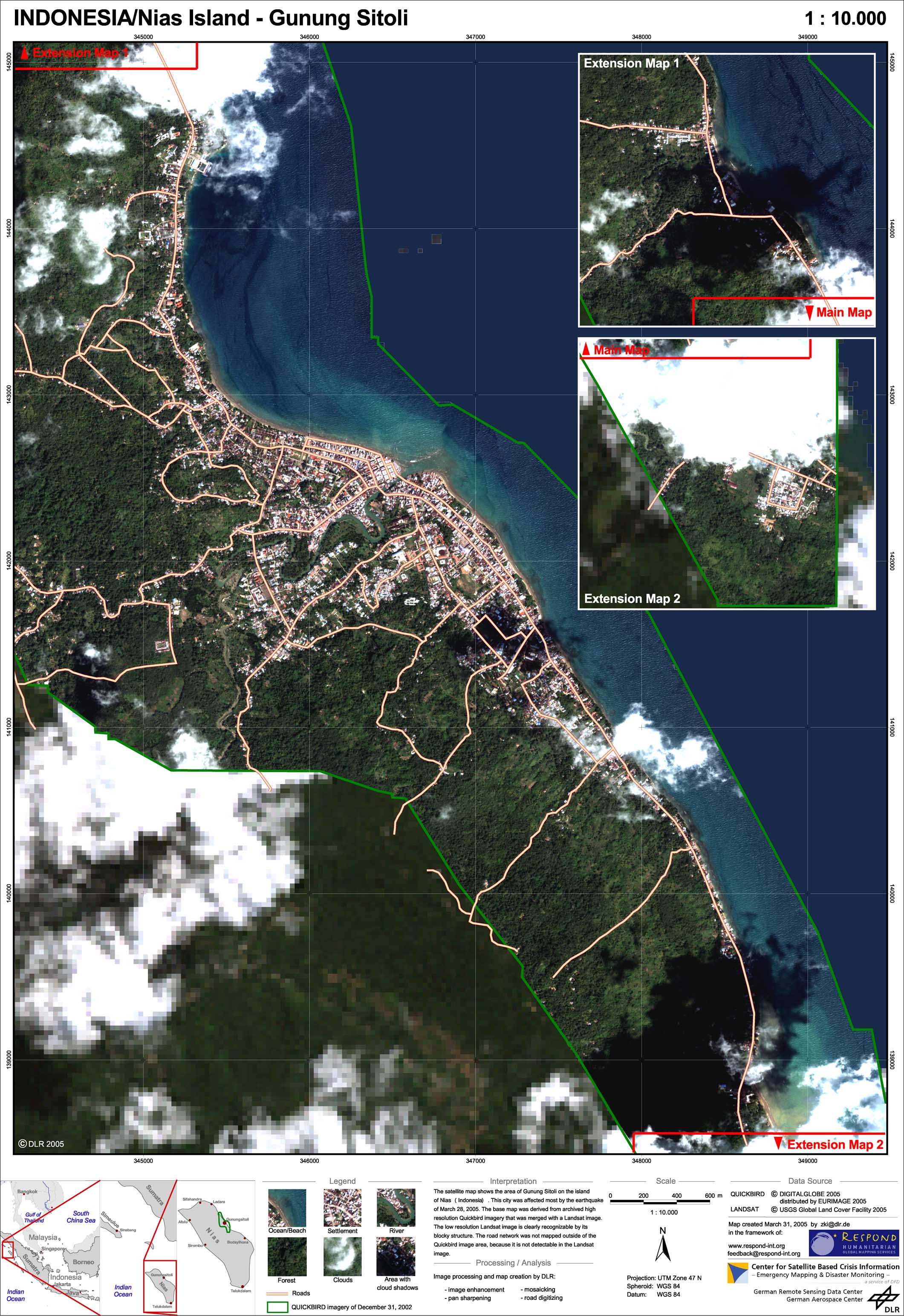
A great earthquake occurred near the West coast of Sumatra (Indonesia) about 205 km west northwest of Sibolga, Sumatra at 23:09 local time in Indonesia (16.09 UTC) on March 28, 2005. According to the USGS the earthquake had a magnitude of 8.7 (Richter scale). Fortunately, no major tsunami resulted from the quake as it happened only three month before in the same region after a earthquake with magnitude 9.0 (Richter scale). The islands of Nias and Simeulue, located off the southwest coast of Sumatra, are the areas worst affected by the latest earthquakes. Nias Island, south of Simeulue, has an estimated population of 444,000, of which some 1,780 people are registered as internally displaced due to the tsunami damage. Simeulue Island has an estimated population of 77,751 people, of which 18,000 people are internally displaced (UN OCHA site report). ZKI produced in the framework of the RESPOND Service Element of the European Space Agency (ESA) high resolution satellite maps of the city of Gunung Sitoli, which was most severely affected by the earthquake. The satellite image maps were produced from archived pre-disaster imagery. Although the images do not allow damage assessment, they are useful tools for orientation in the field since topographic maps are not available.
Indonesia - P01 - Gunung Sitoli - Satellite map (from archived imagery)
Creation Date 01. April 2005
Indonesia - P02 - Gunung Sitoli - Reference map (from archived imagery)
Creation Date 31. March 2005
undefined