- Startseite
-
About us
-
Crisis Information
- Crisis Information
- Overview
- Mapping and Exercises
- Monitoring Services
-
Services and Projects
-
Latest
- EnglishDeutsch
- Accessibility
- Press
Satellite image mapping in support of European Disaster Exercise EURATECH in Portes-lès-Valence/South-France
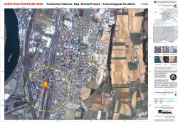
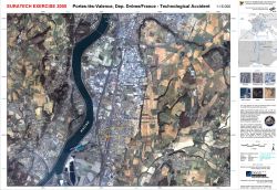
undefinedA major European civil protection exercise takes place from 10 to 14 April 2005 in Portes-lès-Valence/Department Drôme in southern France. The scenario is a hazardous material transportation accident in a full scale community exercise. It is organized by the French Défense et de la Sécurité Civiles (DDSC) and funded by the European Commission and the French Ministry of the Interior. Around 400 French and 100 foreign actors join the exercise. The governmental disaster relief organization of the Federal Republic of Germany (THW), German fire brigades as well as Belgian, Italian and Czech civil protection forces participate in EURATECH. Within the EURATECH 2005 exercise, the Center for Satellite based Crisis Information (ZKI) of DLR and SERTIT backed by CNES, harmonize their production of emergency information derived from satellite data acquired through the International Charter Space and Major Disasters, in order to co-operate towards the development of a European emergency mapping service. Complementary to the satellite images provided through the International Charter Space and Major Disasters, DLR uses high-resolution Ikonos imagery from April 02, 2005 provided by European Space Imaging.
Products
France - P02 - Portes-les-Valence - EURATECH Exercise - detail map
Creation Date 11. April 2005
France - P01 - Portes-les-Valence - EURATECH Exercise - overview map
Creation Date 11. April 2005
Further links


