Floods in Bavaria
undefined
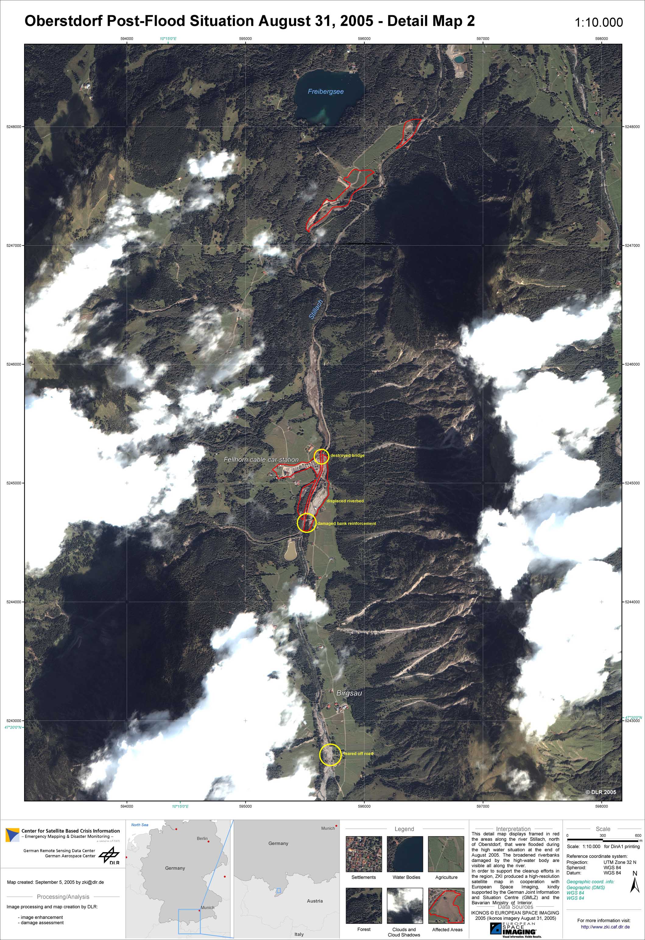
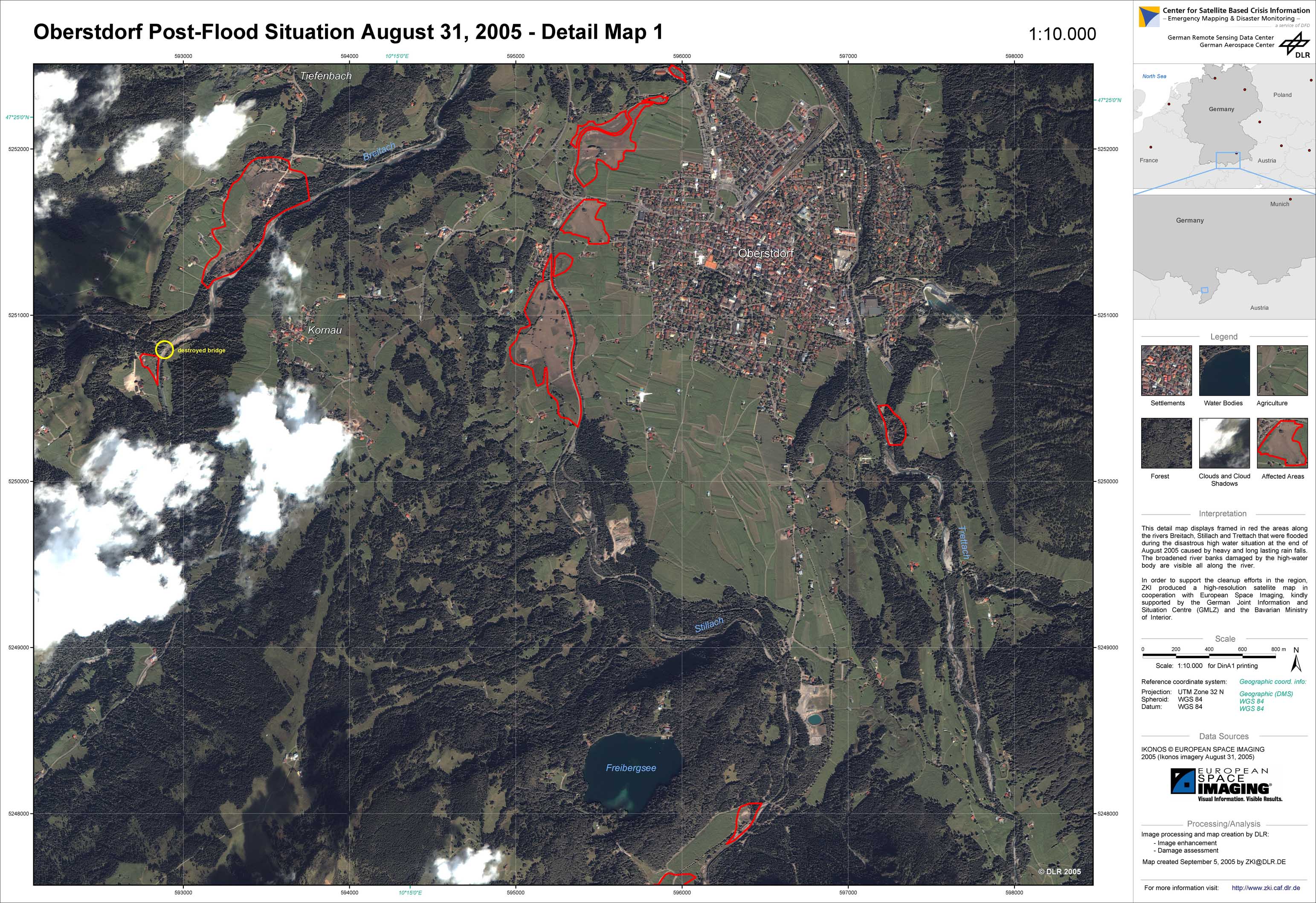
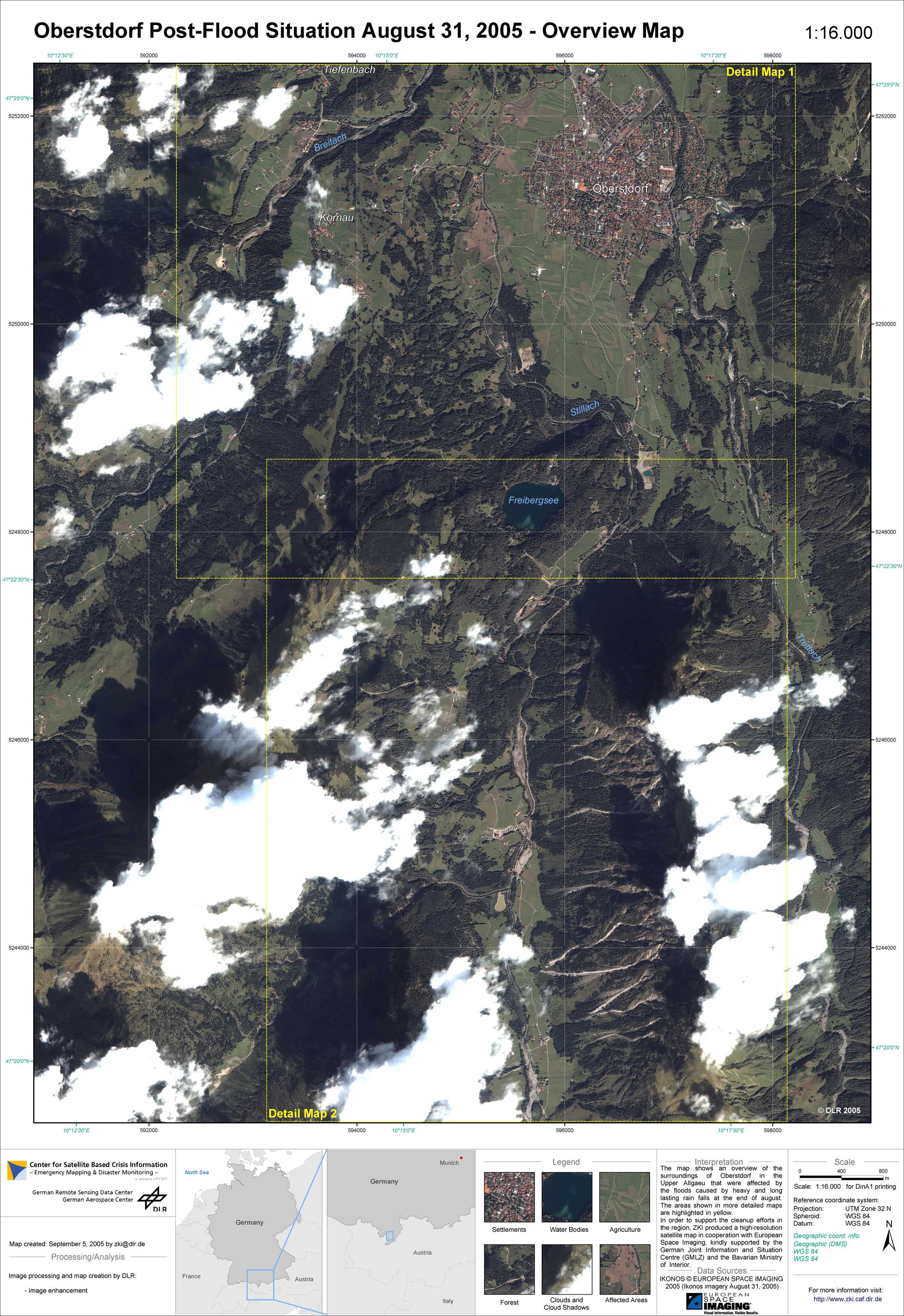
At the end of August 2005, heavy and long-lasting rainfalls of up to 120 litres per square meter led to a disastrous high water situation in large parts of the Alps. In Bavaria, the catchment areas of the rivers Iller, Lech, Isar, and Inn were affected most. Severe obstructions of traffic occured due to flooded streets and railway tracks, outwashed bridges and landslides. Some communes were partially flooded, for 18 Bavarian districts, state of emergency was declared. The town of Garmisch-Partenkirchen was temporarily not accessible. The community of Eschenlohe was hit hardest, as parts of the village were inundated by 1.5 meters of water from the nearby river Loisach. In Upper Allgaeu, the region around Oberstdorf was affected most by the floods. During the flood event, the runoff of many rivers exceeded even the maximum levels of the extreme event in 1999. In order to support the cleanup efforts in the region, ZKI produced high-resolution satellite maps in cooperation with European Space Imaging, kindly supported by the German Joint Information and Situation Centre (GMLZ) and the Bavarian Ministry of the Interior.
Germany - P03 - Oberstdorf region - Post-flood situation as of August 31, 2005 - Detail map 2
Creation Date 05. September 2005
Germany - P02 - Oberstdorf region - Post-flood situation as of August 31, 2005 - Detail map 1
Creation Date 05. September 2005
Germany - P01 - Oberstdorf region - Post-flood situation as of August 31, 2005 - Overview
Creation Date 05. September 2005
undefined