Landslide in the Philippines
undefined
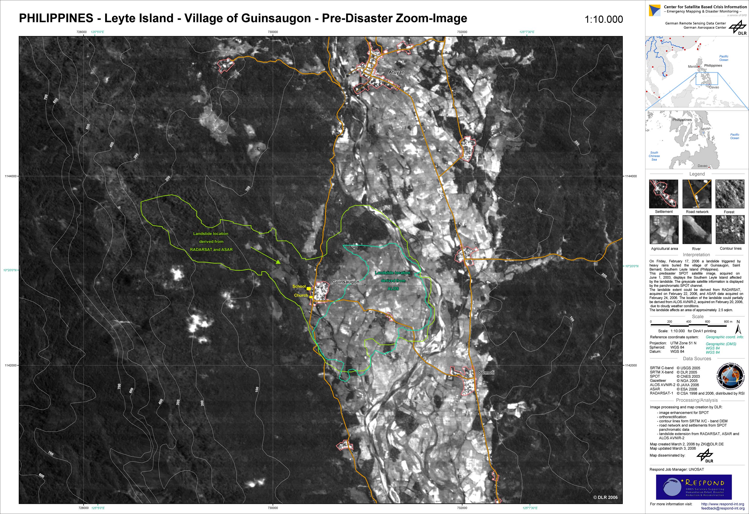
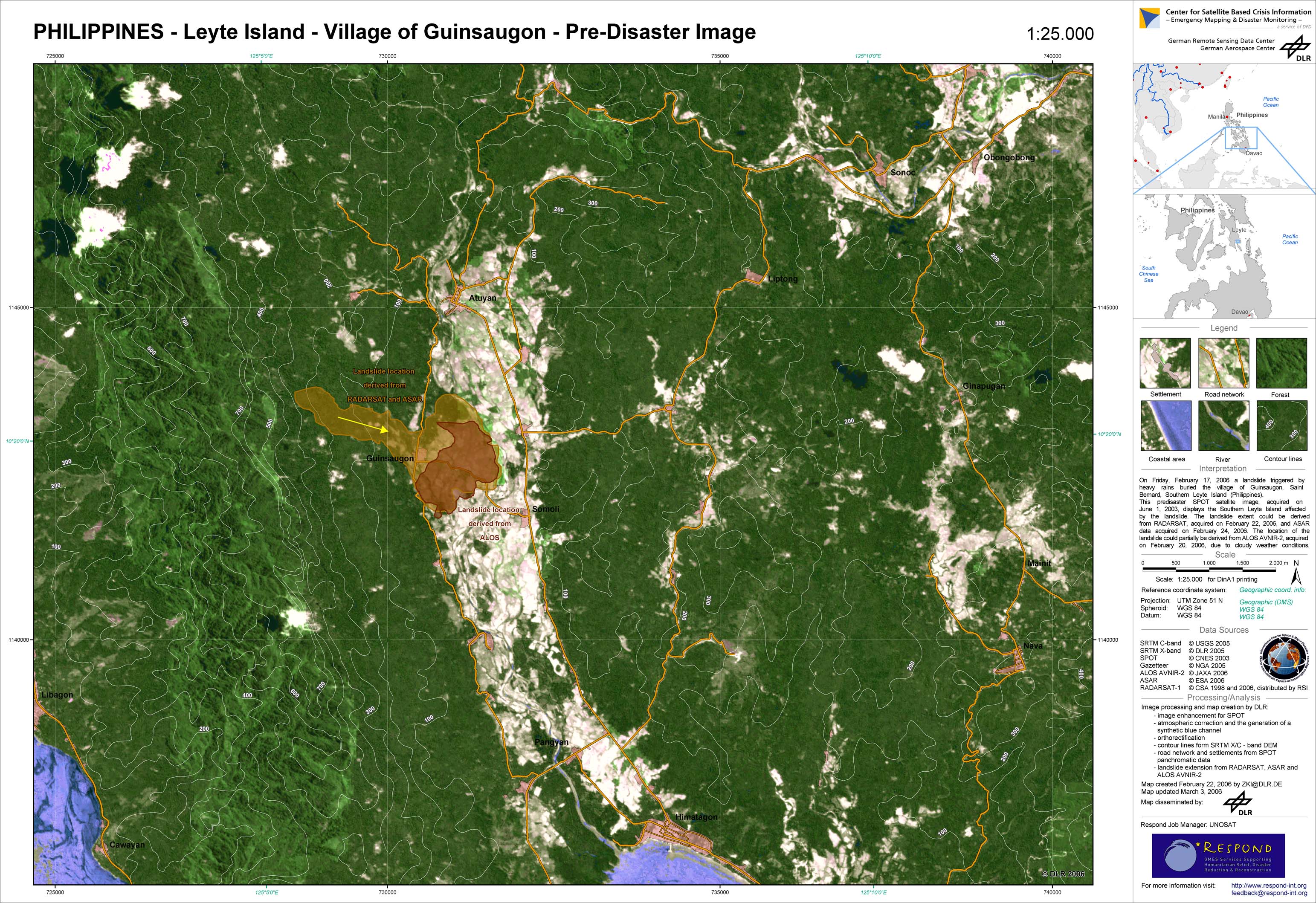
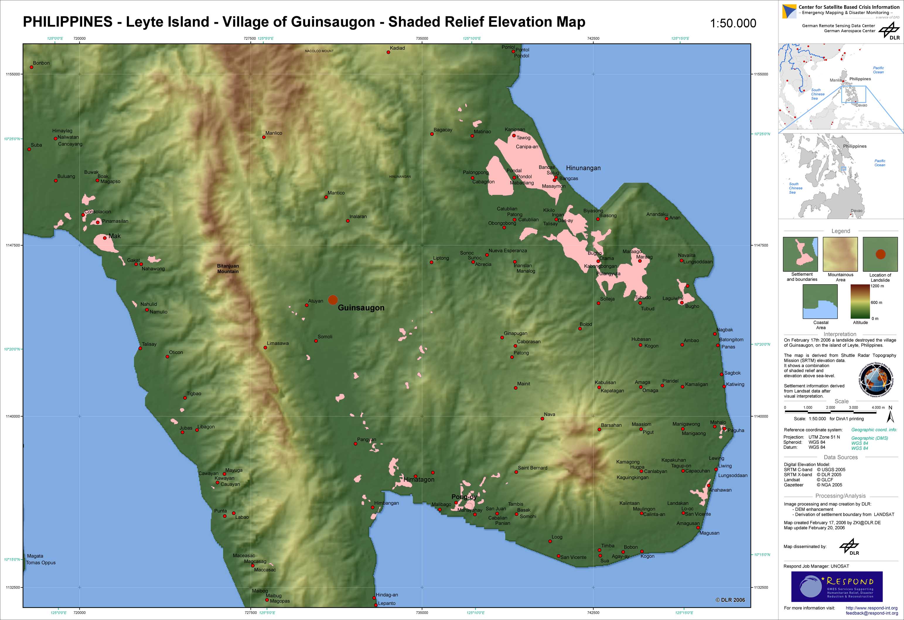
On February 17, 2006, a landslide triggered by heavy rains buried the village of Guinsaungon, Saint Bernard, Southern Leyte Island (Philippines). Most of the approximately 300 houses and the elementary school were fully covered by the mudslide.The village had 1411 inhabitants and in the elementary school, 246 pupils were taught by seven teachers at the time of the incident. The immediate cause of the landslide were continuous rains for the whole past week. Southern Leyte received about four times more than the normal rainfall (478mm vs. 137mm). DLR-ZKI, in cooperation with its partners from the International Charter - Space and Major Disasters and RESPOND was generating up-to-date relief support information (maps, images, etc.), which was being made available to relief organisations. A topographic elevation map gives a first overview of the region affected by the landslide.
Philippines - P03 - Zoom-Map of the landslide-affected area for Guinsaugon
Creation Date 03. March 2006
Philippines - P02 - Landslide-affected area for Guinsaugon
Creation Date 03. March 2006
Philippines - P01 - Elevation overview map for Guinsaugon
Creation Date 20. February 2006
undefined