
Flooding of the river Elbe in Germany
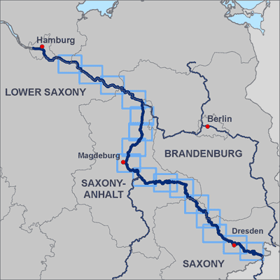
Overview of the provided DLR mapsheets for the 2006 Elbe flood in Germany
Credit:
DLR (CC BY-NC-ND 3.0)
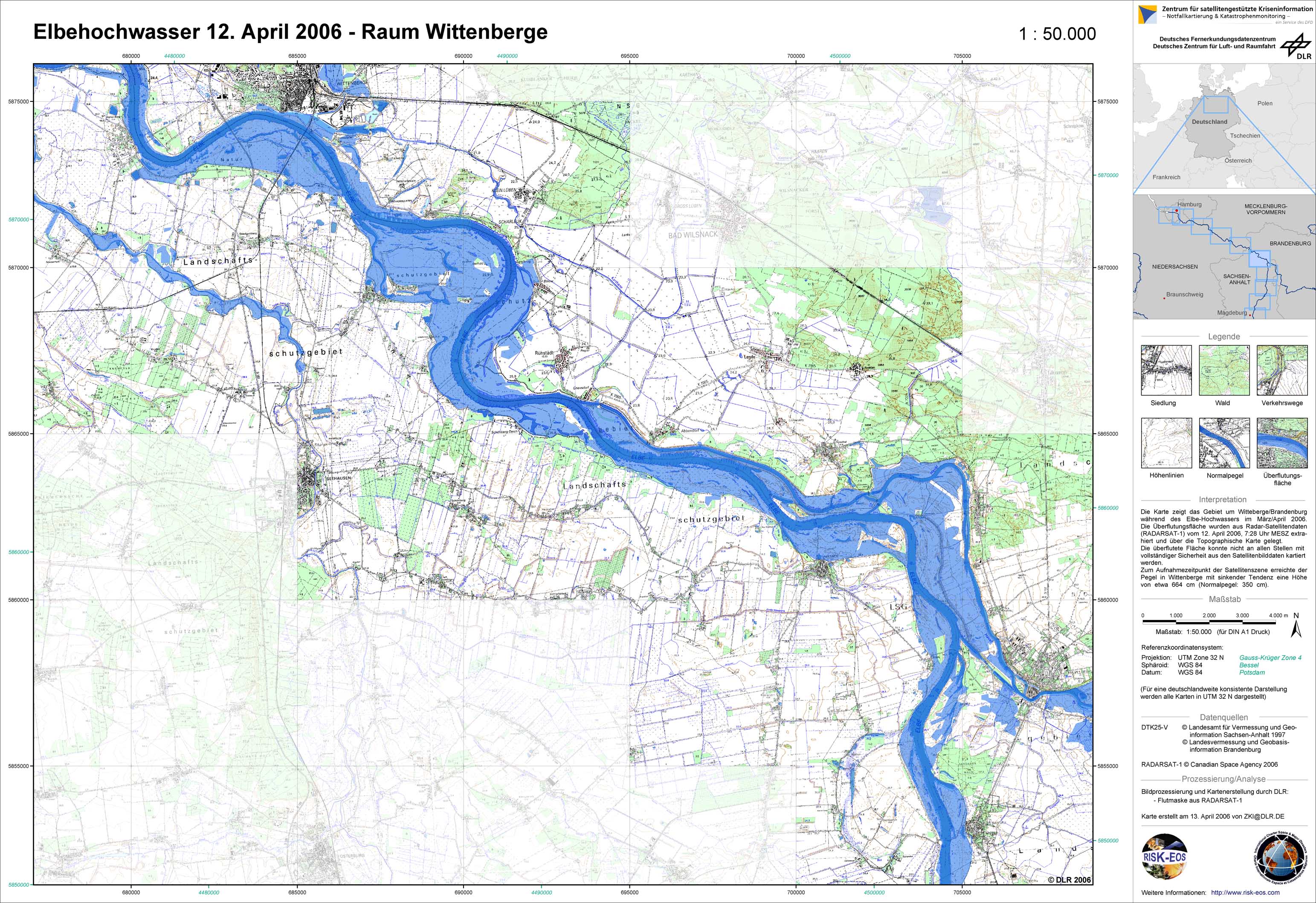
Germany - P19 - Topographic map with flood mask derived from radar satellite data from April 12, 2006 - Wittenberge
Creation Date 13. April 2006
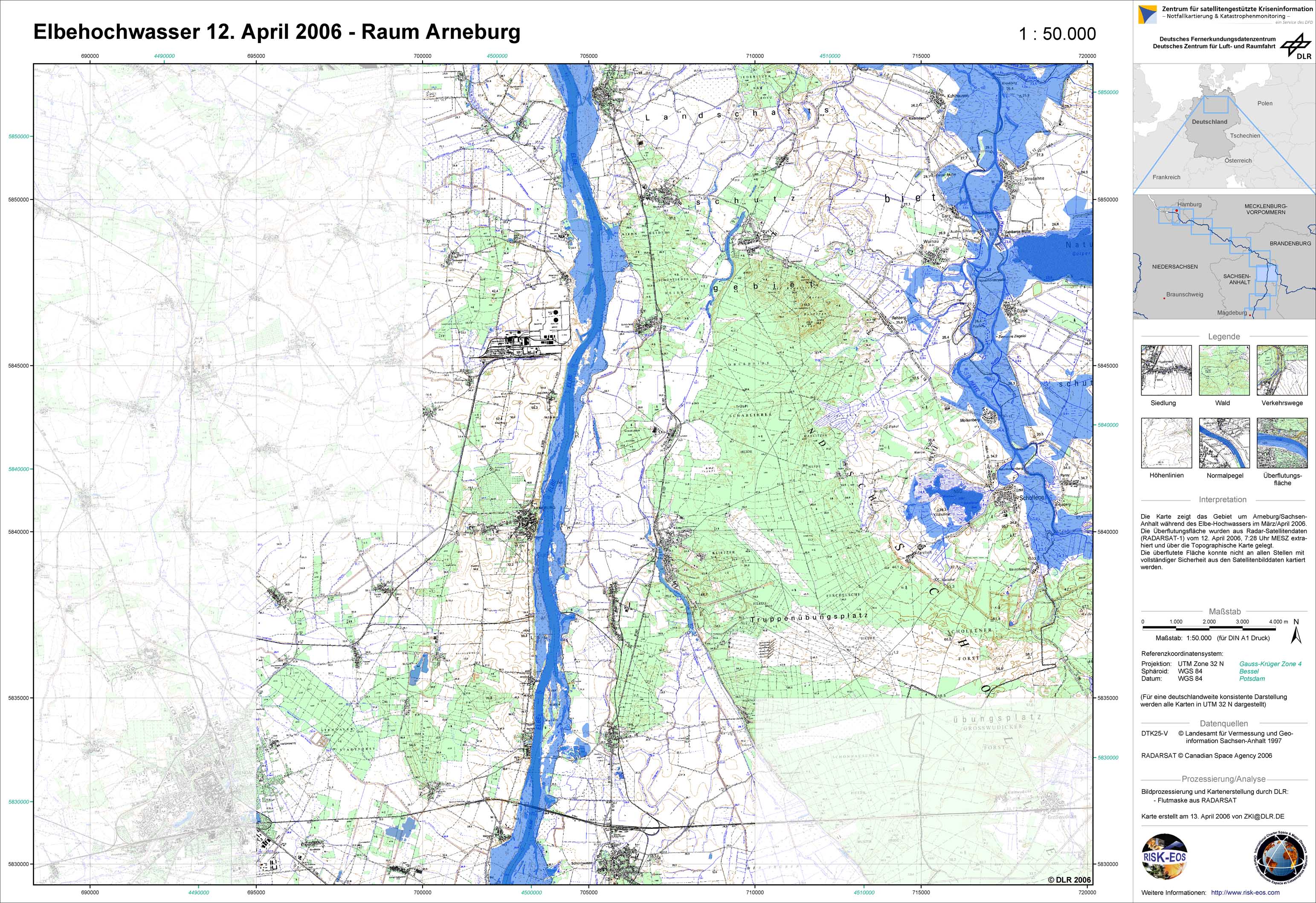
Germany - P18 - Topographic map with flood mask derived from radar satellite data from April 12, 2006 - Arneburg
Creation Date 13. April 2006
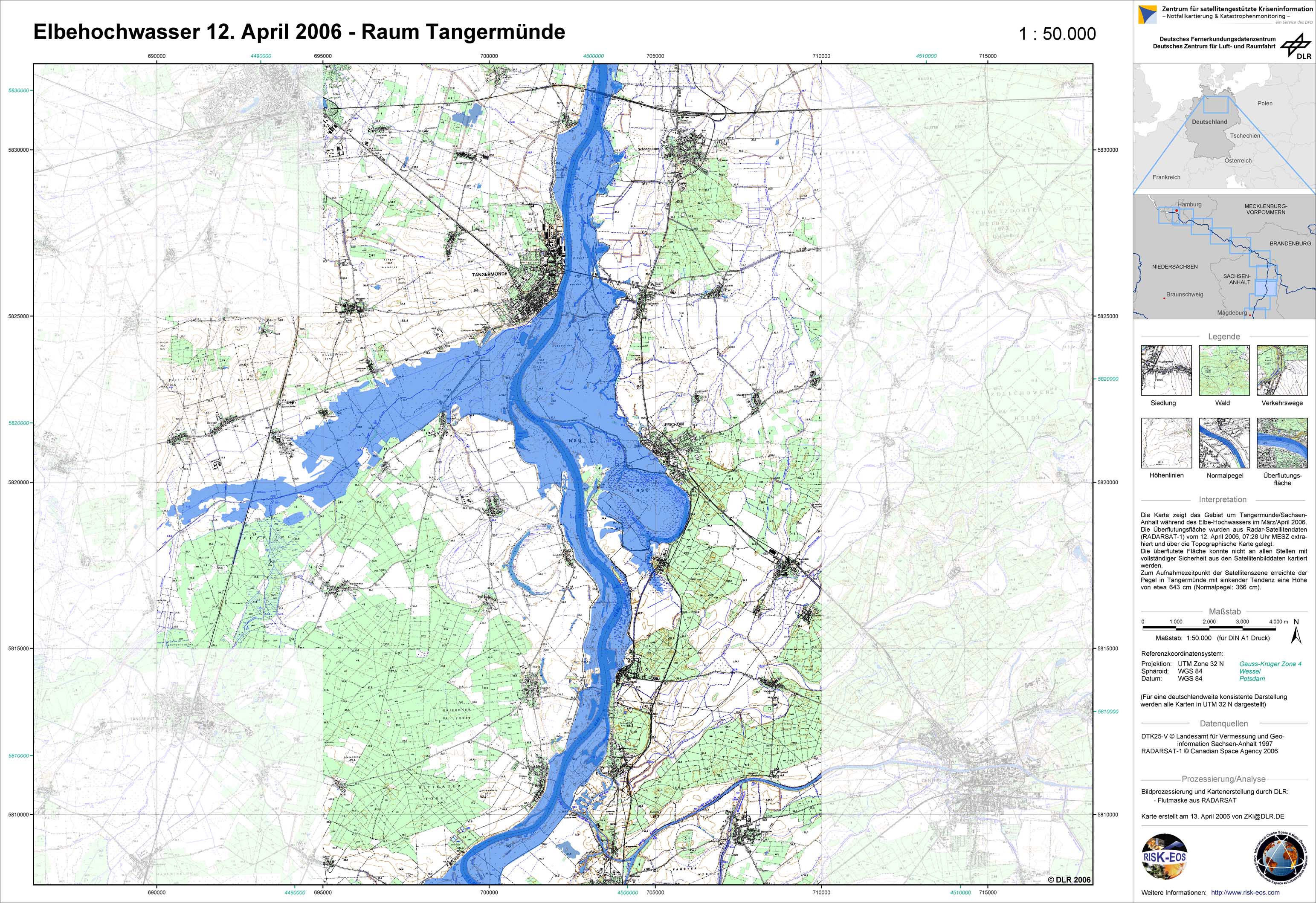
Germany - P17 - Topographic map with flood mask derived from radar satellite data from April 12, 2006 - Tangermuende
Creation Date 13. April 2006
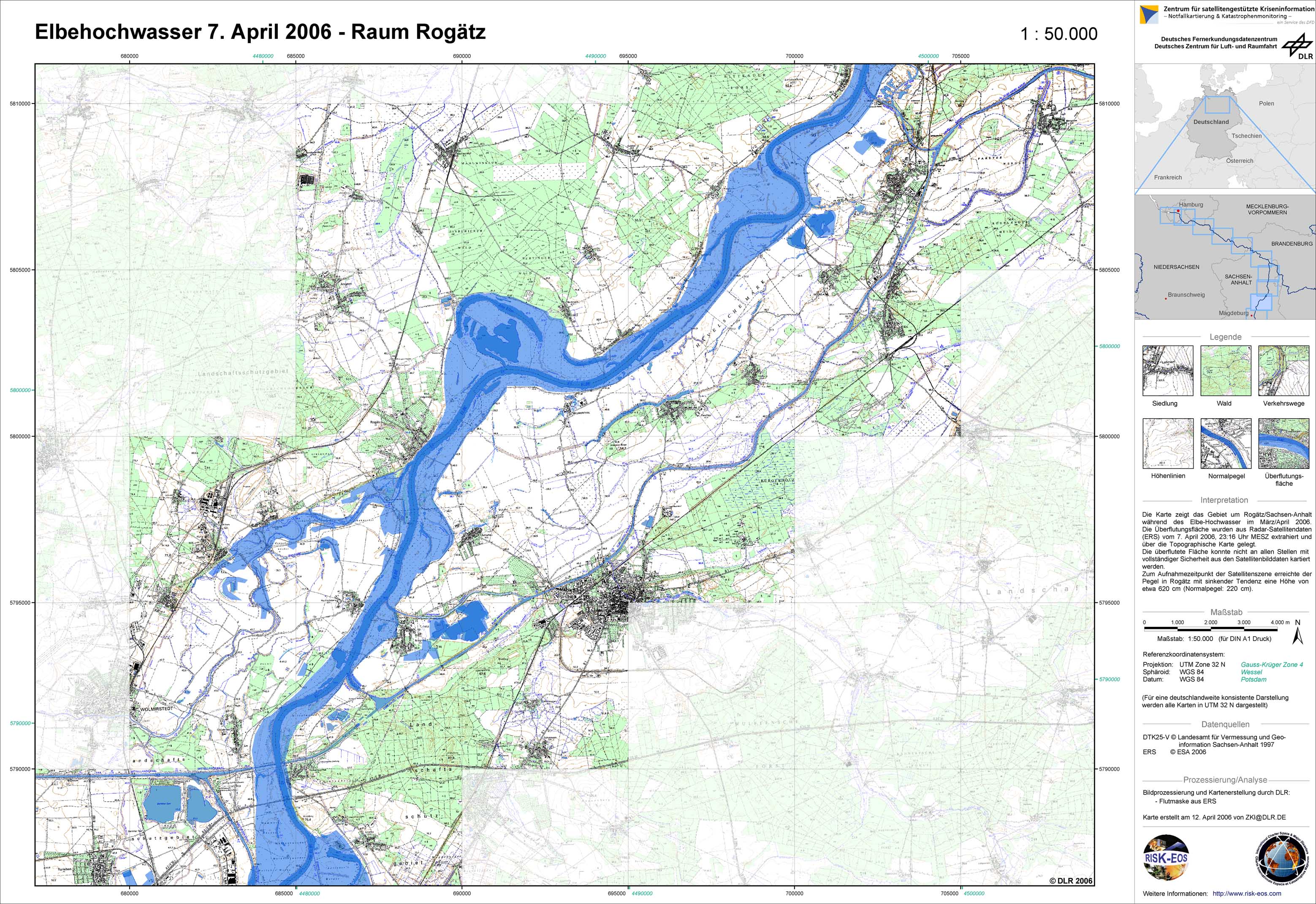
Germany - P13 - Topographic map with flood mask derived from radar satellite data from April 7, 2006 - Rogaetz
Creation Date 12. April 2006
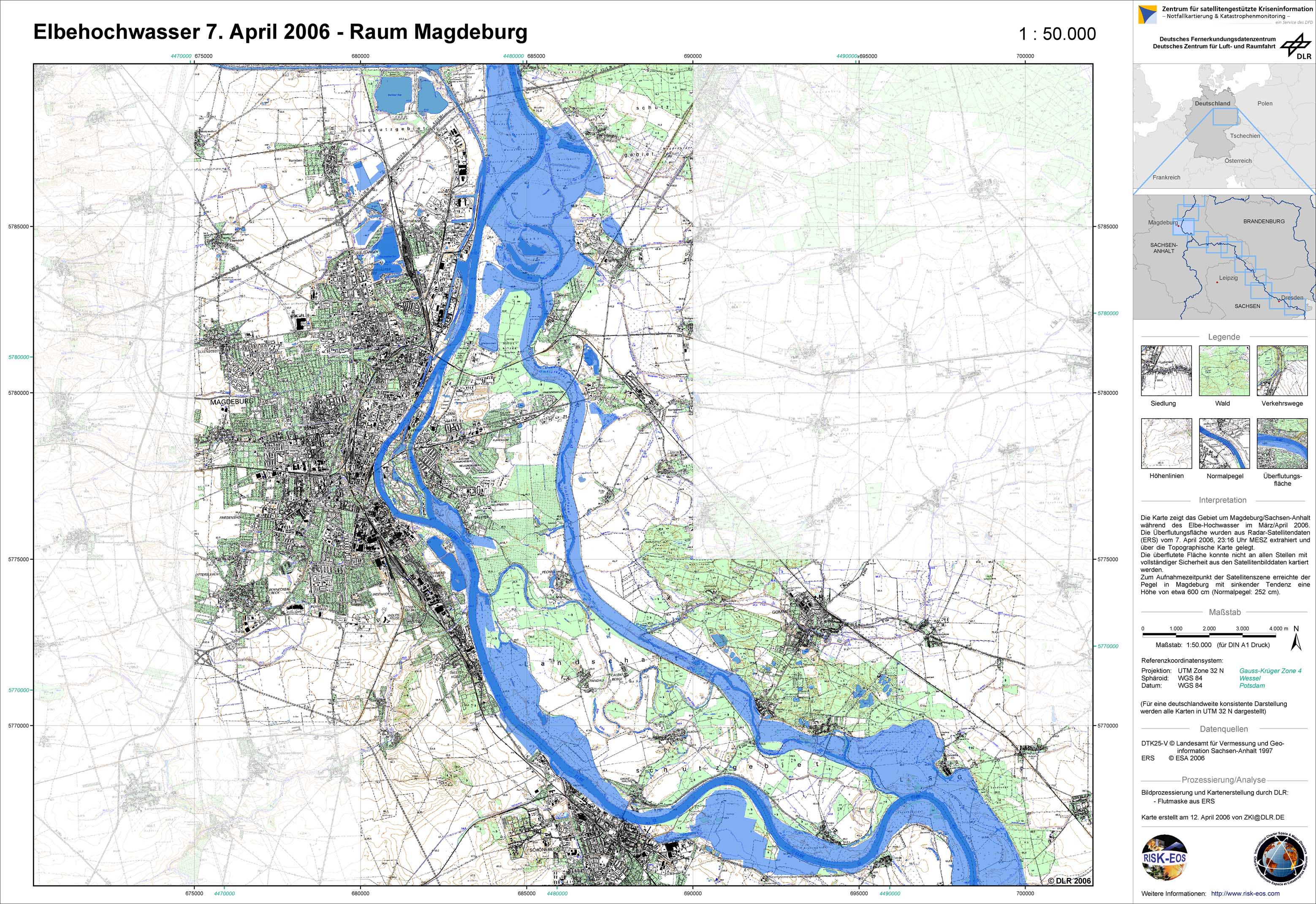
Germany - P12 - Topographic map with flood mask derived from radar satellite data from April 7, 2006 - Magdeburg
Creation Date 12. April 2006
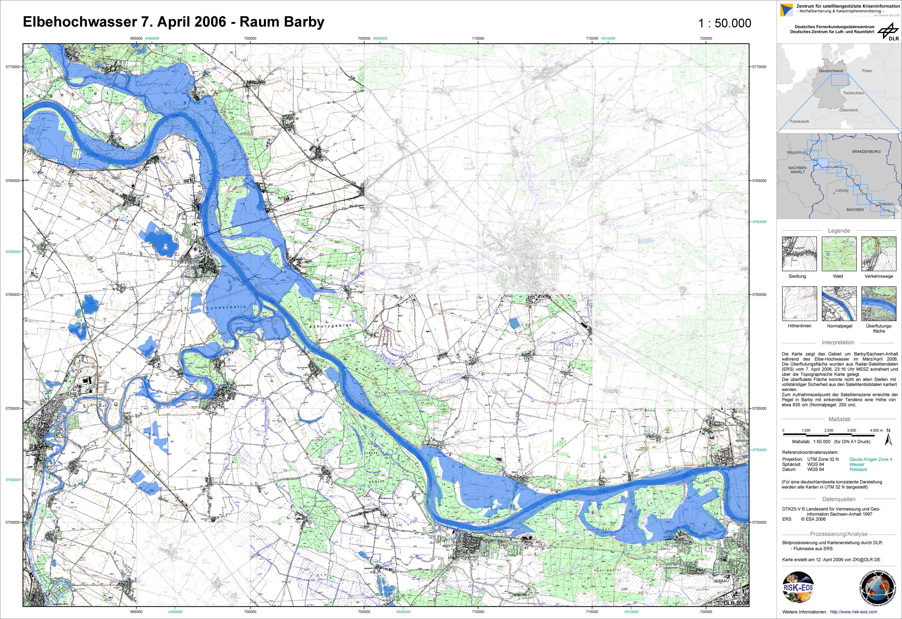
Germany - P11 - Topographic map with flood mask derived from radar satellite data from April 7, 2006 - Barby
Creation Date 12. April 2006
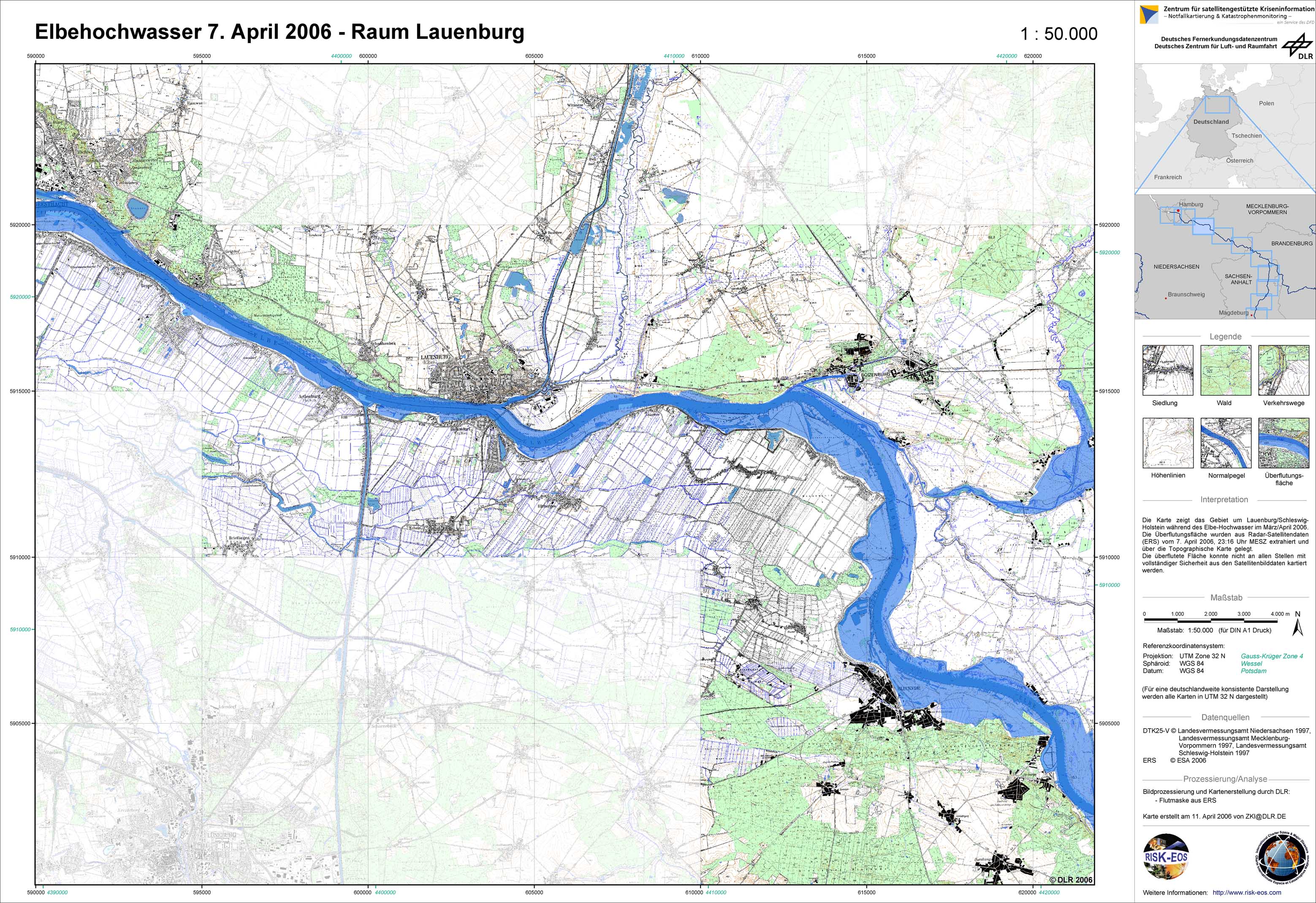
Germany - P16 - Topographic map with flood mask derived from radar satellite data from April 7, 2006 - Lauenburg
Creation Date 11. April 2006
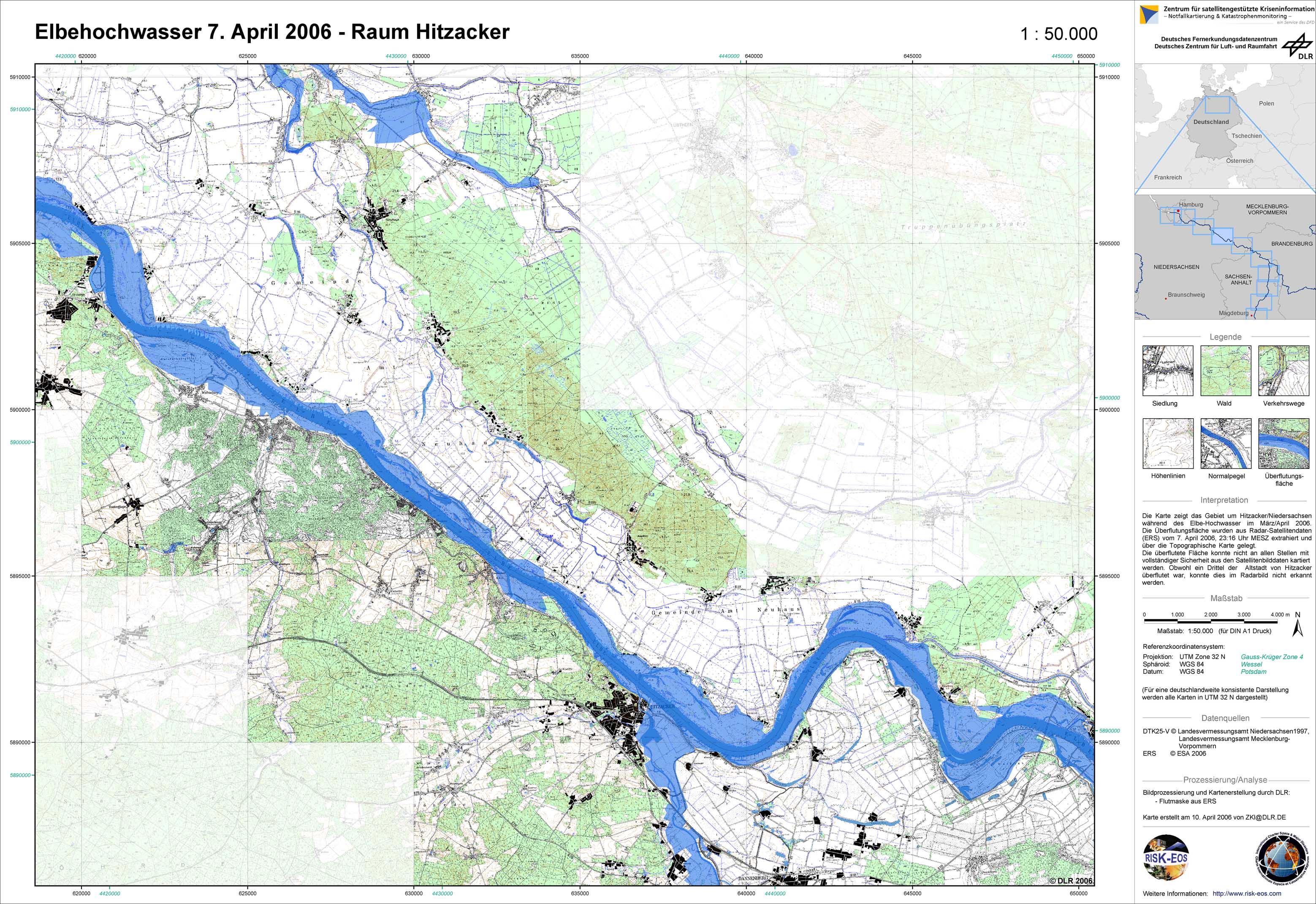
Germany - P15 - Topographic map with flood mask derived from radar satellite data from April 7, 2006 - Hitzacker
Creation Date 10. April 2006
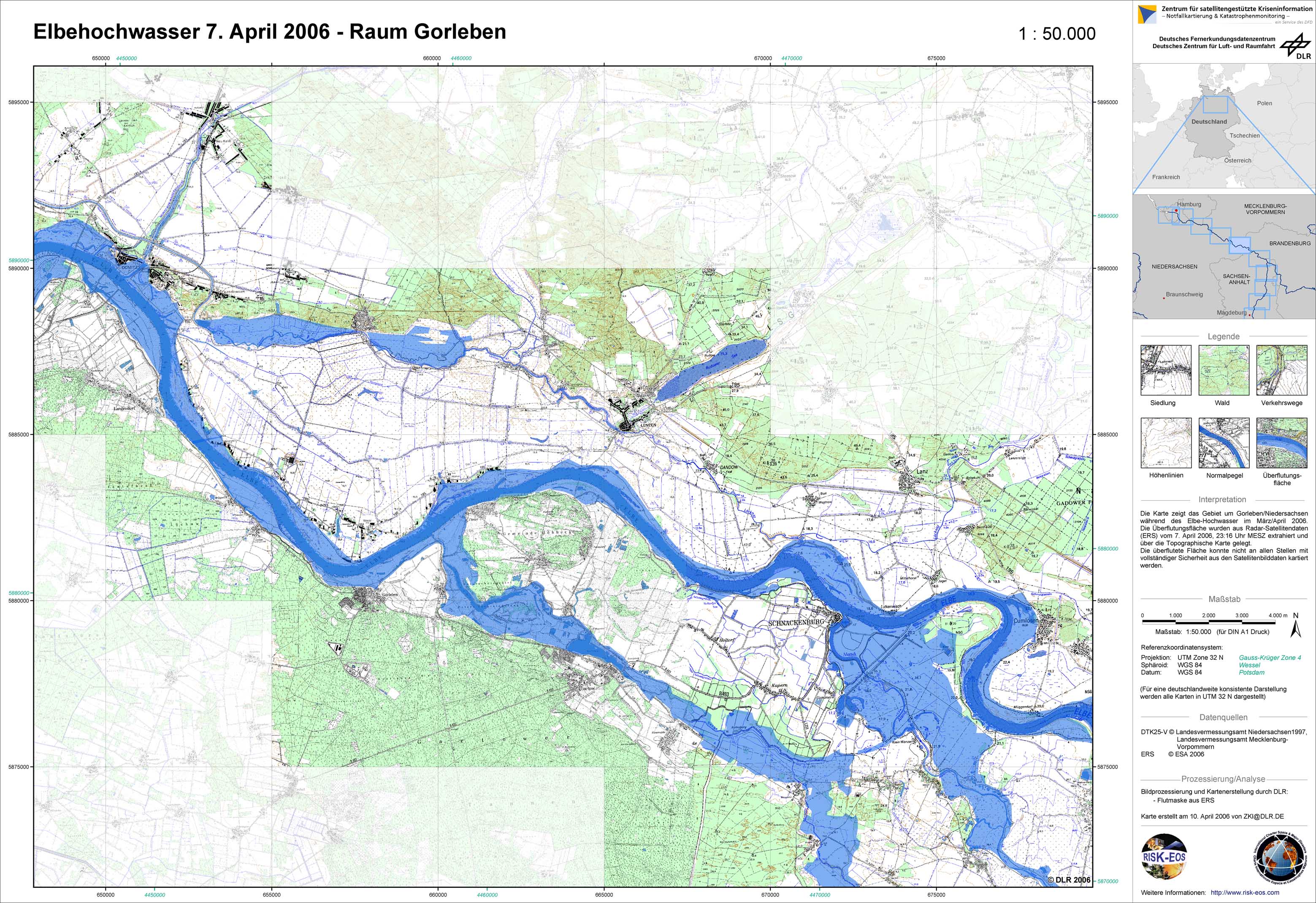
Germany - P14 - Topographic map with flood mask derived from radar satellite data from April 7, 2006 - Gorleben
Creation Date 10. April 2006
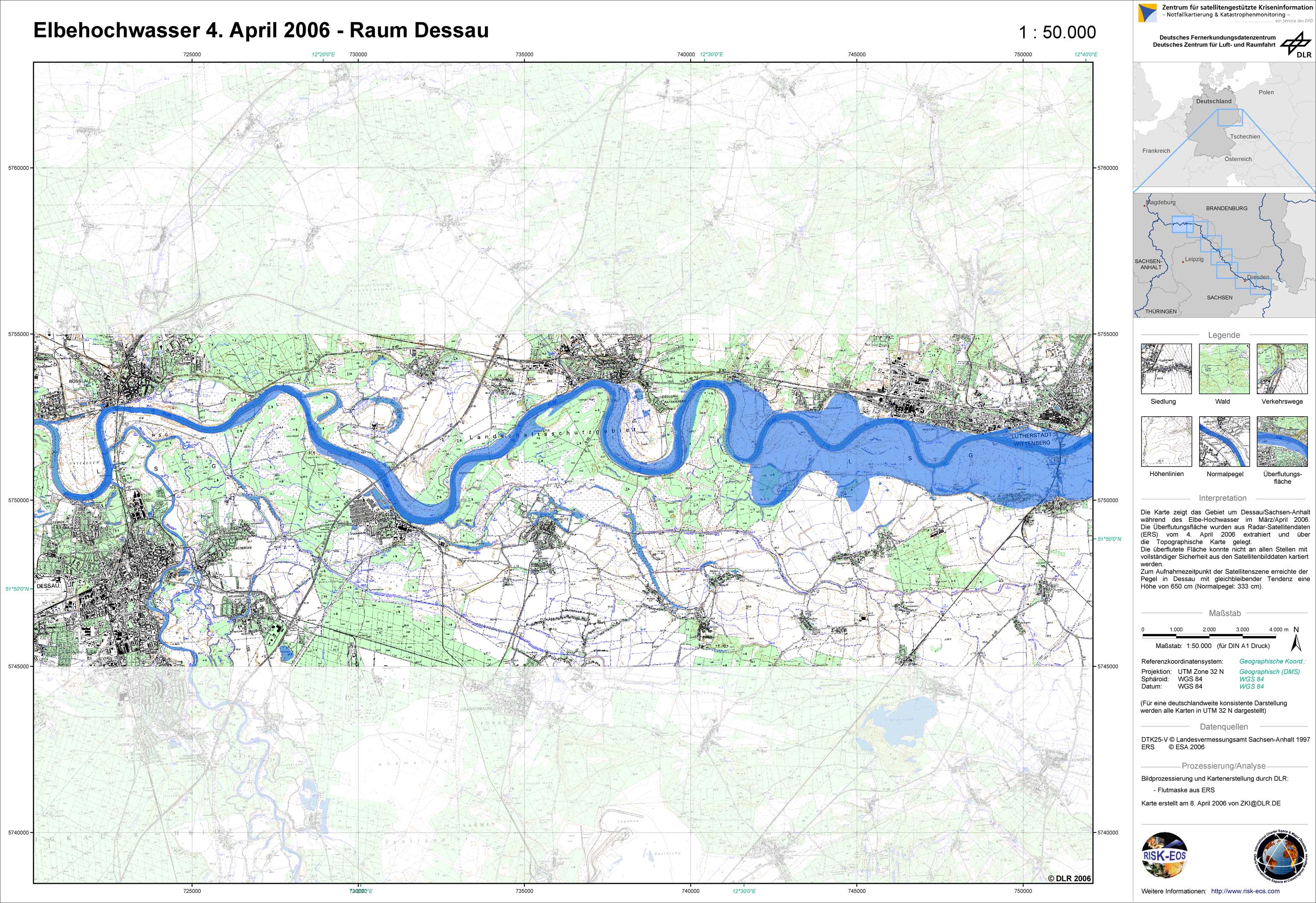
Germany - P10 - Topographic map with flood mask derived from radar satellite data from April 4, 2006 - Dessau
Creation Date 08. April 2006
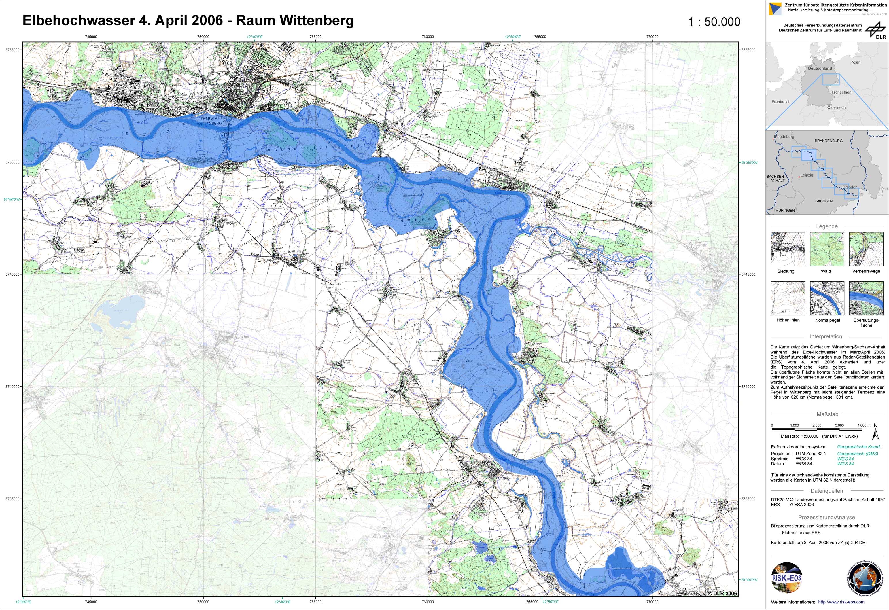
Germany - P09 - Topographic map with flood mask derived from radar satellite data from April 4, 2006 - Wittenberg
Creation Date 08. April 2006
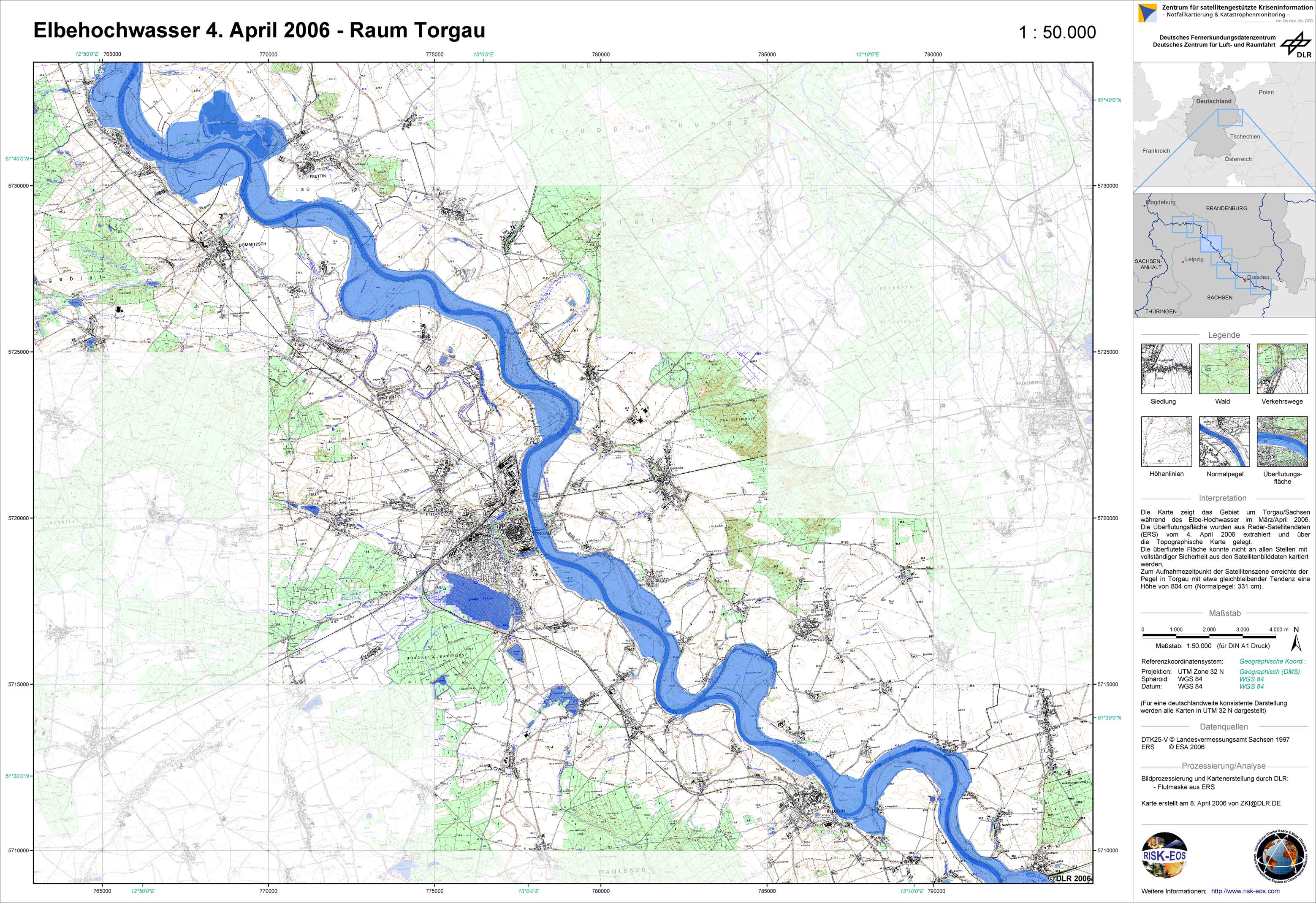
Germany - P08 - Topographic map with flood mask derived from radar satellite data from April 4, 2006 - Torgau
Creation Date 08. April 2006
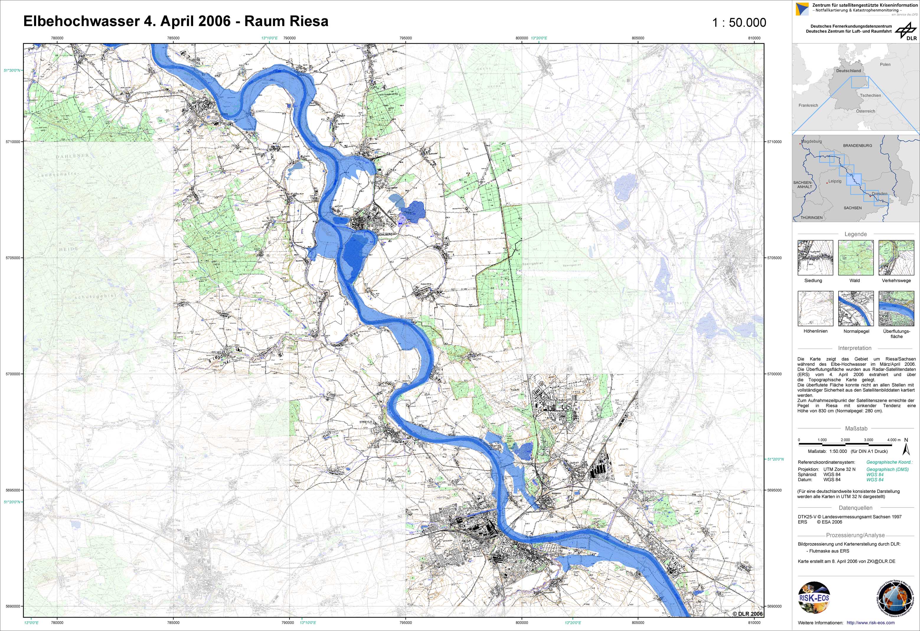
Germany - P07 - Topographic map with flood mask derived from radar satellite data from April 4, 2006 - Riesa
Creation Date 08. April 2006
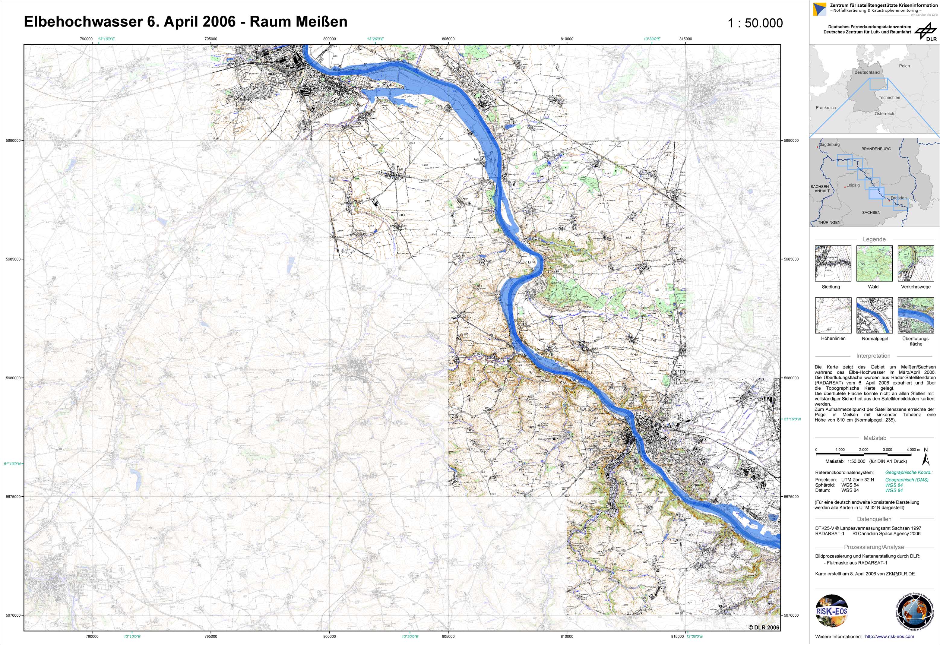
Germany - P06 - Topographic map with flood mask derived from radar satellite data from April 6, 2006 - Meissen
Creation Date 08. April 2006
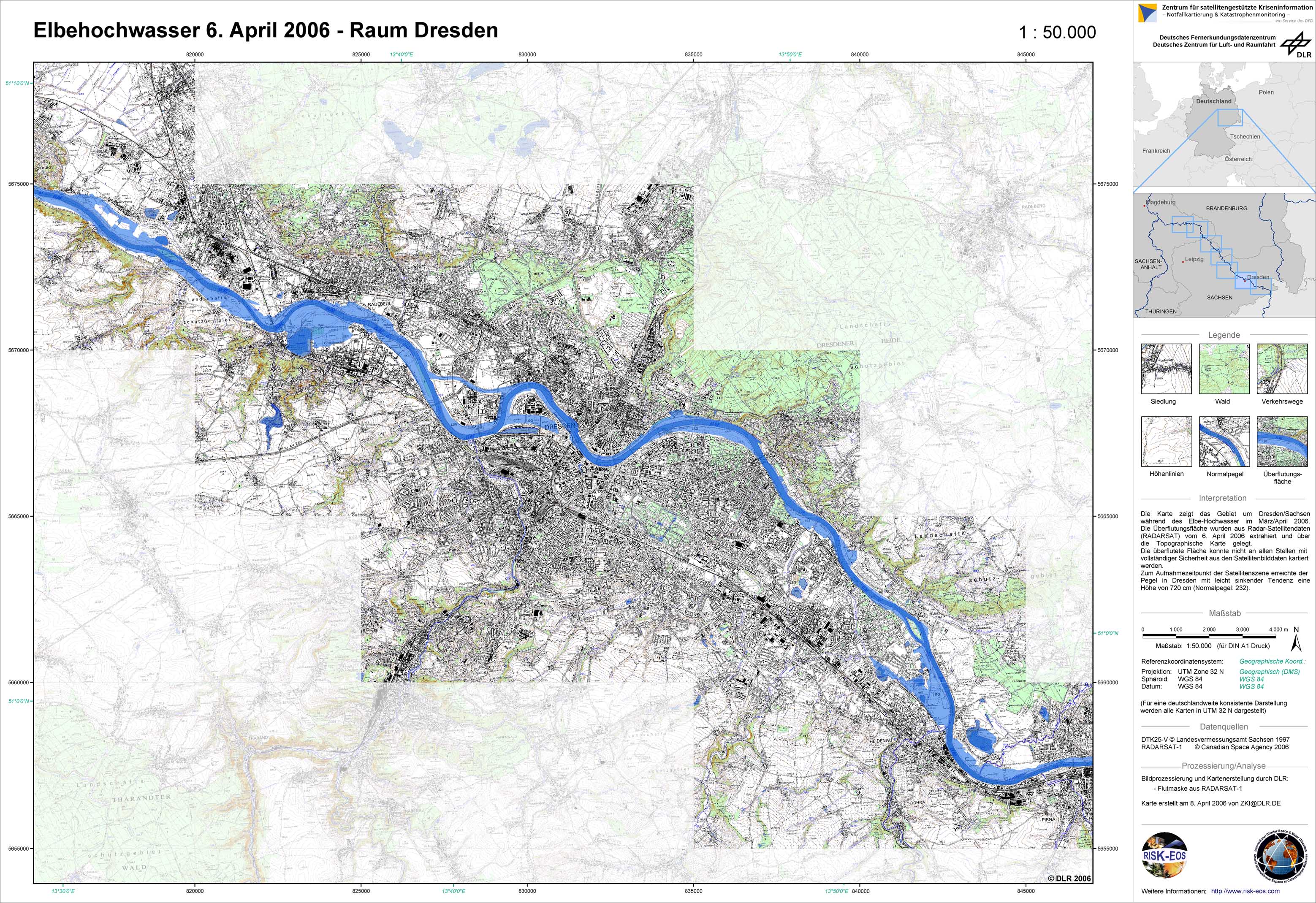
Germany - P05 - Topographic map with flood mask derived from radar satellite data from April 6, 2006 - Dresden
Creation Date 08. April 2006
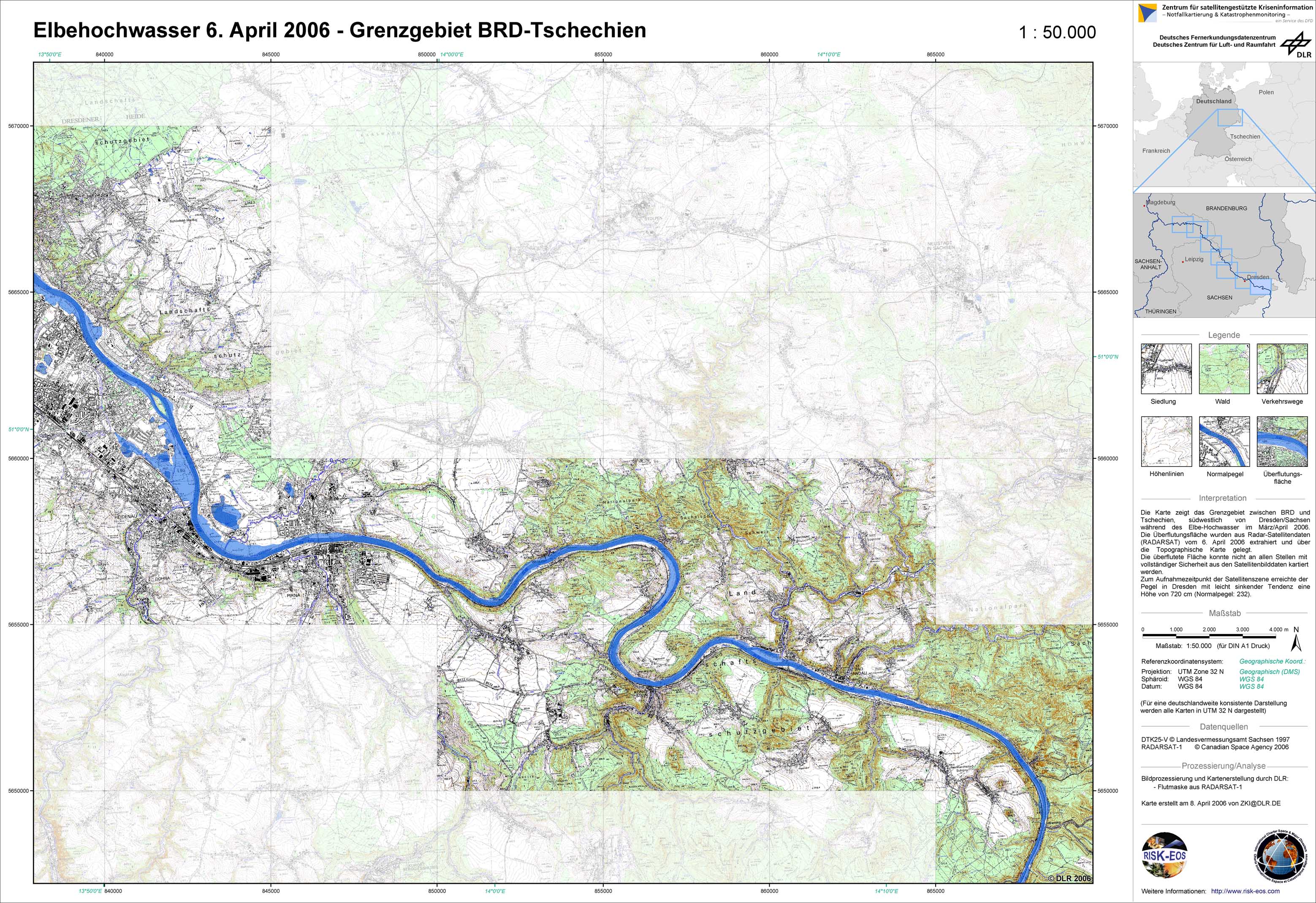
Germany - P04 - Topographic map with flood mask derived from radar satellite data from April 6, 2006 - Border area Germany - Czech Republic
Creation Date 08. April 2006
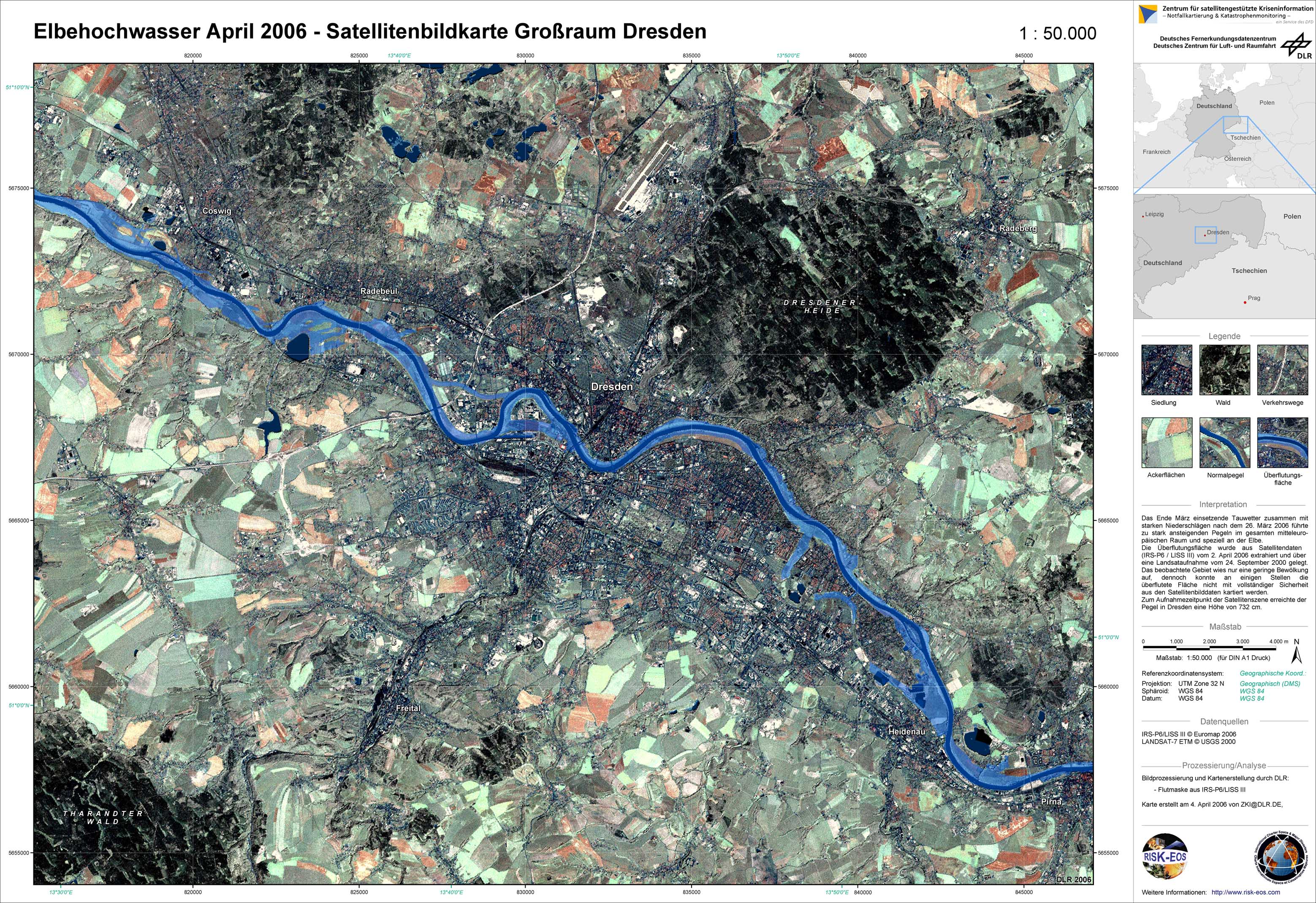
Germany - P03 - Satellite map with flood mask derived from satellite data from April 2, 2006 - Greater Dresden
Creation Date 04. April 2006
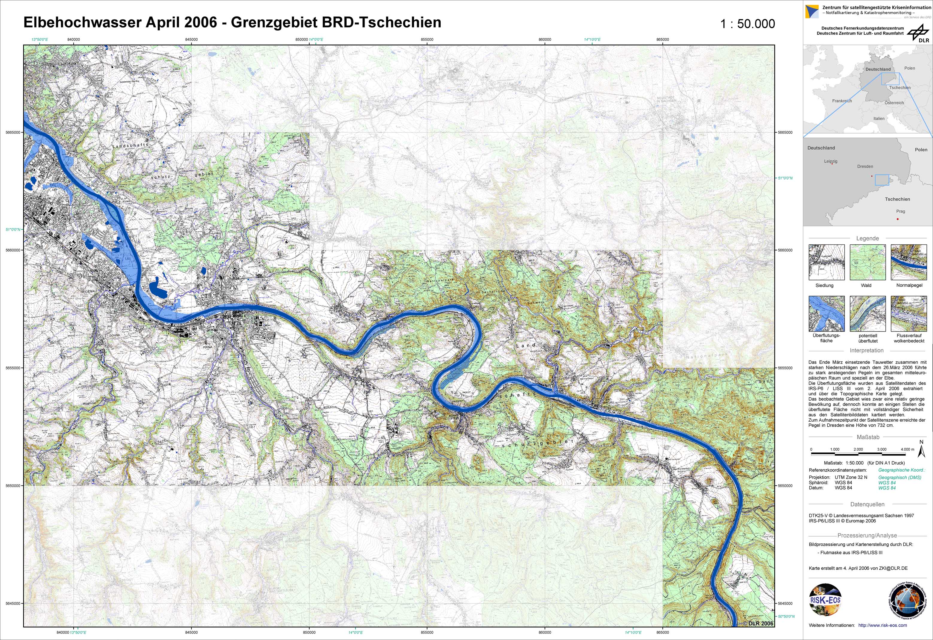
Germany - P01 - Topographic map with flood mask derived from satellite data from April 2, 2006 - Border area between Germany and the Czech Republic
Creation Date 04. April 2006
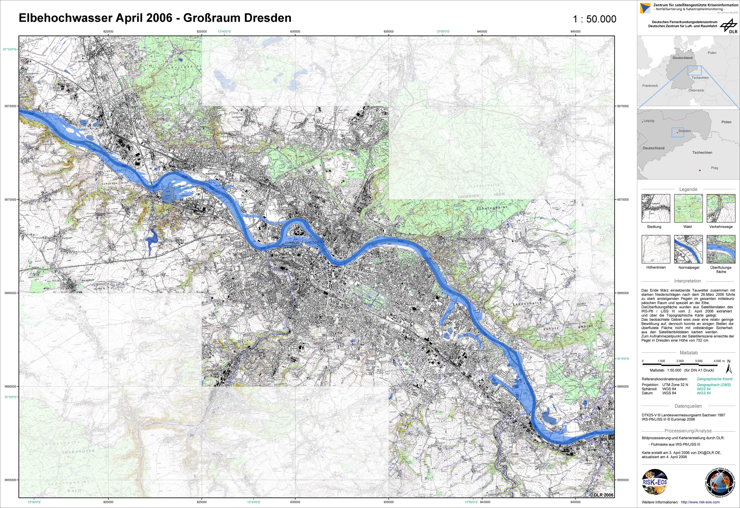
Germany - P02 - Topographic map with flood mask derived from satellite data from April 2, 2006 - Greater Dresden
Creation Date 03. April 2006