18. April 2006

Flooding in Hungary

undefined

Snowmelt in combination with heavy rainfalls led to an aggravation of the flooding situation in Southeast Europe. In Hungary, the most critical situation shifted from the Danube river, where the water level had reached the highest levels for more than 100 years, to the Tisza river (April 18, 2006). In particular the cities of Szolnok and Szeged were affected, where the Hungarian civil protection tried to reinforce the dams with sand bags. In total, about 40 settlements were endangered by the flood. The Monitoring and Information Centre (MIC) of the European Commission had triggered the International Charter 'Space and Major Disasters' on behalf of the Hungarian civil protection. The Center for Satellite Based Crisis Information (ZKI) of DLR had taken over the project management for this Charter activation and produced map products based on up-to-date satellite data. The map production was financed through the GMES Service Element RISK-EOS.

Products

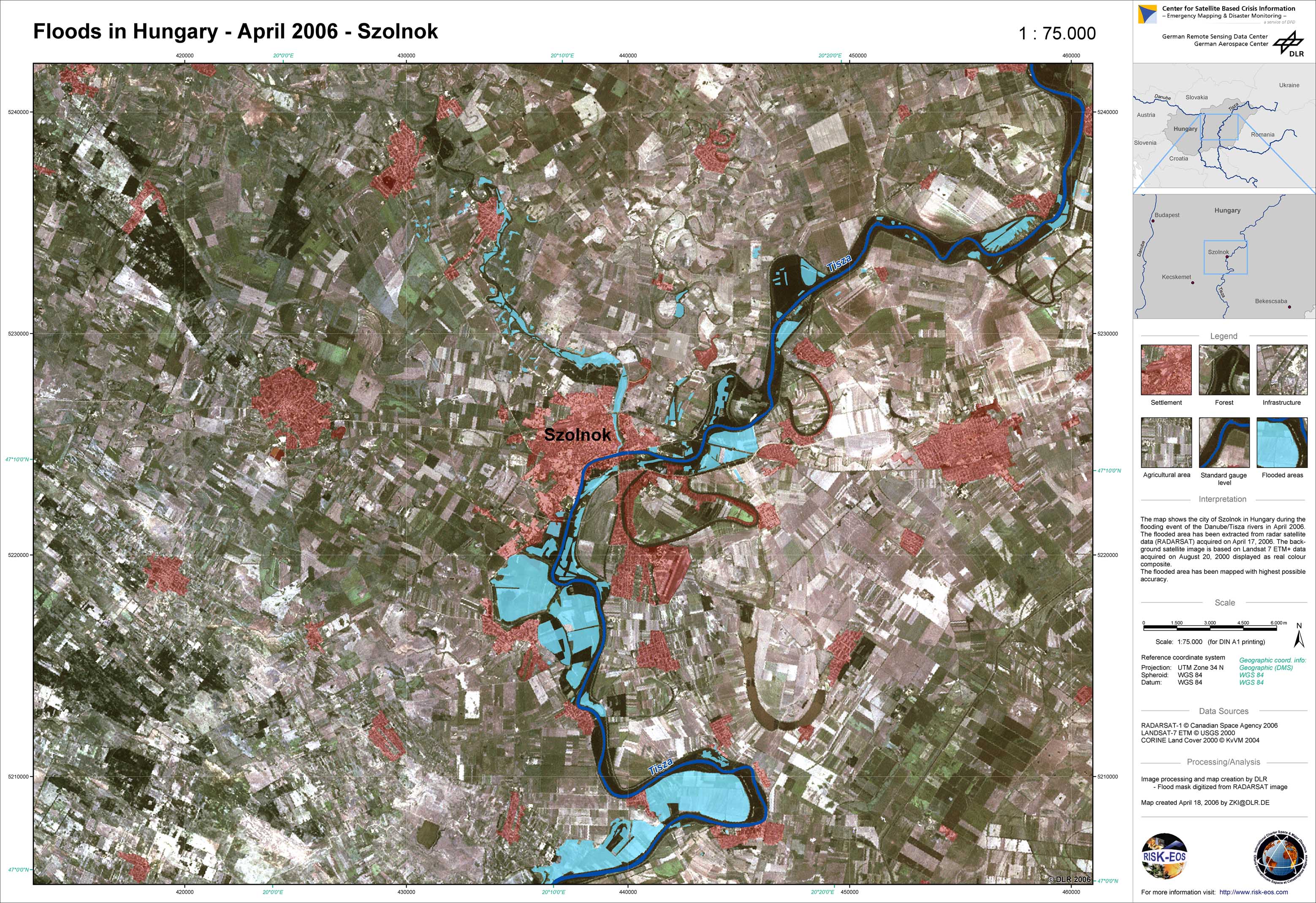
Hungary - P02 - Landsat map with flood mask derived from radar satellite data from April 17, 2006 - Szolnok

Creation Date 19. April 2009

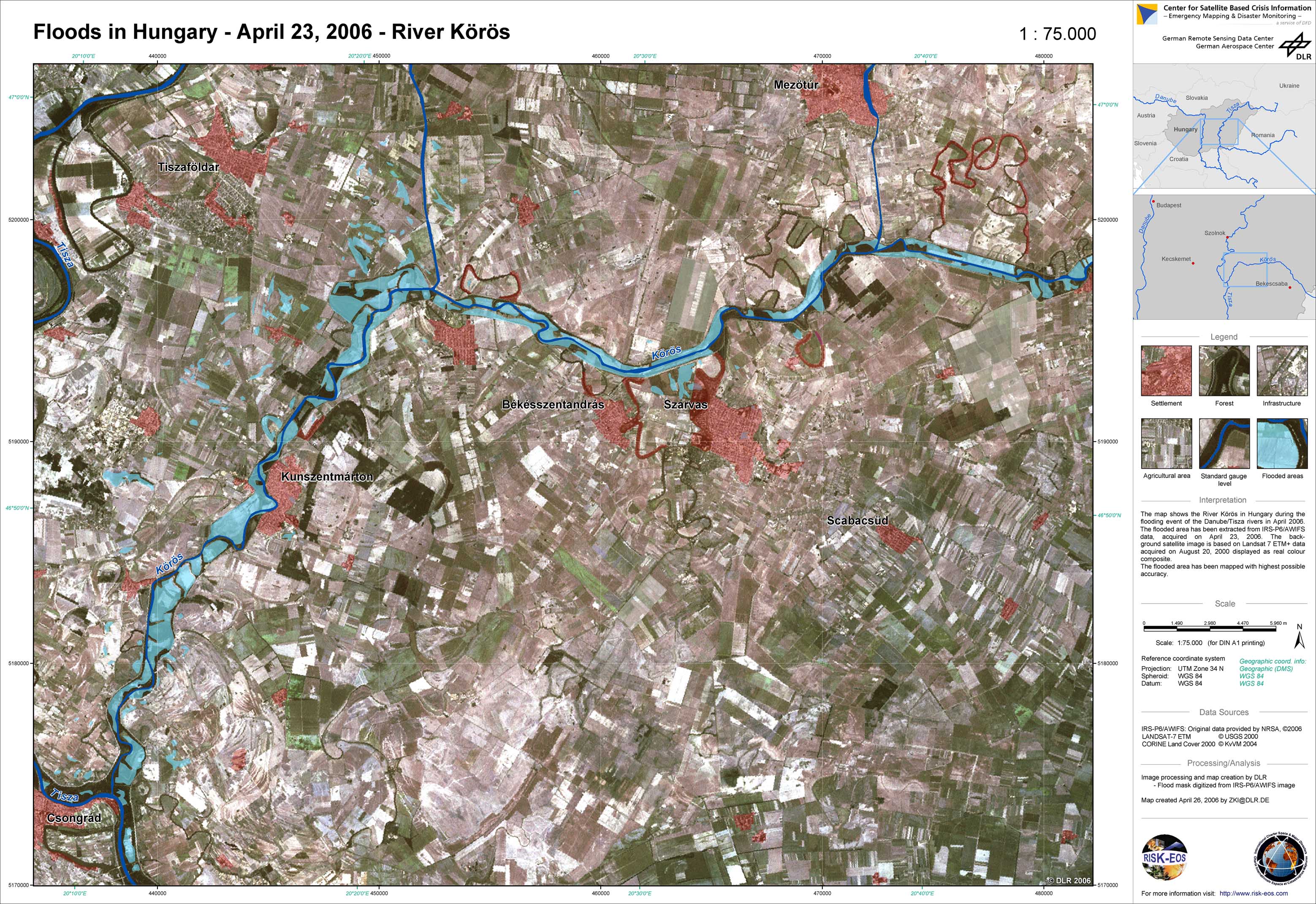
Hungary - P06 - Landsat map with flood mask derived from IRS satellite data from April 23, 2006 - River Körös

Creation Date 26. April 2006

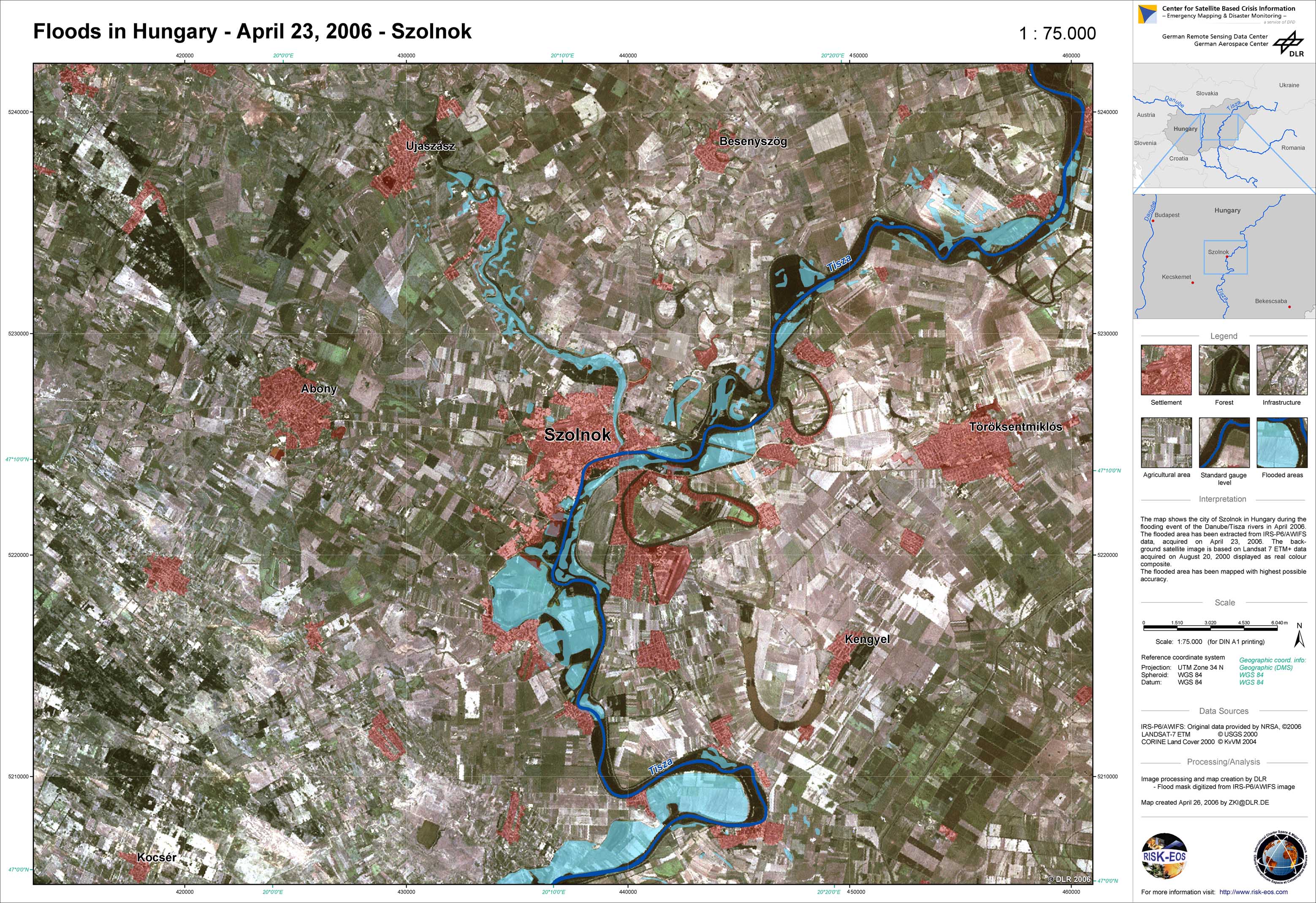
Hungary - P05 - Landsat map with flood mask derived from IRS satellite data from April 23, 2006 - Szolnok

Creation Date 26. April 2006

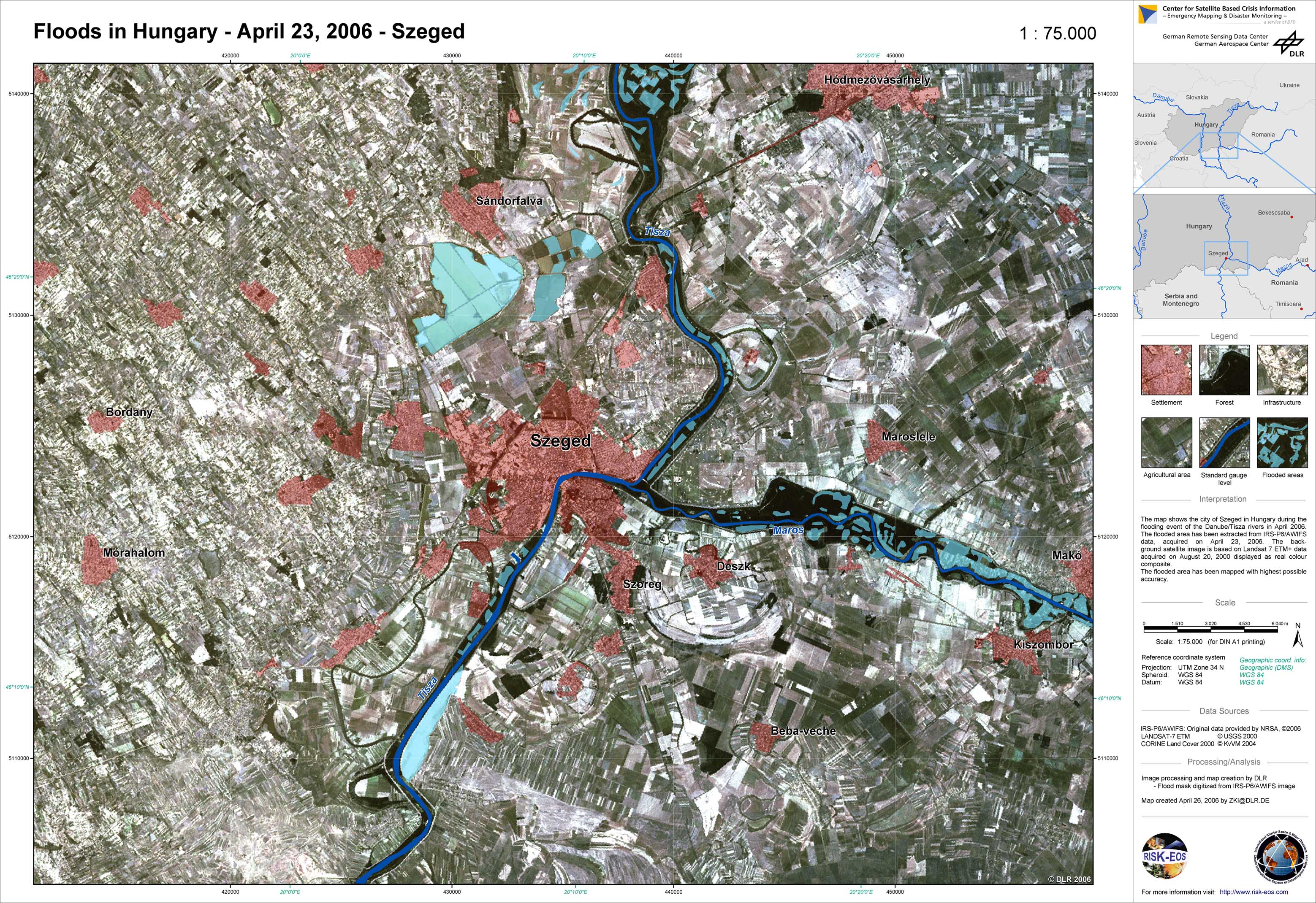
Hungary - P04 - Landsat map with flood mask derived from IRS satellite data from April 23, 2006 - Szeged

Creation Date 26. April 2006

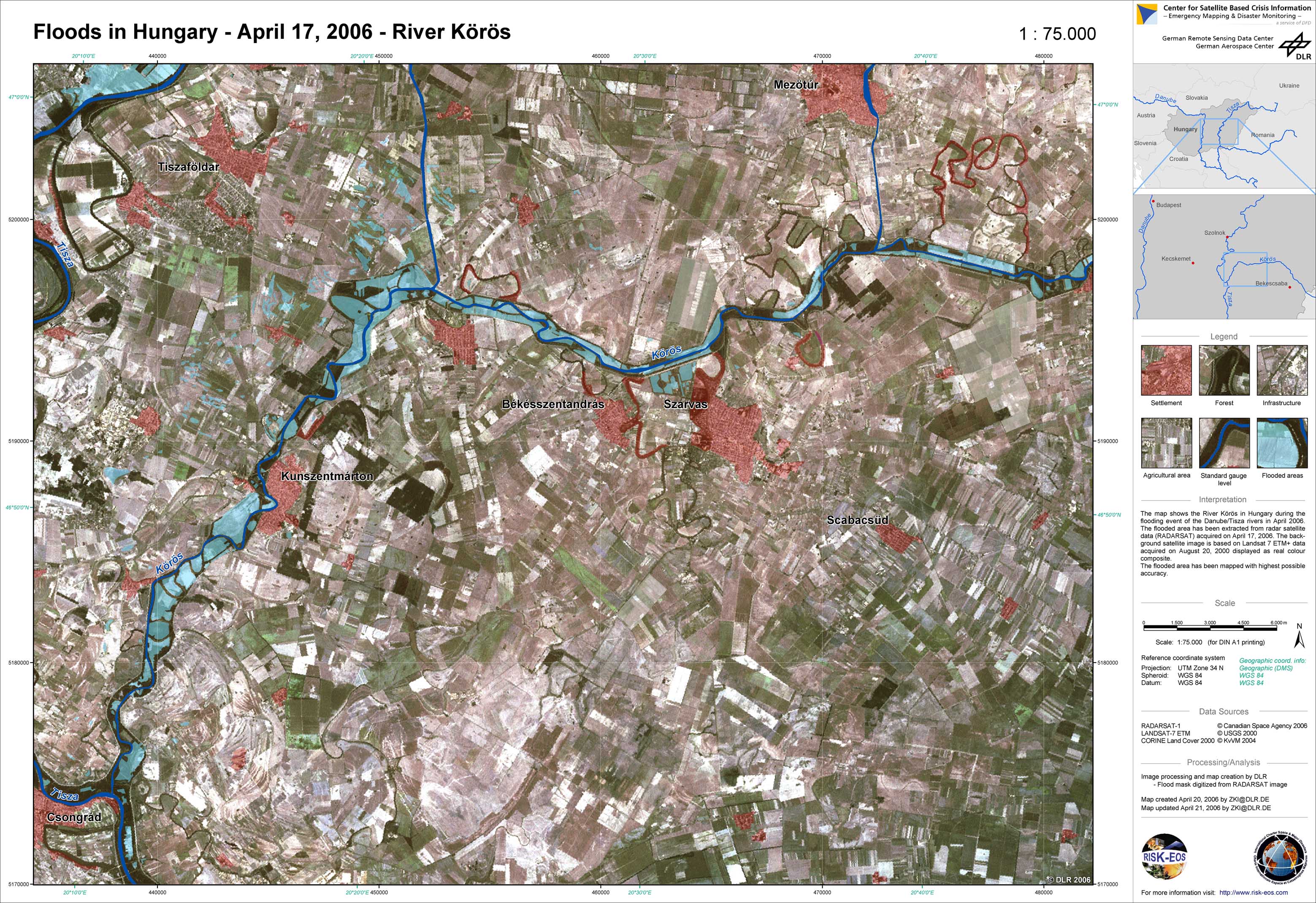
Hungary - P03 - Landsat map with flood mask derived from radar satellite data from April 17, 2006 - River Körös

Creation Date 21. April 2006

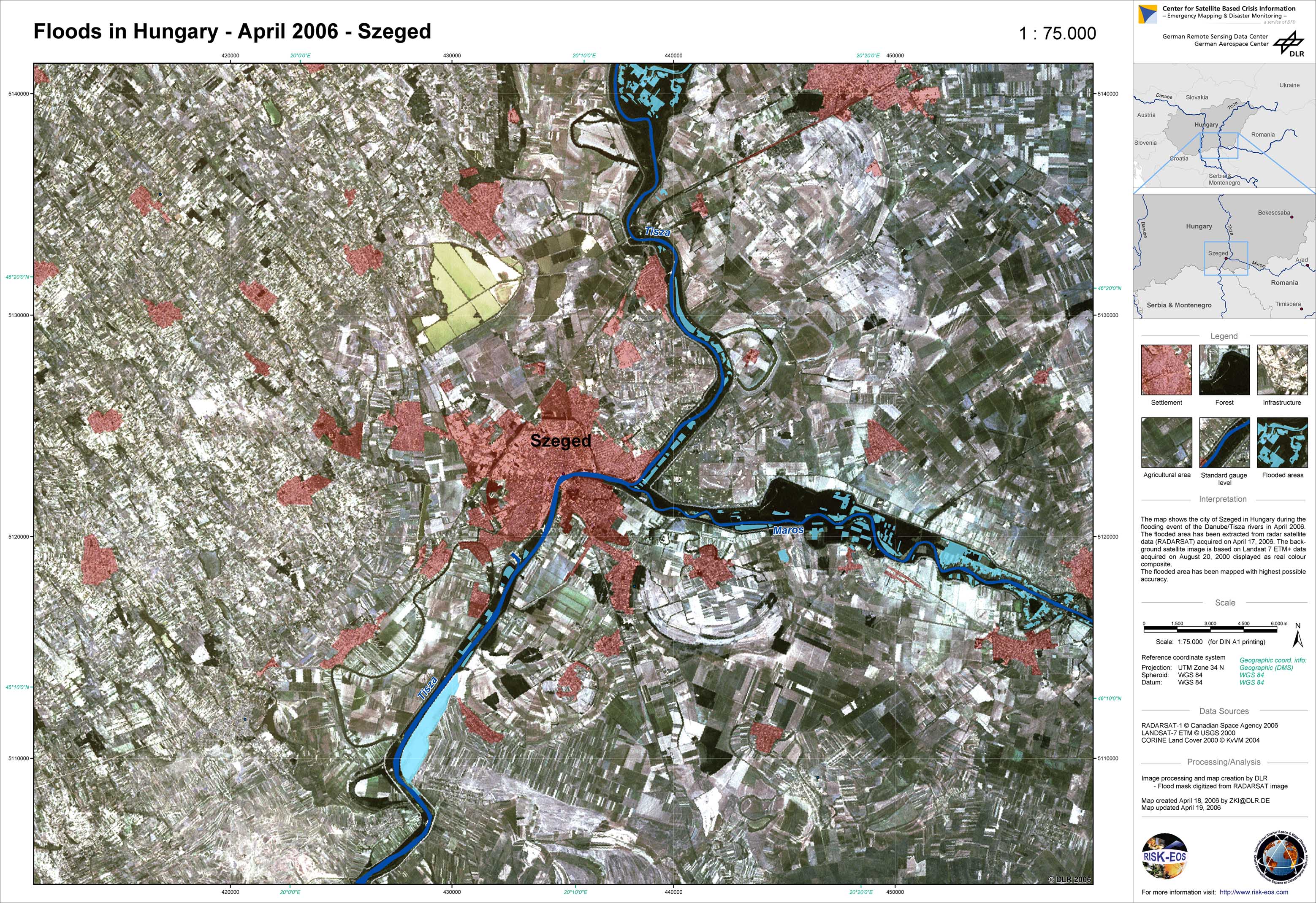
Hungary - P01 - Landsat map with flood mask derived from radar satellite data from April 17, 2006 - Szeged

Creation Date 19. April 2006

undefined