
Earthquake in Yogyakarta, Indonesia
undefined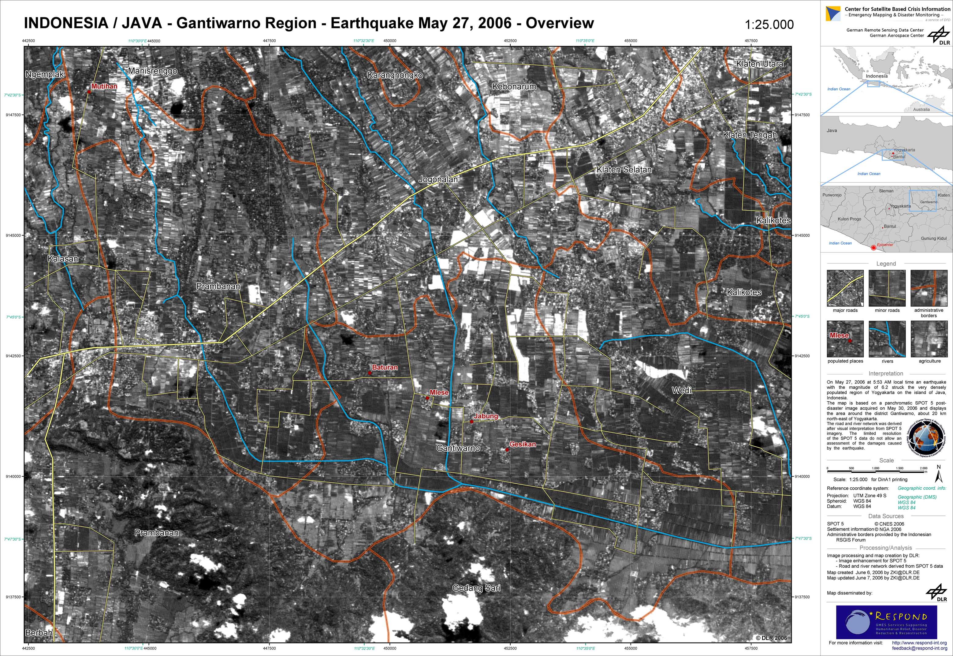
Indonesia - P10 - Overview satellite map - SPOT data from May 30, 2006 - Klaten/Ganitwarno region
Creation Date 07. June 2006
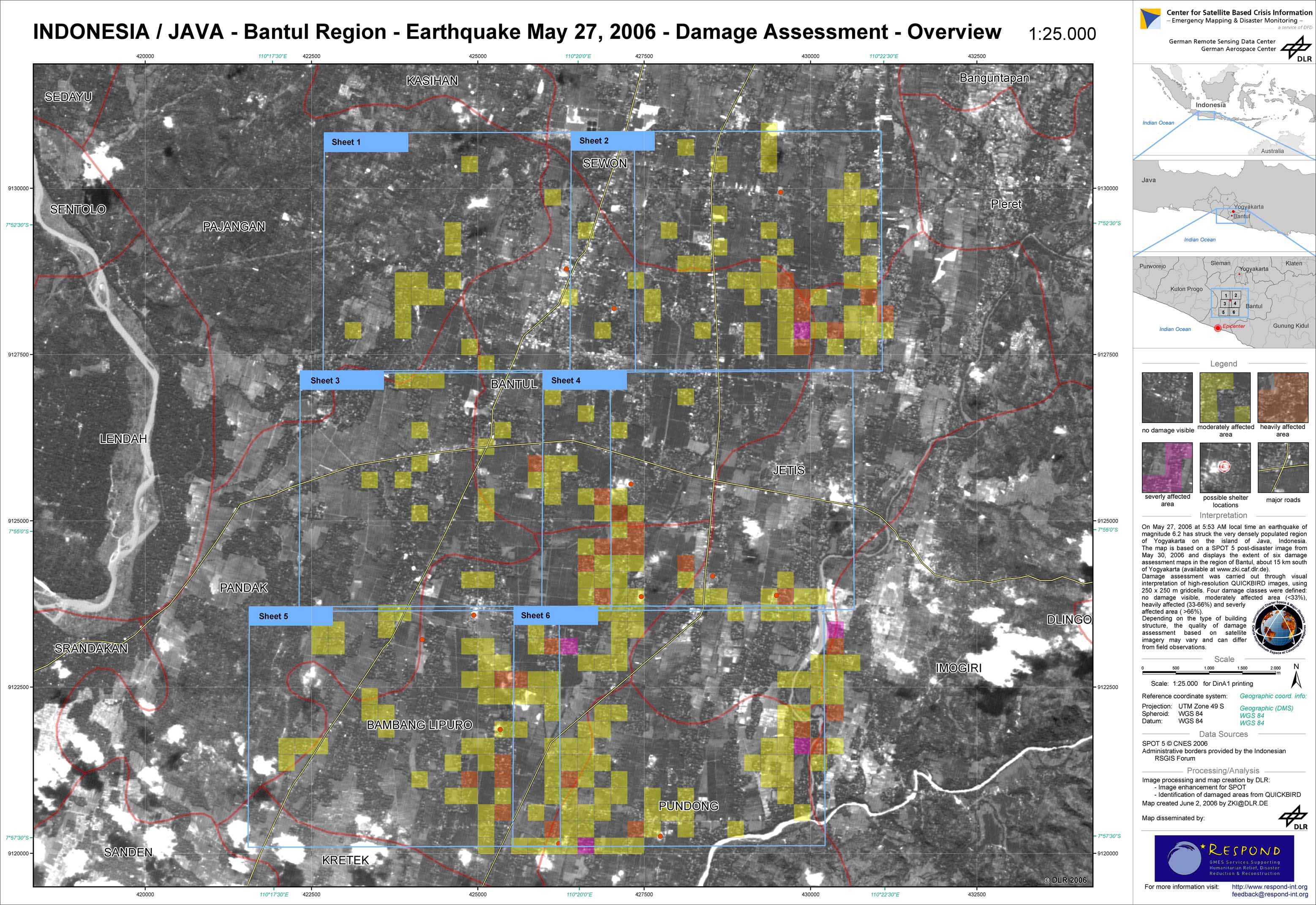
Indonesia - P03 - Damage assessment based on QUICKBIRD data from May 28, 2006 - Bantul Region, Overview Map
Creation Date 02. June 2006
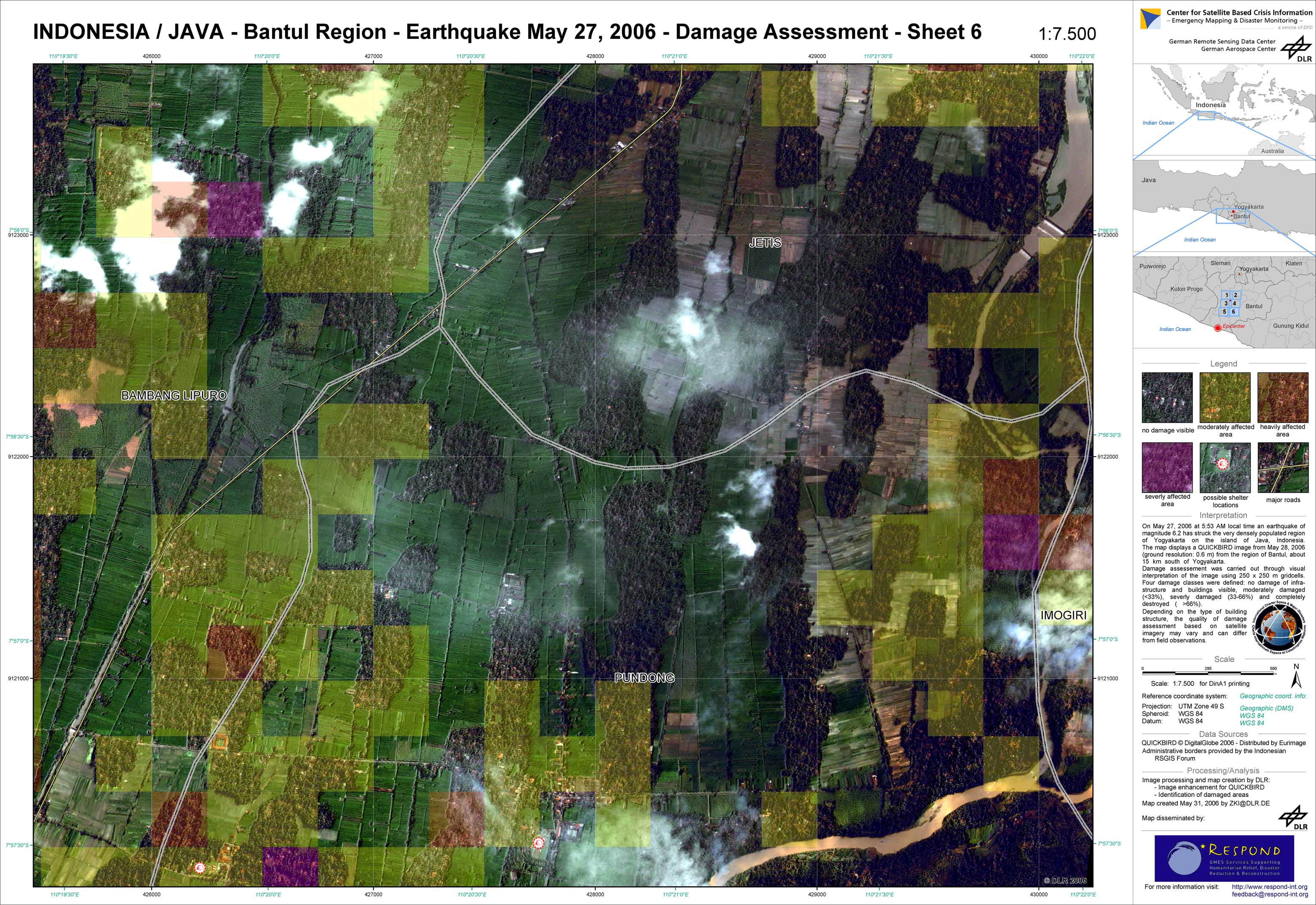
Indonesia - P09 - Damage assessment based on QUICKBIRD data from May 28, 2006 - Bantul Region, Sheet 6
Creation Date 31. May 2006
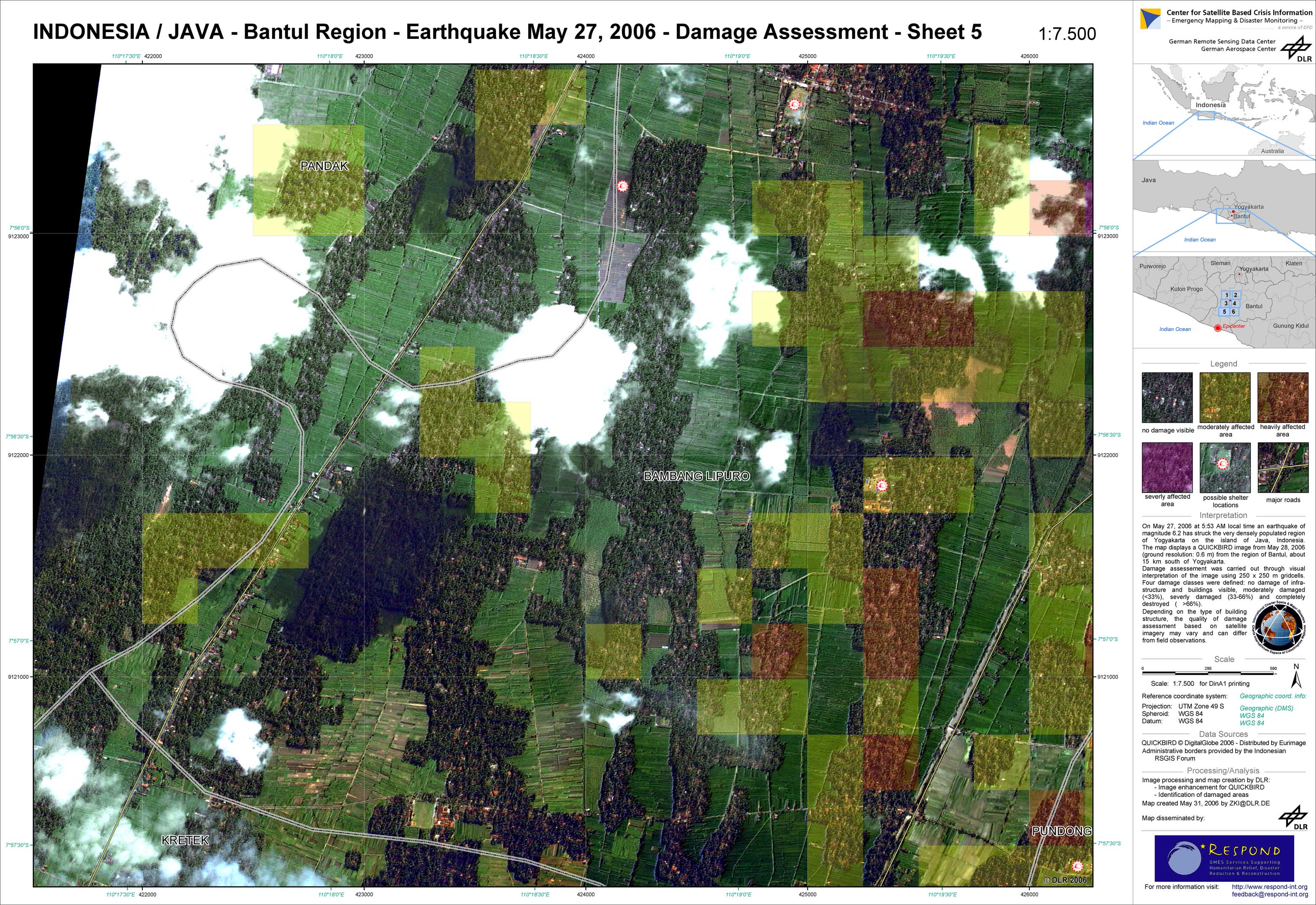
Indonesia - P08 - Damage assessment based on QUICKBIRD data from May 28, 2006 - Bantul Region, Sheet 5
Creation Date 31. May 2006
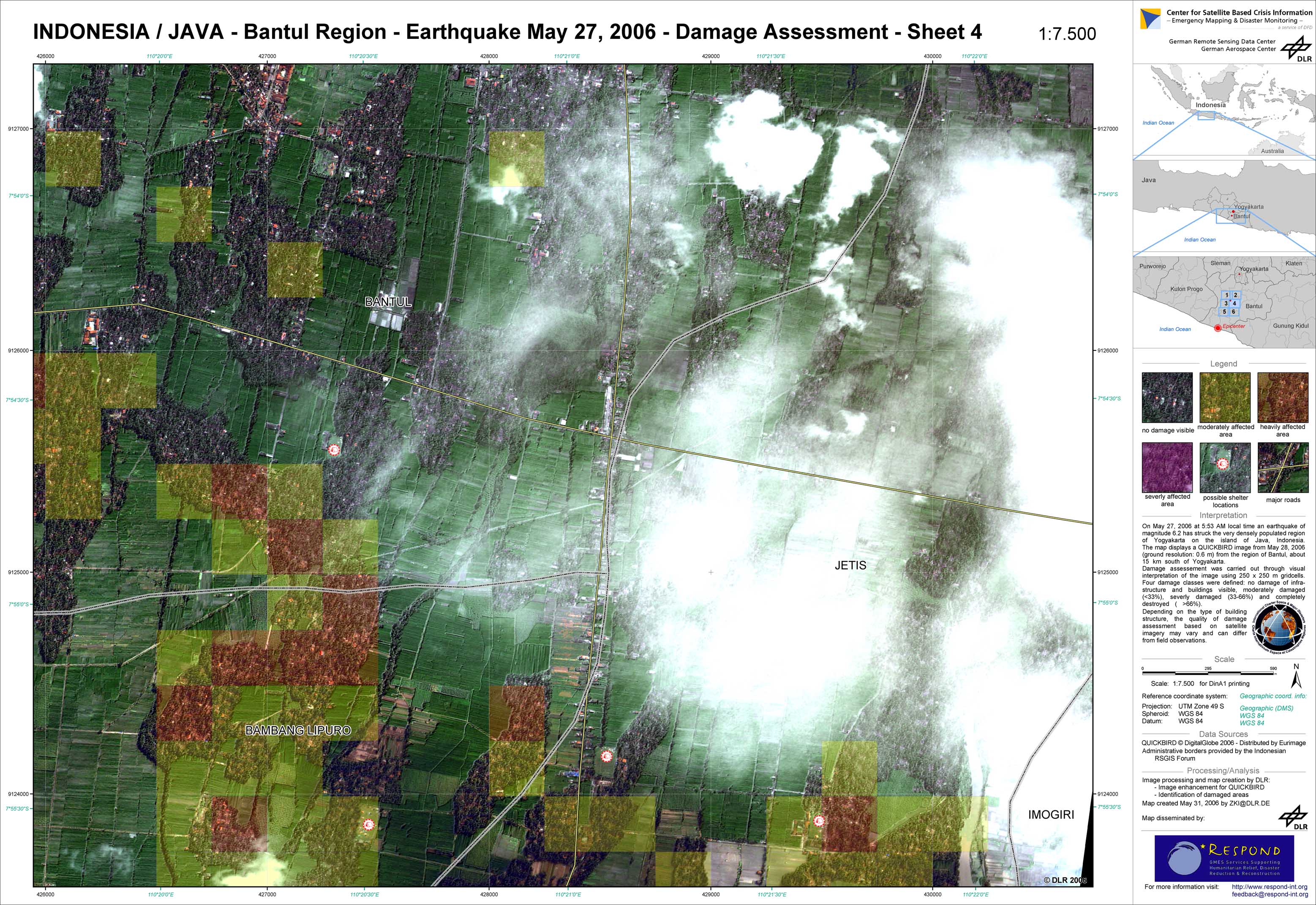
Indonesia - P07 - Damage assessment based on QUICKBIRD data from May 28, 2006 - Bantul Region, Sheet 4
Creation Date 31. May 2006
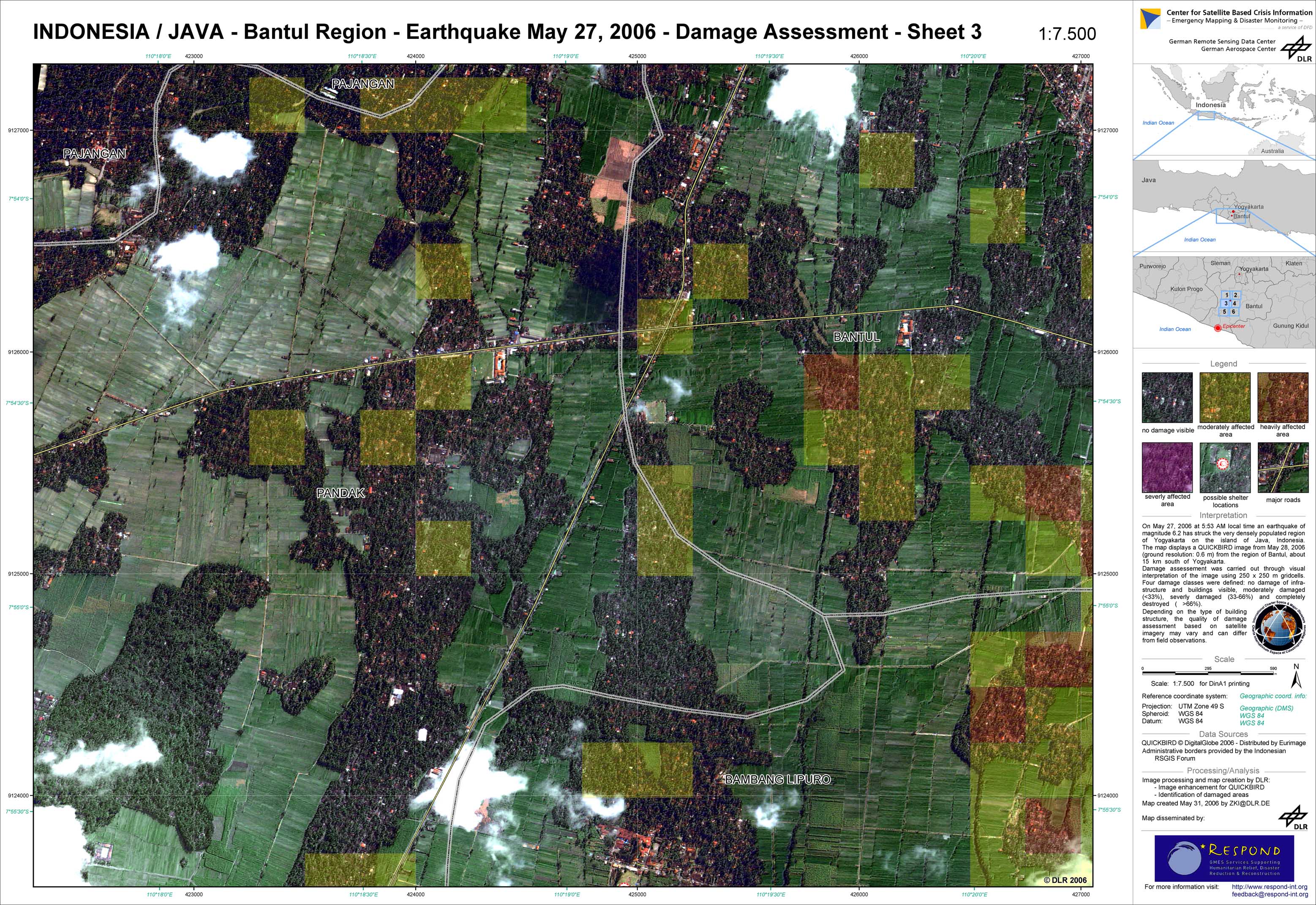
Indonesia - P06 - Damage assessment based on QUICKBIRD data from May 28, 2006 - Bantul Region, Sheet 3
Creation Date 31. May 2006

Indonesia - P05 - Damage assessment based on QUICKBIRD data from May 28, 2006 - Bantul Region, Sheet 2
Creation Date 31. May 2006
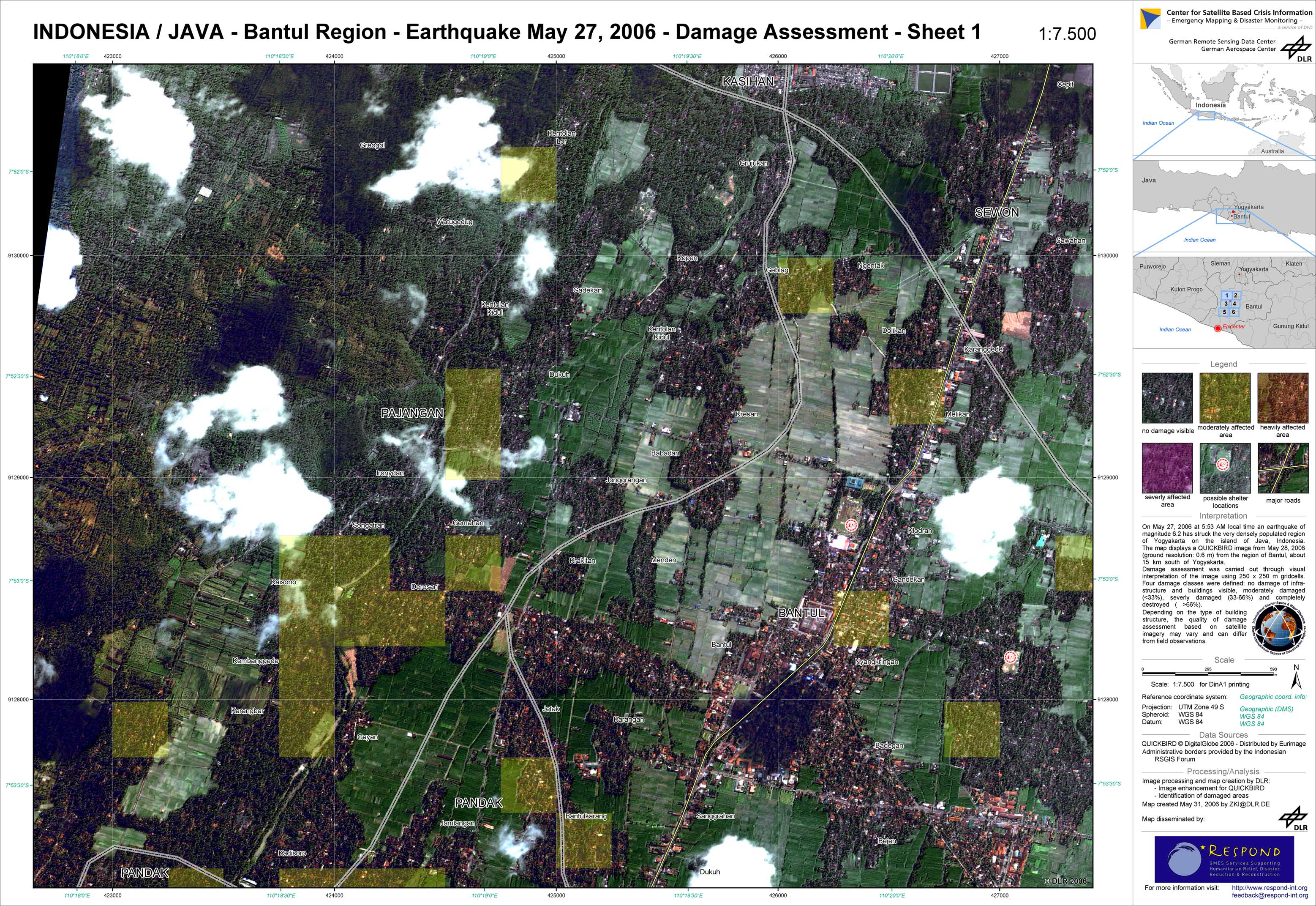
Indonesia - P04 - Damage assessment based on QUICKBIRD data from May 28, 2006 - Bantul Region, Sheet 1
Creation Date 31. May 2006

Indonesia - P01 - Damage assessment based on IKONOS data from May 28, 2006 - Jejeran Region
Creation Date 31. May 2006
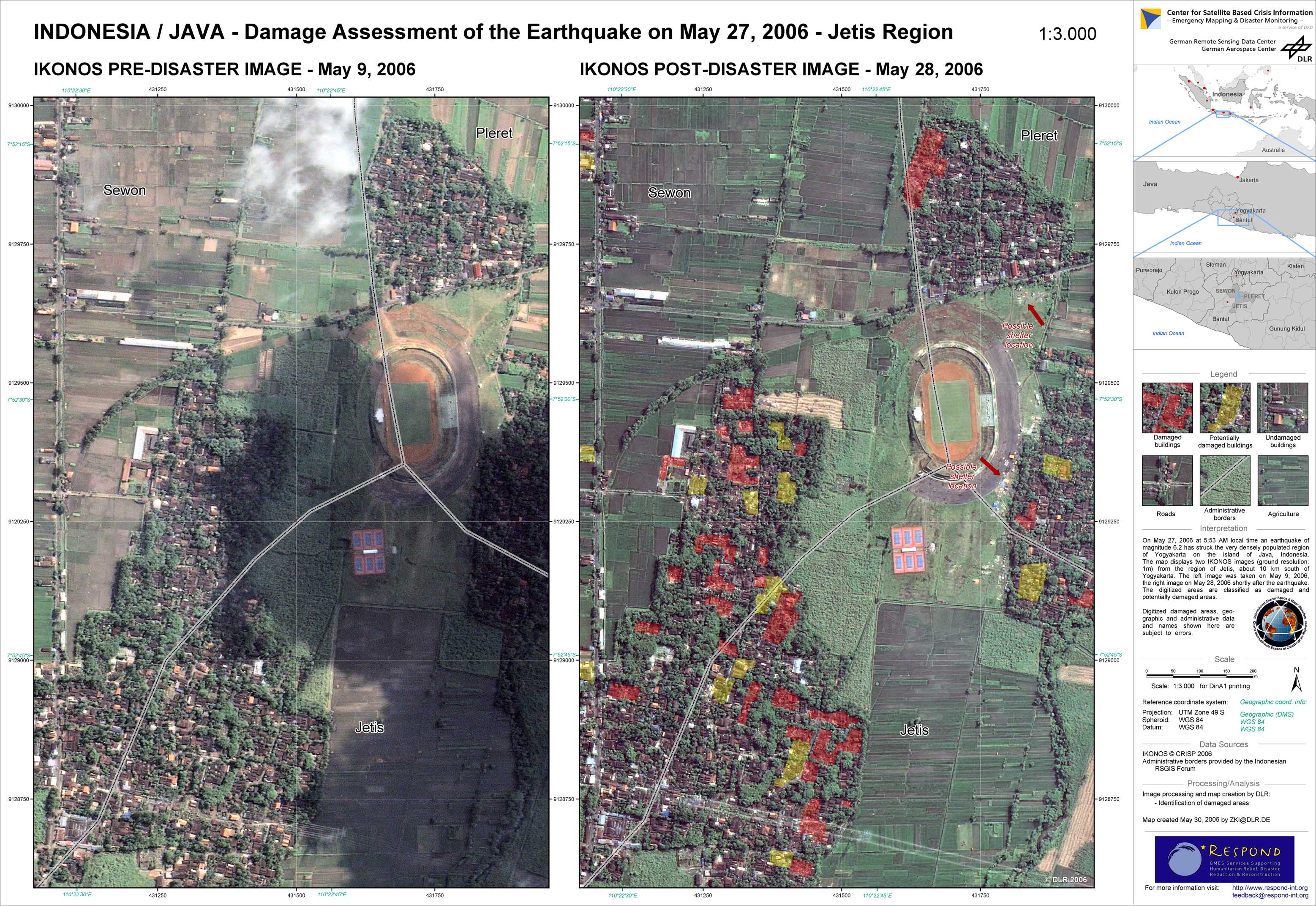
Indonesia - P02 - Damage assessment based on IKONOS data from May 28, 2006 - Jetis Region
Creation Date 30. May 2006