Oil spill at the Lebanese coast
undefined
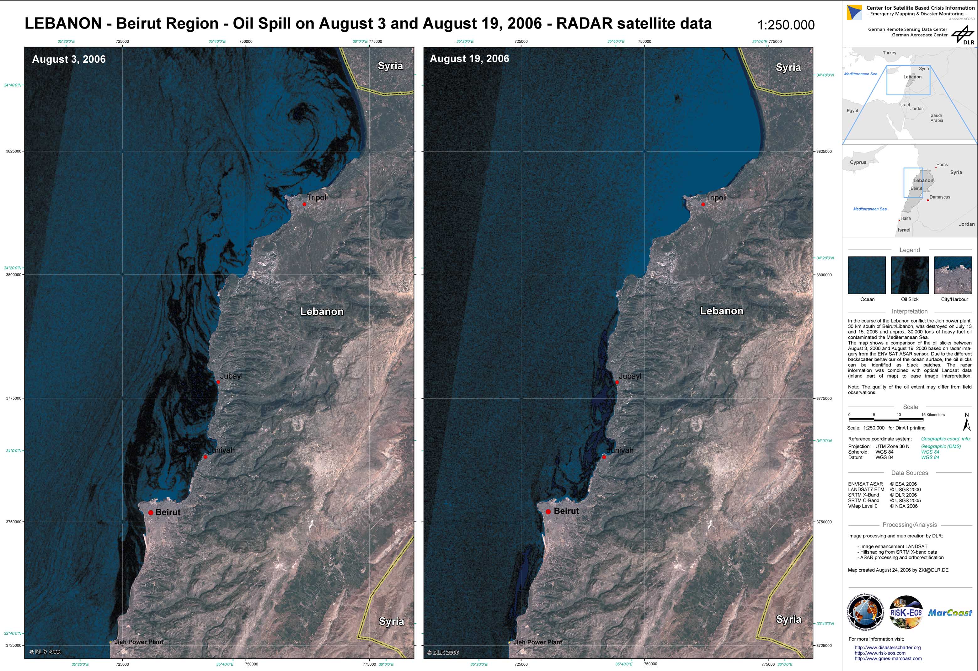
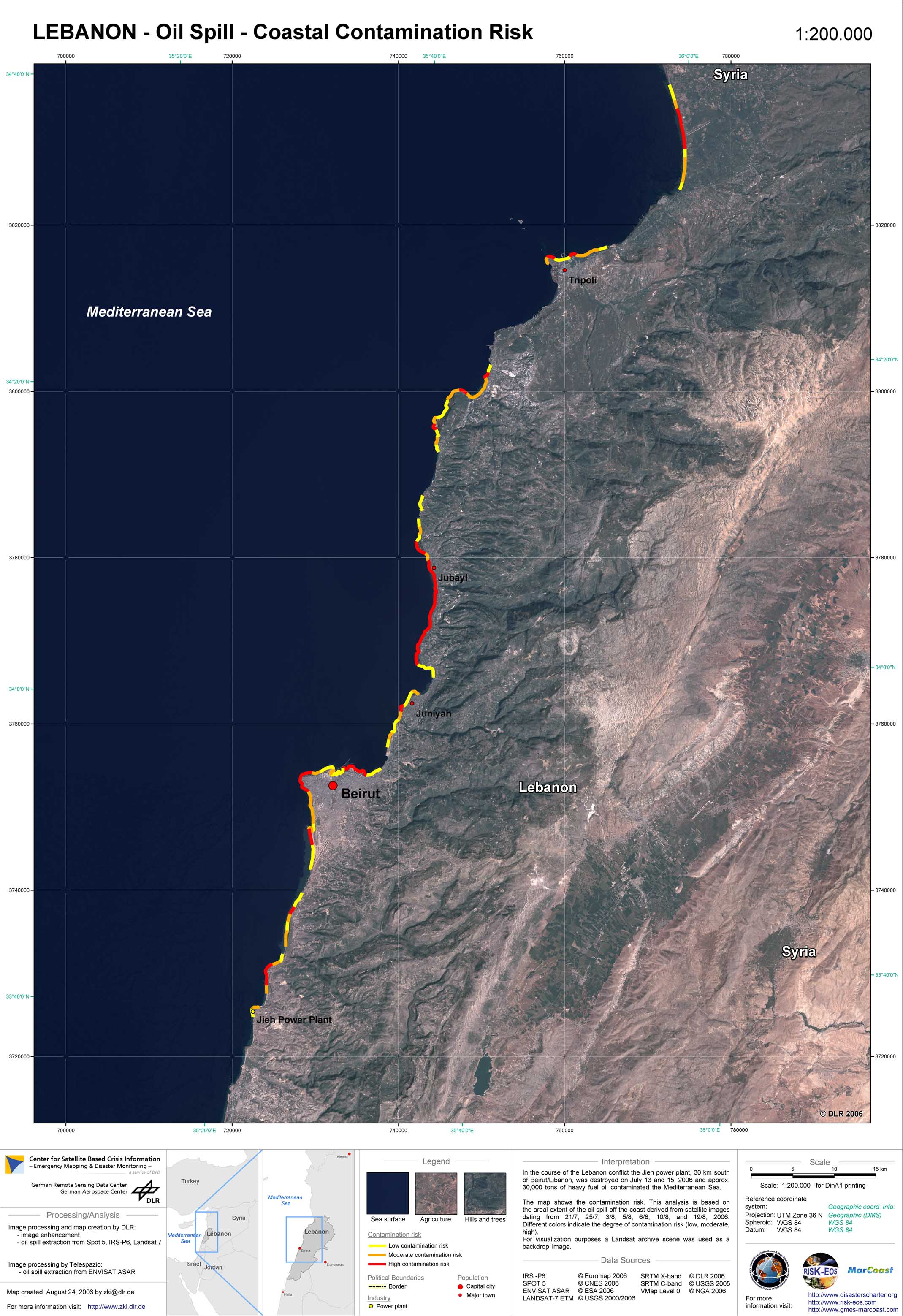
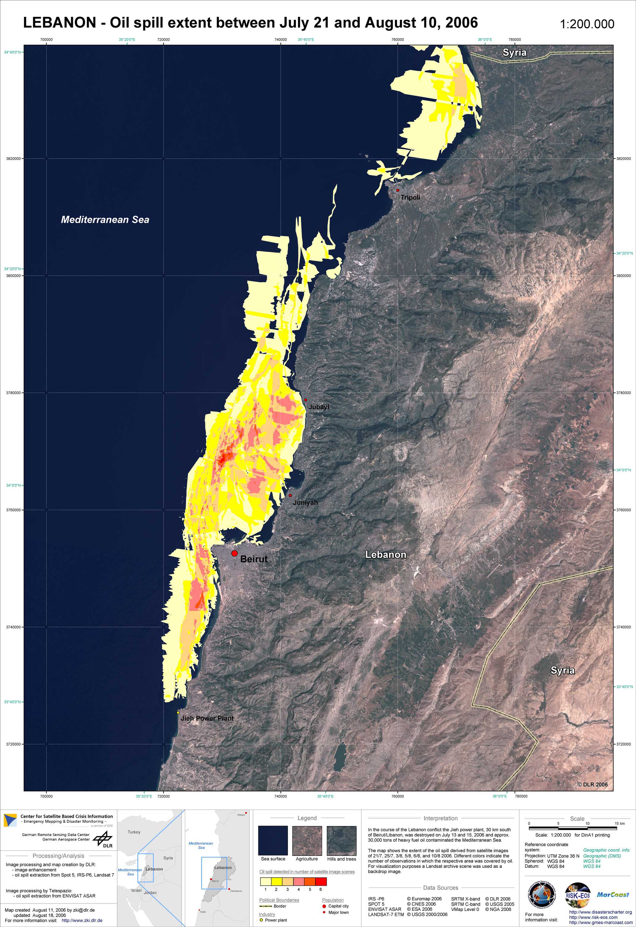
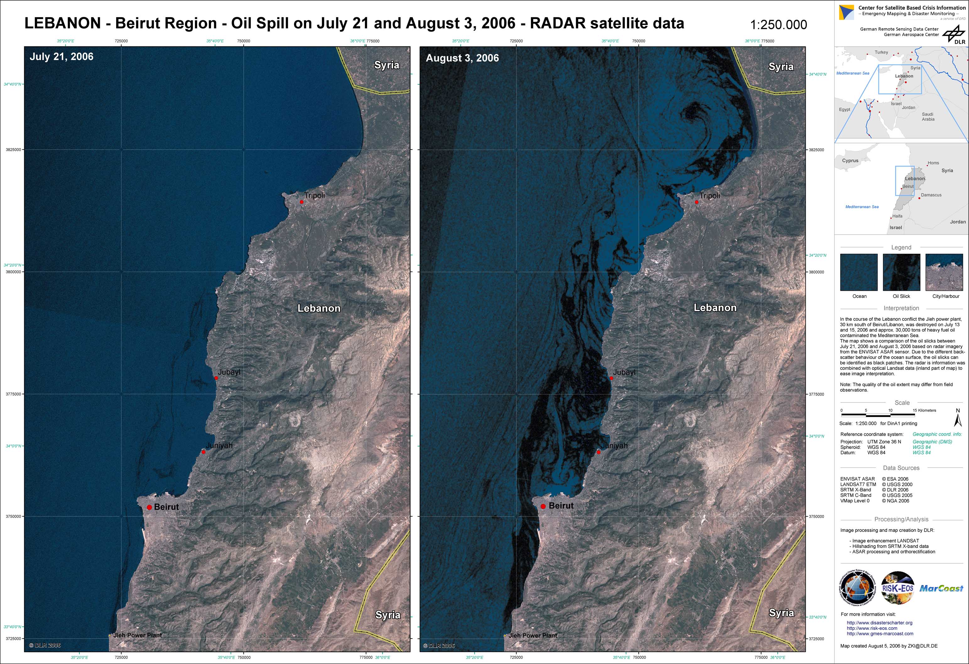
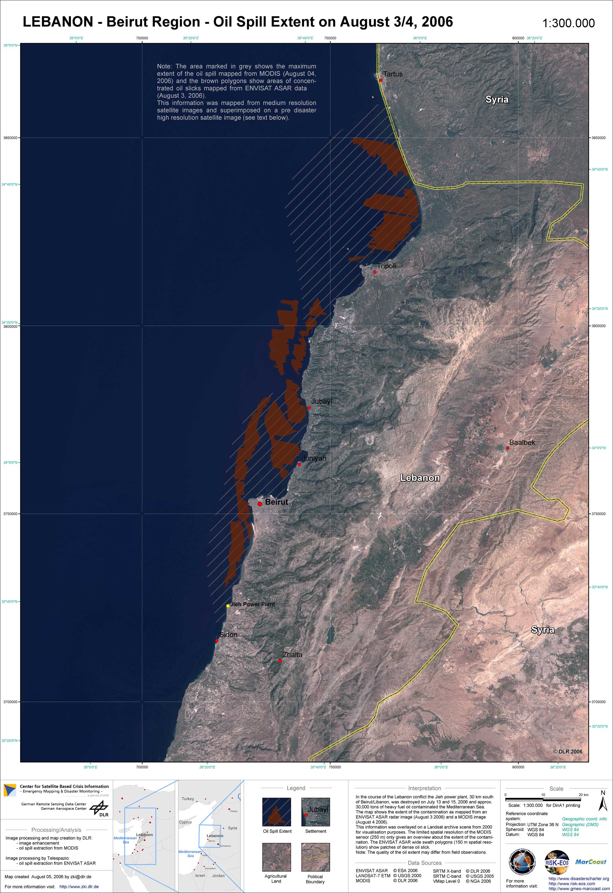
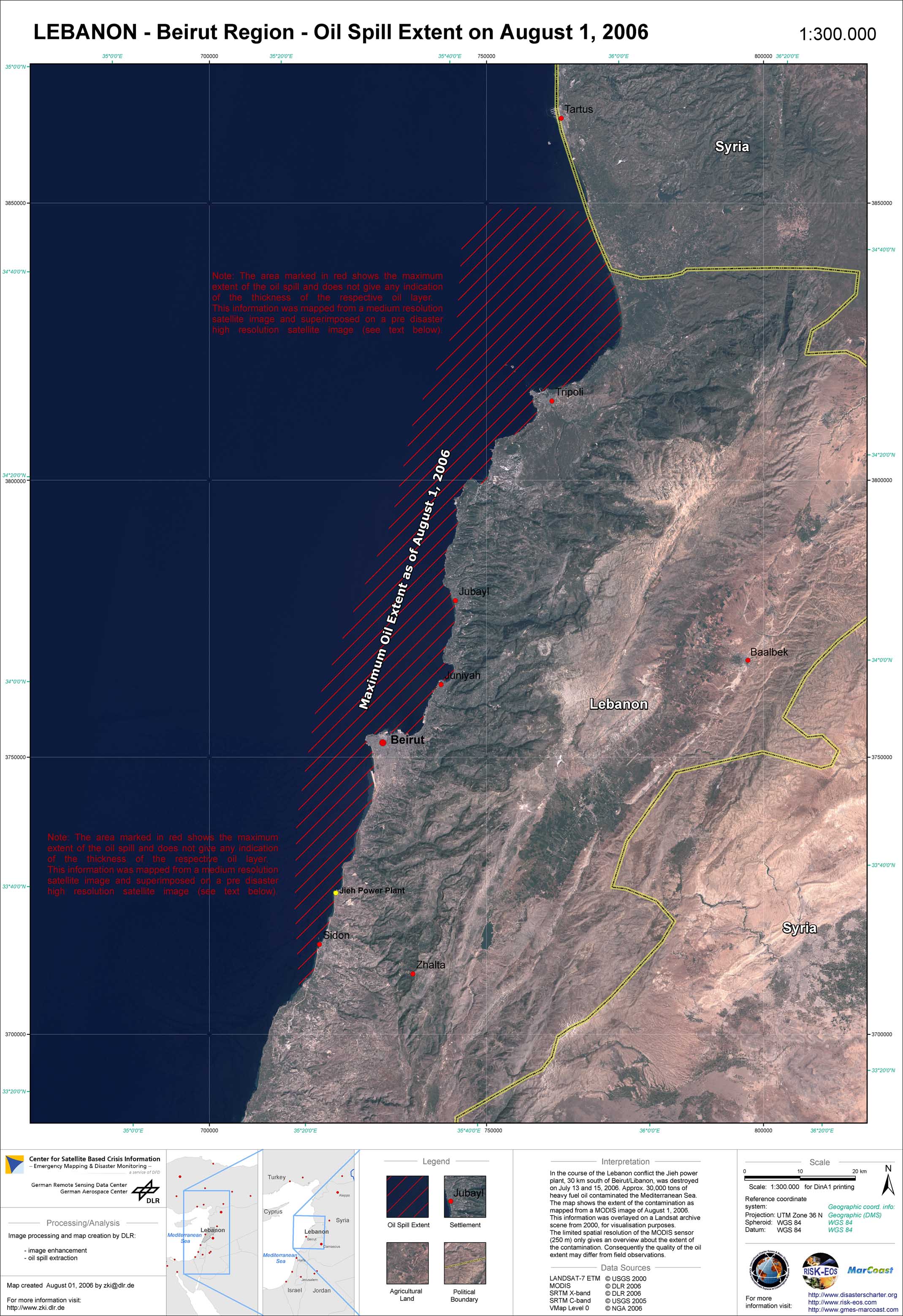
In the course of the conflict in the Middle East, the oil-fuelled power plant of Jieh, located directly on the coastline approximately 30 km south of Beirut, was hit by bombs on July 13 and 15, 2006. Part of the storage tanks caught fire and were burning for several days. A large part of the fuel was spilled into the Mediterranean Sea as a result of the blast. The Lebanese ministry of environment estimated that approximately 30,000 tons of heavy fuel oil were emmitted into the sea. Due to south-westerly winds and the sea currents, the oil spill was partly carried out to sea and partly dispersed along the coast of Lebanon. Until the beginning of August, 2006, the Lebanese coastline had been affected from the Damour region south of Beirut to the Syrian border in the North. Following a request for help from the Lebanese Ministry of Environment, the EC Monitoring and Information Centre (MIC) of DG Environment triggered the International Charter 'Space and Major Disasters' in order to obtain information about the extent of the oil pollution in the coastal strip and, where possible, the size of the pollution. The Center for Satellite Based Crisis Information (ZKI) of DLR took over the project management in this activation and produced satellite analyses in the context of the European GMES Service Elements Risk-EOS and MarCoast.
Lebanon - P06 - Comparison of oil spill extent based on radar data between August 3 and August 19, 2006
Creation Date 24. August 2006
Lebanon - P05 - Coastal contamination risk
Creation Date 24. August 2006
Lebanon - P04 - Oil spill extent between July 21 and August 10, 2006
Creation Date 11. August 2006
Lebanon - P03 - Comparison of oil spill extent based on radar data between July 21 and August 3, 2006
Creation Date 05. August 2006
Lebanon - P02 - Oil spill extent on August 3 and 4, 2006
Creation Date 05. August 2006
Lebanon - P01 - Oil spill extent on August 1, 2006
Creation Date 01. August 2006
undefined