
Floods in Mozambique: ZKI supports UN World Food Programme
undefined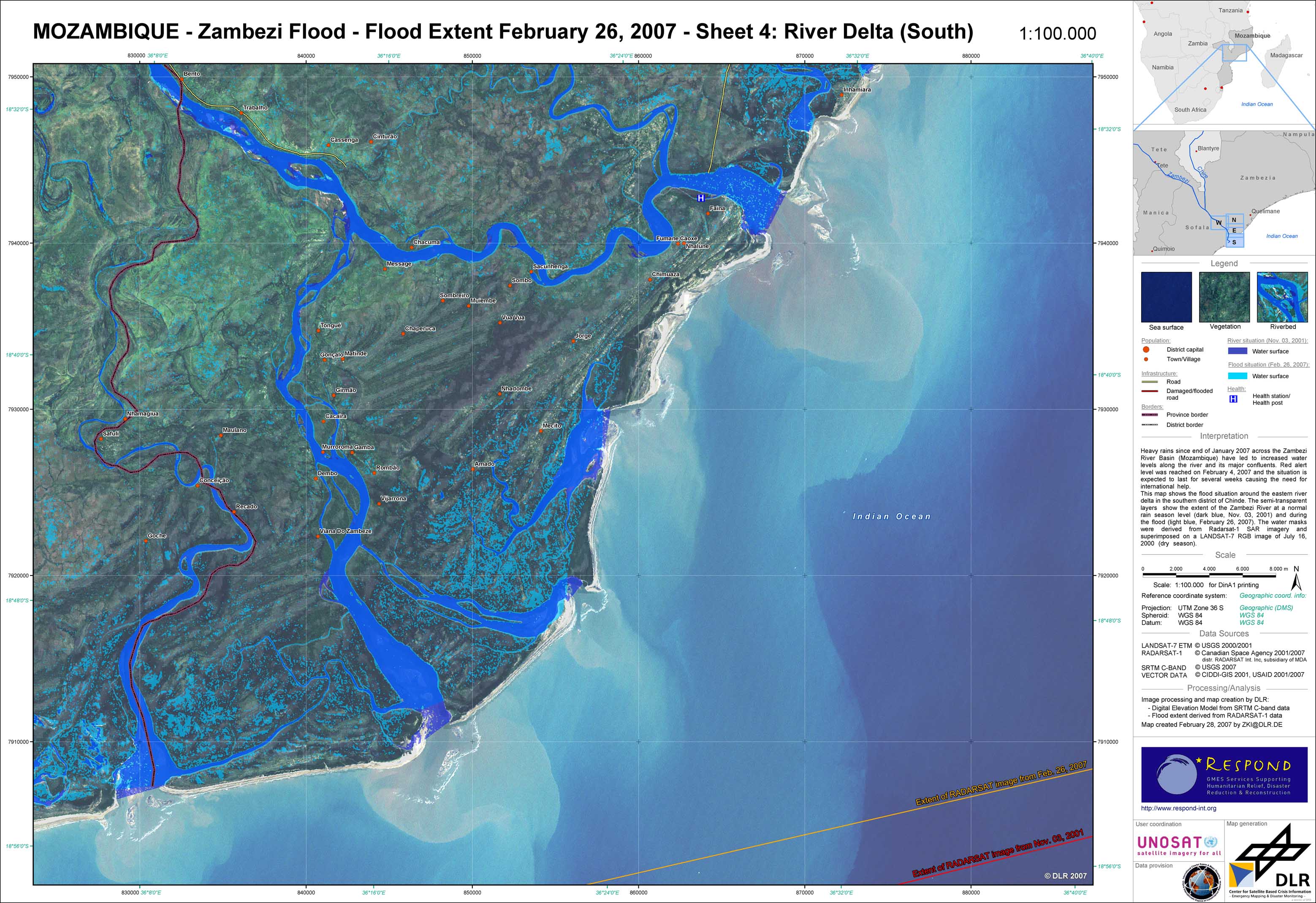
Mozambique - P09 - Zambezi flood extent as of February 26, 2007 - Sheet 4: River Delta (South)
Creation Date 28. February 2007
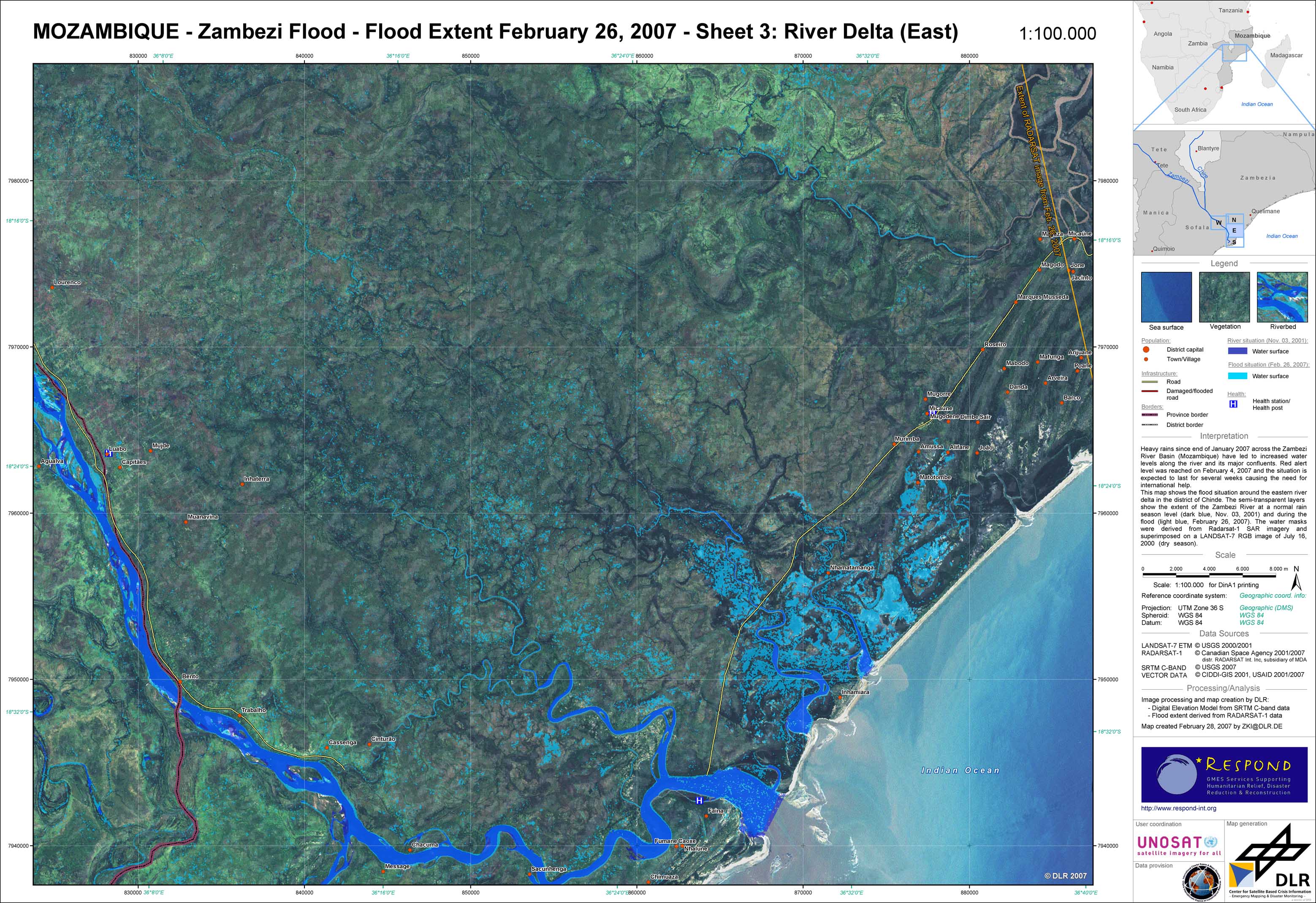
Mozambique - P08 - Zambezi flood extent as of February 26, 2007 - Sheet 3: River Delta (East)
Creation Date 28. February 2007
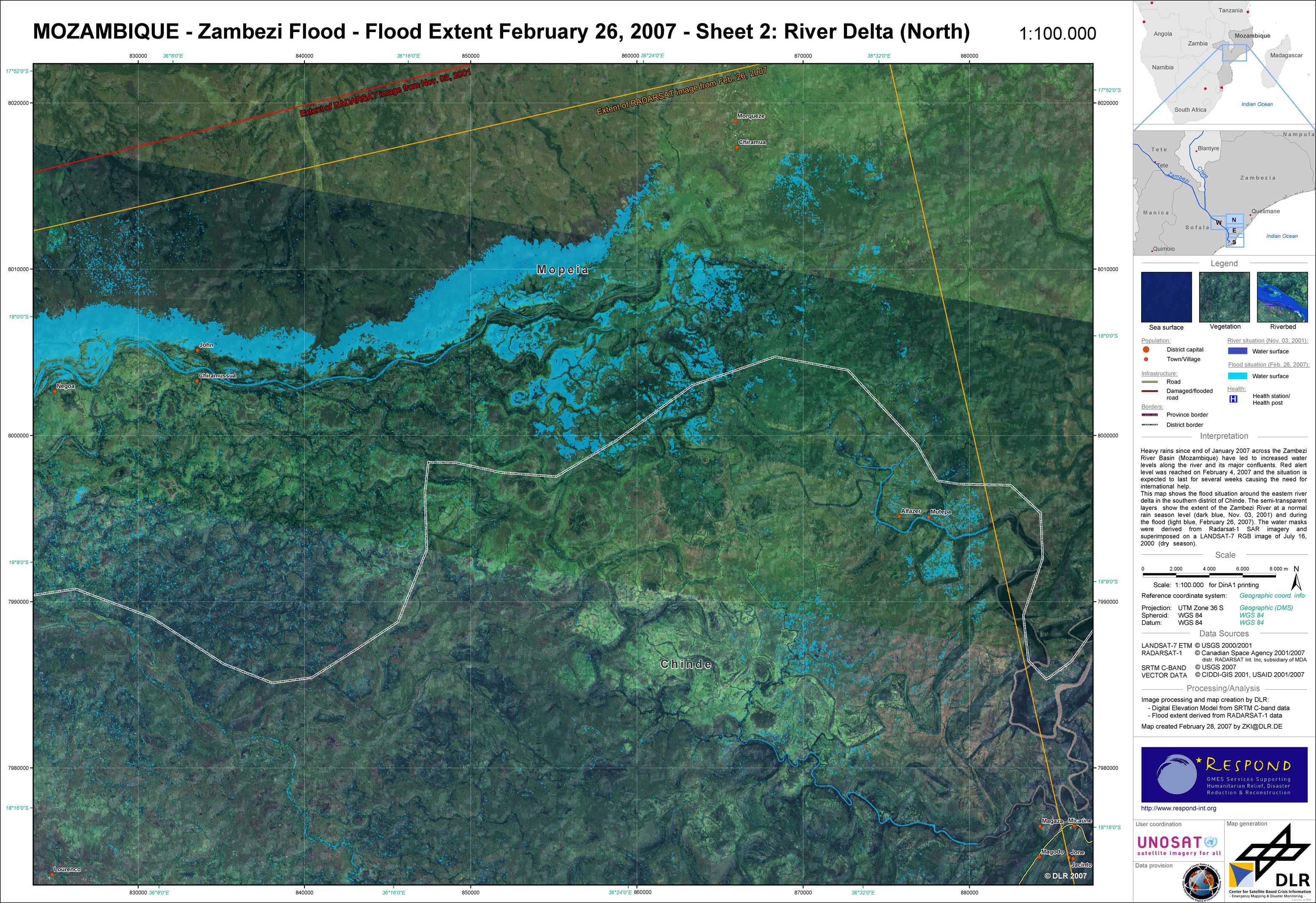
Mozambique - P07 - Zambezi flood extent as of February 26, 2007 - Sheet 2: River Delta (North)
Creation Date 28. February 2007
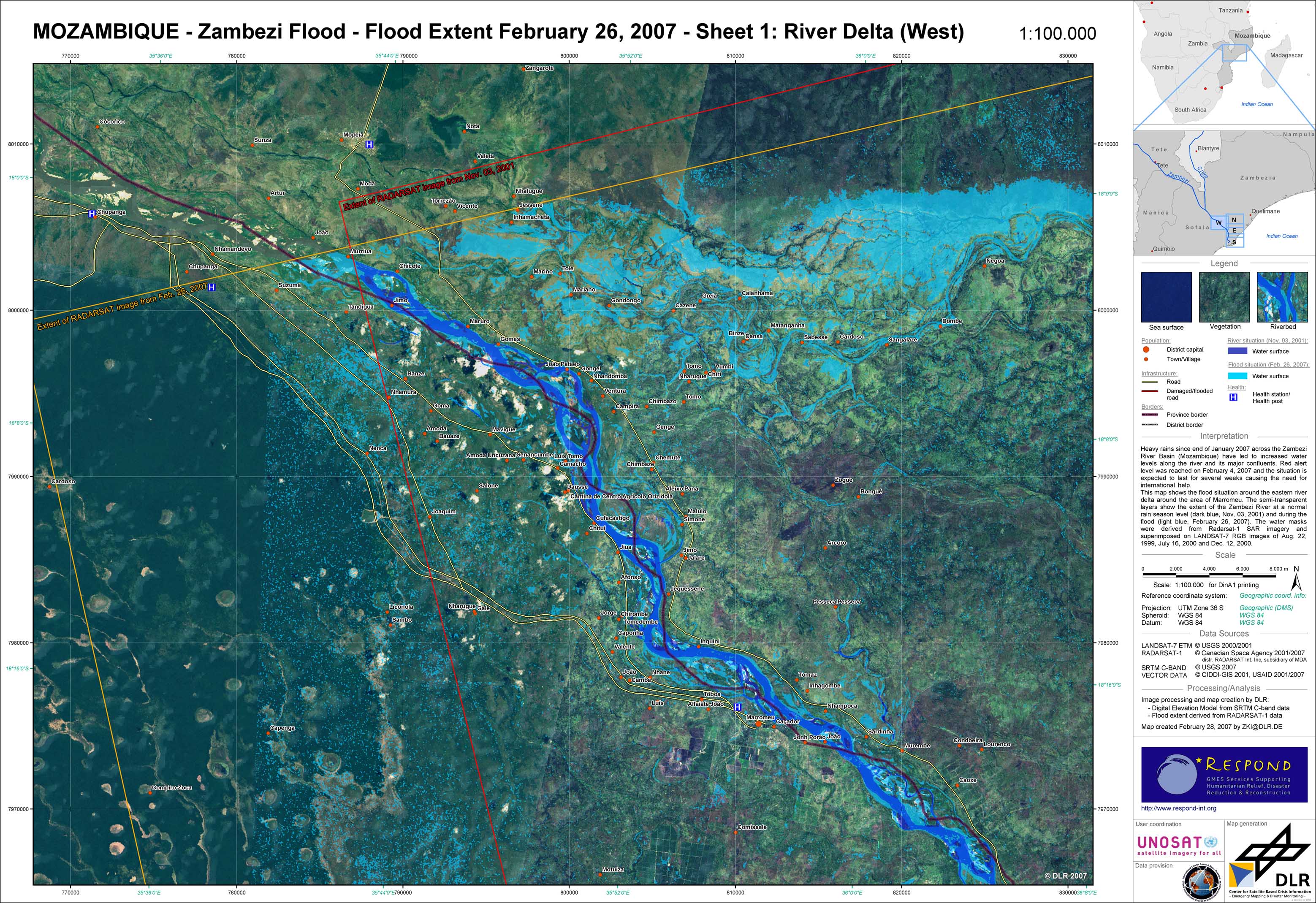
Mozambique - P06 - Zambezi flood extent as of February 26, 2007 - Sheet 1: River Delta (West)
Creation Date 28. February 2007
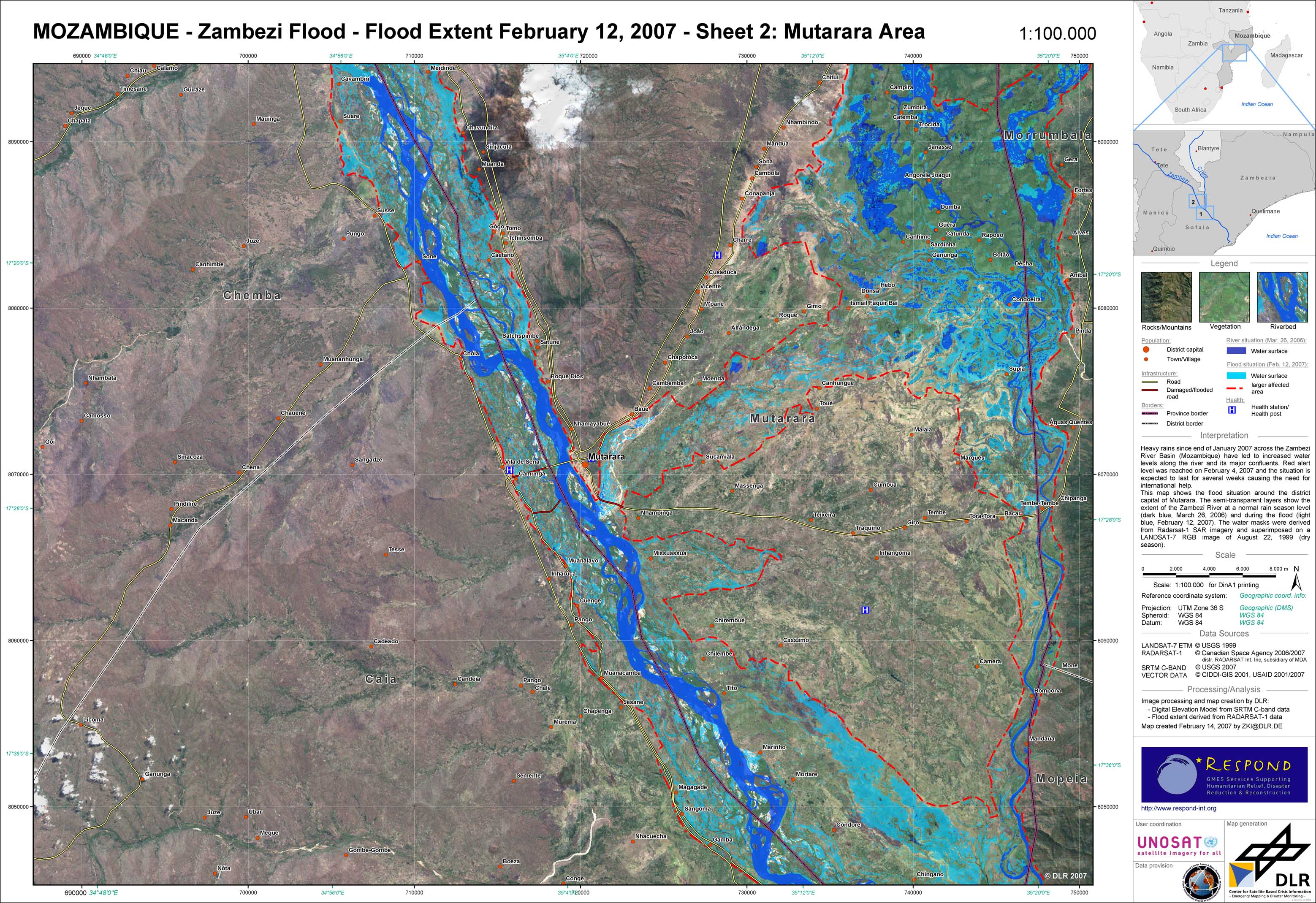
Mozambique - P05 - Zambezi flood extent as of February 11, 2007 - Sheet 2: Mutarara region
Creation Date 14. February 2007
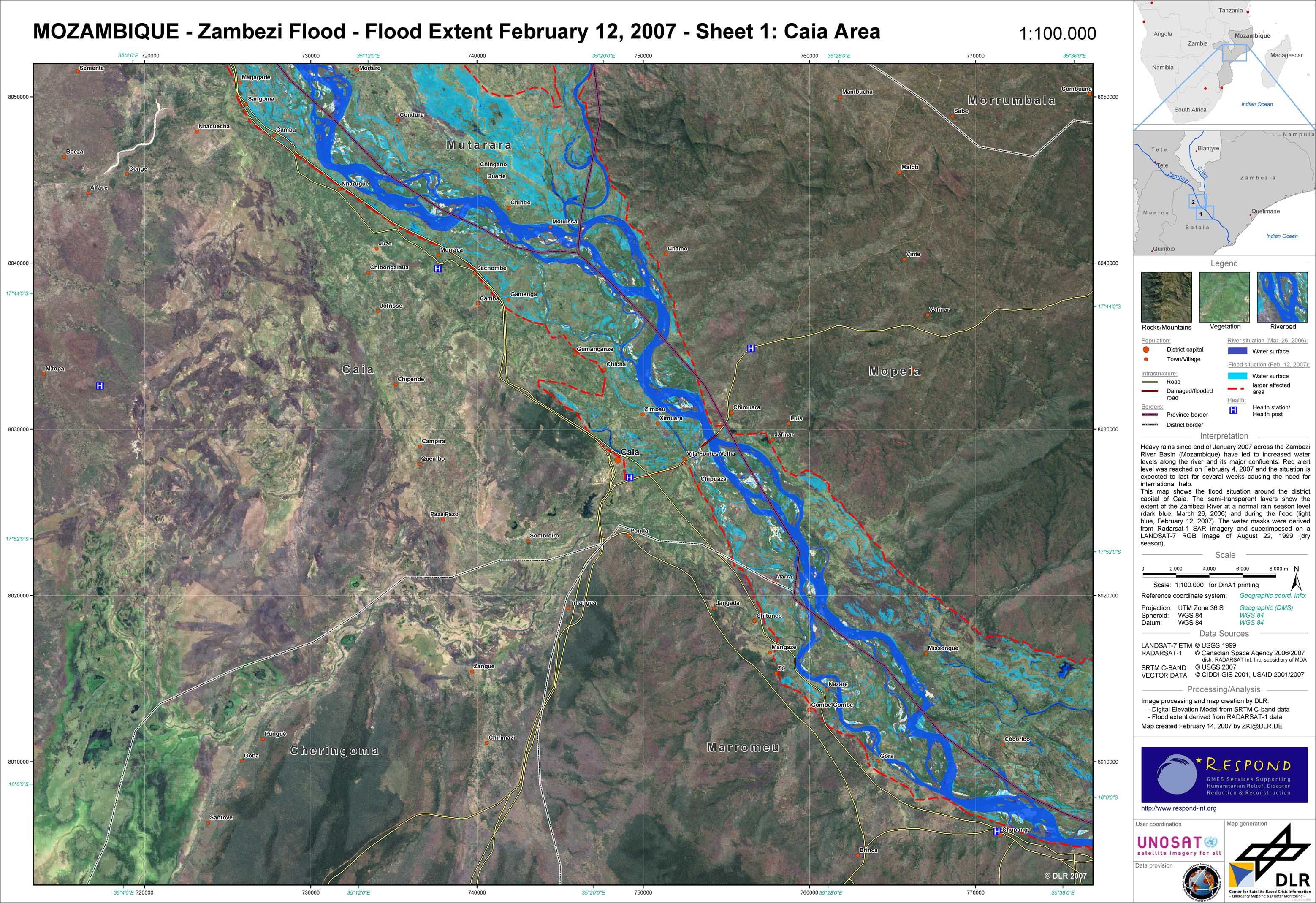
Mozambique - P04 - Zambezi flood extent as of February 12, 2007 - Sheet 1: Caia region
Creation Date 14. February 2007
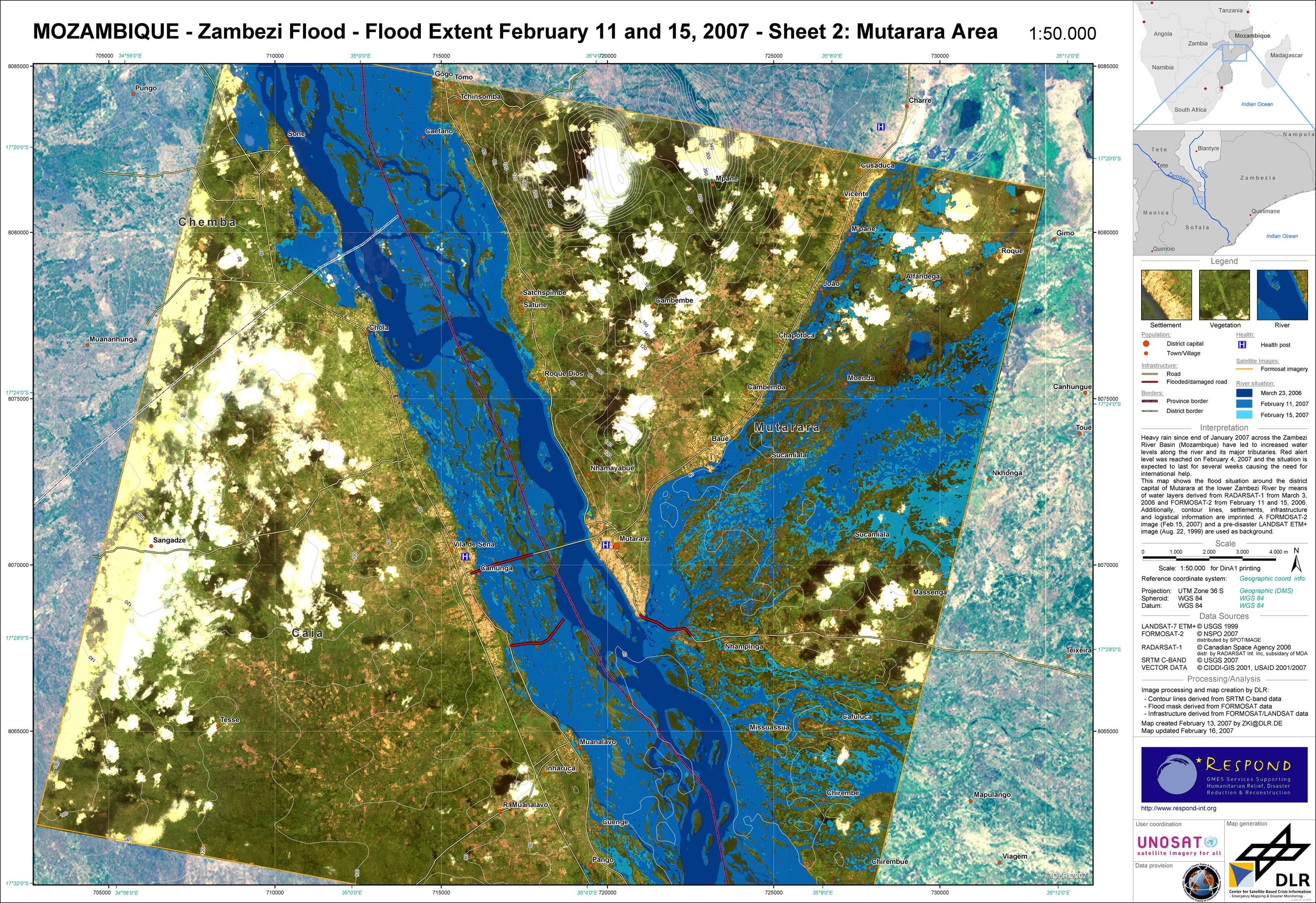
Mozambique - P03 - Zambezi flood extent as of February 11, 2007 and February 15, 2007 - Sheet 2: Mutarara region
Creation Date 13. February 2007
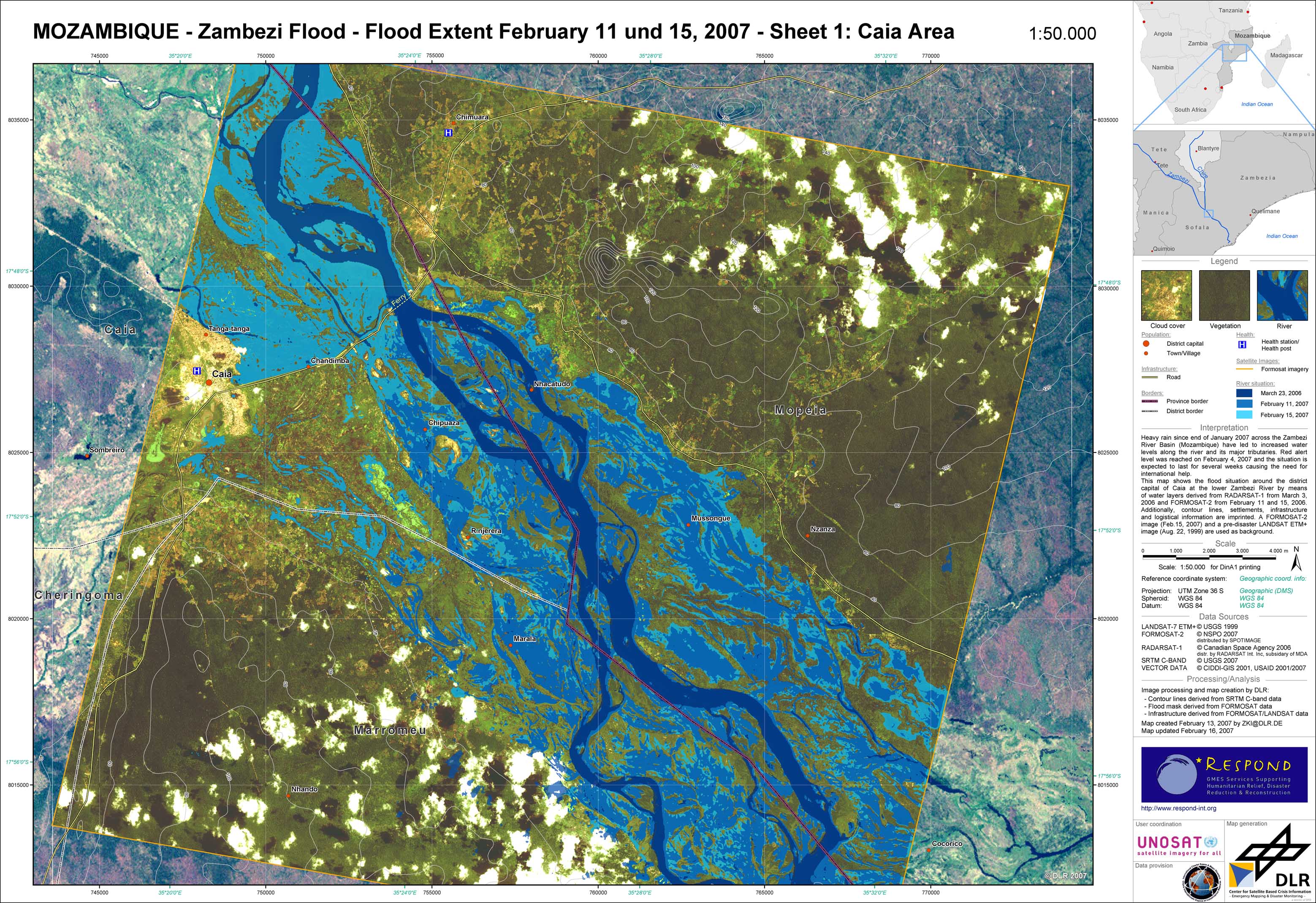
Mozambique - P02 - Zambezi flood extent as of February 11, 2007 and February 15, 2007 - Sheet 1: Caia region
Creation Date 13. February 2007
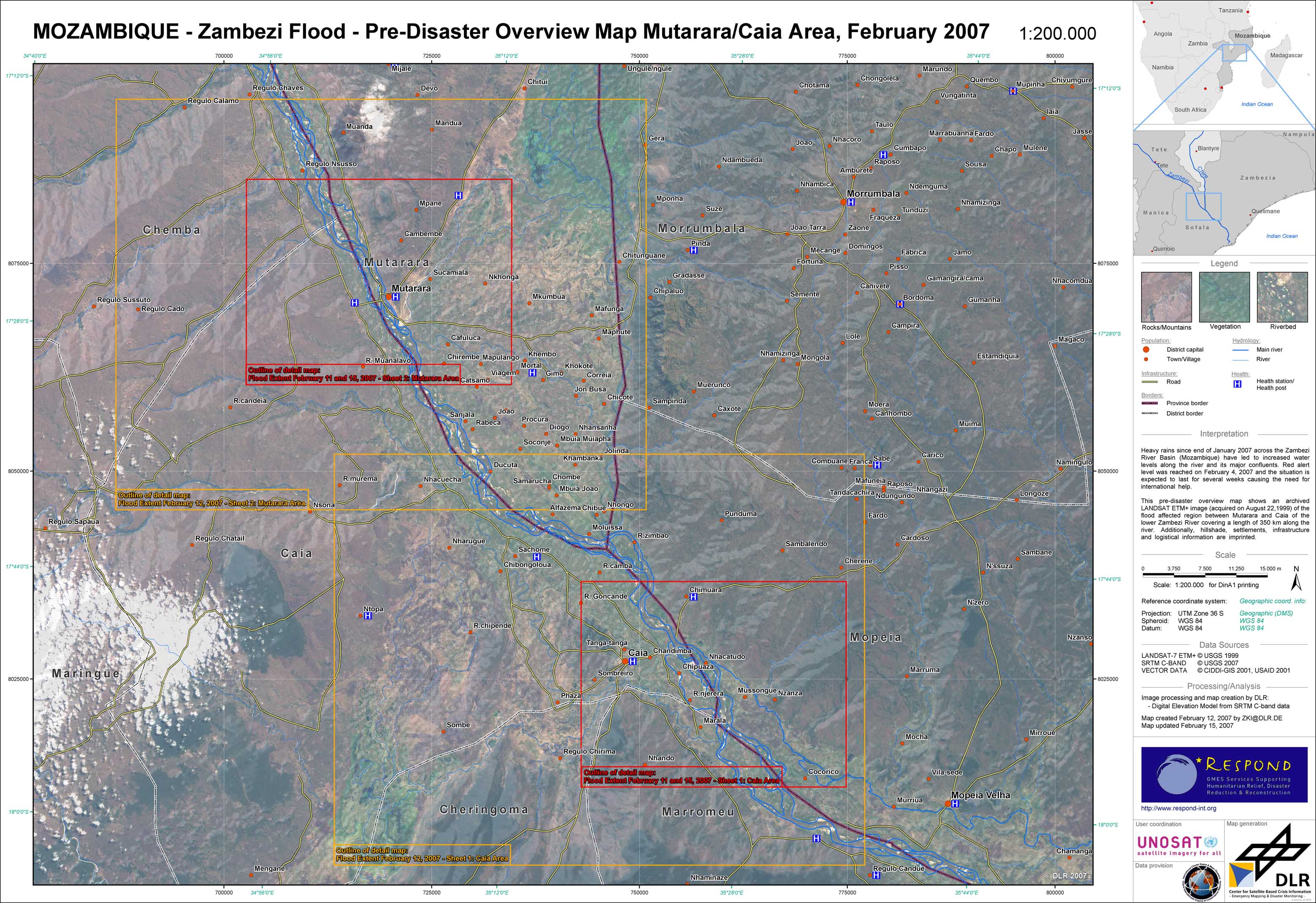
Mozambique - P01 - Pre-disaster overview map of the Mutarara/Caia region
Creation Date 12. February 2007