11. June 2007

DLR maps for G8 Summit in Heiligendamm, June 6 to 8, 2007

undefined

From June 6 to 8, the G8 leaders met for their annual summit in Heiligendamm, Germany. The area of Heiligendamm was spaciously protected for security reasons and the inner security zone was confined by a fence. Many governmental and non-governmental organisations were involved in the logistical organisation and implementation of safety and security for both the official summit and the protest activities. In the context of research activities for satellite based event monitoring, ZKI of DLR processed and analysed satellite data of June 1 and June 7, 2007, before and during the G8-Summit. The satellite based information was transmitted in near real-time to the local THW headquarters near Heiligendamm via satellite communication. DLR used the satellite communication that was provided through the ESA research project ARTES 3 to collect experiences in the interaction between satellite image analysis and satellite communication. These experiences were integrated in particular in the EU research project LIMES.

Products

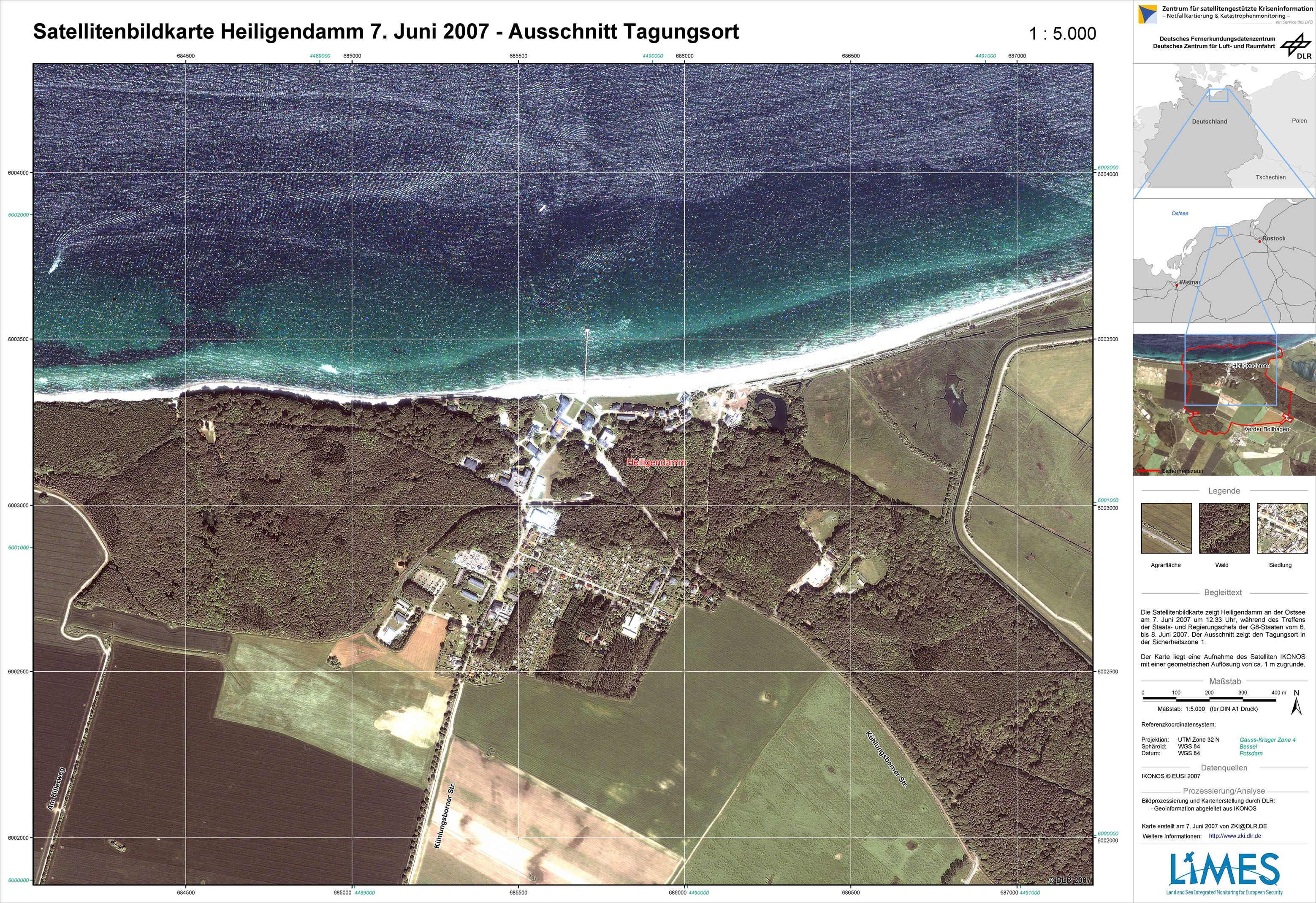
G8 summit 2007 in Heiligendamm - P07 - Satellite map - June 7, 2007 - Subset summit location

Creation Date 07. June 2007

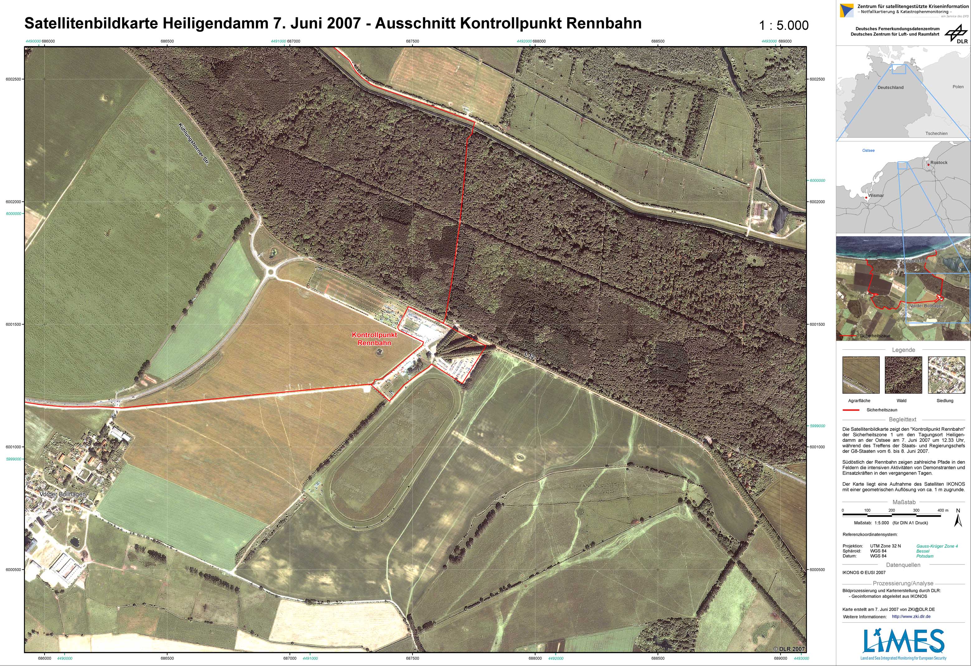
G8 summit 2007 in Heiligendamm - P06 - Satellite map - June 7, 2007 - Subset checkpoint Rennbahn

Creation Date 07. June 2007

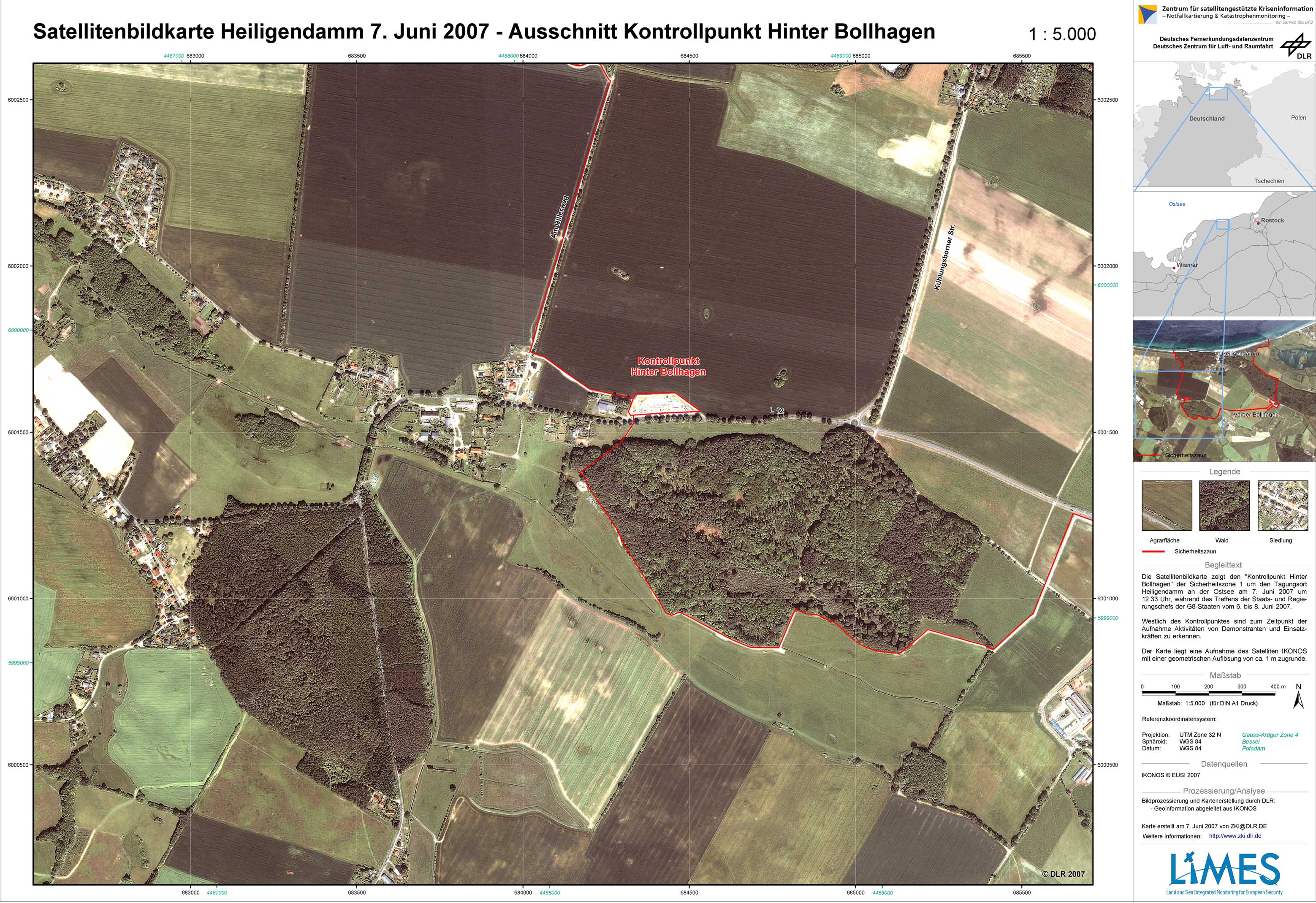
G8 summit 2007 in Heiligendamm - P05 - Satellite map - June 7, 2007 - Subset Hinter Bollhagen

Creation Date 07. June 2007

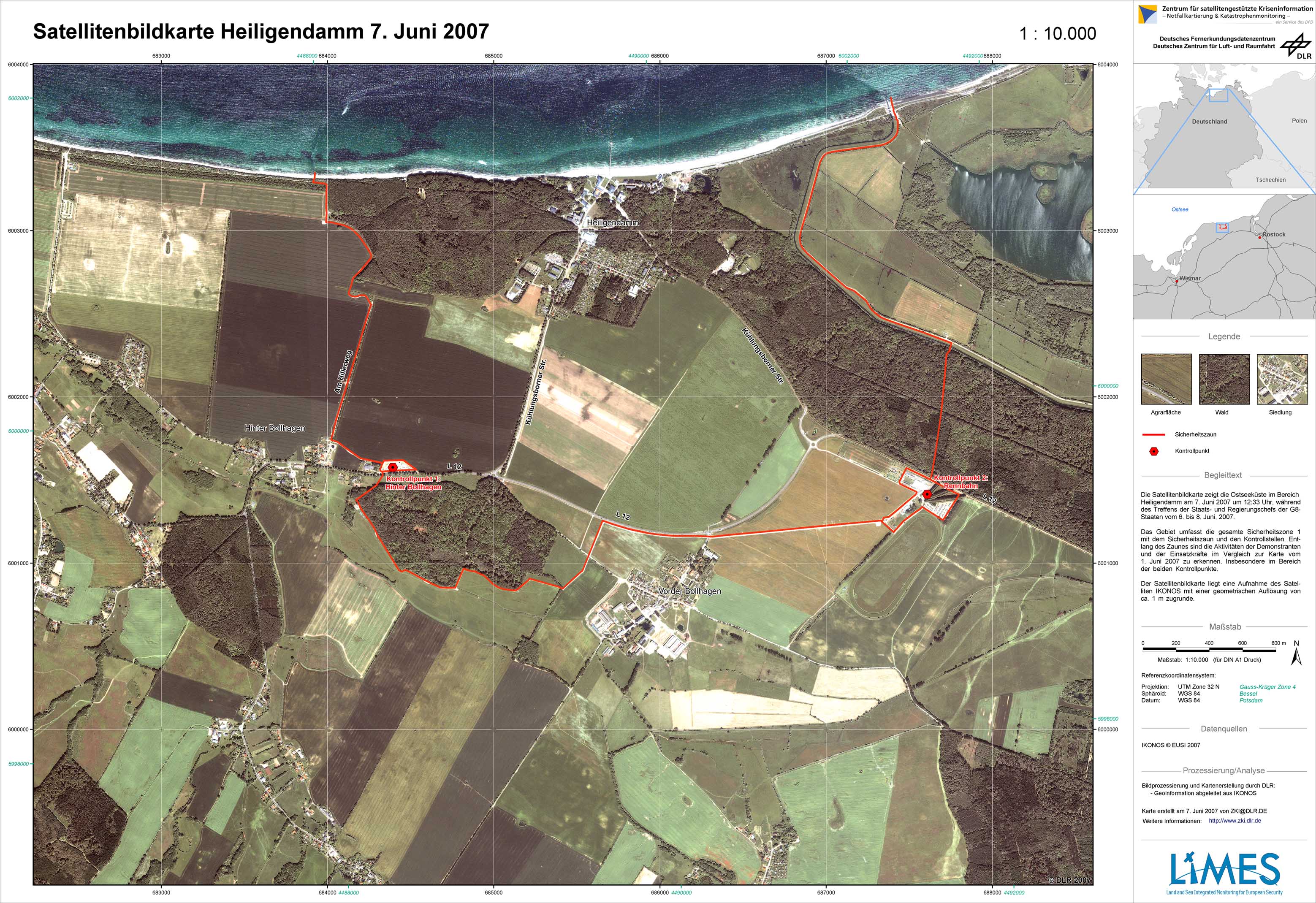
G8 summit 2007 in Heiligendamm - P04 - Satellite map - June 7, 2007 - Subset Heiligendamm

Creation Date 07. June 2007

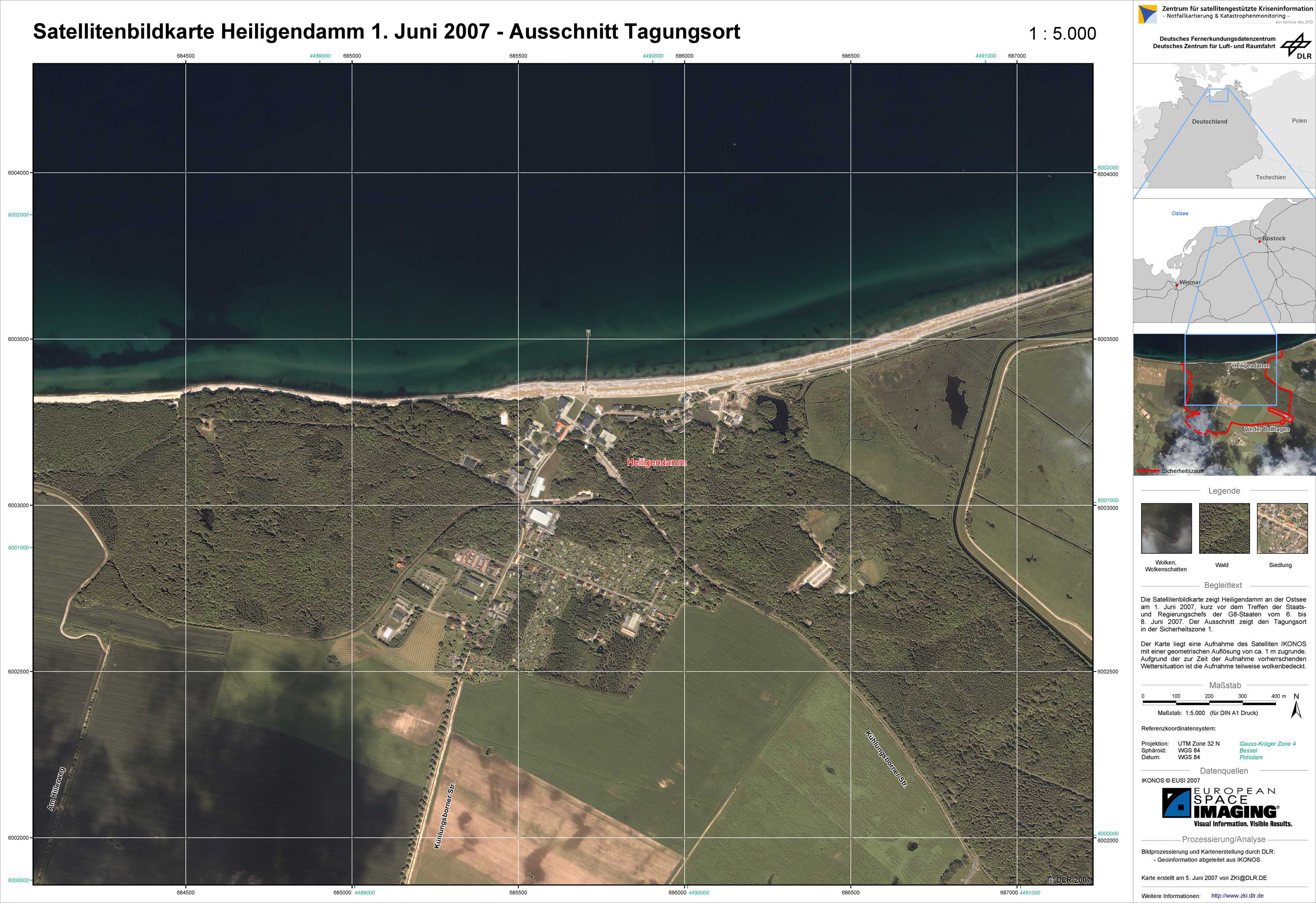
G8 summit 2007 in Heiligendamm - P03 - Satellite map - June 1, 2007 - Subset summit location

Creation Date 05. June 2007

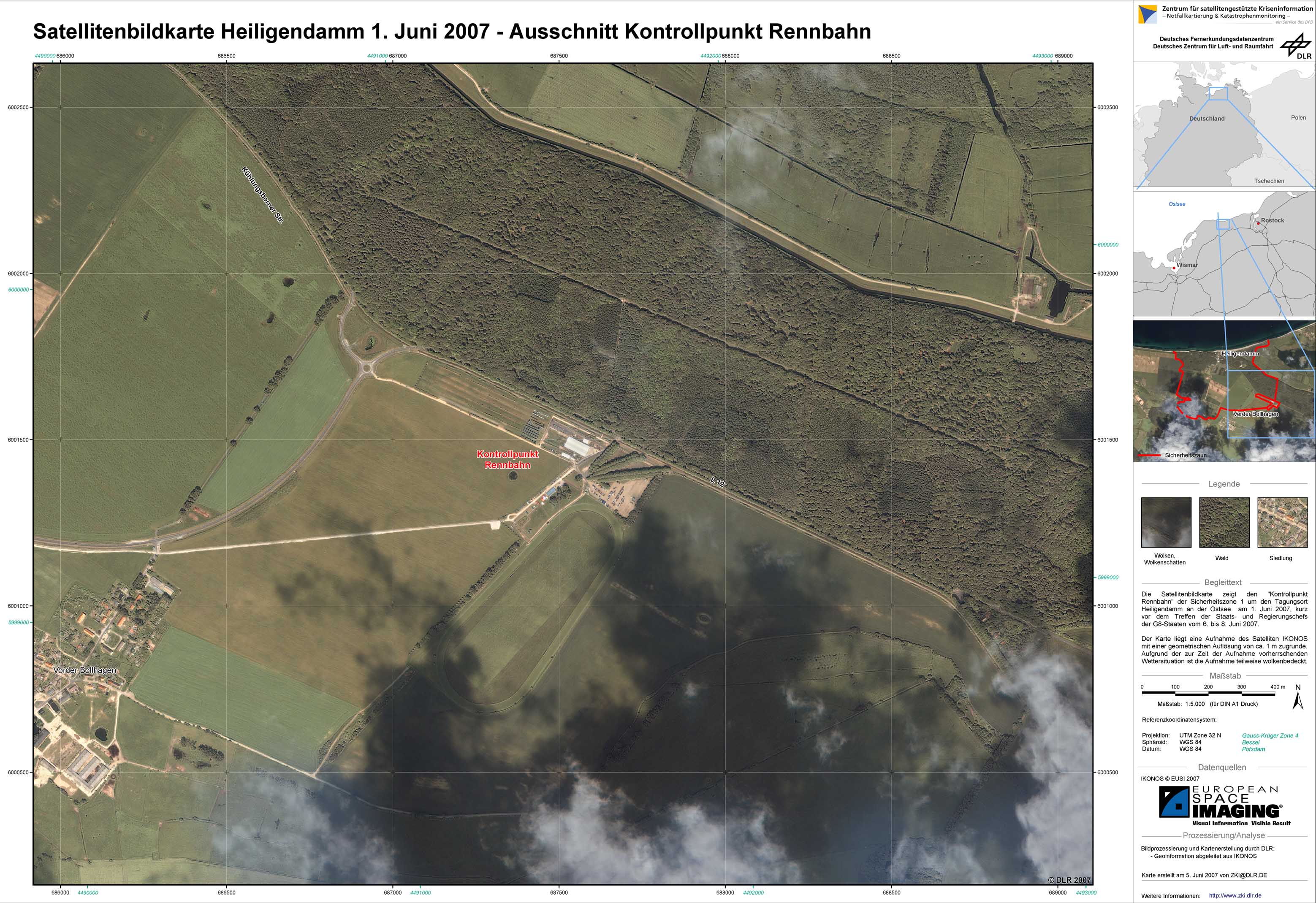
G8 summit 2007 in Heiligendamm - P02 - Satellite map - June 1, 2007 - Subset checkpoint Rennbahn

Creation Date 05. June 2007

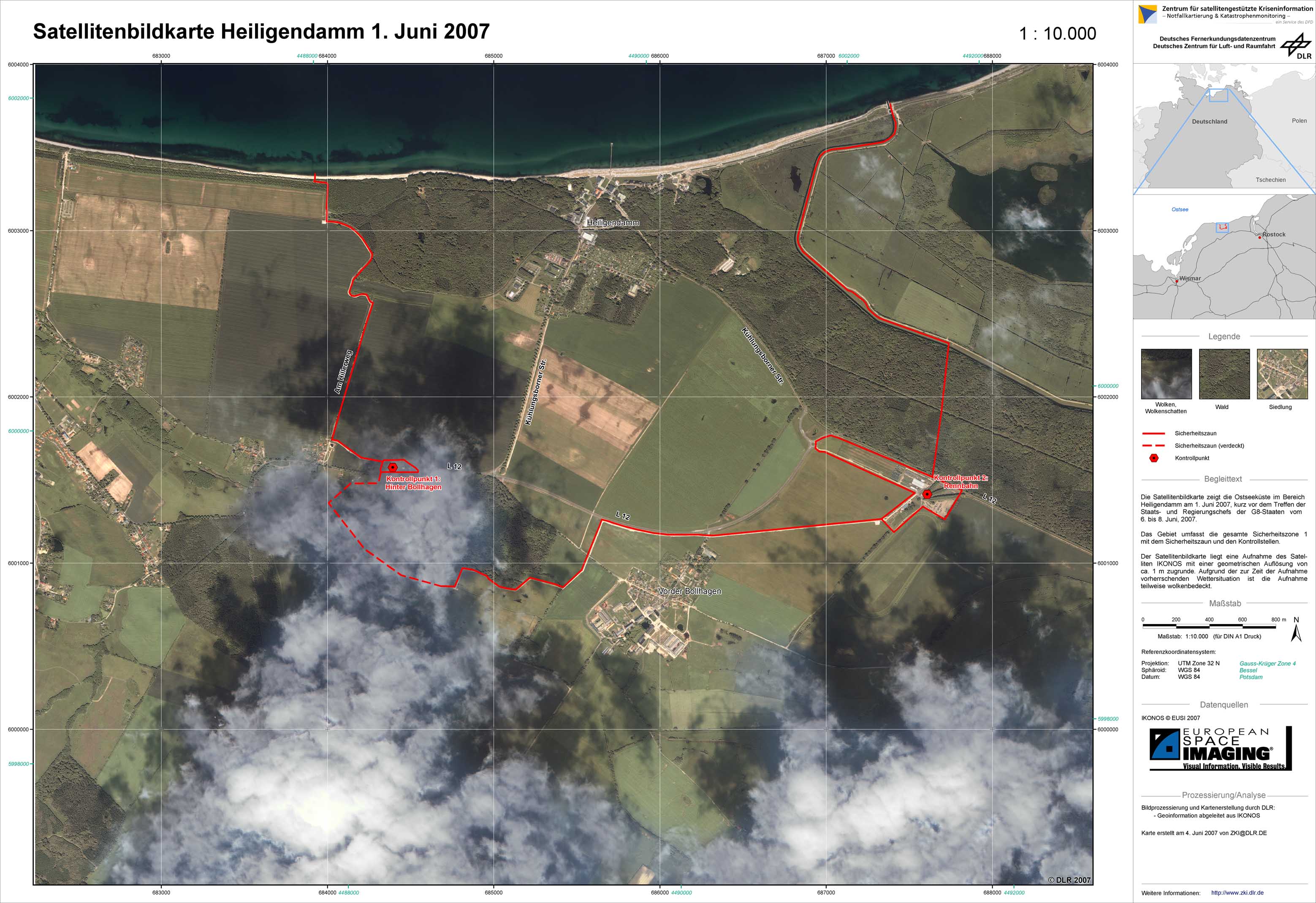
G8 summit 2007 in Heiligendamm - P01 - Satellite map - June 1, 2007 - Subset Heiligendamm

Creation Date 04. June 2007

undefined