Flood in England and Wales, England July 2007
undefined
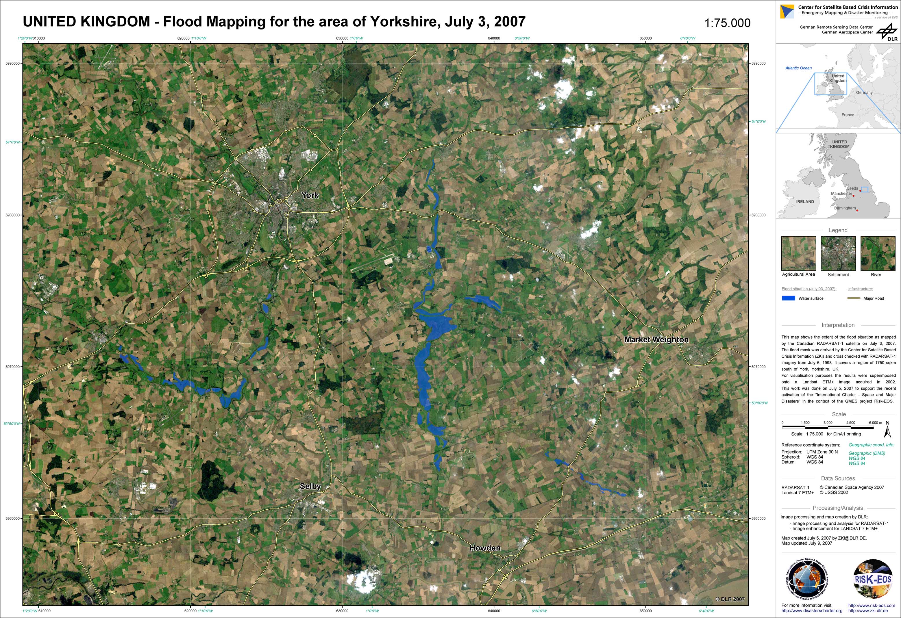
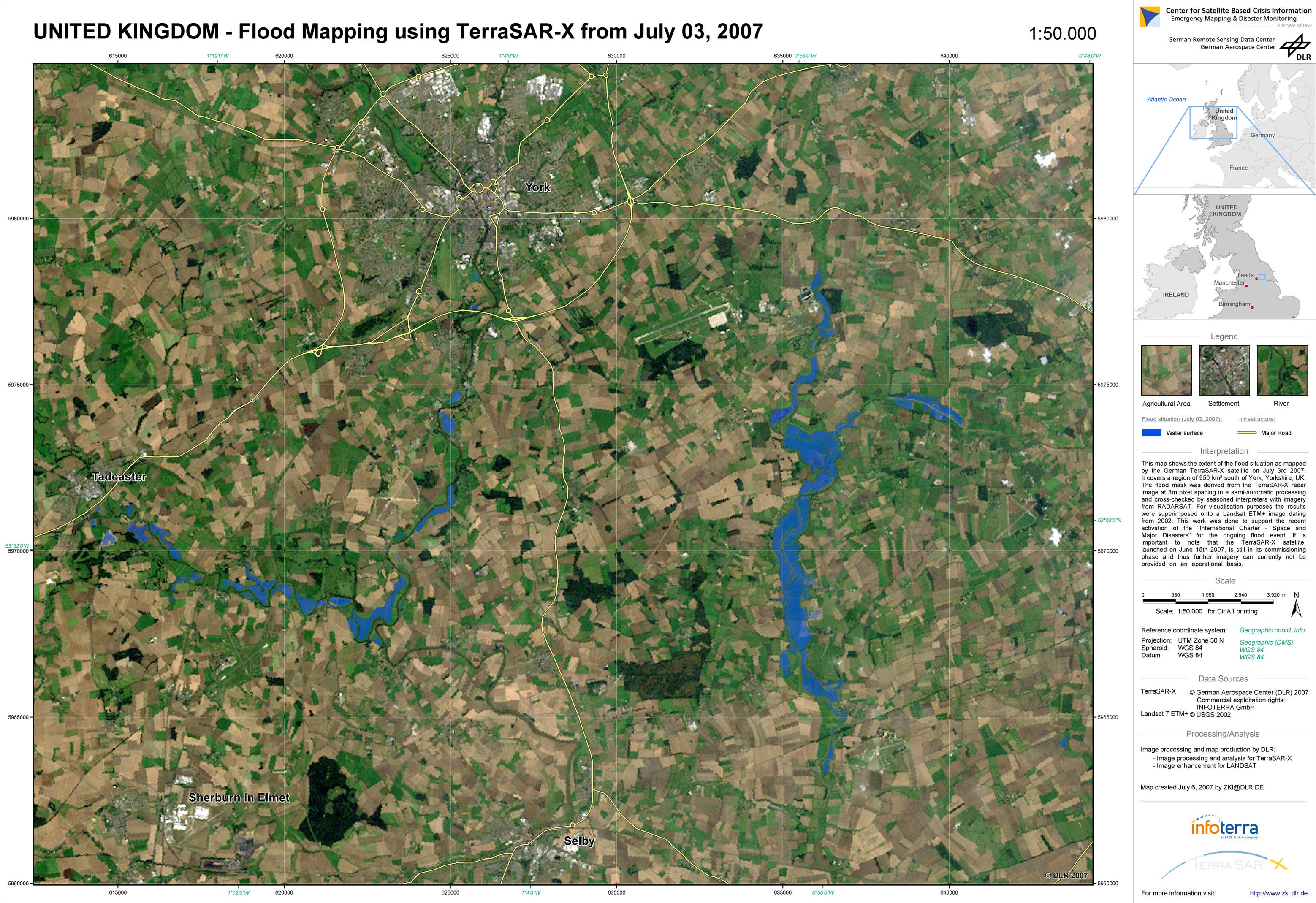
Heavy rainstorms caused by an extraordinary weather situation led to major floodings in parts of the UK. During June 2007, a large low-pressure area coming from the Atlantic Ocean was trapped over Wales and England. The highest precipitation rates measured over the last decade were recorded at a number of meteorological stations in Yorkshire, Lincolnshire and the Midlands. Those areas were mainly affected by floods which led to breakdowns in power supply and the evacuation of residents, for example from the city of Sheffield. The threat of reservoir dam breaks further exacerbated relief activities of the local authorities. The extent of the flood situation was mapped by the German TerraSAR-X satellite on July 3, 2007. It covered a region of approximately 950 km² south of York, Yorkshire, UK. The flood mask was derived from the TerraSAR-X radar image at 3m pixel spacing in a semi-automatic processing and cross-checked by seasoned interpreters with imagery from RADARSAT. For visualisation purposes, the results were superimposed onto a Landsat ETM+ image dating from 2002. This work was done to support the activation of the International Charter - Space and Major Disasters for the ongoing flood event. The Charter was triggered on June 28, 2007, by the Environment Agency of the UK. It is important to note that the TerraSAR-X satellite, launched on June 15, 2007, was still in its commissioning phase and thus further imagery could not be provided on an operational basis.
United Kingdom - P01 - Yorkshire - Flood extent derived from RADARSAT July 3, 2007
Creation Date 09. July 2007
United Kingdom - P02 - Yorkshire - Flood extent derived from TerraSAR-X July 3, 2007
Creation Date 06. July 2007
undefined