
Flood in the United Kingdom, July 2007
undefined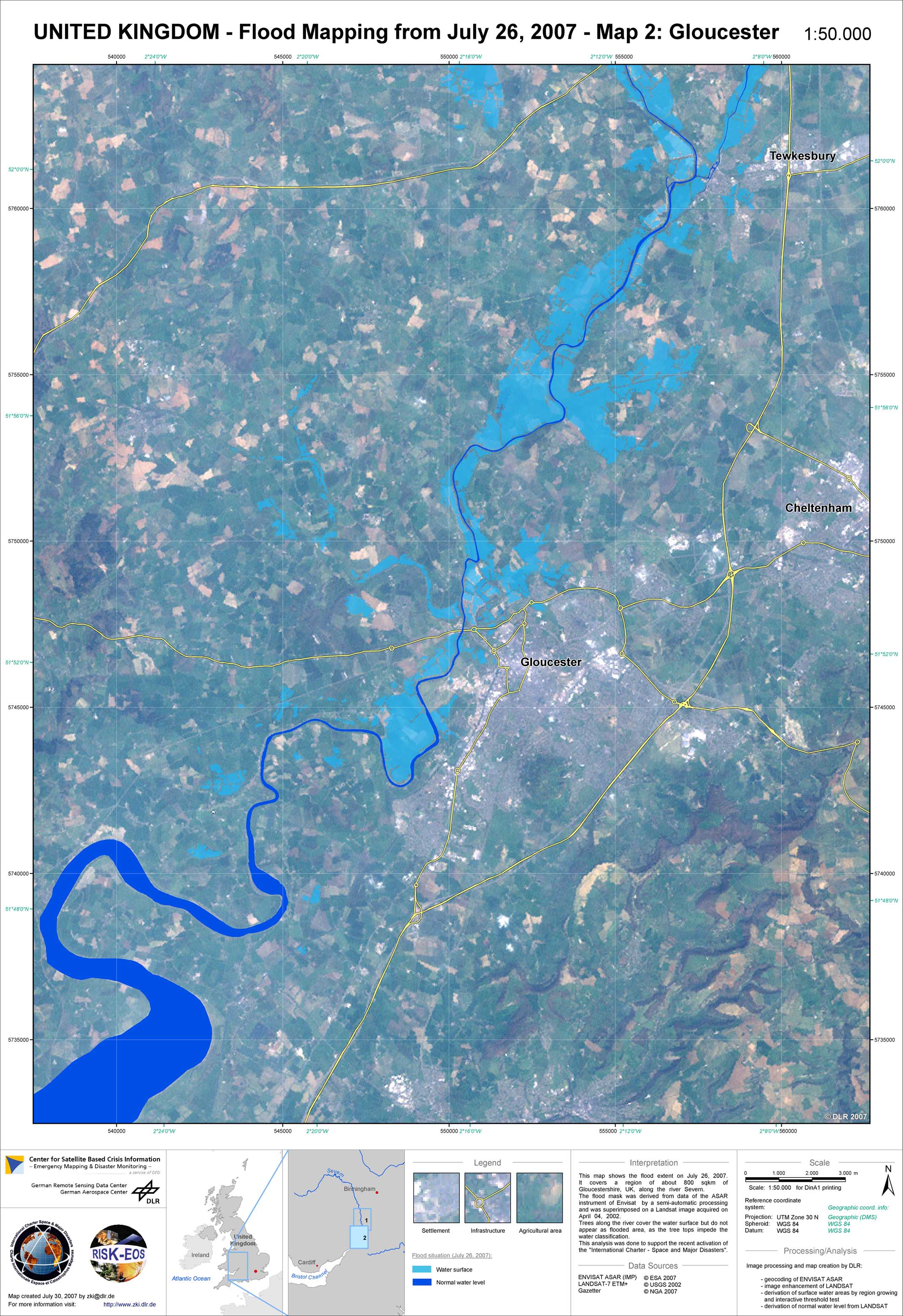
United Kingdom - P06 - Flood extent derived from ENVISAT ASAR (IMP) on 26, 2007 - Map 2: Gloucester
Creation Date 30. July 2007
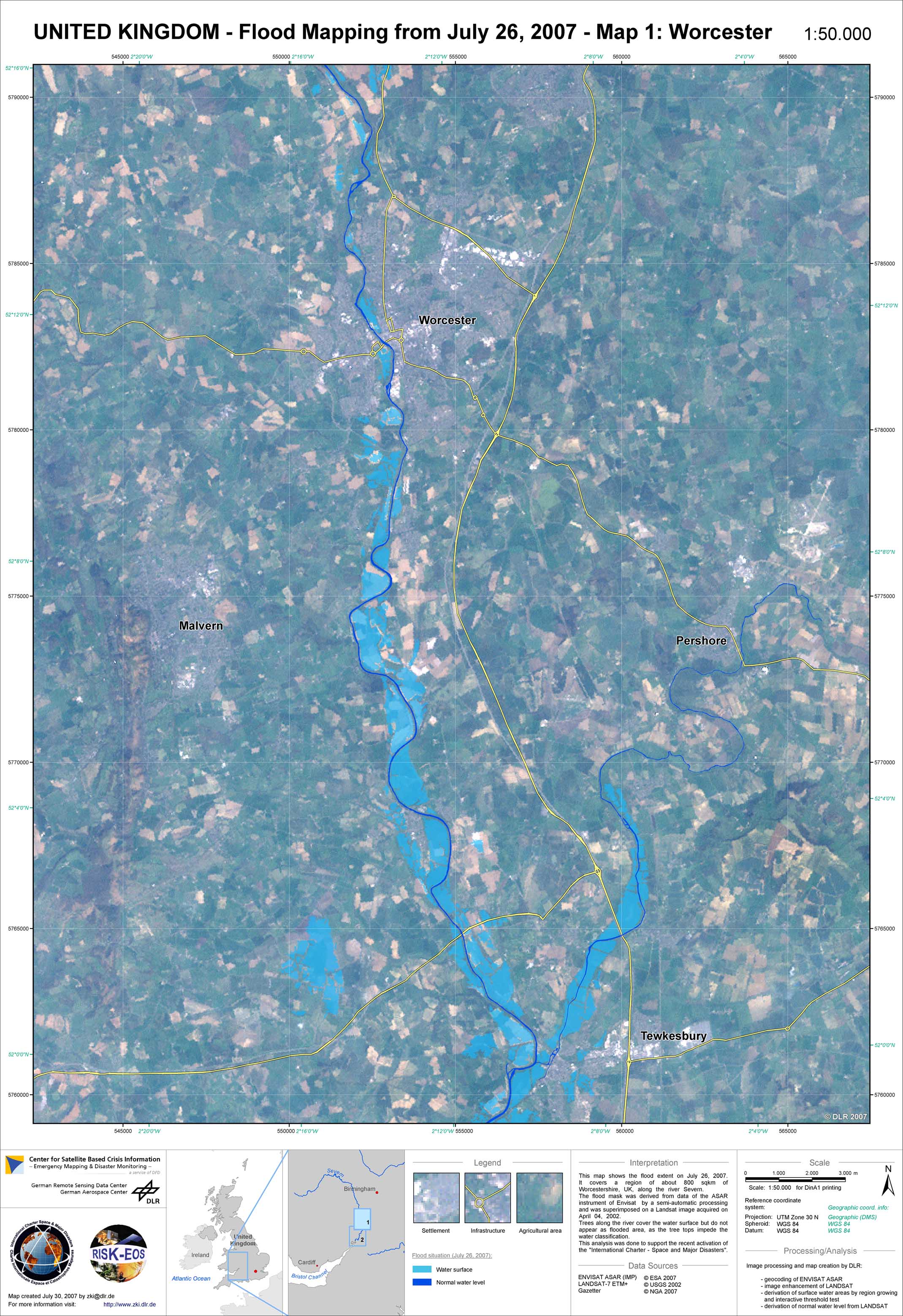
United Kingdom - P05 - Flood extent derived from ENVISAT ASAR (IMP) on 26, 2007 - Map 1: Worcester
Creation Date 30. July 2007
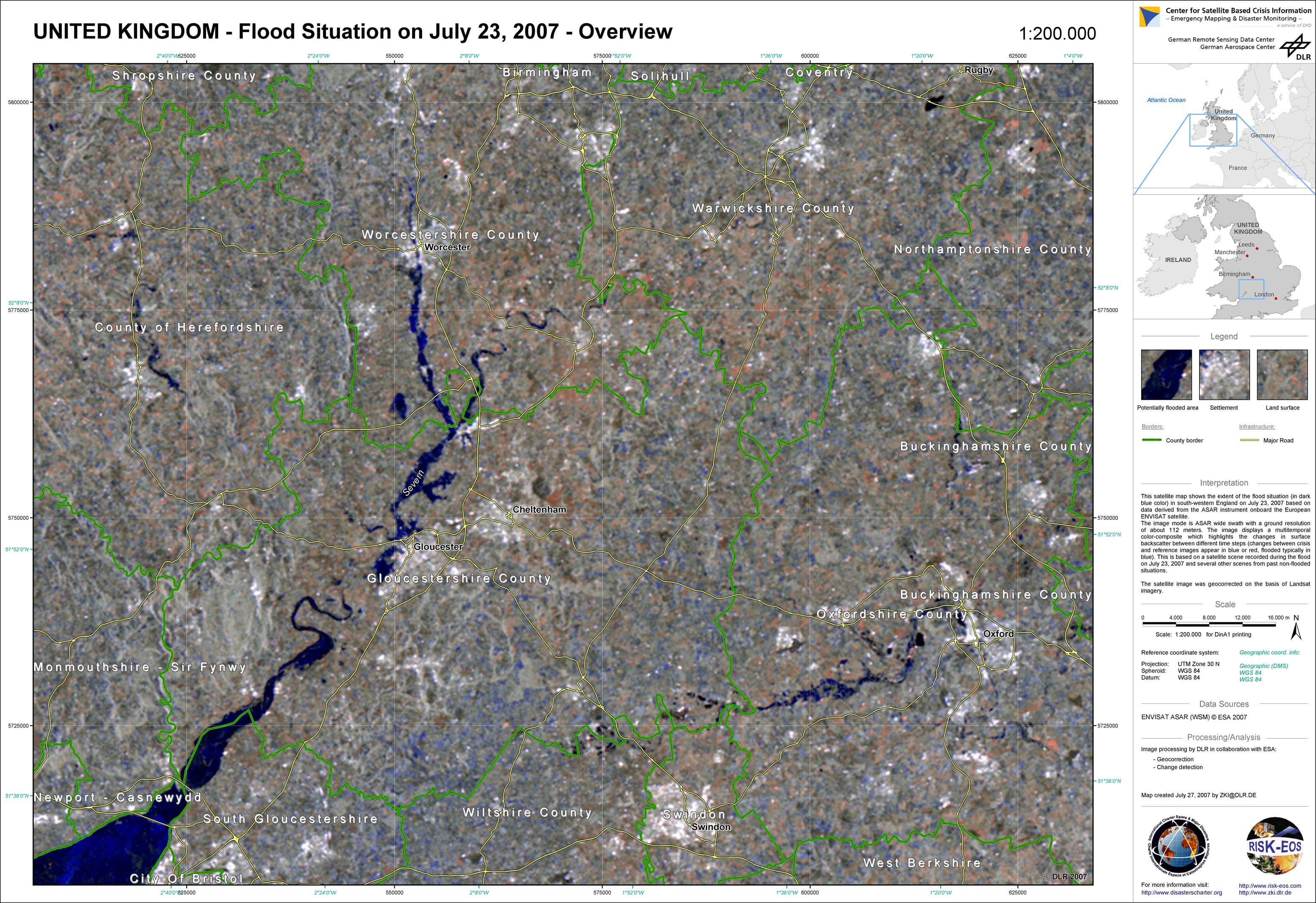
United Kingdom - P01 - Flood situation overview - July 23, 2007
Creation Date 27. July 2007
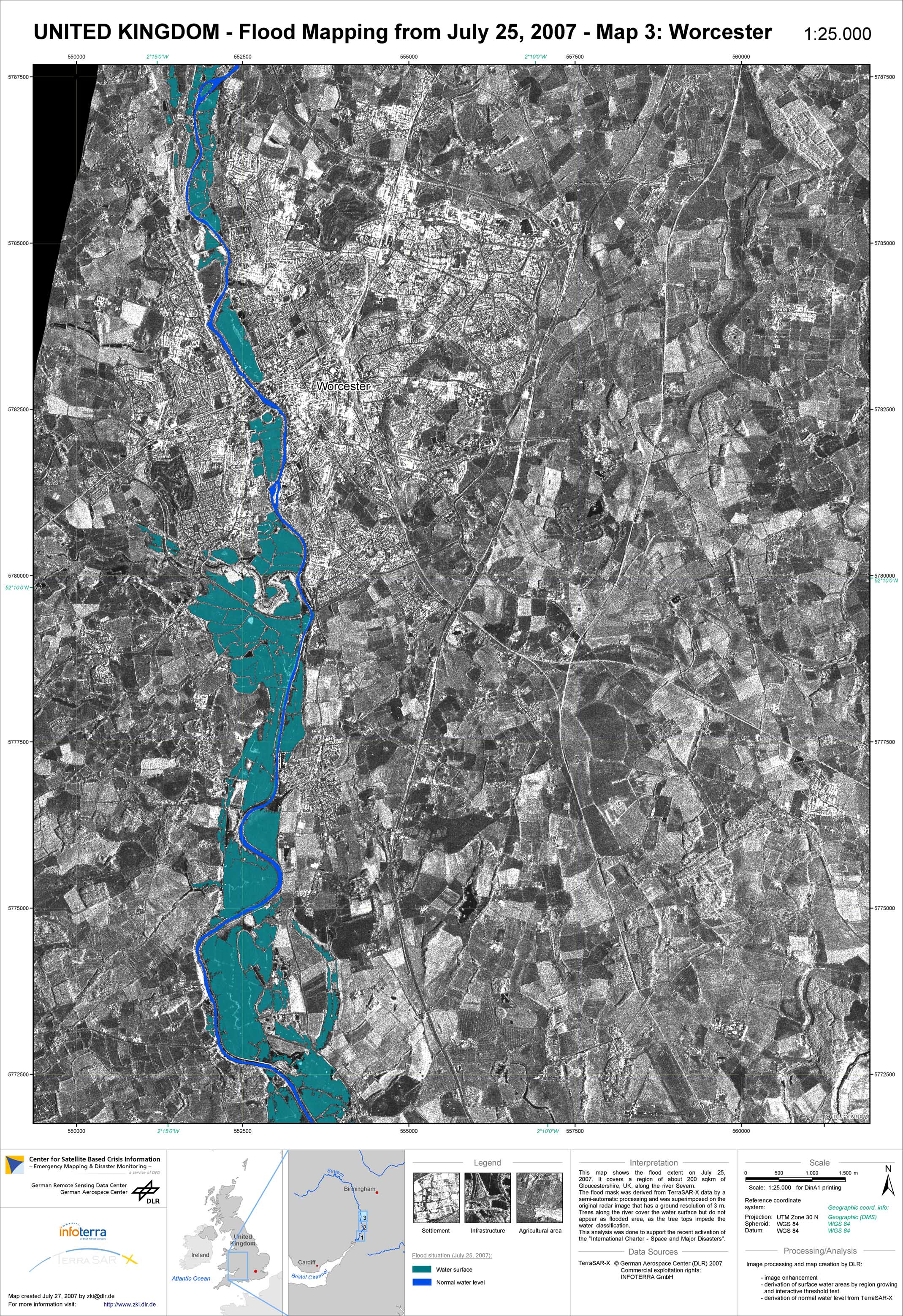
United Kingdom - P04 - Flood extent derived from TerraSAR-X July 25, 2007 - Map 3: Worcester
Creation Date 27. July 2007
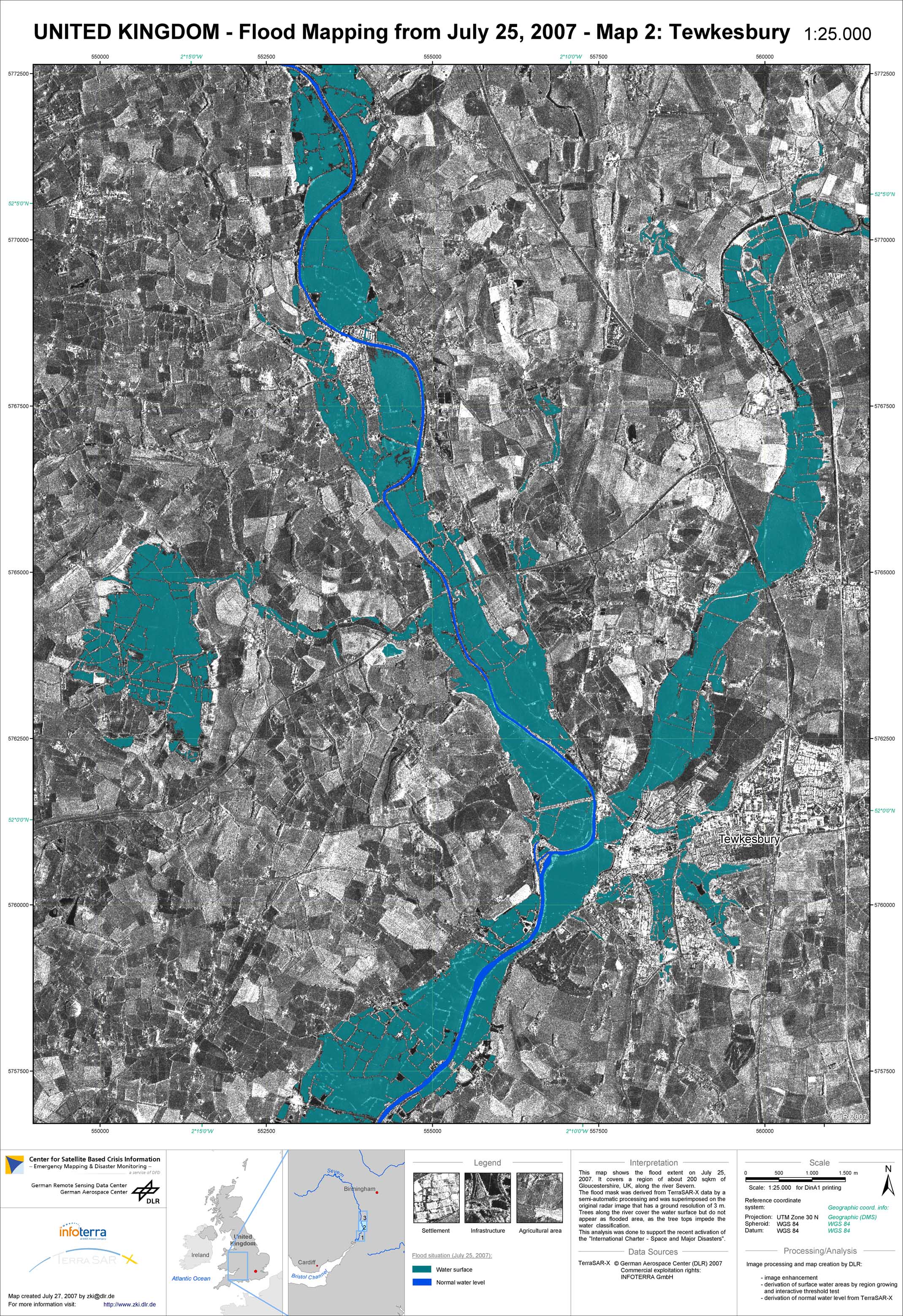
United Kingdom - P03 - Flood extent derived from TerraSAR-X July 25, 2007 - Map 2: Tewkesbury
Creation Date 27. July 2007
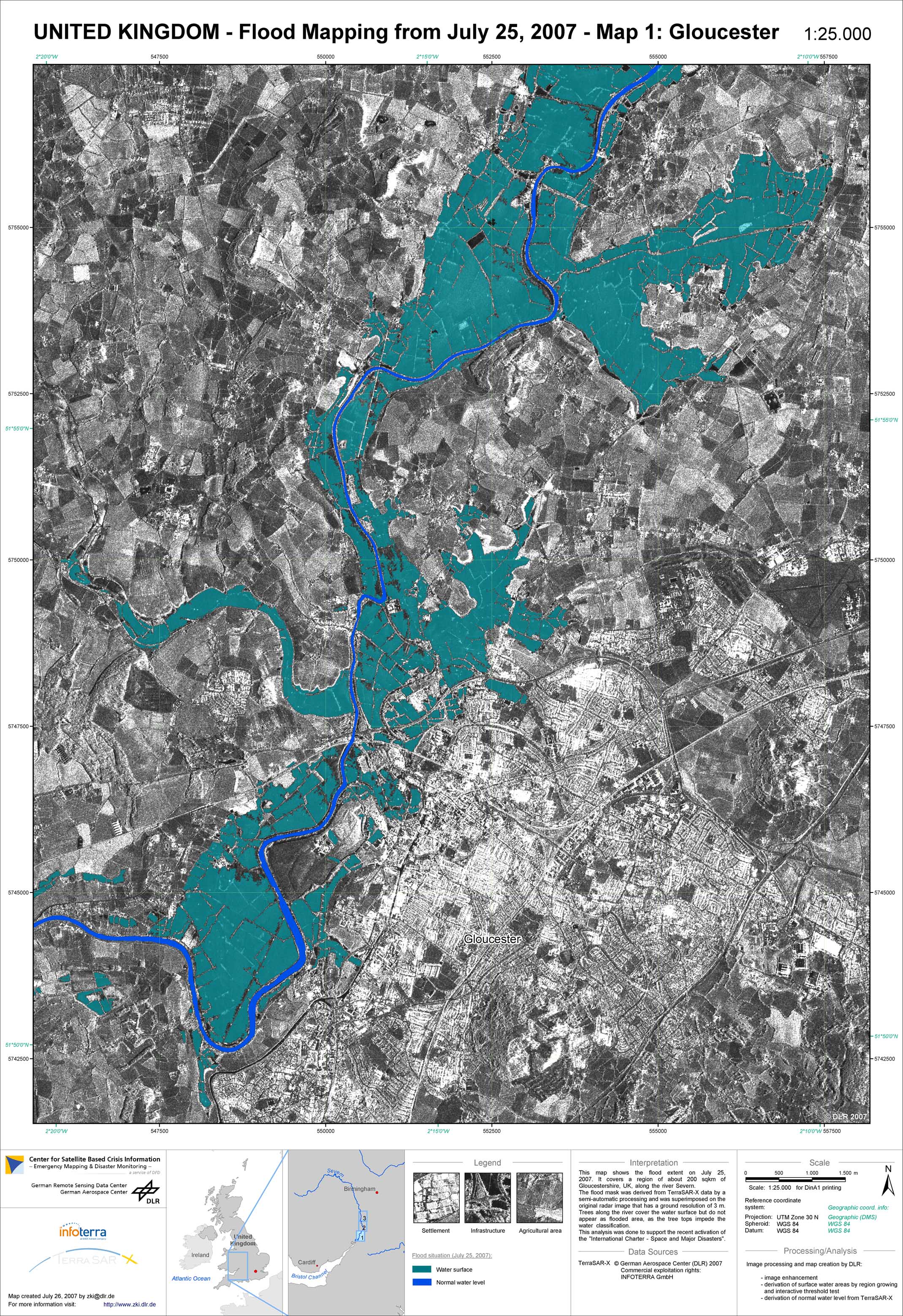
United Kingdom - P02 - Flood extent derived from TerraSAR-X July 25, 2007 - Map 1: Gloucester
Creation Date 26. July 2007