Forest fires in southern Europe, August 2007
undefined
In 2007, southeastern Europe was affected by the worst wildfires for decades. Conditioned by extrem heat since middle of August 2007, large natural or man-made fires started. After the end of August, Greece was the most affected country. The fires killed at least 60 people. It was expected that the death toll rises, since many villages were still trapped by the fires. The Peleponnes peninsula was affected most. Following the devastating situation, the Greek government had declared the nation-wide state of emergency. In the meantime, the Greek emergency services were supported by international forces. 13 fire-fighting airplanes and helicopters were deployed - including three German helicopters. ZKI of DLR is continously monitoring the fire situation in Europe with the help of the sensor NOAA-AVHRR 18 as well as with MODIS TERRA-1 and AQUA-1. It uses the receiving stations of the German Remote Sensing Data Center and processes the data automatically. Due to the severe situation in Greece, the fire information for this area was published on this dedicated ZKI-webpage. In the context of the International Charter 'Space and Major Disasters', ZKI produced together with its French partner SERTIT satellite image maps of the areas affected by the fire disaster. The products of ZKI were realized through the GMES service element Risk-EOS.
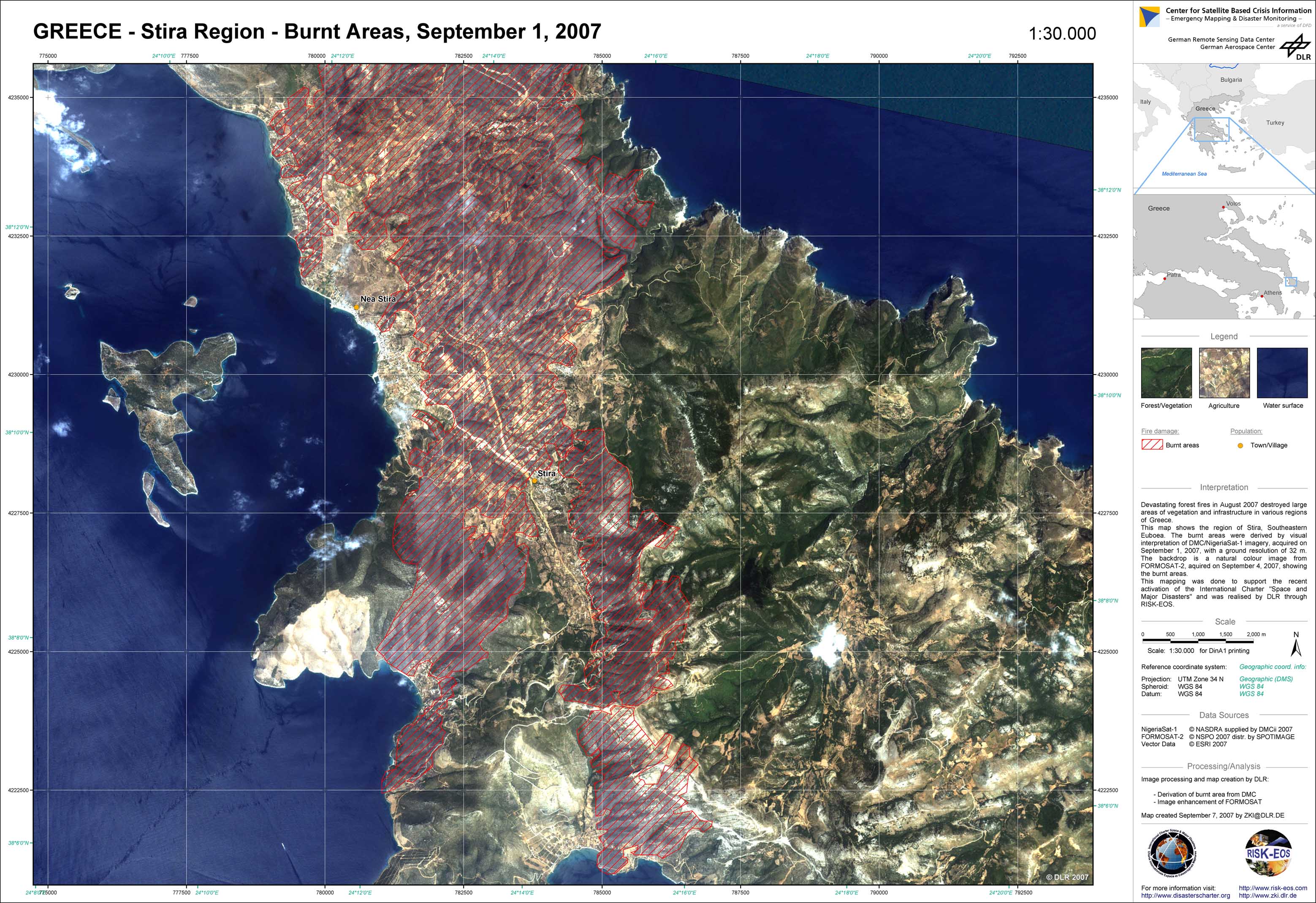
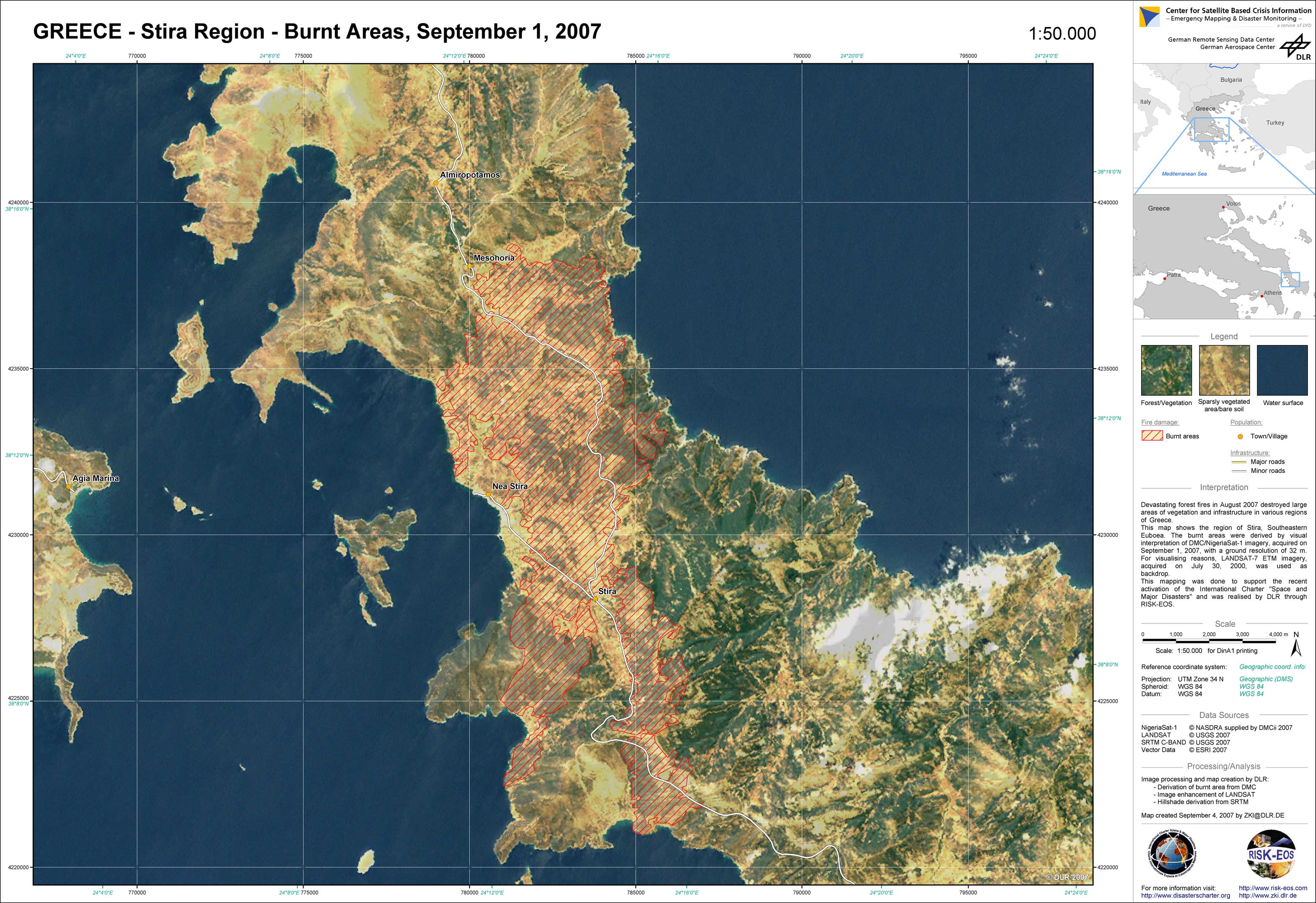
Greece - P08 - Stira Region - Burnt areas from FORMOSAT data, September 1, 2007
Creation Date 07. September 2007
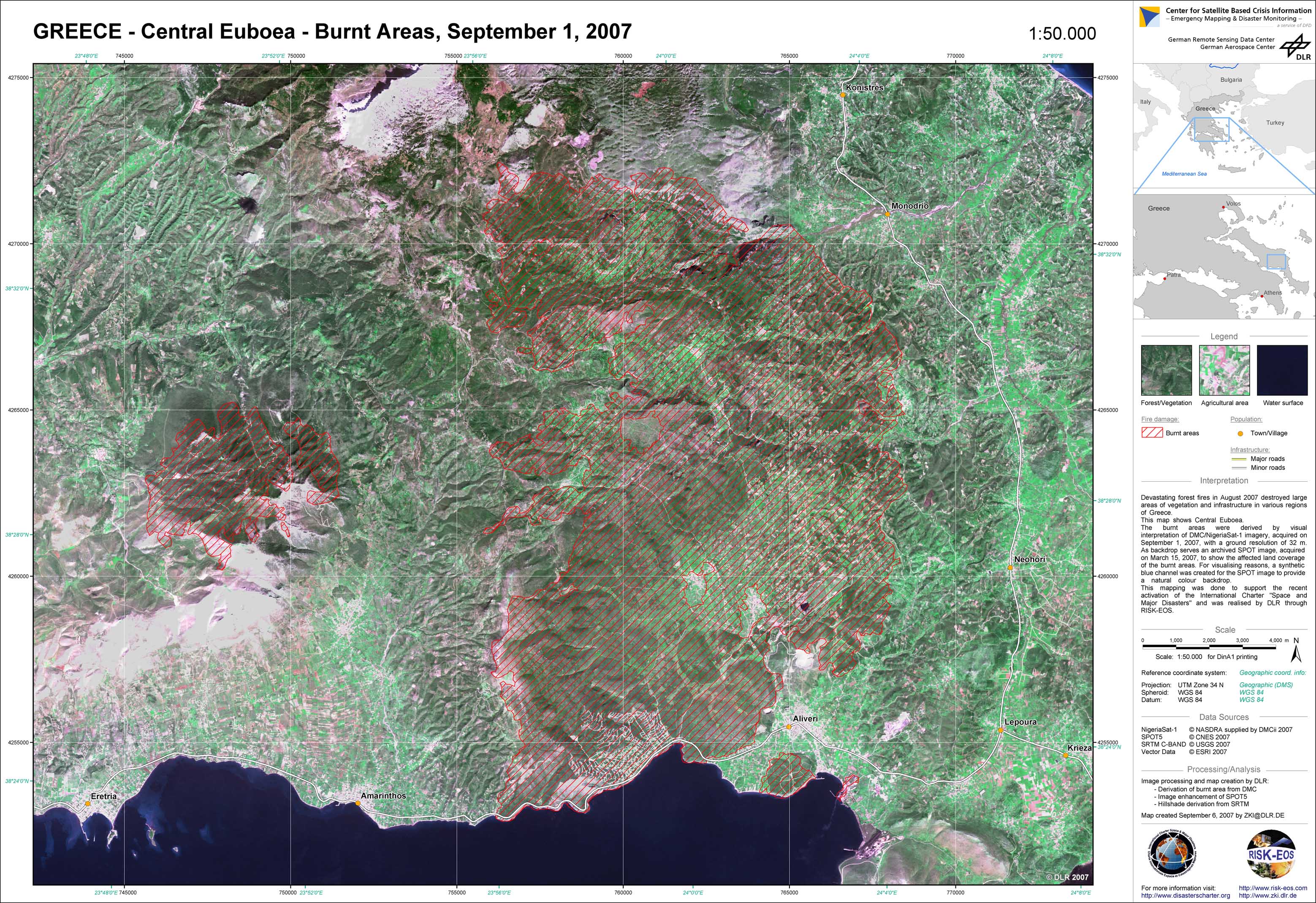
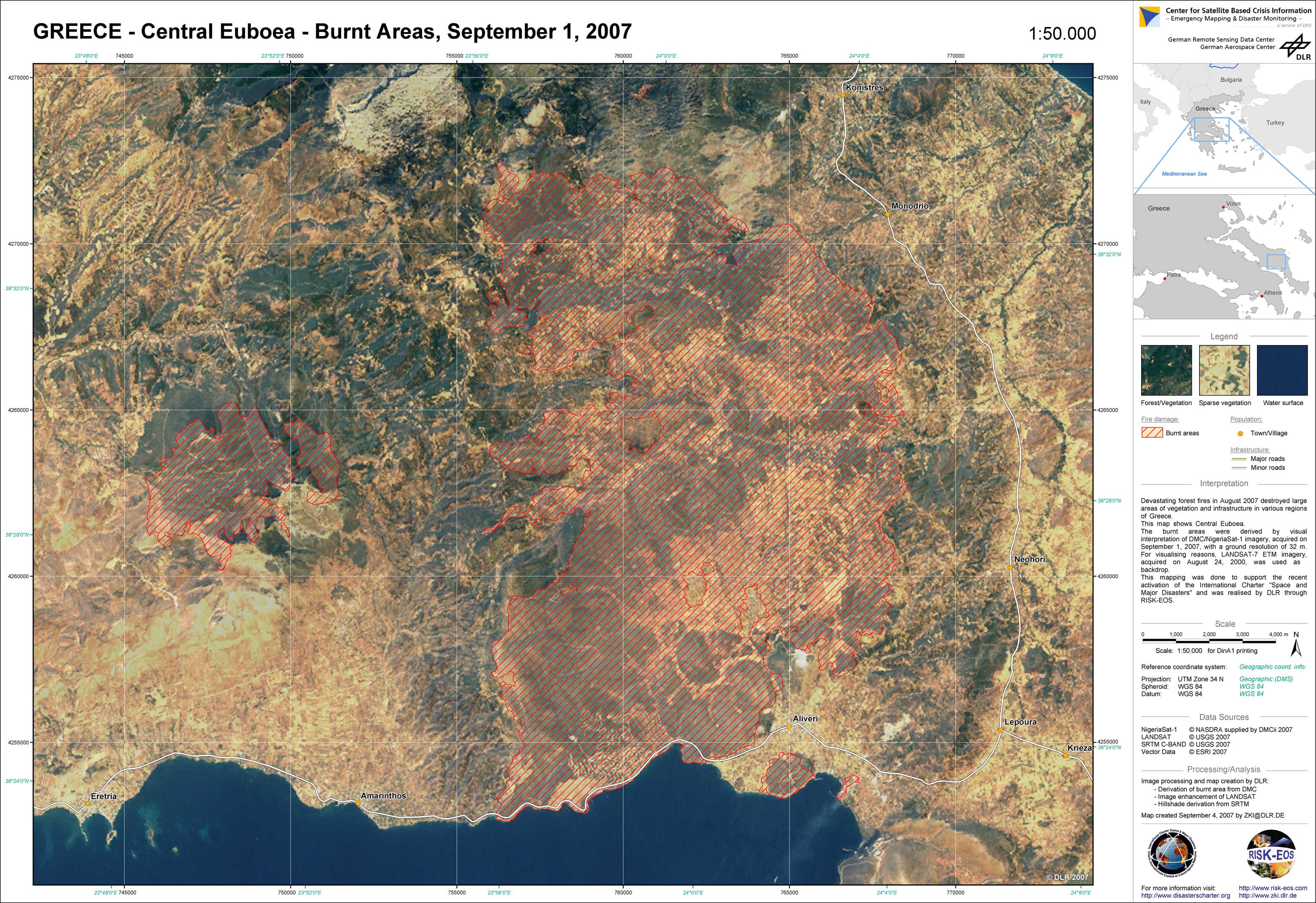
Greece - P06 - Central Euboea - Burnt areas from SPOT data, September 1, 2007
Creation Date 06. September 2007
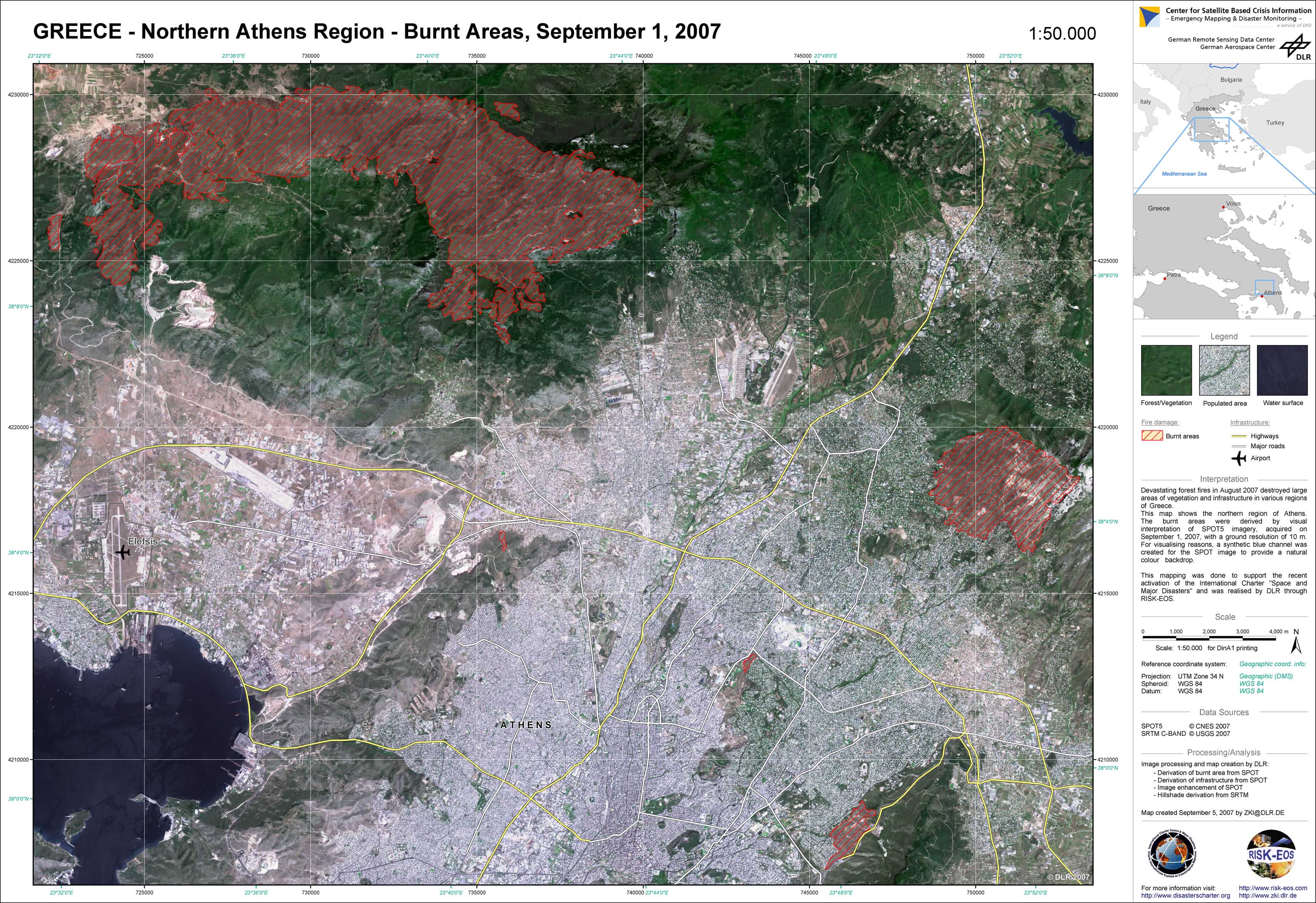
Greece - P03 - Northern Athens region - Burnt areas from SPOT data, September 1, 2007
Creation Date 05. September 2007
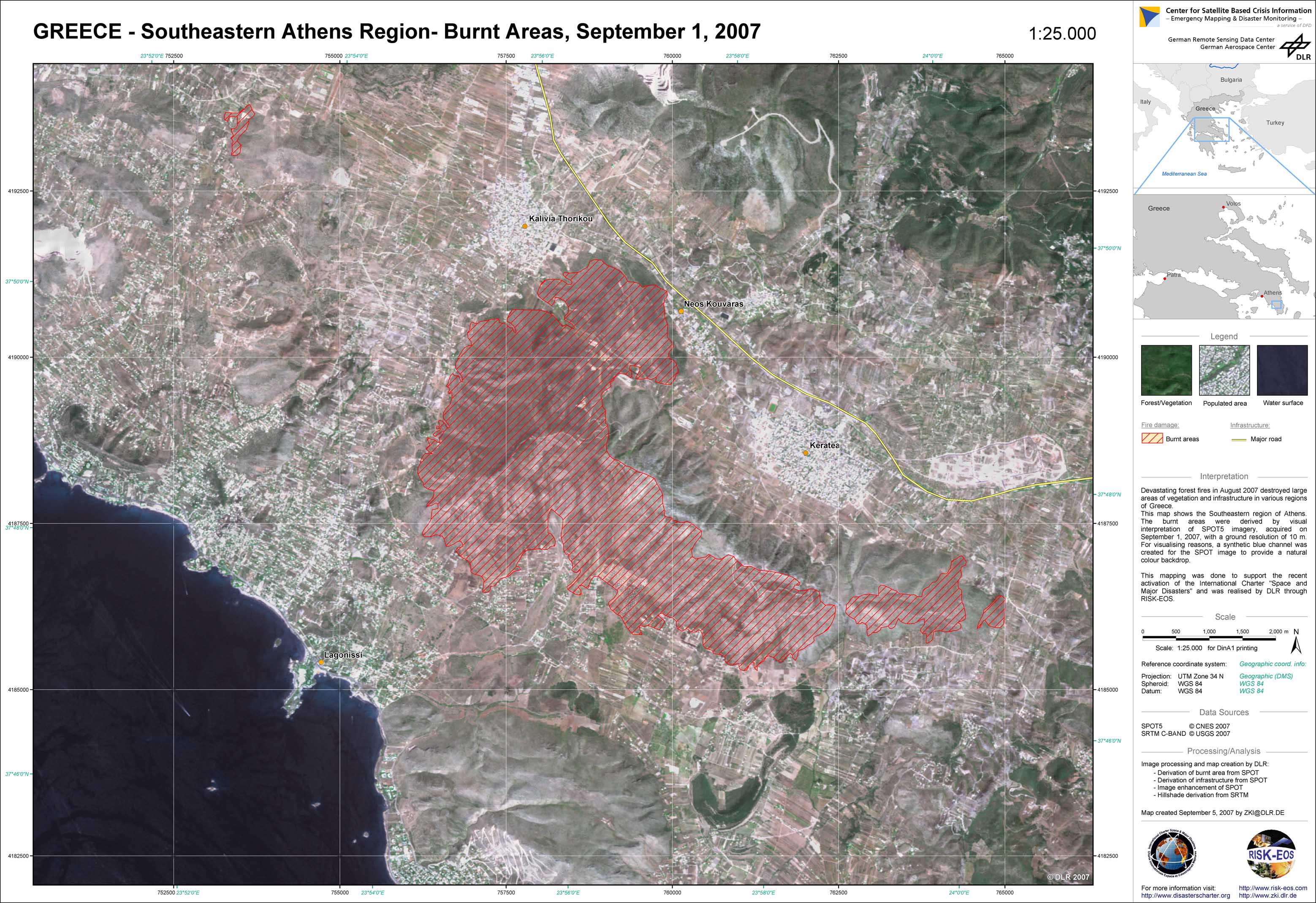
Greece - P04 - Southeastern Athens region - Burnt areas from SPOT data, September 1, 2007
Creation Date 05. September 2007
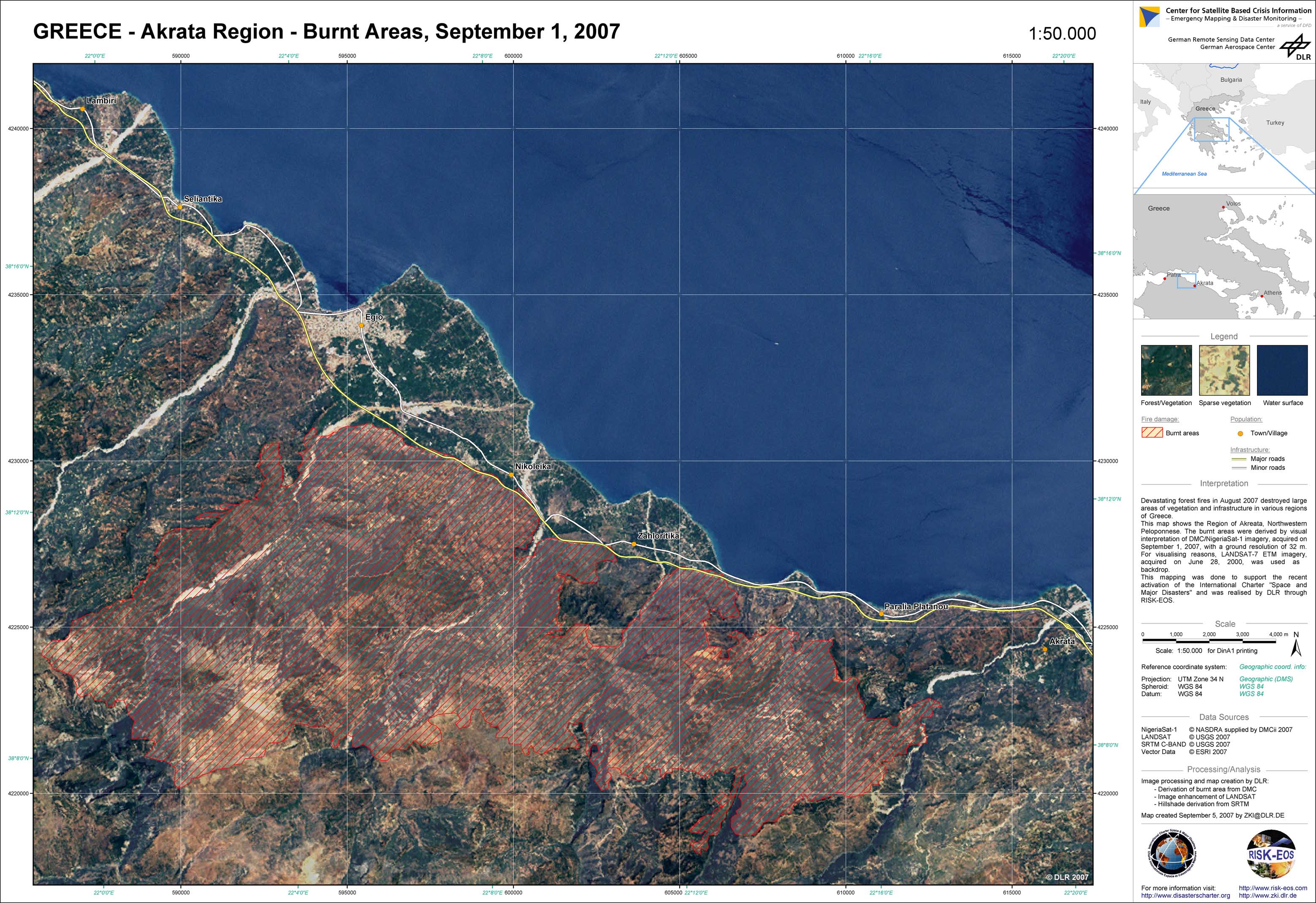
Greece - P02 - Akrata region - Burnt areas from DMC data, September 1, 2007
Creation Date 04. September 2007
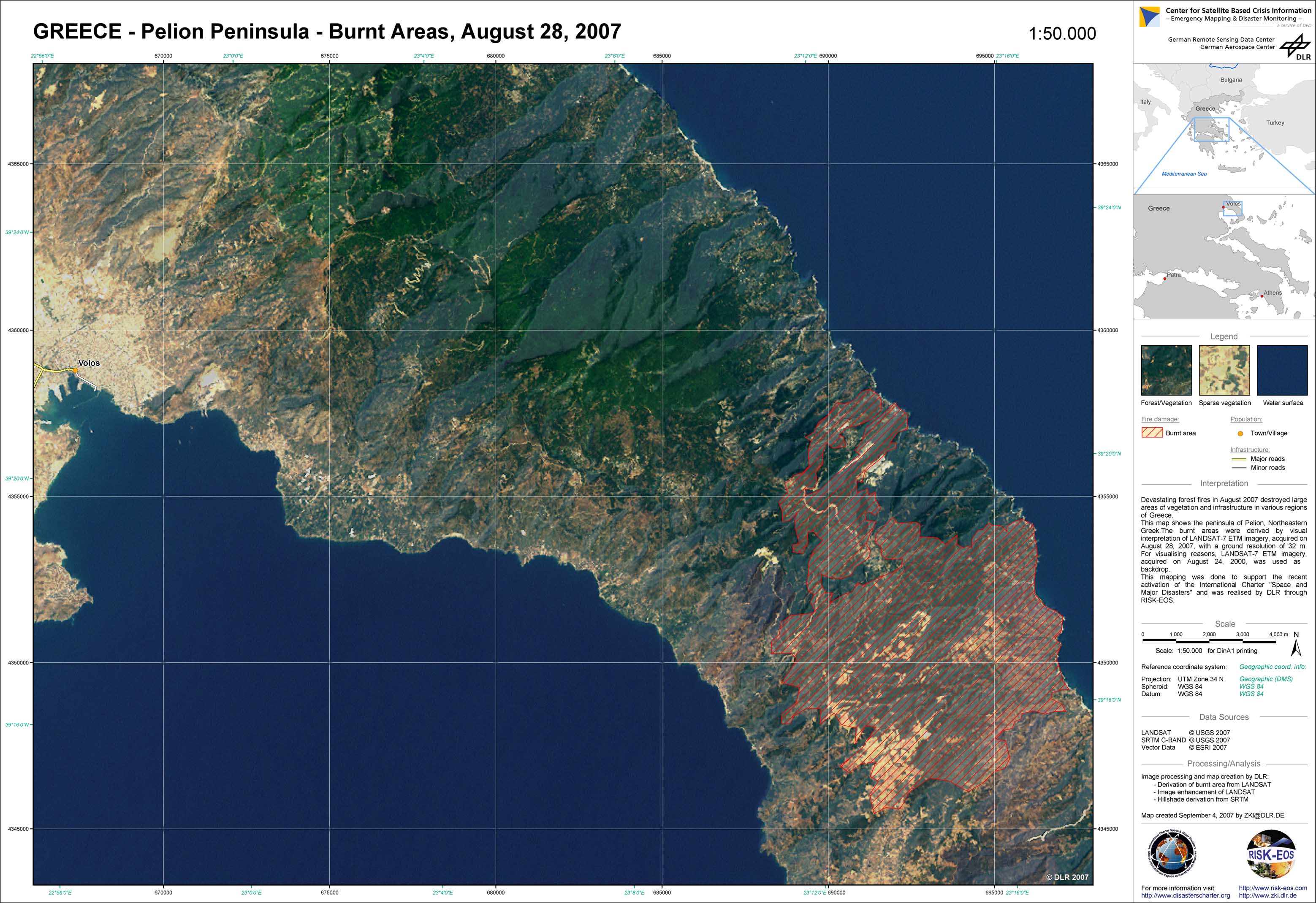
Greece - P01 - Pelion peninsula - Burnt areas from LANDSAT data, August 28, 2007
Creation Date 04. September 2007
Greece - P05 - Central Euboea - Burnt areas from DMC data, September 1, 2007
Creation Date 04. September 2007
Greece - P07 - Stira region - Burnt areas from DMC data, September 1, 2007
Creation Date 04. September 2007
undefined