ZKI produces maps of affected regions after tropical cyclone 'Sidr' in Bangladesh
undefined
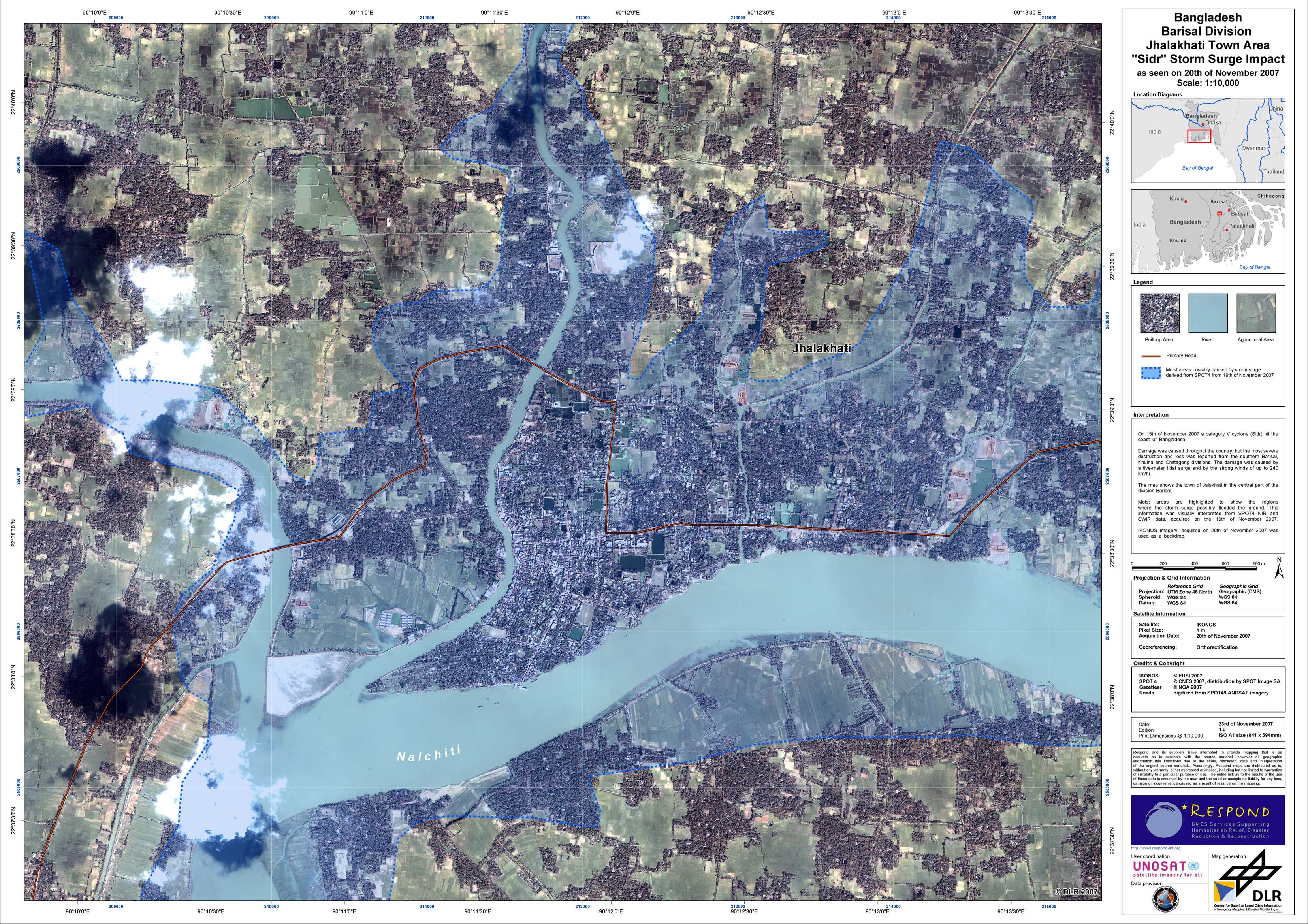
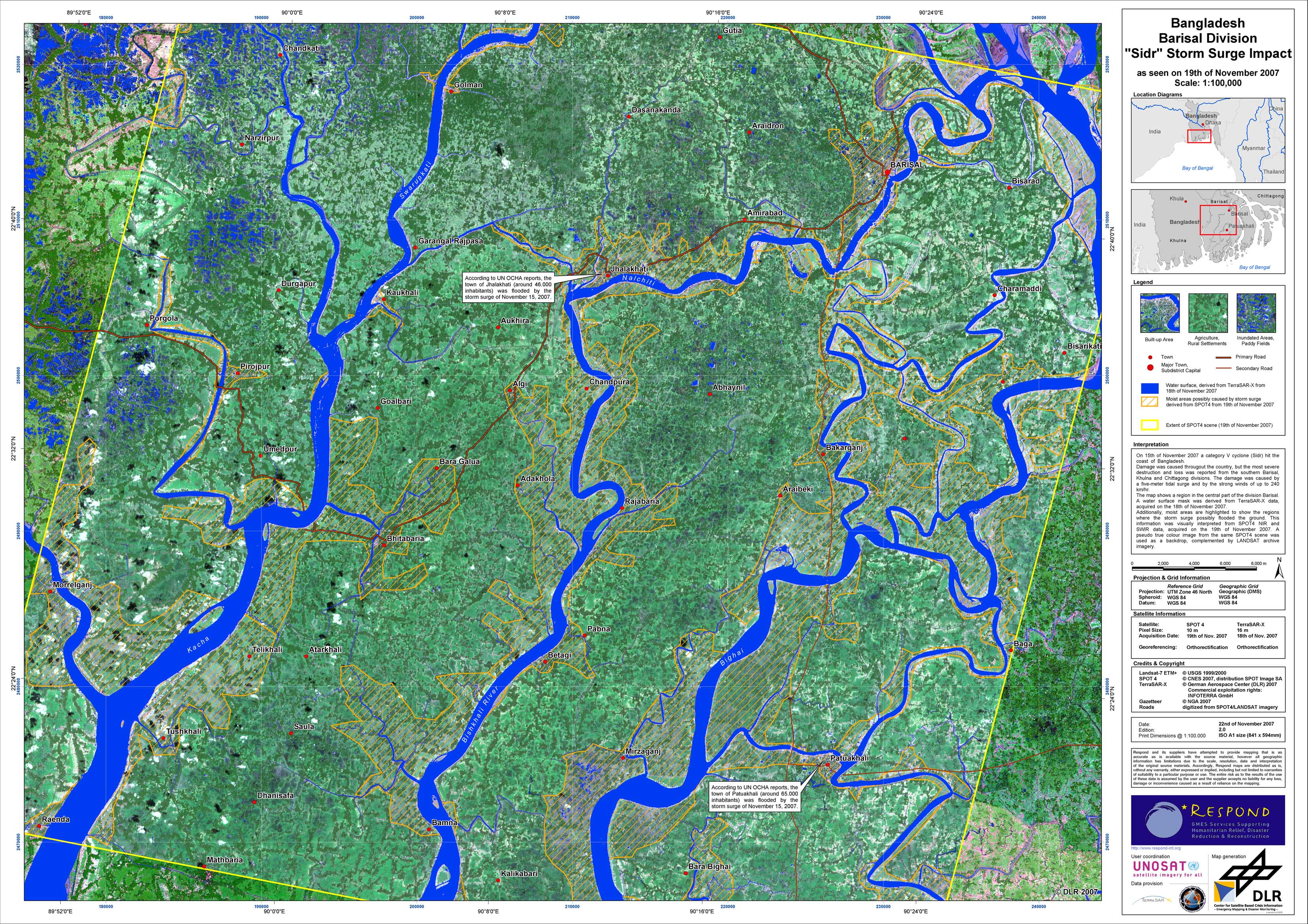
During the night from November 15 and 16, 2007, tropical cyclone 'Sidr' swept over the the southwestern part of Bangladesh, leaving behind a trail of destruction. With wind speeds of up to 240 km/h at the coast and up to 160 km/h at the capital Dhaka, Sidr forced three million people to flee from their homes in 15 coastal districts of Bangladesh. According to the UN OCHA reports, more than 3,000 people lost their lives in the cyclone, which caused a storm surge of up to five meters in heigth, flooding the towns of Patuakhali, Barguna and Jhalakathi. By the storm and the surge an estimated 300,000 homes were destroyed and 600,000 were partially damaged. Nearly 900,000 acres of crops were destroyed. UNOSAT has triggered the International Charter 'Space and Major Disasters' on behalf of the World Food Programme (WFP), which asked for support, demanding satellite-based information on the impact of Sidr. The Center for Satellite Based Crisis Information (ZKI) at DLR took over the project management in this Charter call and produced satellite image maps of the regions affected most by the event. On the right side of the sceen, you can doanlaod a dossier of visual interpretations of very high resolution satellite data (IKONOS), aquired on Nov 20, 2007, covering parts of the disctricts Barisal, Jhalakathi, Paluakathi, Barguna, Pirjopur and Bagerhat.
Bangladesh - Jalakhati - P02 - Impact of storm surge during cyclone 'Sidr'
Creation Date 23. November 2007
Bangladesh - Barisal - P01 - Impact of storm surge during cyclone 'Sidr'
Creation Date 21. November 2007
undefined