
Floods in Namibia
undefined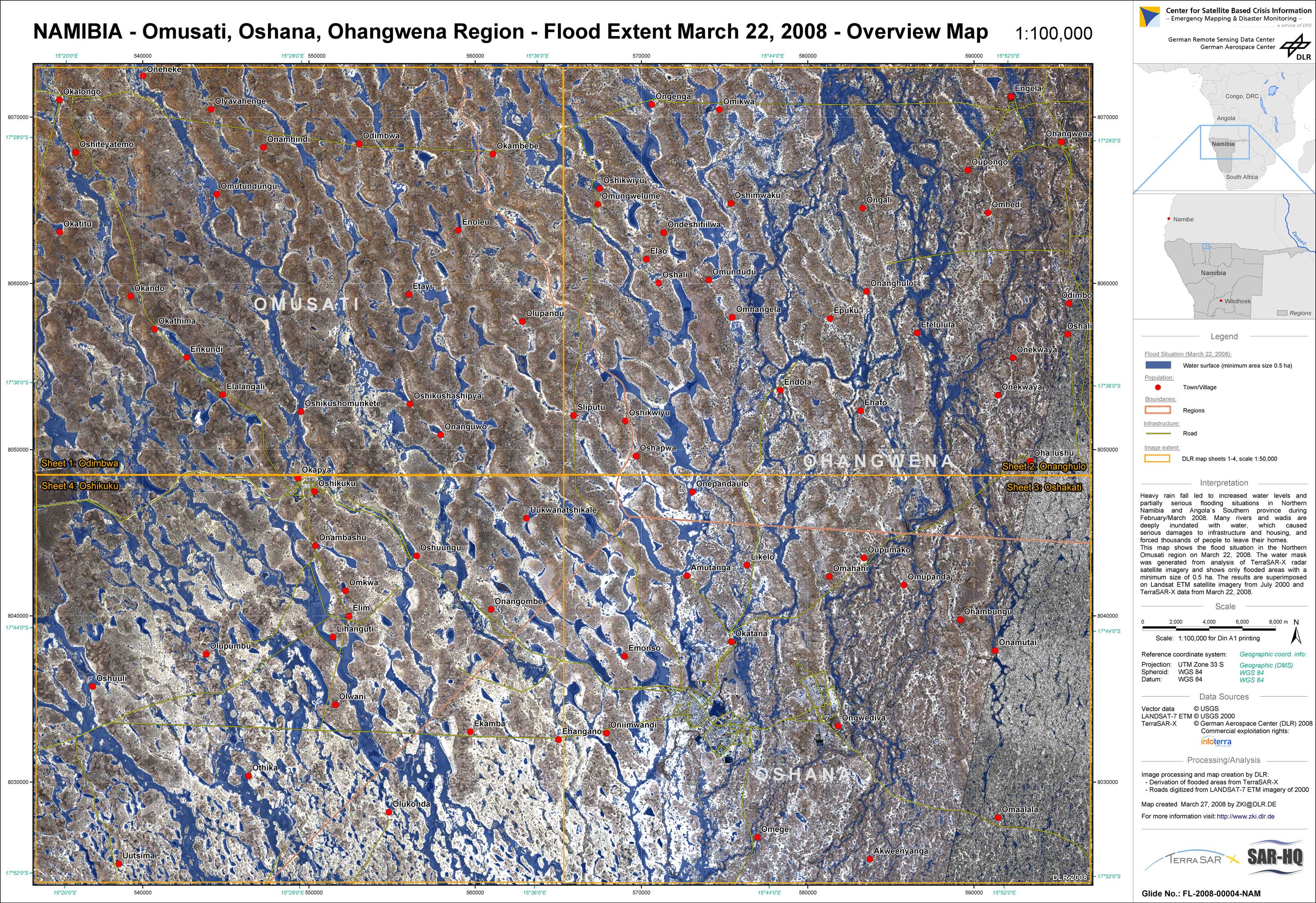
Namibia - P07 - Flood extent as of March 22, 2008 derived from TerraSAR-X data - Omusati, Oshana, Ohangwena region
Creation Date 27. March 2008
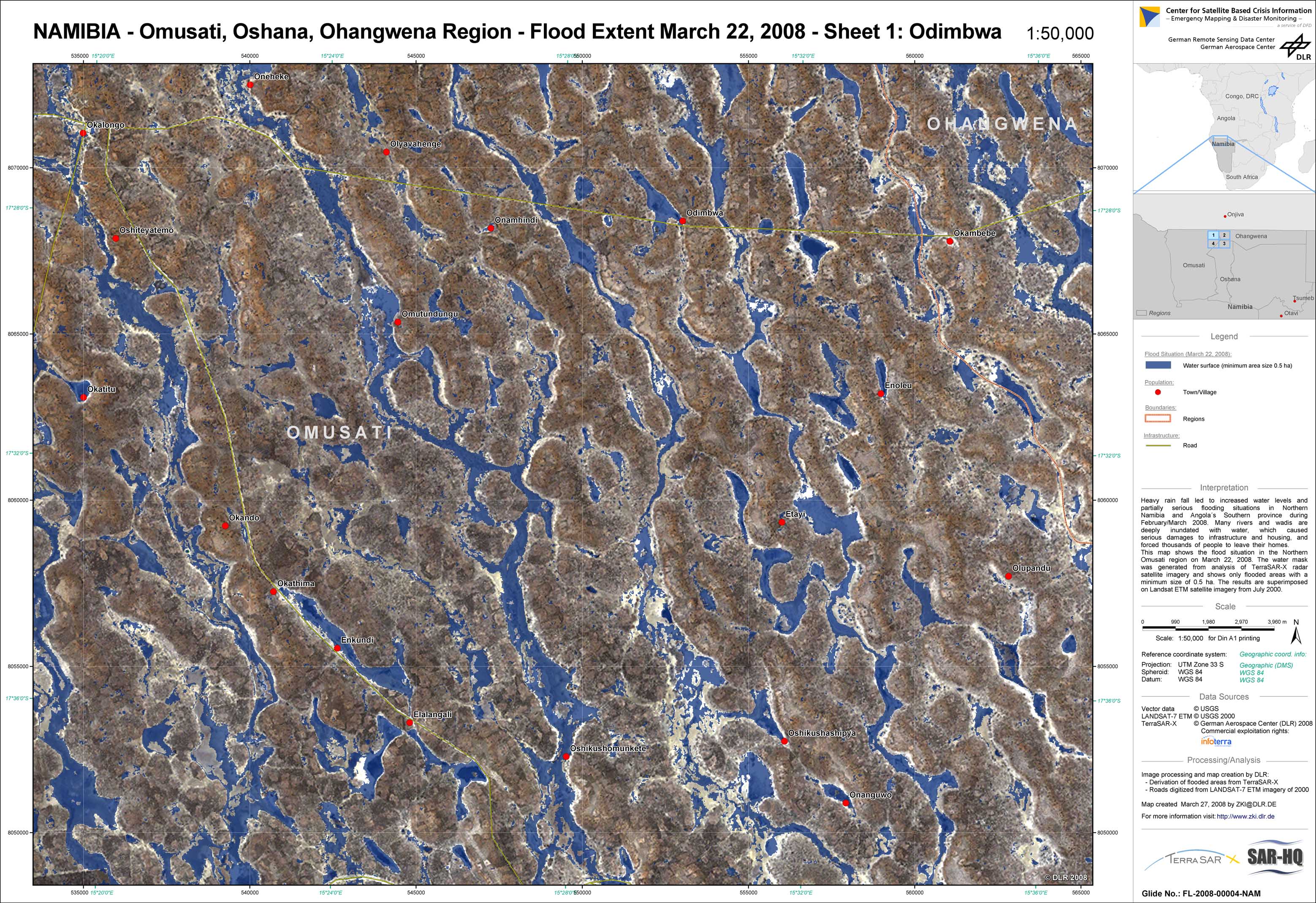
Namibia - P08 - Flood extent as of March 22, 2008 derived from TerraSAR-X data - Omusati, Oshana, Ohangwena region - sheet 1: Obimbwa
Creation Date 27. March 2008
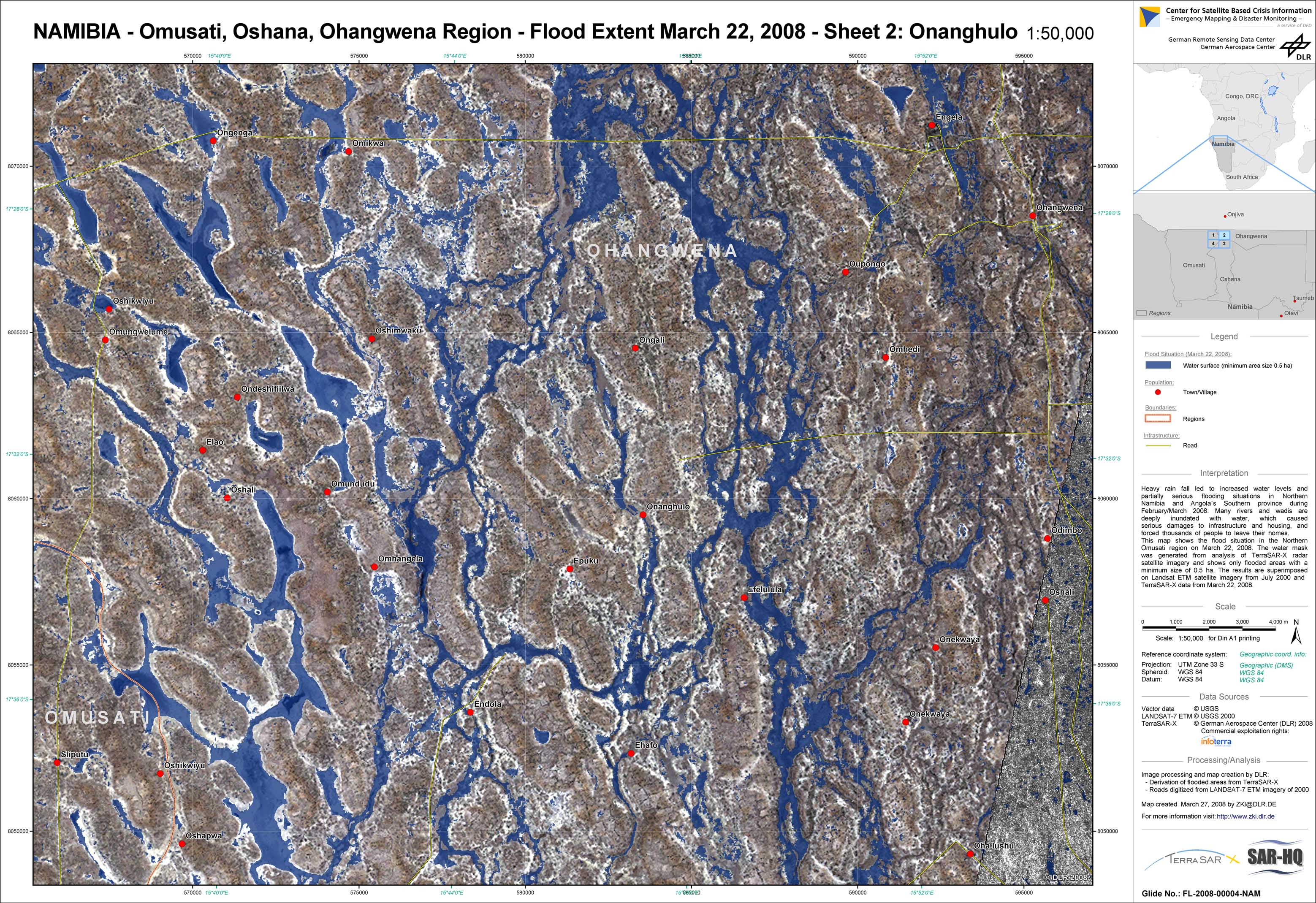
Namibia - P09 - Flood extent as of March 22, 2008 derived from TerraSAR-X data - Omusati, Oshana, Ohangwena region - sheet 2: Onanghulo
Creation Date 27. March 2008
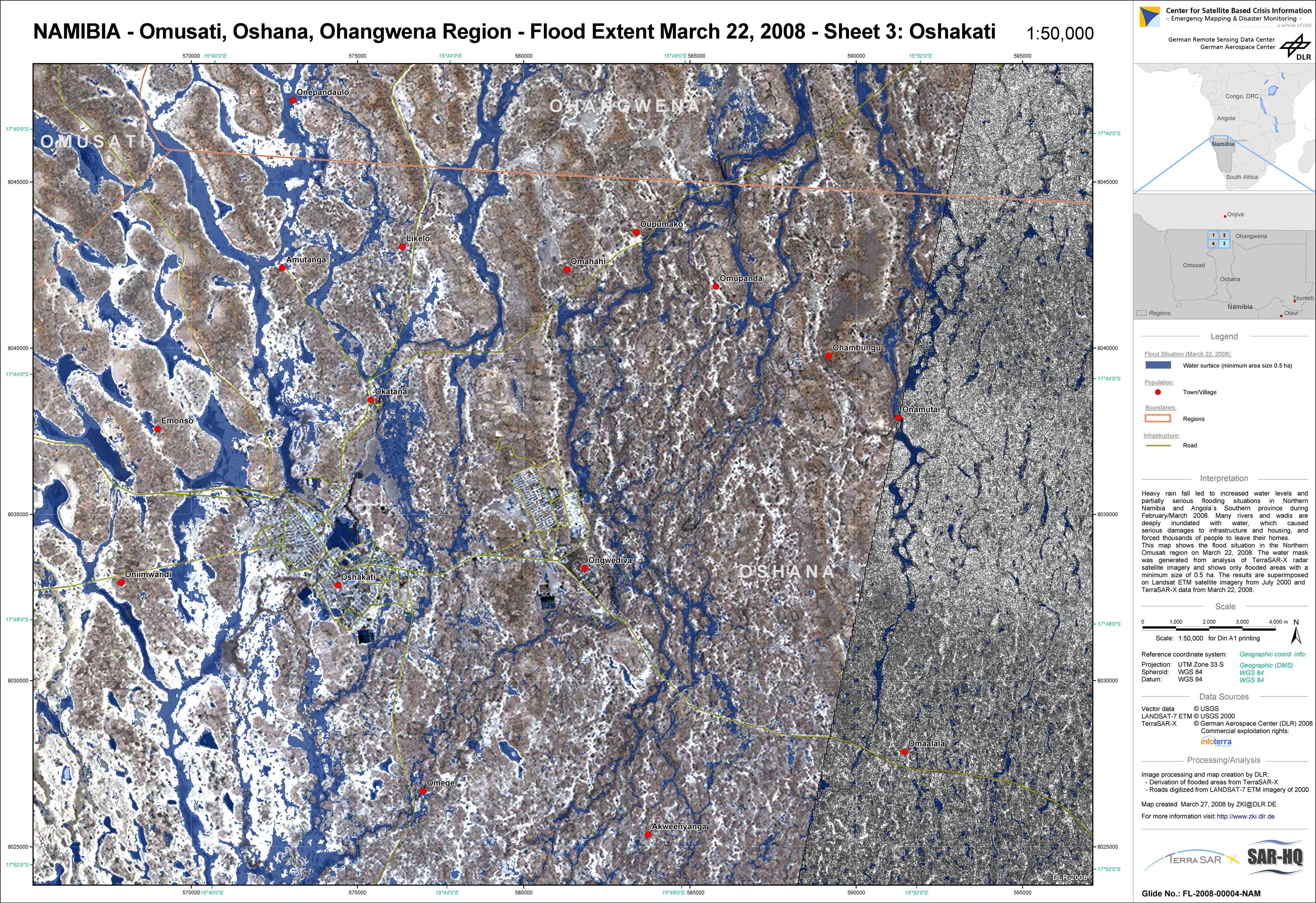
Namibia - P10 - Flood extent as of March 22, 2008 derived from TerraSAR-X data - Omusati, Oshana, Ohangwena region - sheet 3: Oshakati
Creation Date 27. March 2008
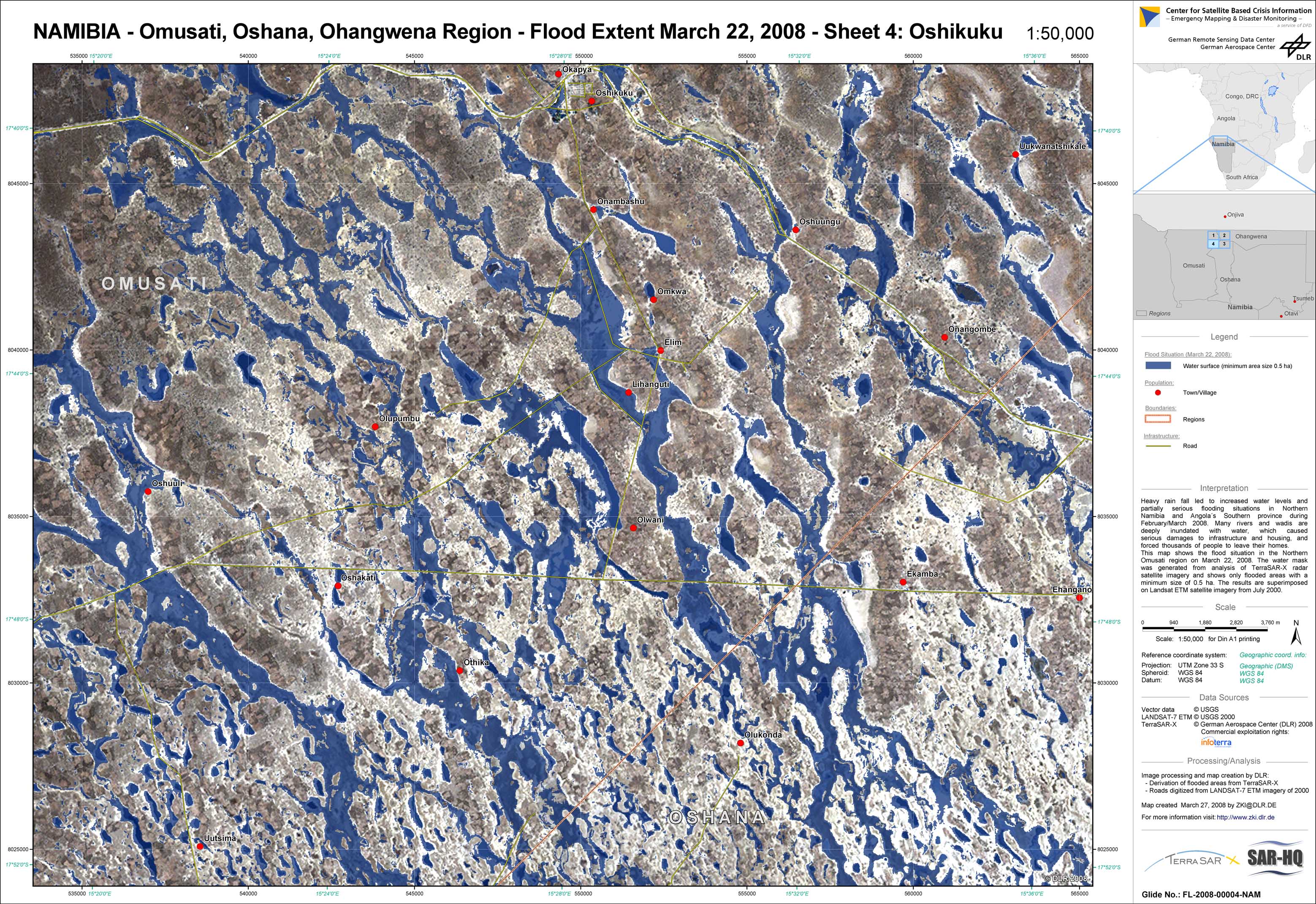
Namibia - P11 - Flood extent as of March 22, 2008 derived from TerraSAR-X data - Omusati, Oshana, Ohangwena region - sheet 4: Oshikuku
Creation Date 27. March 2008
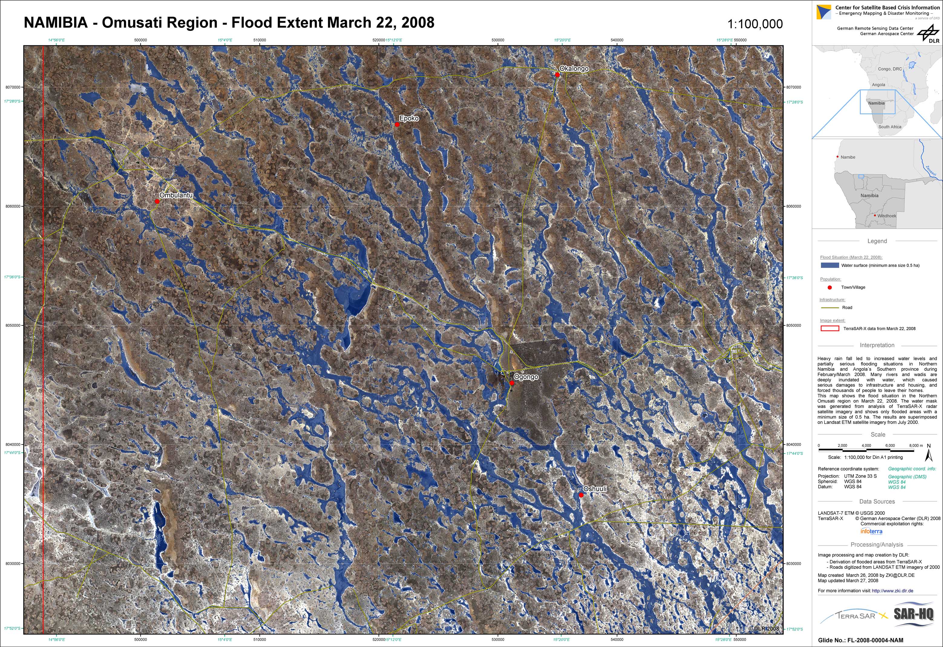
Namibia - P06 - Flood extent as of March 22, 2008 derived from TerraSAR-X data - Omusati region
Creation Date 26. March 2008
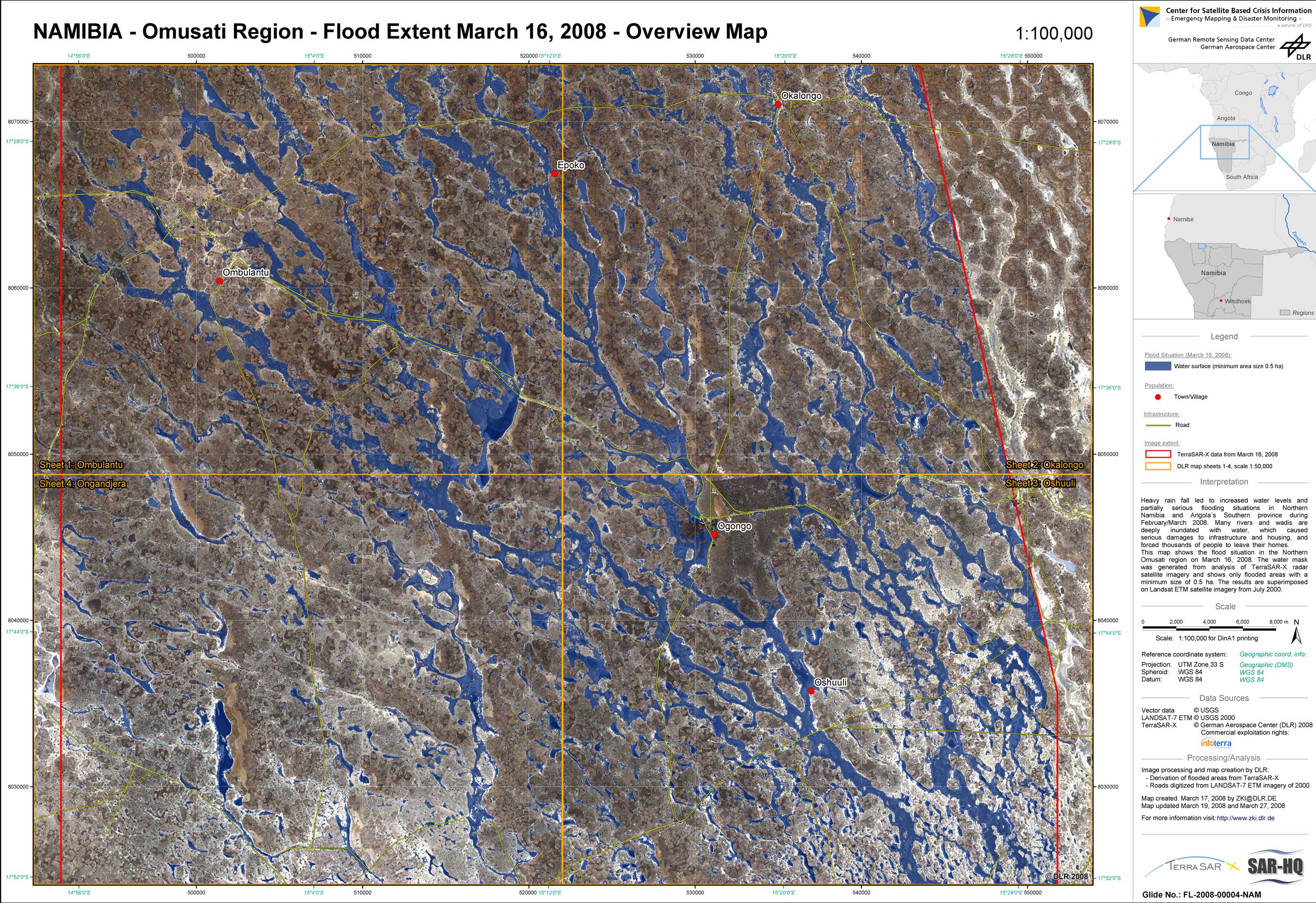
Namibia - P01 - Map sheet overview for March 16, 2008, Omusati region
Creation Date 19. March 2008
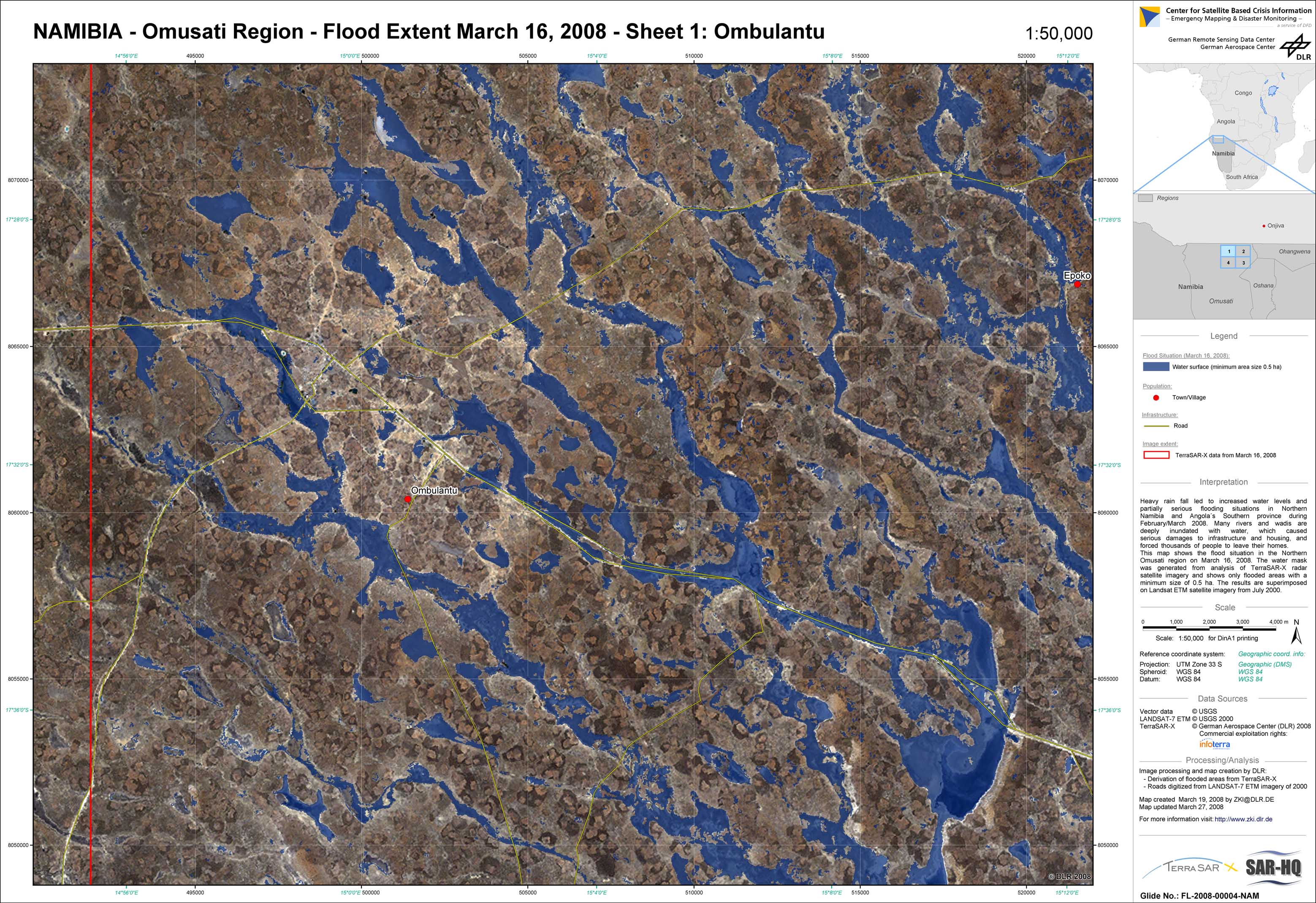
Namibia - P02 - Flood extent as of March 16, 2008 derived from TerraSAR-X data - Omusati region - sheet 1: Ombulantu
Creation Date 19. March 2008

Namibia - P03 - Flood extent as of March 16, 2008 derived from TerraSAR-X data - Omusati region - sheet 2: Okalongo
Creation Date 19. March 2008
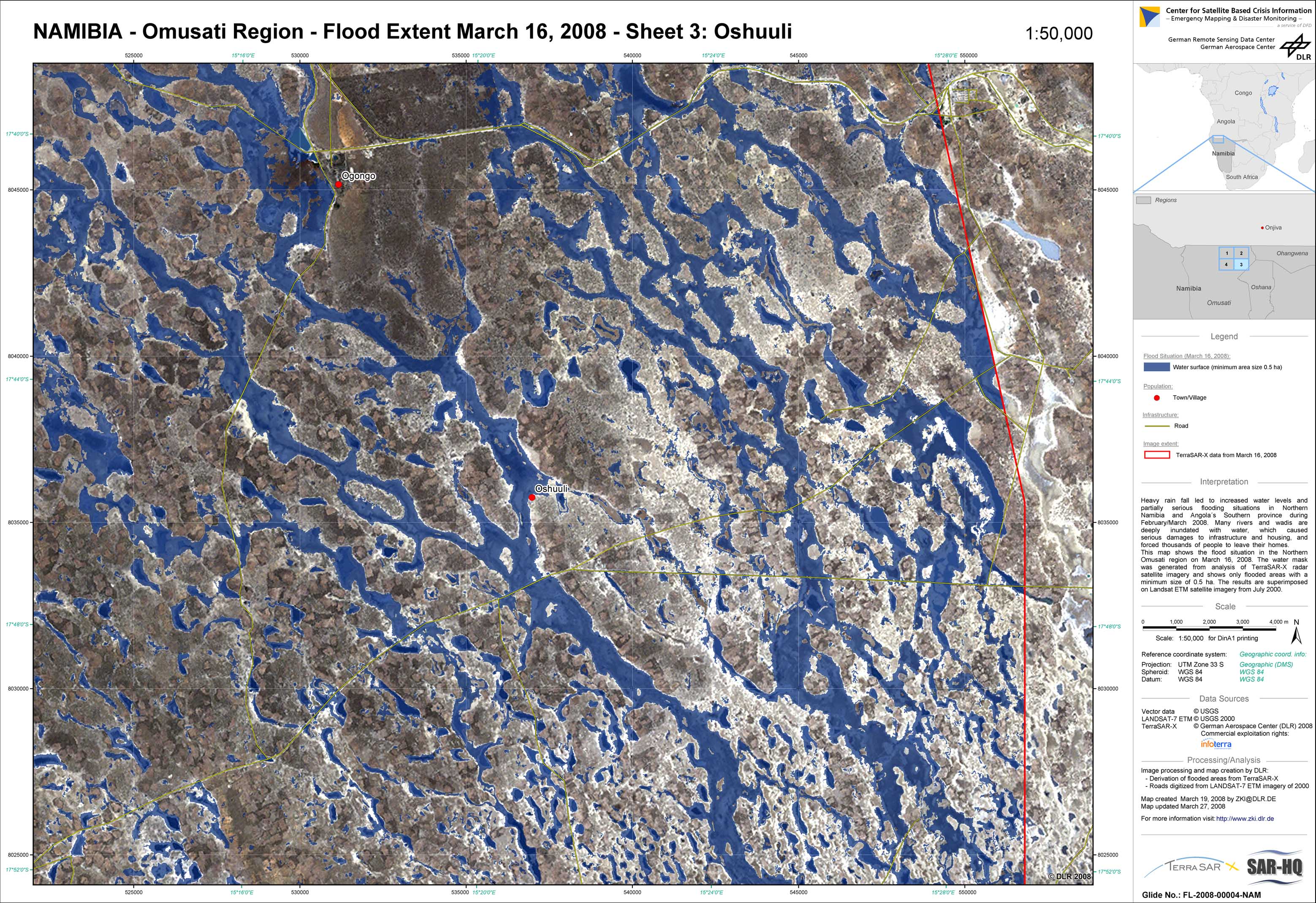
Namibia - P04 - Flood extent as of March 16, 2008 derived from TerraSAR-X data - Omusati region - sheet 3: Oshuuli
Creation Date 19. March 2008
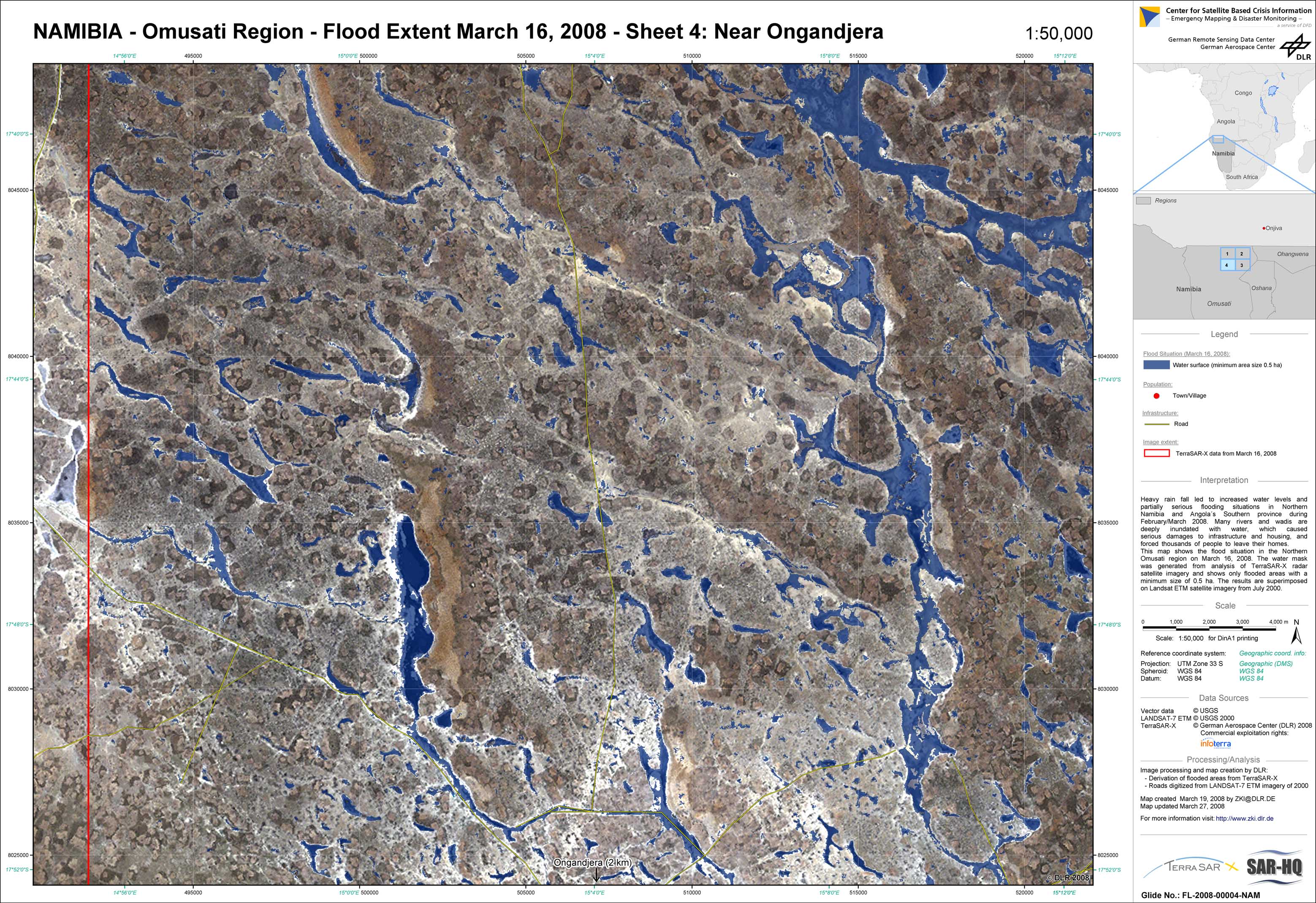
Namibia - P05 - Flood extent as of March 16, 2008 derived from TerraSAR-X data - Omusati region - sheet 4: Ongandjera
Creation Date 19. March 2008