
Tropical Cyclone Nargis: ZKI maps flooding in Myanmar
undefined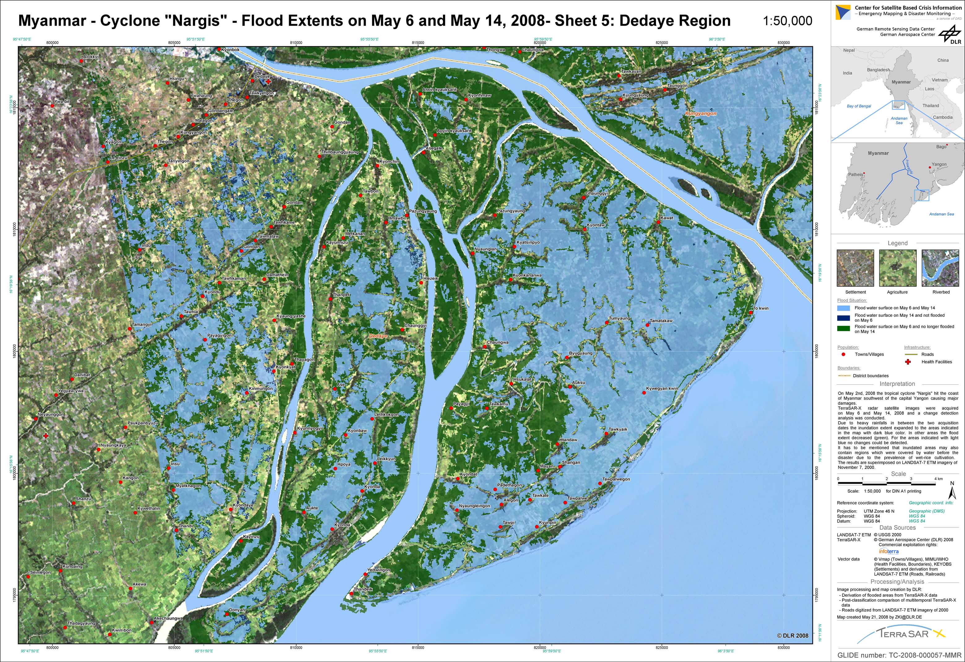
Myanmar - P17 - Flood Extents as of May 6 and May 14, 2008 - Sheet 5: Dedaye region
Creation Date 21. May 2008
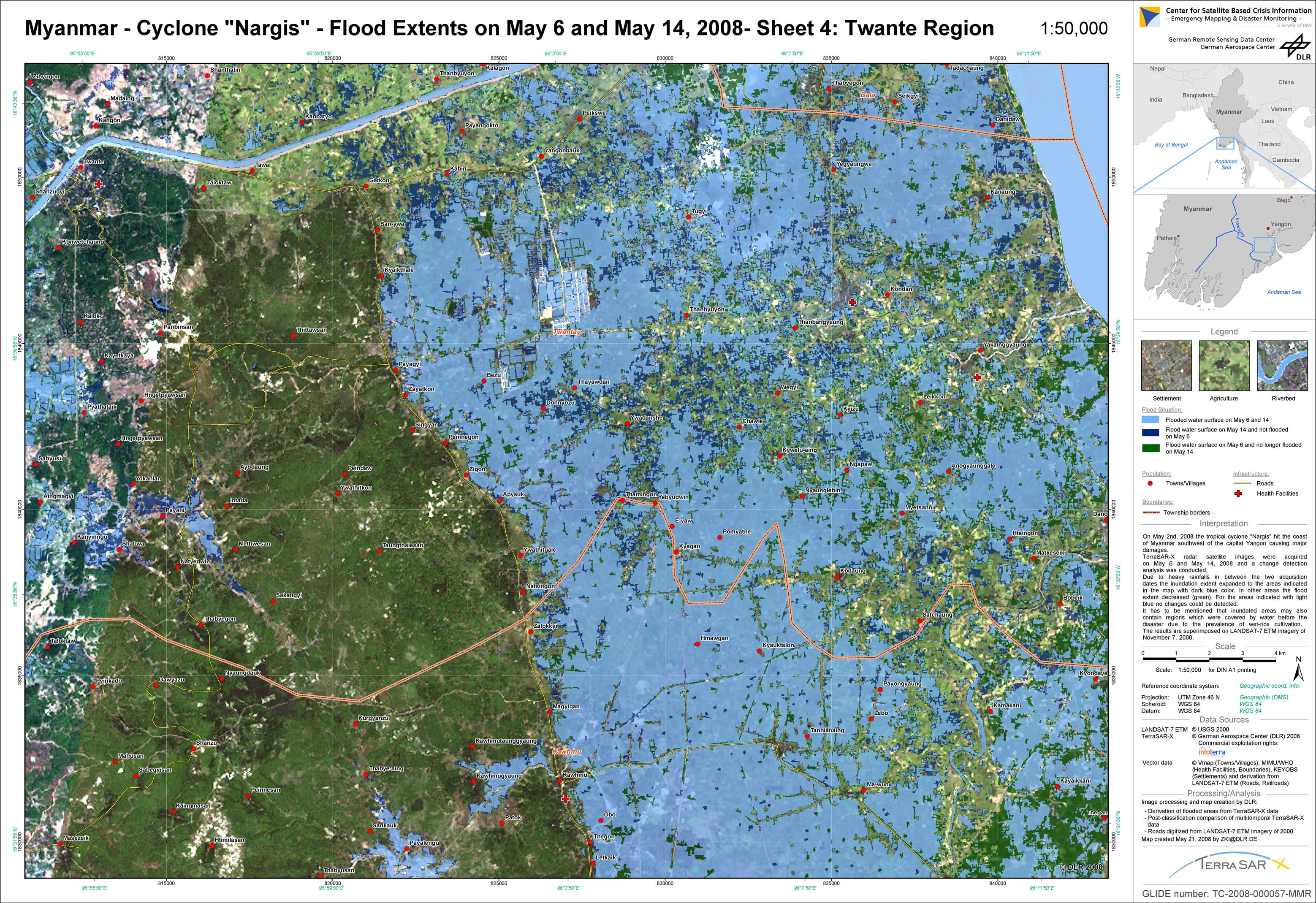
Myanmar - P16 - Flood Extents as of May 6 and May 14, 2008 - Sheet 4: Twante region
Creation Date 21. May 2008
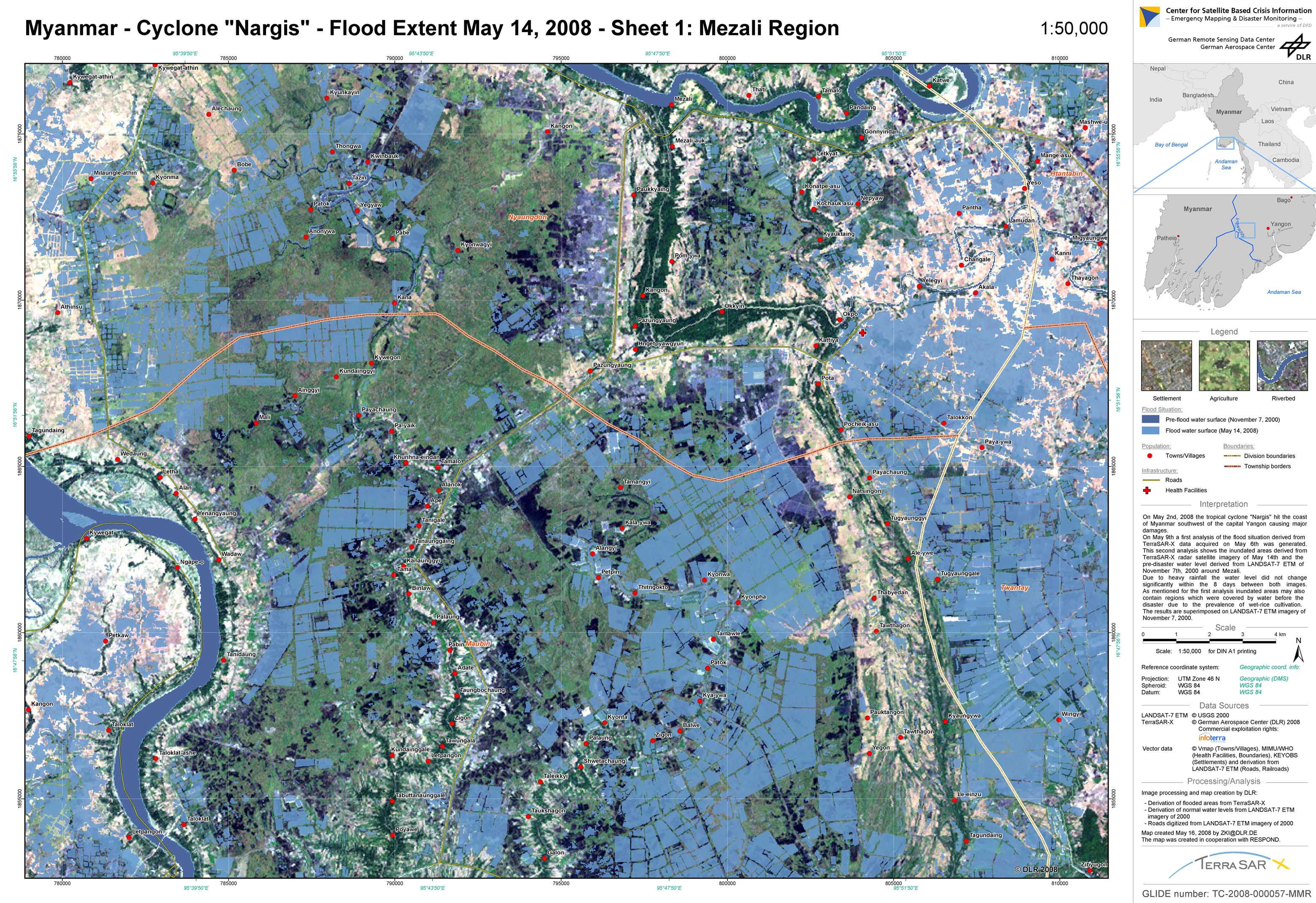
Myanmar - P10 - Flood extent as of May 14, 2008 derived from TerraSAR-X data - Map 1: Mezali region
Creation Date 16. May 2008
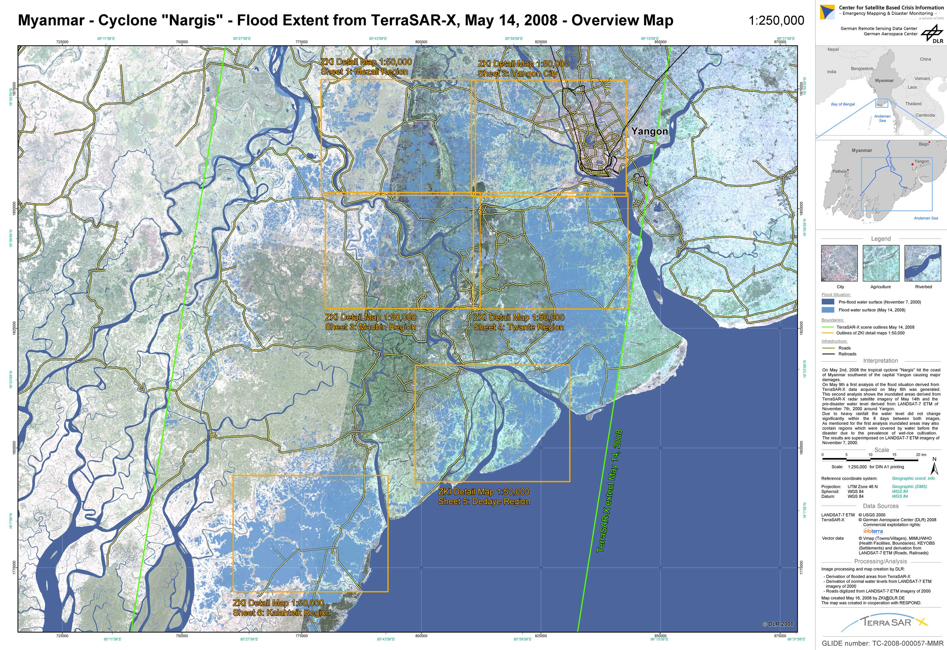
Myanmar - P09 - Flood extent derived from TerraSAR-X data of May 14, 2008 - Overview Map
Creation Date 16. May 2008
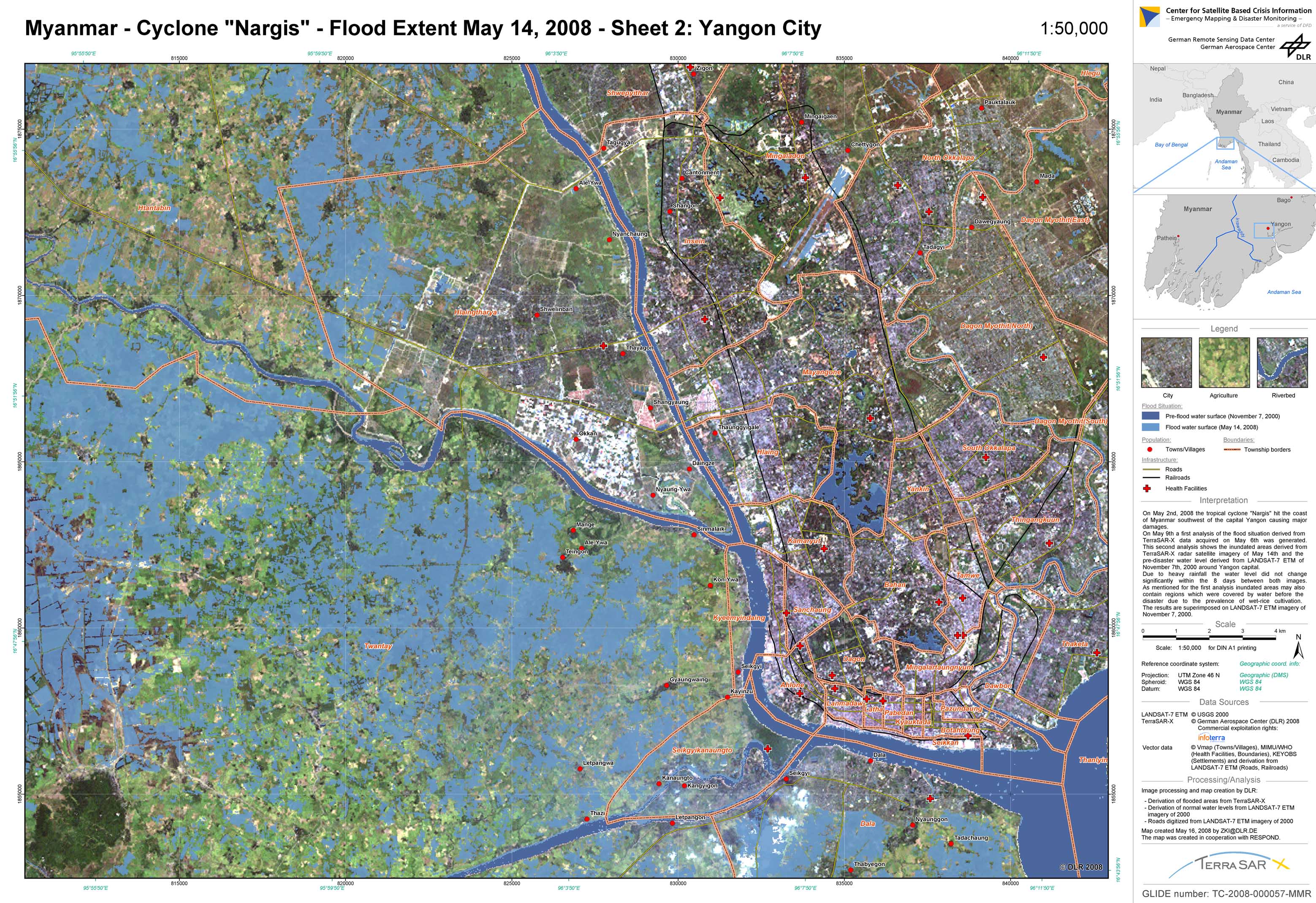
Myanmar - P11 - Flood extent as of May 14, 2008 derived from TerraSAR-X data - Map 2: Yangon region
Creation Date 16. May 2008
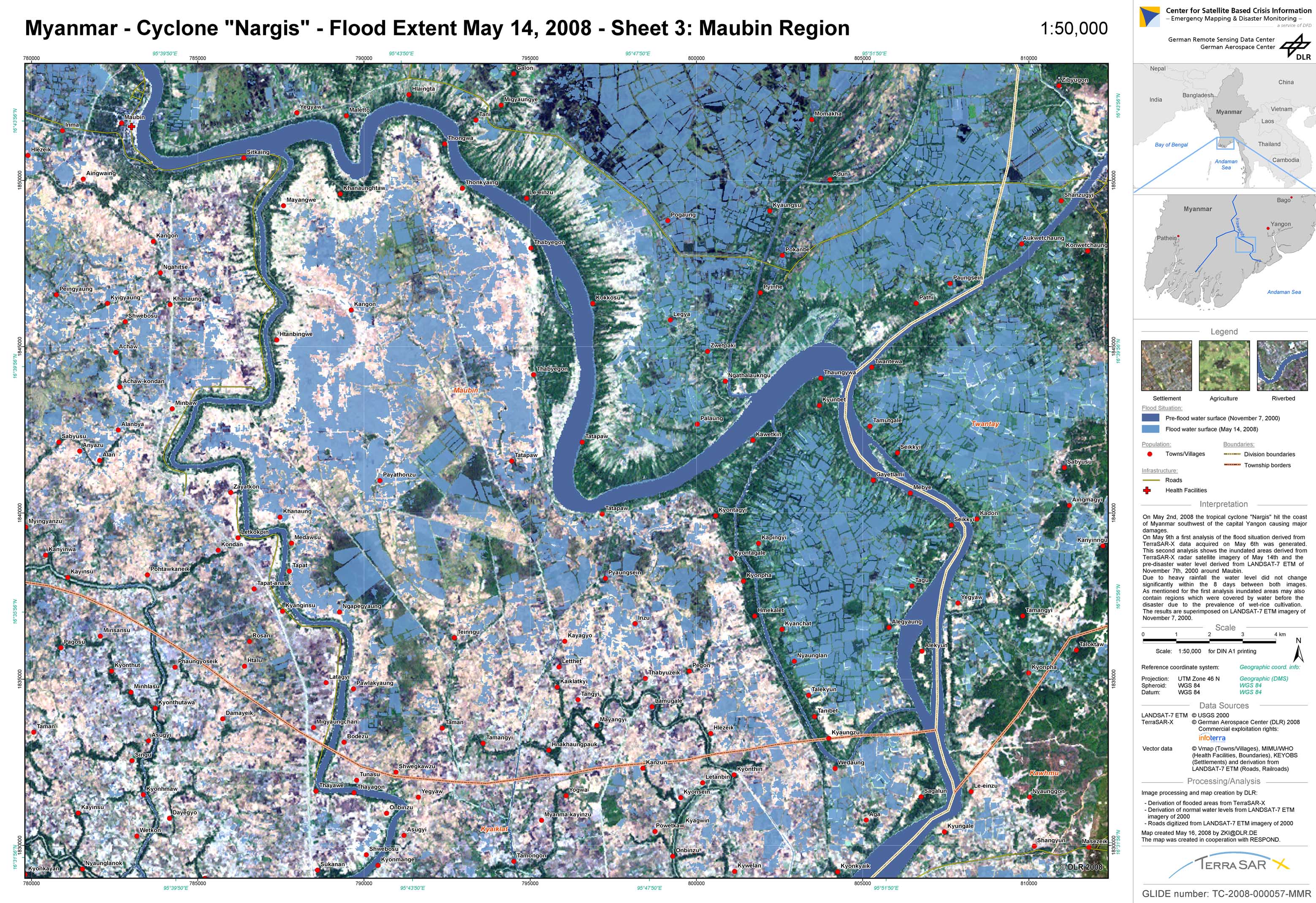
Myanmar - P12 - Flood extent as of May 14, 2008 derived from TerraSAR-X data - Map 3: Maubin region
Creation Date 16. May 2008
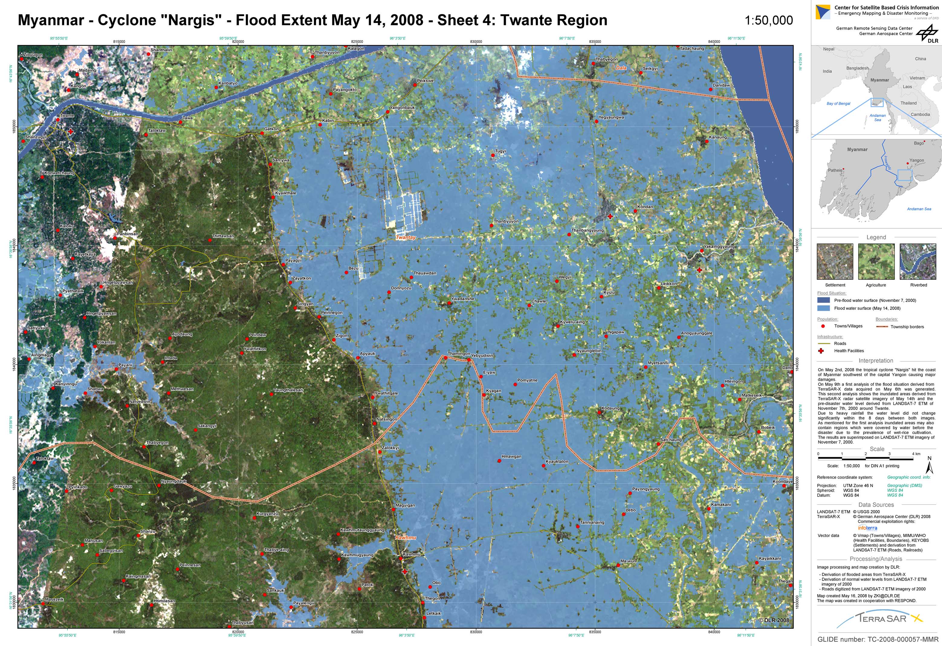
Myanmar - P13 - Flood extent as of May 14, 2008 derived from TerraSAR-X data - Map 4: Twante region
Creation Date 16. May 2008
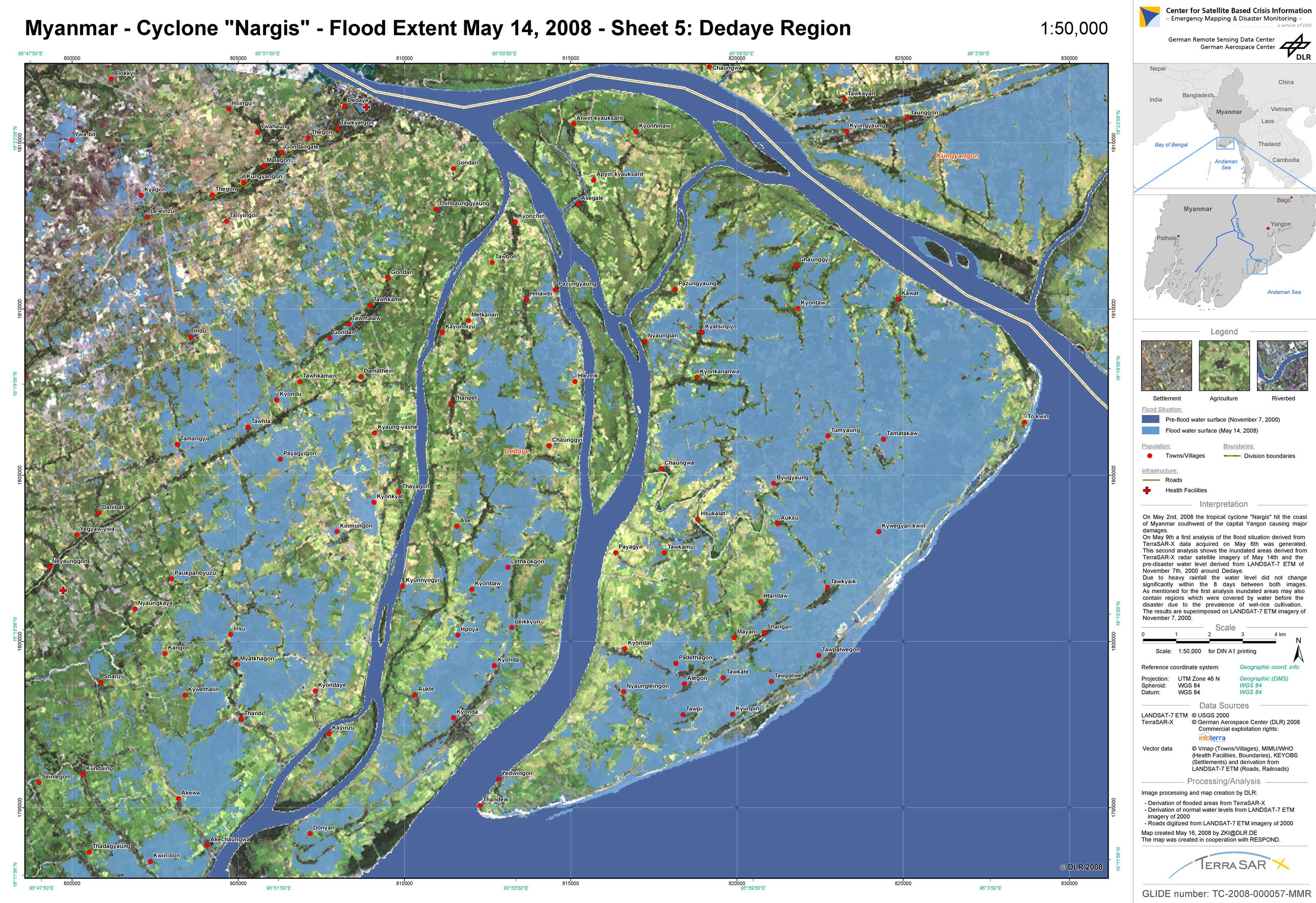
Myanmar - P14 - Flood extent as of May 14, 2008 derived from TerraSAR-X data - Map 5: Dedaye region
Creation Date 16. May 2008
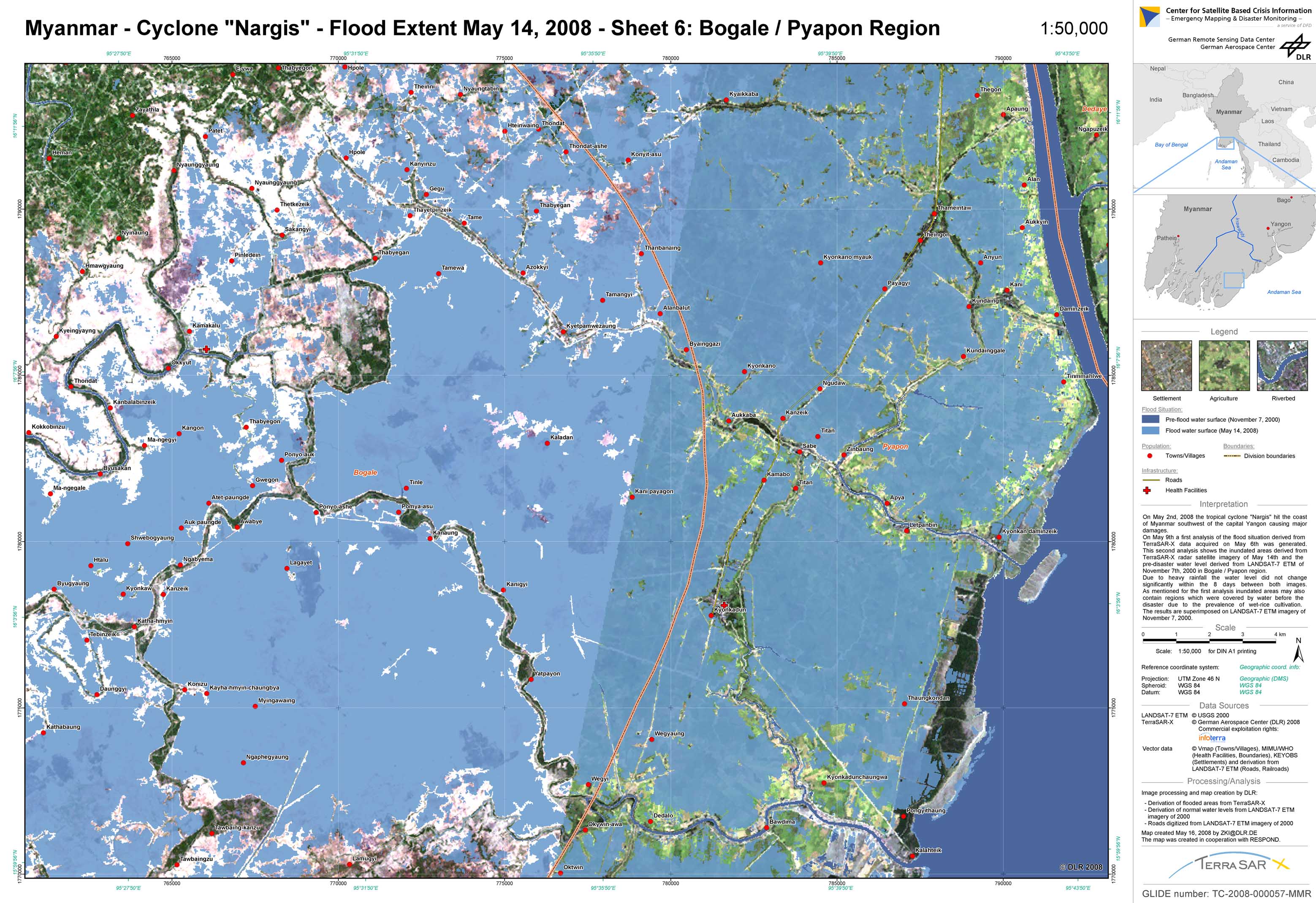
Myanmar - P15 - Flood extent as of May 14, 2008 derived from TerraSAR-X data - Map 6: Bogale / Pyapon region
Creation Date 16. May 2008
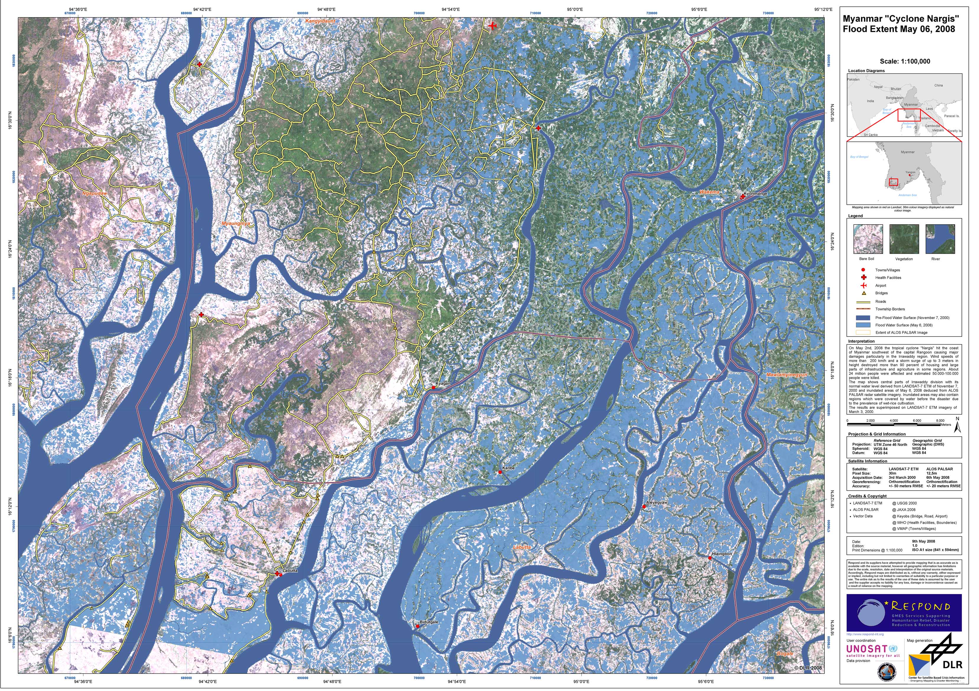
Myanmar - P01 - Flood extent as of May 6, 2008 derived from ALOS/PALSAR data - Irrawaddy division
Creation Date 10. May 2008
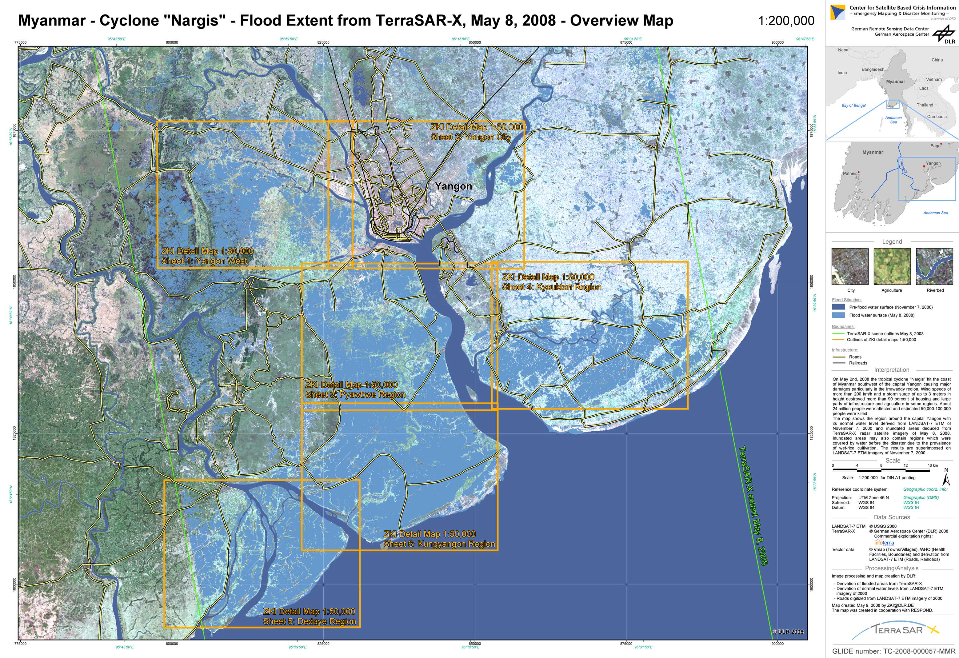
Myanmar - P02 - Flood extent as of May 8, 2008 derived from TerraSAR-X data - Overview Map
Creation Date 10. May 2008
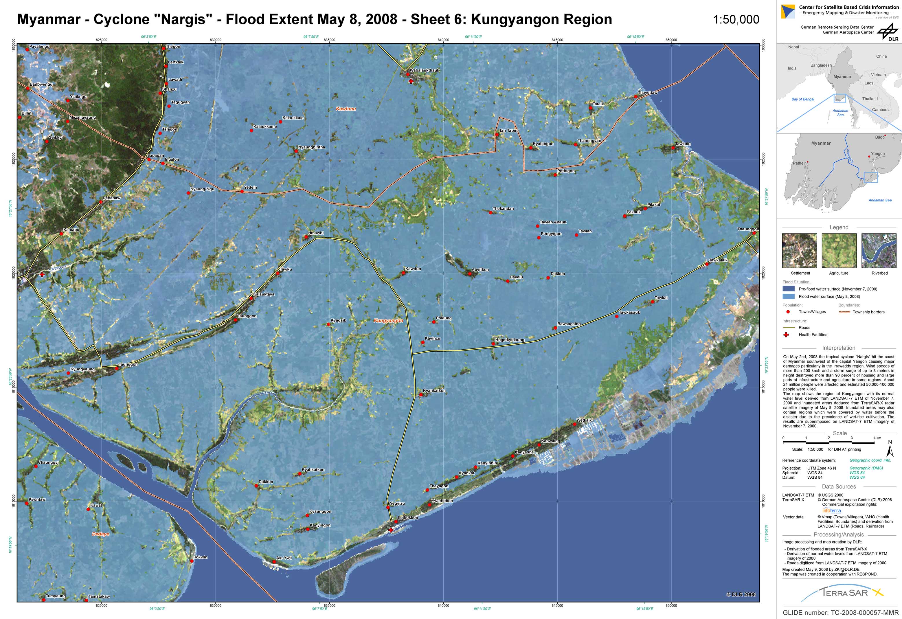
Myanmar - P08 - Flood extent as of May 8, 2008 derived from TerraSAR-X data - Map 6: Kungyangon region
Creation Date 09. May 2008
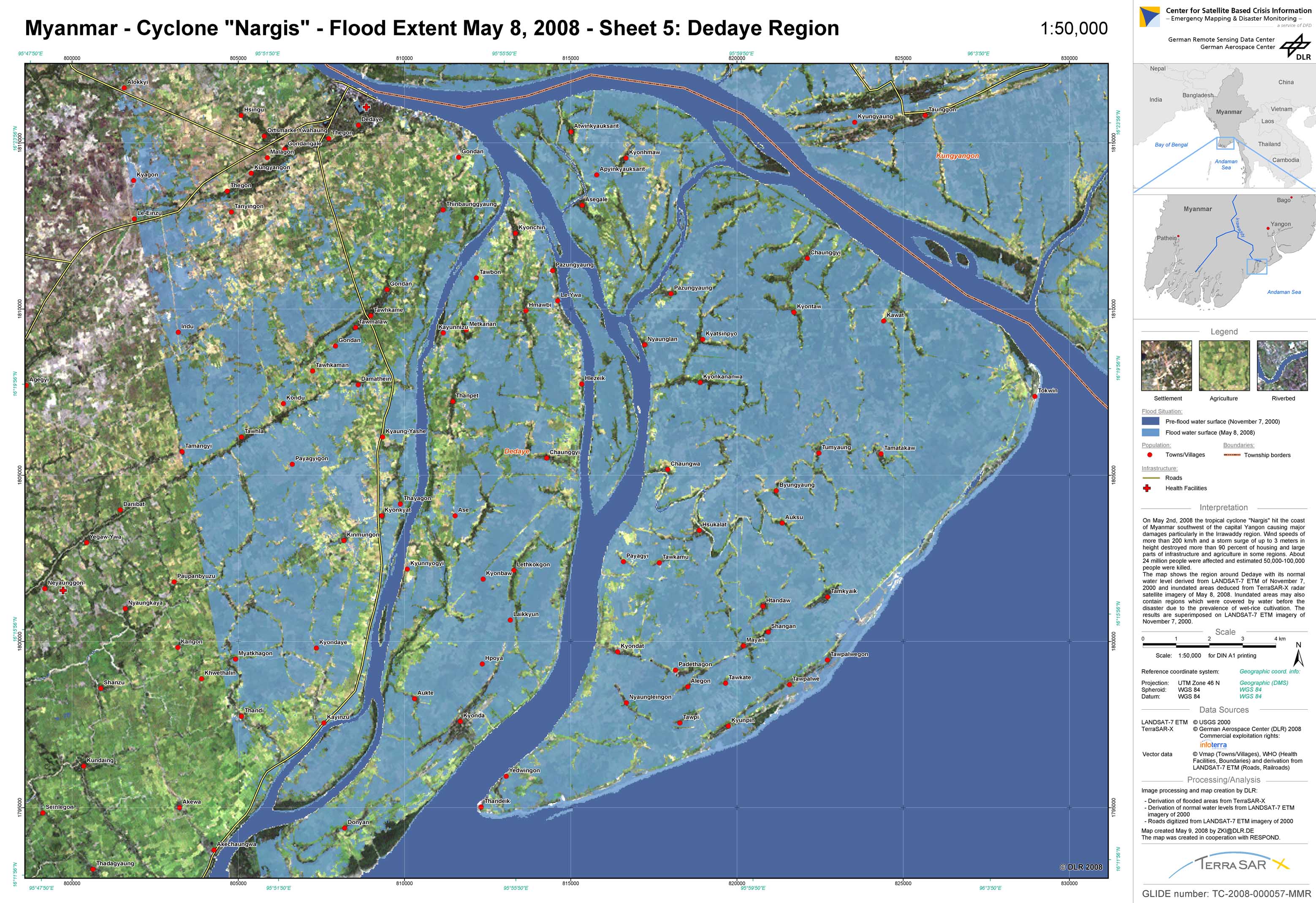
Myanmar - P07 - Flood extent as of May 8, 2008 derived from TerraSAR-X data - Map 5: Dedaye region
Creation Date 09. May 2008
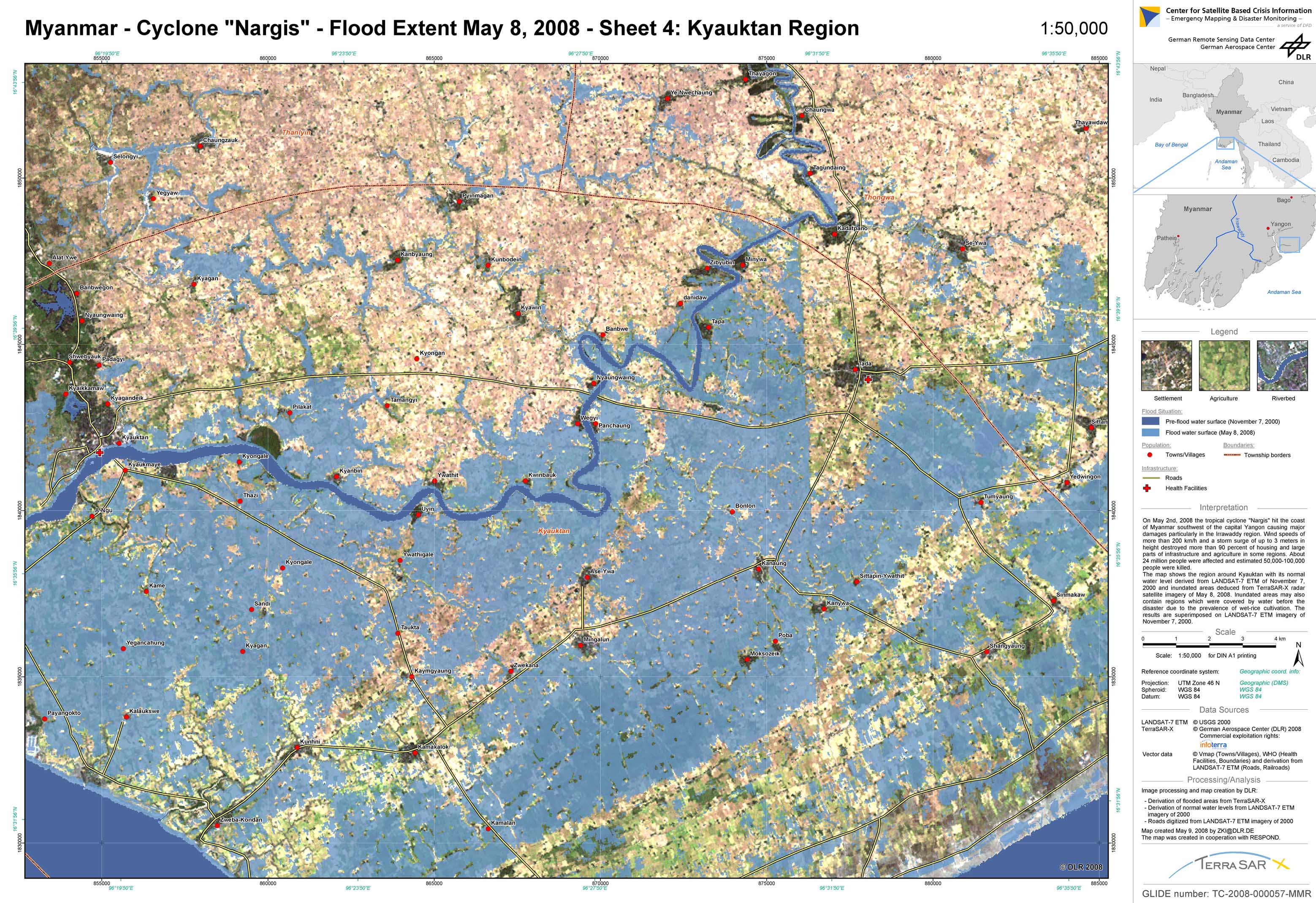
Myanmar - P06 - Flood extent as of May 8, 2008 derived from TerraSAR-X data - Map 4: Kyauktan region
Creation Date 09. May 2008
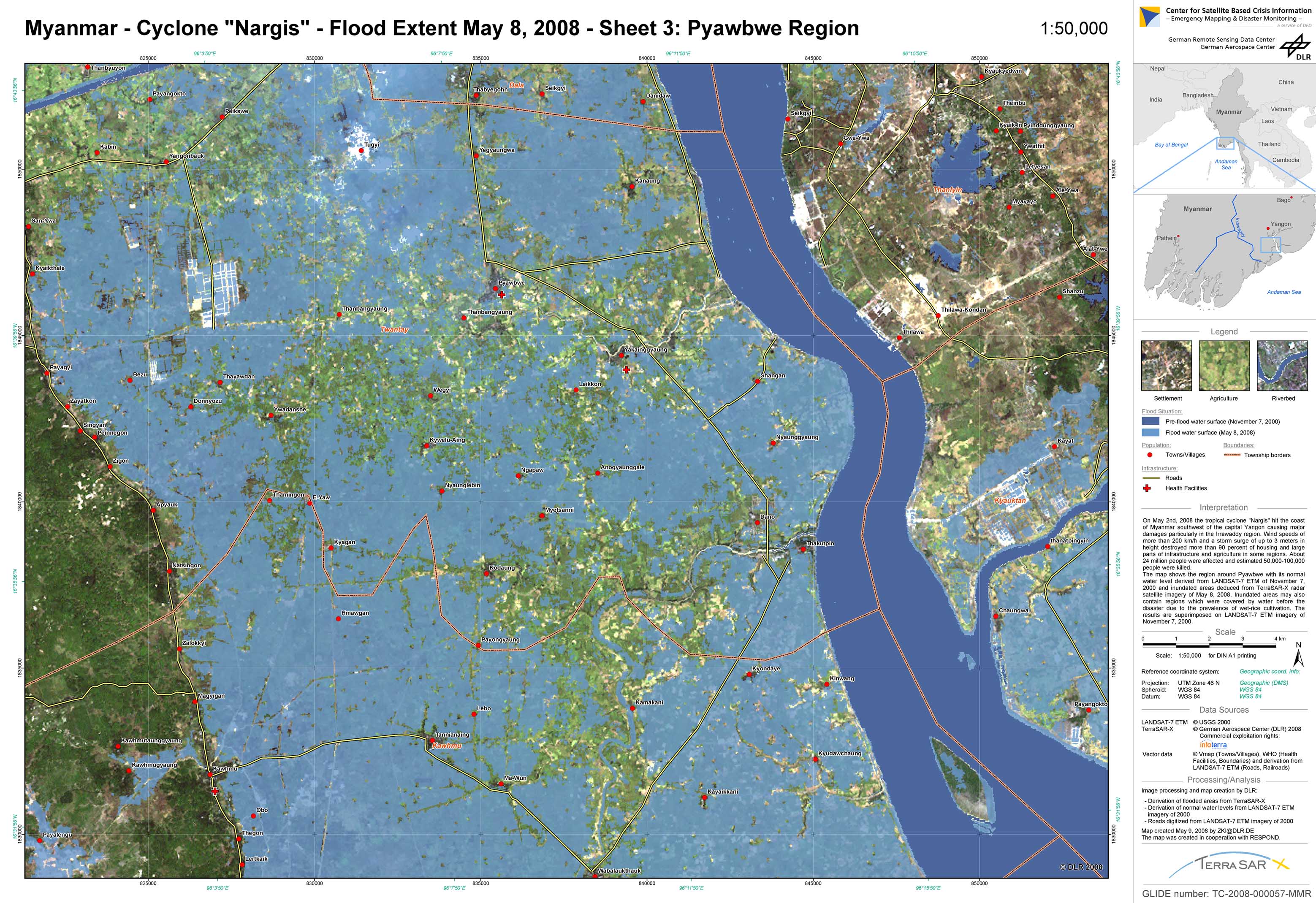
Myanmar - P05 - Flood extent as of May 8, 2008 derived from TerraSAR-X data - Map 3: Pyawbwe region
Creation Date 09. May 2008
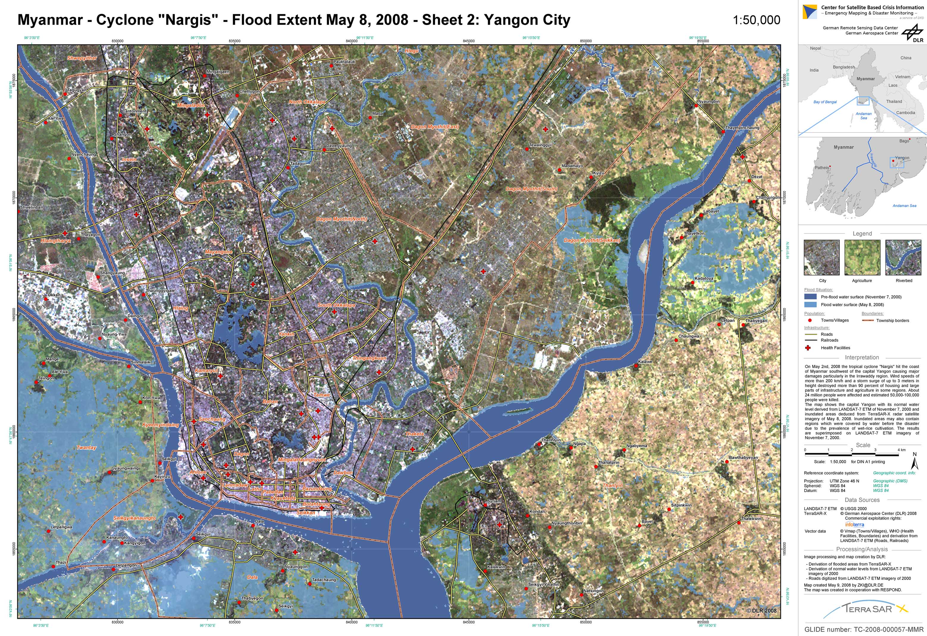
Myanmar - P04 - Flood extent as of May 8, 2008 derived from TerraSAR-X data - Map 2: Yangon (Rangun) city
Creation Date 09. May 2008
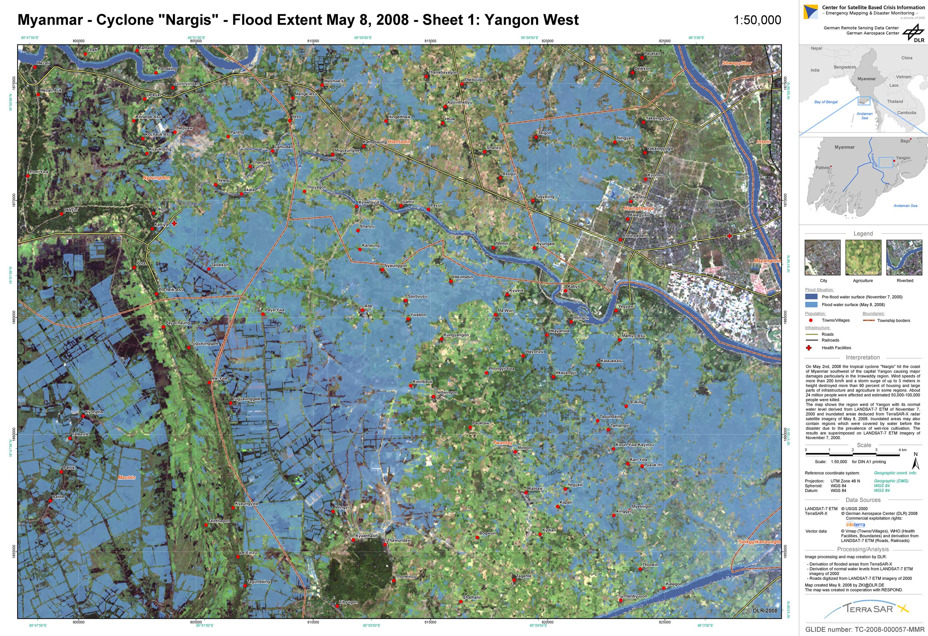
Myanmar - P03 - Flood extent as of May 8, 2008 derived from TerraSAR-X data - Map 1: Western Yangon (Rangun)
Creation Date 09. May 2008