Earthquake in China
undefined
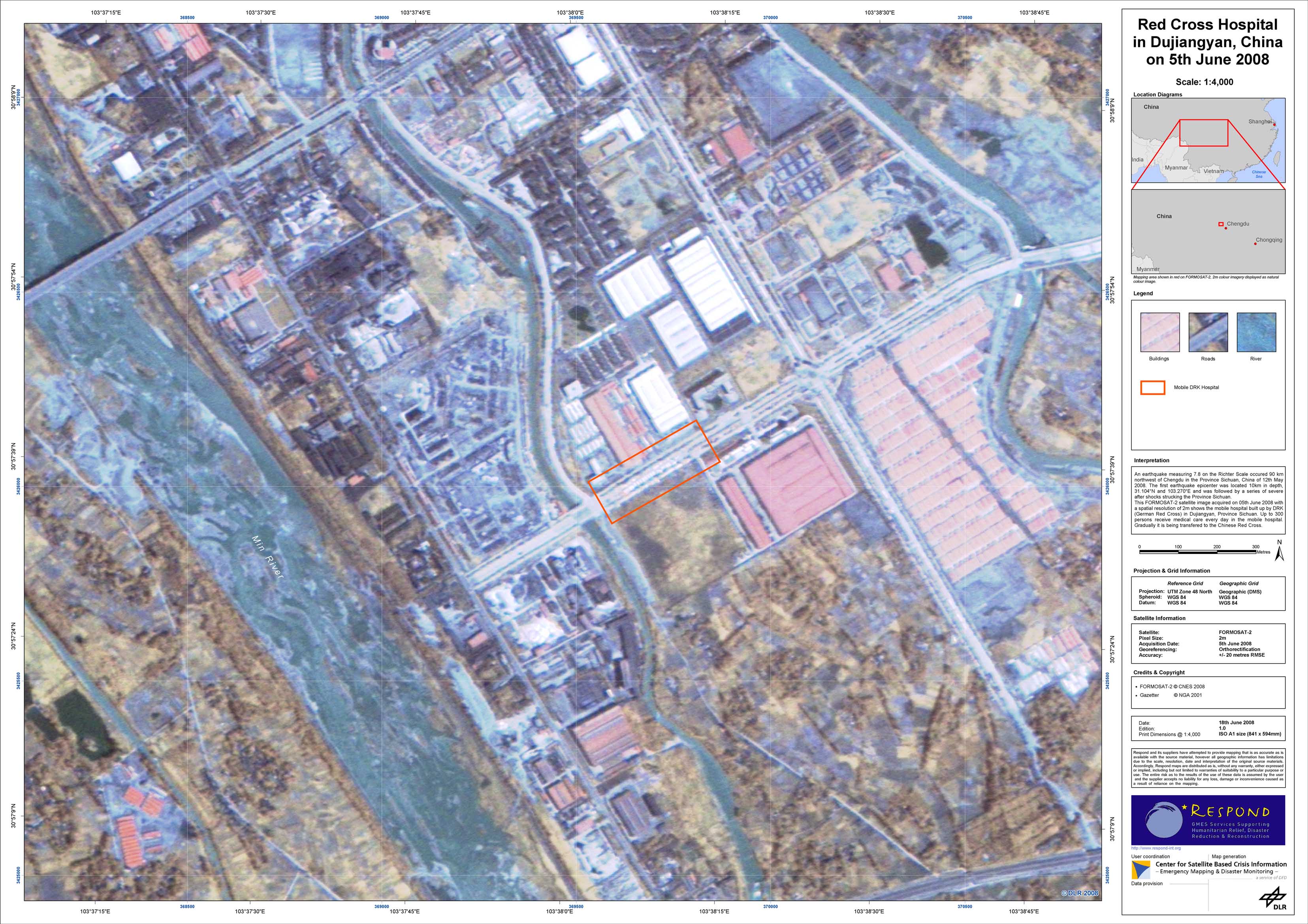
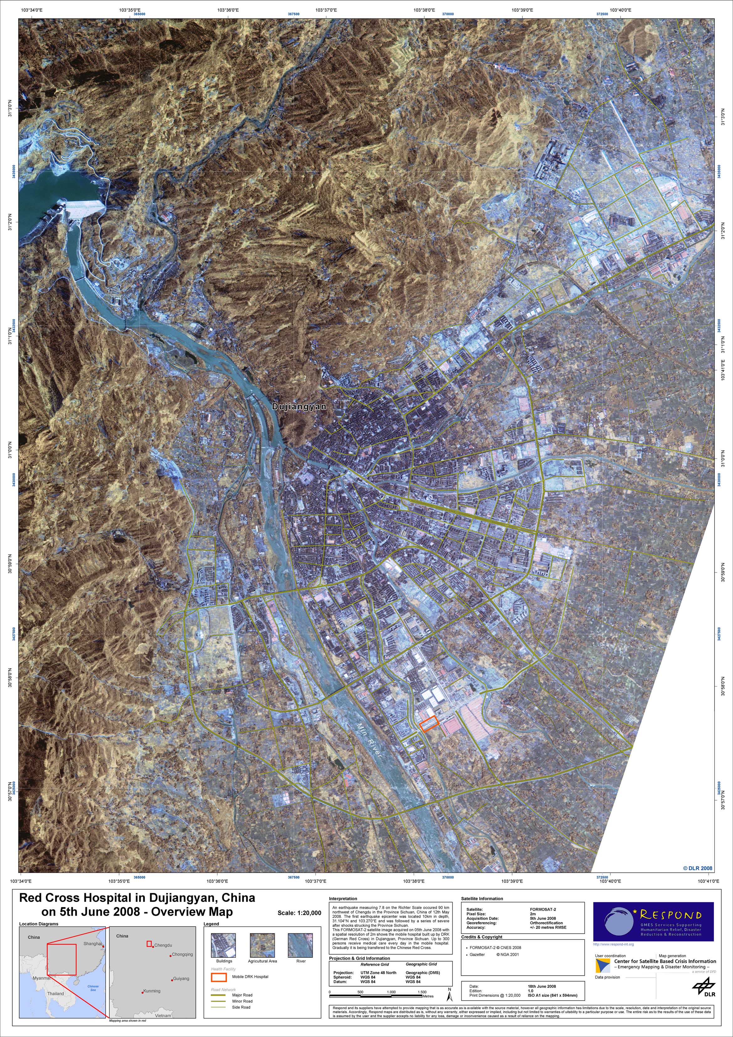
On May 12, 2008, the strongest earthquake in China since 1976 occurred 90 km northwest of Chengdu in the Province of Sichuan. Measuring 7.8 on the Richter scale, the earthquake was followed by a series of severe after-shocks that struck the whole region. Over 69,000 people died, 374,141 people were injured and 17,469 were still missing on June 12, 2008. The tremors destroyed more than 80 percent of the buildings in the vicinity and more than 5 million people lost their homes. The city of Dujiangyan with its 600,000 inhabitants suffered from some of the worst effects of the earthquake. Emergency relief teams, army troops and various organisations were immediately sent to the affected areas. National relief teams mainly organised the relief actions supported by international emergency aid from different sides. On May 26, 2008, the DRK built up a mobile hospital with 120 beds, an operation room, a laboratory and a maternity ward. Since then over 12,000 persons received medical care, which is up to 300 persons every day. Gradually, it has been transferred to the Chinese Red Cross and was officially handed over on June 15, 2008. The German Red Cross (DRK), one of the German users of Respond, asked for maps of Dujiangyan showing the DRK mobile hospital. After the enquiry of the Disaster Response Unit of the German Red Cross Head Quarters, a high resolution FORMOSAT-2 satellite image was ordered and pre-processed by DLR. The satellite image was acquired on June 05, 2008, with a spatial resolution of 2m. It was used to create two different maps: an overview map and a detail map showing the Red Cross mobile hospital.
China - Dujiangyan - P02 - Detail map of location of DRK mobile hospital from FORMOSAT-2 data of June 5, 2008, Dujiangyan, China
Creation Date 20. June 2008
China - Dujiangyan - P01 - Overview map from FORMOSAT-2 data of June 5, 2008, Dujiangyan, China
Creation Date 20. June 2008
undefined