
Embankment breach: ZKI maps flooding in India/Nepal
undefined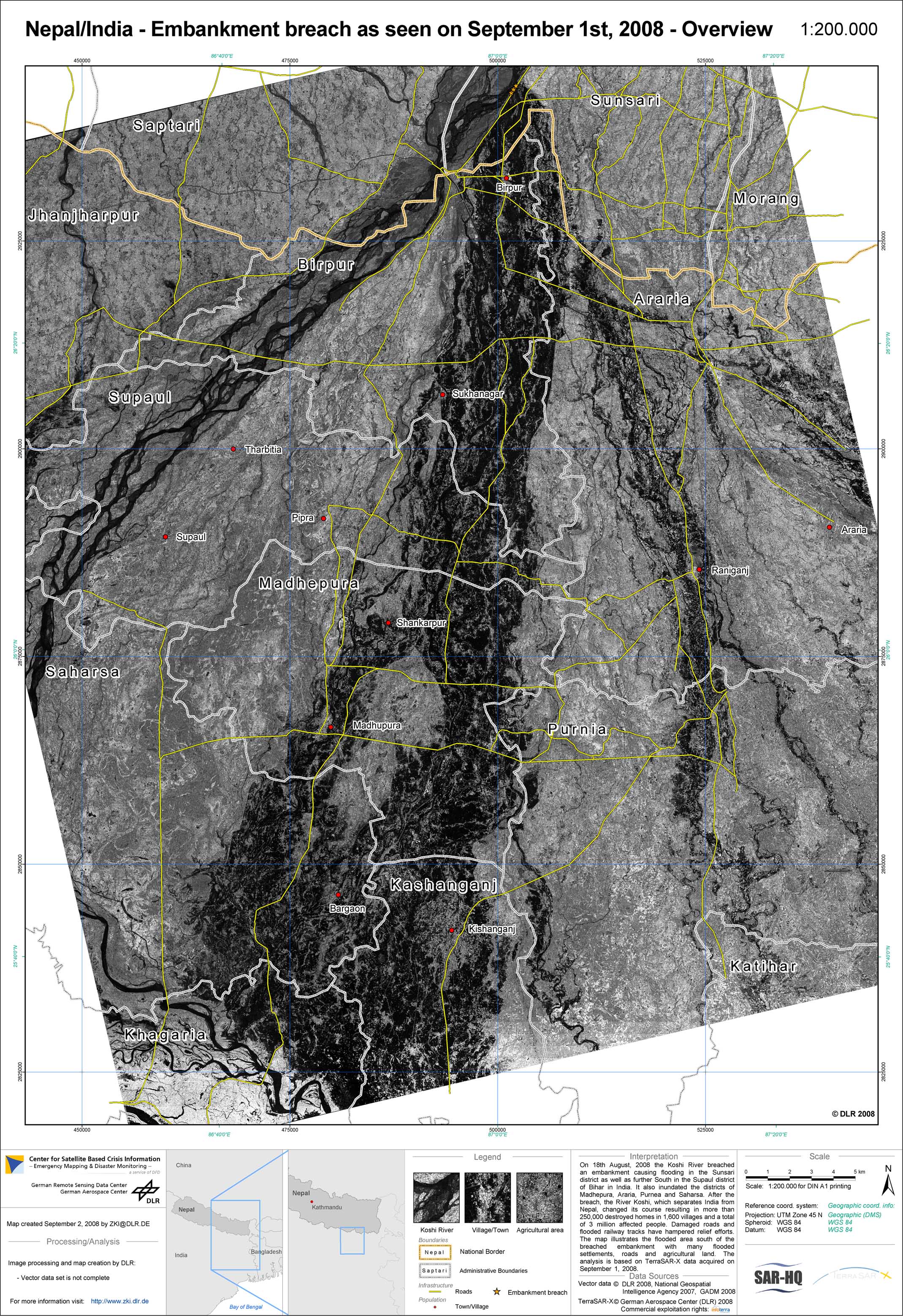
Nepal - P07 - Flood extent as of August 30, 2008 derived from TerraSAR-X data - Overview Map
Creation Date 08. September 2008
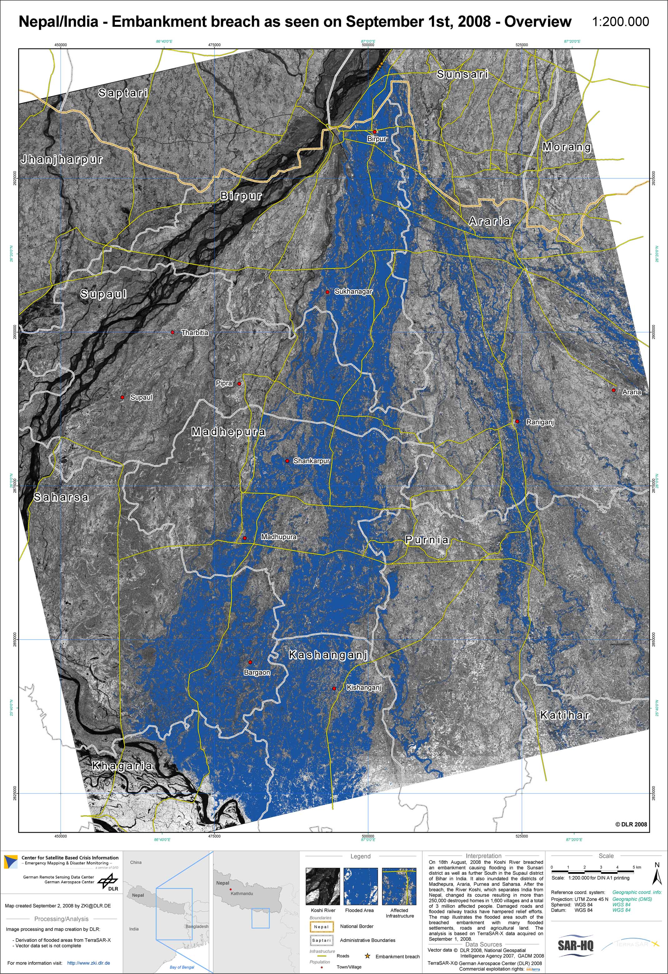
Nepal - P08 - Flood extent as of September 1, 2008 derived from TerraSAR-X data - Overview Map with flood mask
Creation Date 08. September 2008
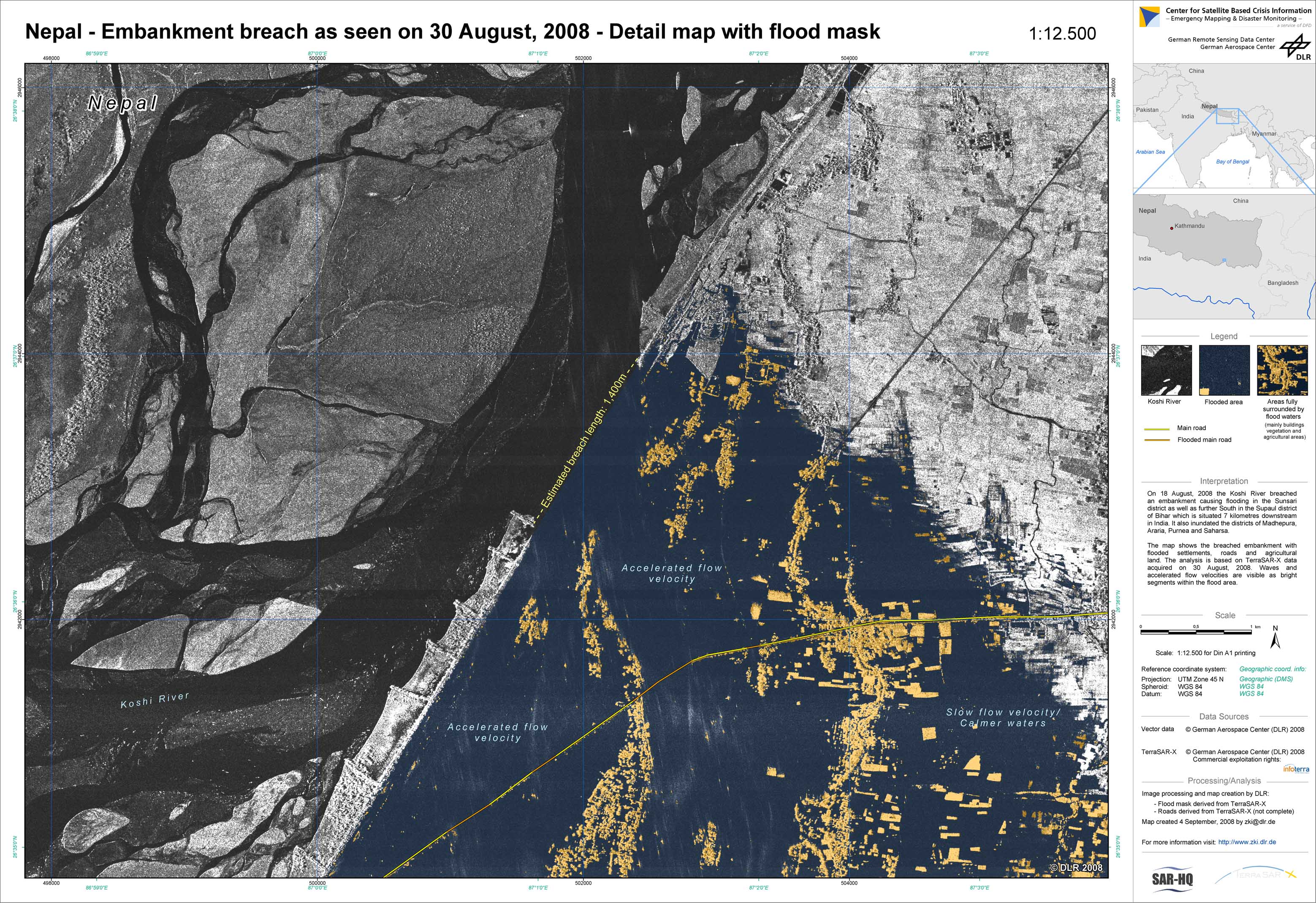
Nepal - P06 - Flood extent as of August 30, 2008 derived from TerraSAR-X data - Detail Map with flood mask
Creation Date 04. September 2008
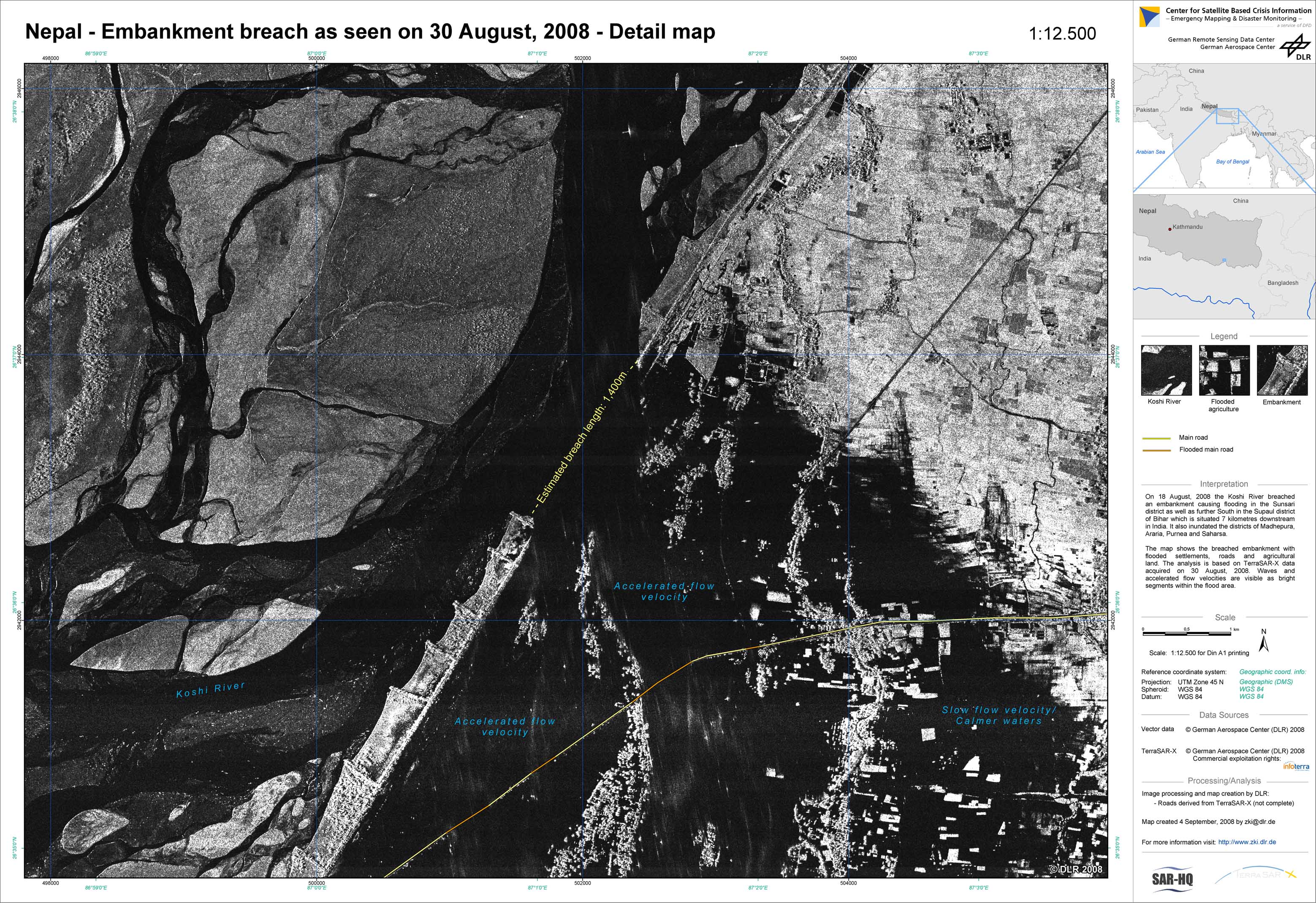
Nepal - P05 - Flood extent as of August 30, 2008 derived from TerraSAR-X data - Detail Map
Creation Date 04. September 2008
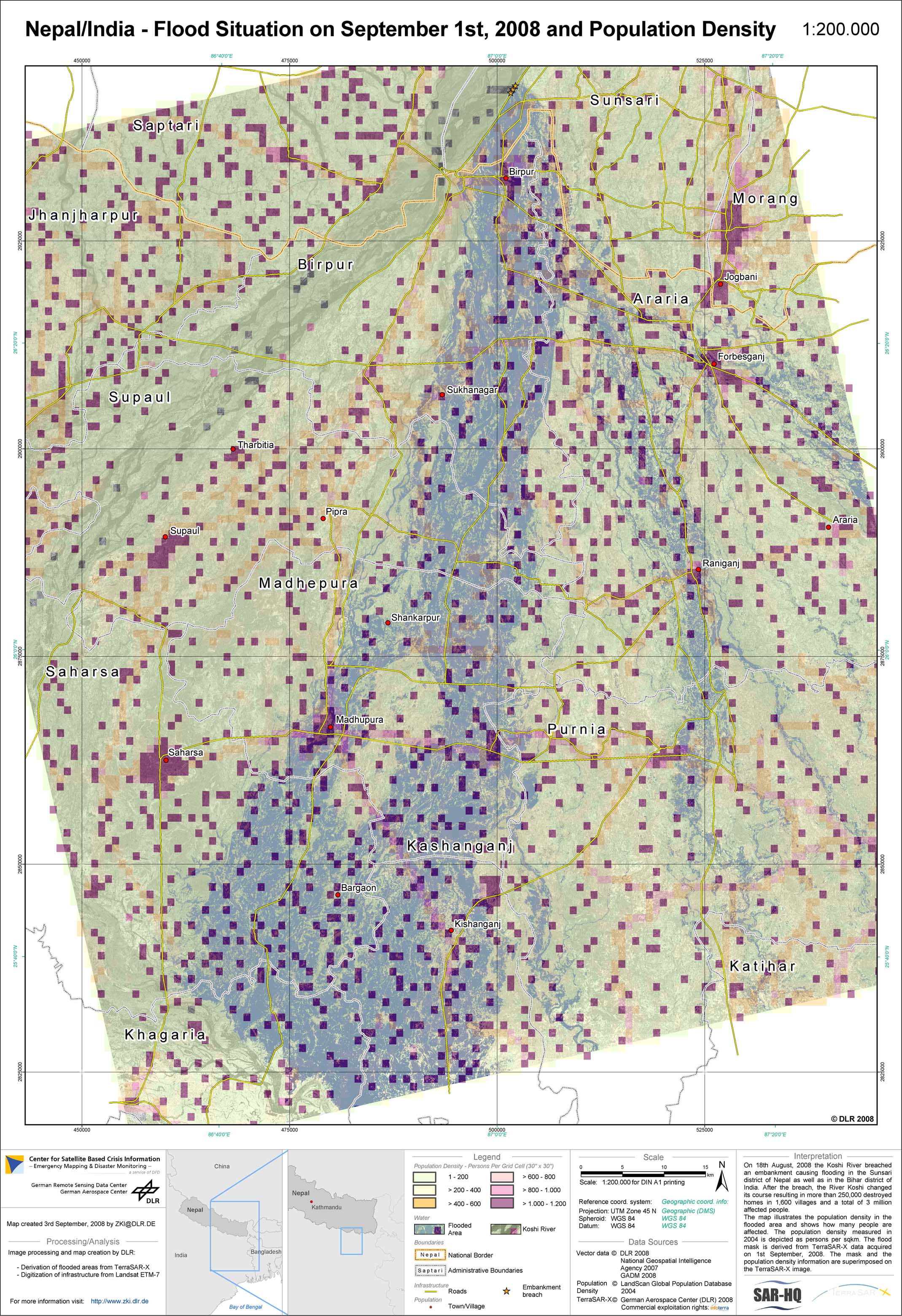
Nepal - P09 - Map of population density in flooded region on September 1, 2008
Creation Date 03. September 2008
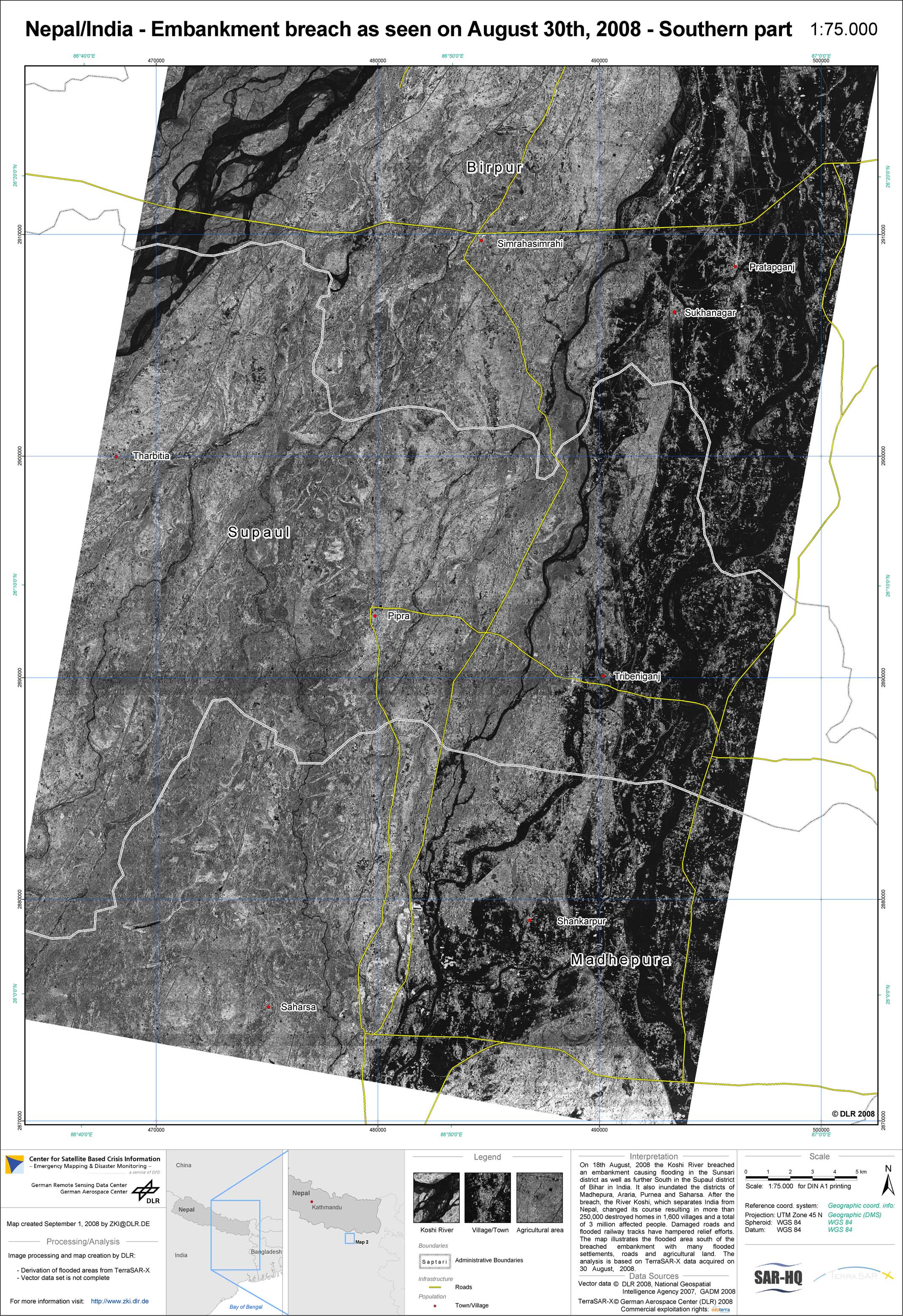
Nepal - P03 - Flood extent as of August 30, 2008 derived from TerraSAR-X data - Map 2: Southern part
Creation Date 02. September 2008
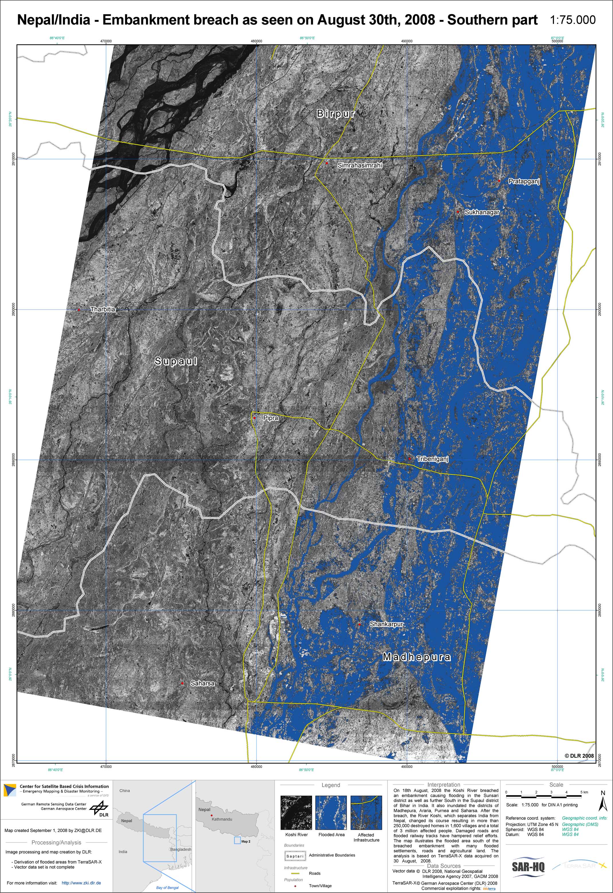
Nepal - P04 - Flood extent as of August 30, 2008 derived from TerraSAR-X data - Map 2: Southern part with flood mask
Creation Date 02. September 2008
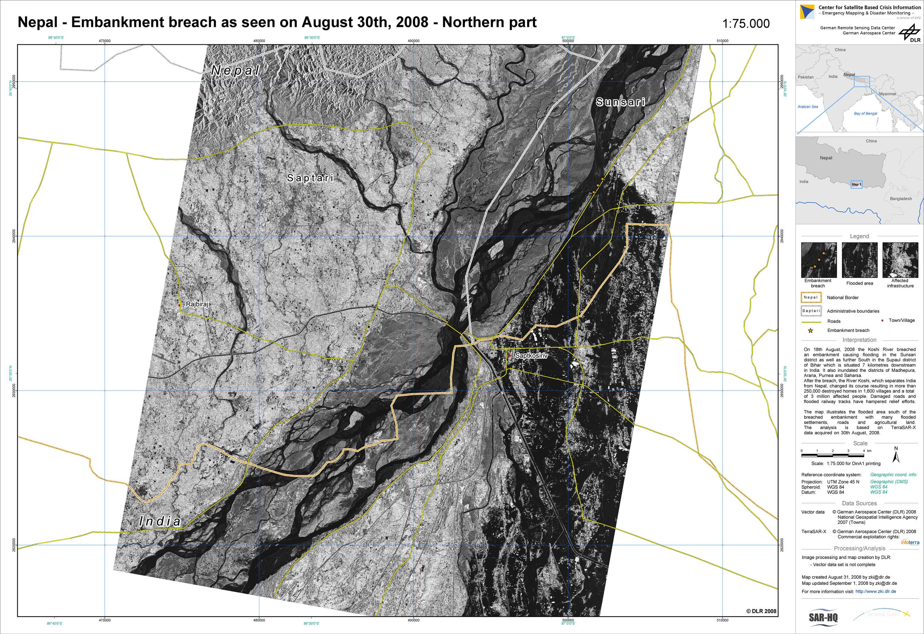
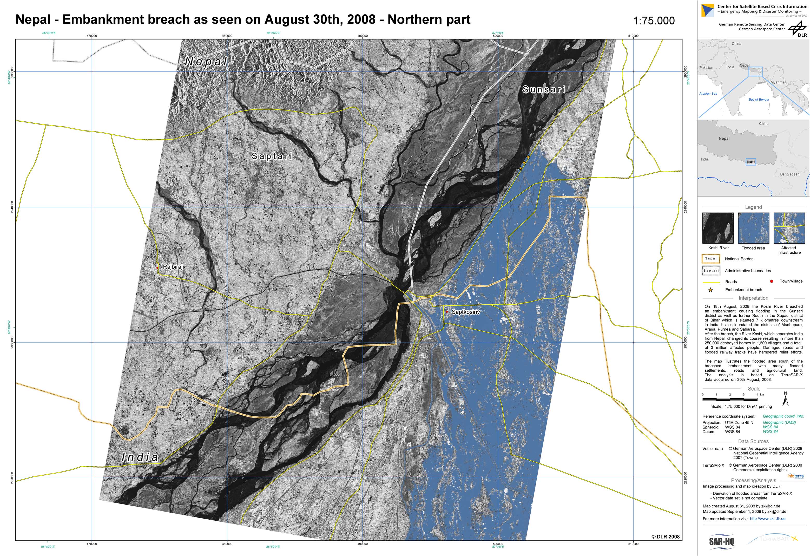
Nepal - P01 - Flood extent as of August 30, 2008 derived from TerraSAR-X data - Map 1: Northern part
Creation Date 01. September 2008
Nepal - P02 - Flood extent as of August 30, 2008 derived from TerraSAR-X data - Map 1: Northern part with flood mask
Creation Date 01. September 2008