
Atlantic tropical cyclones: ZKI maps flooding in Haiti
undefined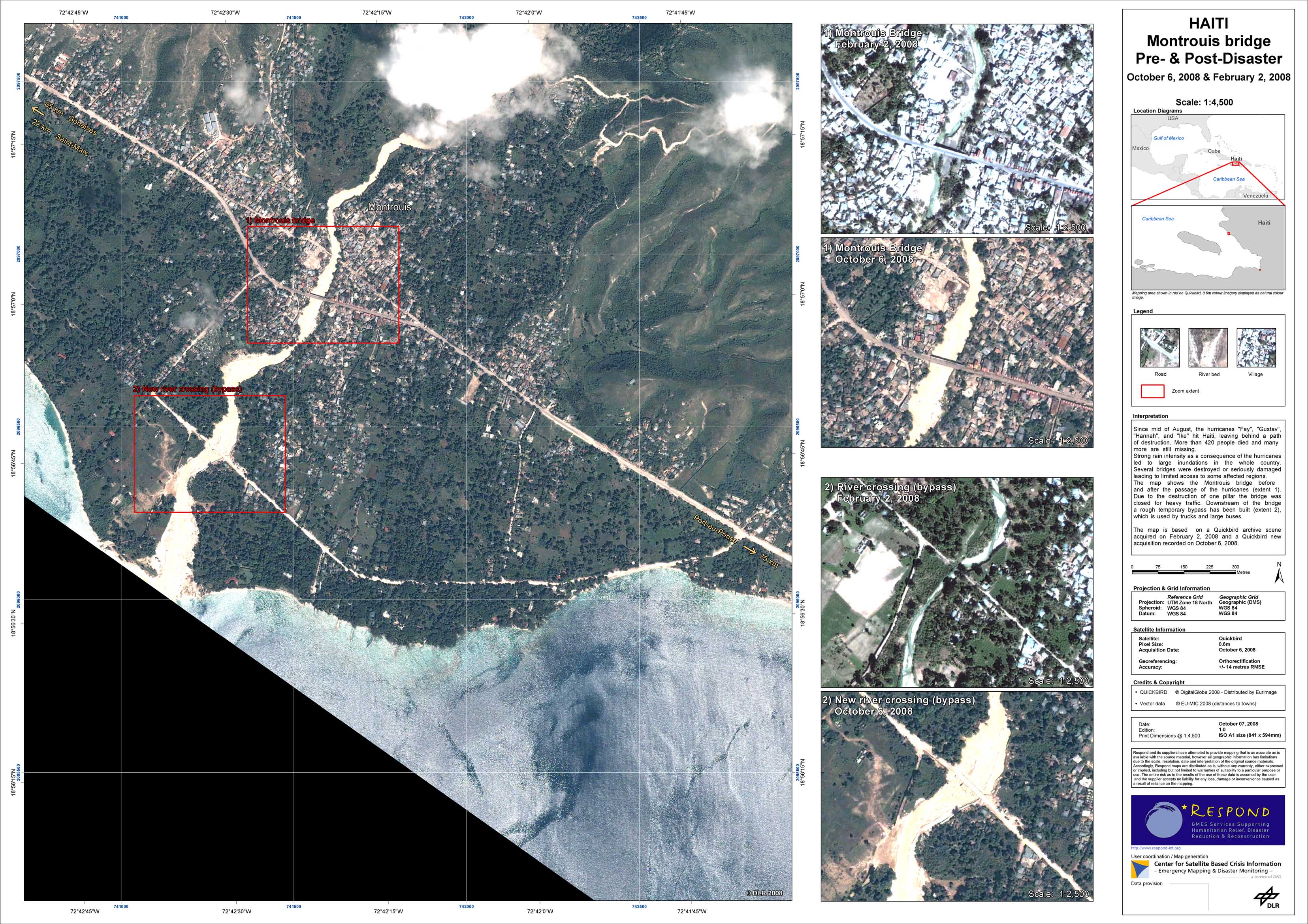
Haiti - P09 - Montrouis bridge on October 6, 2008 (pre-/post-disaster)
Creation Date 07. October 2008
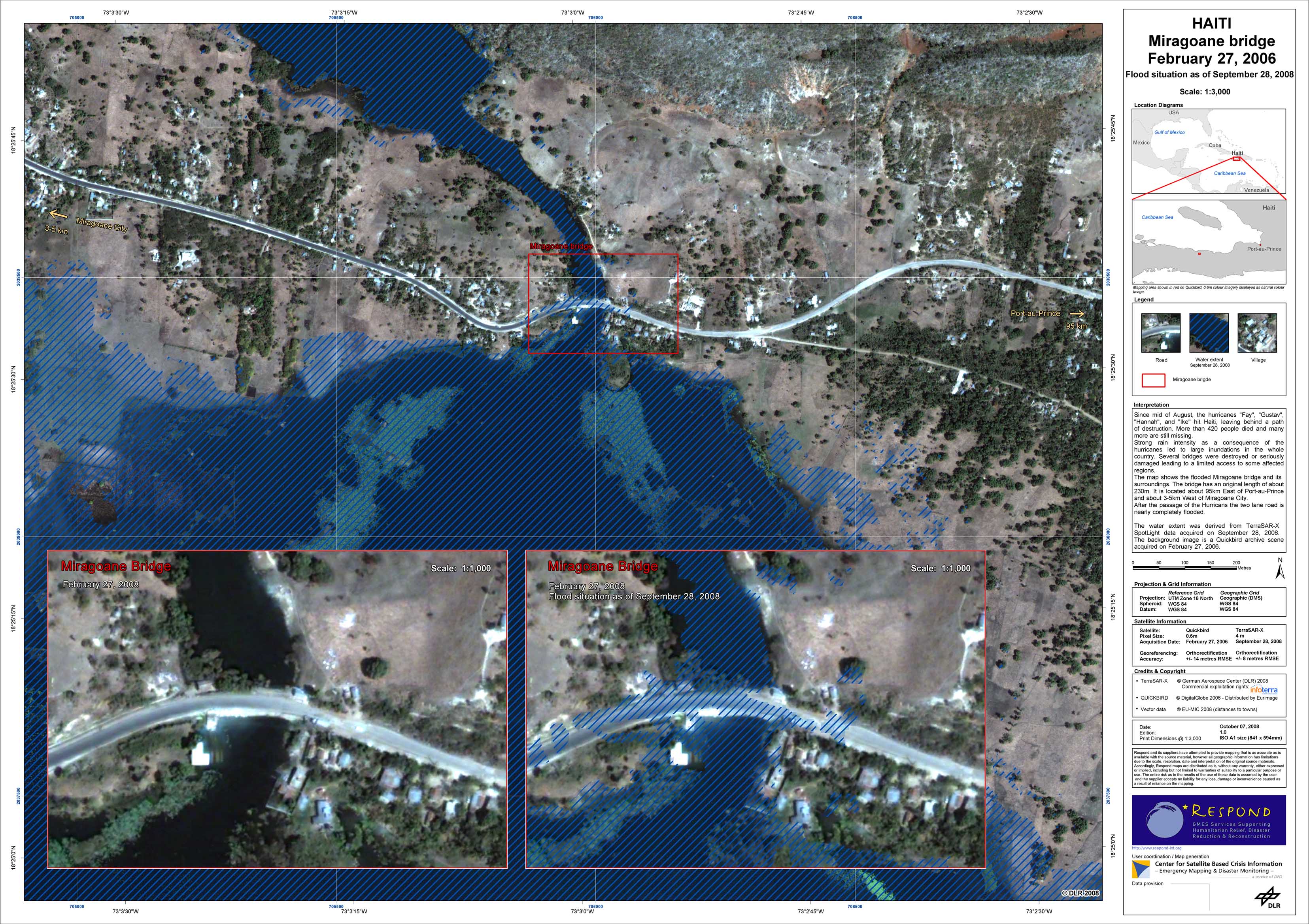
Haiti - P06 - Miragoane bridge on February 27, 2006 (pre-disaster) and flood situation on September 28, 2008
Creation Date 07. October 2008
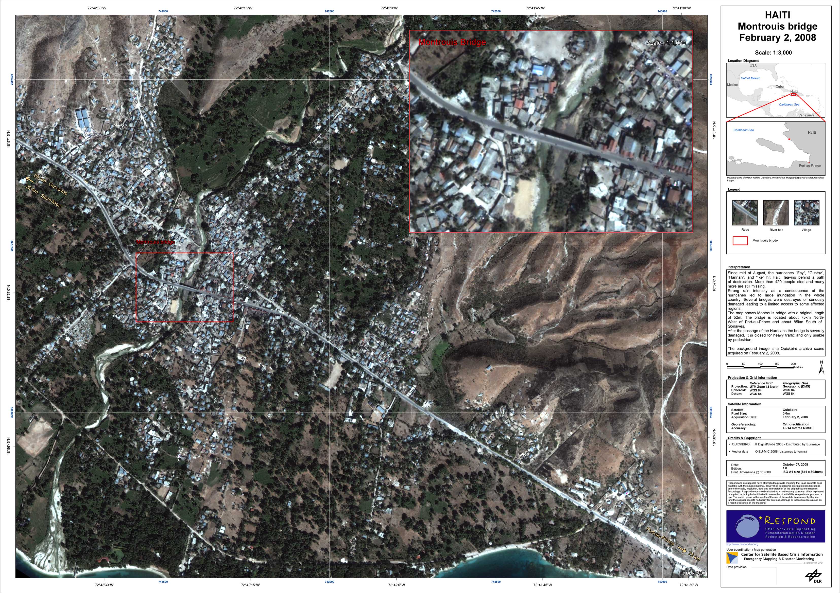
Haiti - P08 - Montrouis bridge on February 2, 2008 (pre-disaster)
Creation Date 07. October 2008
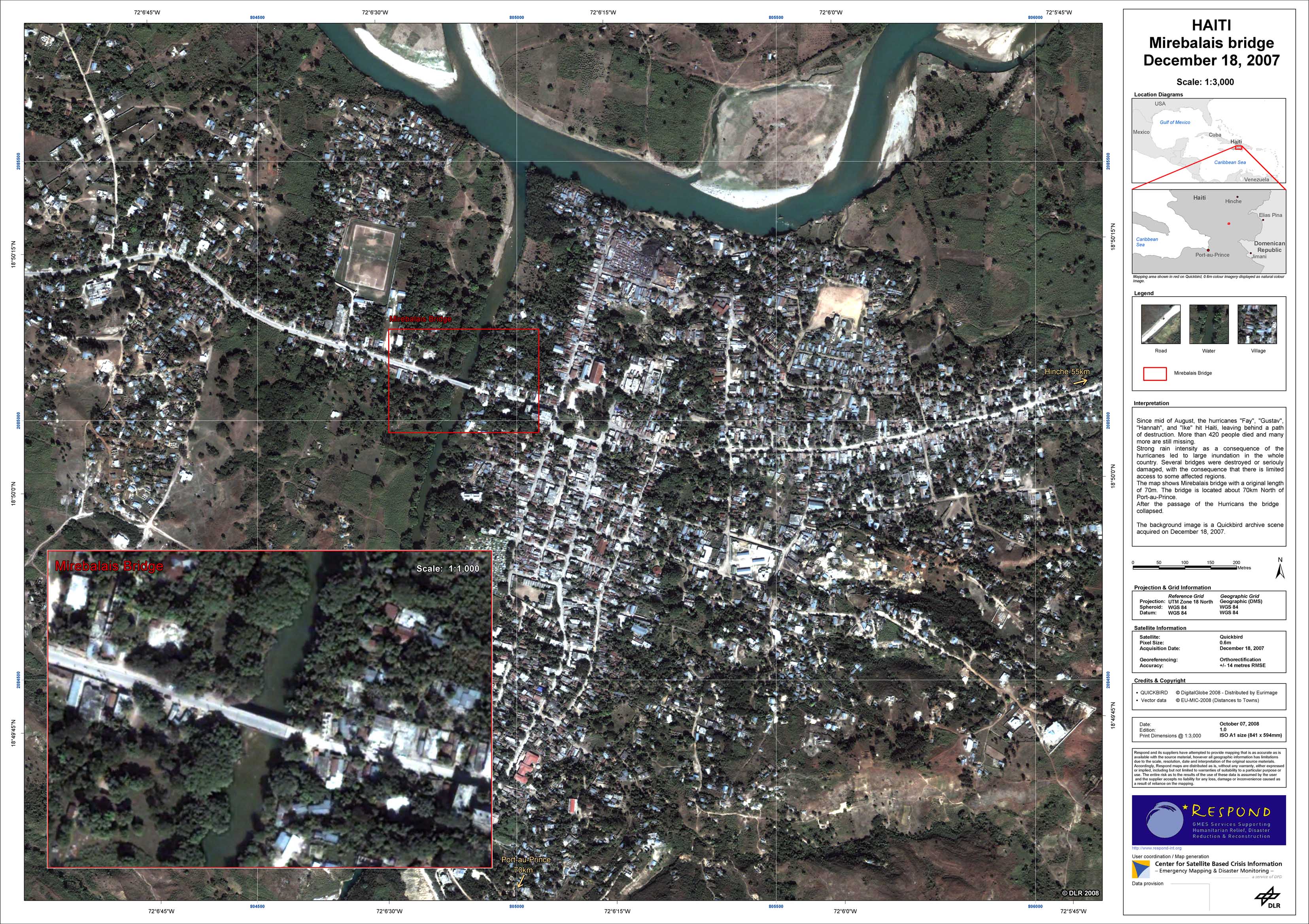
Haiti - P07 - Mirebalais bridge on December 18, 2007 (pre-disaster)
Creation Date 07. October 2008
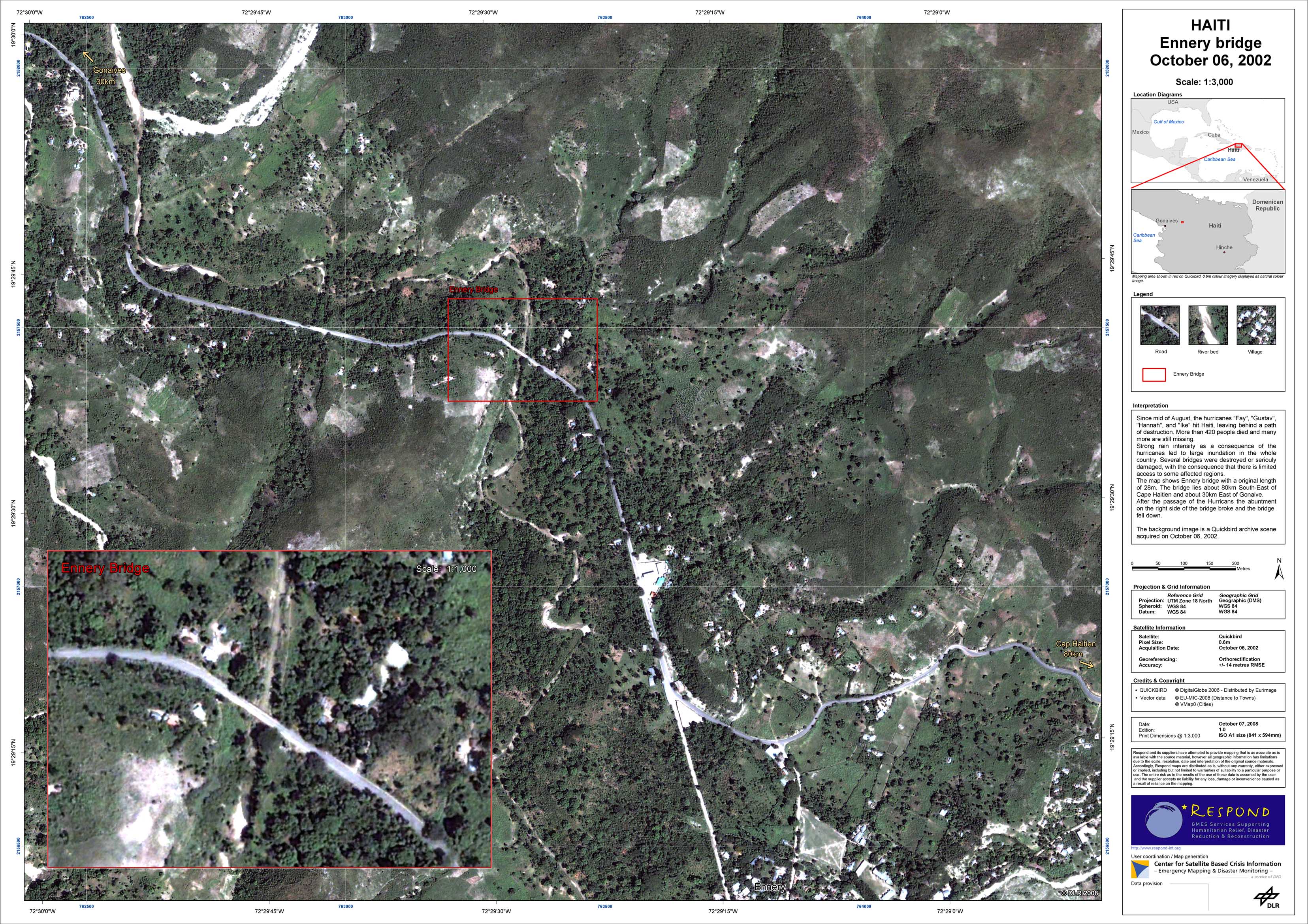
Haiti - P05 - Ennery bridge on October 6, 2002 (pre-disaster)
Creation Date 07. October 2008
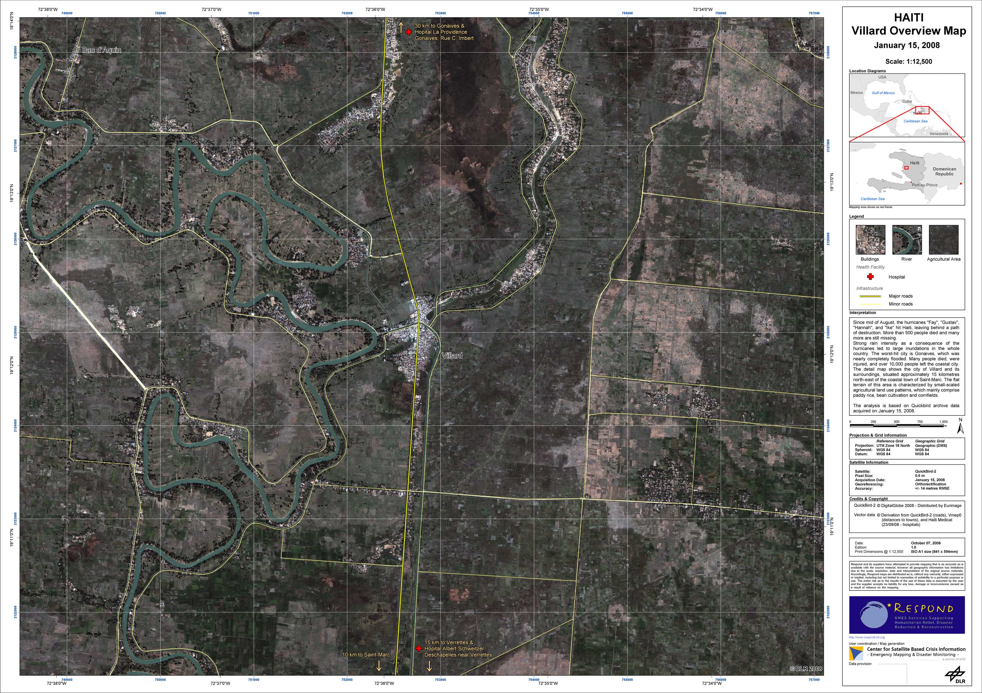
Haiti - P03 - Overview map of Villard on January 15, 2008 (pre-disaster)
Creation Date 07. October 2008
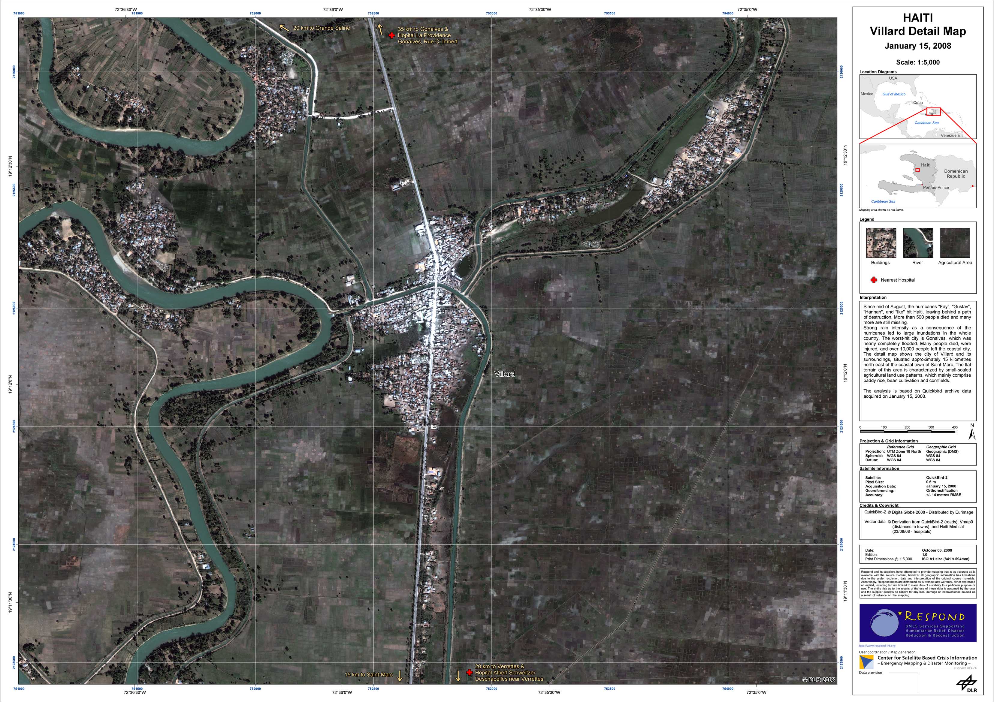
Haiti - P04 - Detail map of Villard on January 15, 2008 (pre-disaster)
Creation Date 06. October 2008
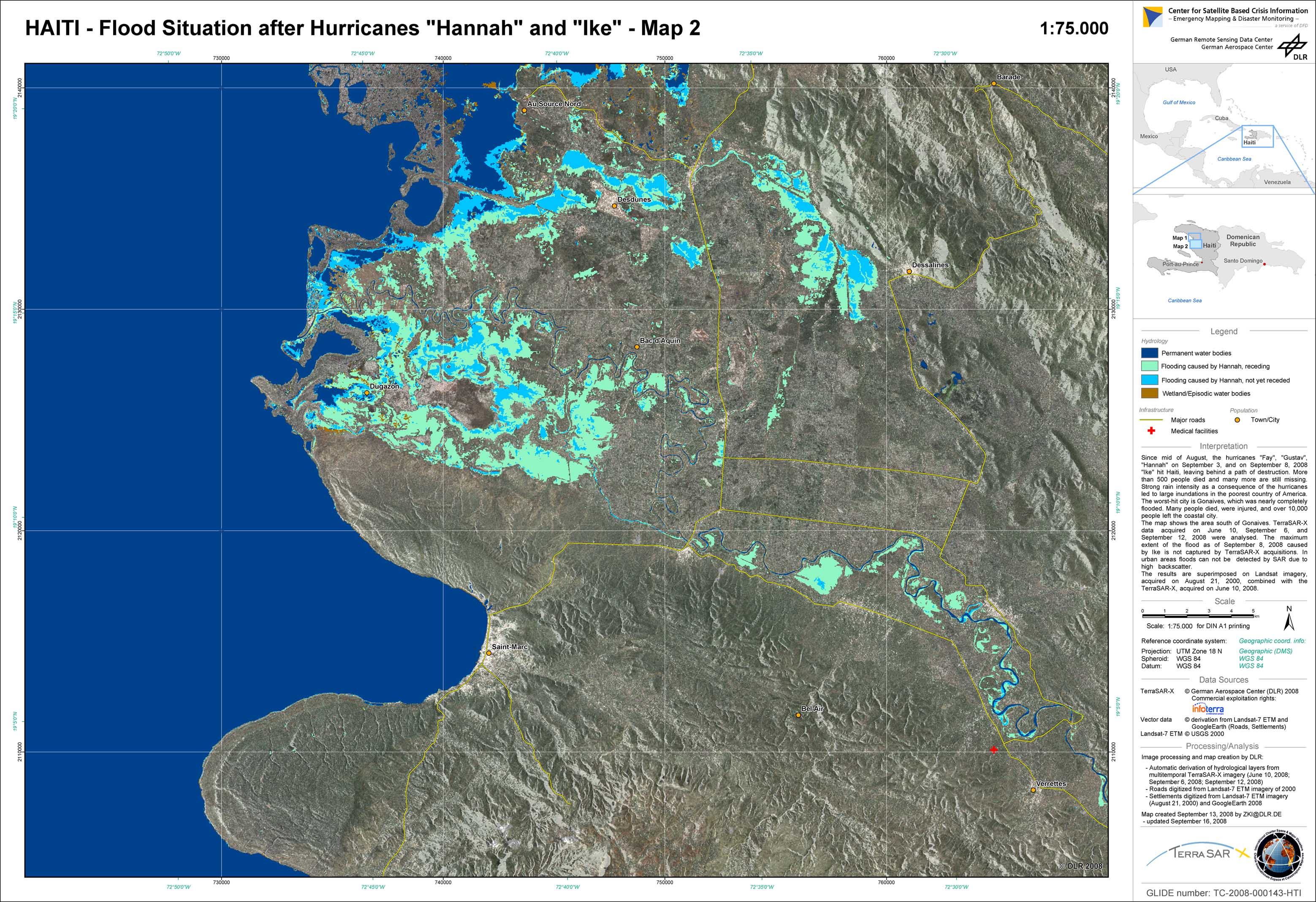
Haiti - P02 - Flood situation after Hurricanes Hannah and Ike - Map 2
Creation Date 16. September 2008
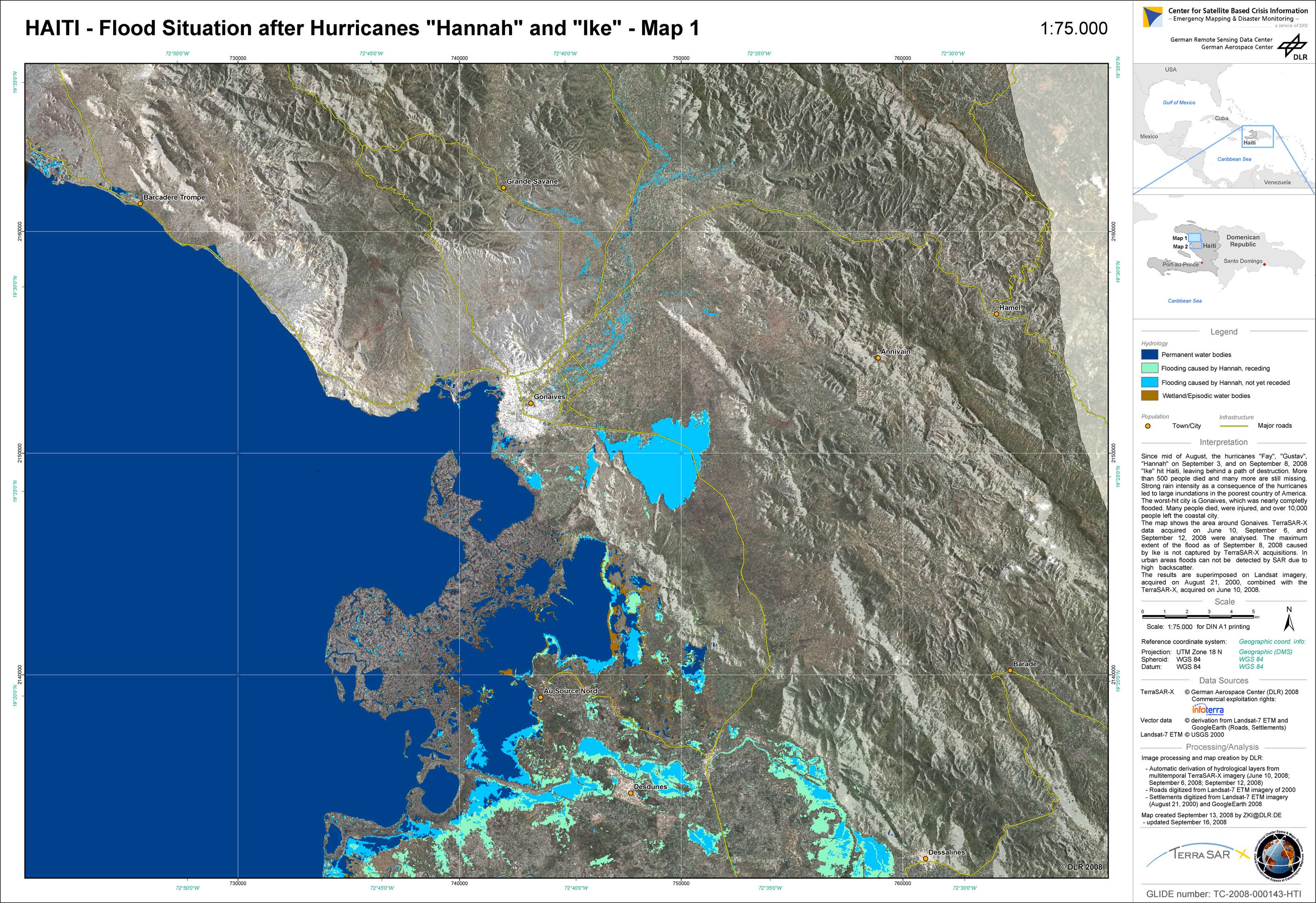
Haiti - P01 - Flood situation after Hurricanes Hannah and Ike - Map 1
Creation Date 16. September 2008