ZKI maps floods in Mexico
undefined
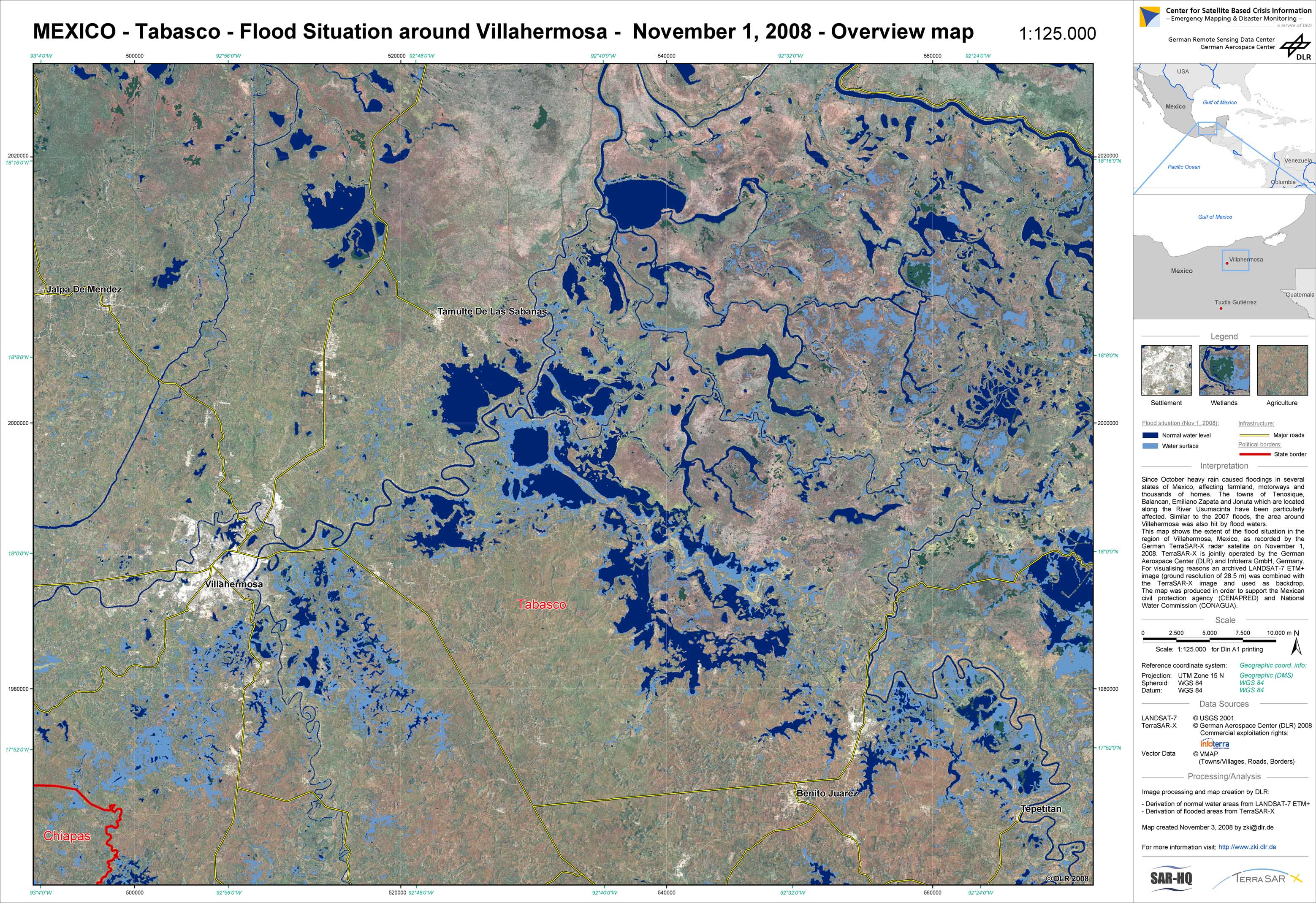
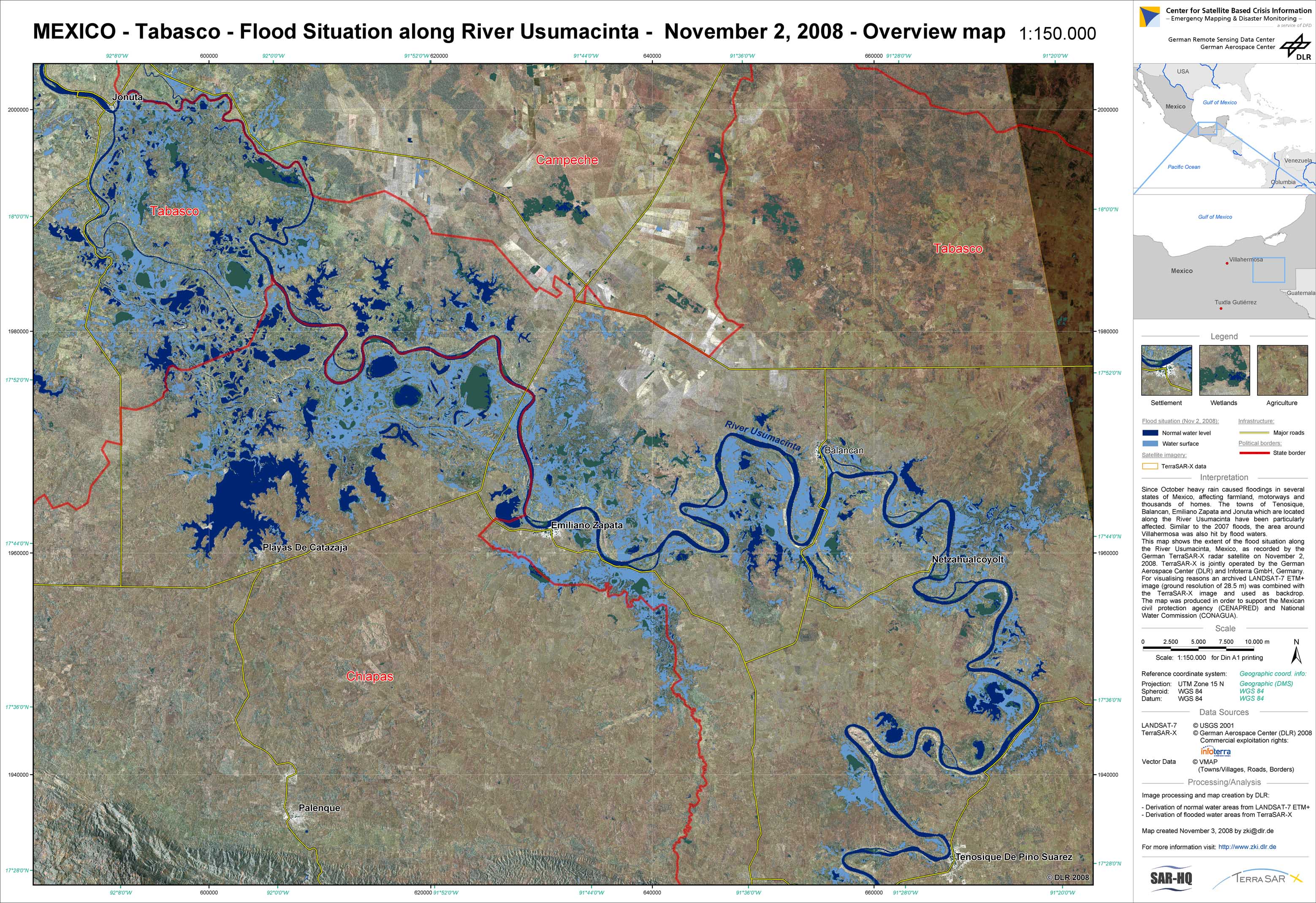
Since October, heavy rain caused floodings in several states of Mexico, affecting farmland, motorways and thousands of homes. The towns of Tenosique, Balancan, Emiliano Zapata and Jonuta, which are located along the River Usumacinta, have been particularly affected by the flooding. Similar to the 2007 floods, also the area around the city of Villahermosa was hit by flood waters. The Center for Satellite Based Crisis Information (ZKI) of DLR supports the Mexican National Water Commission (CONAGUA) and Civil Protection Agency (CENAPRED) with satellite image maps of the floods.
Mexico - Tabasco - P01 - Flooded areas from TerraSAR-X (ScanSAR Mode) on November 1, 2008, Region Villahermosa - Overview map
Creation Date 03. November 2008
Mexico - Tabasco - P02 - Flooded areas from TerraSAR-X (ScanSAR Mode) on November 2, 2008, River Usumacinta - Overview map
Creation Date 03. November 2008
undefined