25. March 2009

Flooding of Kavango, Namibia and Angola

undefined

Heavy rains in Angola and parts of Zambia's Western Province led to flooding in Namibia's north and north-eastern parts. On March 18, 2009, emergency was declared in the concerned areas where floods have caused large-scale destruction to homes, schools, health facilities, mahangu and maize fields and infrastructure. The maps show the area around Rundu (Namibia) and Calai (Angola), two towns situated along the Cubango River bank.

Products

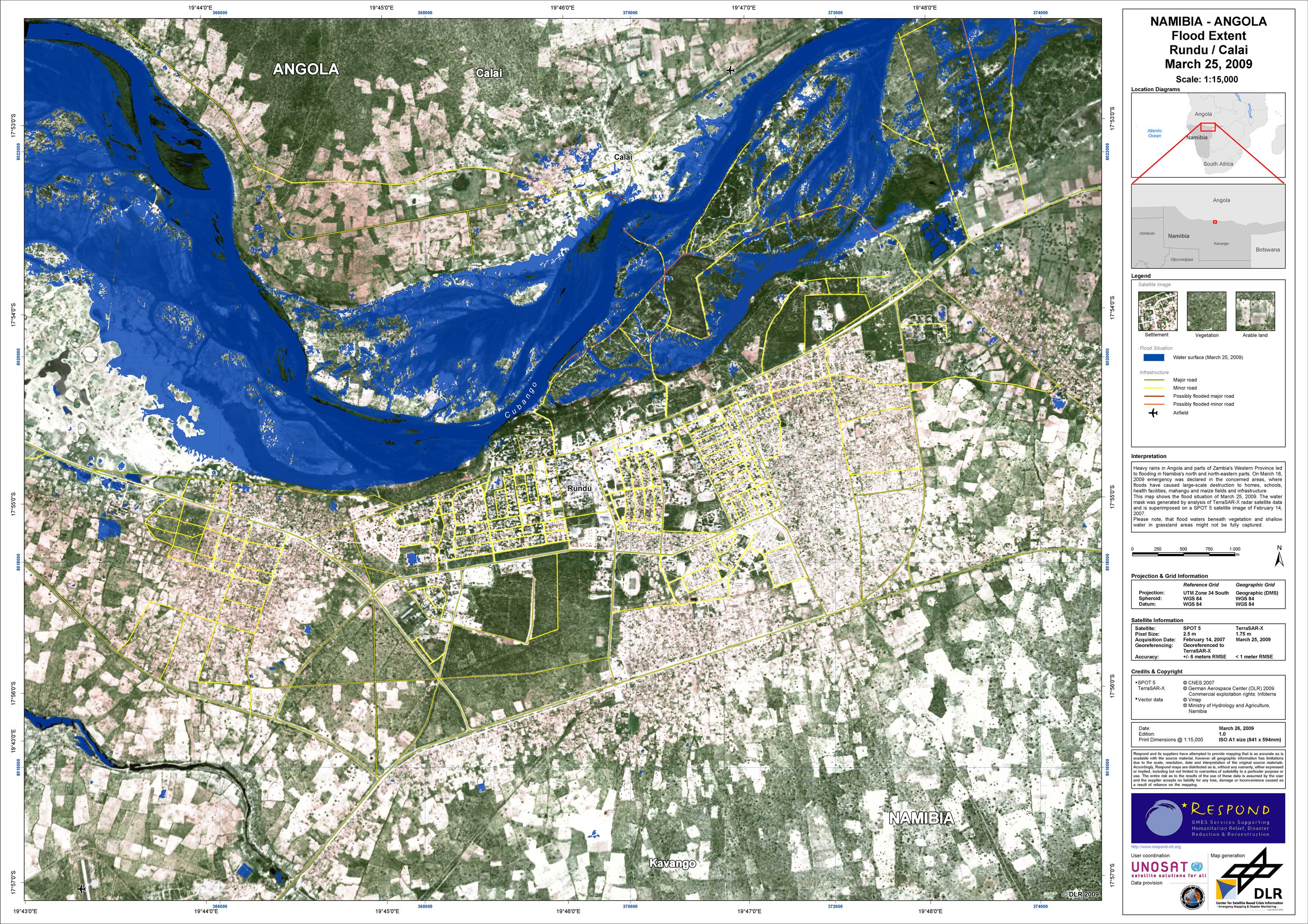
Namibia - P03 - Rundu - Flood mapping from TerraSAR-X data of March 25, 2009

Creation Date 26. March 2009

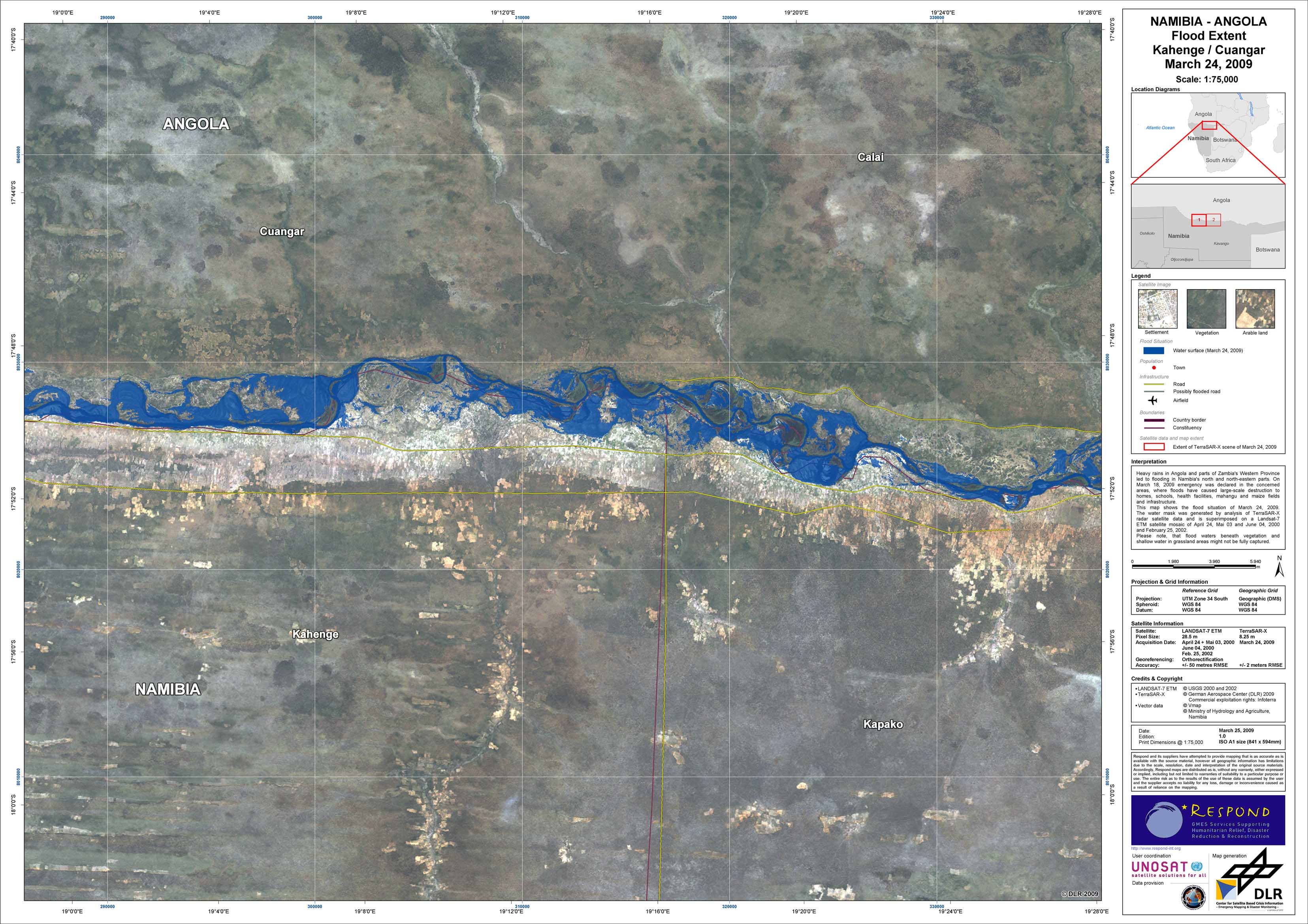
Namibia - P01 - Rundu region (western part) - Flood mapping from TerraSAR-X data of March 24, 2009

Creation Date 25. March 2009

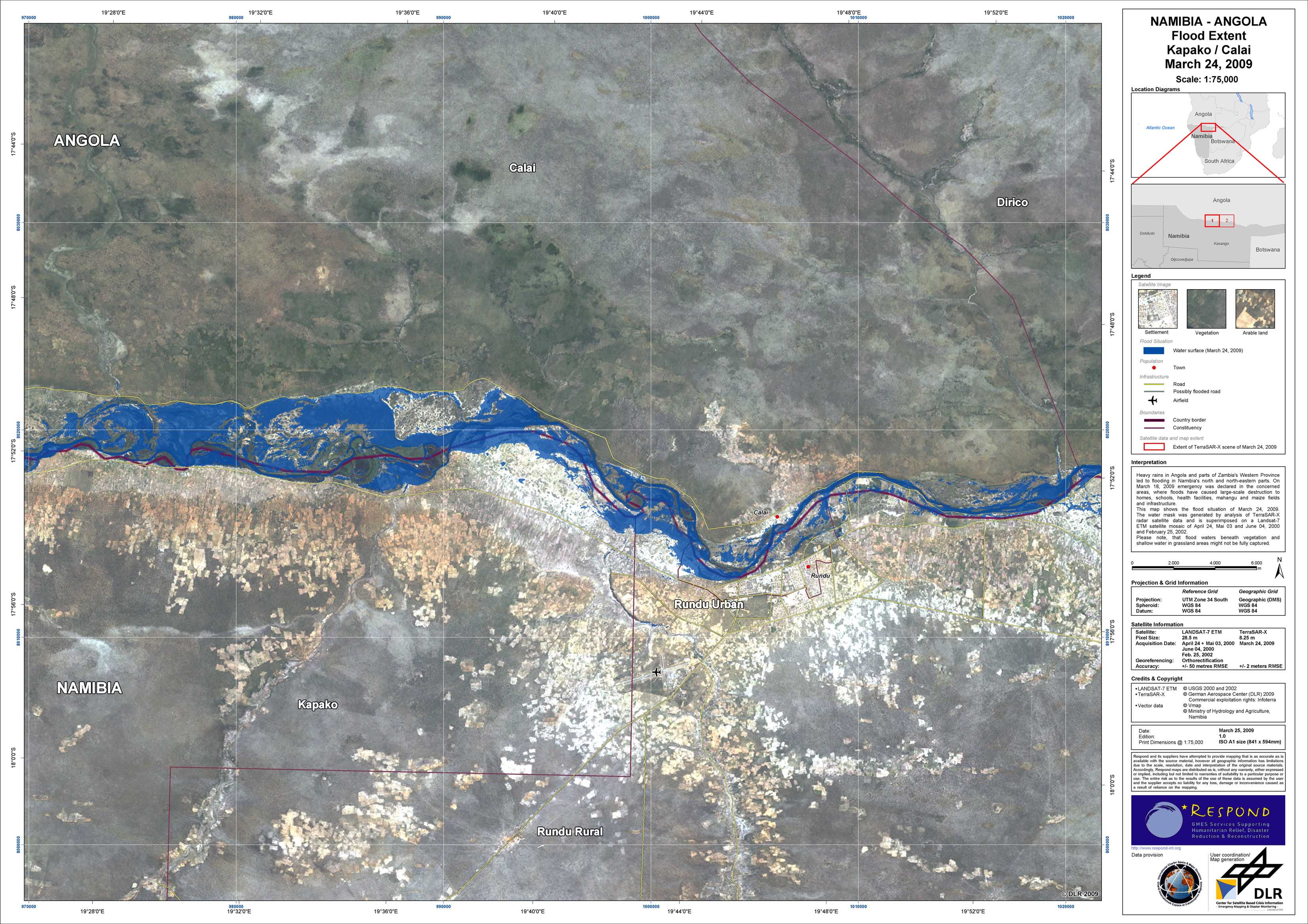
Namibia - P02 - Rundu region (eastern part) - Flood mapping from TerraSAR-X data of March 24, 2009

Creation Date 25. March 2009

undefined