
Flooding in Maranhão and Piauí, Brazil
undefined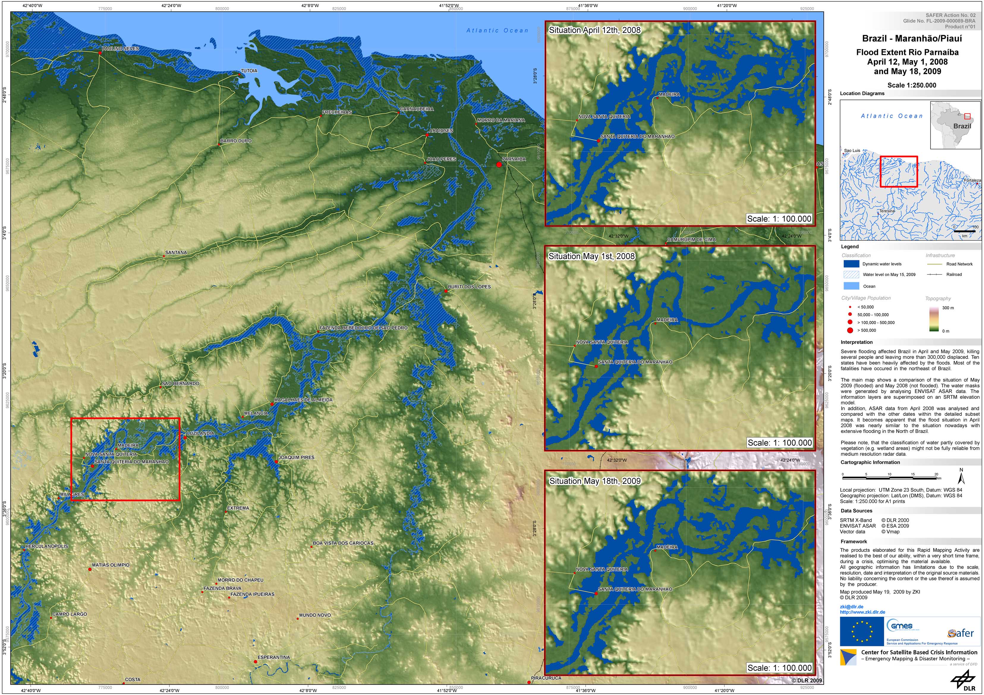
Brazil - P07 - Flood map of the Rio Parnaíba of April 12 and May 01, 2008, and May 18, 2009, in the eastern Maranhão/Piauí region
Creation Date 19. May 2009
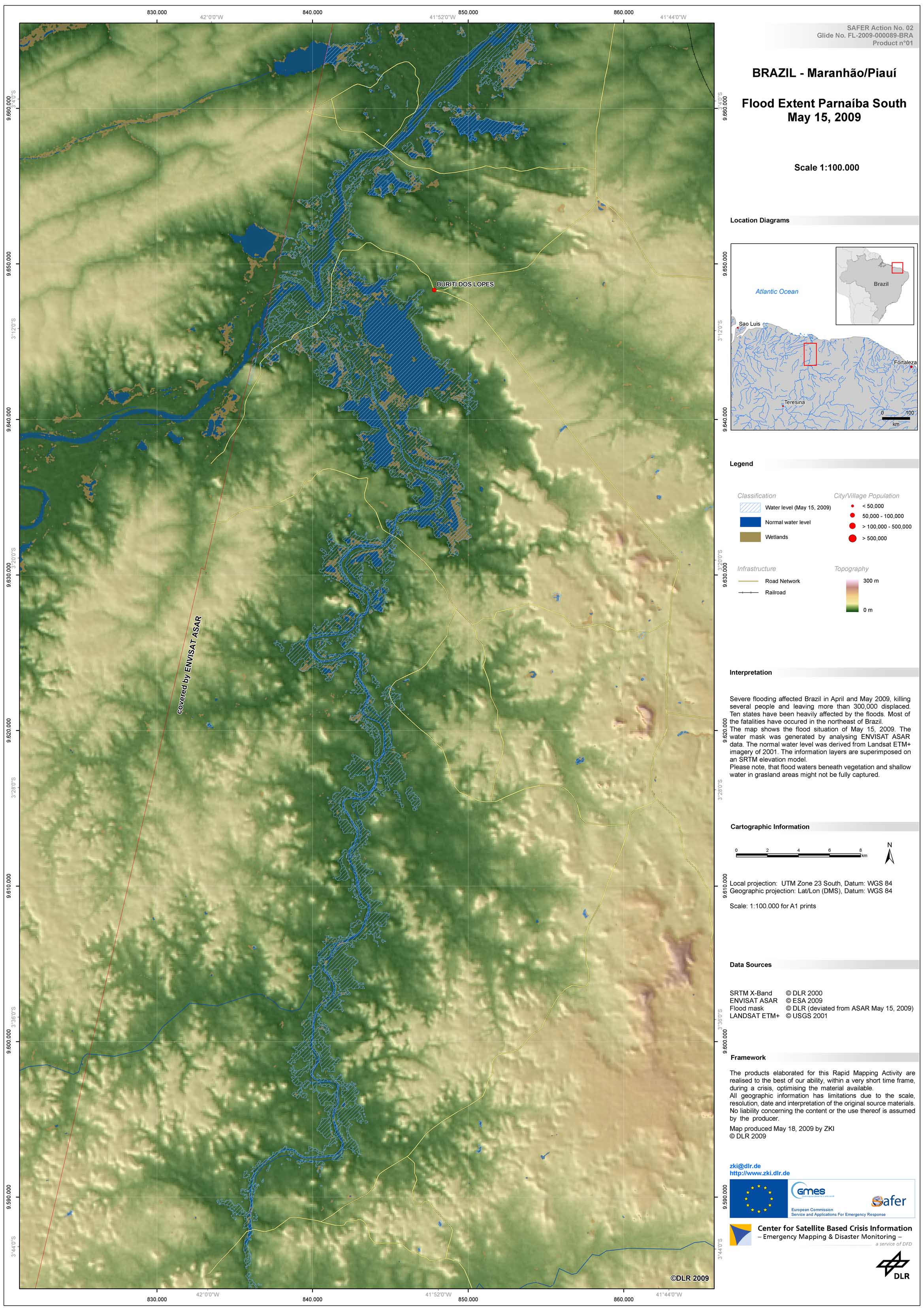
Brazil - P06 - Flood map of the southern Rio Parnaíba of May 15, 2009, in the eastern Maranhão/Piauí region
Creation Date 18. May 2009
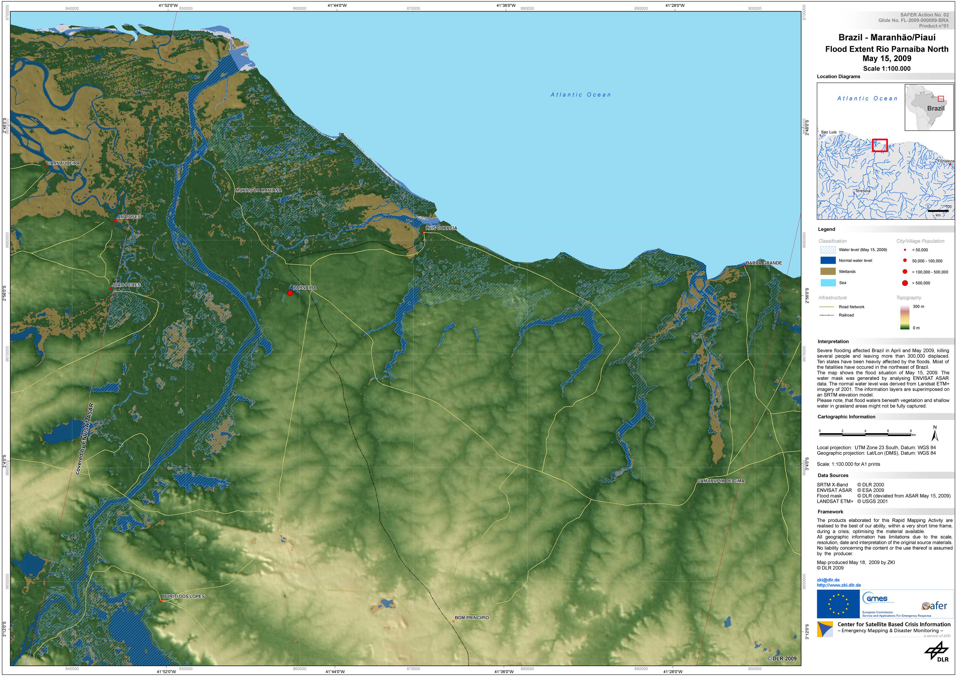
Brazil - P05 - Flood map of the northern Rio Parnaíba of May 15, 2009 in the eastern Maranhão/Piauí region
Creation Date 18. May 2009
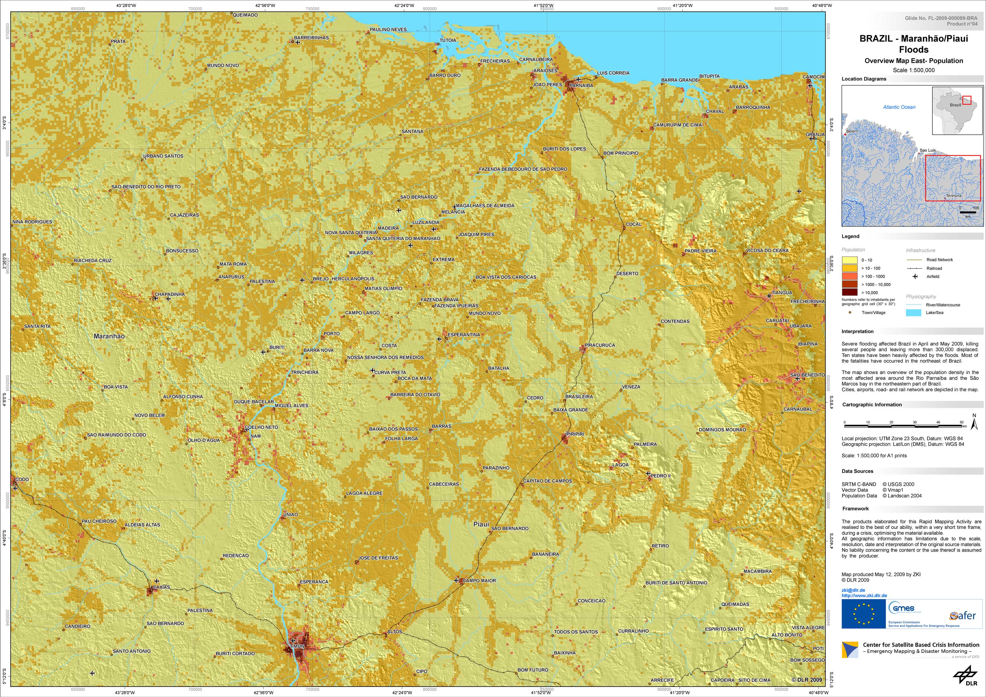
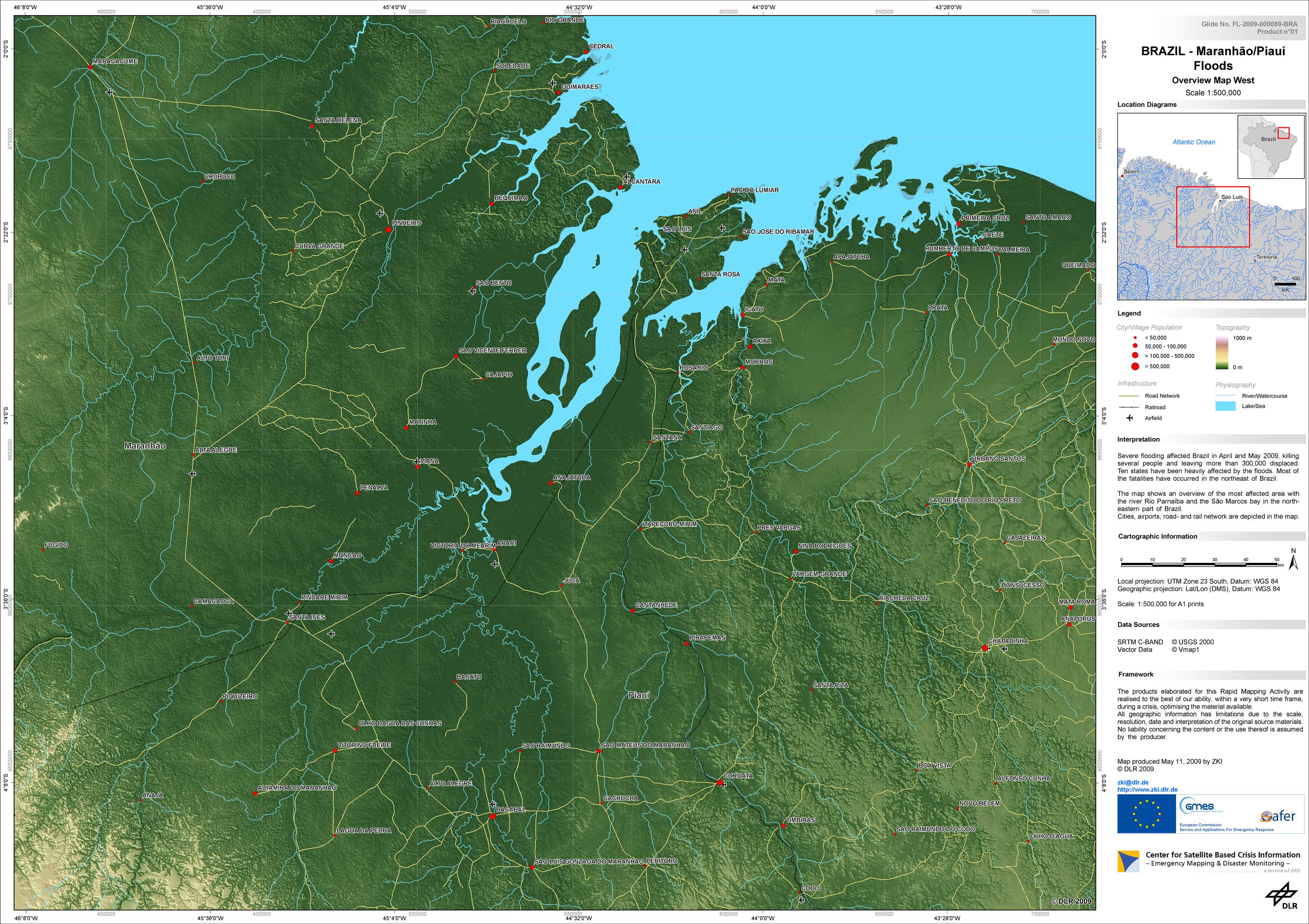
Brazil - P04 - Overview map of the Rio Parnaíba in the eastern Maranhão/Piauí region
Creation Date 18. May 2009
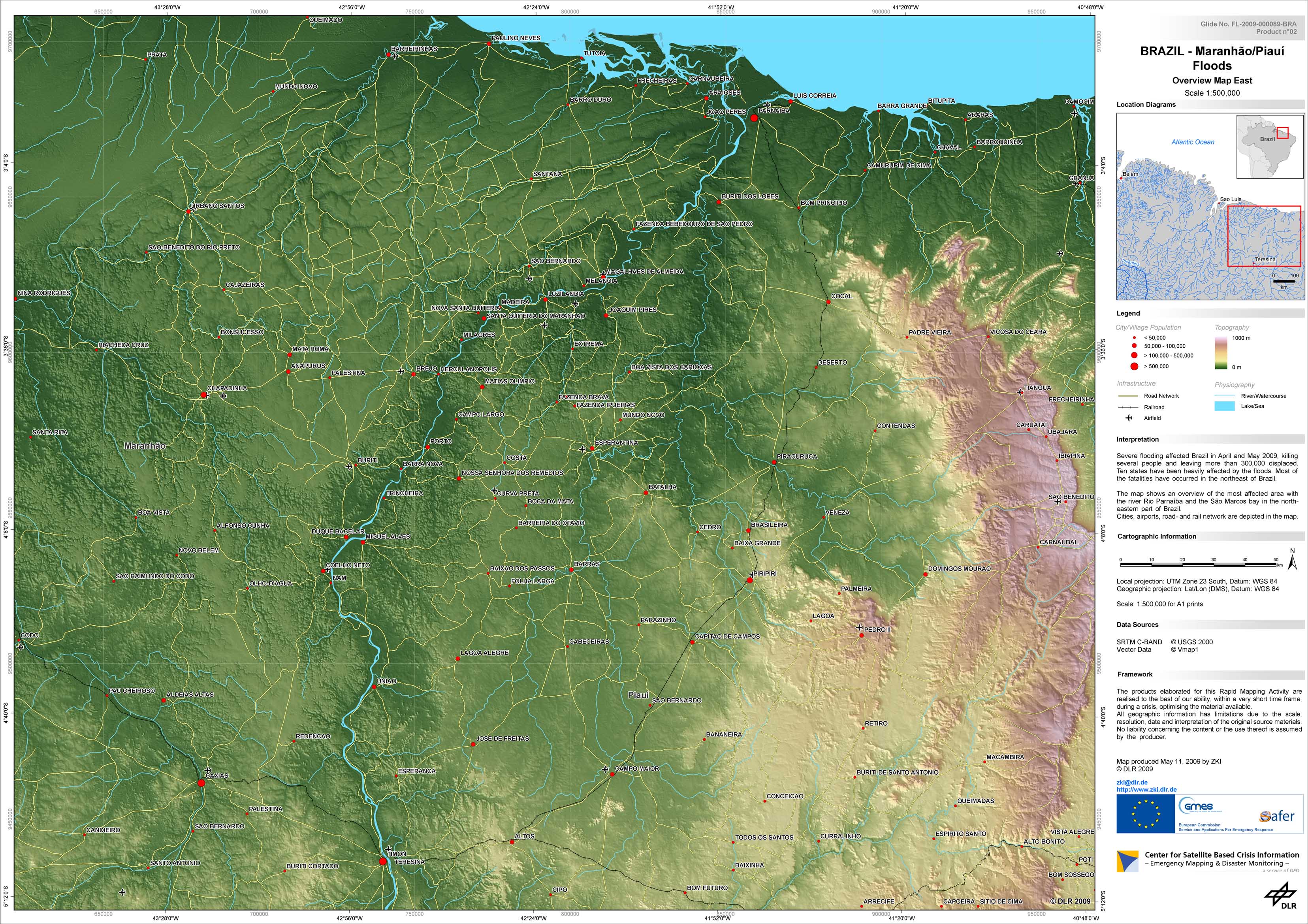
Brazil - P02 - Overview map of the Rio Parnaíba in the eastern Maranhão/Piauí region
Creation Date 12. May 2009
Brazil - P01 - Overview map of the São Marcos bay area in the Maranhão region
Creation Date 12. May 2009
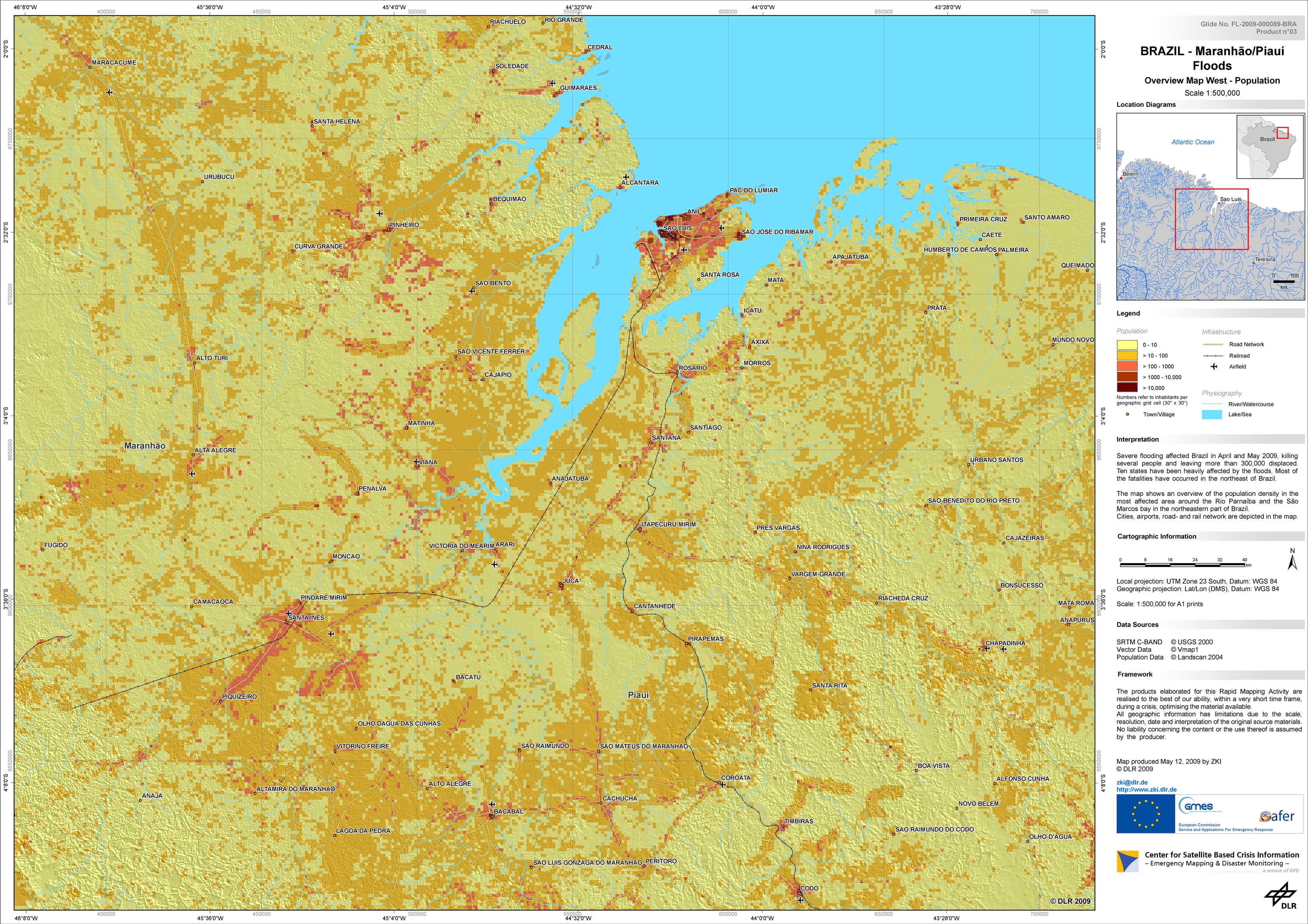
Brazil - P03 - Overview map of the São Marcos bay area in the Maranhão Region
Creation Date 12. May 2009