Landslide in Aini Jamoat, Tajikistan
undefined
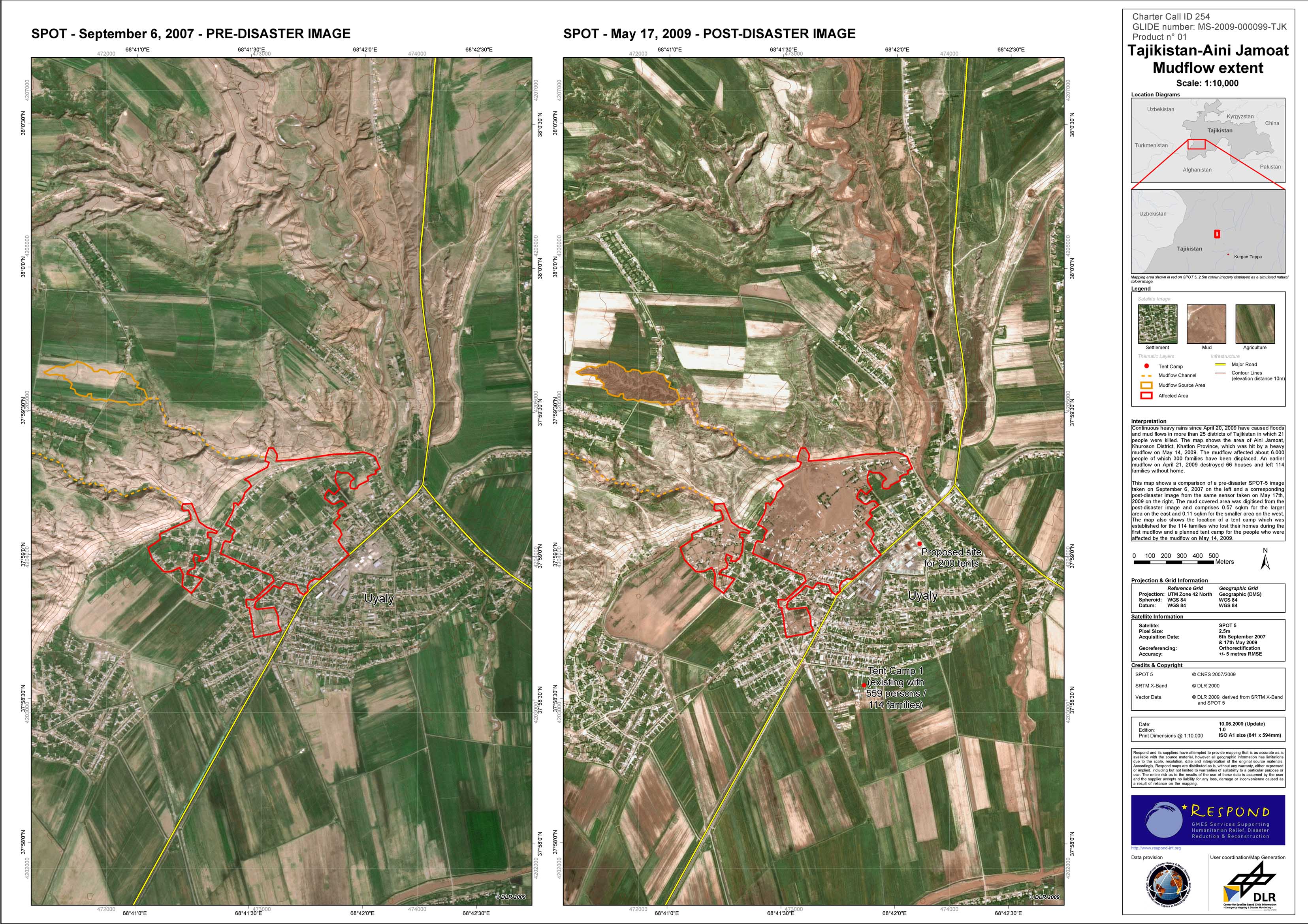
On May 14th, 2009, heavy rainfall led to a mudflow in Aini Jamoat in the Khatlon province in western Tajikistan. About 6000 people were affected by the event, 200 houses were destroyed and about 300 families had to be displaced. The disaster site is located 30 km from Kurgan Teppa city and 75 km south of the capital city of Dushanbe. Continuous heavy rains since April 20, 2009, have caused floods and mud flows in more than 25 districts of Tajikistan in which 21 people were killed. The area of Aini Jamoat, Khuroson District, Khatlon Province, was hit twice. An earlier mudflow on April 21, 2009, destroyed 66 houses and left 114 families without home. Two tent camps were established to provide shelter for people who were affected by the two mudflows. The Center for Satellite Based Crisis Information (ZKI) at DLR produced a detailed map of the affected region at the northern suburban area of Aini Jamoat. The map shows the affected area and source area of the mud flow based on a comparison of a pre-disaster SPOT-5 image taken on September 6, 2007, and a corresponding post-disaster image from the same sensor taken on May 17th, 2009.
P01 - Mudflow as of July 14, 2009, in Aini Jamoat in the Khatlon province in western Tajikistan
Creation Date 20. May 2009
undefined