22. July 2009

Landslide in Nachterstedt, Germany, July 18th, 2009, at around 5:40 AM

undefined

A landslide occurred on July 18, 2009, at around 5:40 AM in Nachterstedt in the German state Saxony-Anhalt. The resulting breakline has a length of 350 m. A two-story building, parts of an apartment building and parts of a street slid down. The former mining area was still at risk of further earth movements after the event and only limited access is granted even to rescue workers. The maps produced by ZKI are based on aerial images acquired on July 22, 2009. Post-disaster data is compared to pre-disaster imagery of the area, acquired on May 5, 2006. They are produced in the frame of DLR's ARGOS project (Airborne Wide Area High Altitude Monitoring System).

Products

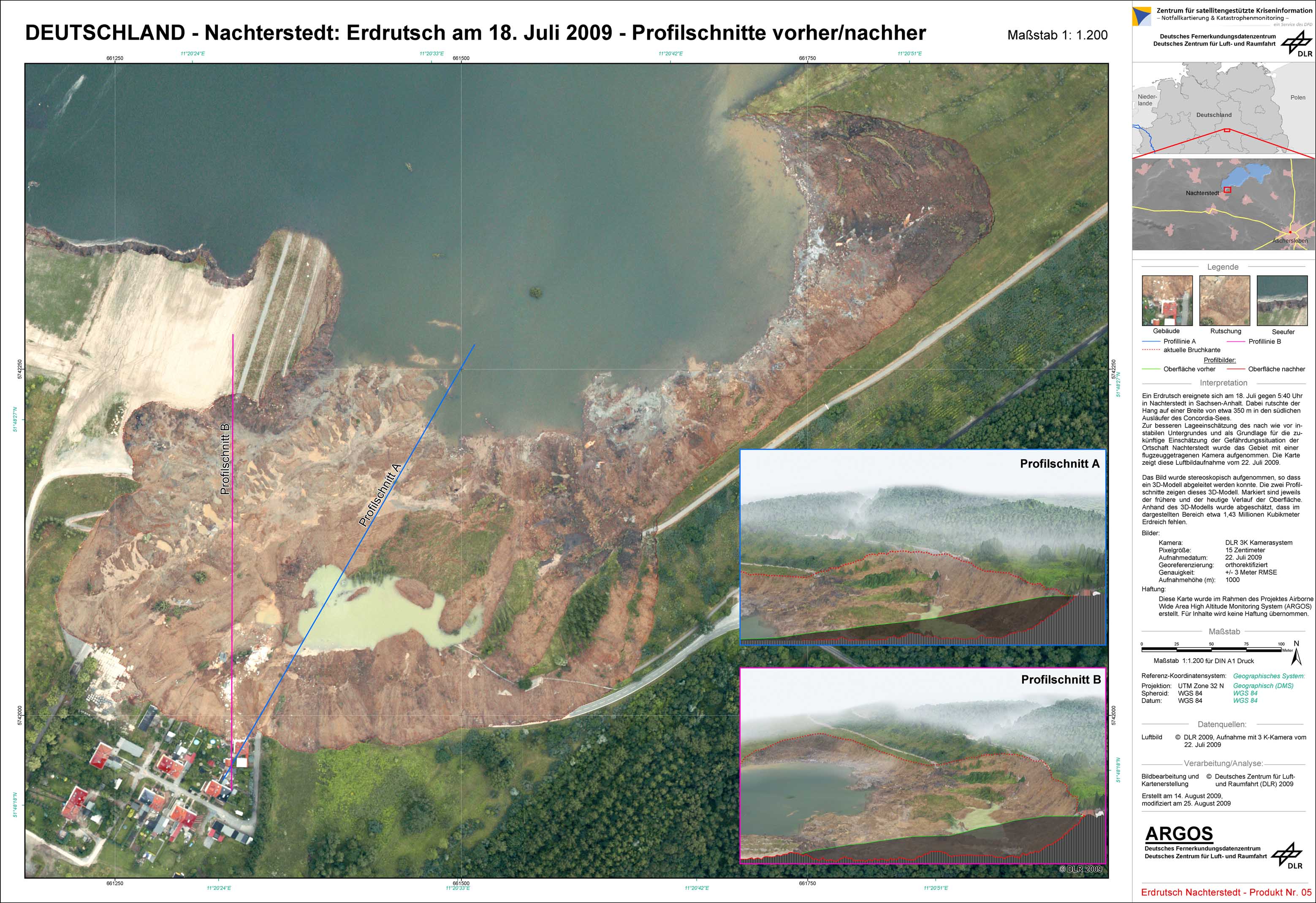
Germany - Nachterstedt - P05 - Landslide as of July 18, 2009 - Cross sections map before/after

Creation Date 14. August 2009

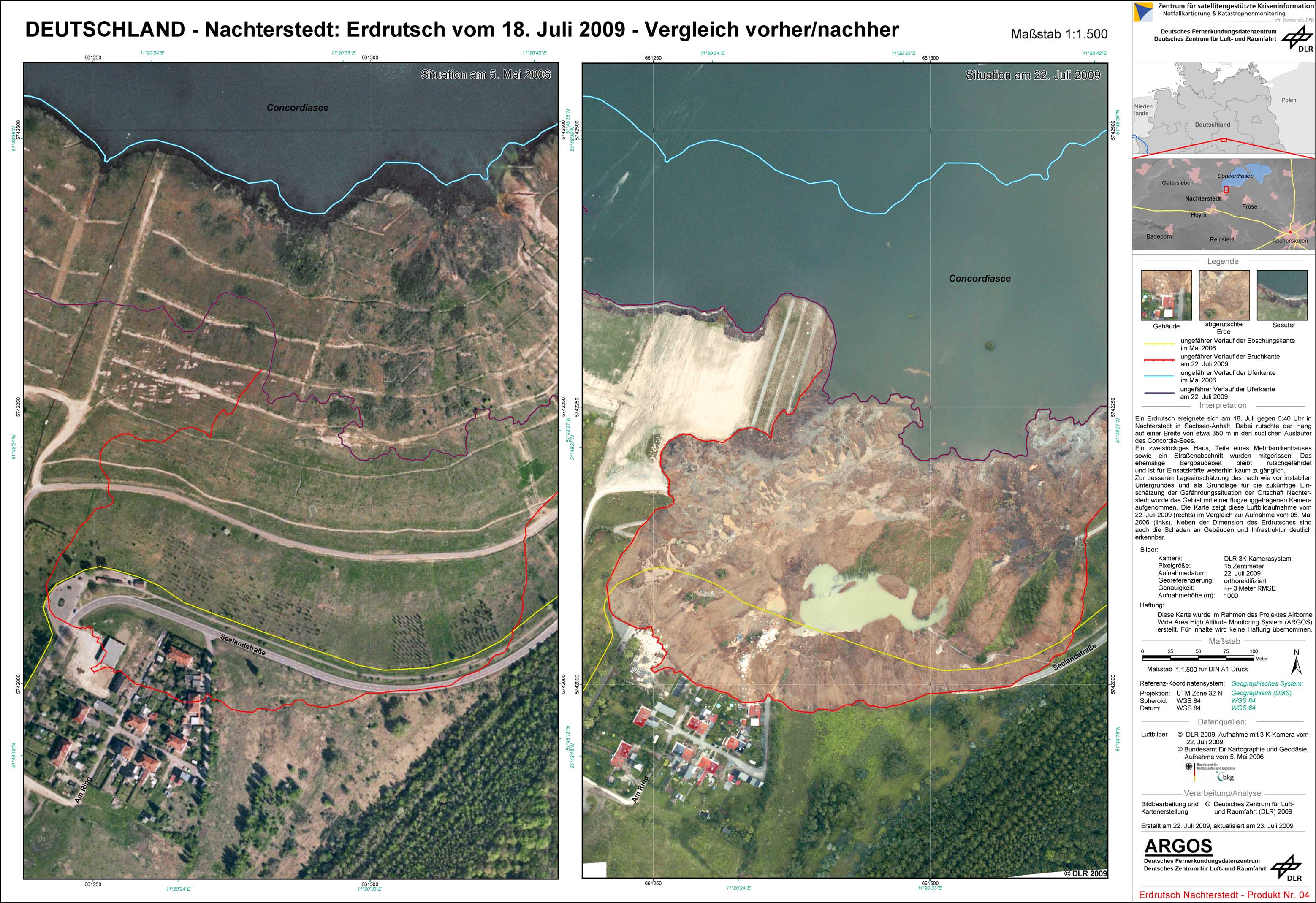
Germany - Nachterstedt - P04 - Landslide as of July 18, 2009 - Comparison map before/after

Creation Date 29. July 2009

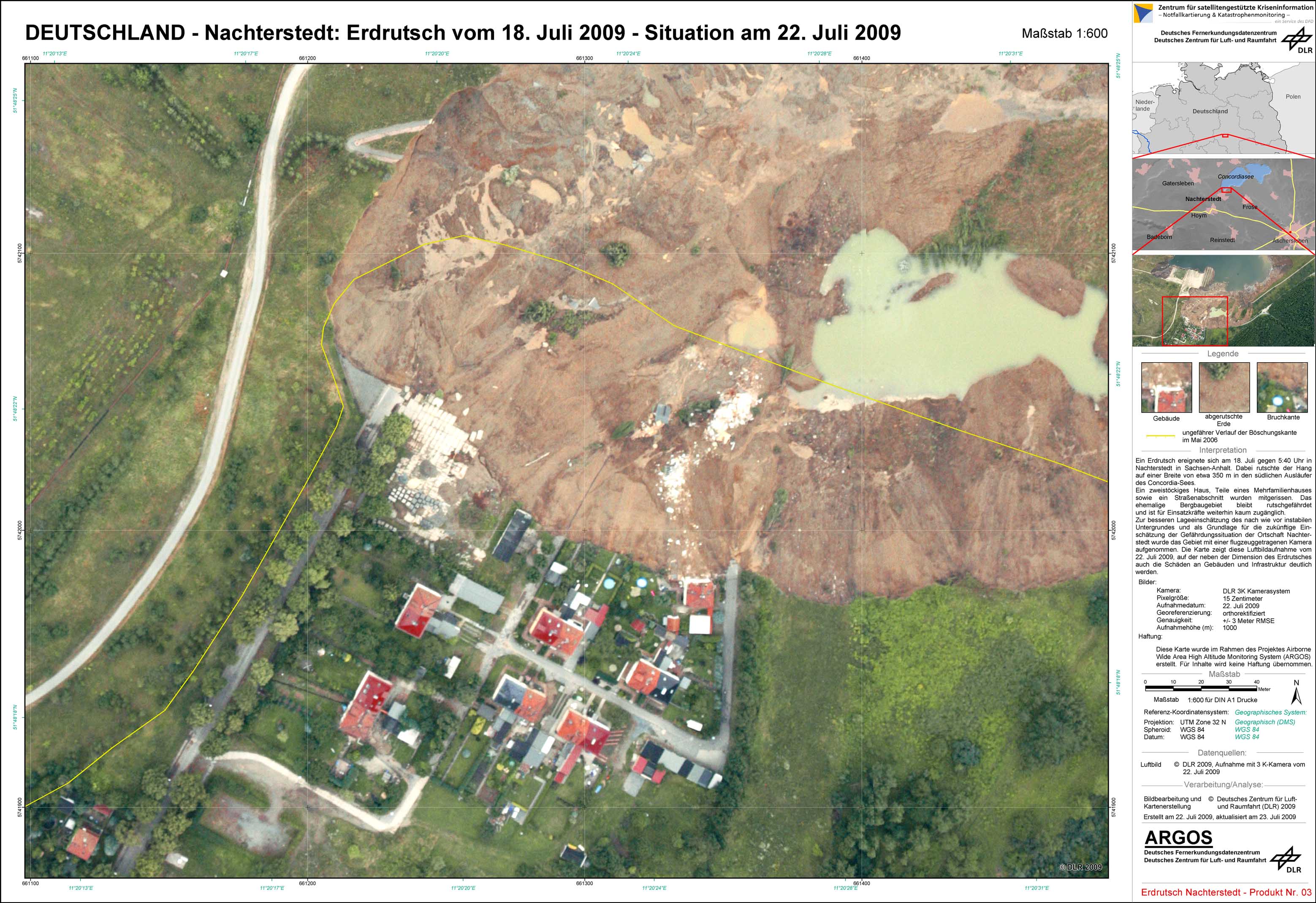
Germany - Nachterstedt - P03 - Landslide as of July 18, 2009 - Detail map

Creation Date 29. July 2009

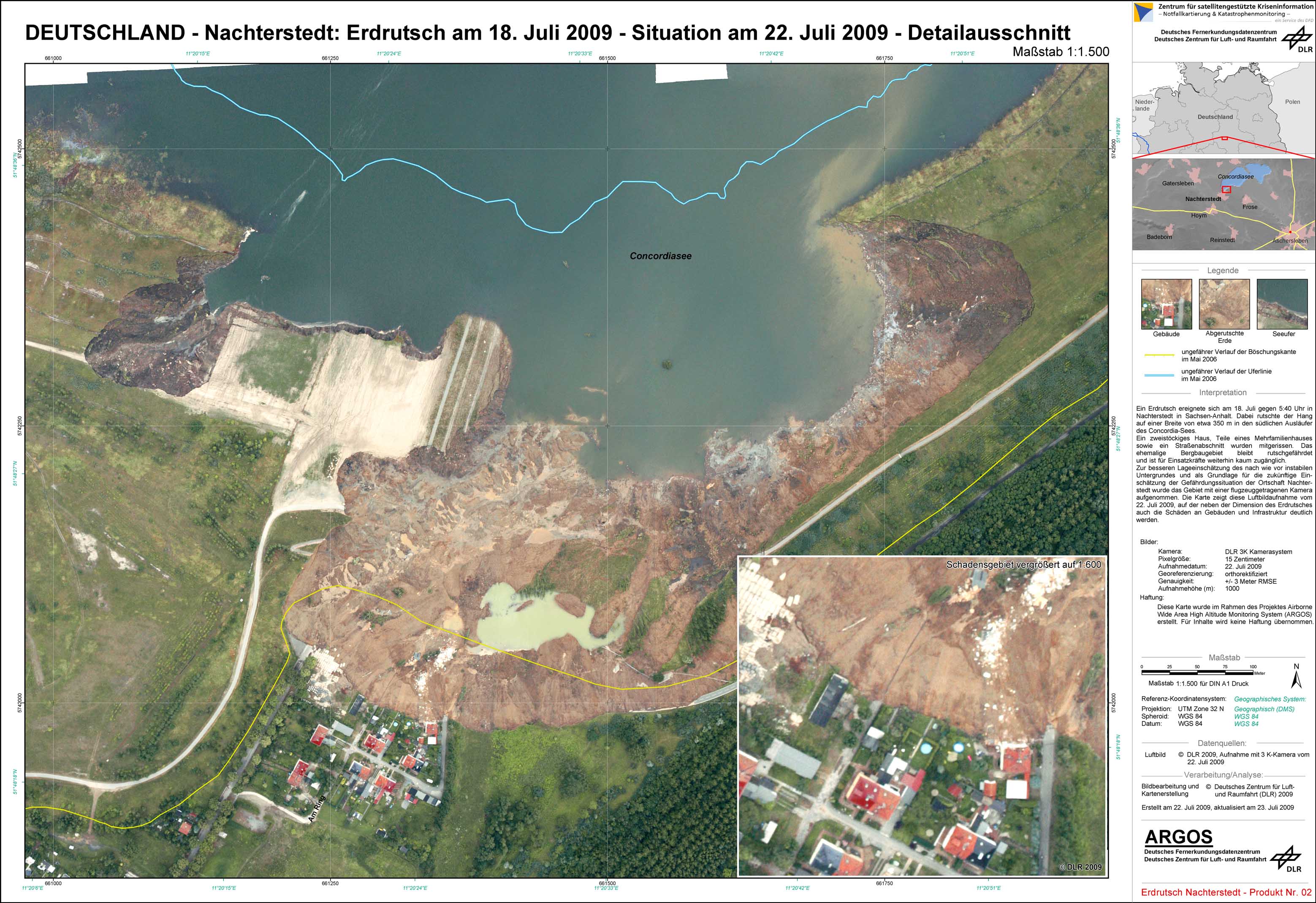
Germany - Nachterstedt - P02 - Landslide as of July 18, 2009 - Map with local zoom

Creation Date 29. July 2009

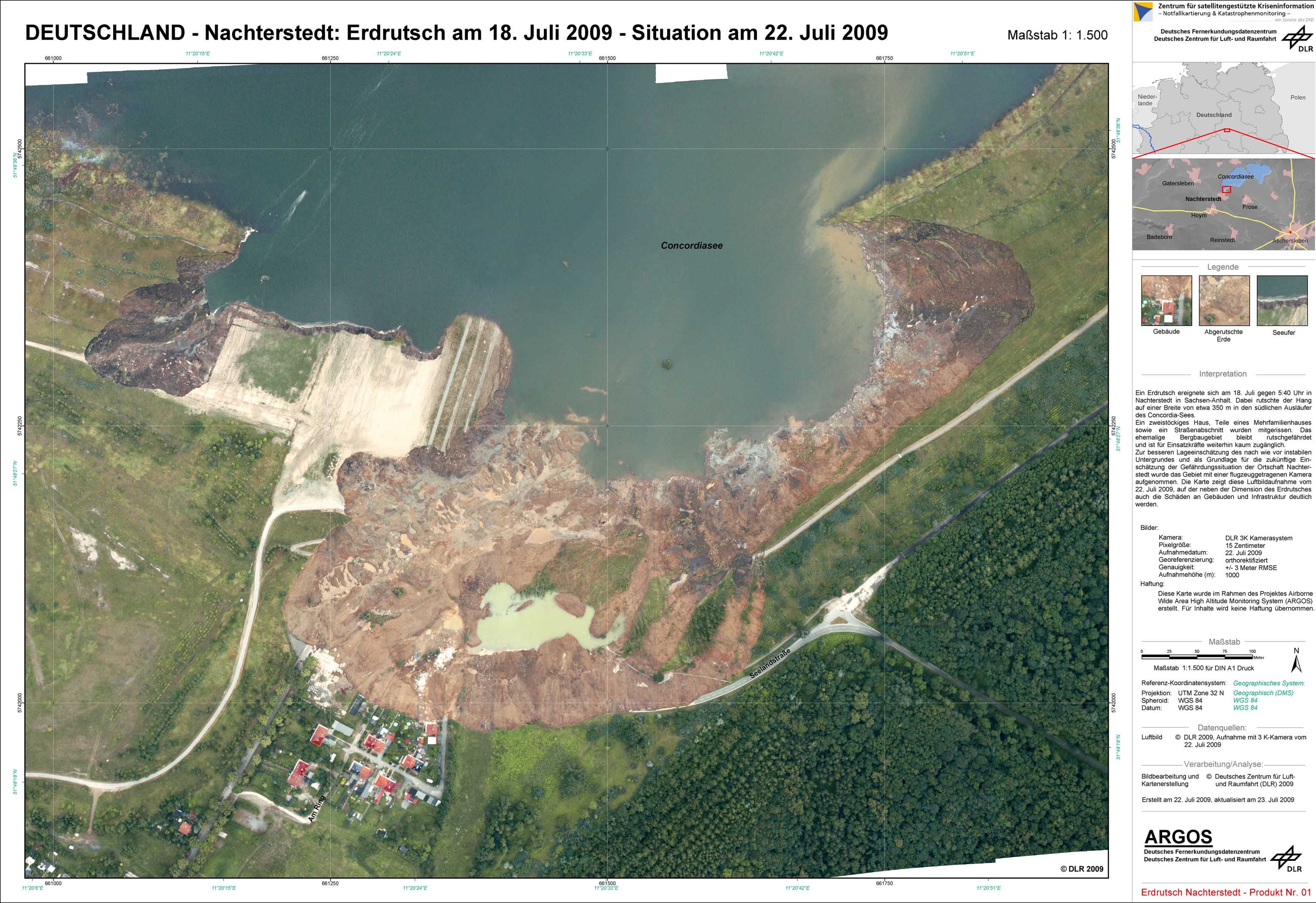
Germany - Nachterstedt - P01 - Landslide as of July 18, 2009

Creation Date 22. July 2009

undefined