
Forest fires in Greece
undefined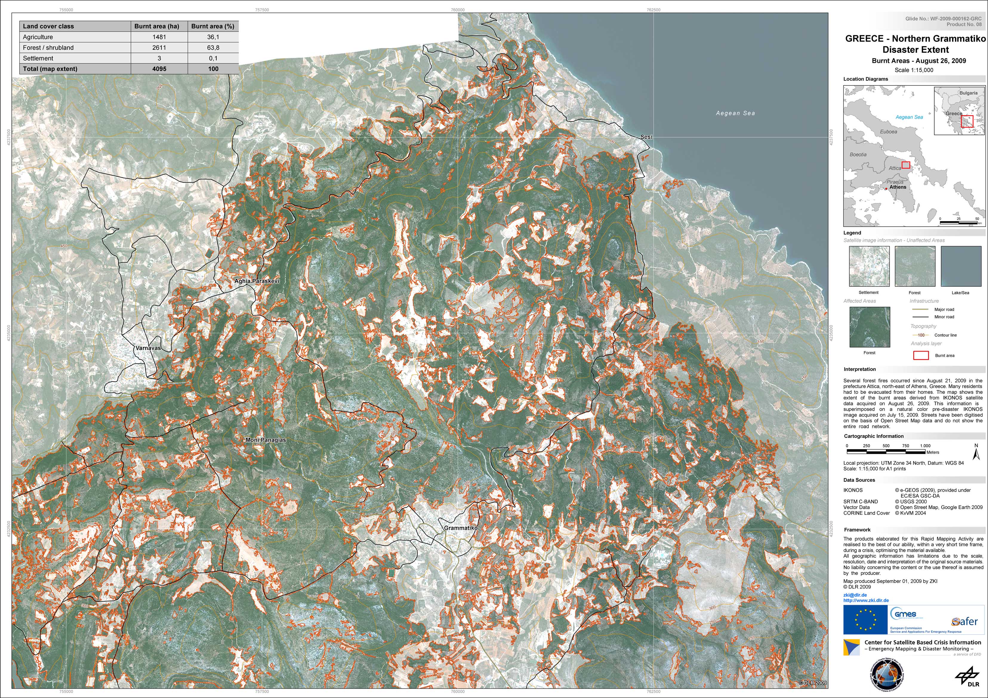
Greece - P08 - Grammatiko - Northern part - Burnt area as of August 26, 2009, highlighted on pre-disaster satellite image
Creation Date 01. September 2009
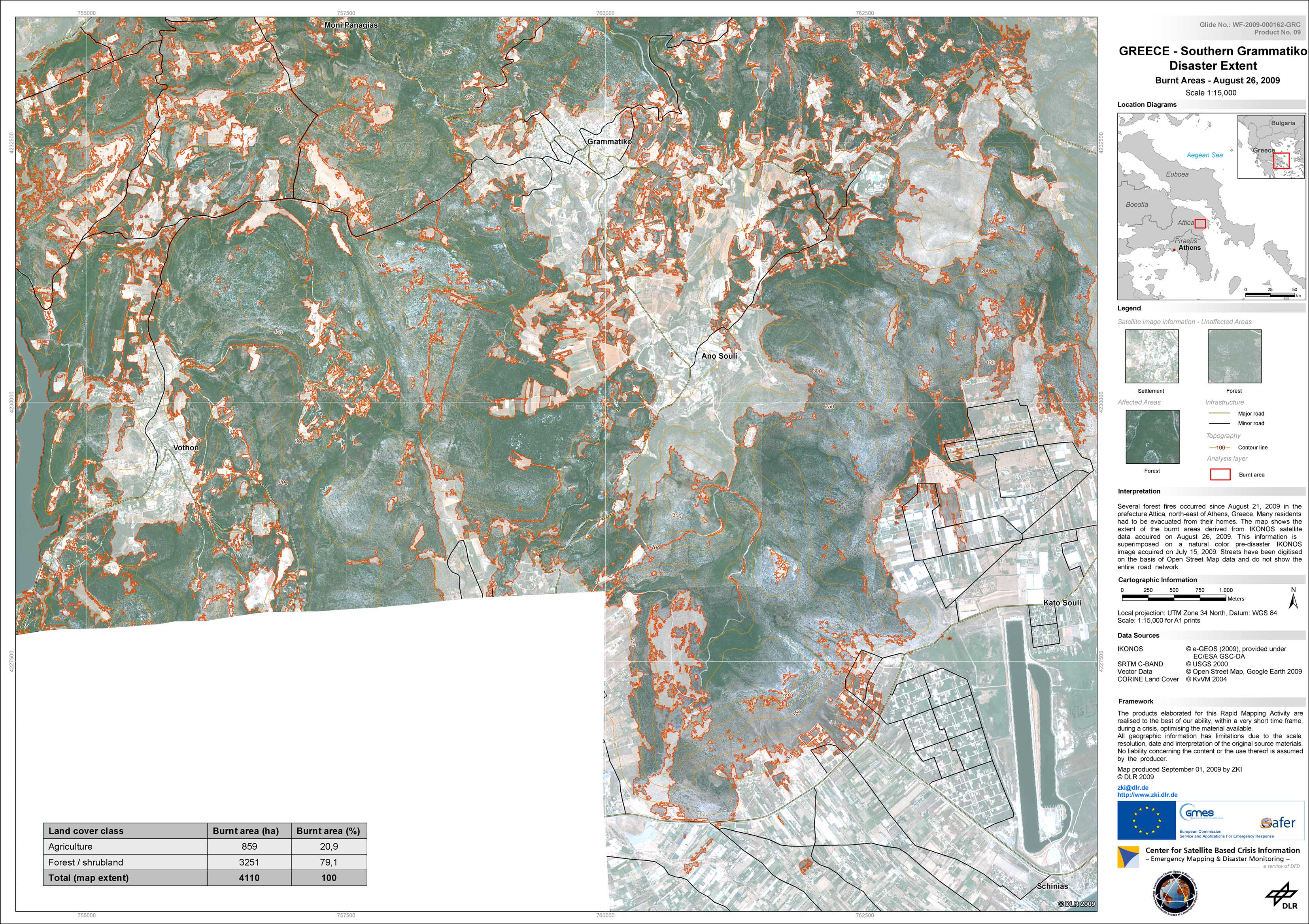
Greece - P09 - Grammatiko - Southern part - Burnt area as of August 26, 2009, highlighted on pre-disaster satellite image
Creation Date 01. September 2009
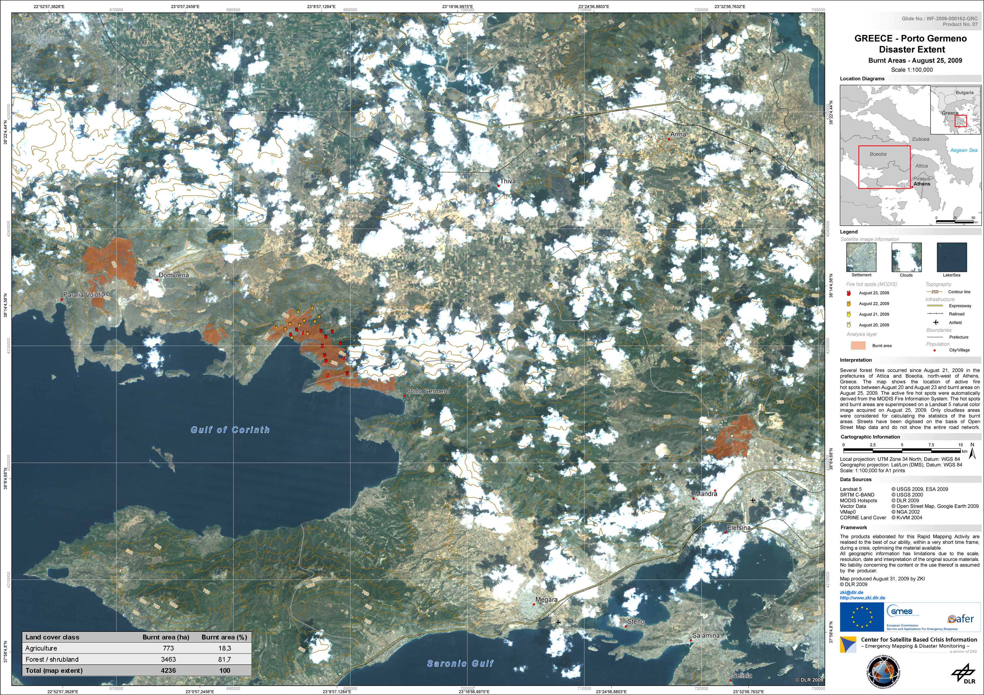
Greece - P07 - Region around Porto Germeno - Burnt area as of August 25, 2009
Creation Date 31. August 2009
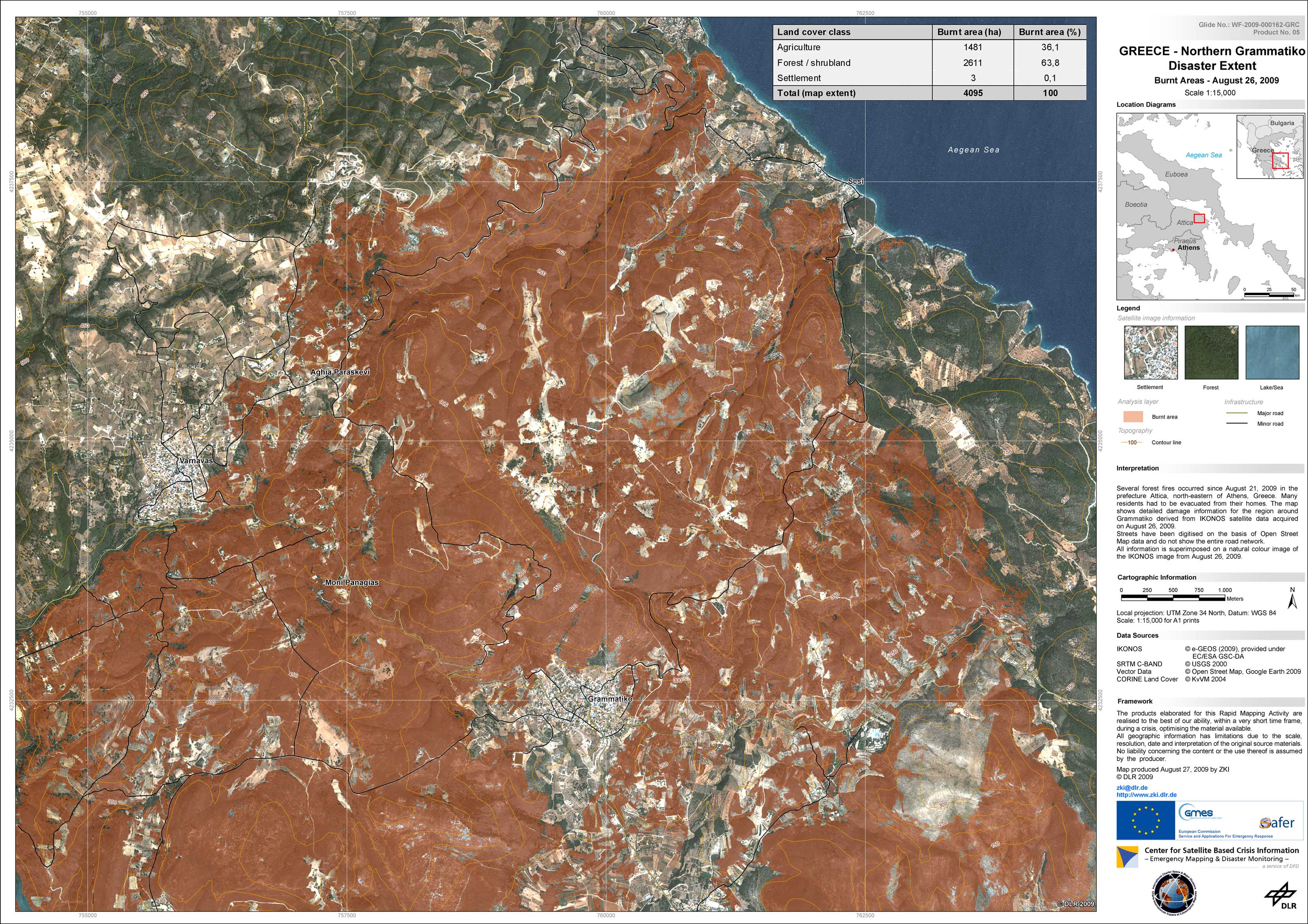
Greece - P05 - Grammatiko - Northern part - Burnt area as of August 26, 2009
Creation Date 27. August 2009
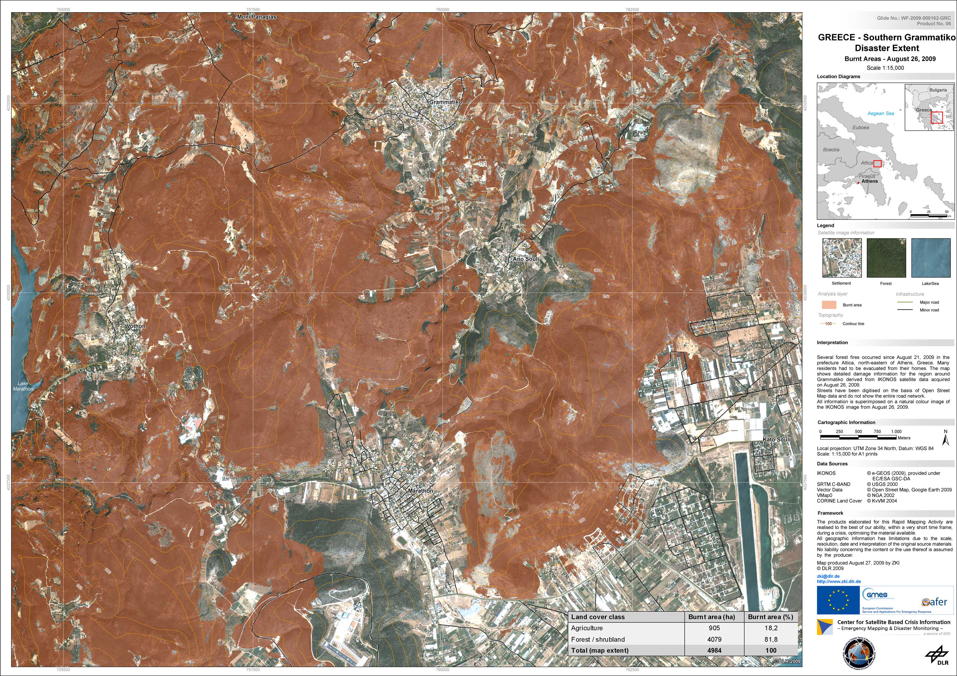
Greece - P06 - Grammatiko - Southern part - Burnt area as of August 26, 2009
Creation Date 27. August 2009
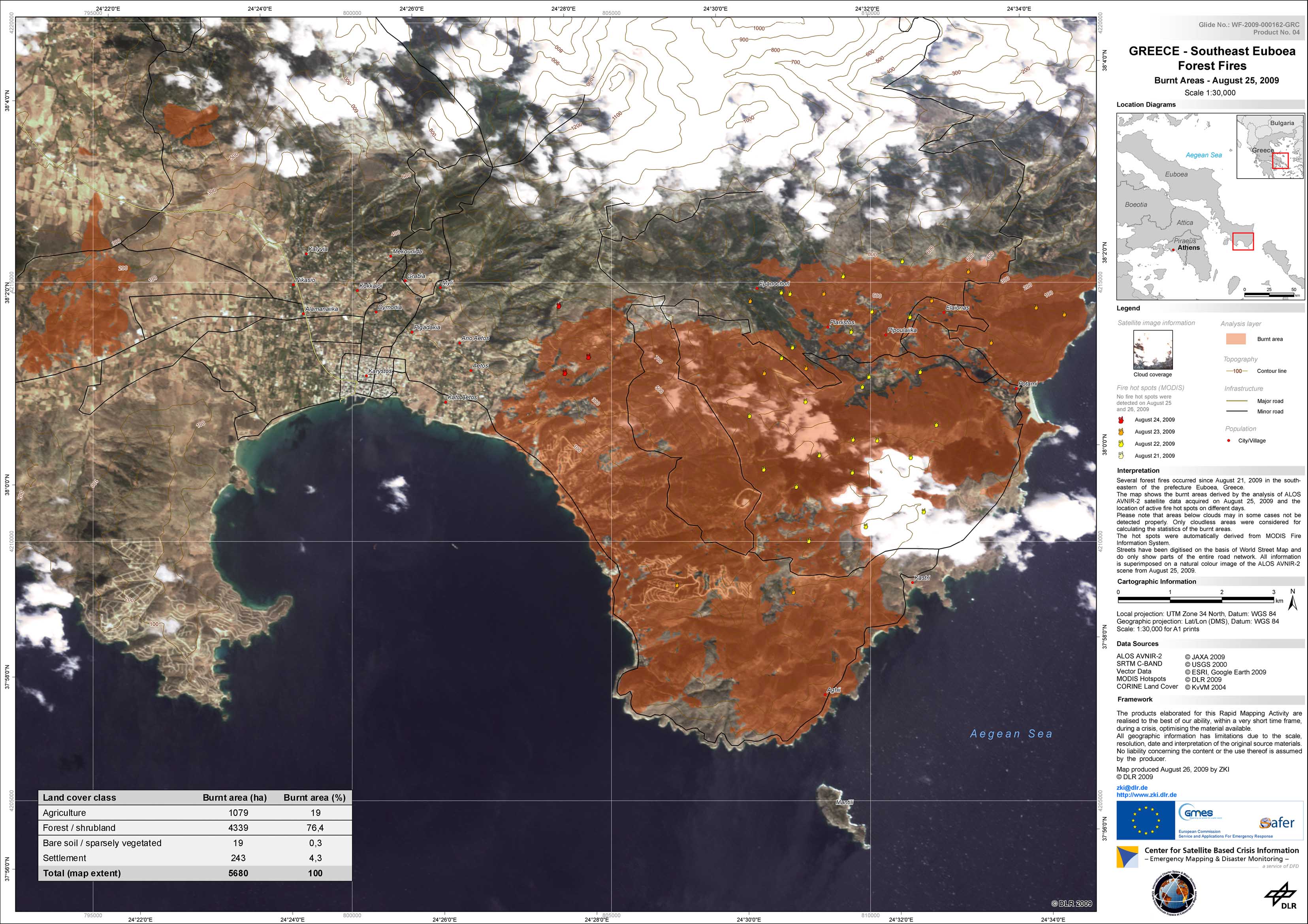
Greece - P04 - Euboea - Burnt area as of August 25, 2009
Creation Date 26. August 2009
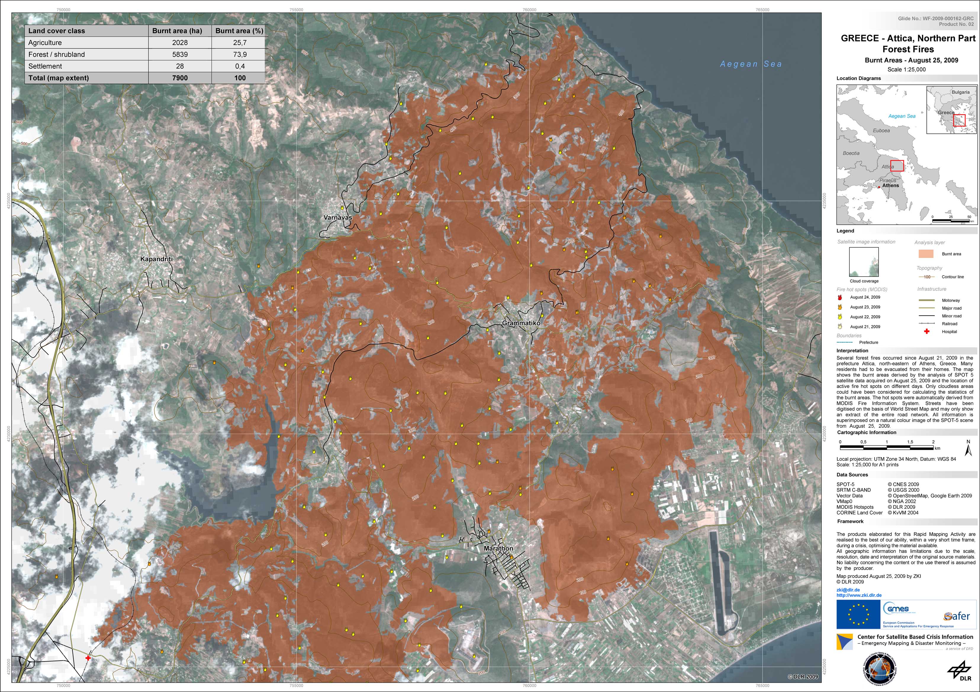
Greece - P02 - Attica - Northern part - Burnt area as of August 25, 2009
Creation Date 25. August 2009
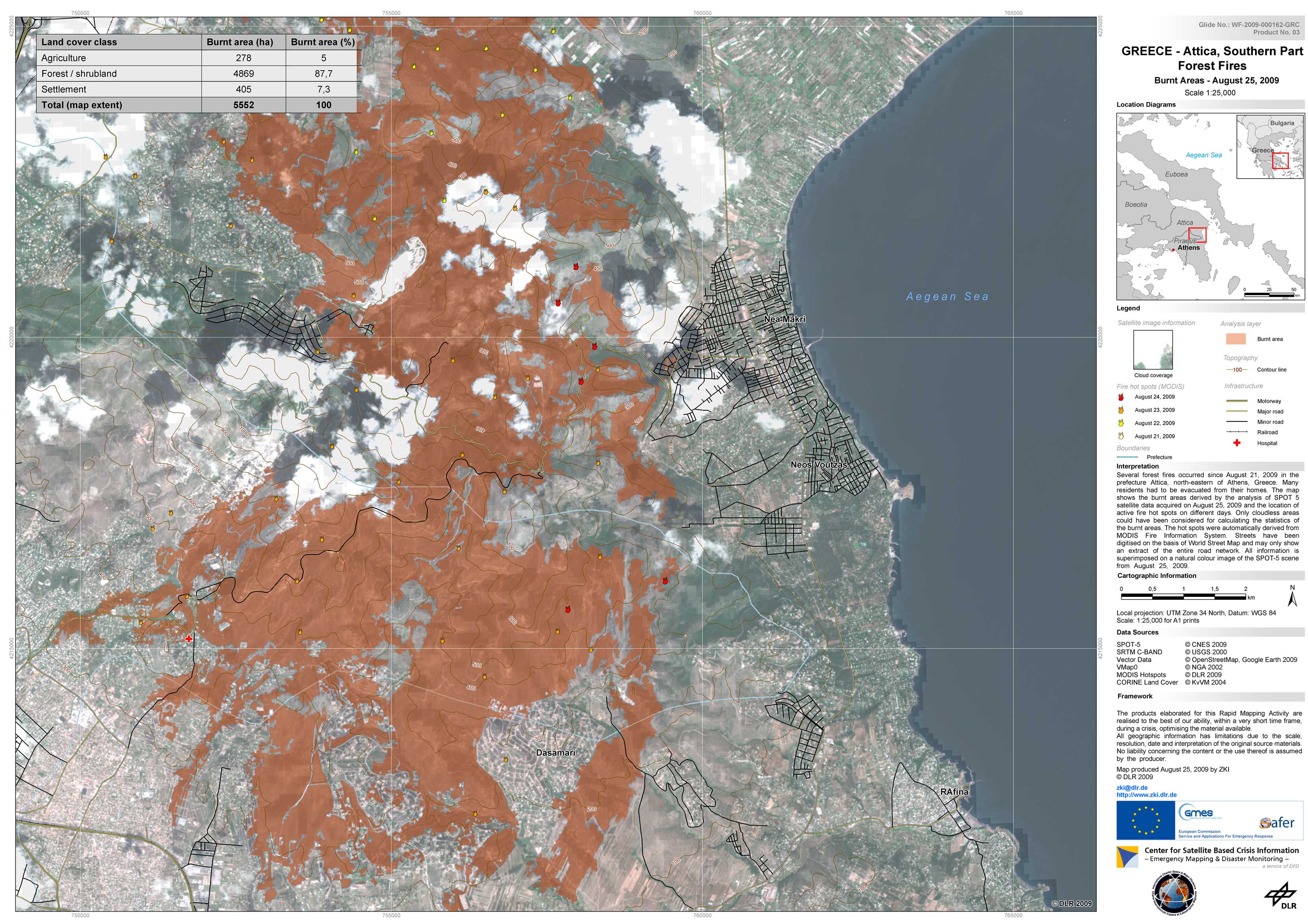
Greece - P03 - Attica - Southern part - Burnt area as of August 25, 2009
Creation Date 25. August 2009
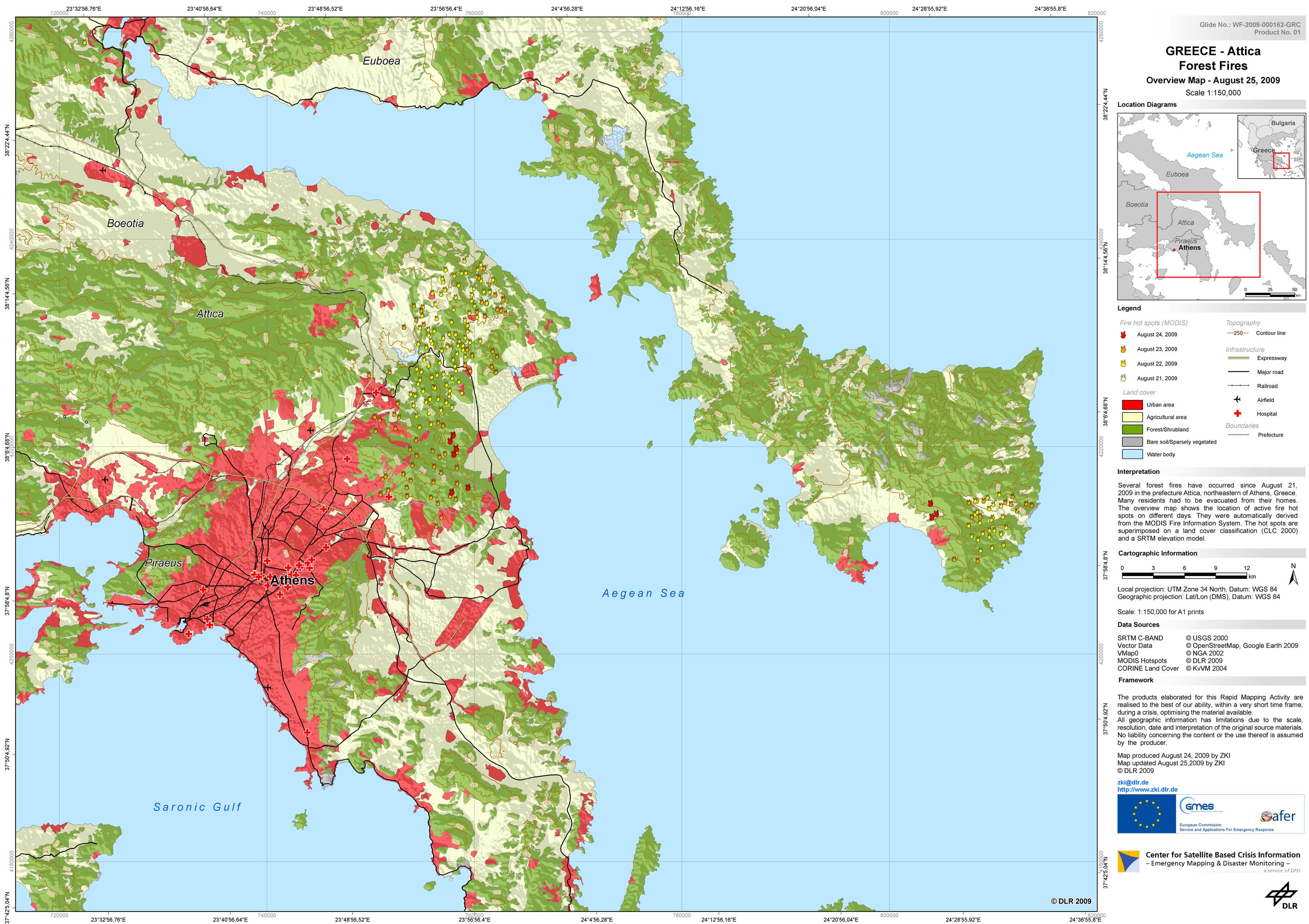
Greece - P01 - Attica - Forest fires - August 2009
Creation Date 24. August 2009