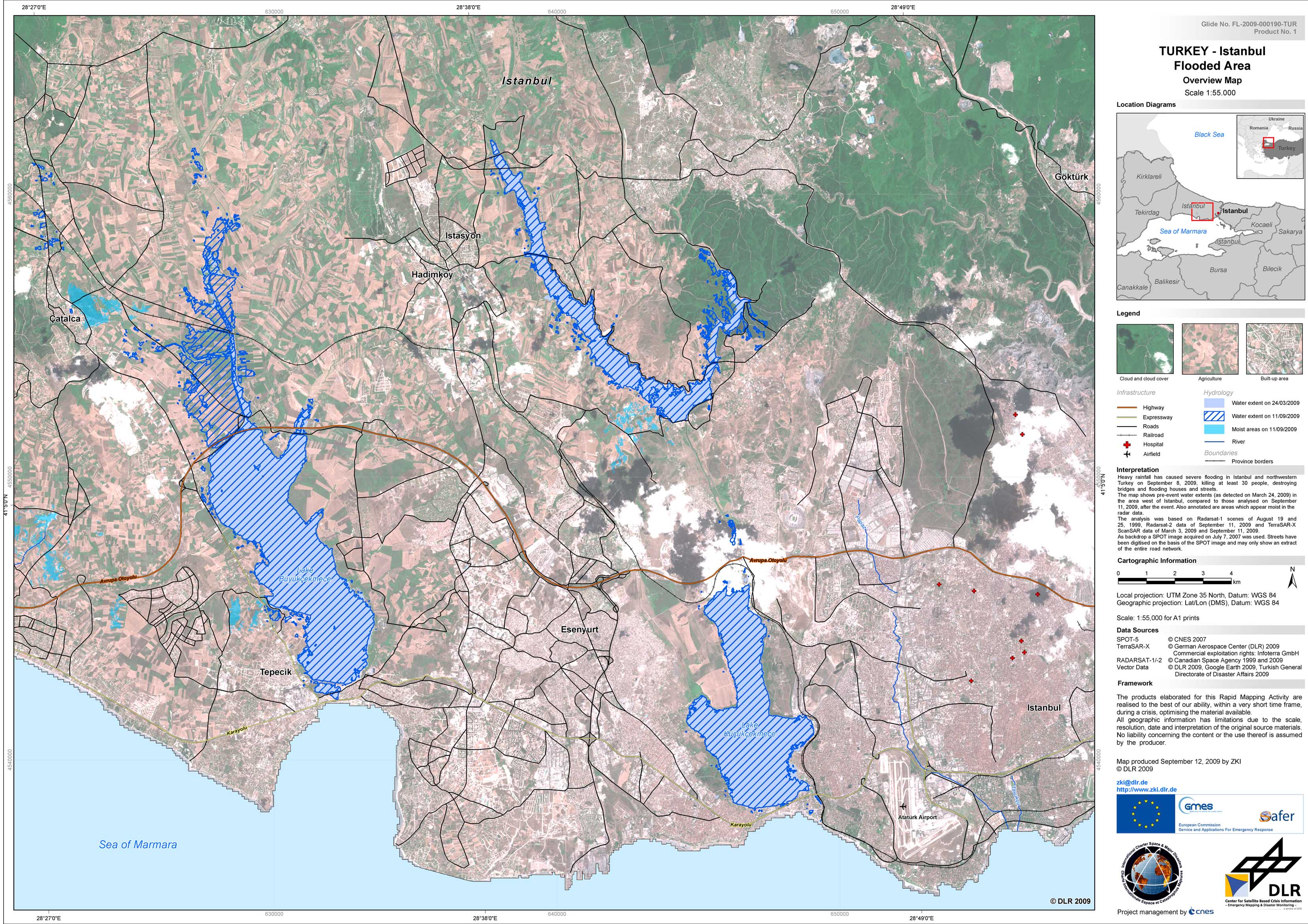
Flash floods near Istanbul, Turkey, September 11th, 2009
undefined
Heavy rainfall has caused severe flooding in Istanbul and northwestern Turkey on September 8, 2009, killing at least 30 people, destroying bridges and flooding houses and streets. The map shows pre-event water extents (as detected on March 24, 2009) in the area west of Istanbul, compared to those analysed on September 11, 2009, after the event. Also annotated are areas which appear moist in the radar data. The analysis was based on Radarsat-1 scenes of August 19 and 25, 1999, Radarsat-2 data of September 11, 2009 and TerraSAR-X ScanSAR data of March 3, 2009 and September 11, 2009. As backdrop a SPOT image acquired on July 7, 2007 was used. Streets have been digitised on the basis of the SPOT image and may only show an extract of the entire road network.
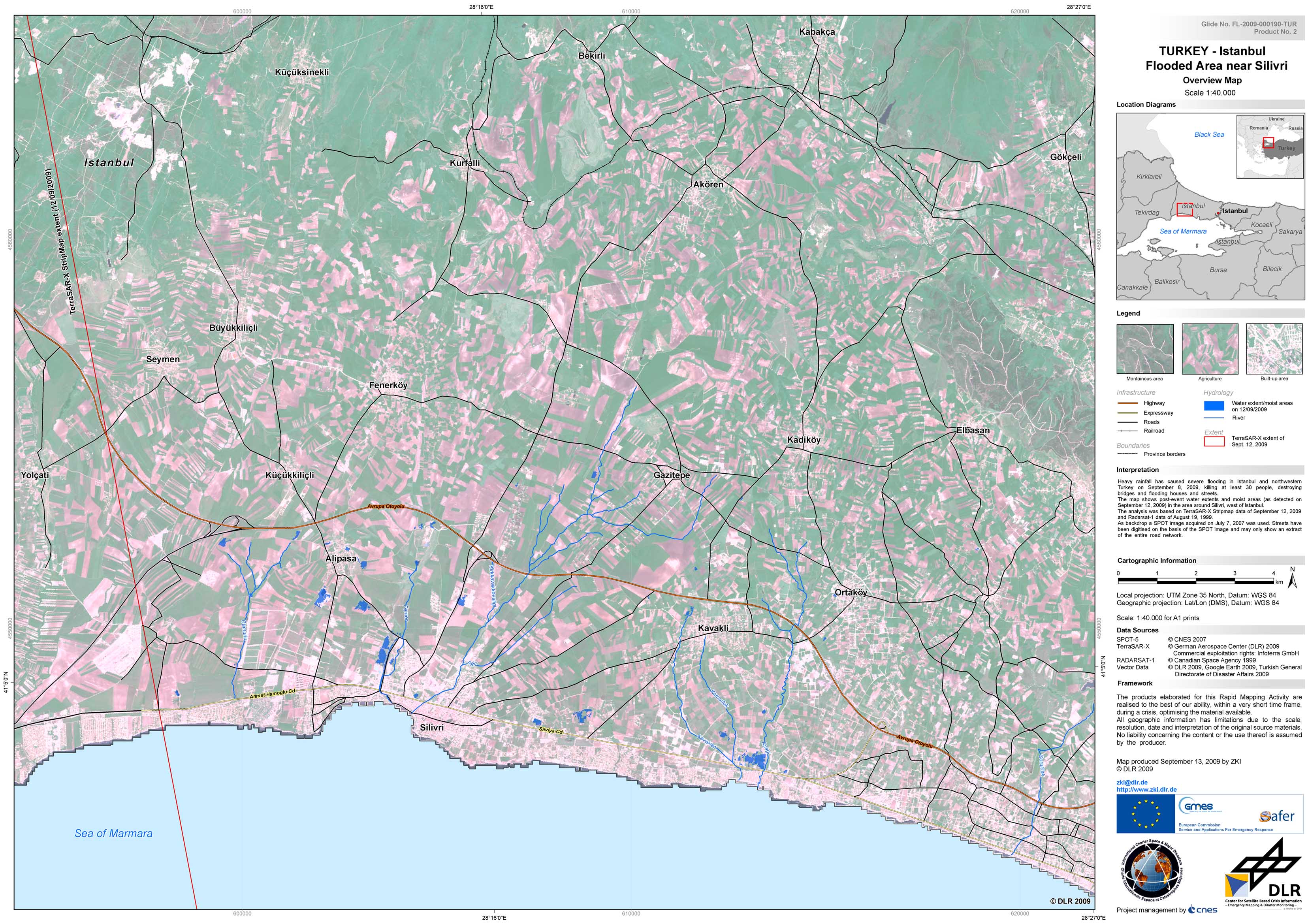
Turkey - P02 - Flooded areas around Silivri west of Istanbul as of September 12, 2009
Creation Date 13. September 2009
Turkey - P01 - Flooded areas west of Istanbul as of September 11, 2009
Creation Date 12. September 2009
undefined