
Earthquakes in Sumatra / Indonesia on September 30 and October 1, 2009
undefined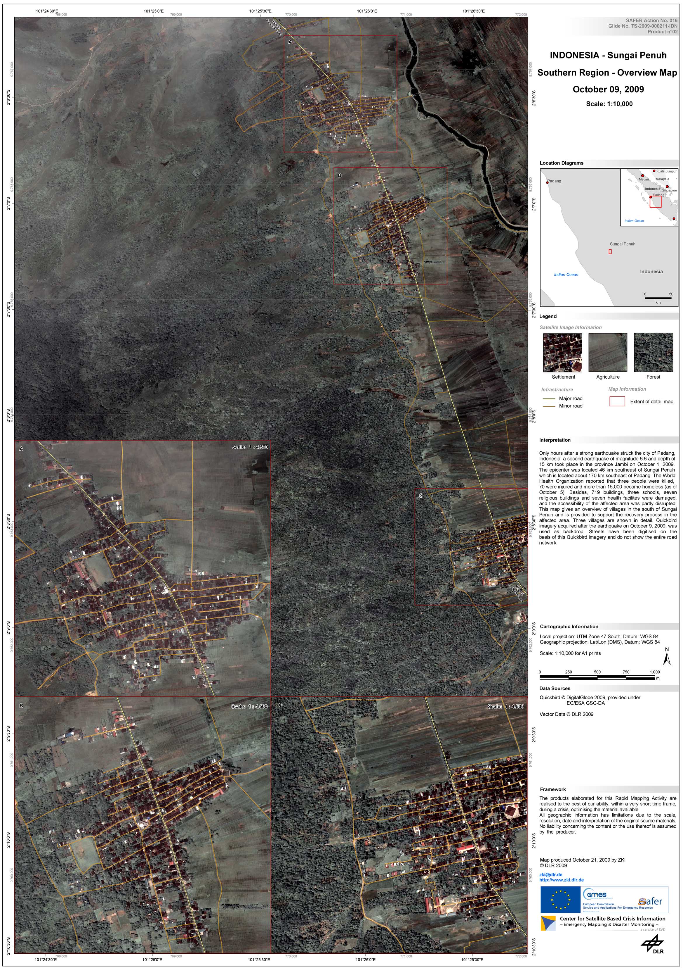
Indonesia - Sumatra - P12 - Region south of Sungai Penuh - Overview satellite map
Creation Date 21. October 2009
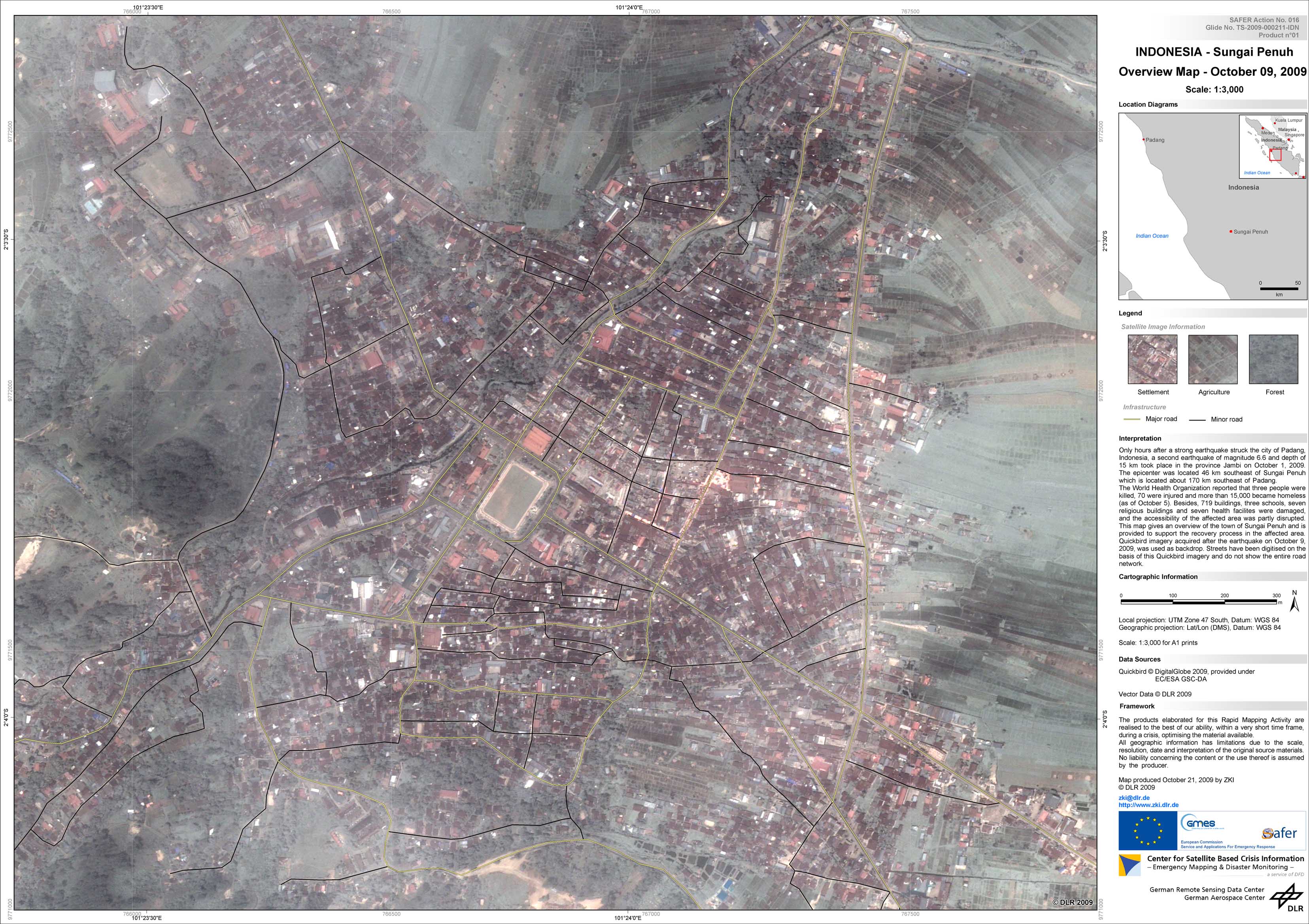
Indonesia - Sumatra - P11 - Sungai PenuhOverview satellite map
Creation Date 21. October 2009
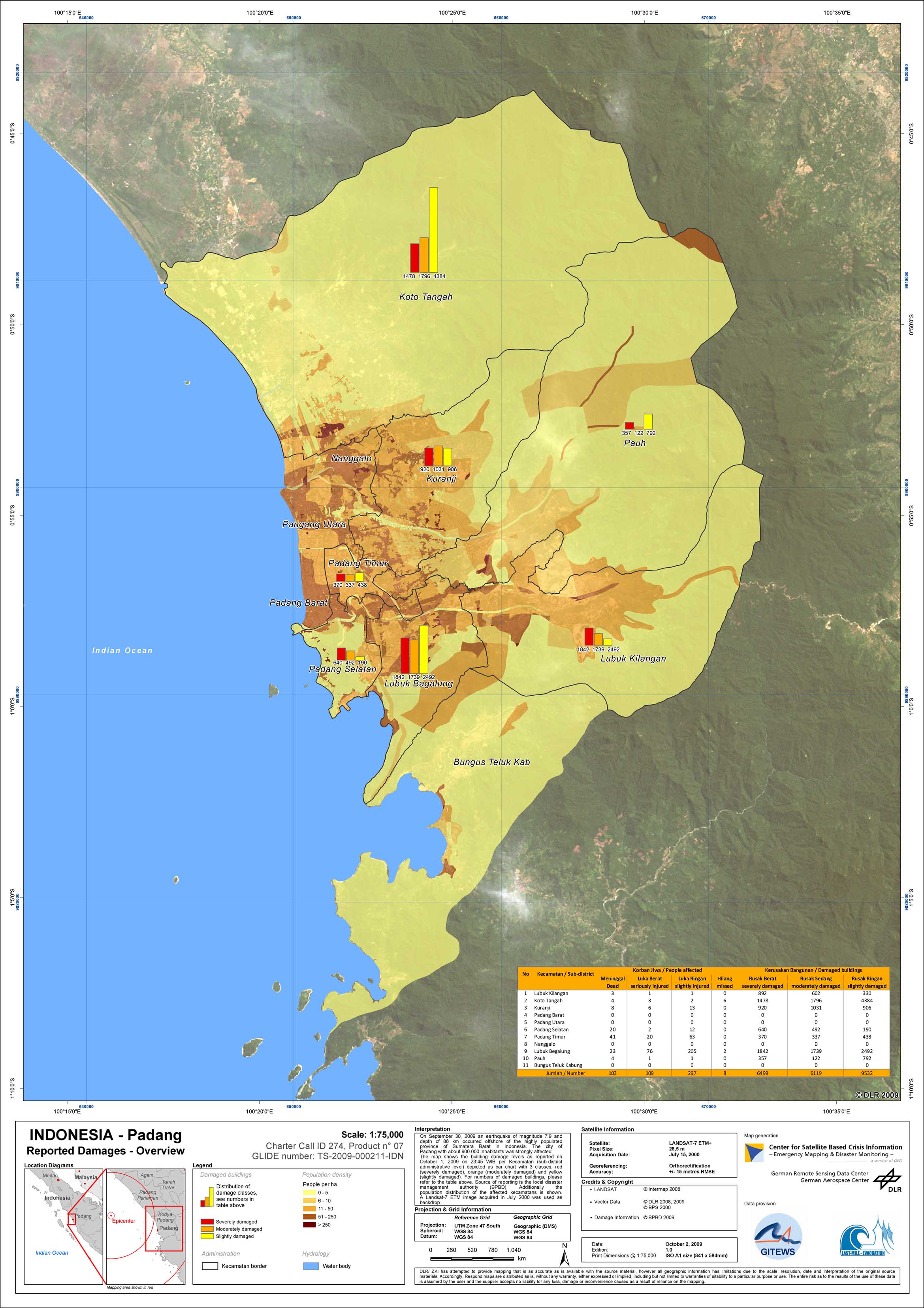
Indonesia - Sumatra - P07 - Reported Building Damage: Overview Map of City of Padang
Creation Date 12. October 2009
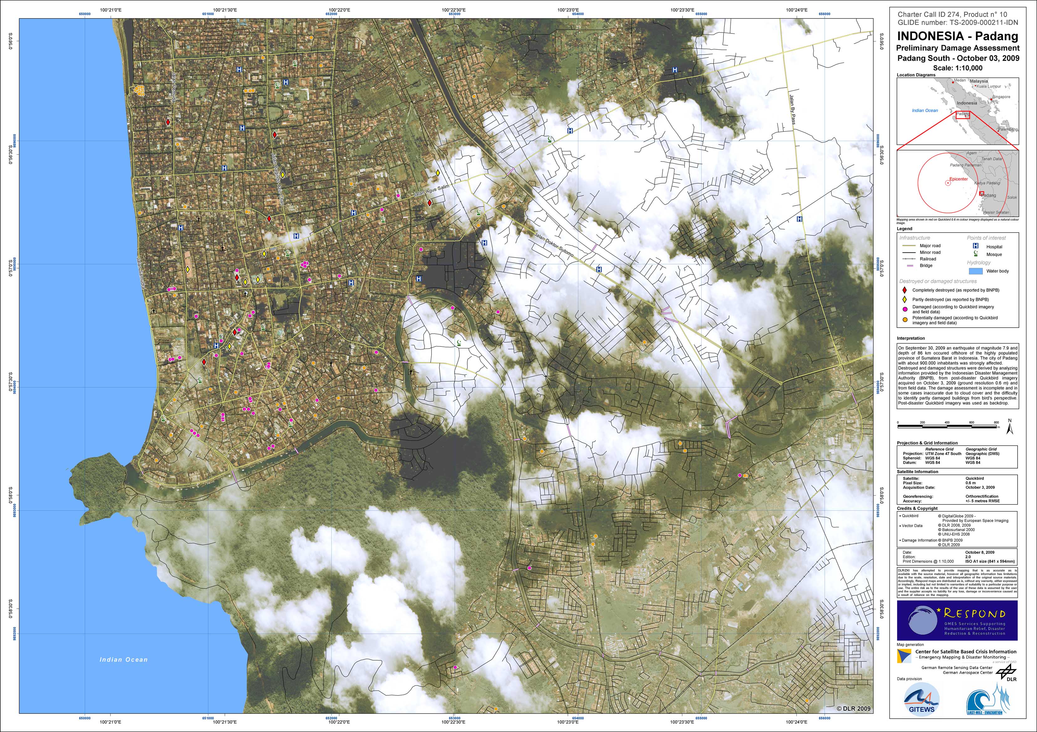
Indonesia - Sumatra - P10 - Preliminary Damage Assessment Map of City of Padang, Southern Part
Creation Date 08. October 2009
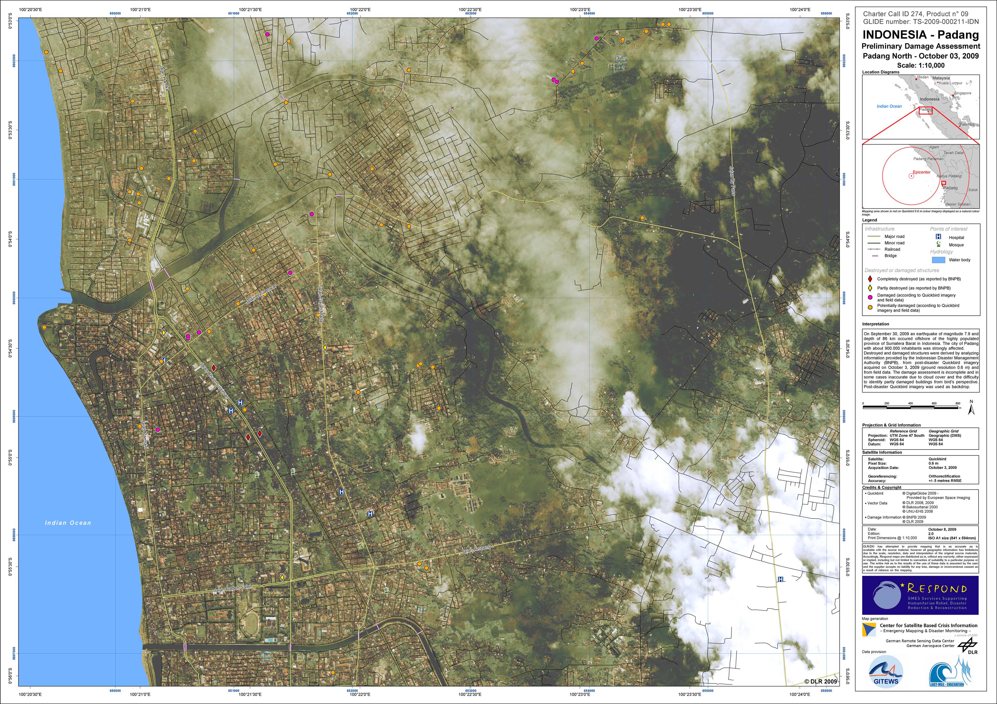
Indonesia - Sumatra - P09 - Preliminary Damage Assessment Map of City of Padang, Northern Part
Creation Date 08. October 2009
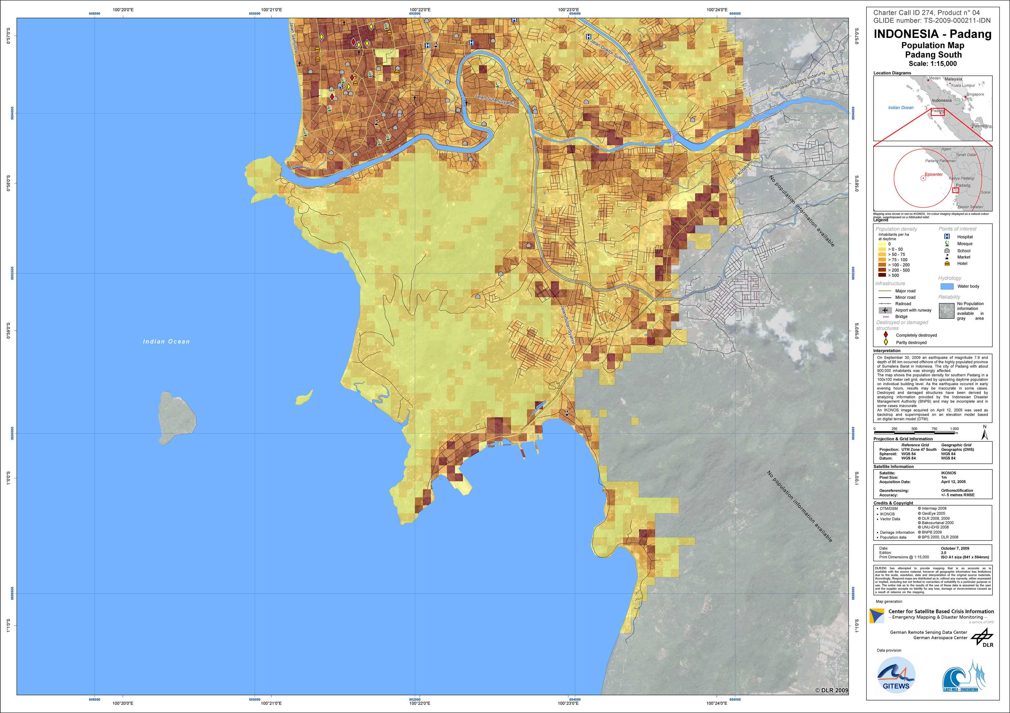
Indonesia - Sumatra - P04 - Population Map of Padang, Southern Part, with building damages as of October 1, 2009
Creation Date 07. October 2009
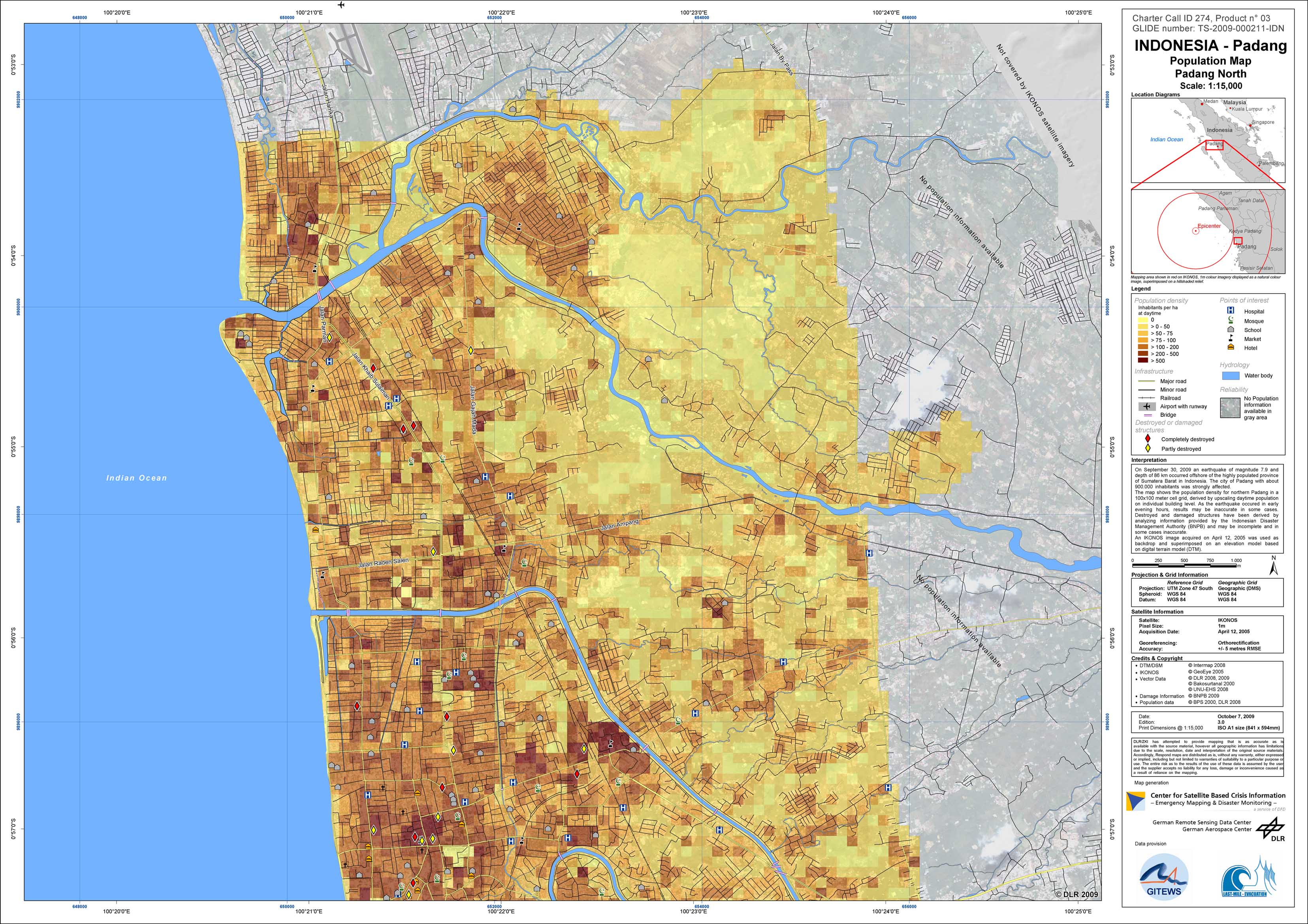
Indonesia - Sumatra - P03 - Population Map of Padang, Northern part, with building damages as of October 1, 2009
Creation Date 07. October 2009
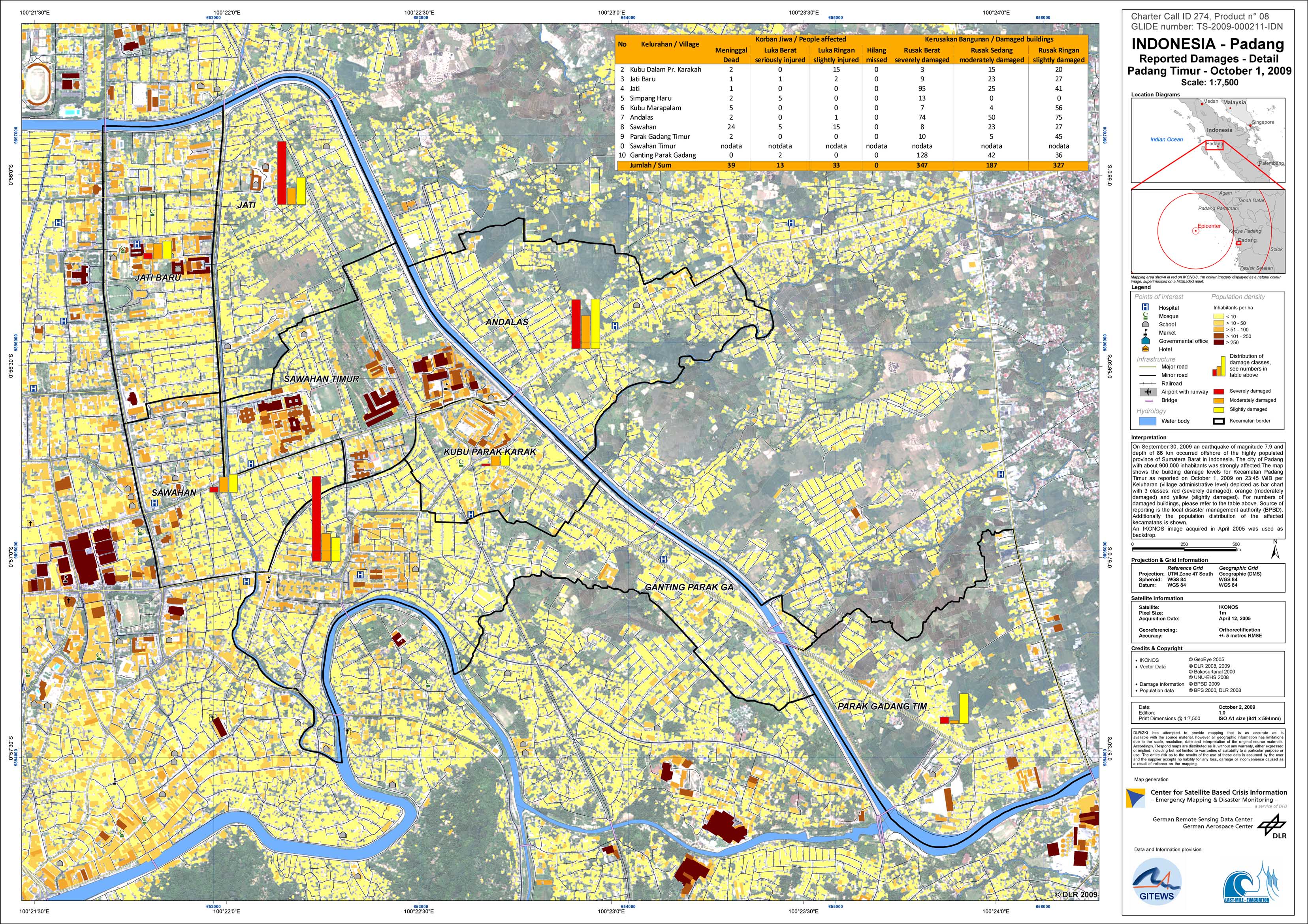
Indonesia - Sumatra - P08 - Reported Building Damage: Detail Map of City of Padang
Creation Date 02. October 2009
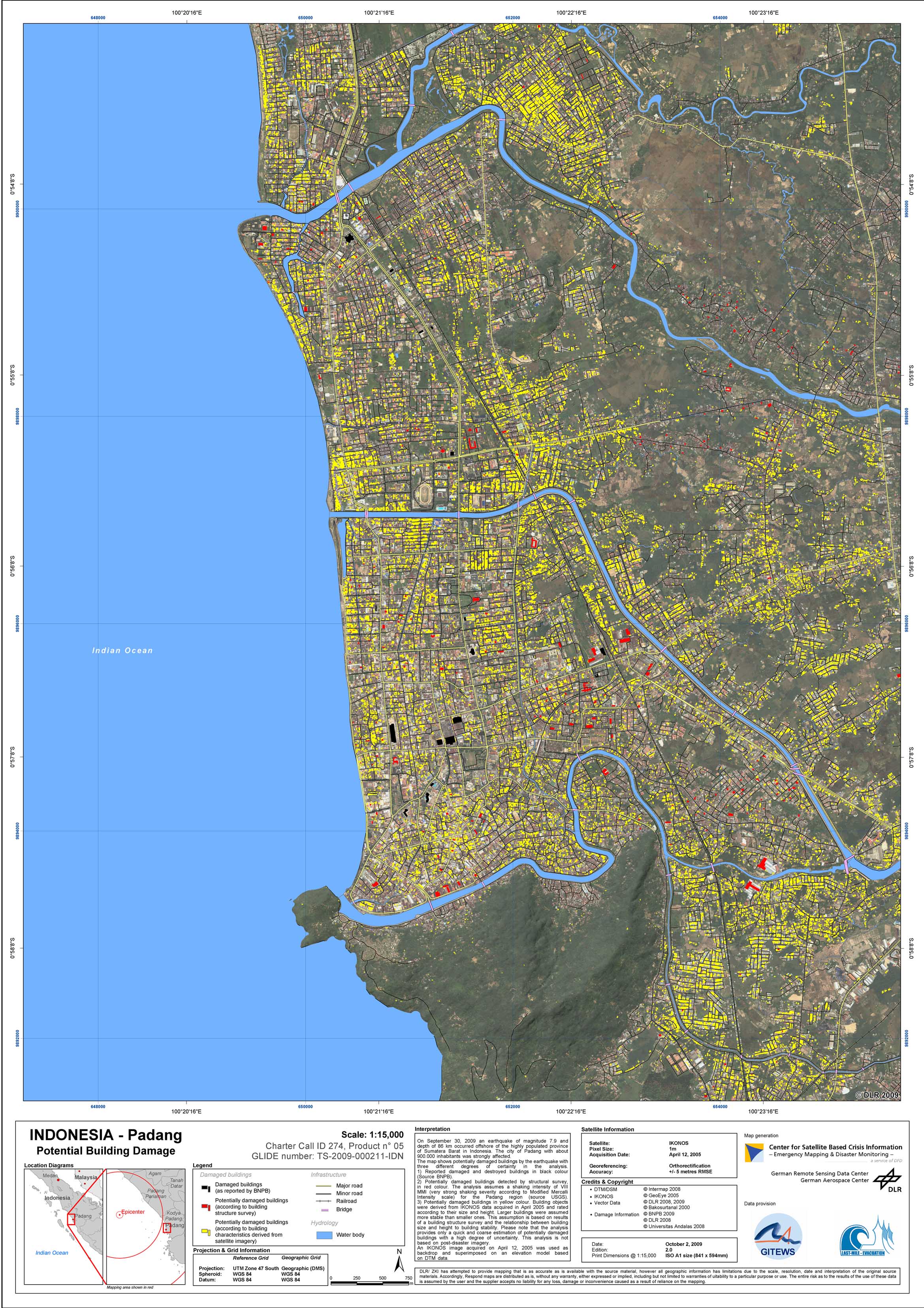
Indonesia - Sumatra - P05 - Potential Building Damage: Map of Padang
Creation Date 02. October 2009
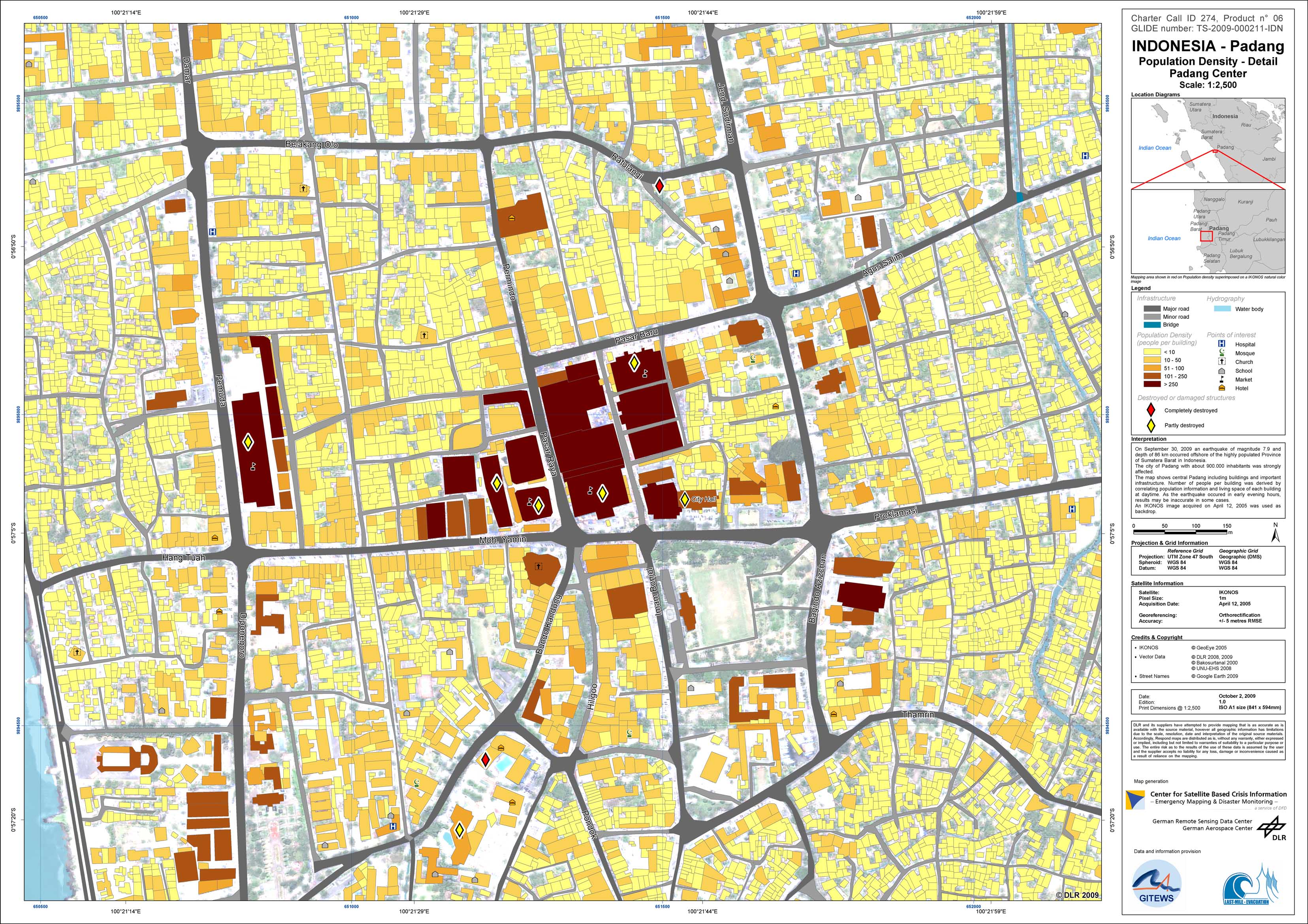
Indonesia - Sumatra - P06 - Map showing population density per building and damaged or destroyed buildings for central Padang
Creation Date 02. October 2009
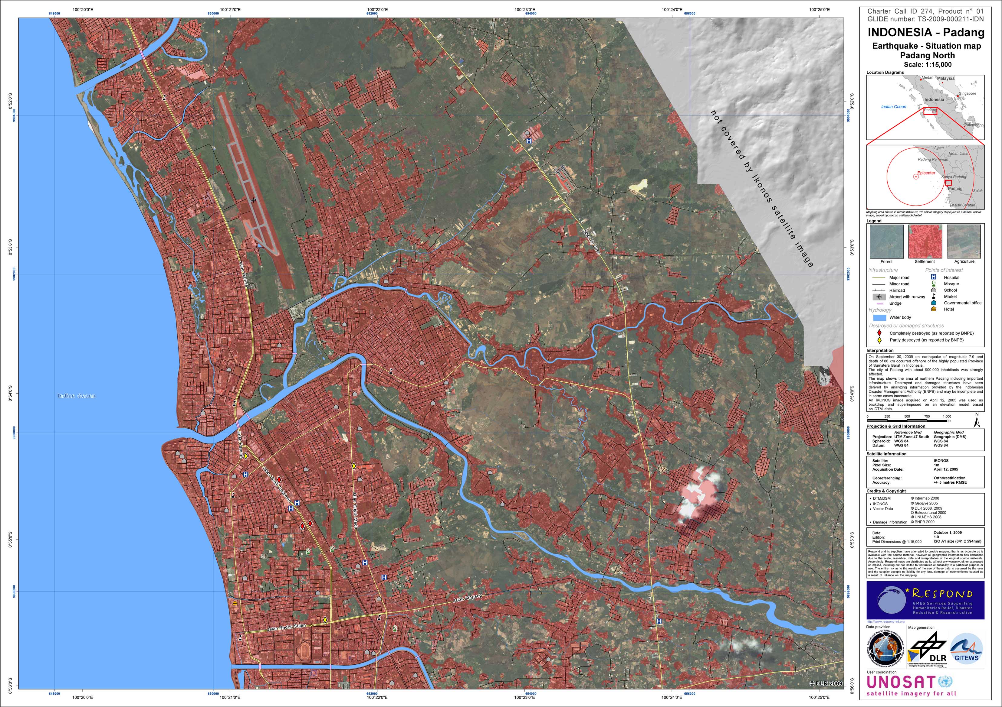
Indonesia - Sumatra - P01 - Situation Map of Padang, Northern part, with building damages as of October 1, 2009
Creation Date 01. October 2009
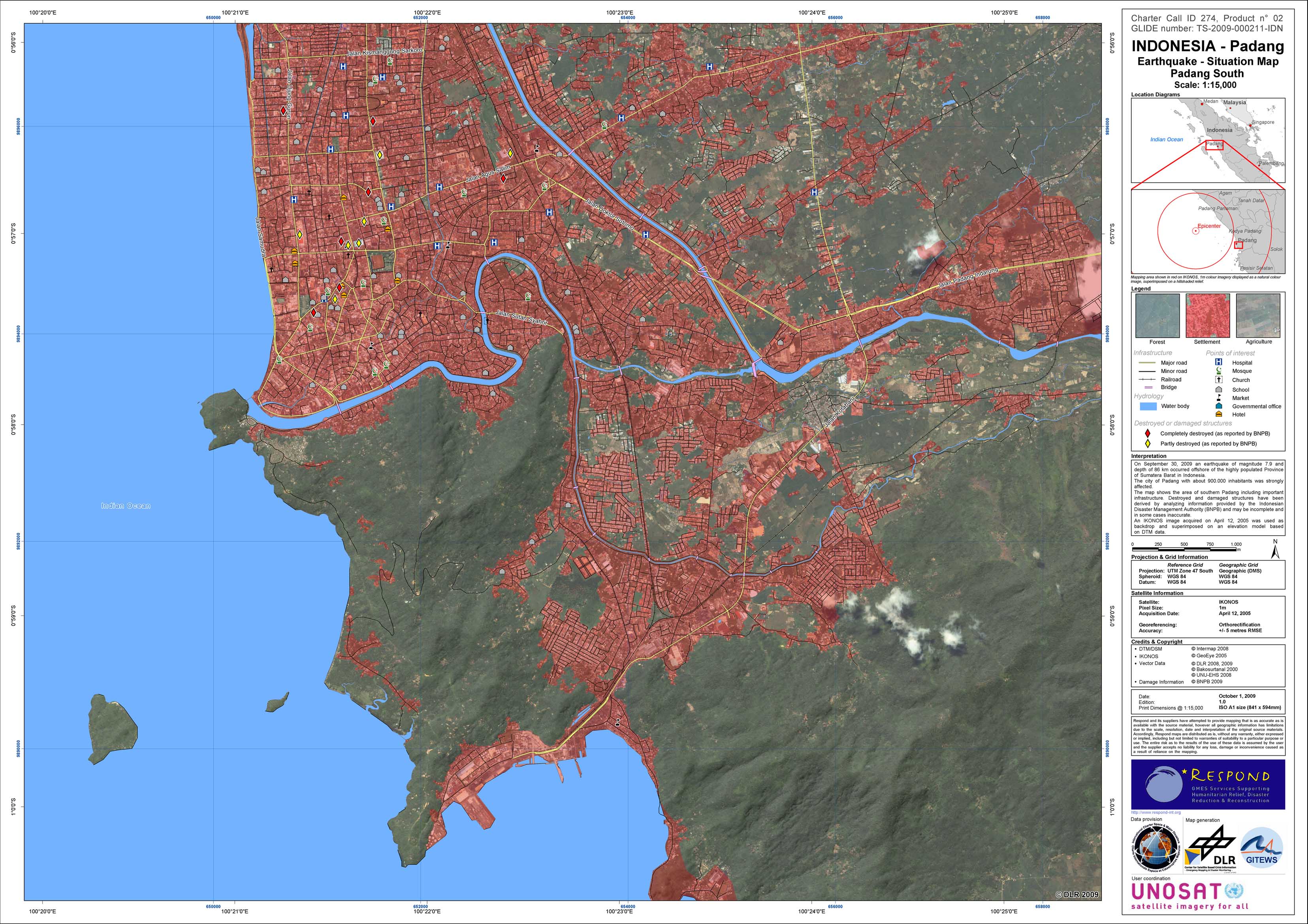
Indonesia - Sumatra - P02 - Situation Map of Padang, Southern Part, with building damages as of October 1, 2009
Creation Date 01. October 2009