
Floods in Albania on January 2010
undefined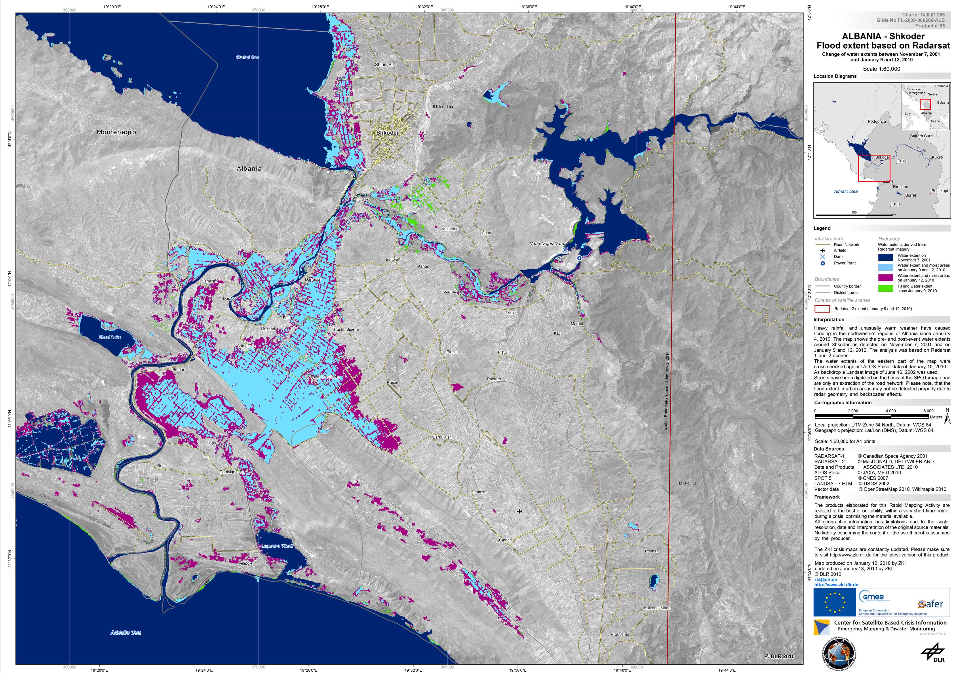
Albania - P06 - Satellite map of the flooded area around Shkoder - Change of water extents between November 7, 2010 and January 9 and 12, 2010
Creation Date 13. January 2013
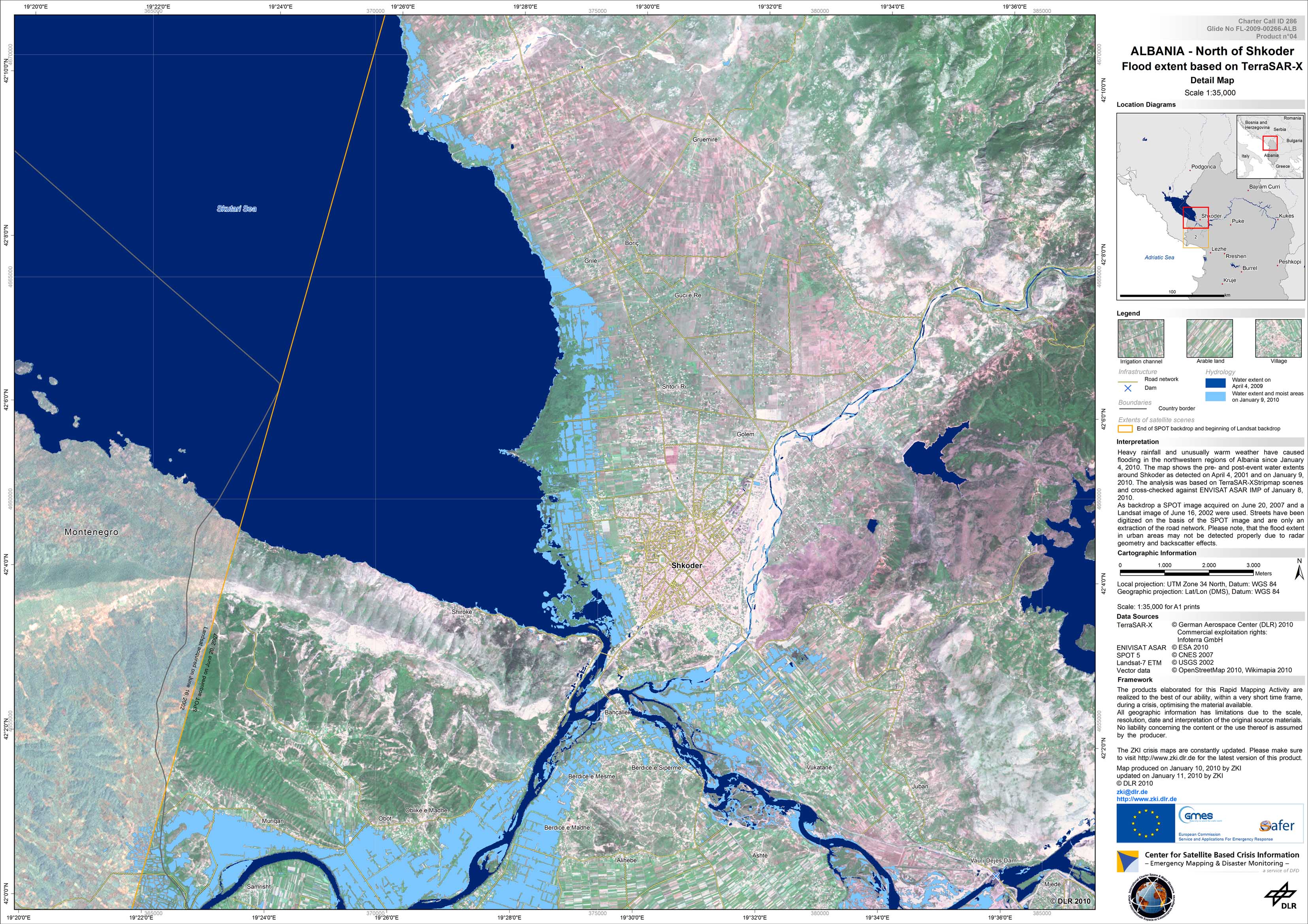
Albania - P04 - Satellite map of the flooded area around Shkoder based on TerraSAR-X imagery of January 9, 2010, northern part
Creation Date 11. January 2013
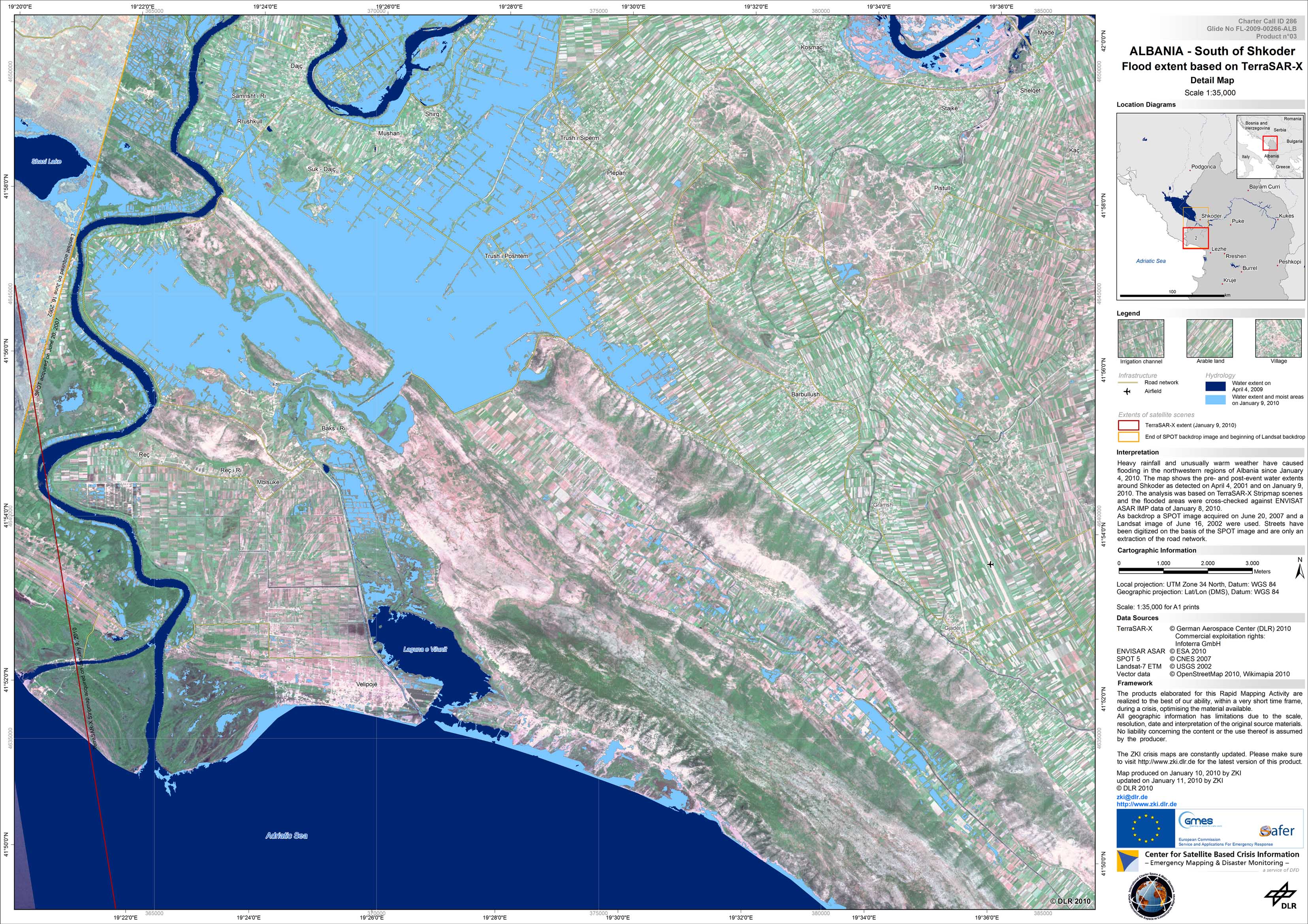
Albania - P03 - Satellite map of the flooded area around Shkoder based on TerraSAR-X imagery of January 9, 2010, southern part
Creation Date 11. January 2013
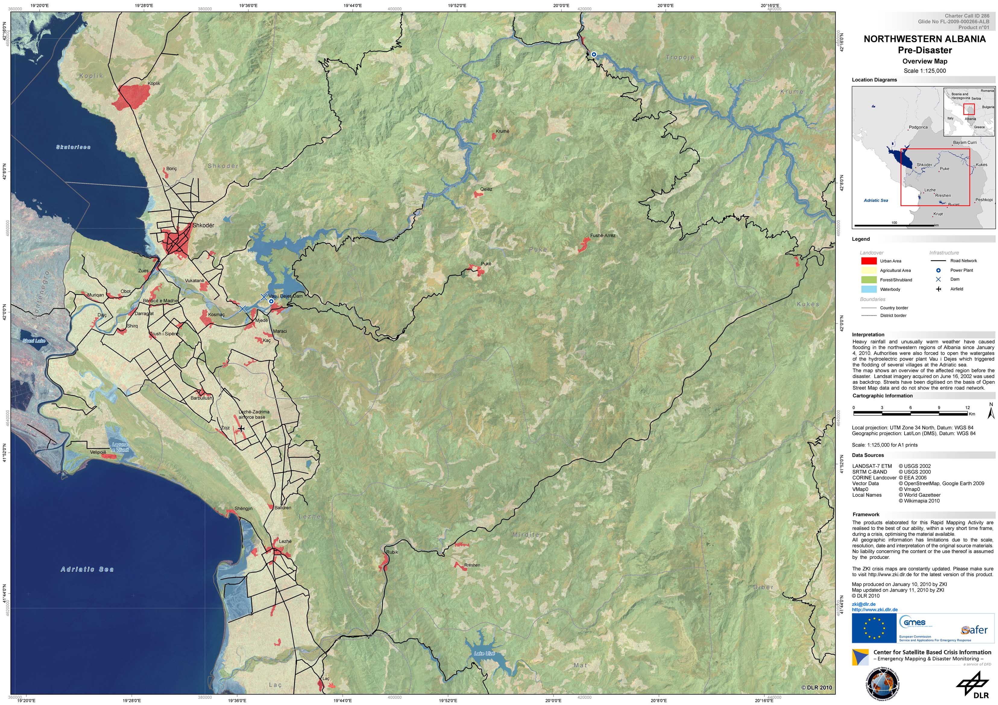
Albania - P01 - Overview map of the affected region near Shkoder
Creation Date 11. January 2013
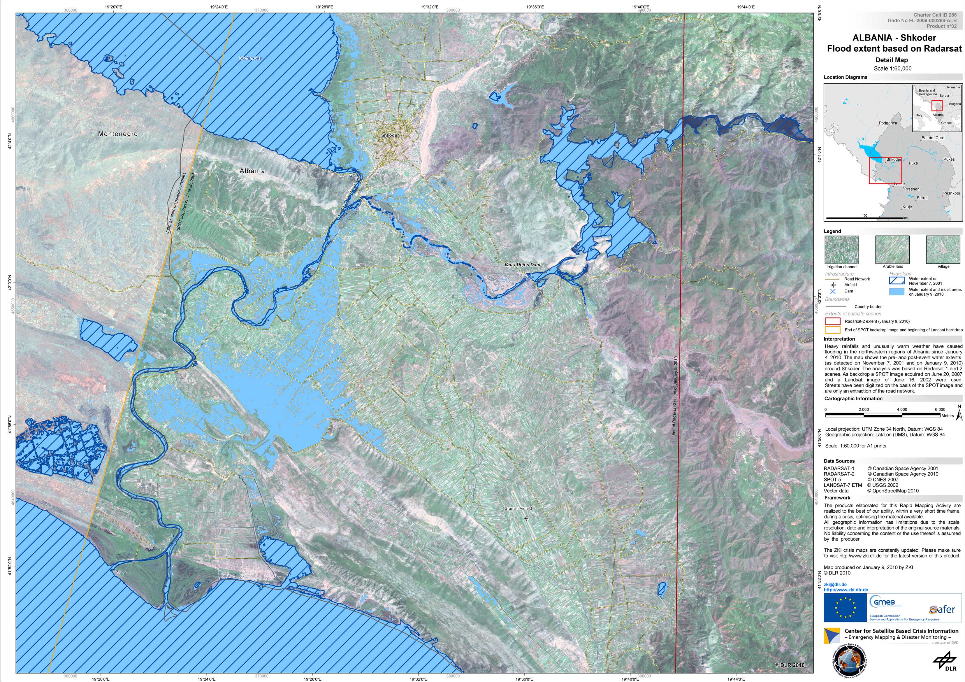
Albania - P02 - Satellite map of the flooded area around Shkoder based on Radarsat imagery of January 9, 2010
Creation Date 10. January 2013
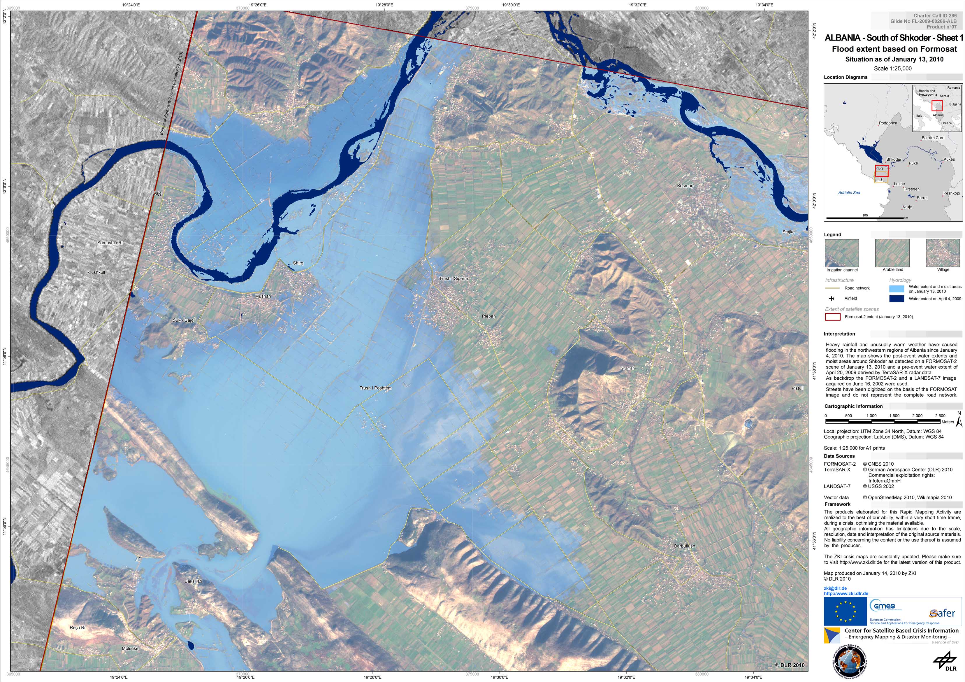
Albania - P07 - Satellite map of the flooded area around Shkoder based on Formosat-2 imagery of January 13, 2010, northern part
Creation Date 14. January 2010
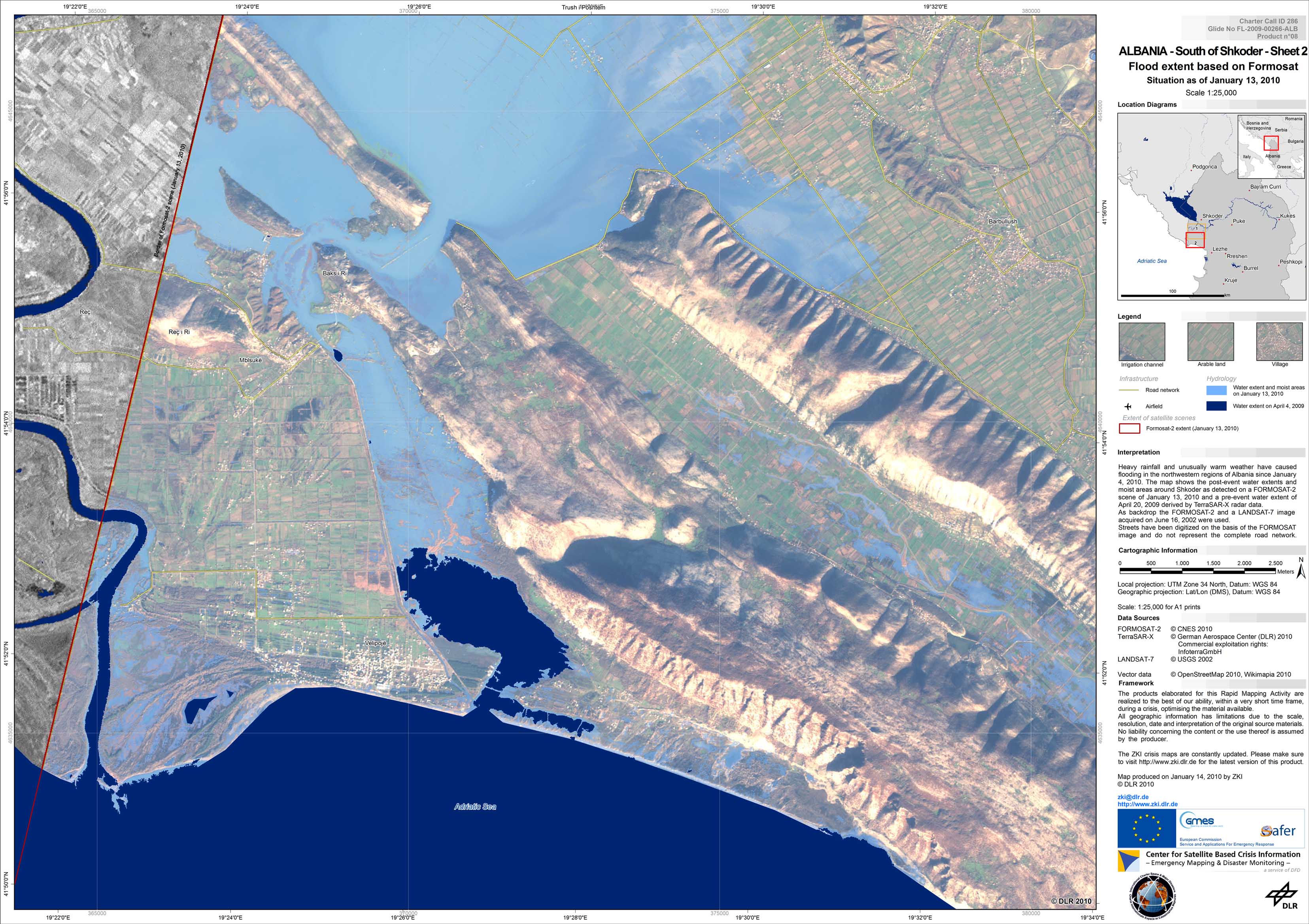
Albania - P08 - Satellite map of the flooded area around Shkoder based on Formosat-2 imagery of January 13, 2010, southern part
Creation Date 14. January 2010
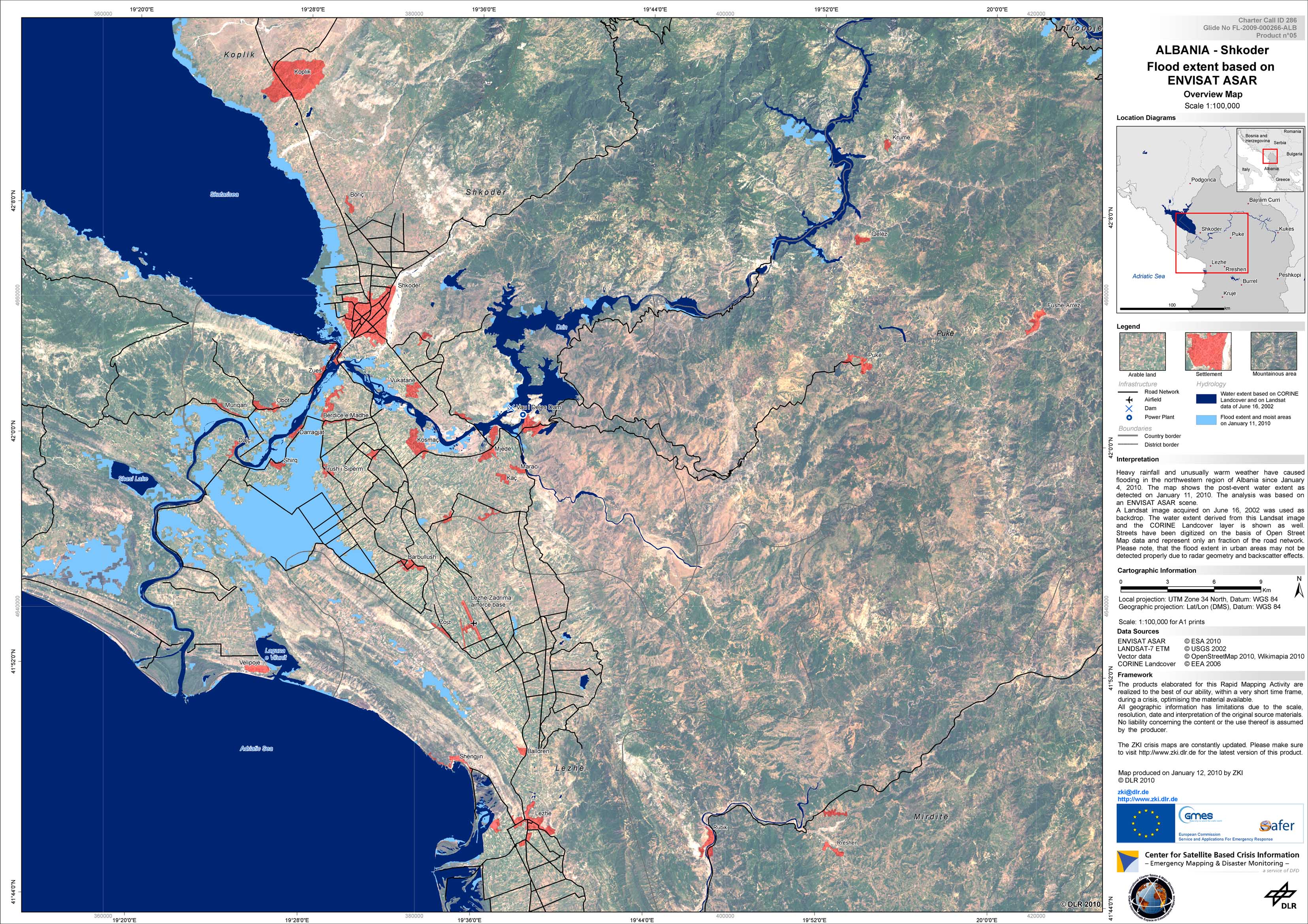
Albania - P05 - Satellite map of the flooded area around Shkoder based on Envisat Asar imagery of January 11, 2010
Creation Date 12. January 2010