
Floods in Hungary on March 2010
undefined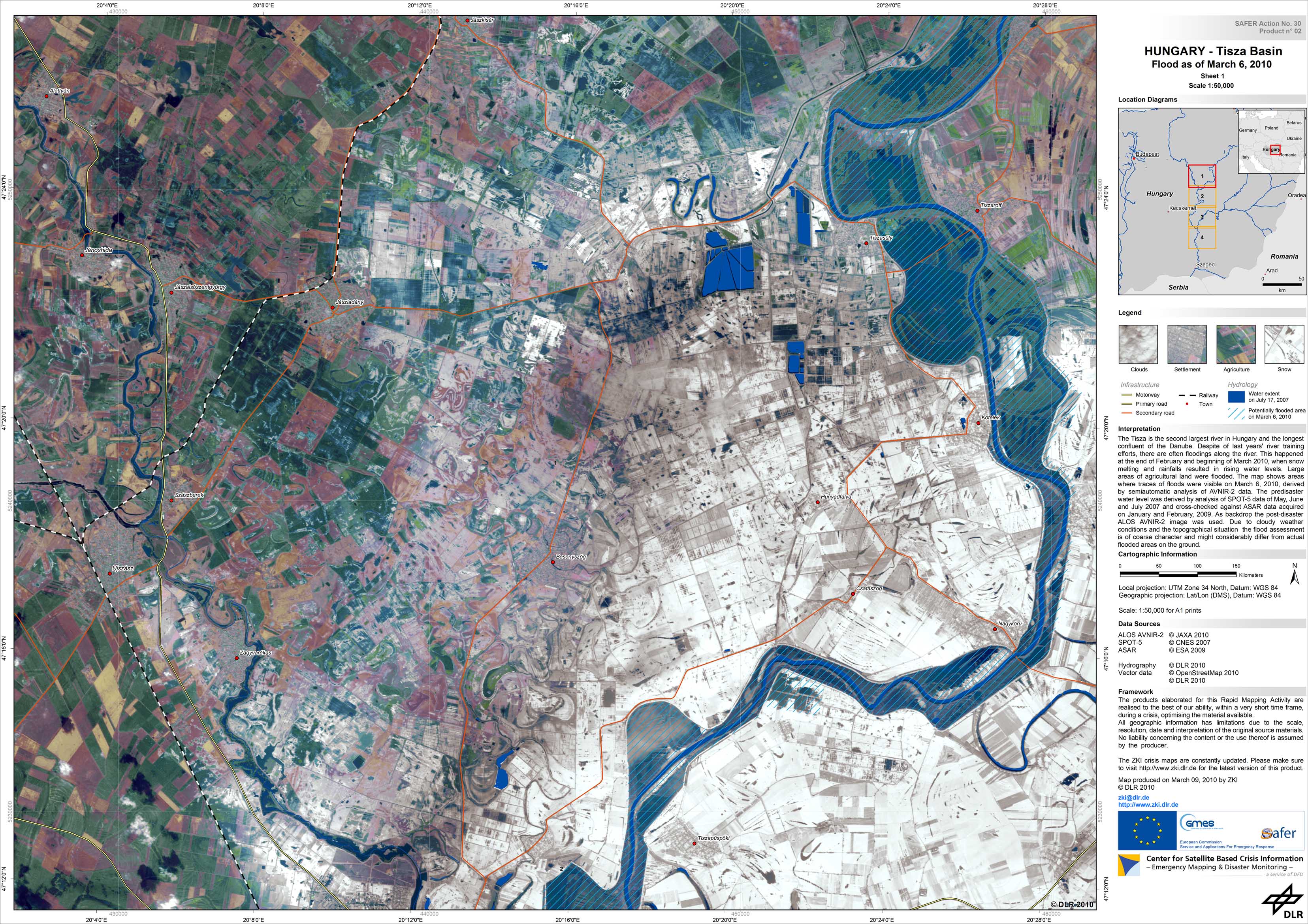
Hungary - Tisza region - P02 - Satellite map of potentially flooded areas in the Tisza basin, Hungary, based on AVNIR-2 imagery of March 06, 2010 - Area 2, Sheet 1
Creation Date 09. March 2010
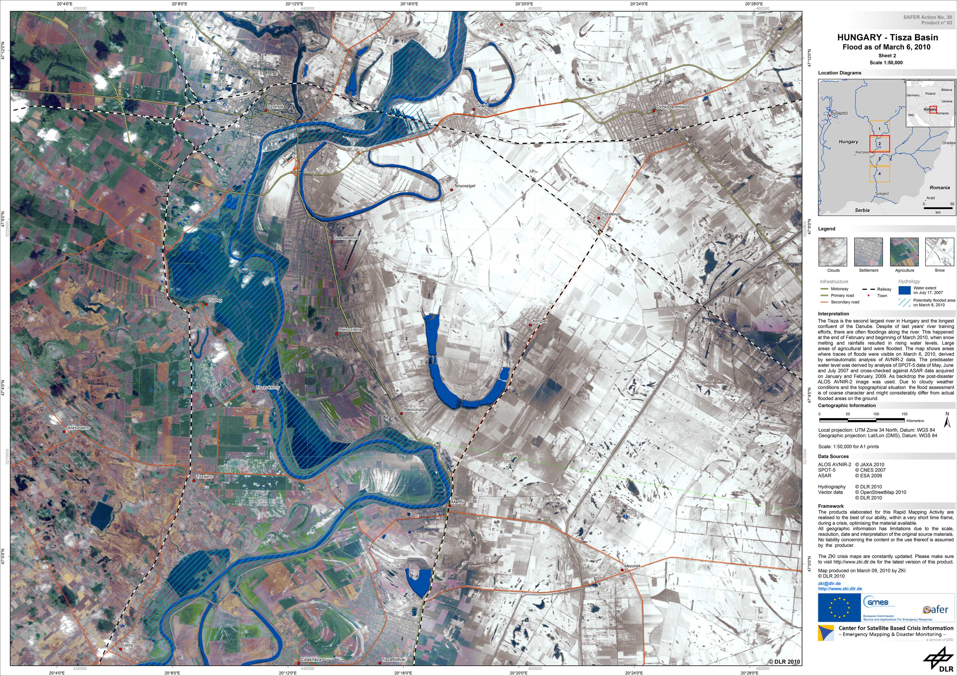
Hungary - Tisza region - P03 - Satellite map of potentially flooded areas in the Tisza basin, Hungary, based on AVNIR-2 imagery of March 06, 2010 - Area 2, Sheet 2
Creation Date 09. March 2010
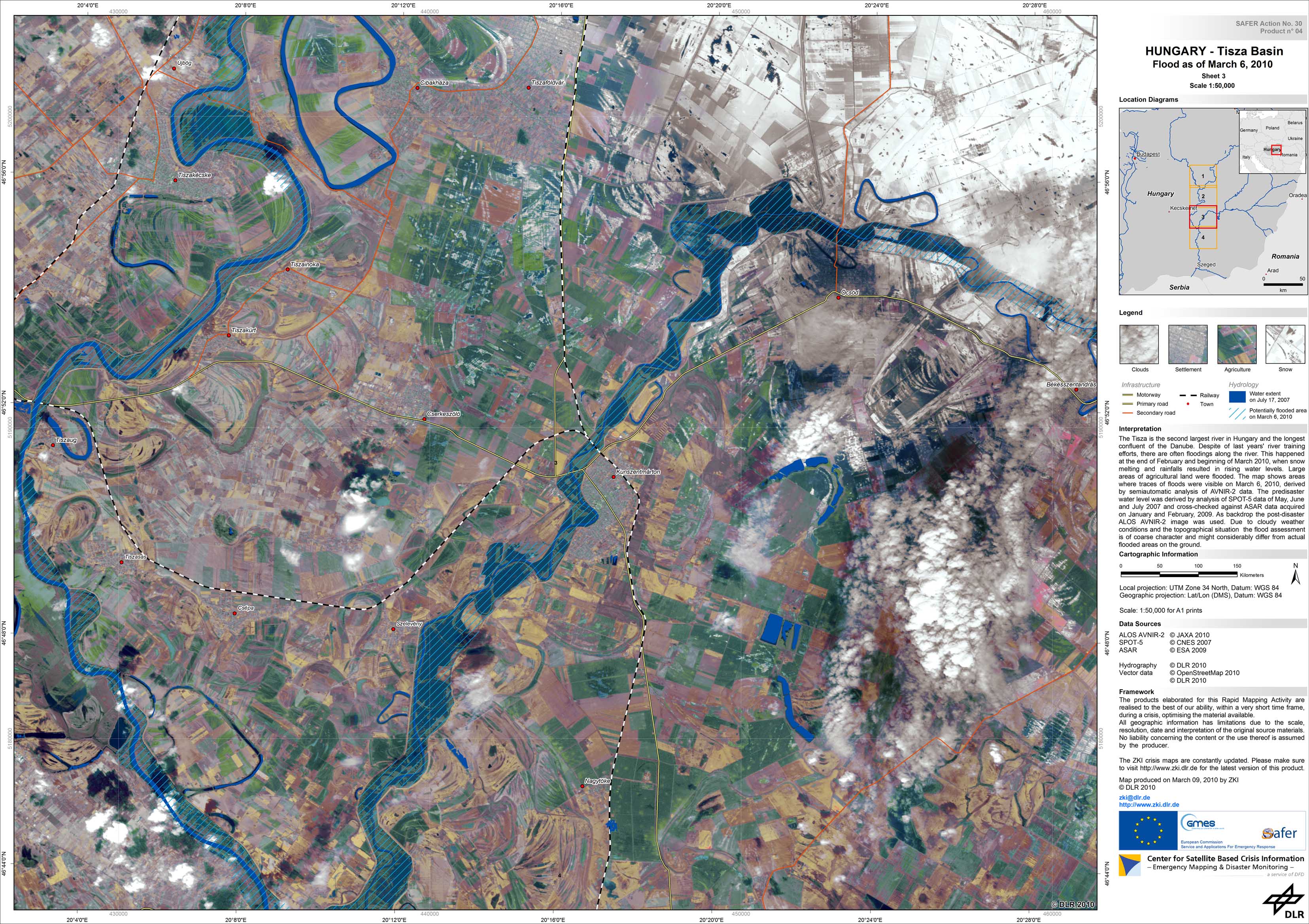
Hungary - Tisza region - P04 - Satellite map of potentially flooded areas in the Tisza basin, Hungary, based on AVNIR-2 imagery of March 06, 2010 - Area 2, Sheet 3
Creation Date 09. March 2010
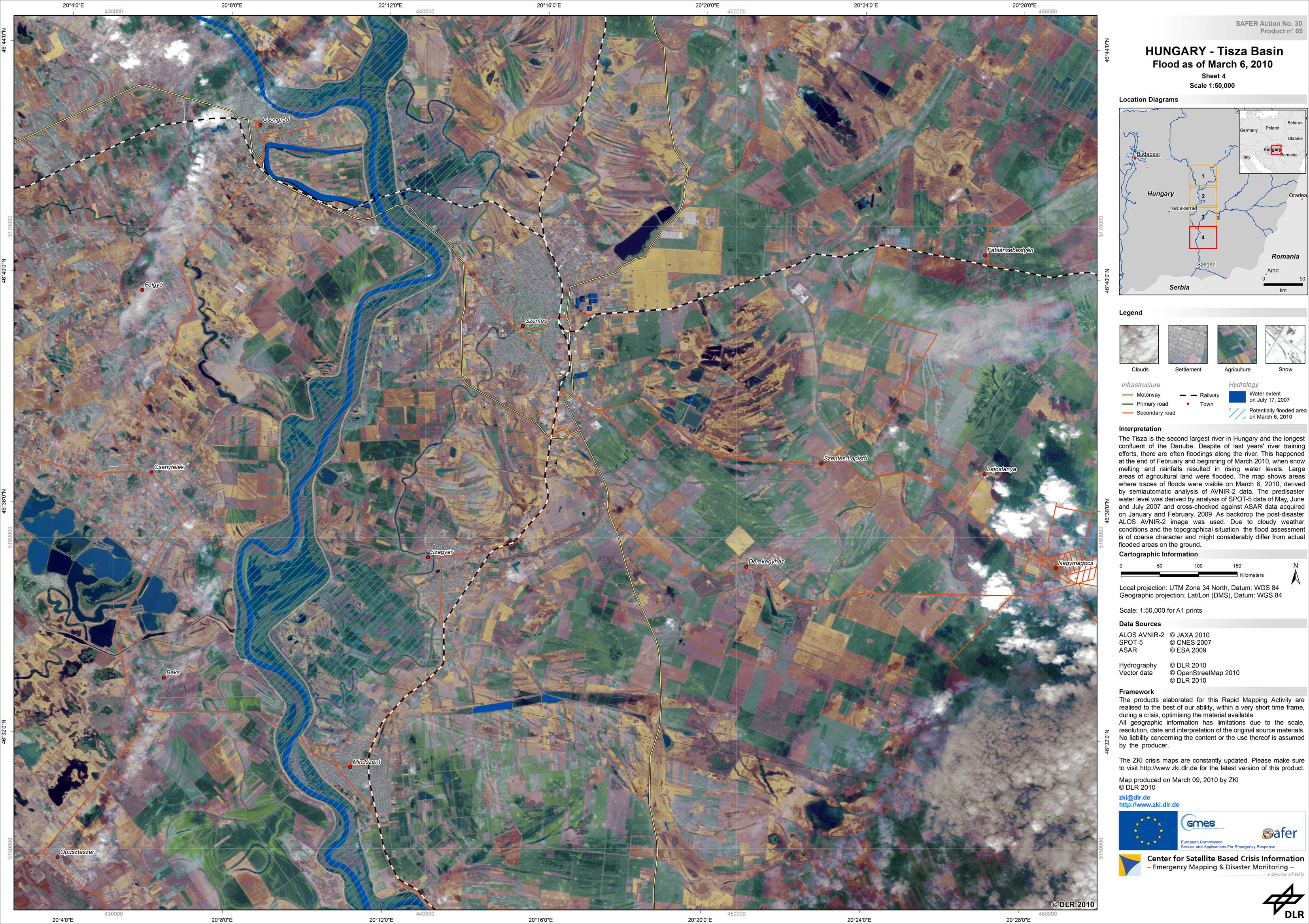
Hungary - Tisza region - P05 - Satellite map of potentially flooded areas in the Tisza basin, Hungary, based on AVNIR-2 imagery of March 06, 2010 - Area 2, Sheet 4
Creation Date 09. March 2010
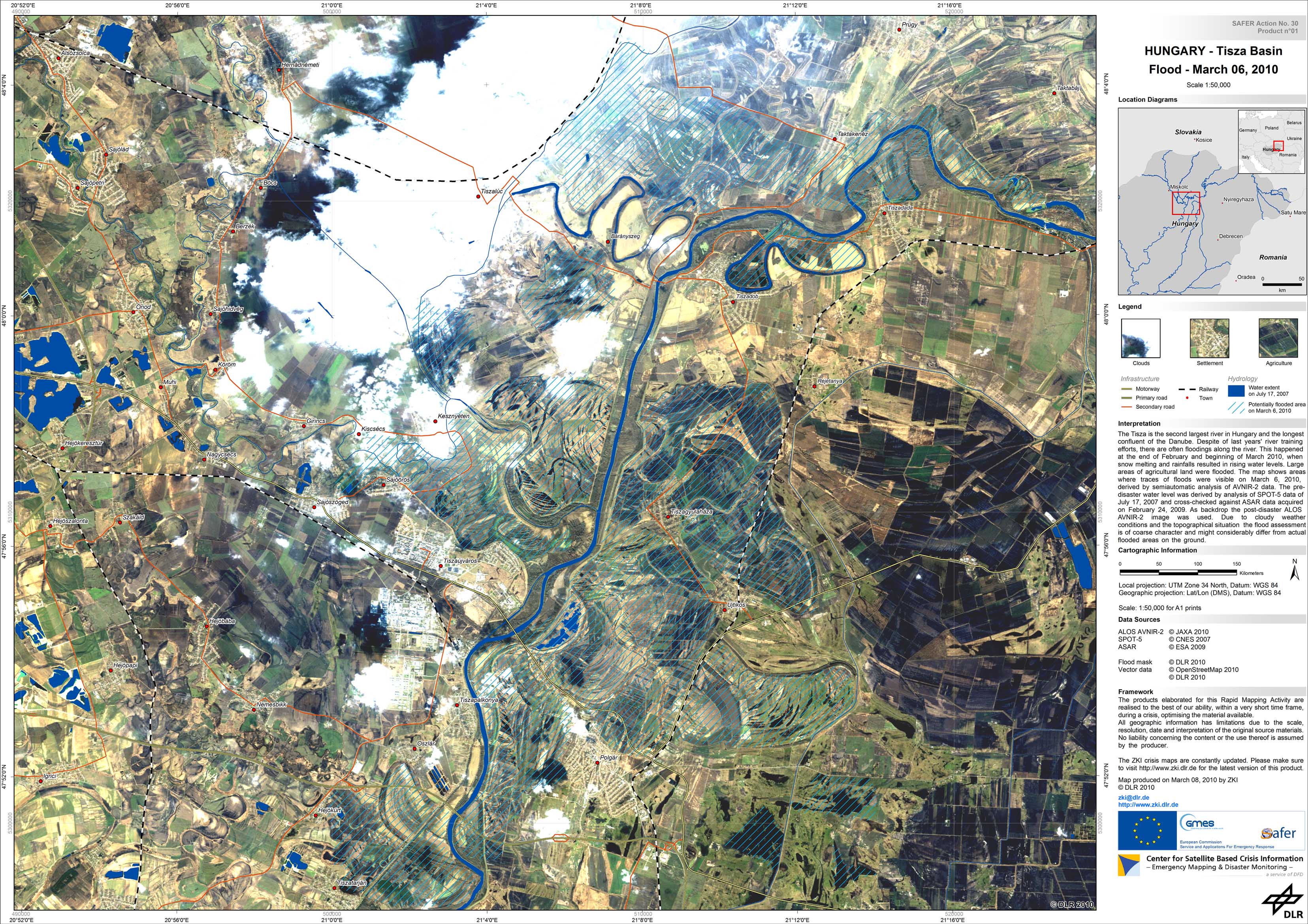
Hungary - Tisza region - P01 - Satellite map of potentially flooded areas in the Tisza basin, Hungary, based on AVNIR-2 imagery of March 06, 2010 - Area 1
Creation Date 08. March 2010