
Floods in Sri Lanka on May 14, 2010
undefined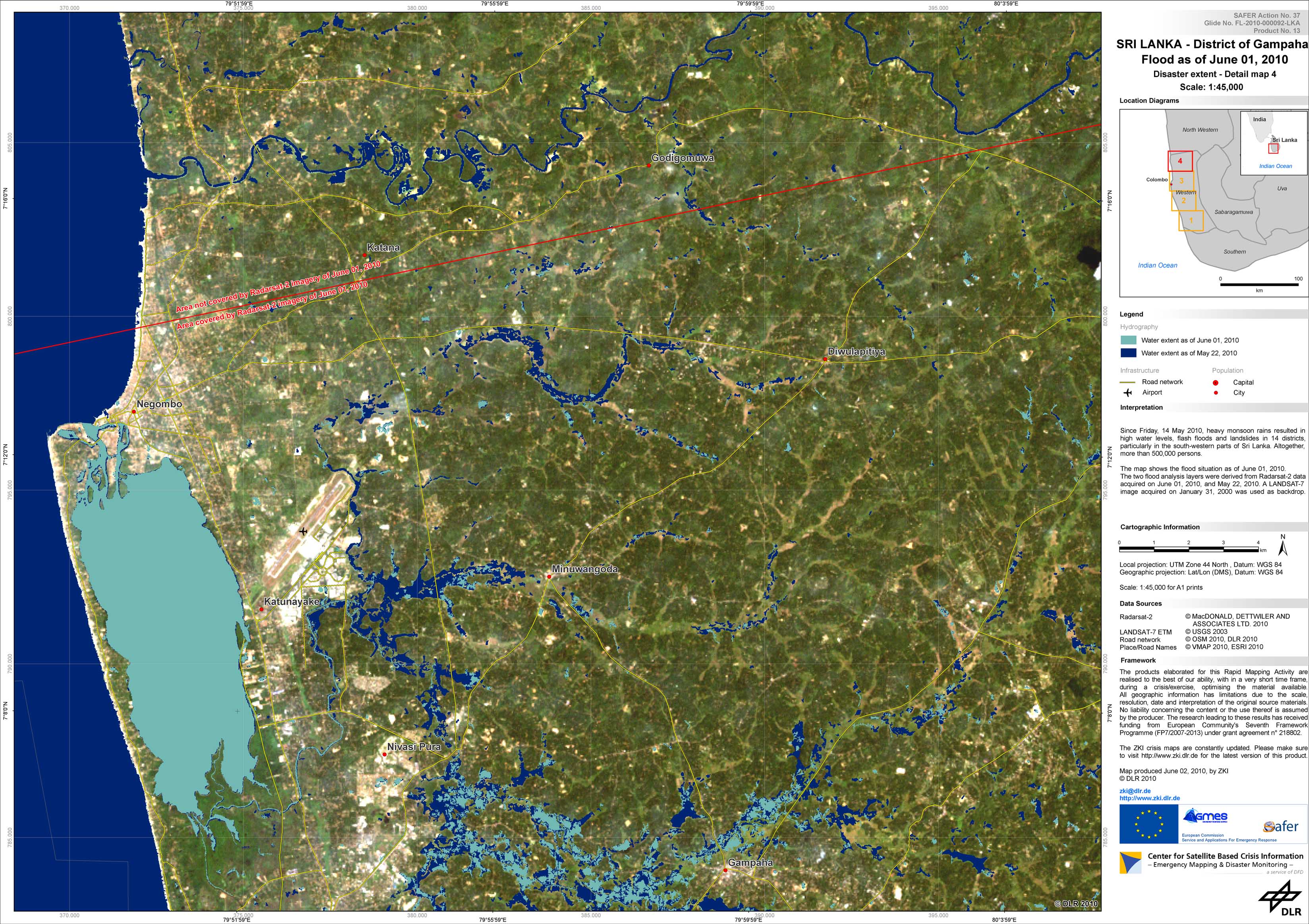
Sri Lanka - P13 - Satellite map of flooded areas in the district of Gampaha, Sri Lanka, as of June 01, 2010 - Detail map 4
Creation Date 02. June 2010
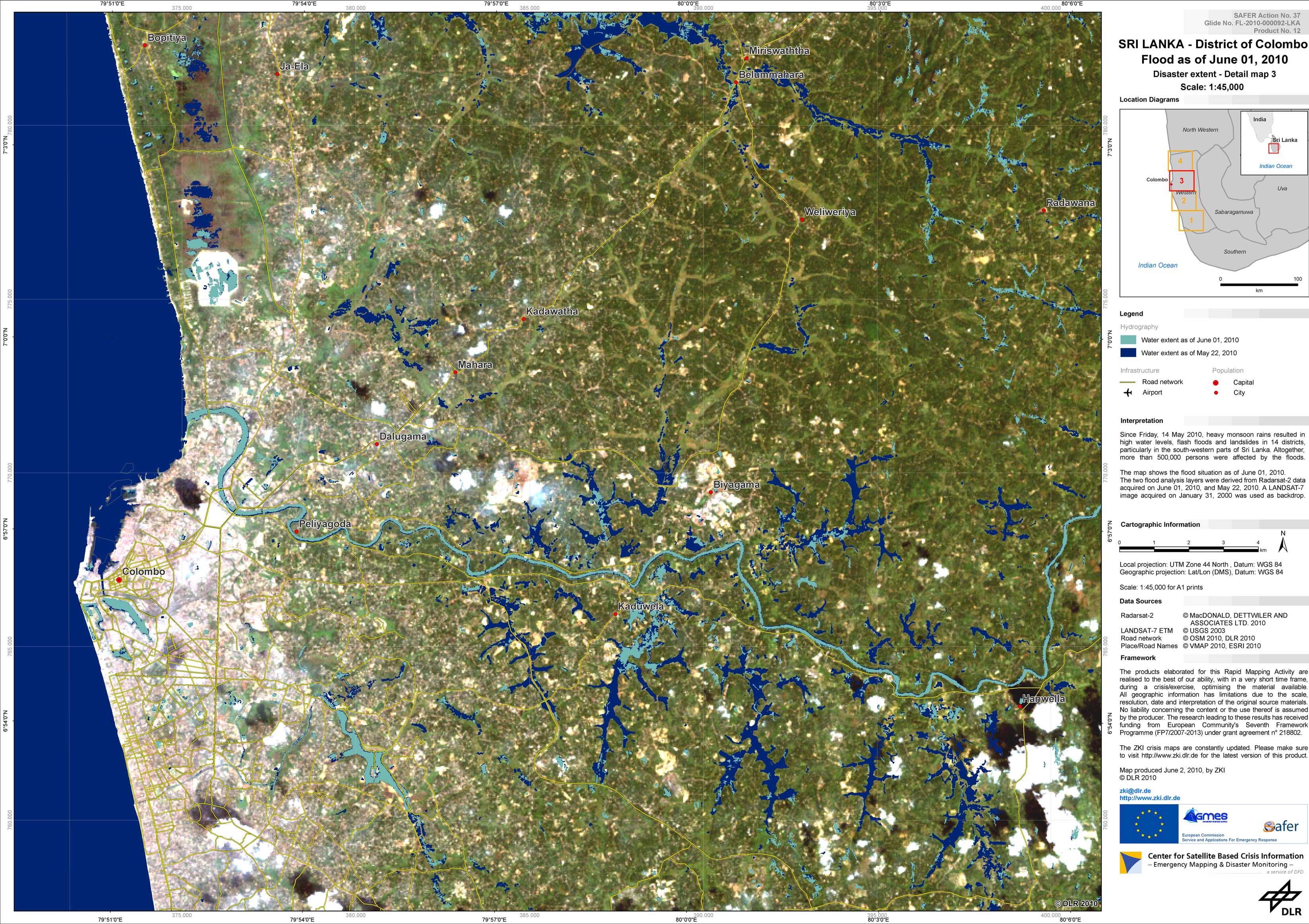
Sri Lanka - P12 - Satellite map of flooded areas in the district of Colombo, Sri Lanka, as of June 01, 2010 - Detail map 3
Creation Date 02. June 2010
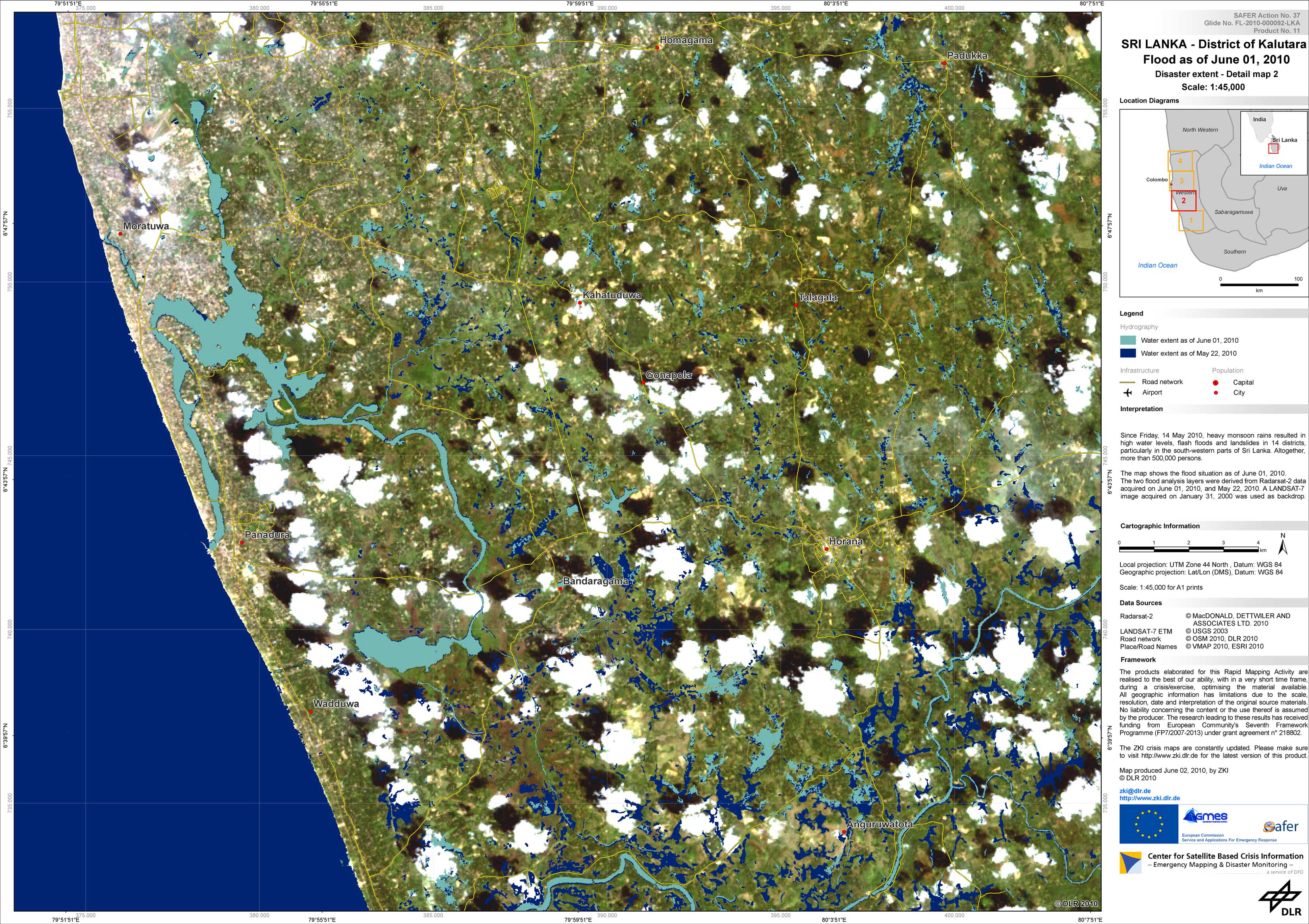
Sri Lanka - P11 - Satellite map of flooded areas in the district of Kalutara, Sri Lanka, as of June 01, 2010 - Detail map 2
Creation Date 02. June 2010
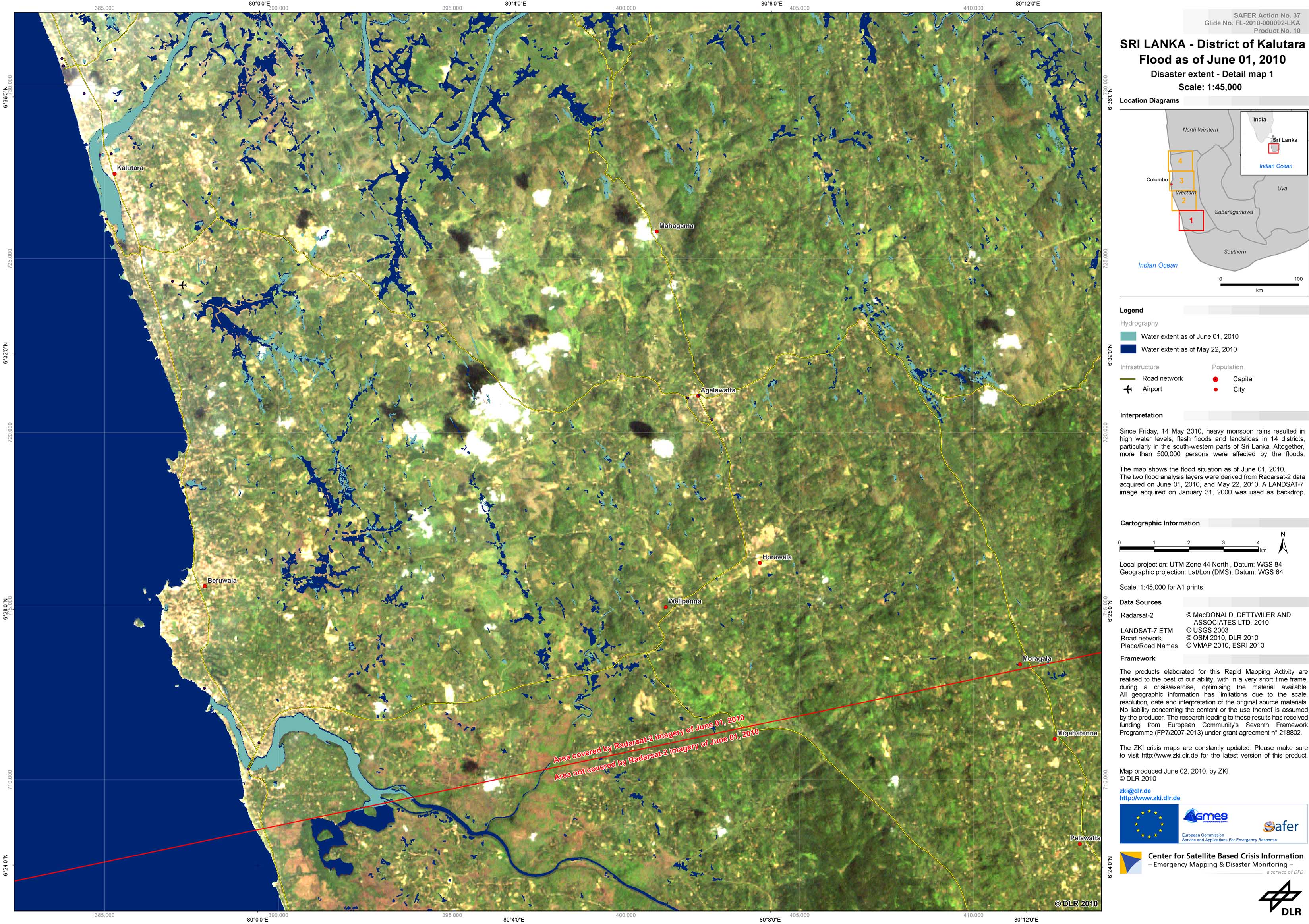
Sri Lanka - P10 - Satellite map of flooded areas in the district of Kalutara, Sri Lanka, as of June 01, 2010 - Detail Map 1
Creation Date 02. June 2010
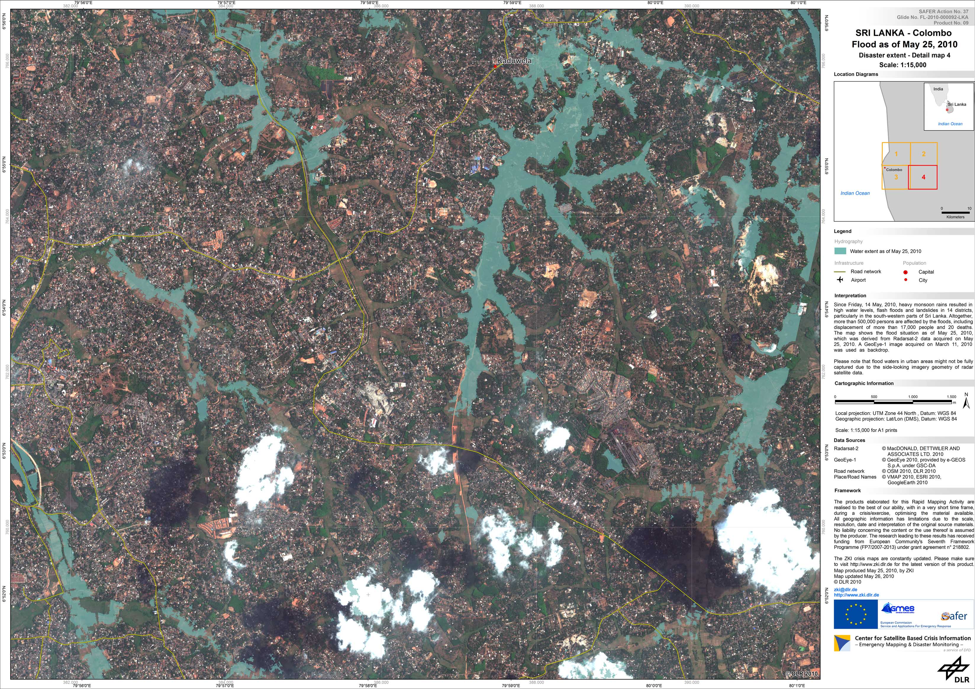
Sri Lanka - P09 - Satellite map of flooded areas in the city of Colombo, Sri Lanka, as of May 25, 2010 - Detail map 4
Creation Date 26. May 2010
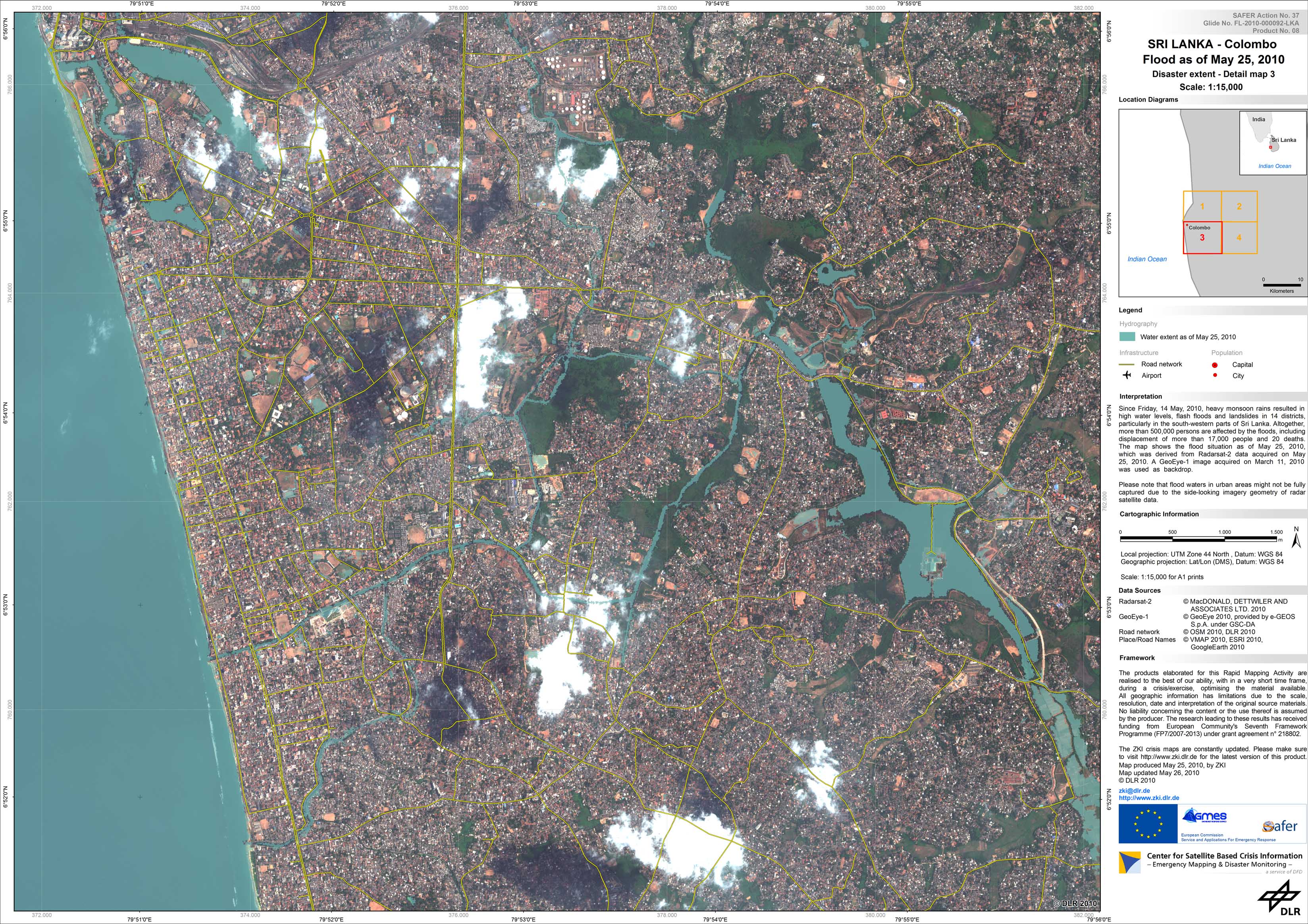
Sri Lanka - P08 - Satellite map of flooded areas in the city of Colombo, Sri Lanka, as of May 25, 2010 - Detail map 3
Creation Date 26. May 2010
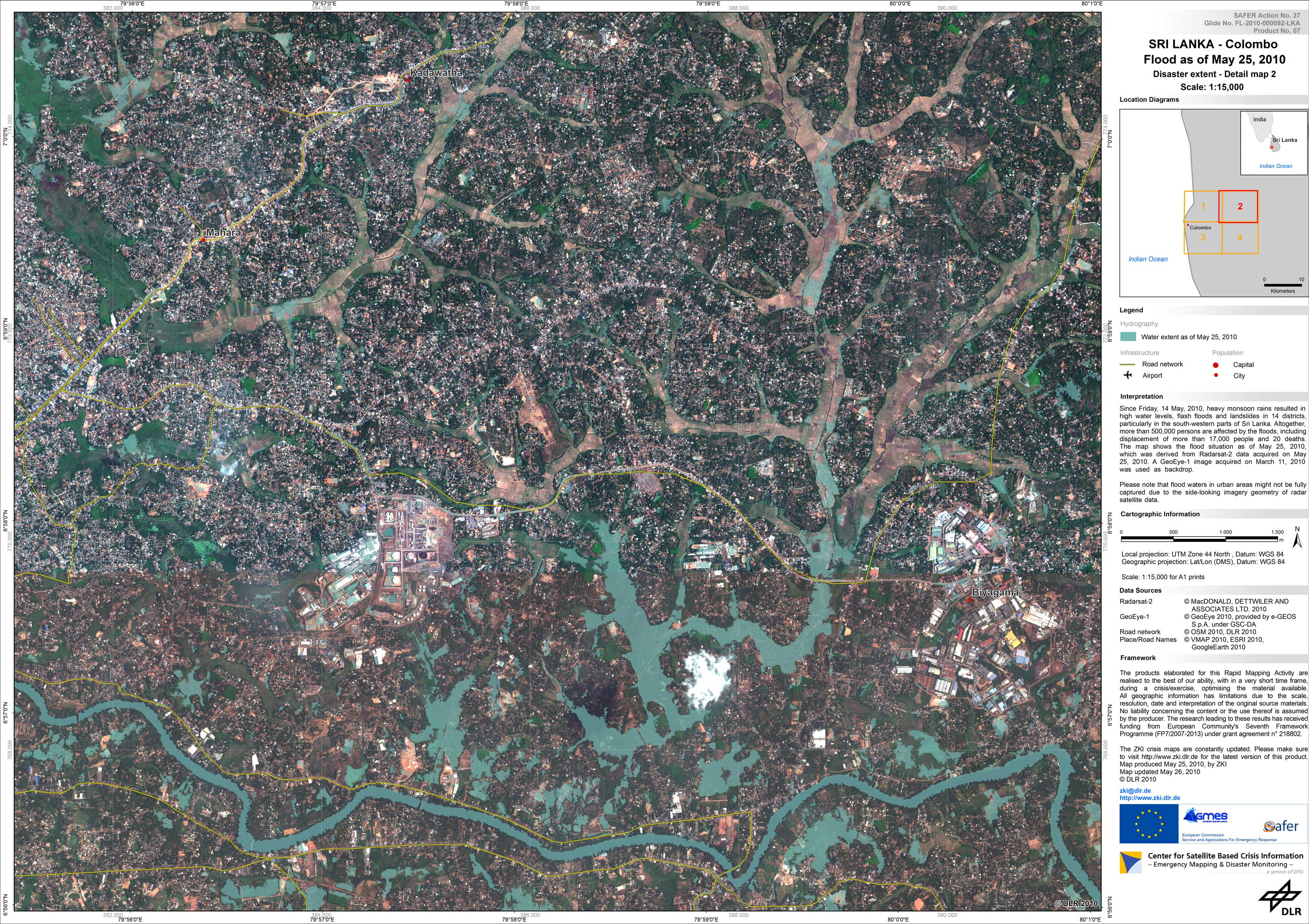
Sri Lanka - P07 - Satellite map of flooded areas in the city of Colombo, Sri Lanka, as of May 25, 2010 - Detail map 2
Creation Date 26. May 2010
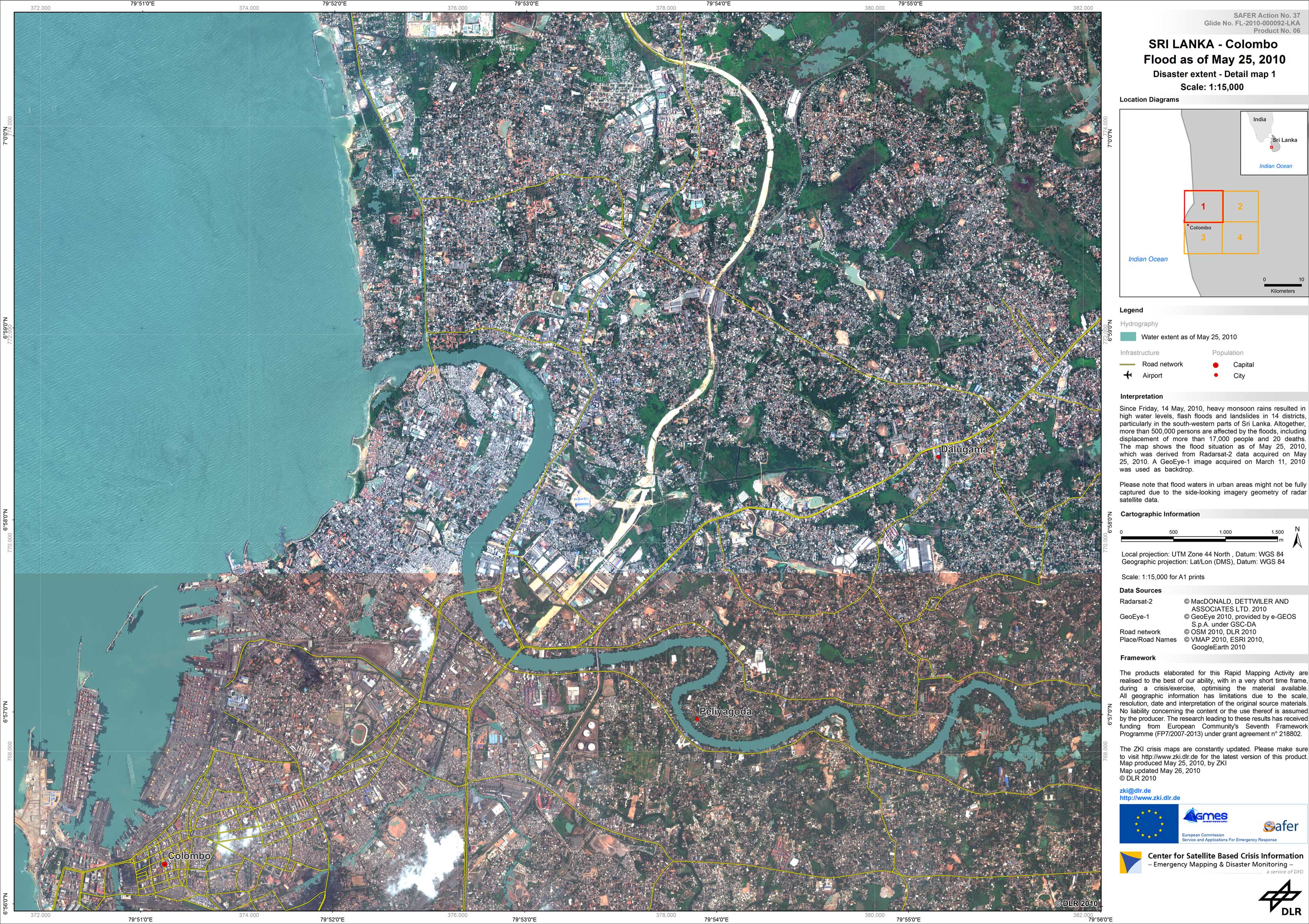
Sri Lanka - P06 - Satellite map of flooded areas in the city of Colombo, Sri Lanka, as of May 25, 2010 - Detail map 1
Creation Date 26. May 2010
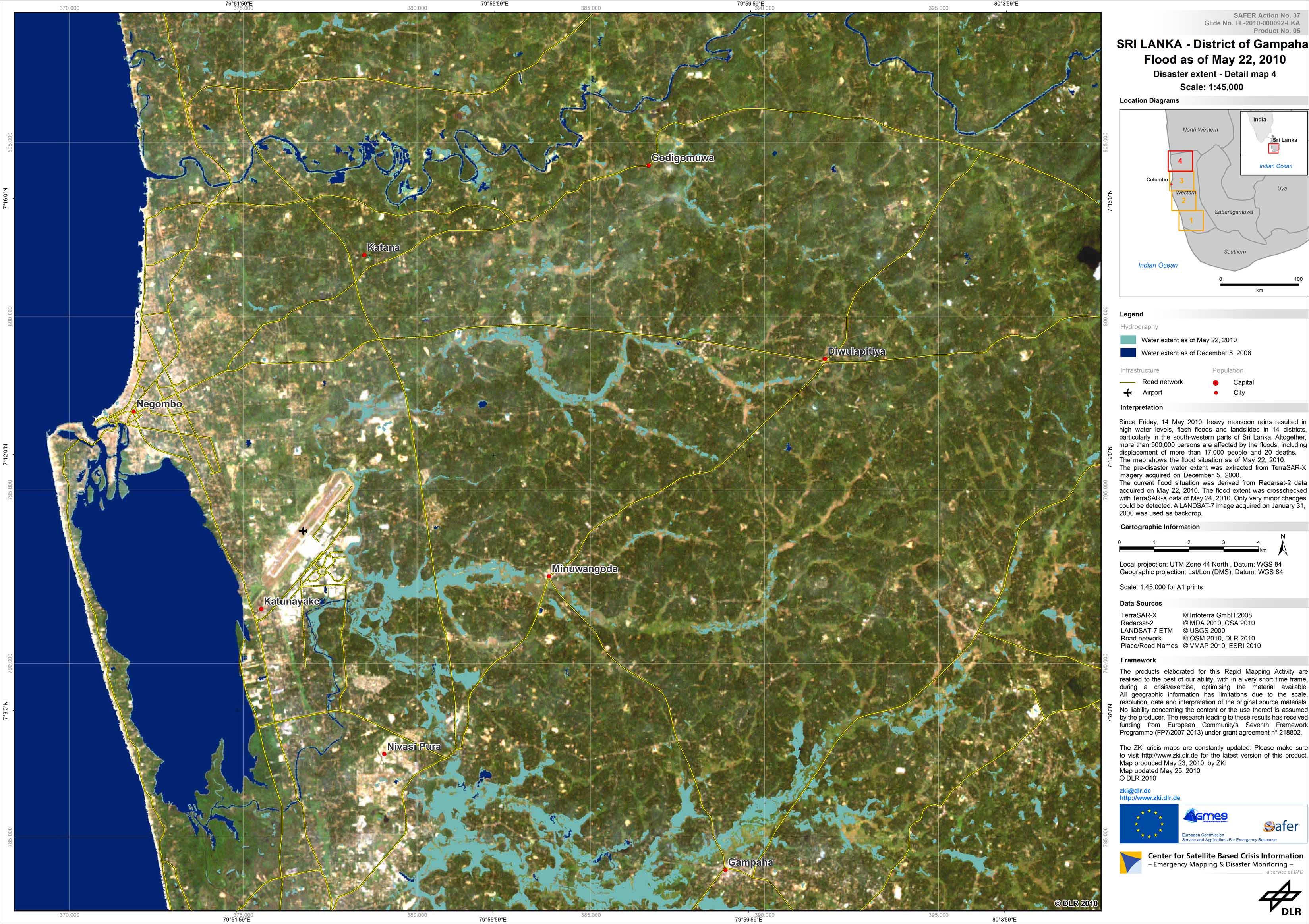
Sri Lanka - P05 - Satellite map of flooded areas in the district of Gampaha, Sri Lanka, as of May 22, 2010 - Detail map 4
Creation Date 25. May 2010
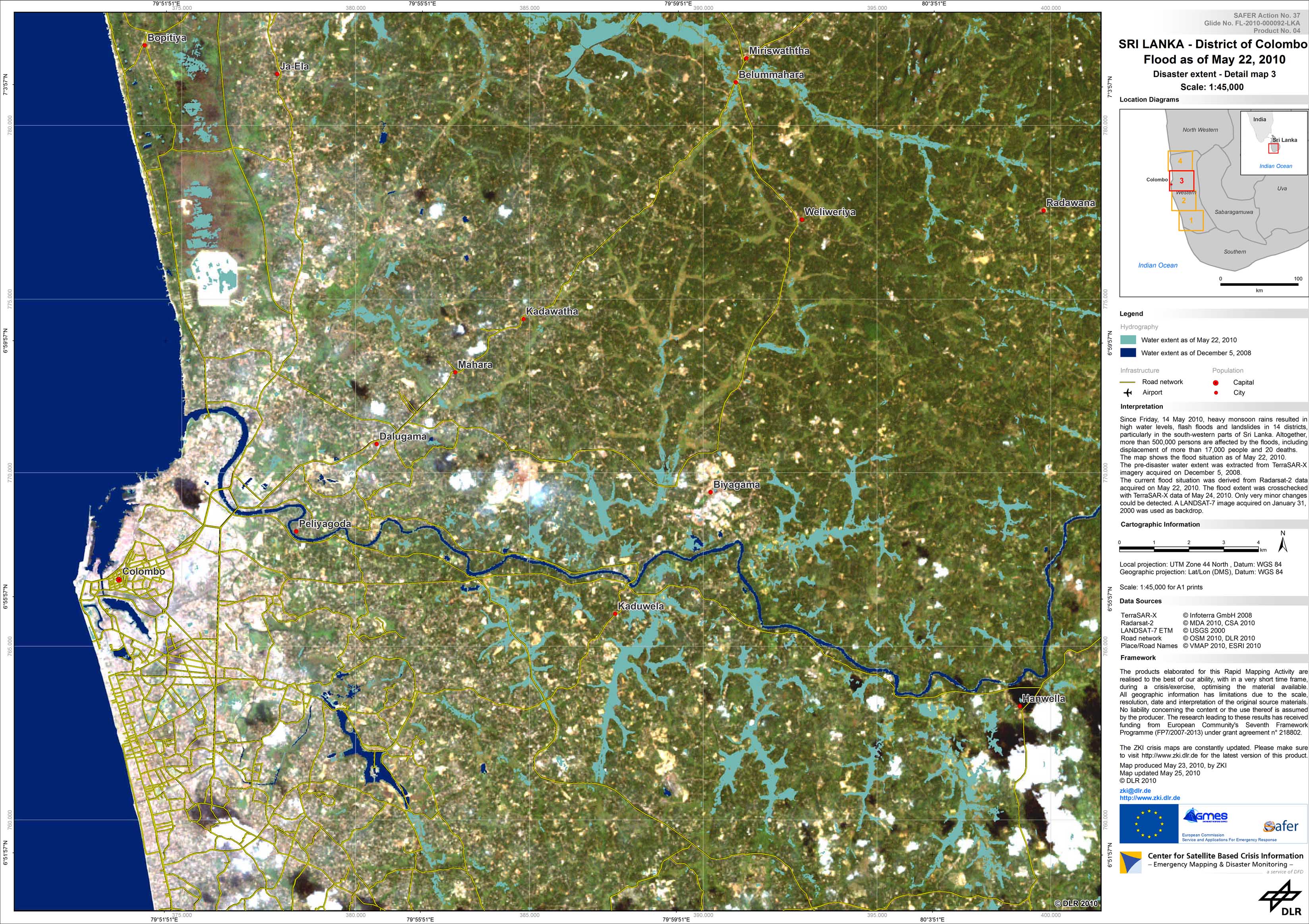
Sri Lanka - P04 - Satellite map of flooded areas in the district of Colombo, Sri Lanka, as of May 22, 2010 - Detail map 3
Creation Date 25. May 2010
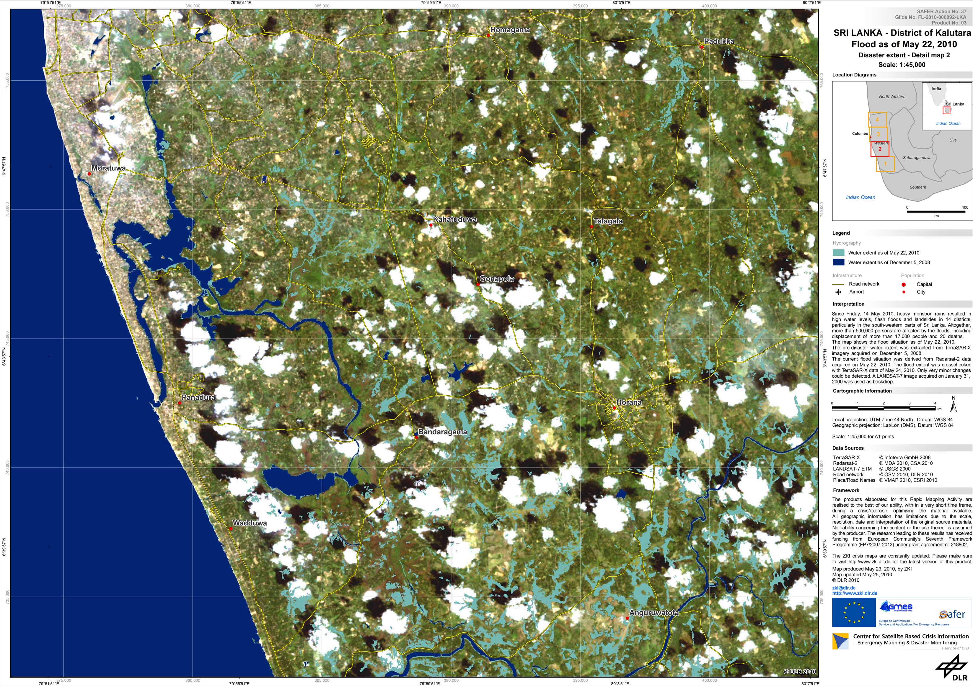
Sri Lanka - P03 - Satellite map of flooded areas in the district of Kalutara, Sri Lanka, as of May 22, 2010 - Detail map 2
Creation Date 25. May 2010
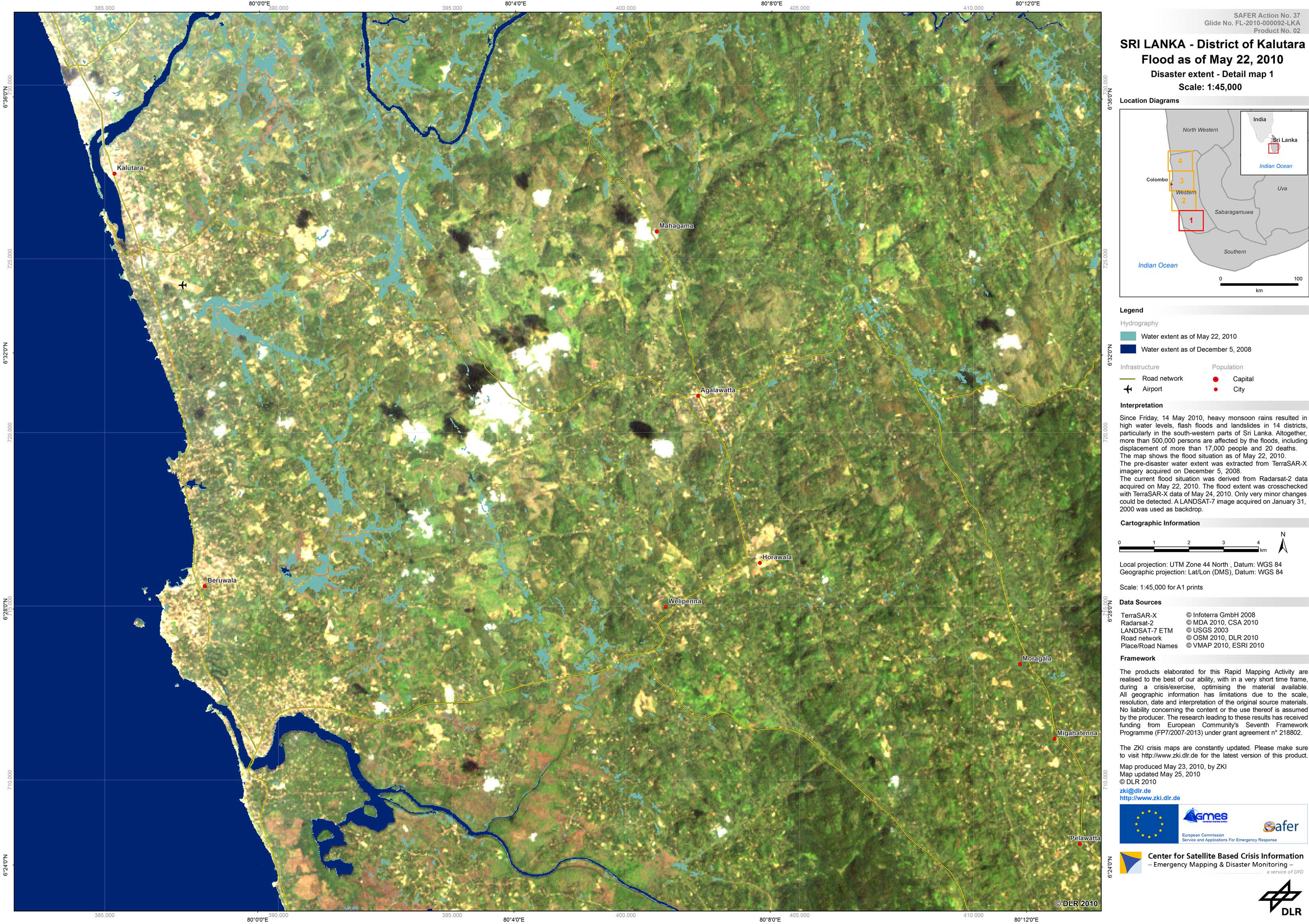
Sri Lanka - P02 - Satellite map of flooded areas in the district of Kalutara, Sri Lanka, as of May 22, 2010 - Detail Map 1
Creation Date 25. May 2010
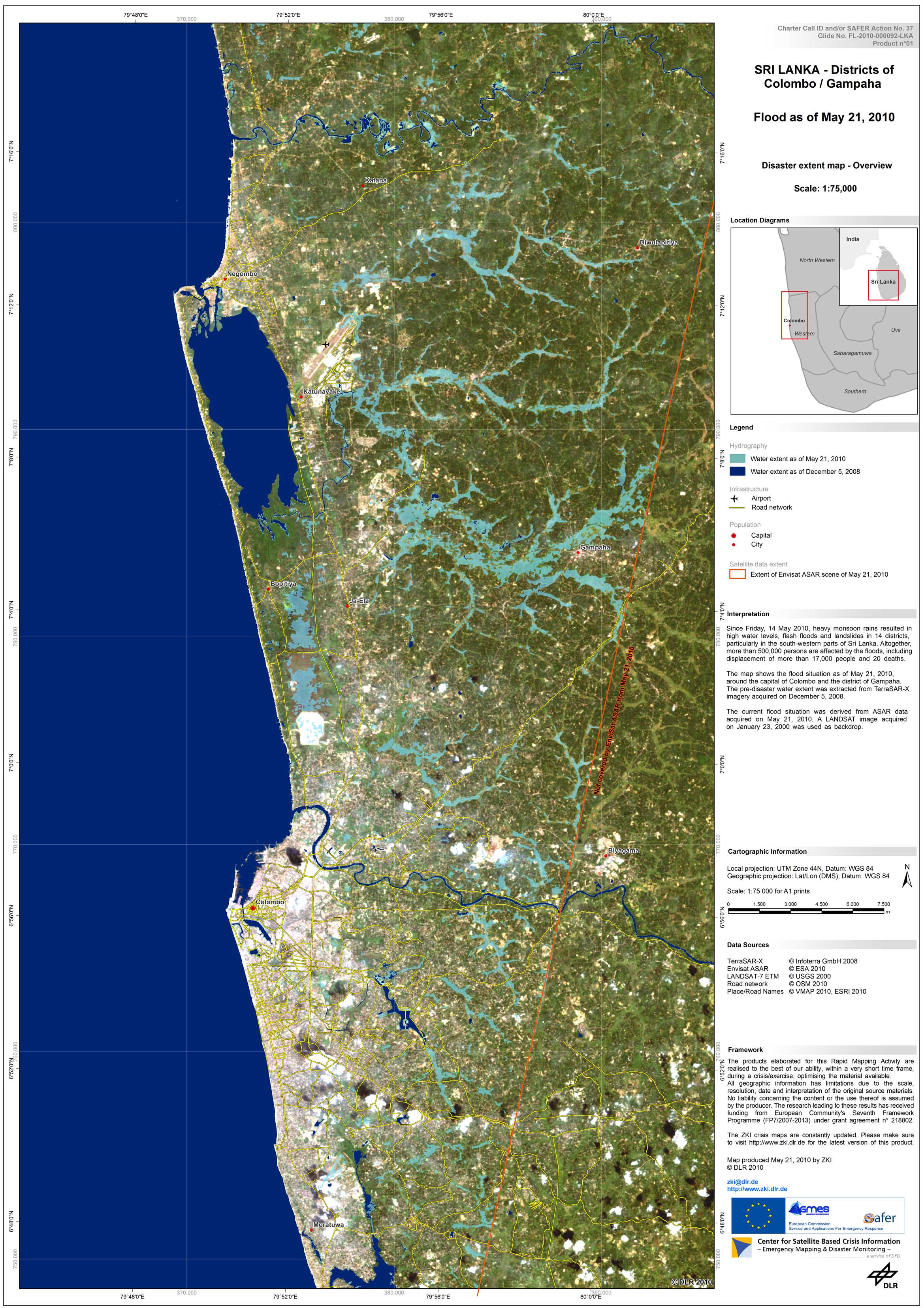
Sri Lanka - P01 - Satellite Map of flooded areas in the districts Colombo and Gampaha, Sri Lanka, as of May 21, 2010 - Overview Map
Creation Date 21. May 2010