
Flood in Burkina Faso
undefined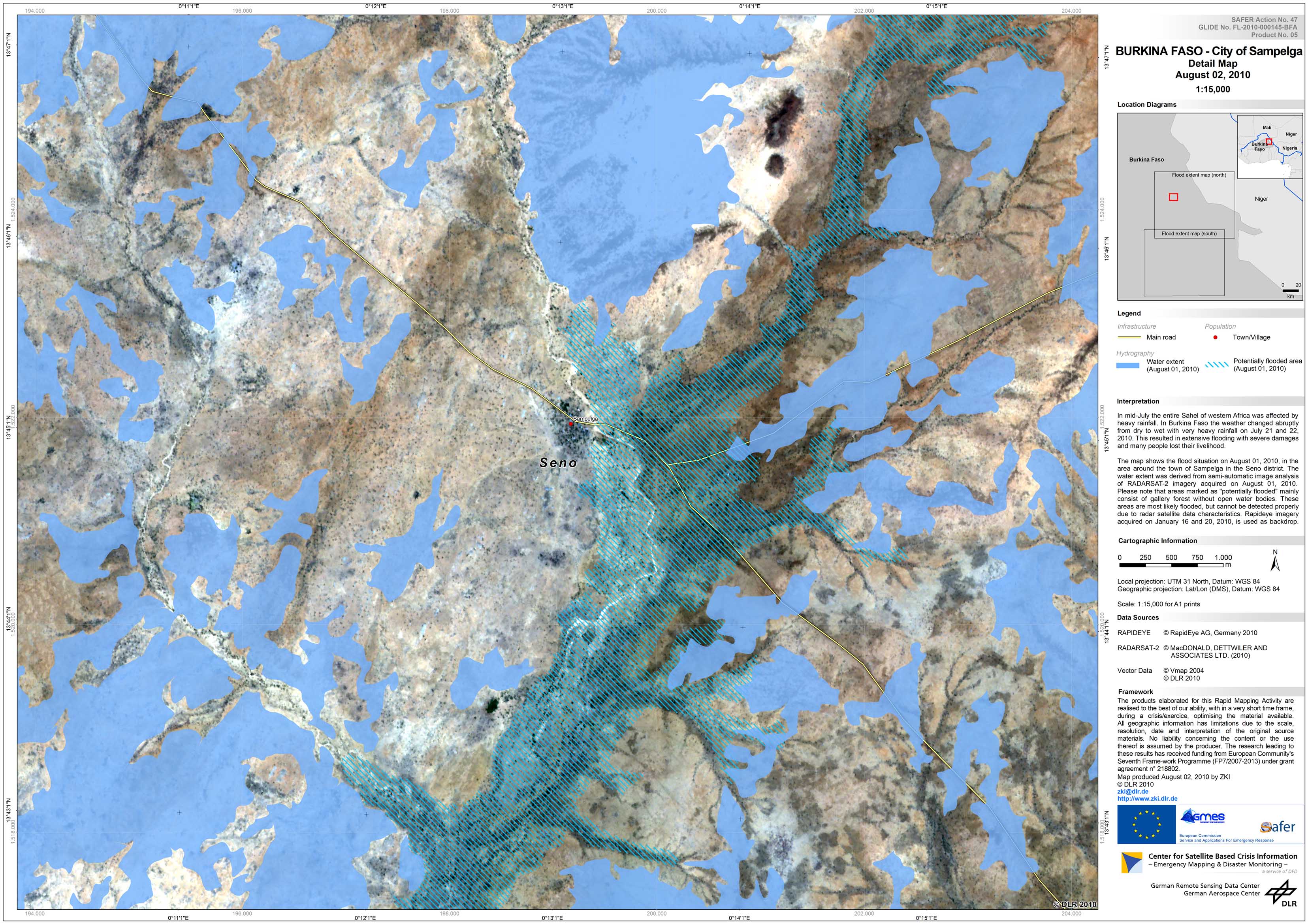
Burkina-Faso - P05 - City of Sampelga, Seno District - Detail Map
Creation Date 02. August 2010
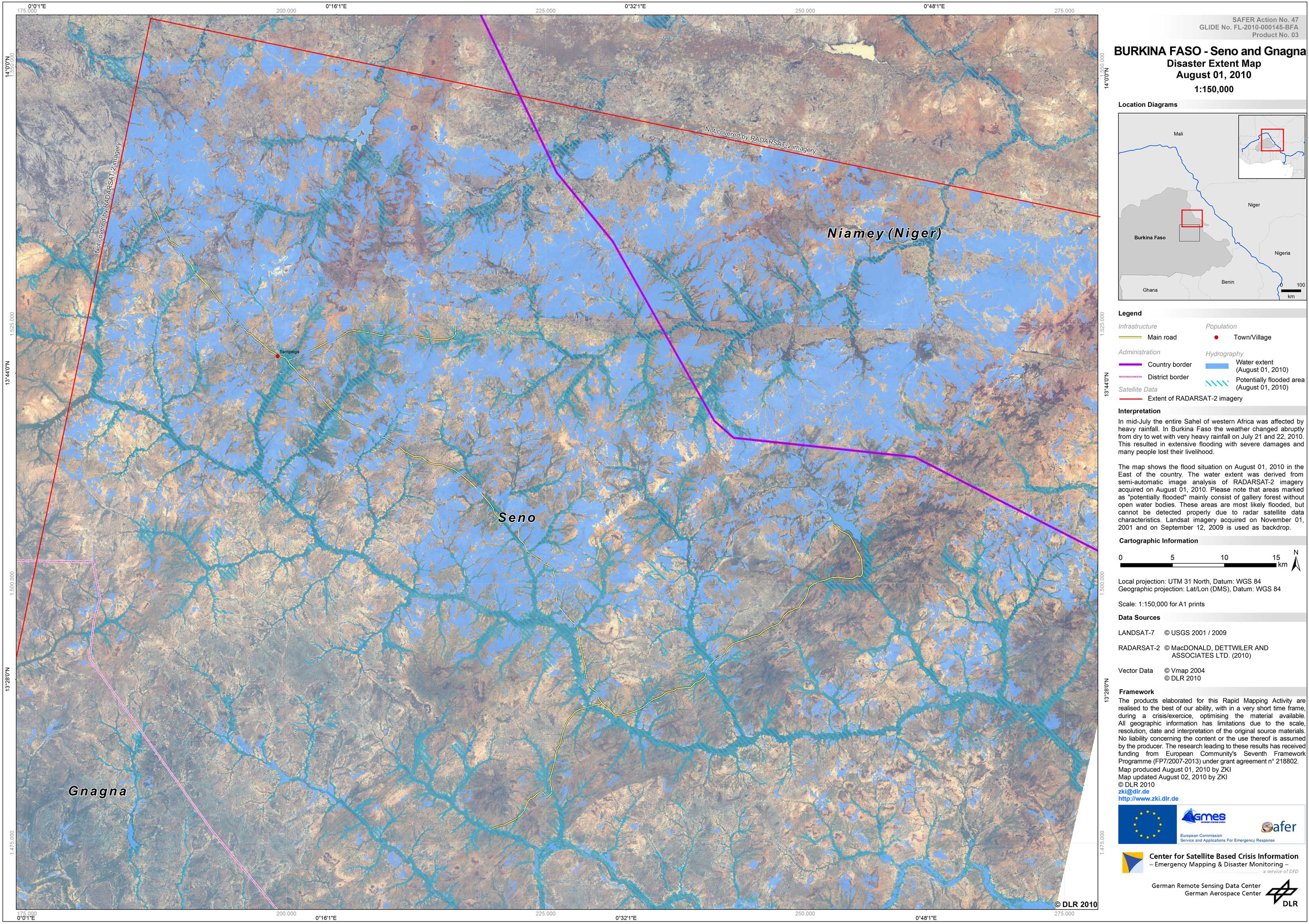
Burkina-Faso - P03 - Seno and Gnagna Districts - Flood Extent Map - Burkina Faso - Seno and Gnagna Districts (Northern part)
Creation Date 01. August 2010
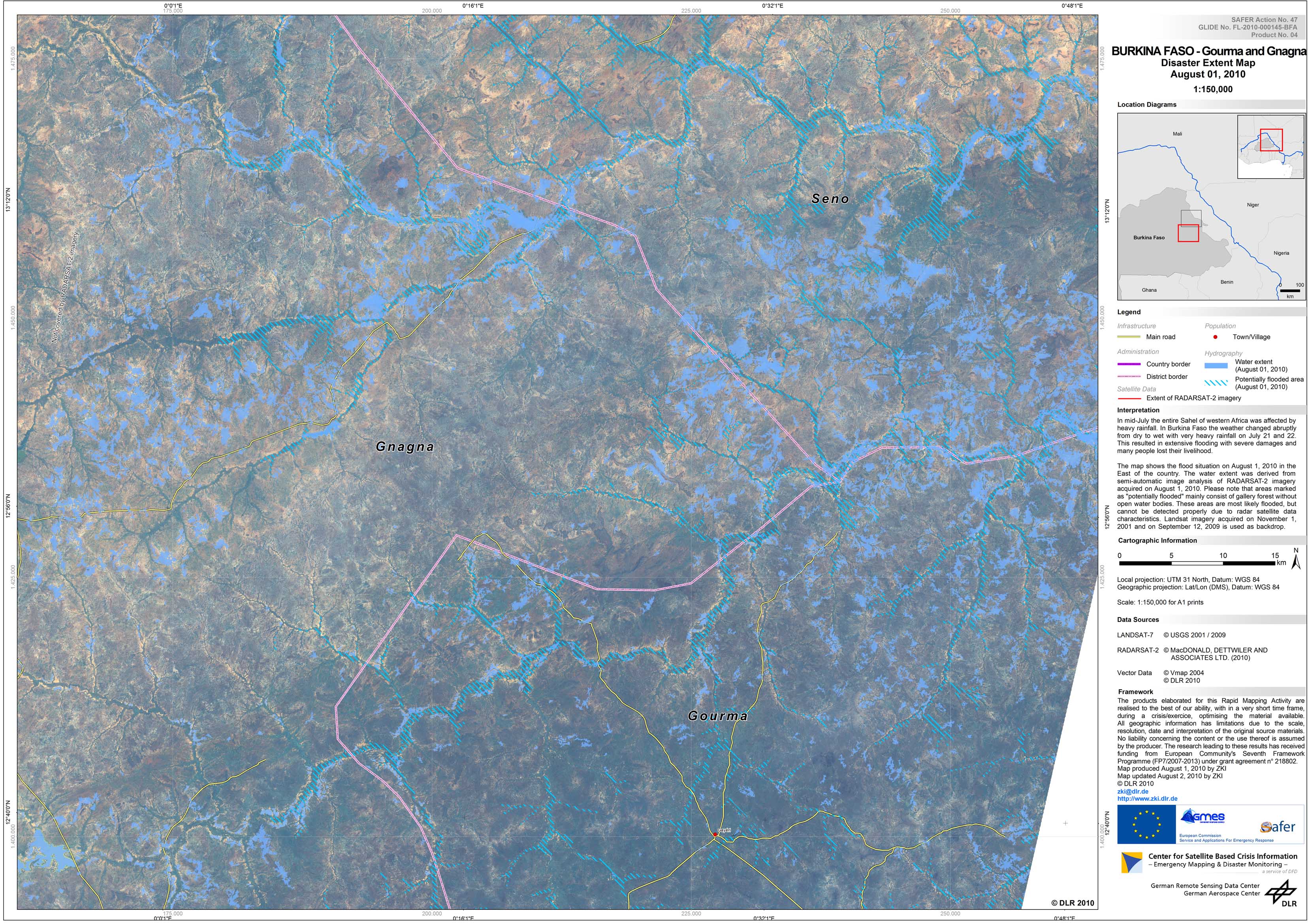
Burkina-Faso - P04 - Gourma and Gnagna Districts - Flood Extent Map - Burkina Faso - Gourma and Gnagna Districts (Southern part)
Creation Date 01. August 2010
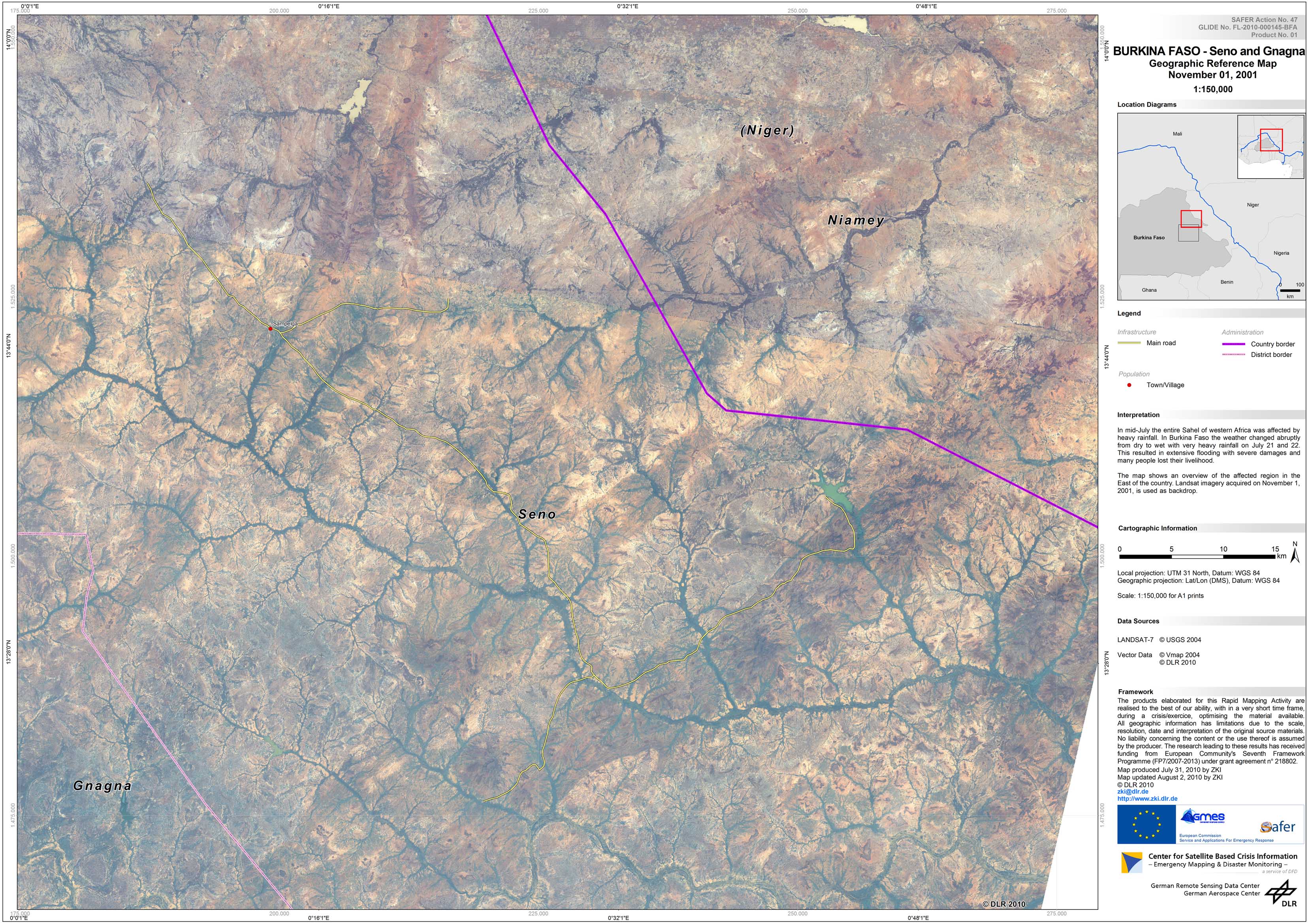
Burkina-Faso - P01 - Seno and Gnagna Districts - Northern part - Geographic Reference Map
Creation Date 31. July 2010
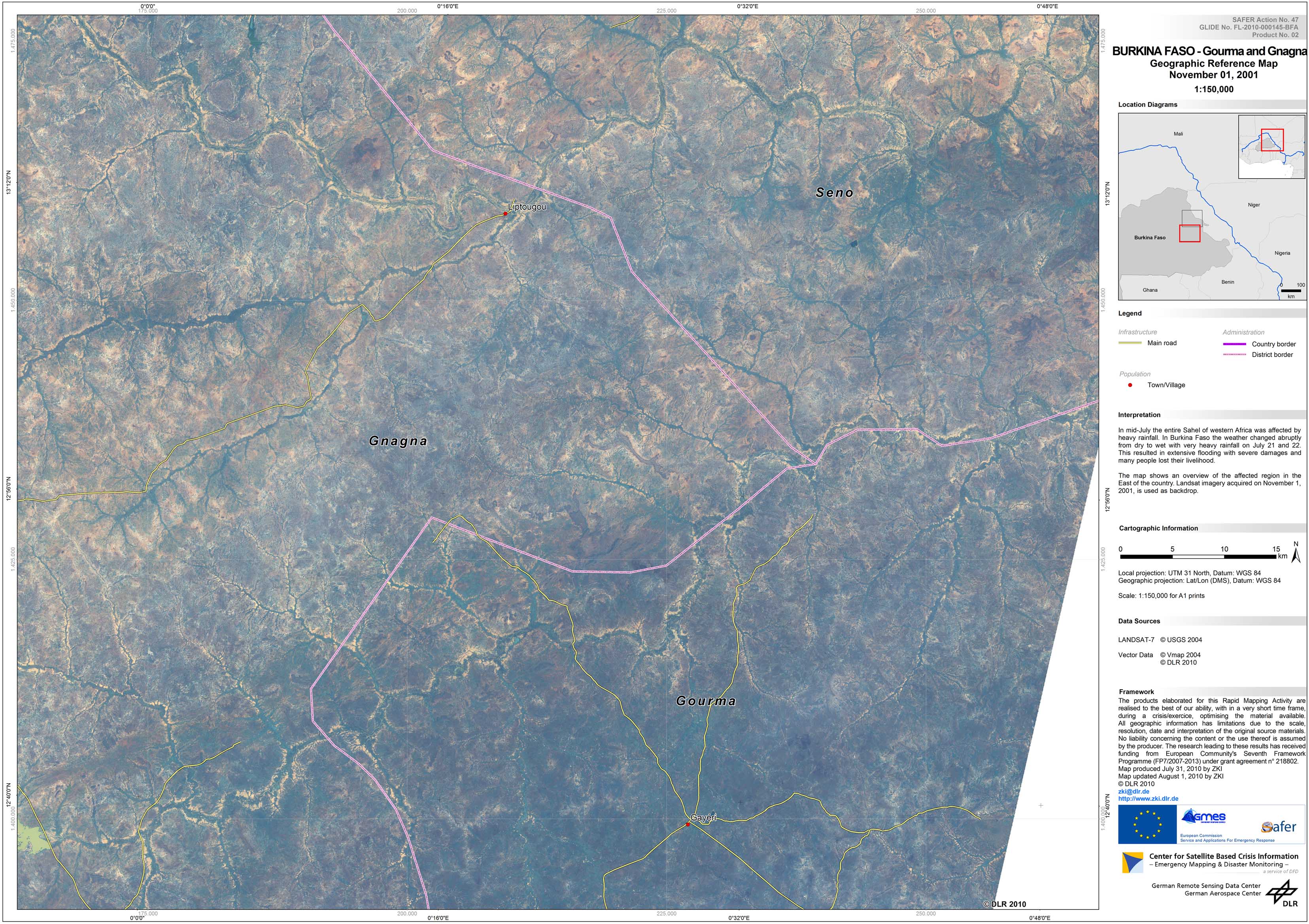
Burkina-Faso - P02 - Gourma and Gnagna Districts - Southern part - Geographic Reference Map
Creation Date 31. July 2010