Flooding along the river Niger in August 2010
undefined
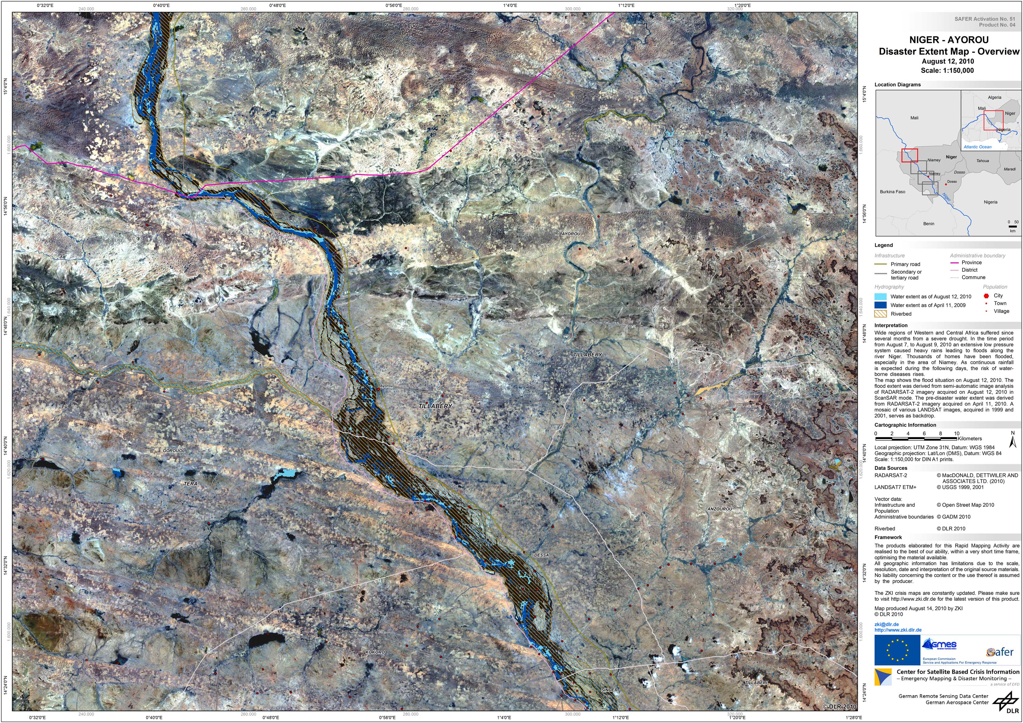
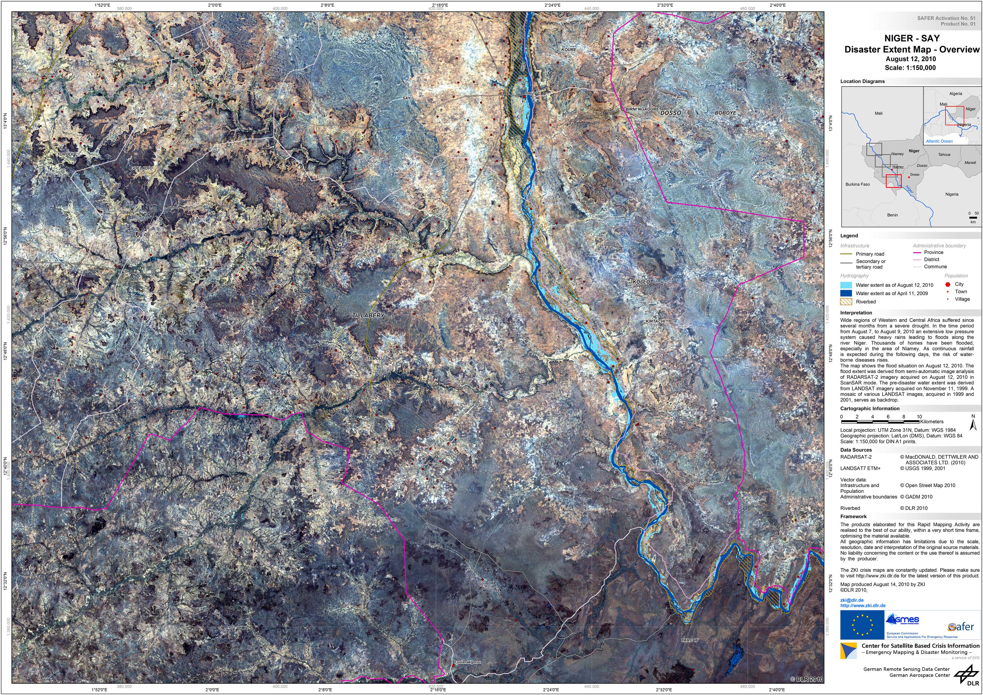
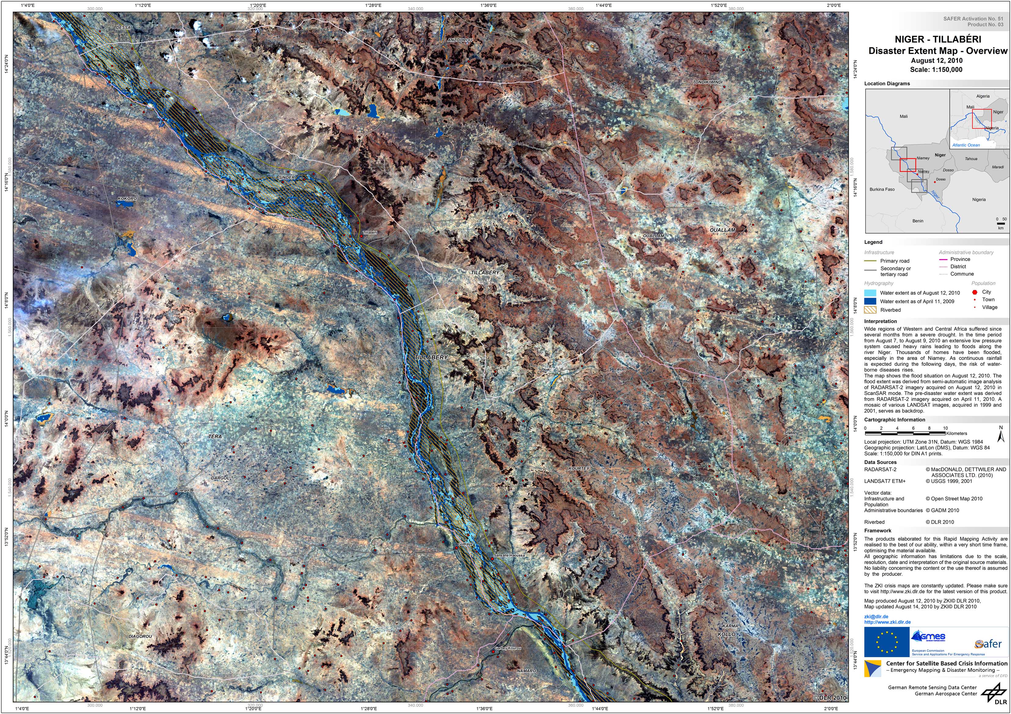
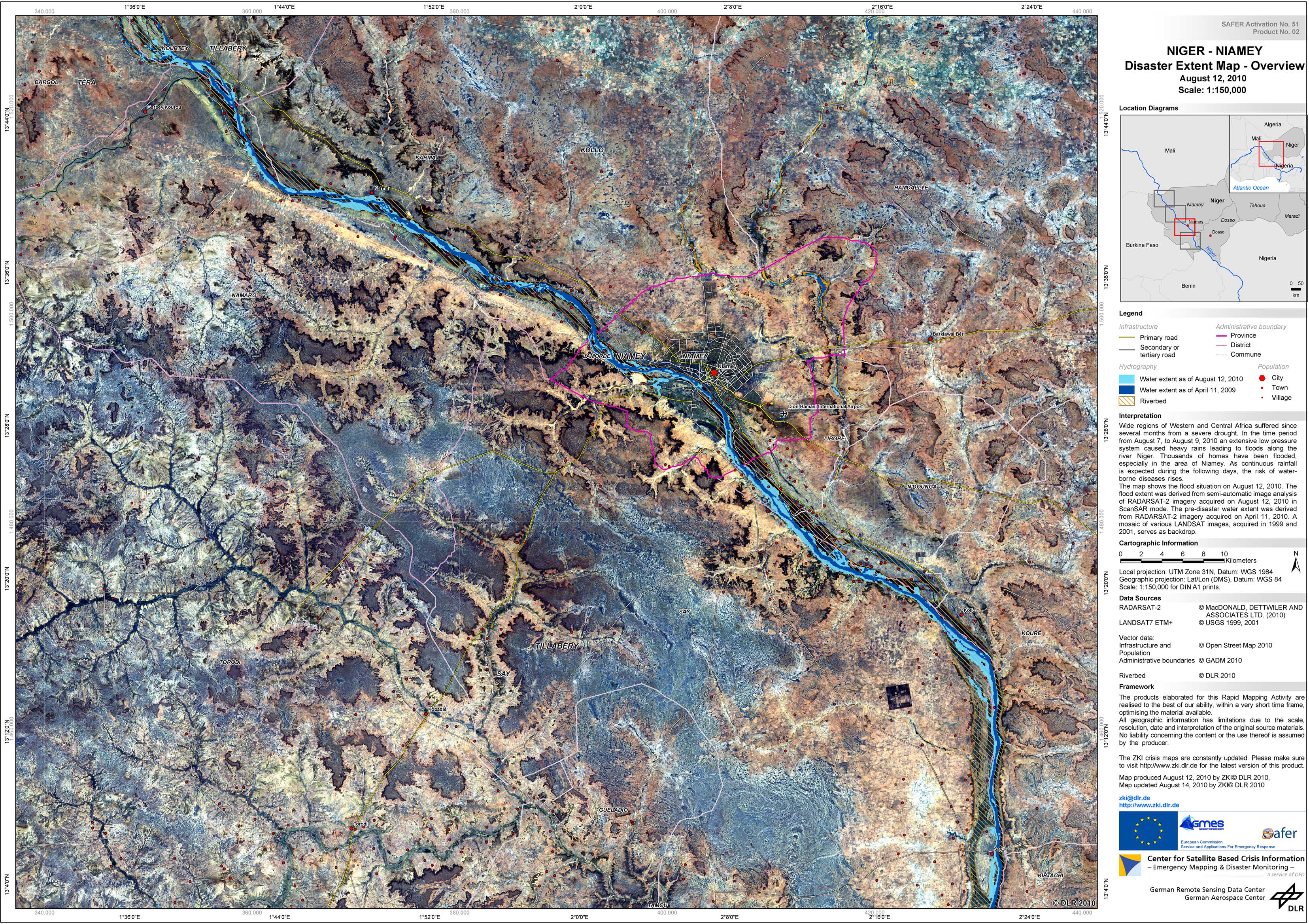
Since June West and Central Africa was suffering from a severe drought. In early August (7th to 9th of August) a large low pressure system caused heavy rains resulting in floods along the Niger river. Thousands of homes were flooded, especially in the surroundings of Niamey. As the water levels are not receding significantly due to ongoing rainfall, the risk of waterborne diseases is rising. ZKI provides Reference and Flood Maps in the framework of the GMES Emergency Response project SAFER with funding from the European Community's Seventh Framework Programme.
Niger - P04 - Ayorou - Flood as of August 12 - Disaster Extent Map - Overview
Creation Date 14. August 2010
Niger - P01 - Say - Flood as of August 12 - Disaster Extent Map - Overview
Creation Date 14. August 2010
Niger - P03 - Tillaberi - Flood as of August 12 - Disaster Extent Map - Overview
Creation Date 13. August 2010
Niger - P02 - Niamey - Flood as of August 12 - Disaster Extent Map - Overview
Creation Date 13. August 2010
undefined