Flood in Senegal, September 2010
undefined
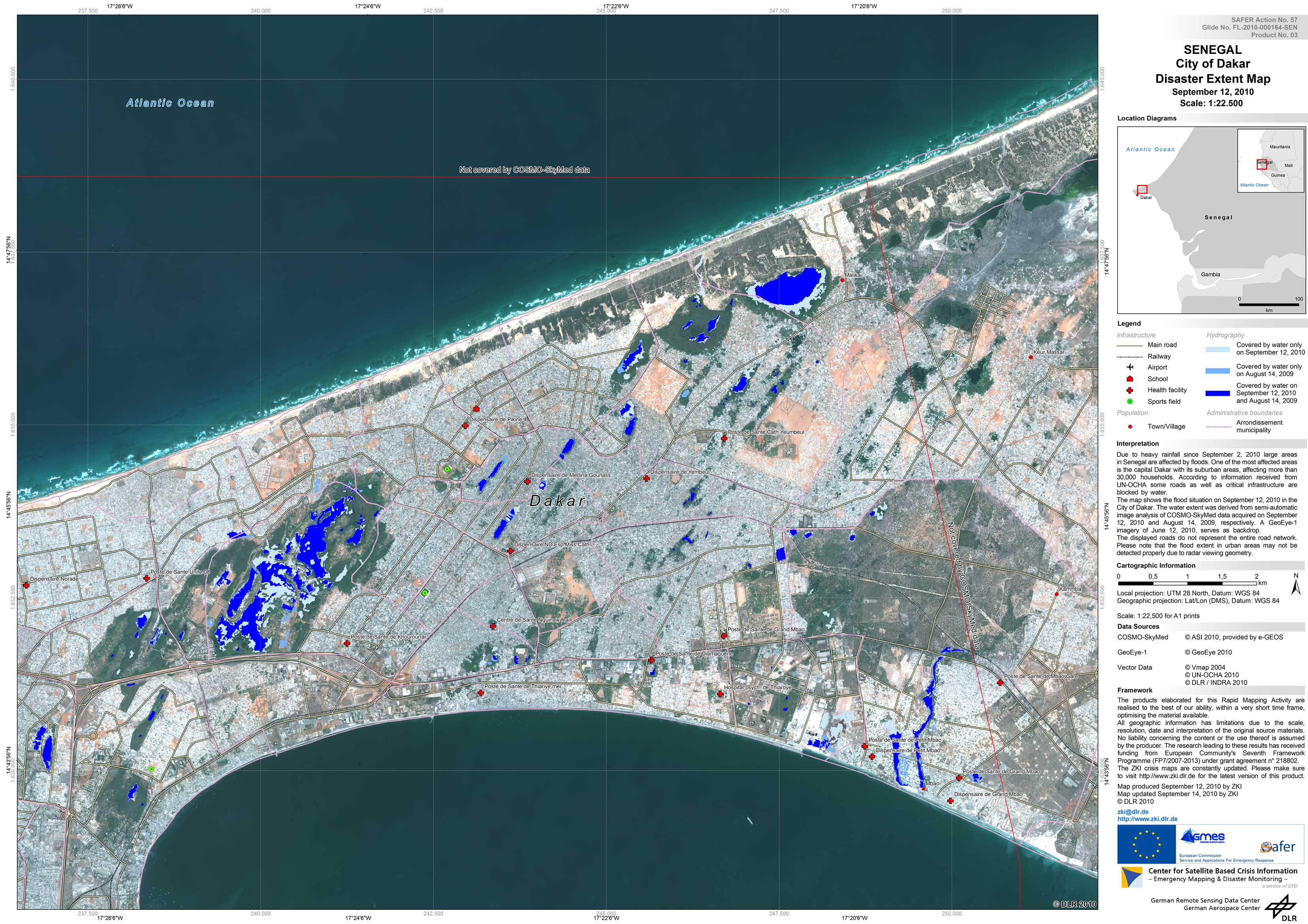
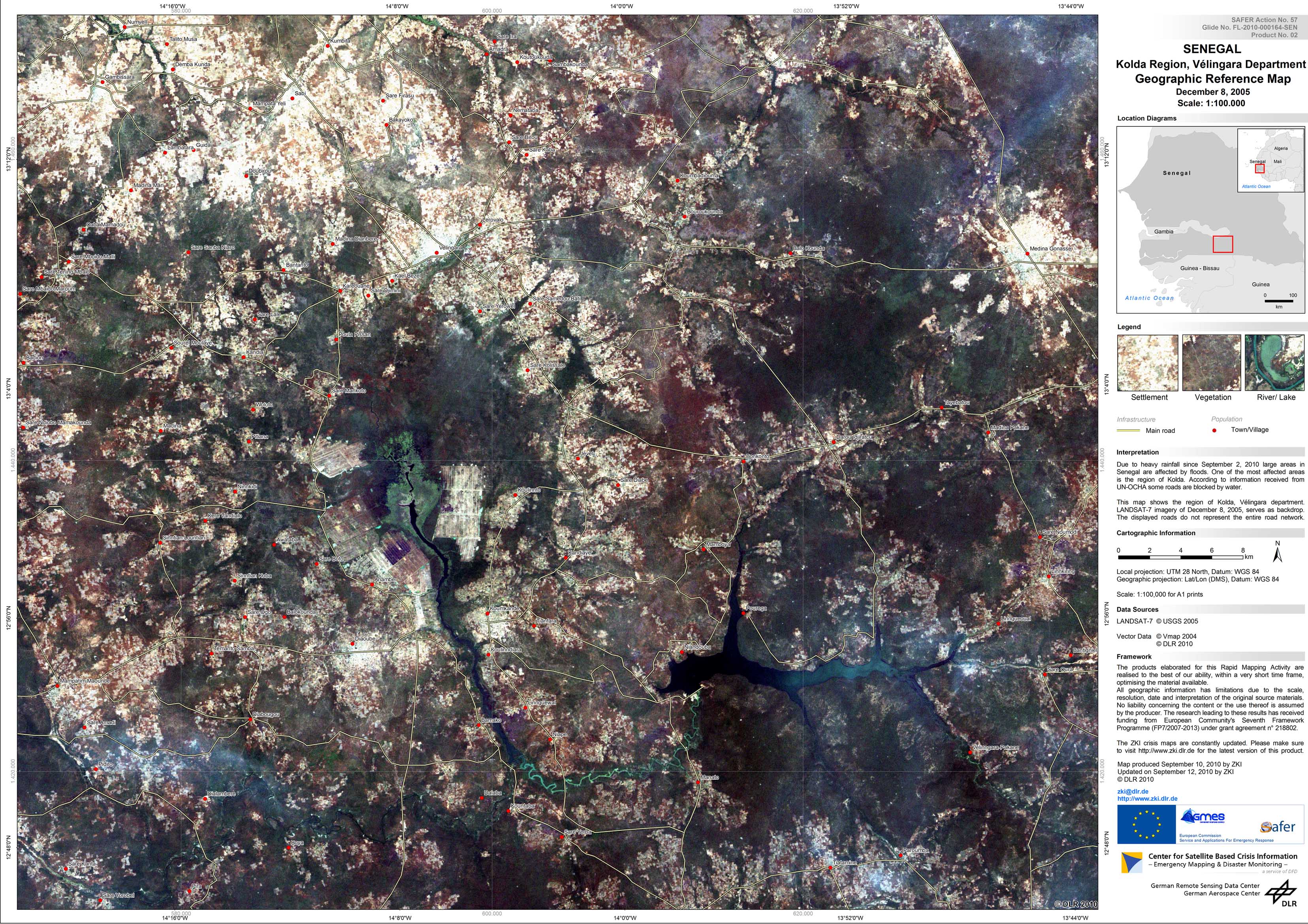
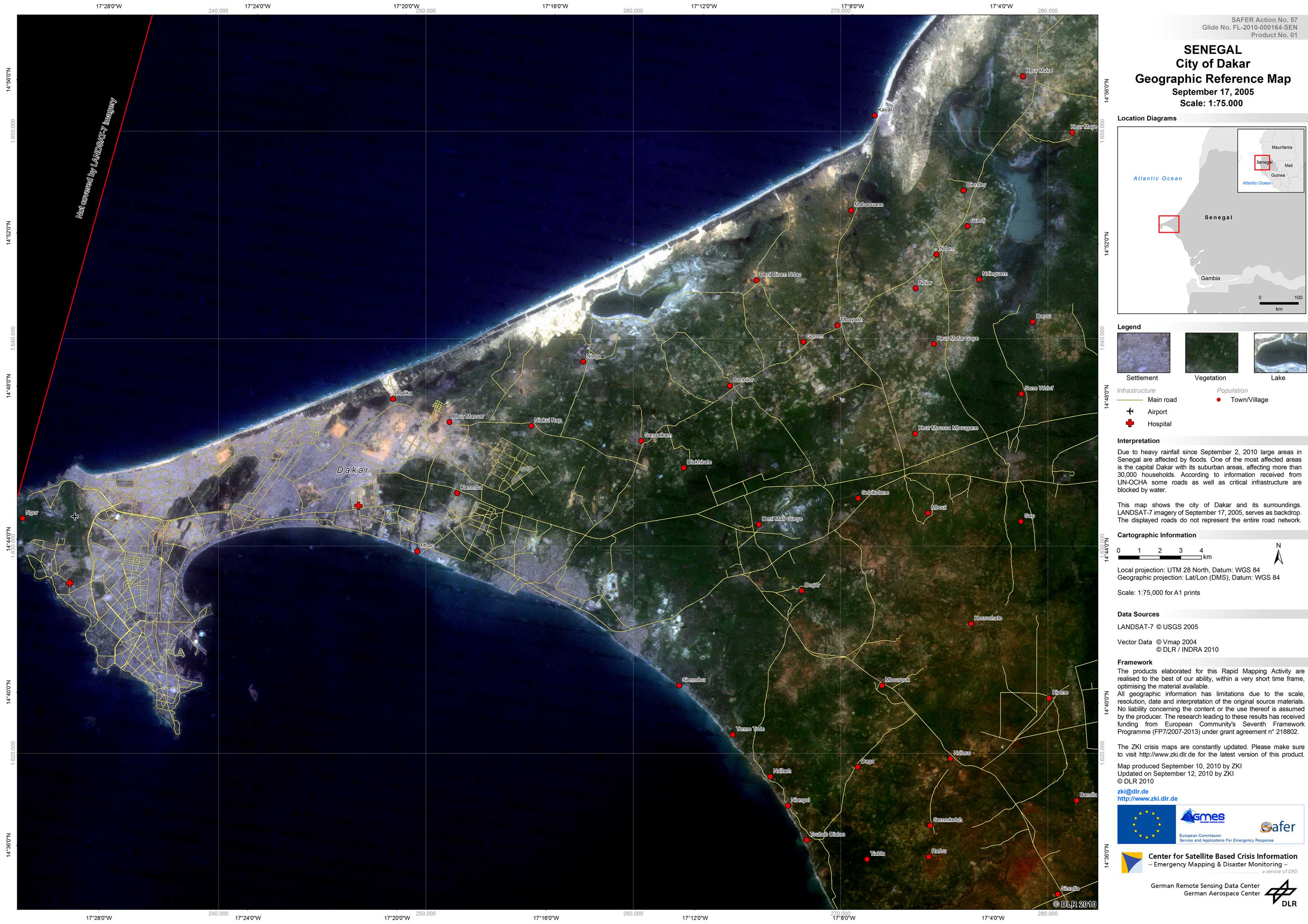
Due to heavy rainfall since September 2, 2010 large areas in Senegal are affected by floods. One of the most affected areas is the capital Dakar with its suburban areas, affecting more than 30,000 households. According to information received from UN-OCHA some roads as well as critical infrastructure are blocked by water.ZKI provides Reference and Flood Maps in the framework of the GMES Emergency Response project SAFER with funding from the European Community's Seventh Framework Programme.
Senegal - P03 - Dakar - Flood as of September 12, 2010 - Disaster Extent Map
Creation Date 14. September 2010
Senegal - P02 - Kolda - Geographic Reference Map - Overview
Creation Date 12. September 2010
Senegal - P01 - Dakar - Geographic Reference Map - Overview
Creation Date 12. September 2010
undefined