
Floods on the river Schwarze Elster (Germany) 2010
undefined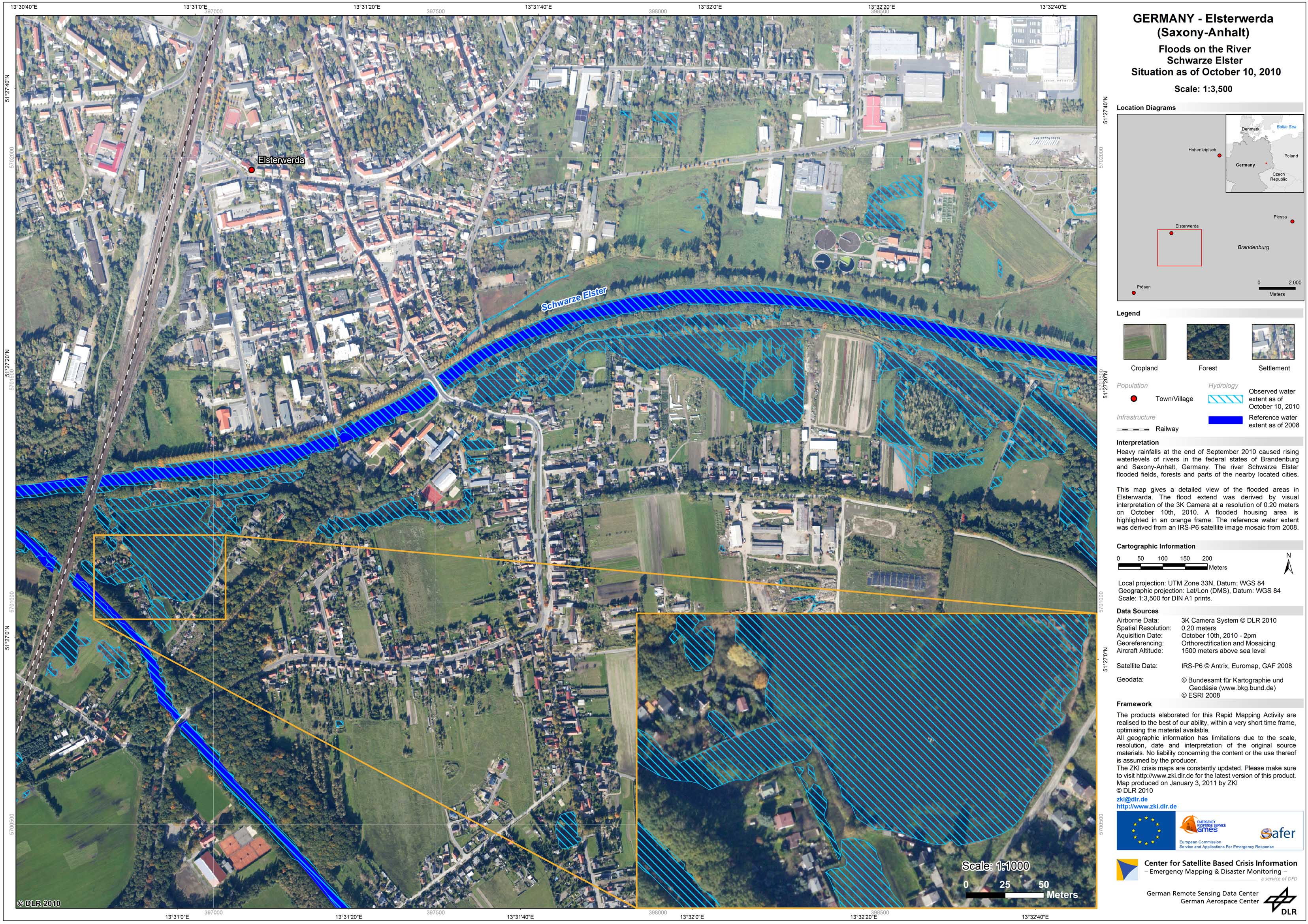
Germany - Schwarze Elster - P08 - Disaster Extent Map - Elsterwerda - Detail - 3K camera
Creation Date 23. December 2010
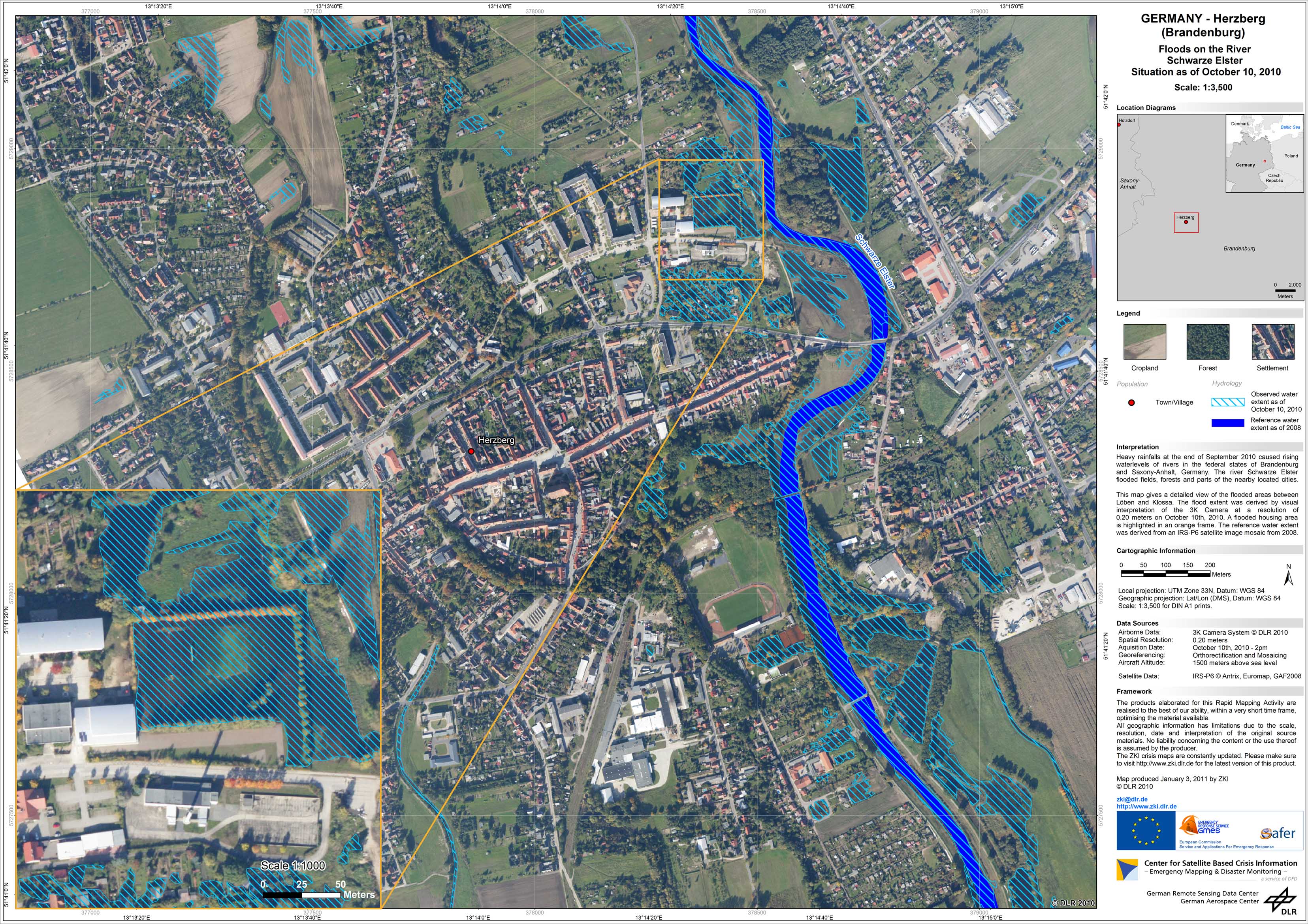
Germany - Schwarze Elster - P07 - Disaster Extent Map - Herzberg - Detail - 3K camera
Creation Date 23. December 2010
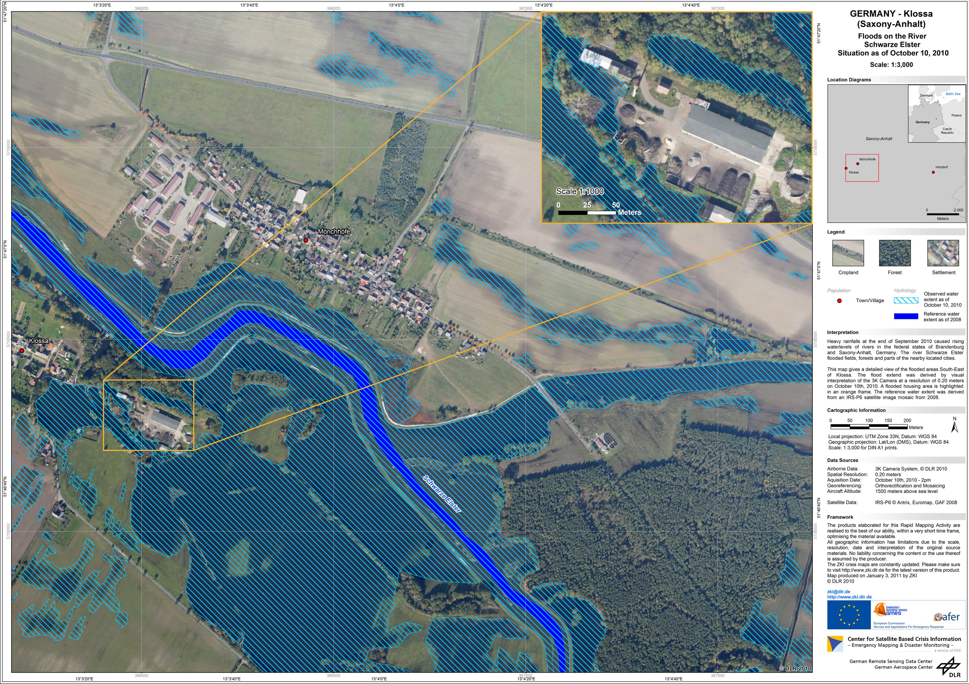
Germany - Schwarze Elster - P06 - Disaster Extent Map - Klossa - Detail - 3K camera
Creation Date 23. December 2010
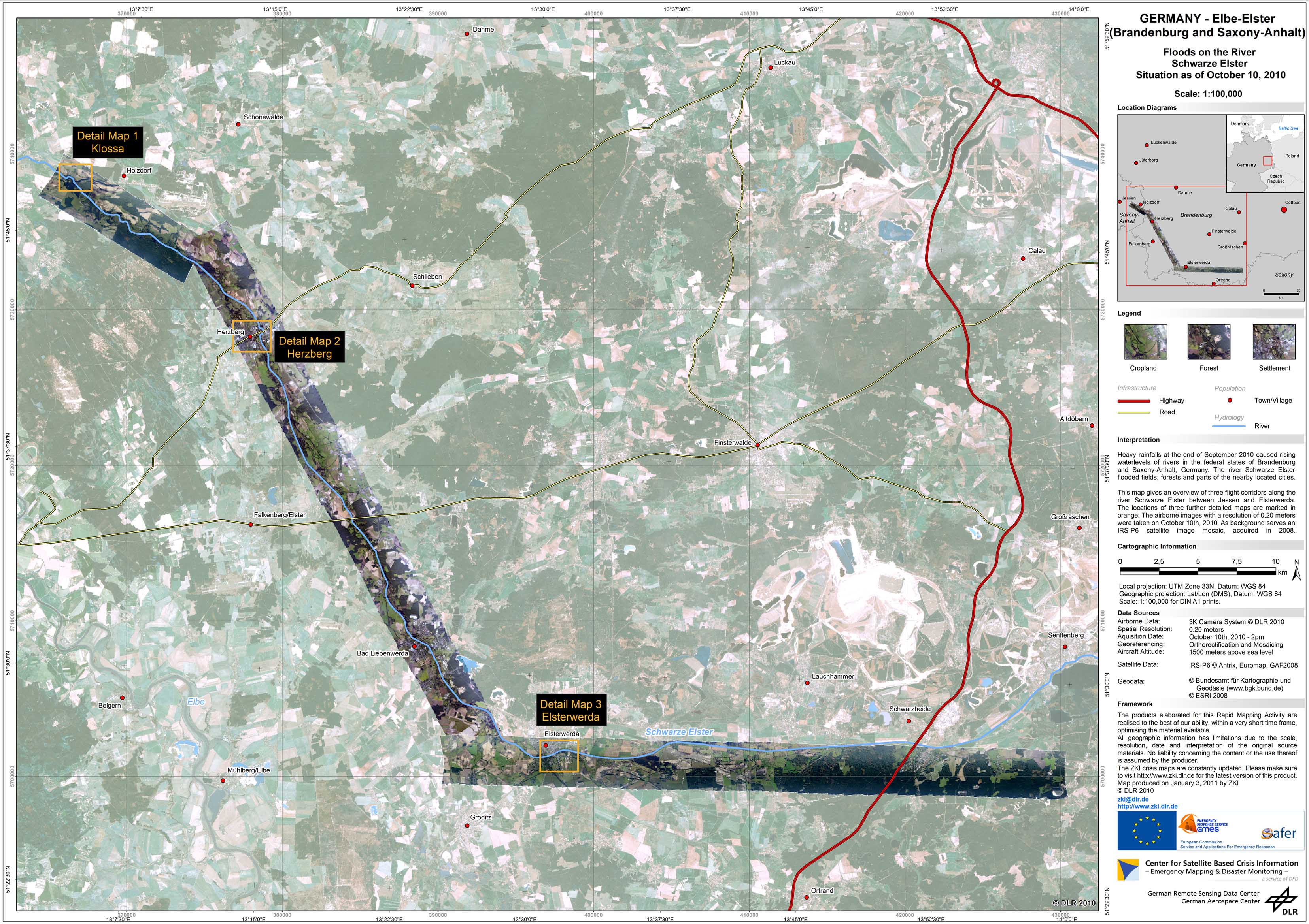
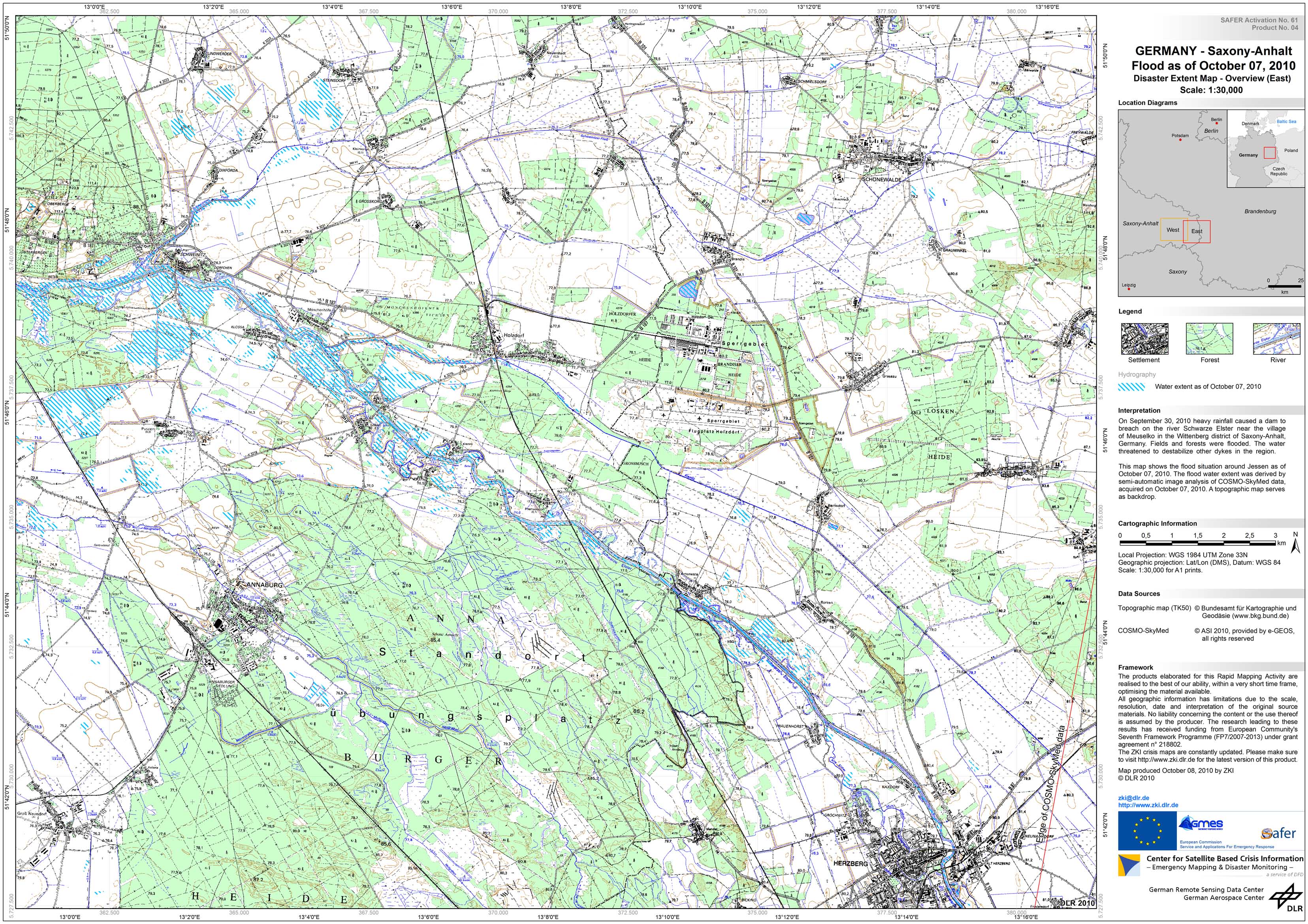
Germany - Schwarze Elster - P05 - Disaster Extent Map - Overview - 3K camera
Creation Date 23. December 2010
Germany - Schwarze Elster - P04 - Flood as of October 04, 2010 - Disaster Extent Map - Detail (East)
Creation Date 08. October 2010
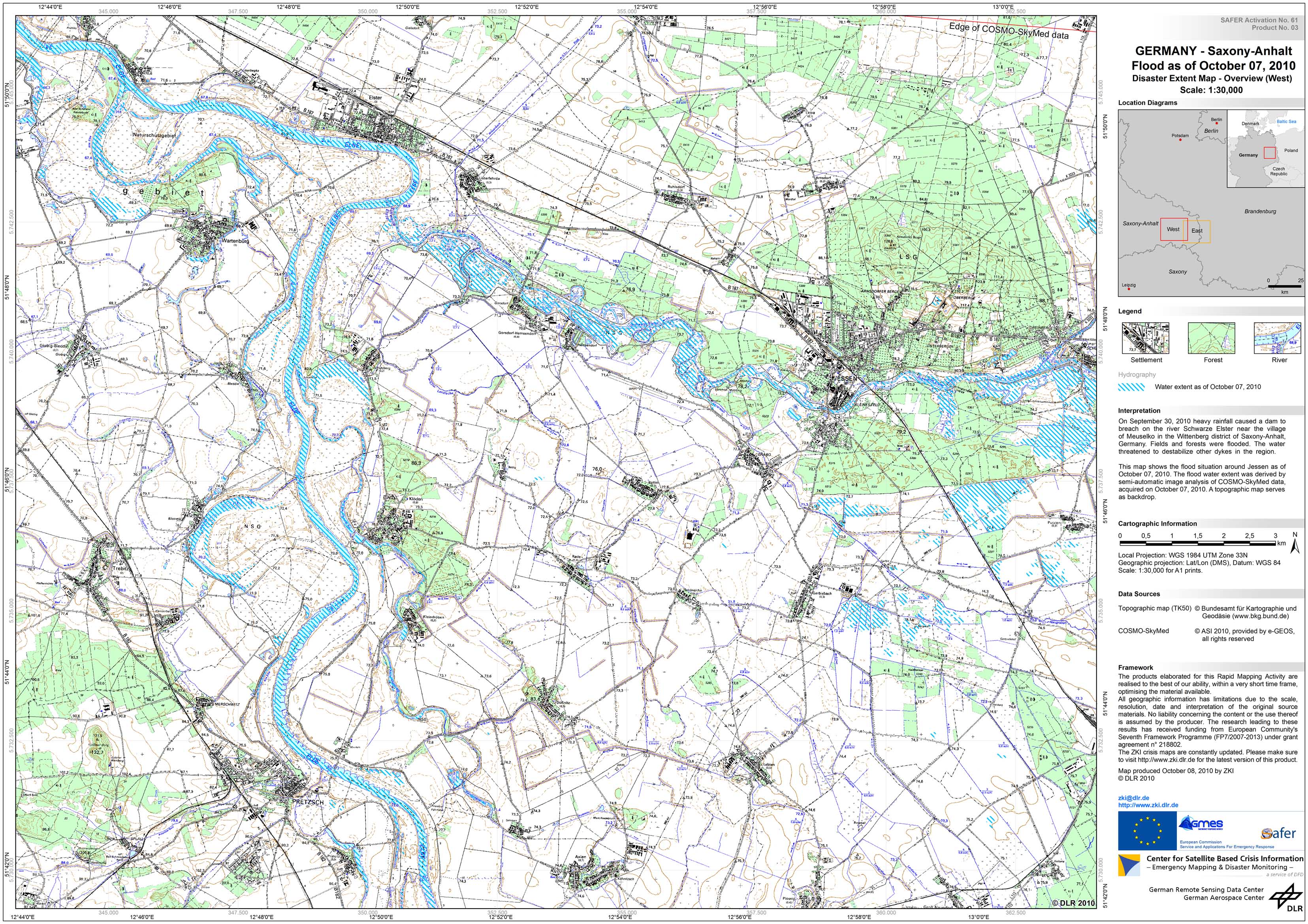
Germany - Schwarze Elster - P03 - Flood as of October 04, 2010 - Disaster Extent Map - Detail (West)
Creation Date 08. October 2010
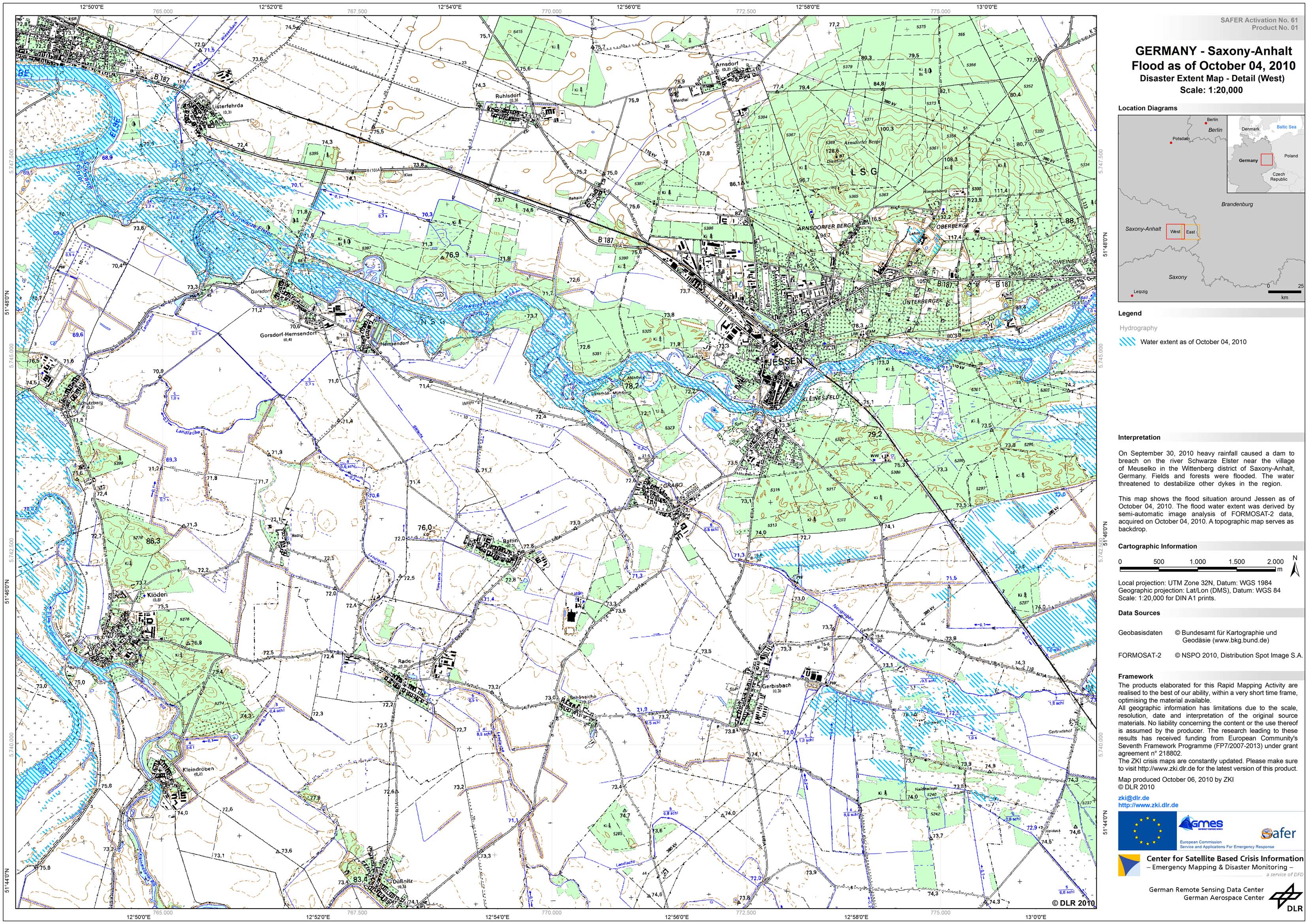
Germany - Schwarze Elster - P01 - Flood as of October 04, 2010 - Disaster Extent Map - Detail (West)
Creation Date 06. October 2010
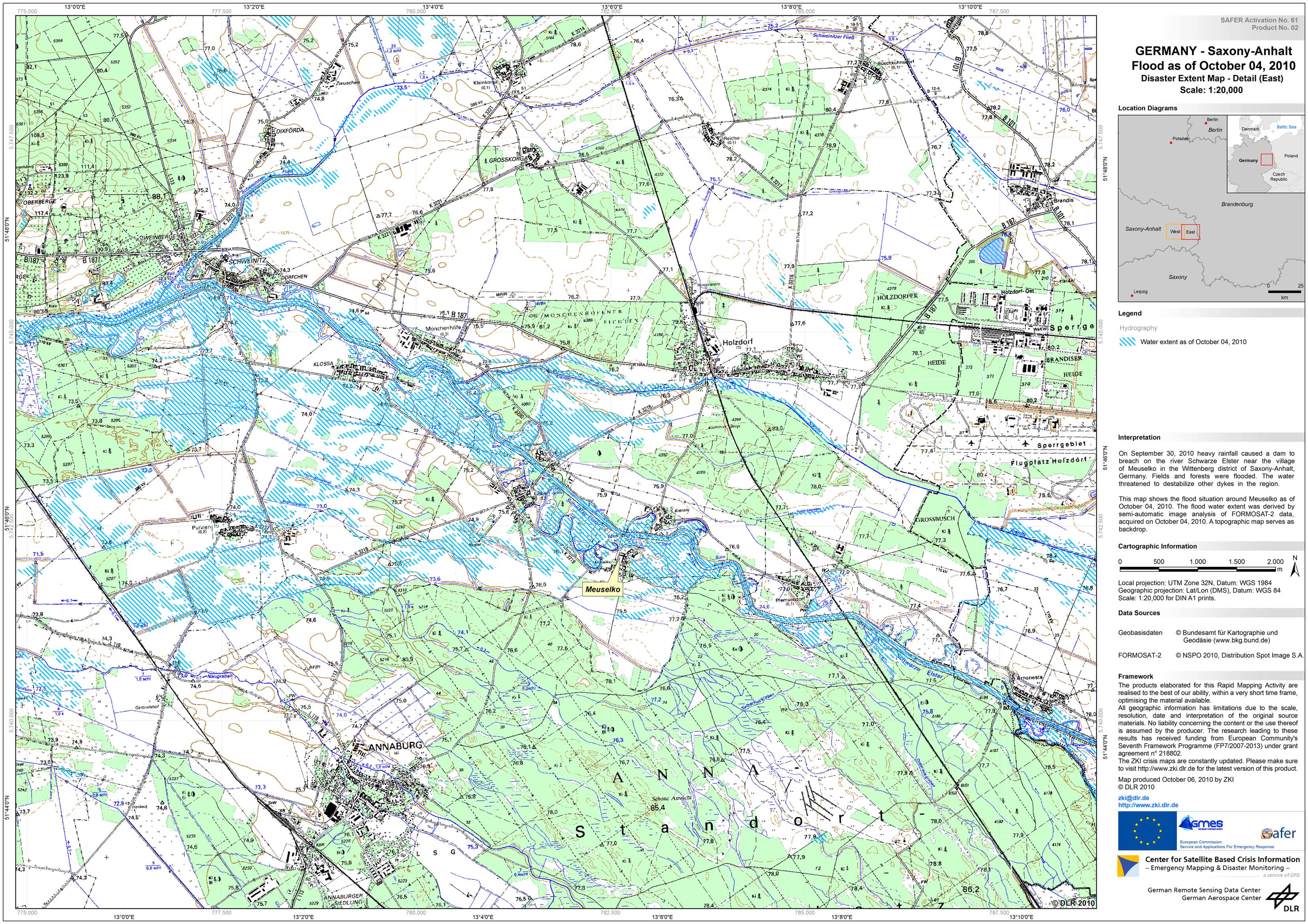
Germany - Schwarze Elster - P02 - Flood as of October 04, 2010 - Disaster Extent Map - Detail (East)
Creation Date 06. October 2010