
Tsunami in Indonesia, October 2010
undefined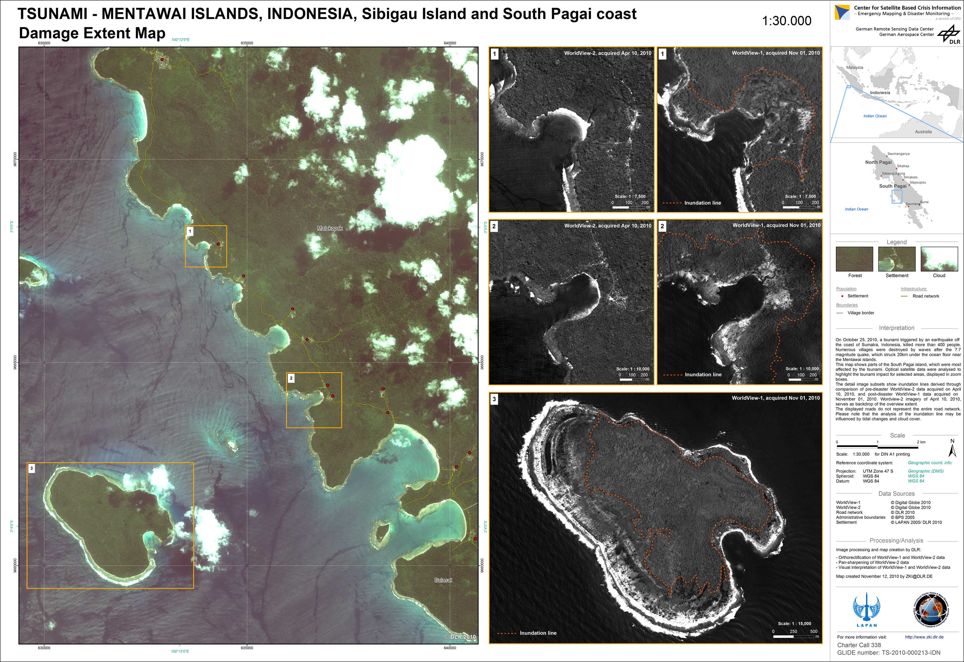
Indonesia - Tsunami - Mentawai Islands - P10 - Damage Extent Map - Sibigau Island and South Pagai coast
Creation Date 12. November 2010
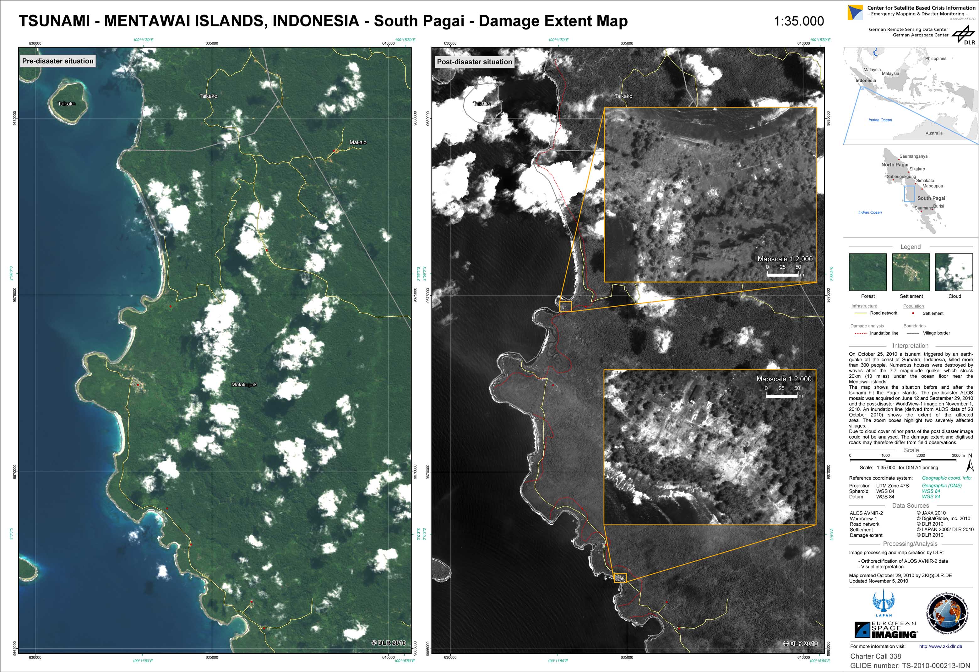
Indonesia - Tsunami - Mentawai Islands - P07 - Damage Extent Map - South Pagai
Creation Date 05. November 2010
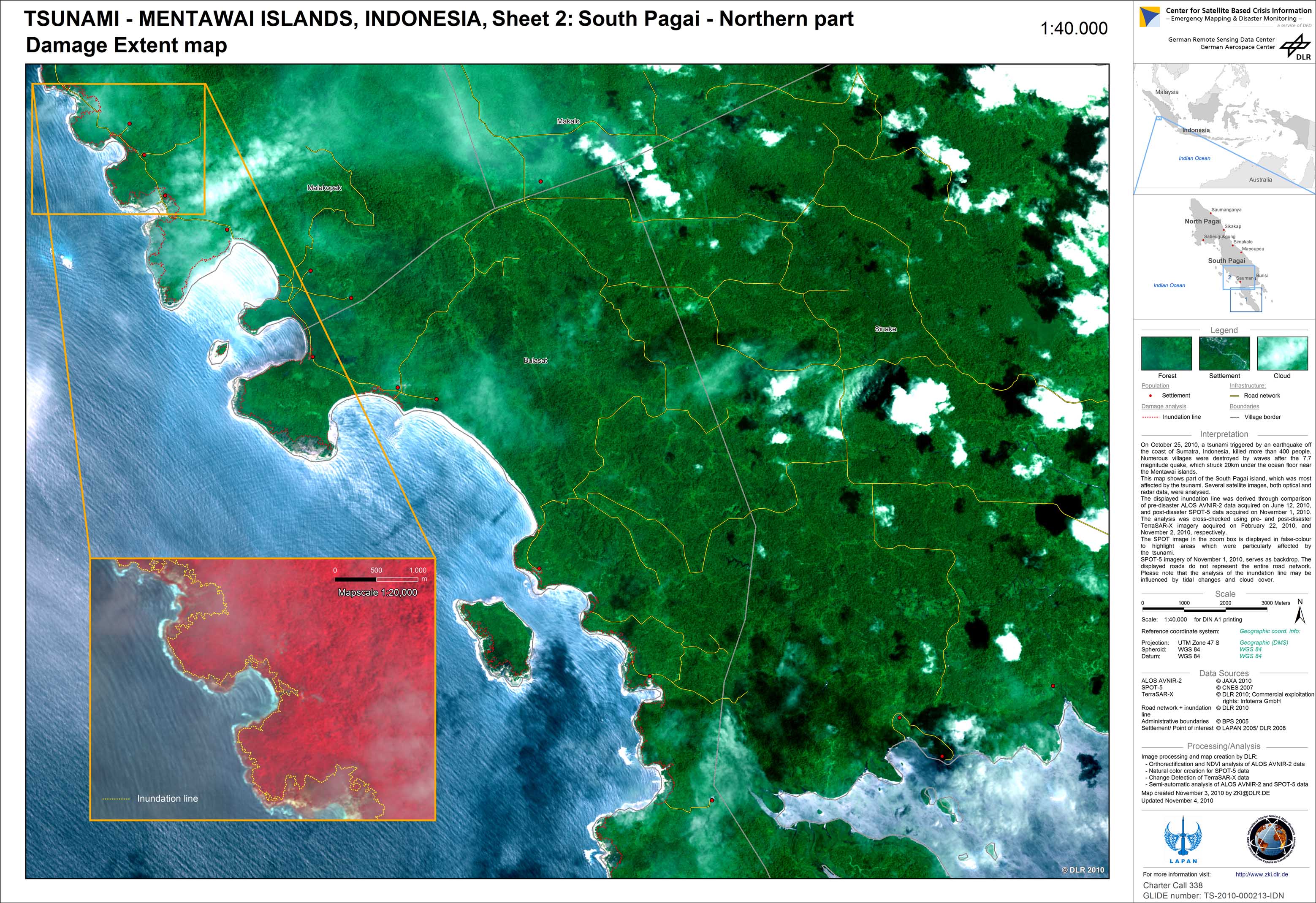
Indonesia - Tsunami - Mentawai Islands - P09 - Damage Extent Map - Sheet 2: South Pagai - Northern Part
Creation Date 04. November 2010
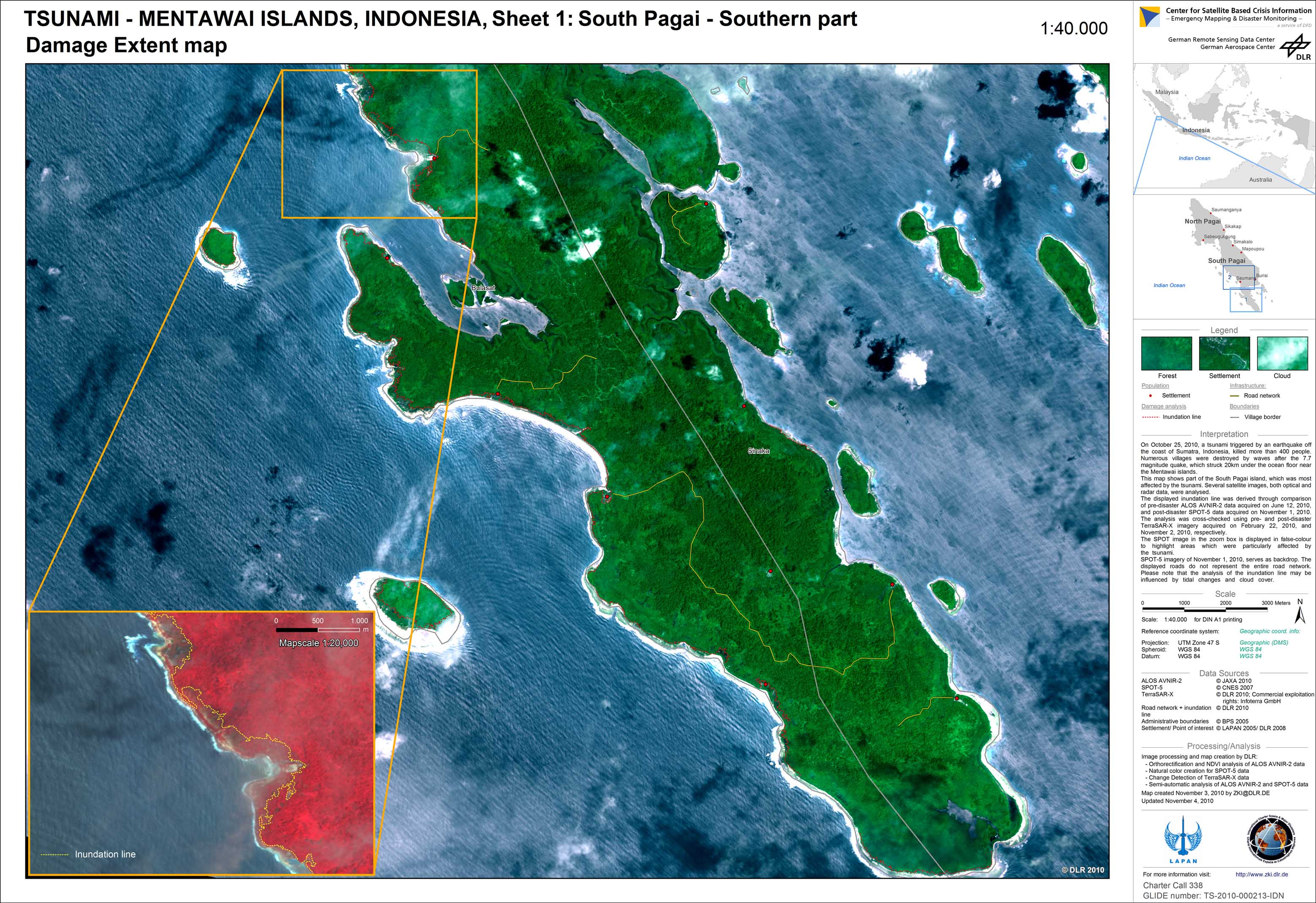
Indonesia - Tsunami - Mentawai Islands - P08 - Damage Extent Map - Sheet 1: South Pagai - Southern Part
Creation Date 04. November 2010
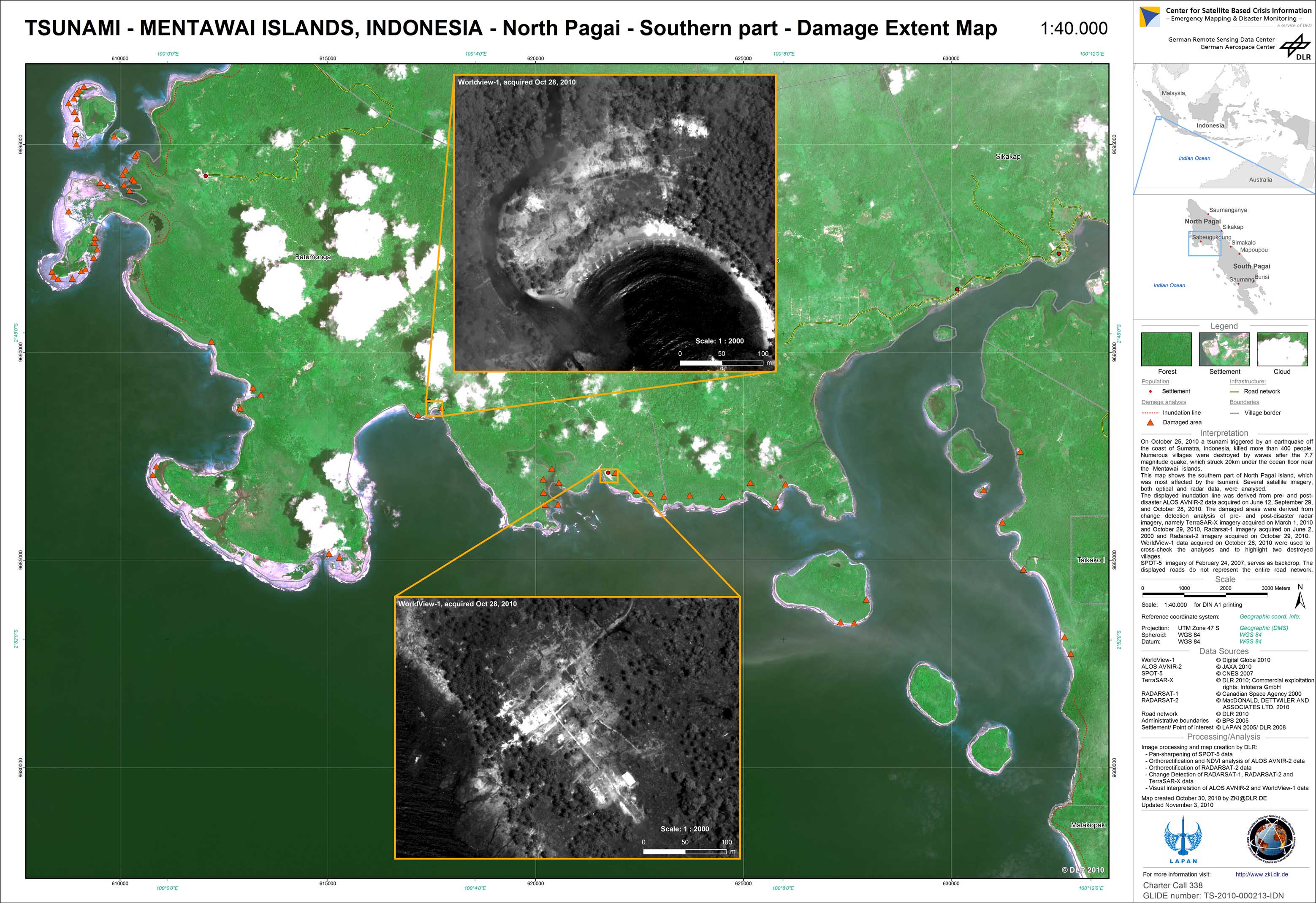
Indonesia - Tsunami - Mentawai Islands - P06 - Damage Extent Map - North Pagai, southern part
Creation Date 03. November 2010
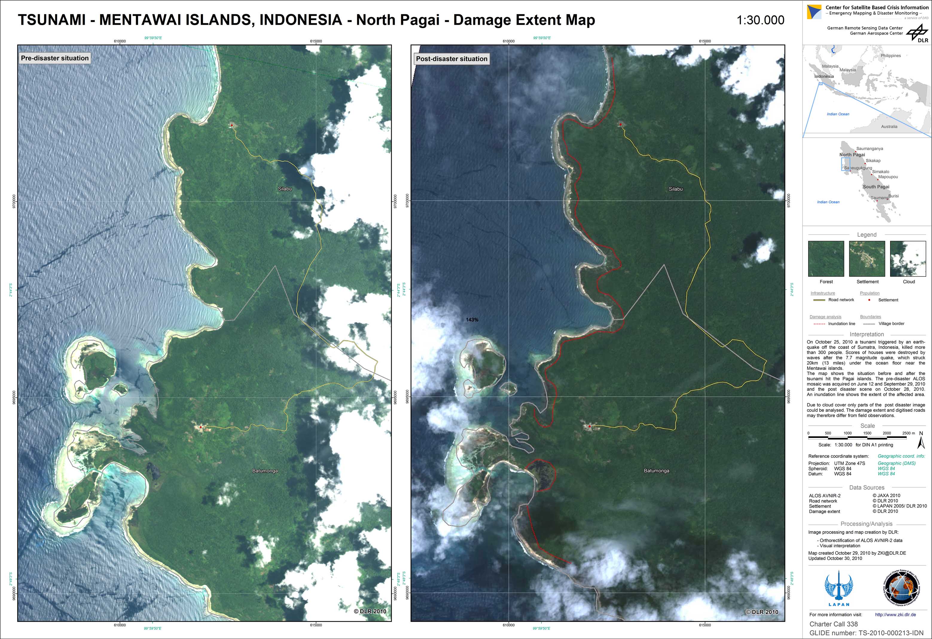
Indonesia - Tsunami - Mentawai Islands - P05 - Damage Extent Map - North Pagai
Creation Date 30. October 2010
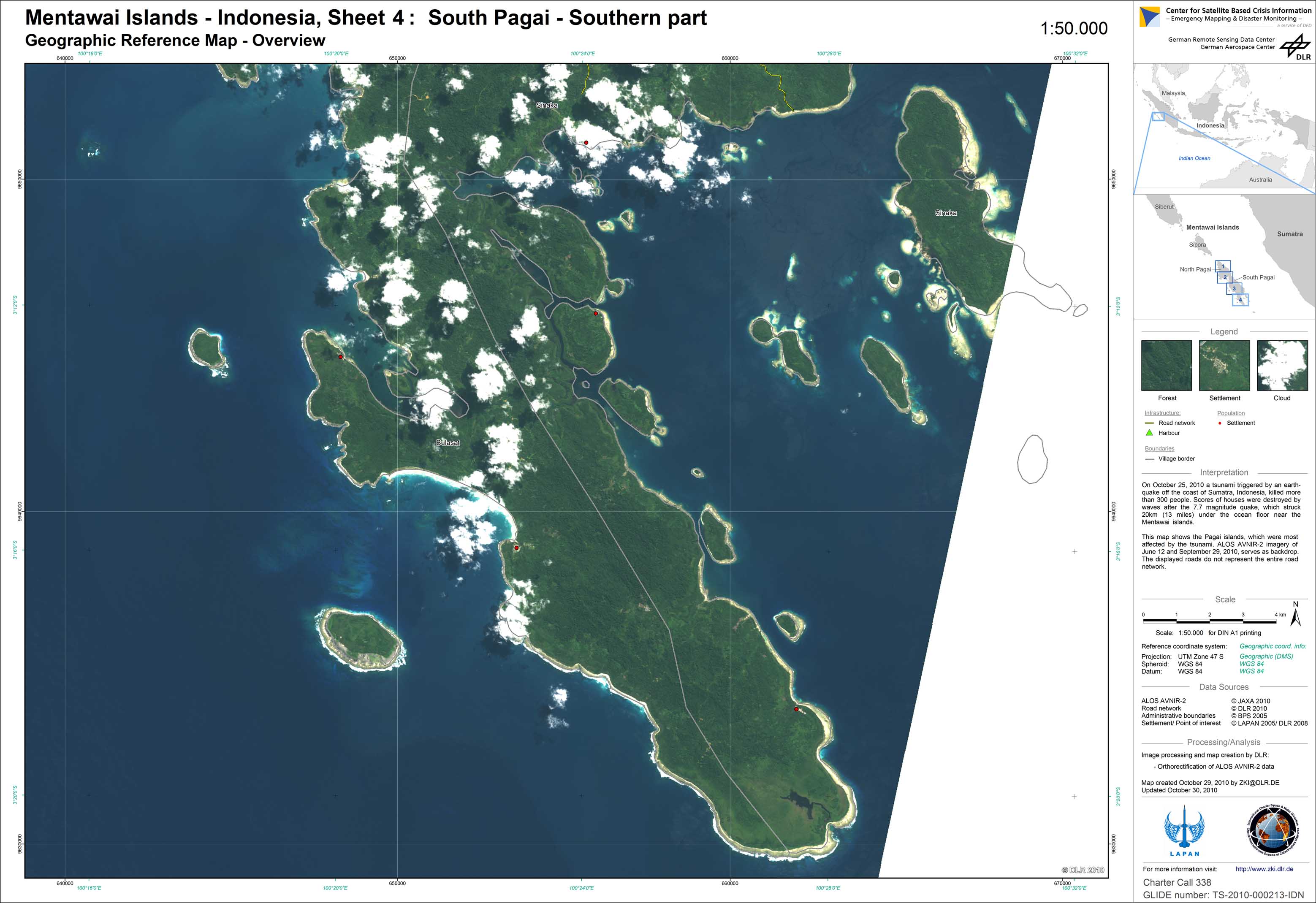
Indonesia - Mentawai Islands - P04 - Geographic Reference Map - Overview - Sheet 4: South Pagai - Southern part
Creation Date 30. October 2010
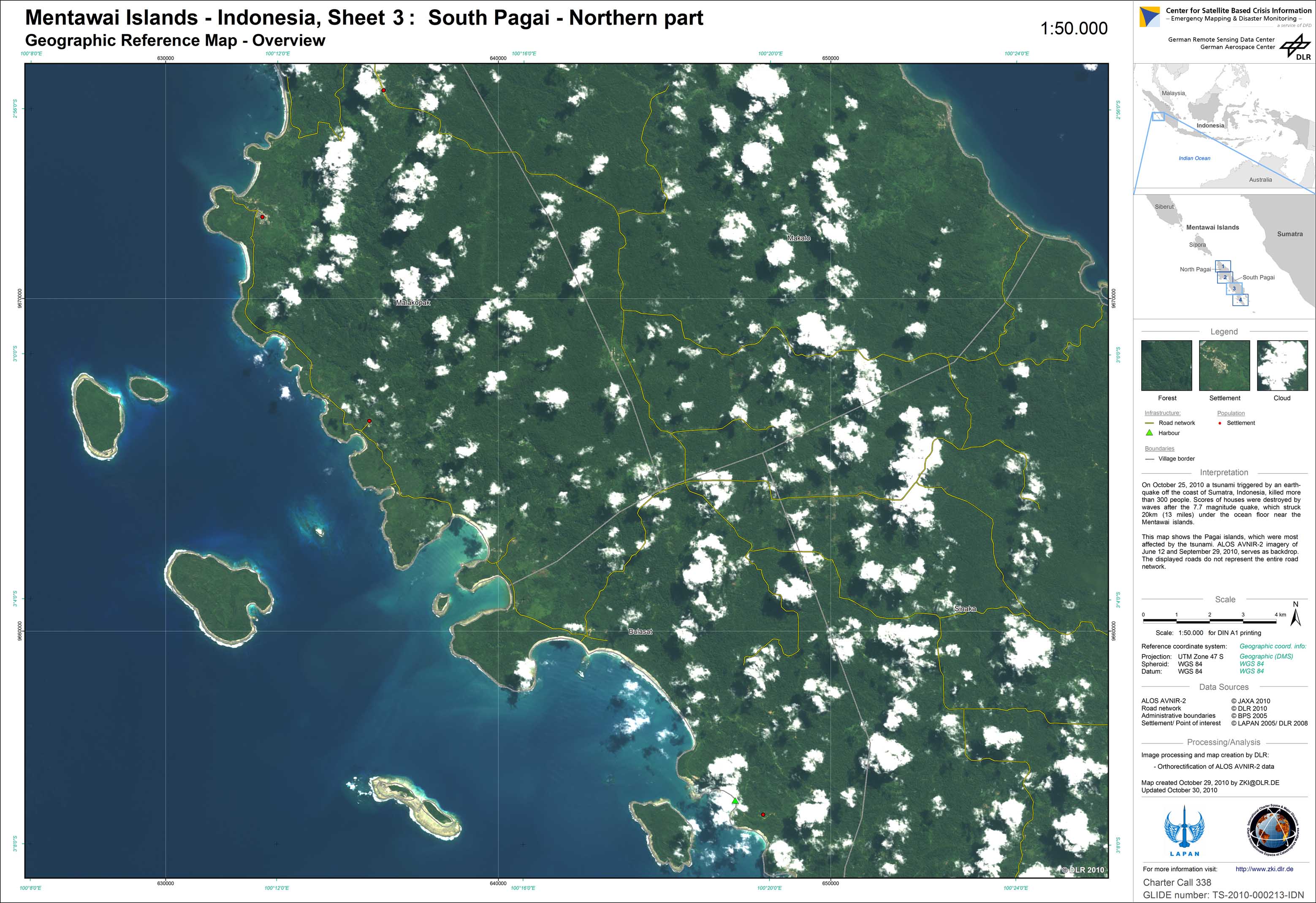
Indonesia - Mentawai Islands - P03 - Geographic Reference Map - Overview - Sheet 3: South Pagai - Northern part
Creation Date 30. October 2010
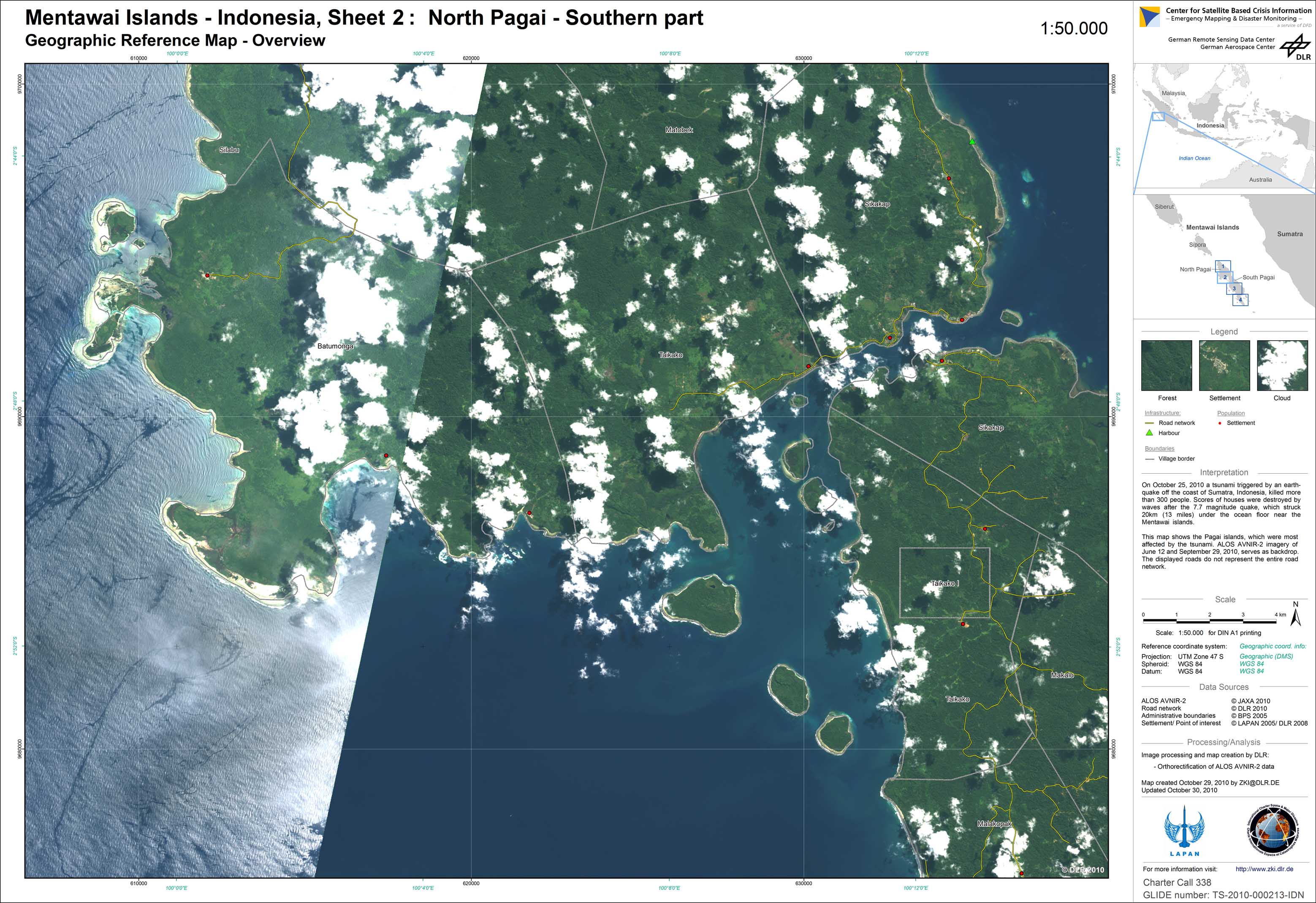
Indonesia - Mentawai Islands - P02 - Geographic Reference Map - Overview - Sheet 2: North Pagai - Southern part
Creation Date 30. October 2010
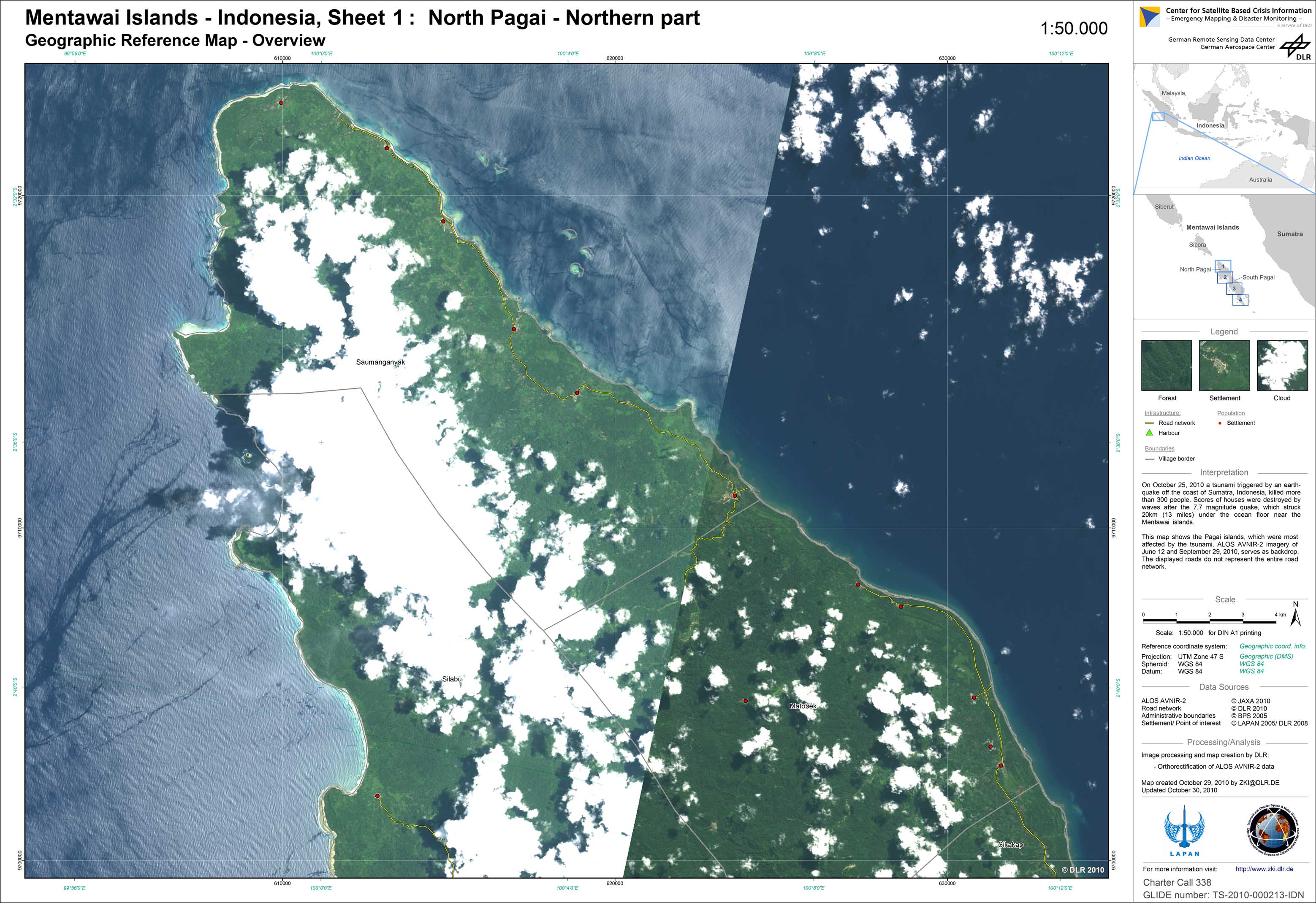
Indonesia - Mentawai Islands - P01 - Geographic Reference Map - Overview - Sheet 1: North Pagai - Northern part
Creation Date 30. October 2010