Dune fires in the Netherlands
undefined
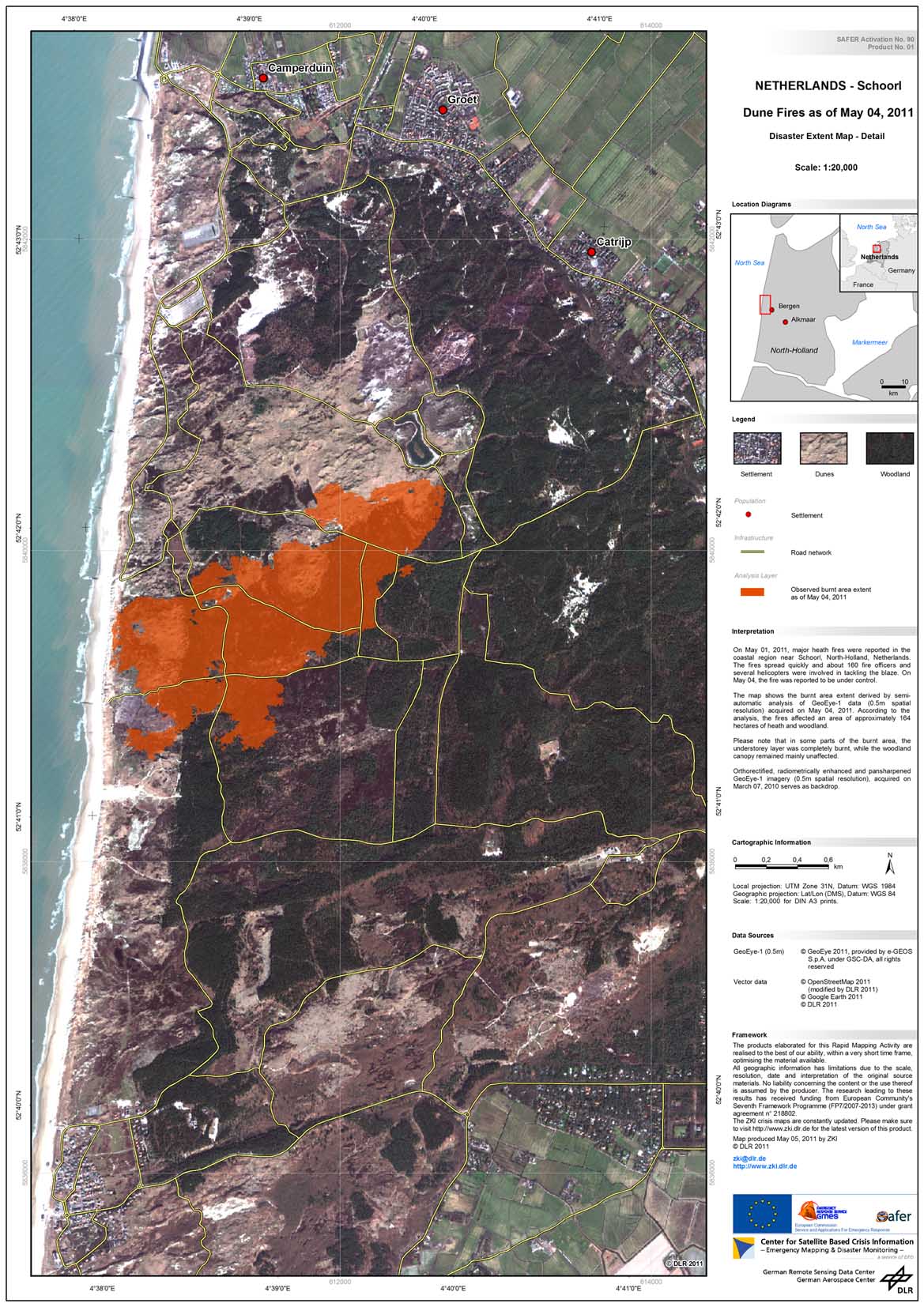
On May 01, 2011, a major heath fire was reported in the coastal region near Schoorl, North Holland, Netherlands. The fires spread quickly and 160 fire officers and several helicopters were involved in tackling the blaze. On May 04, the fire was reported to be under control.On May 02, 2011 the GMES SAFER mechanism was activated through the National Focal Point of the Netherlands. Very high resolution new and archive optical satellite imagery were ordered. The DLR/ZKI map shows the burnt area extent derived by the analysis of GeoEye-1 data acquired on May 04, 2011.
Netherlands - Schoorl - P01 - Disaster Extent Map - Detail
Creation Date 05. May 2011
undefined