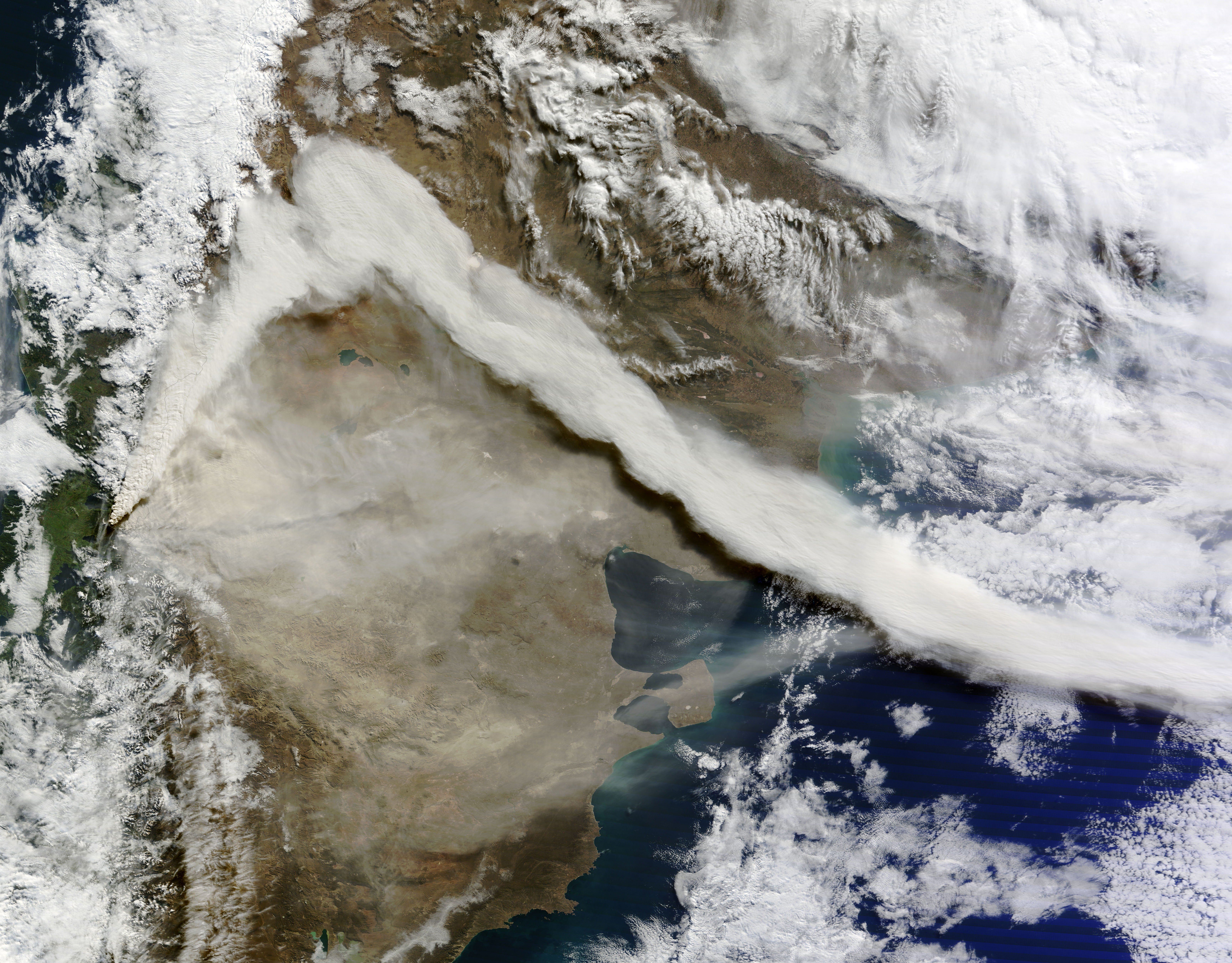
Satellite image from 7th of June 2011 showing the eruption of the volcano Puyehue.
Credit:
Goddard / MODIS Rapid Response Team / Wikimedia Commons
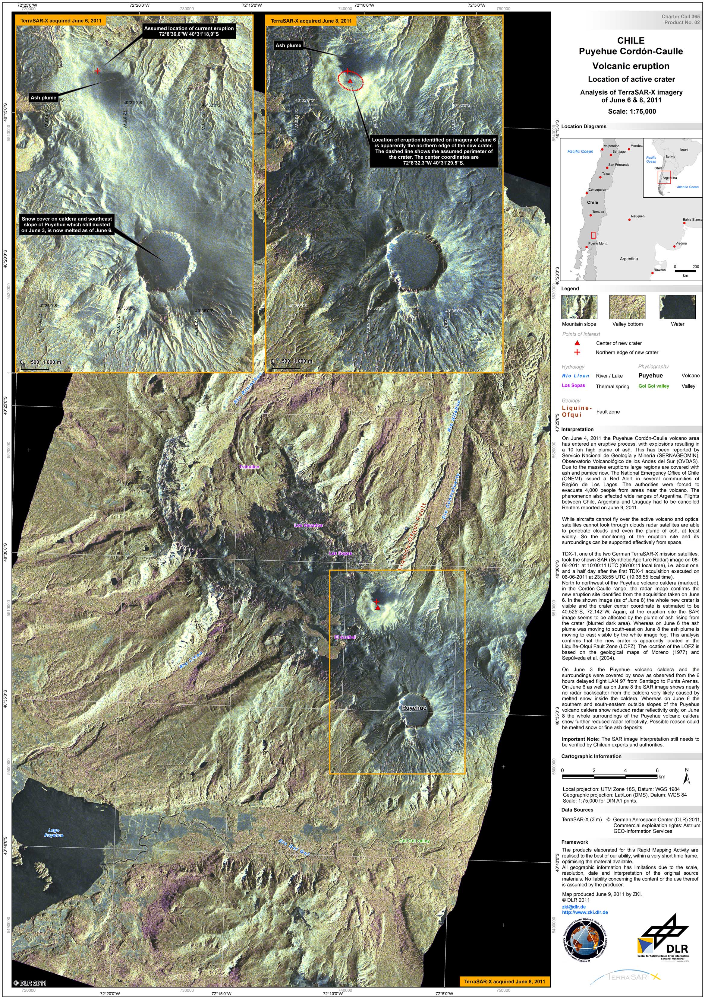
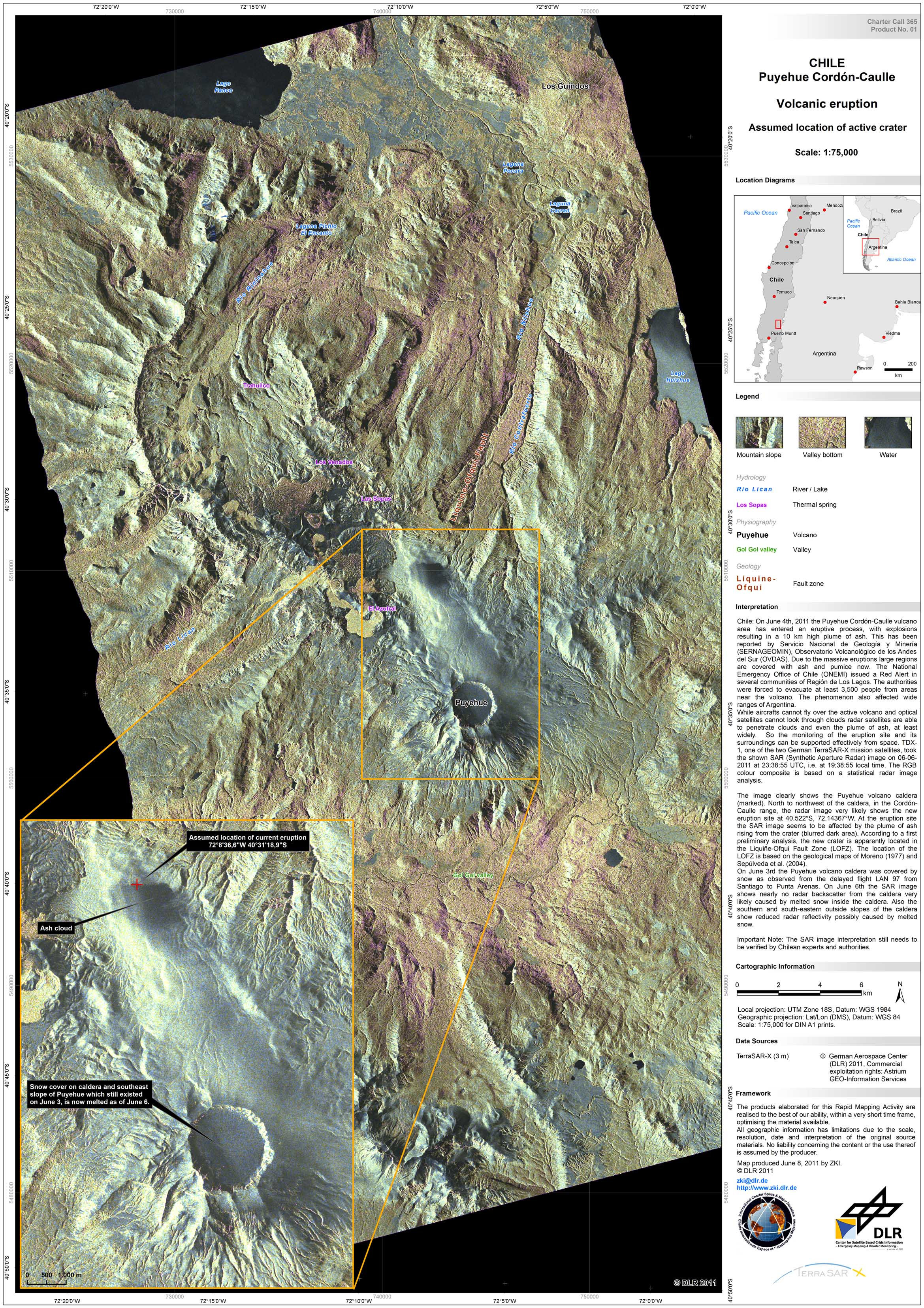
On June 4, 2011 the Puyehue Cordón-Caulle vulcano area in Chile has entered in an eruptive process, with explosions resulting in a 10 km high plume of ash. This has been reported by Servicio Nacional de Geología y Minería (SERNAGEOMIN), Observatorio Volcanológico de los Andes del Sur (OVDAS). Due to the massive eruptions large regions are covered with ash and pumice now. The National Emergency Office of Chile (ONEMI) issued a Red Alert in several communities of Región de Los Lagos. The authorities were forced to evacuate at least 4,000 people from areas near the volcano. The phenomenon also affected wide ranges of Argentina. While aircrafts cannot fly over the active volcano and optical satellites cannot look through clouds radar satellites are able to penetrate clouds and even the plume of ash, at least widely. So the monitoring of the eruption site and its surroundings can be supported effectively from space. TDX-1, one of the two German TerraSAR-X mission satellites, took the shown SAR (Synthetic Aperture Radar) images on June 6, 2011, at 23:38:55 UTC, i.e. at 19:38:55 local time and on June 8, 2011, at 10:00:11 UTC, i.e. at 06:00:11 local time.
Products
Chile - Volcano Puyehue-Cordon Caulle - P02 - Overview Map 2 - Location of active crater