12. September 2011

Floods in Pakistan

undefined

After heavy monsoon rains in August and September 2011, the province Sindh in the south of Pakistan was hit by severe floods. More than 300 people have been killed and around 8 million acres of agricultural land have been affected. 1.8 million people have been made homeless, 7.5 million were affected by the floods, and thousands of villages have been swallowed up by the rising waters. According to the National Disaster Management Authority (NDMA), all 23 districts of Sindh have been affected by the floods. ZKI provides Flood Maps in the framework of the GMES Emergency Response project SAFER with funding from the European Community`s Seventh Framework Programme.

Products

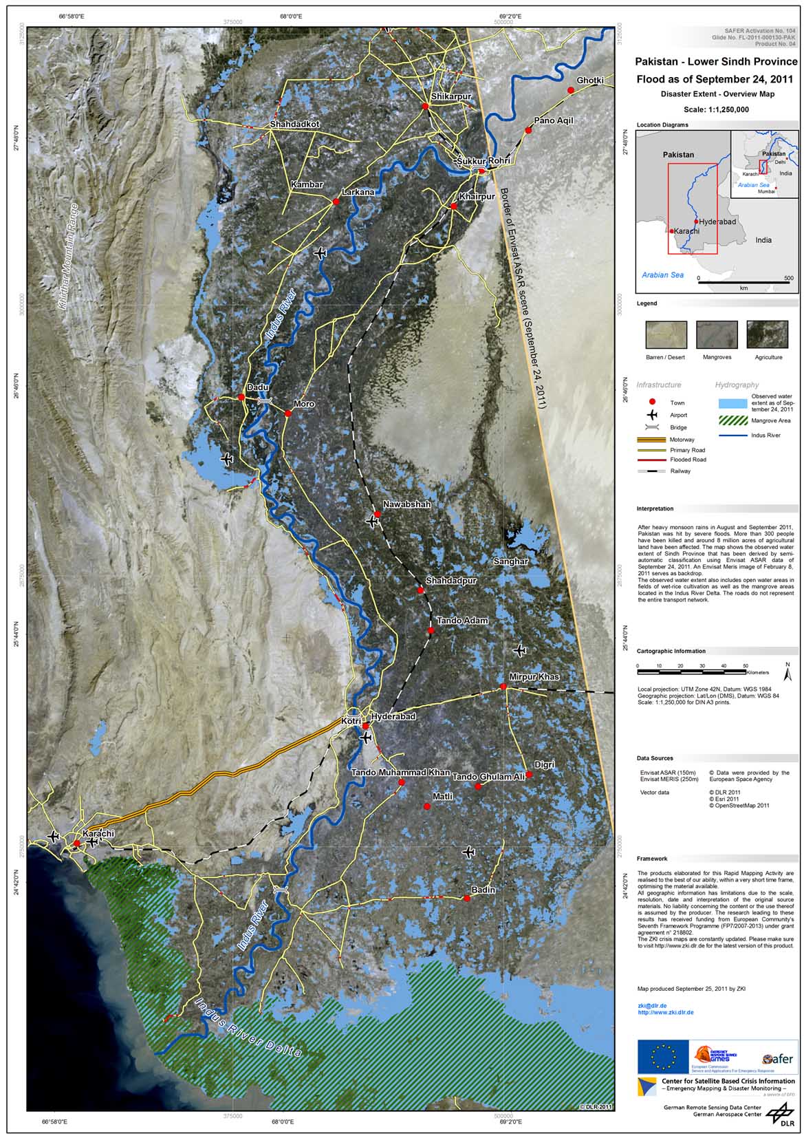
Pakistan - P06 - Lower Sindh Province - Flood extent map - Overview

Creation Date 25. September 2011

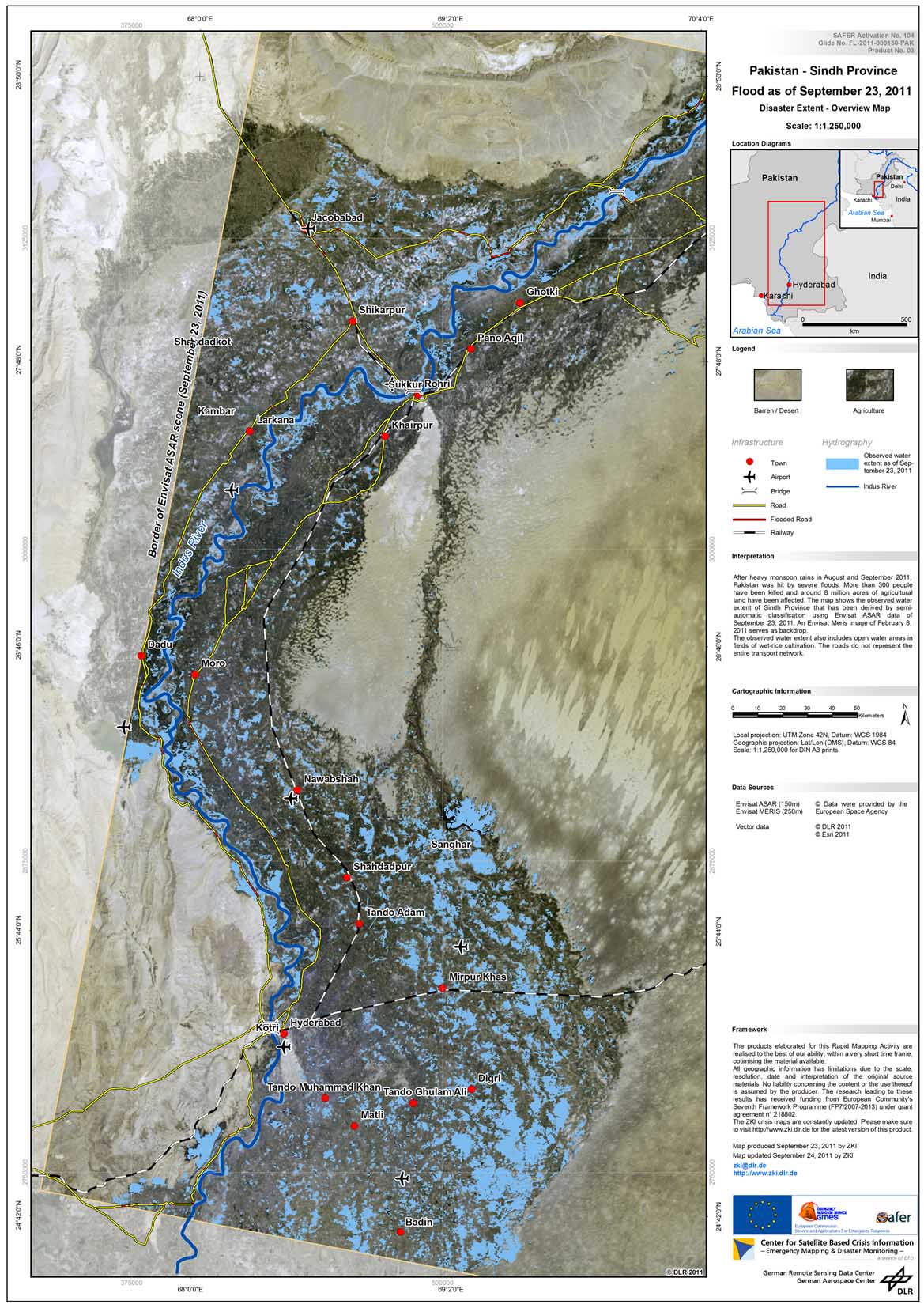
Pakistan - P05 - Sindh - Flood extent map - Overview

Creation Date 24. September 2011

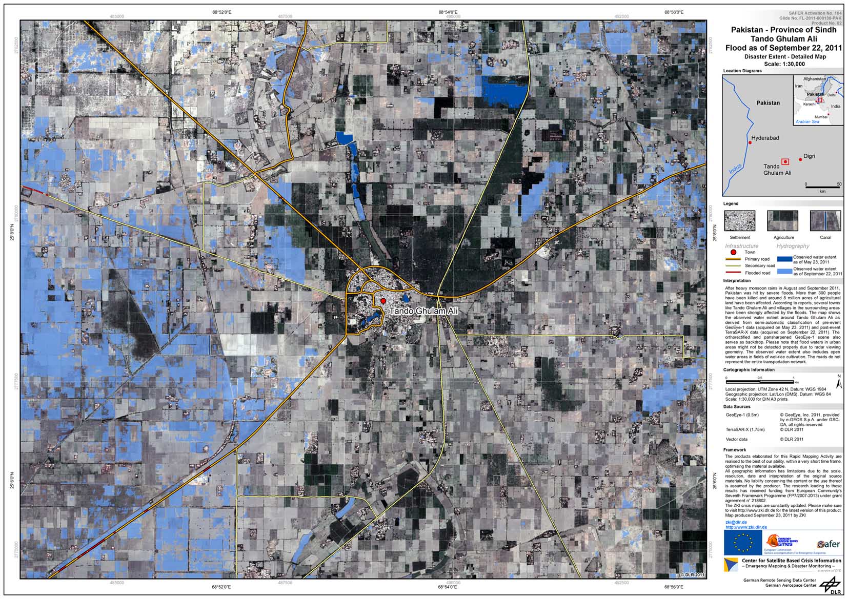
Pakistan - P04 - Sindh - Tando Ghulam Ali - Flood extent map - Detail

Creation Date 23. September 2011

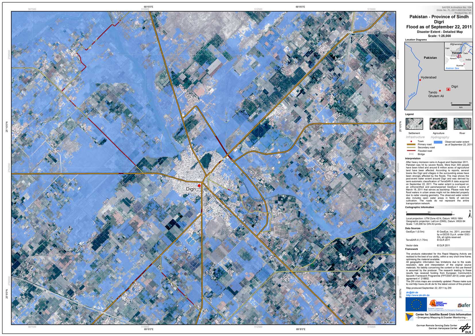
Pakistan - P03 - Sindh - Digri - Flood extent map - Detail

Creation Date 22. September 2011

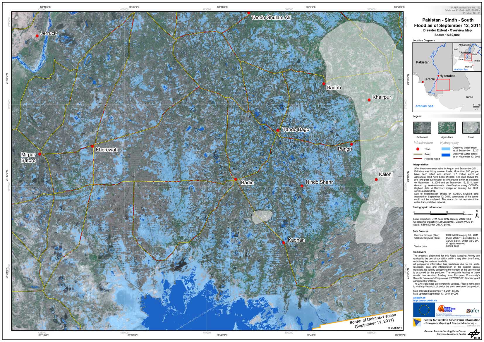
Pakistan - P01 - Sindh - Flood extent map - Overview - South

Creation Date 13. September 2011

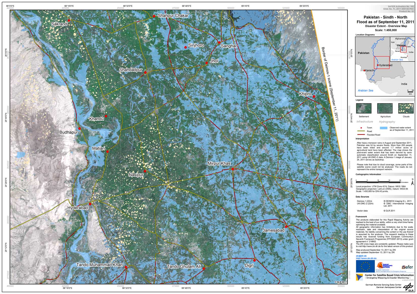
Pakistan - P02 - Sindh - Flood extent map - Overview - North

Creation Date 13. September 2011

undefined