Flood in Malawi
undefined
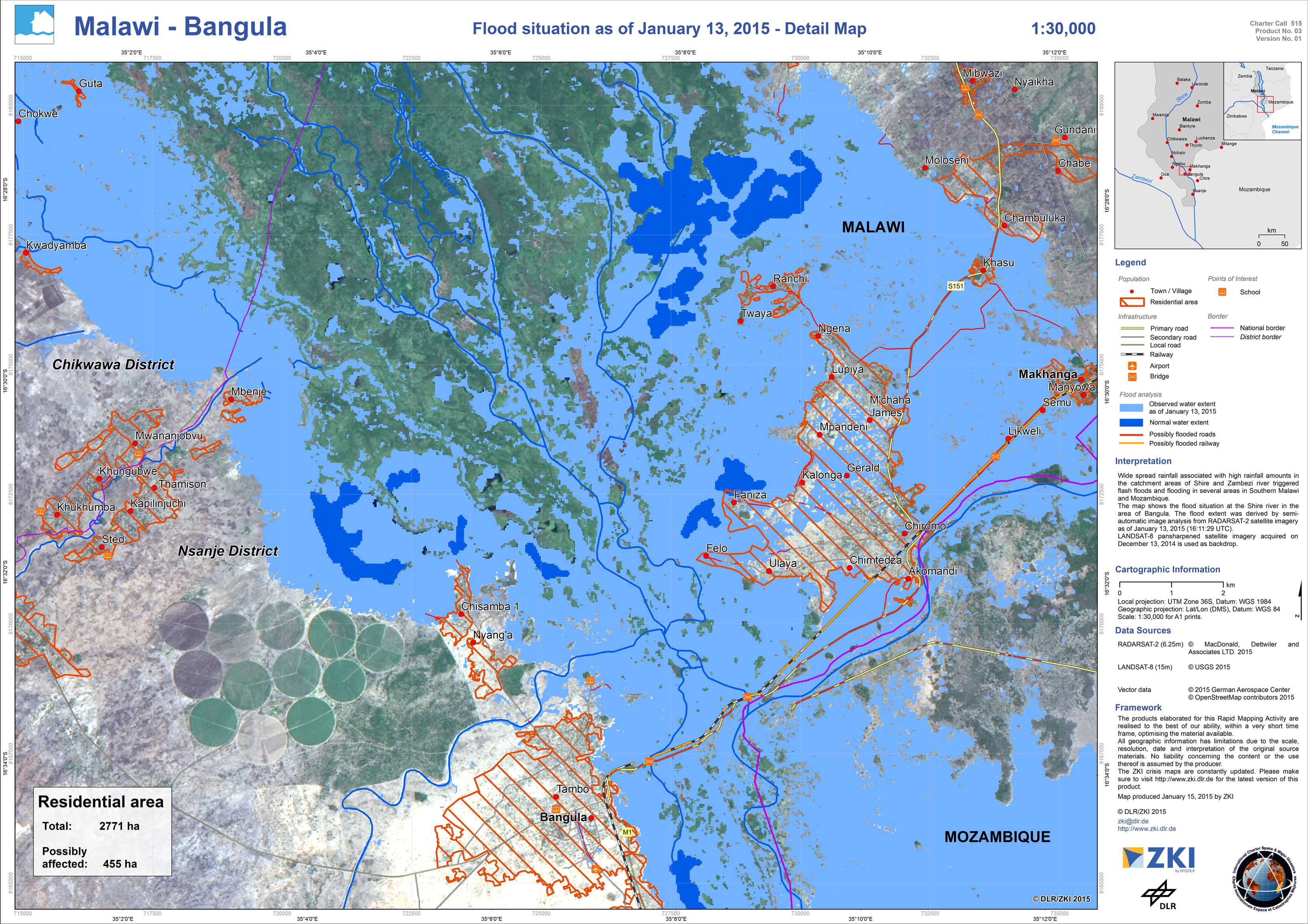
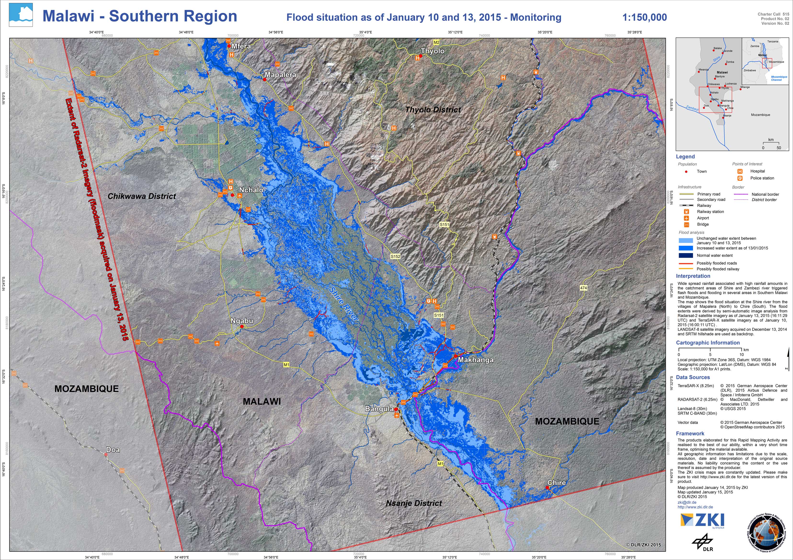
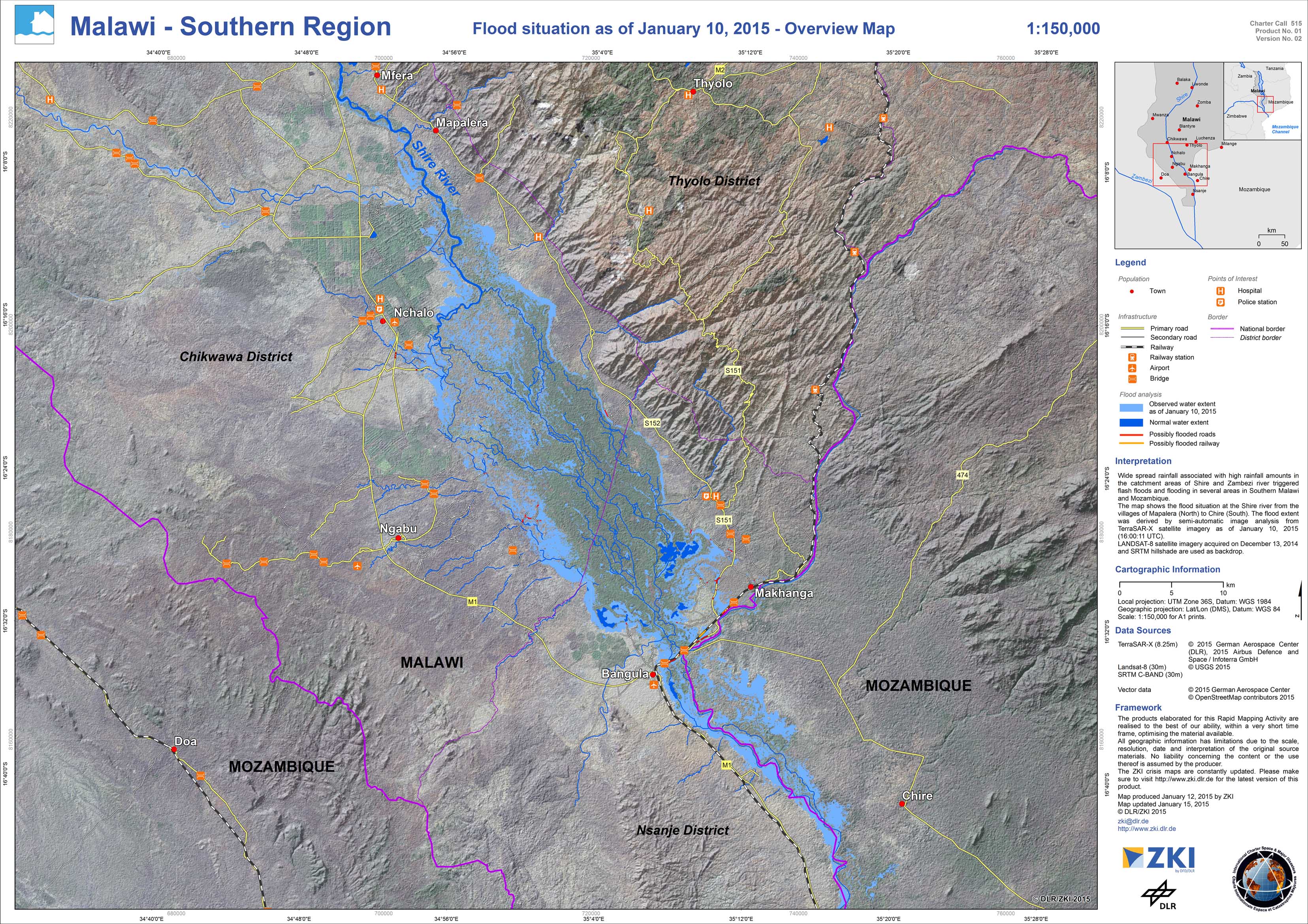
Wide spread rainfall associated with high rainfall amounts in the catchment areas of Shire and Zambesi rivers triggered flash floods and flooding in several areas in Southern Malawi and Mozambique. The International Charter Space and Major Disasters has been activated for this flood event. Here, the DLR/ZKI contributes with the delivery of TerraSAR-X data, the project management as well as value adding service. The information products were provided to the Department of Disaster Management Affairs of Malawi.
Malawi - Bangula - P03 - Flood situation as of January 13, 2015 - Detail Map
Creation Date 16. January 2015
Malawi - Southern Region - P02 - Flood situation as of January 10 and 13, 2015 - Monitoring
Creation Date 15. January 2015
Malawi - Southern Region - P01 - Flood situation as of January 10, 2015 - Overview map
Creation Date 15. January 2015
undefined