
Forest fire exercise in Catalonia (Pilot demonstration PHAROS-System)
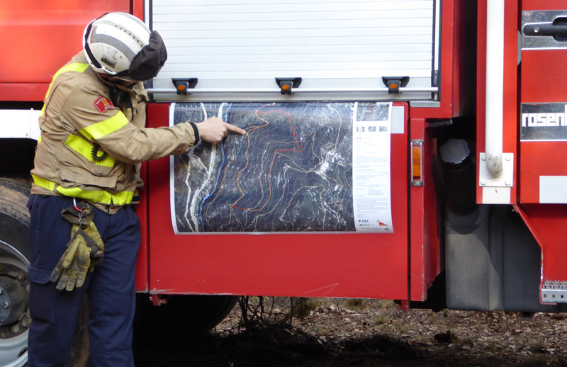
Firefighter briefing using DLR maps.
Credit:
DLR (CC-BY 3.0).
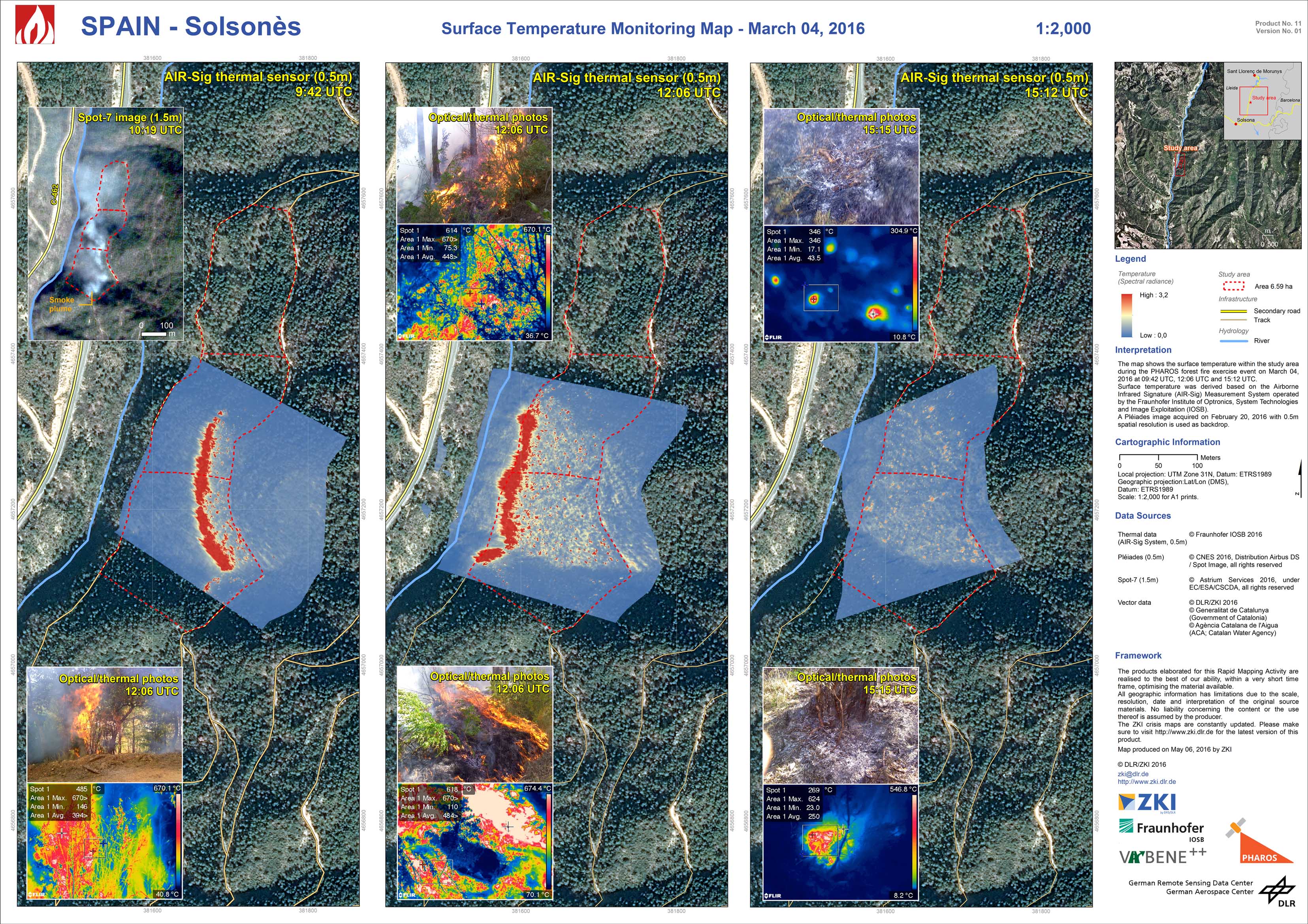
Spain - Solsonès - P11 - Surface Temperature Monitoring Map - March 04, 2016
Creation Date 11. May 2016
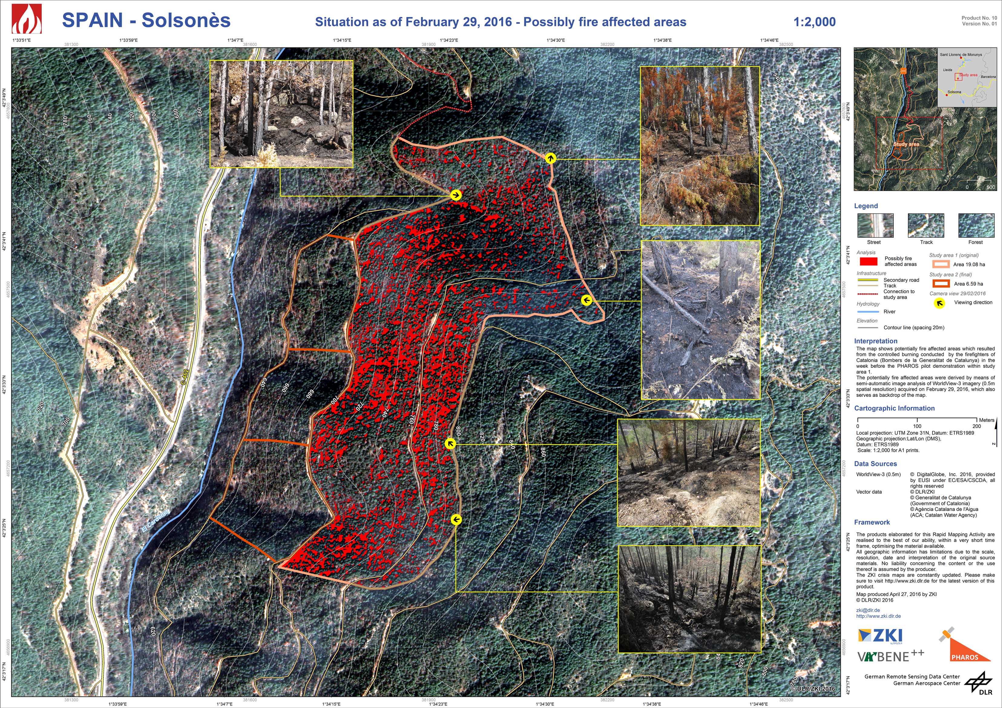
Spain - Solsonès - P10 - Situation as of February 29, 2016 - Possibly fire affected areas
Creation Date 04. May 2016
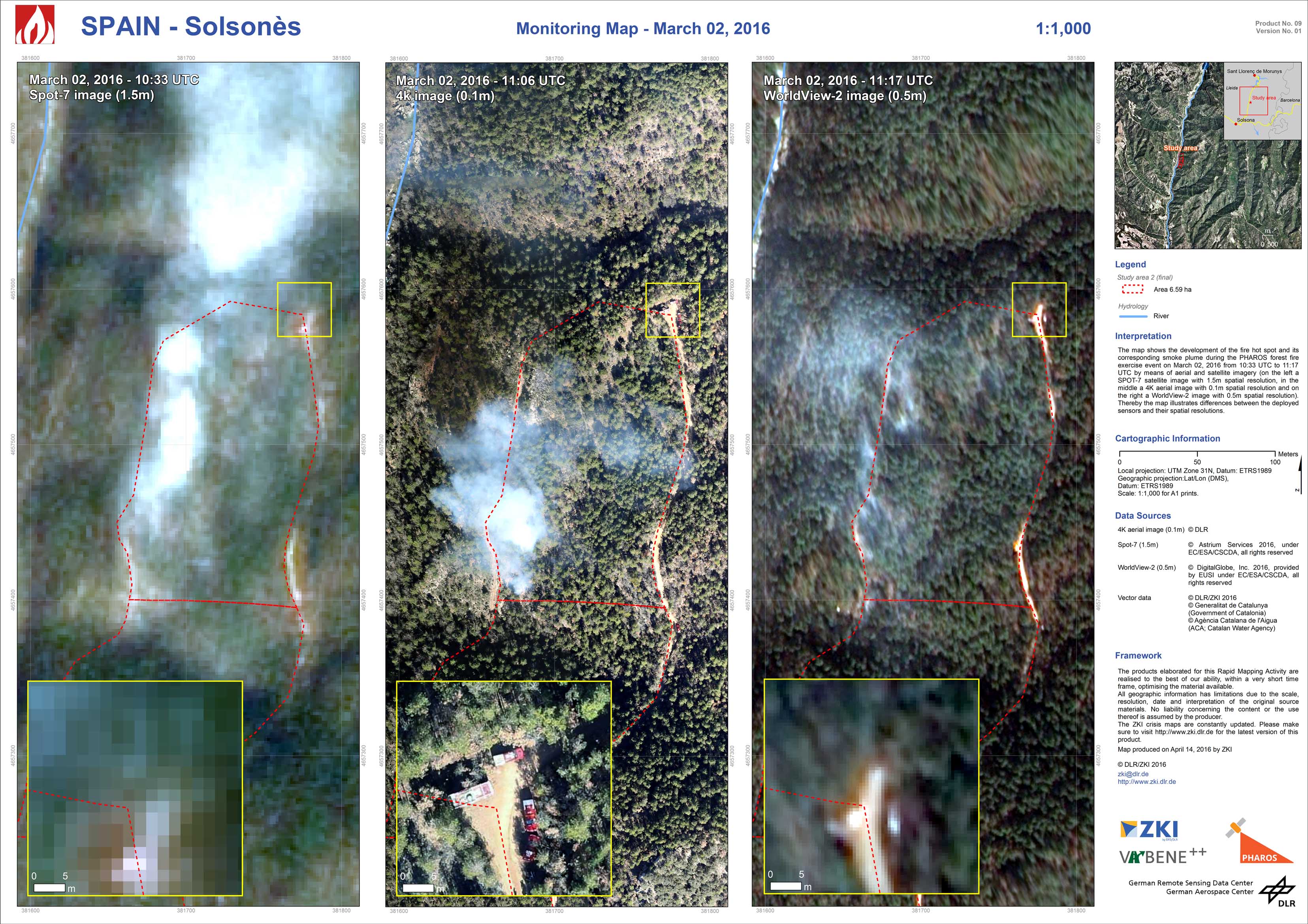
Spain - Solsonès - P09 - March 02, 2016 - 11:17 UTC WorldView-2 image (0.5m)
Creation Date 14. April 2016
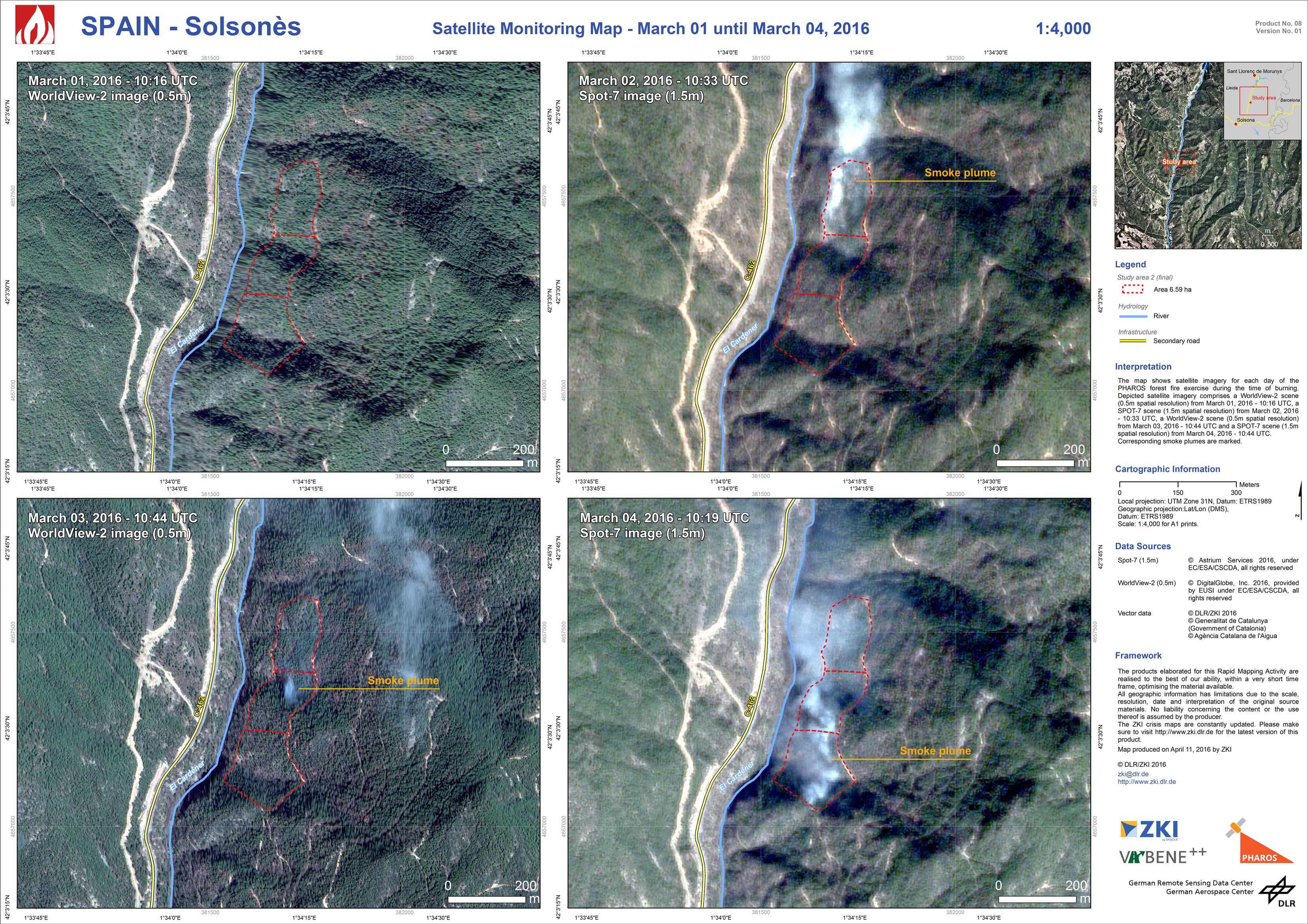
Spain - Solsonès - P08 - March 04, 2016 - 10:19 UTC Spot-7 image (1.5m)
Creation Date 12. April 2016
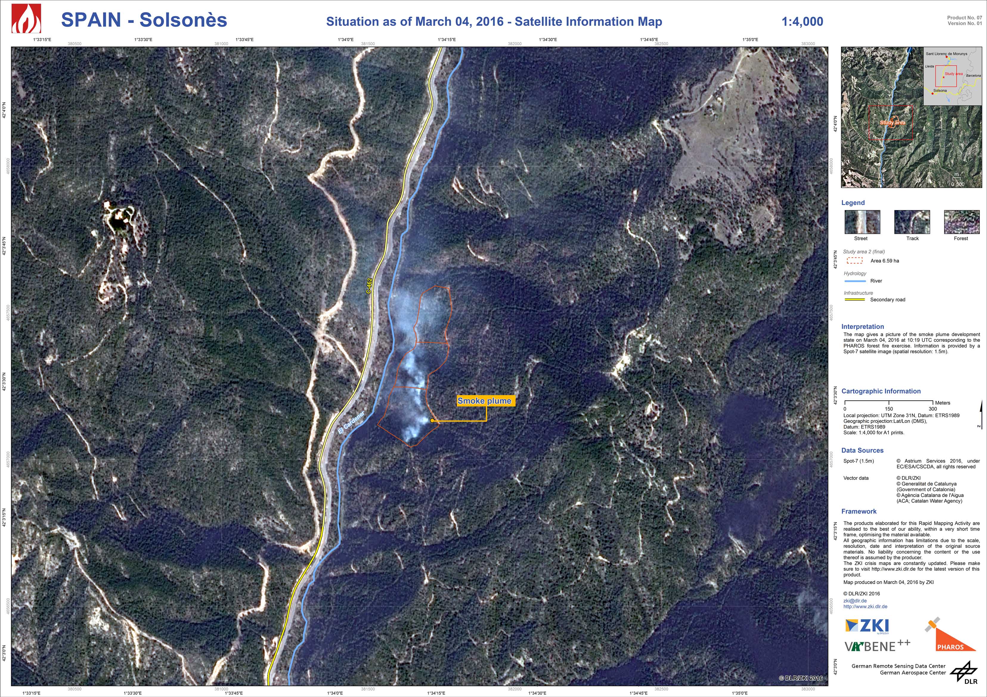
Spain - Solsonès - P07 - Situation as of March 04, 2016 - Satellite Information Map
Creation Date 11. March 2016
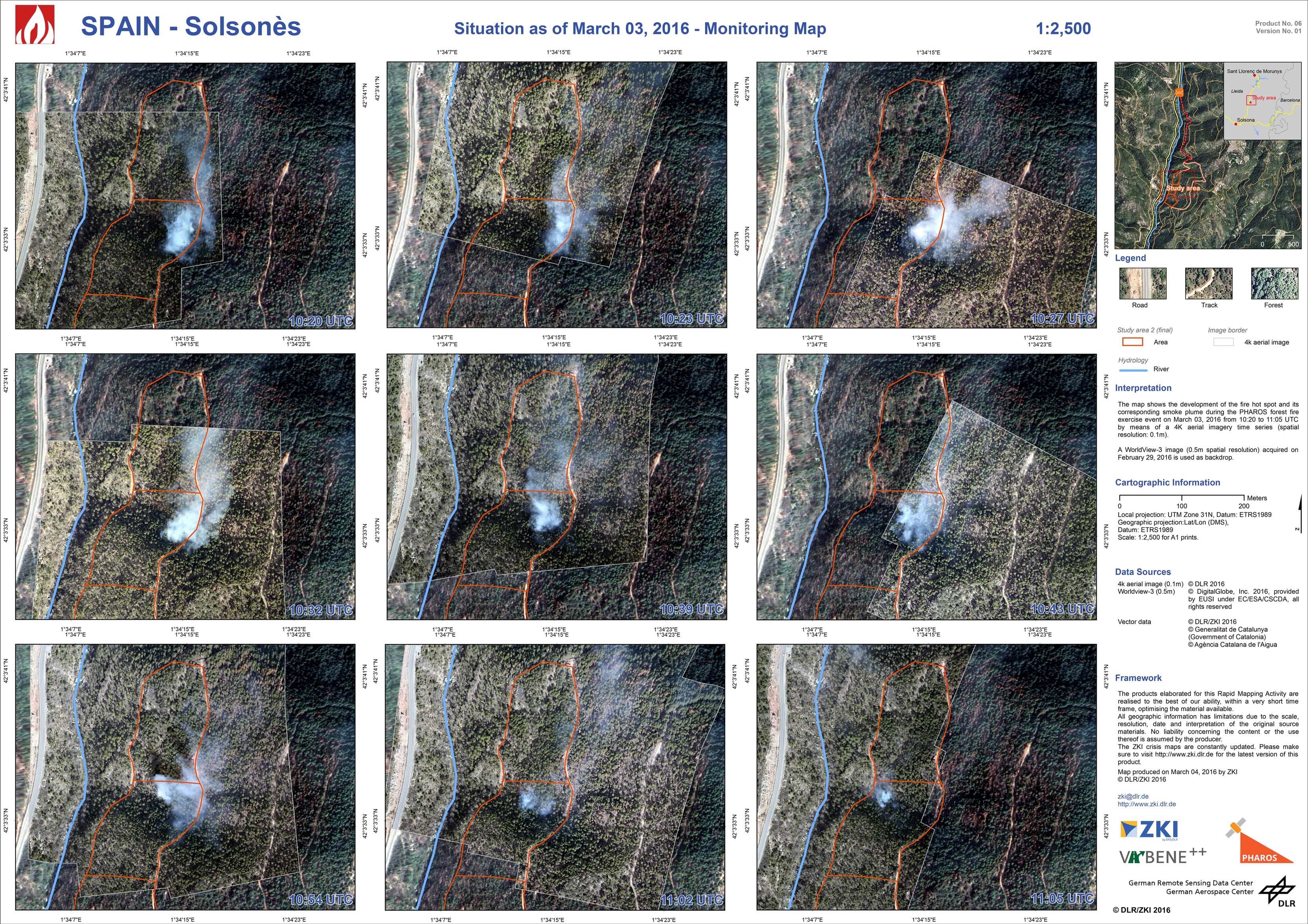
Spain - Solsonès - P06 - Situation as of March 03, 2016 - Monitoring Map
Creation Date 04. March 2016
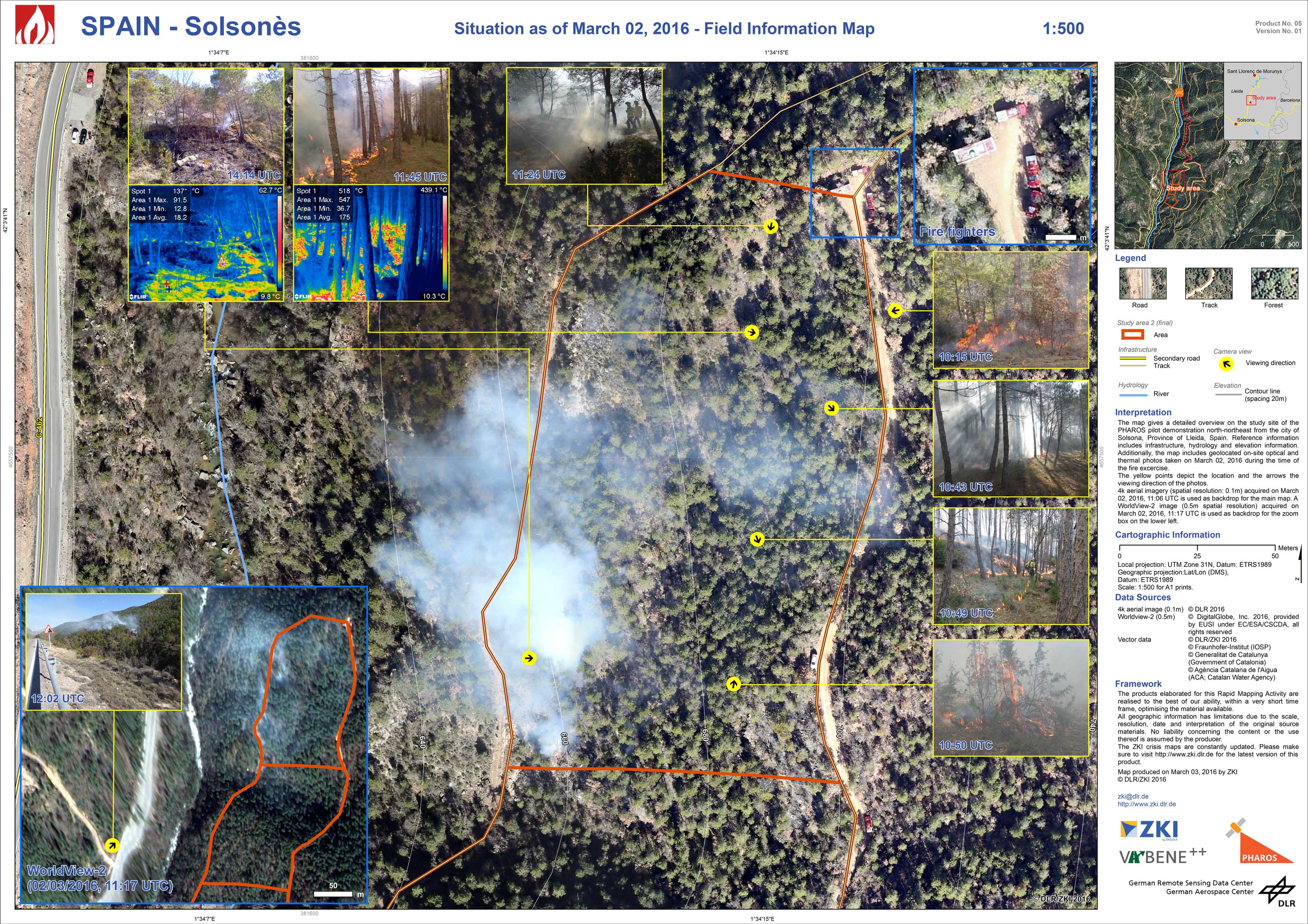
Spain - Solsonès - P05 - Situation as of March 02, 2016 - Field Information Map
Creation Date 03. March 2016
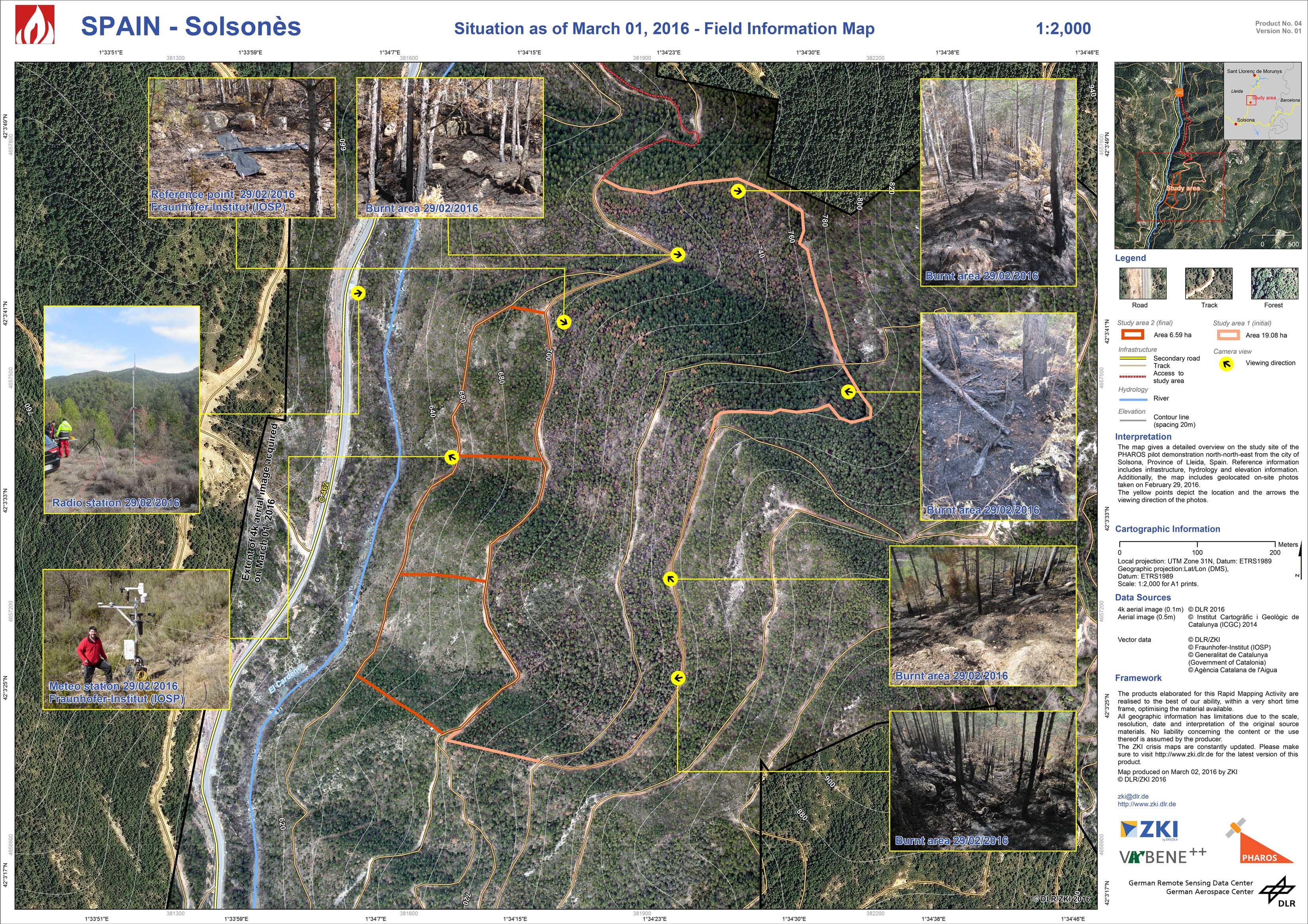
Spain - Solsonès - P04 - Situation as of March 01, 2016 - Field Information Map
Creation Date 02. March 2016
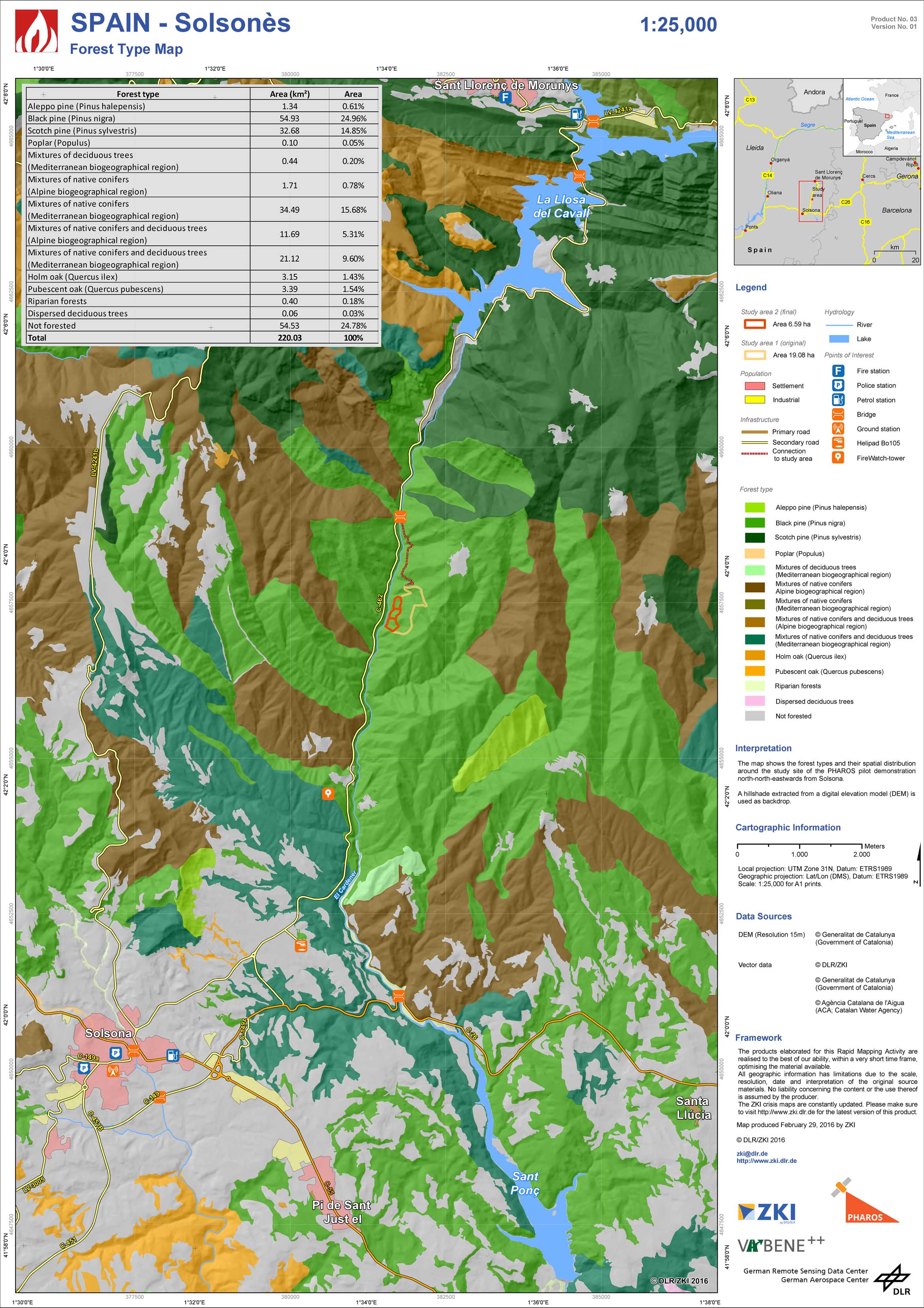
Spain - Solsonès - P03 - Forest Type Map
Creation Date 29. February 2016
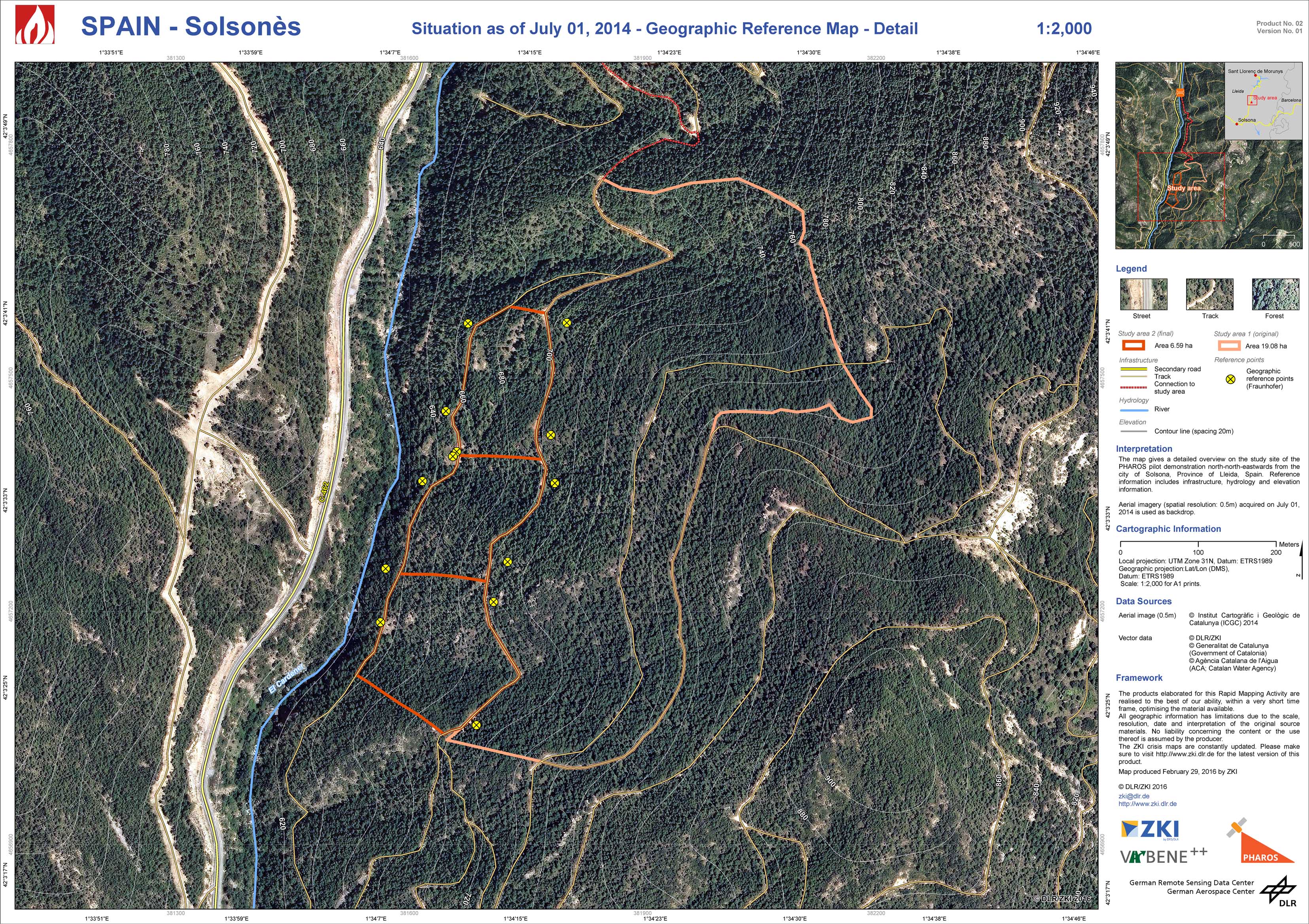
Spain - Solsonès - P02
Creation Date 29. February 2016
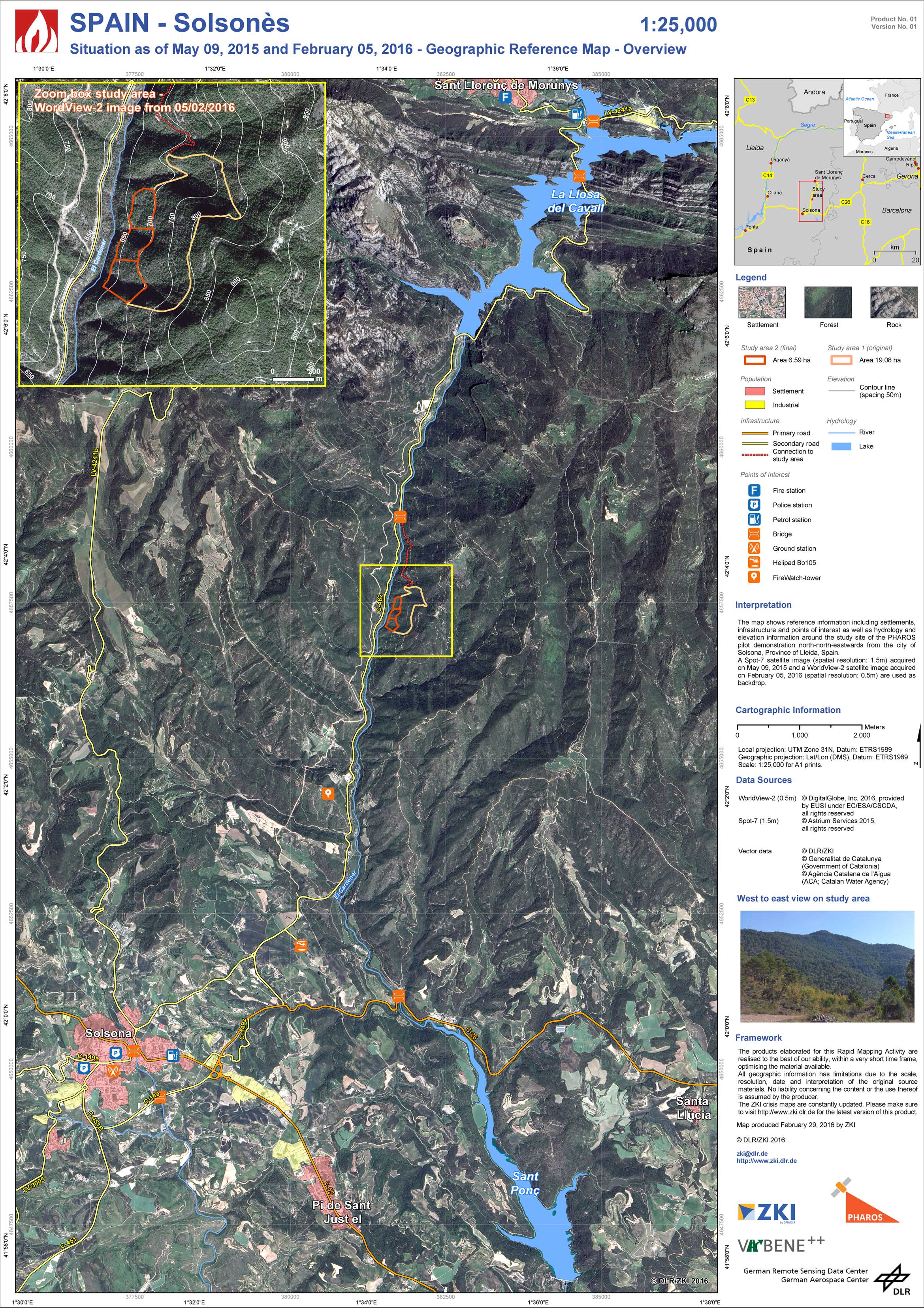
Spain - Solsonès - P01 - Situation as of May 09, 2015 and February 05, 2016 - Geographic Reference Map - Overview
Creation Date 29. February 2016