DRIVER+ Trial "Austria" and IRONORE2019 on 12th to 14th September 2019, Eisenerz/Austria
17. September 2019
DRIVER+ Trial "Austria" and IRONORE2019 on 12th to 14th September 2019, Eisenerz/Austria
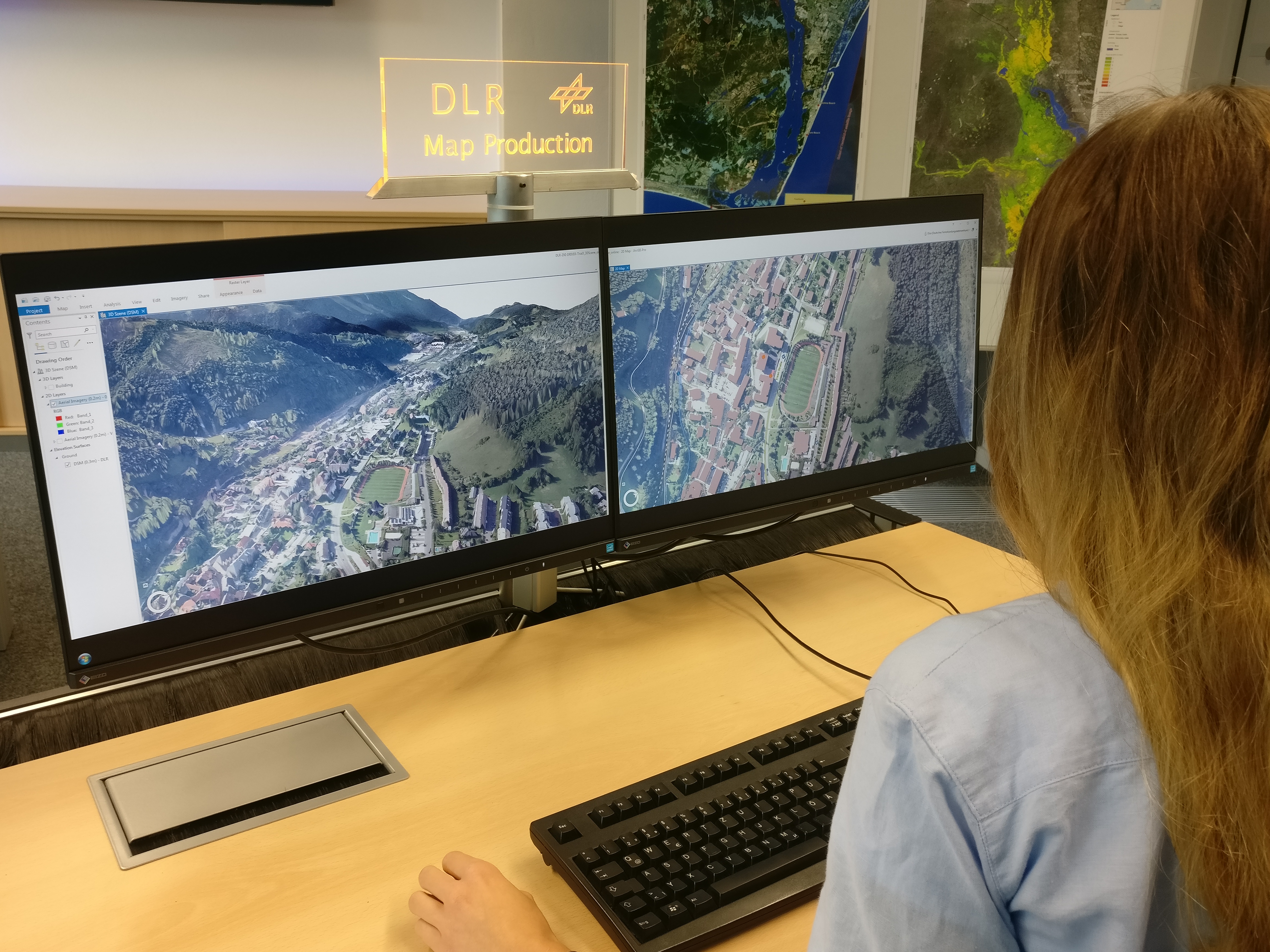
Provision of aerial imagery with additional geodata in a synchronized view of the 3D scene and associated 2D map.
Credit:
DLR ZKI.
To strengthen crisis management, the EU-project DRIVER+ (Driving Innovation in Crisis Management for European Resilience) conducted the fourth Trial, this time in the Eisenerz region (Styria, Austria) from 12 to 14 September 2019. Innovative solutions have been assessed by experts based on an earthquake scenario. The German Aerospace Center (DLR) provided real-time unmanned aerial imagery to create situational awareness and support rescue logistics.
To demonstrate the use of unmanned aerial systems (UAS) for disaster management in controlled airspace, the research aircraft D-CODE was used as a UAS-demonstrator and remote-controlled just like an unmanned aircraft. The flight and mission planning of the aircraft was carried out by means of a ground control station for unmanned aircraft, developed at the Institute of Flight Guidance in Braunschweig. For DRIVER+, D-CODE was equipped with the 3K camera system of the Remote Sensing Technology Institute, which was designed especially for disaster management missions. Using this camera system, the research aircraft was able to capture an area of 80 square kilometers in about ten minutes, produce georeferenced aerial photographs and transmit the results directly via a data link connection to a ground station. During the exercise, aerial photographs were taken during several flights and were available on site within a few minutes for damage assessment, coordination of rescue forces and the search for injured and missing persons. The collected data was forwarded to the Center for Satellite Based Crisis Information (ZKI) at the German Remote Sensing Data Center (DFD). ZKI created interactive information products, such as maps, which ease data interpretation for end-users and ensure the exchange of information.
Simultaneously, the Bavarian Red Cross (BRK), in cooperation with the ZKI, tested new support capabilities in the large-scale European exercise IRONORE2019, that took place in parallel in the Eisenerz region. In addition to already established maps, the ZKI provided the BRK with special 3D products. "This allows the operational leader on site to plan the mission and, for example, to mark dangerous terrain passages or avoid them, which significantly increases the security of the operational units," explains Uwe Kippnich (project manager of BRK’s rapid deployment group G.I.L.T.). "With further optimization, we will be able to support the units on site in the disaster area even better. Large-scale exercises such as IRONORE2019, financed by the European Commission, offer ideal and almost realistic conditions for testing procedures and processes," says Dr. Monika Gähler (Head of the Center for Satellite Based Crisis Information) from the German Aerospace Center in Oberpfaffenhofen.
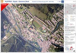
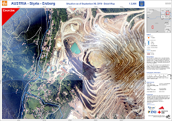
Products
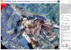
Austria – Styria – Eisenerz/Erzberg – Overview map